

View Information About HSR Ratings
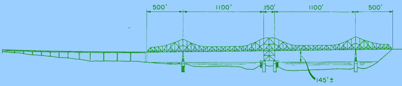
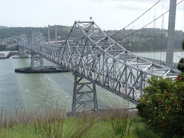
Please note that the HAER documentation refers to a previous bridge that once stood next to this bridge. It has been included because the history of that bridge is key to understanding this bridge. In 1927, a cantilever bridge was completed at this location. Decades later, a need for more traffic lanes was needed and therefore a second cantilever truss bridge, the one that is extant today, was completed in 1958, allowing the 1927 cantilever to carry westbound traffic only while the new bridge carried eastbound traffic. This bridge assumed the same overall cantilever truss design as the 1927 bridge, and its trusses were also designed with the same arrangements and configurations. However, the composition of the beams that made up the trusses of the new bridge were completely different in design, foregoing rivets, v-lacing and lattice for welds, rolled beams, and built-up beams with welded plate with punched holes. As a result, the 1958 bridge looks very much like the 1927 bridge when viewed from elevation at long distances, but up close it looks very different. In 2003, the highly significant historic 1927 bridge was replaced by a new suspension bridge. This solution was chosen to address seismic issues rather than simply preserving the historic bridge through a seismic retrofit. It should be noted that this replacement bridge was built on a slightly different alignment so that the historic 1927 bridge remained in place after its completion. As such, the 1927 bridge was able to carry traffic while the 1958 bridge received a seismic retrofit. In 2007, despite the fact that the historic bridge was not in the way of its replacement bridge, and despite its high level of historic significance, this bridge was demolished.

In the wake of the demolition of the 1927 bridge, the 1958 bridge, while nowhere near as significant, does have some historic significance. It still conveys the truss configuration of the 1927 bridge. It also is a relatively early example of a long-span type bridge that used welded built-up beams as opposed to riveted built-up beams. With its truss configuration the same as the 1927 bridge, but with these welded built-up beams (and connected by bolted connections rather than rivets) the 1958 bridge made a unique comparison to the 1927 bridge since it was a way to see how essentially the same bridge design was built in different decades, and thus it nicely illustrated how fabrication and truss fastener technologies had evolved. Today, the bridge is an increasingly rare example of a cantilever truss bridge, and so its historic significance grows as a result.

While today, bridge historians have gained an appreciation for the beauty and craftsmanship in earlier riveted truss bridges, it is interesting to note that when the 1958 bridge was built its use of bolted connected and its lack of v-lacing and lattice were described in news articles as both better in terms of design, but were also described as more aesthetically pleasing with their simple, streamlined appearance in comparison to the 1927 bridge. It is odd how times change, since in today's world where bridges suffer visually from excessive simplicity and plainness, it is hard to imagine that the 1927 bridge with its v-lacing and lattice forming a unique geometric art as anything but beautiful.
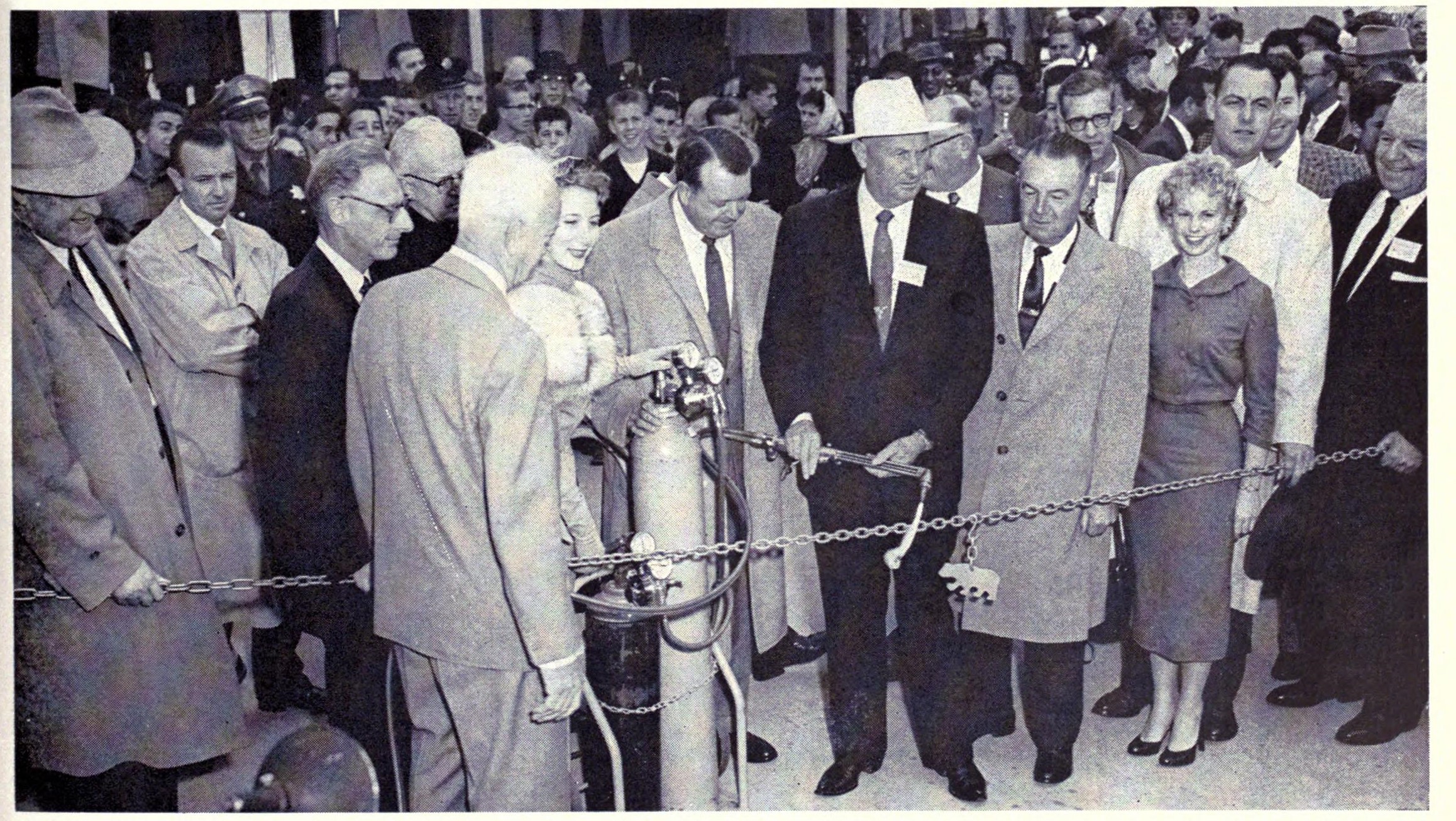


Above: Historical advertisement featuring bridge.
![]()
![]()
![]()
Coordinates (Latitude, Longitude):
Search For Additional Bridge Listings:
Bridgehunter.com: View listed bridges within 0.5 miles (0.8 kilometers) of this bridge.
Bridgehunter.com: View listed bridges within 10 miles (16 kilometers) of this bridge.
Additional Maps:
Google Streetview (If Available)
GeoHack (Additional Links and Coordinates)
Apple Maps (Via DuckDuckGo Search)
Apple Maps (Apple devices only)
Android: Open Location In Your Map or GPS App
Flickr Gallery (Find Nearby Photos)
Wikimedia Commons (Find Nearby Photos)
Directions Via Sygic For Android
Directions Via Sygic For iOS and Android Dolphin Browser
USGS National Map (United States Only)
Historical USGS Topo Maps (United States Only)
Historic Aerials (United States Only)
CalTopo Maps (United States Only)

© Copyright 2003-2024, HistoricBridges.org. All Rights Reserved. Disclaimer: HistoricBridges.org is a volunteer group of private citizens. HistoricBridges.org is NOT a government agency, does not represent or work with any governmental agencies, nor is it in any way associated with any government agency or any non-profit organization. While we strive for accuracy in our factual content, HistoricBridges.org offers no guarantee of accuracy. Information is provided "as is" without warranty of any kind, either expressed or implied. Information could include technical inaccuracies or errors of omission. Opinions and commentary are the opinions of the respective HistoricBridges.org member who made them and do not necessarily represent the views of anyone else, including any outside photographers whose images may appear on the page in which the commentary appears. HistoricBridges.org does not bear any responsibility for any consequences resulting from the use of this or any other HistoricBridges.org information. Owners and users of bridges have the responsibility of correctly following all applicable laws, rules, and regulations, regardless of any HistoricBridges.org information.
![]()