

View Information About HSR Ratings
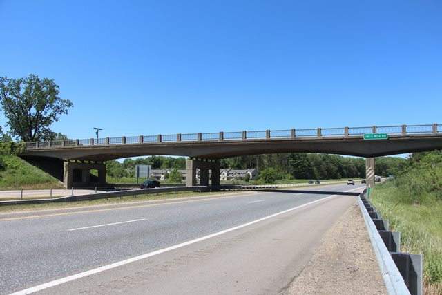
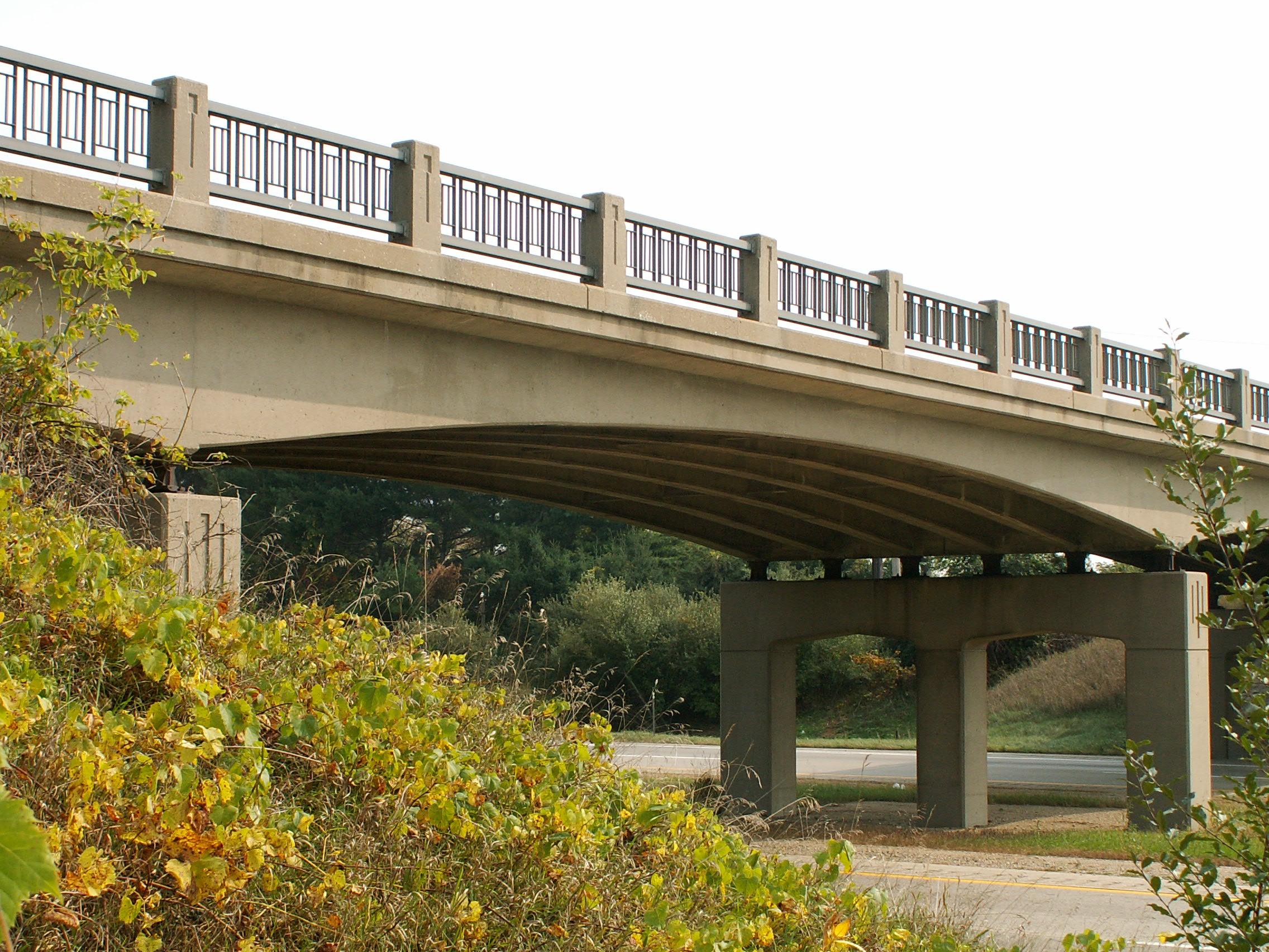
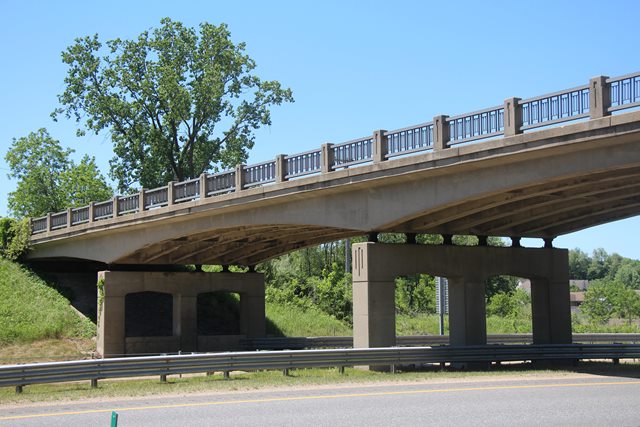
It is expressway bridges like this that help turn a boring expressway drive into a beautiful look into historic bridge design. Curved t-beam bridges like this one were built in the late 50s and early 60s, and are among the last bridges built in Michigan to incorporate aesthetics as a major part of the design. This aesthetic detail can be seen in the railings and the elegant curved nature of the beams. The curved beams also served to increase vertical clearance on the bridge.
With a construction date of 1960, this bridge was not be old enough to be eligible for the National Register of Historic Places until 2010. This bridge is a good example of curved t-beam construction on I-94. MDOT has recently been going around and bolting modern Armco railings to a number of these bridges. Any bridges that remain without these railings added stand out as having a greater level of historic significance.
This section of I-94 is a high priority NAFTA corridor as well as just a plain busy expressway. If MDOT were to upgrade this highway, which has a high accident and fatality rate, to three lanes, many bridges would likely be demolished. It is possible however, that these t-beams would be able to stay. Sigler Road Bridge on I-75 holds three lanes under it.

This bridge is tagged with the following special condition(s): Unorganized Photos
![]()
![]()
![]()
![]()
Coordinates (Latitude, Longitude):
Search For Additional Bridge Listings:
Bridgehunter.com: View listed bridges within 0.5 miles (0.8 kilometers) of this bridge.
Bridgehunter.com: View listed bridges within 10 miles (16 kilometers) of this bridge.
Additional Maps:
Google Streetview (If Available)
GeoHack (Additional Links and Coordinates)
Apple Maps (Via DuckDuckGo Search)
Apple Maps (Apple devices only)
Android: Open Location In Your Map or GPS App
Flickr Gallery (Find Nearby Photos)
Wikimedia Commons (Find Nearby Photos)
Directions Via Sygic For Android
Directions Via Sygic For iOS and Android Dolphin Browser
USGS National Map (United States Only)
Historical USGS Topo Maps (United States Only)
Historic Aerials (United States Only)
CalTopo Maps (United States Only)

© Copyright 2003-2024, HistoricBridges.org. All Rights Reserved. Disclaimer: HistoricBridges.org is a volunteer group of private citizens. HistoricBridges.org is NOT a government agency, does not represent or work with any governmental agencies, nor is it in any way associated with any government agency or any non-profit organization. While we strive for accuracy in our factual content, HistoricBridges.org offers no guarantee of accuracy. Information is provided "as is" without warranty of any kind, either expressed or implied. Information could include technical inaccuracies or errors of omission. Opinions and commentary are the opinions of the respective HistoricBridges.org member who made them and do not necessarily represent the views of anyone else, including any outside photographers whose images may appear on the page in which the commentary appears. HistoricBridges.org does not bear any responsibility for any consequences resulting from the use of this or any other HistoricBridges.org information. Owners and users of bridges have the responsibility of correctly following all applicable laws, rules, and regulations, regardless of any HistoricBridges.org information.
![]()