

View Information About HSR Ratings
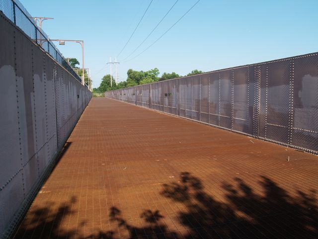
This structure is an aqueduct that carries the canal over a creek, in other words a bridge carrying water over water. Aqueducts like this were a fact of life in canal construction, but surviving functional examples, particularly in the United States are rare today. This bridge is far larger than the other surviving similar aqueduct on the Illinois and Michigan Canal, the Aux Sable Creek Aqueduct. However, the Fox River Aqueduct has lesser historic integrity. The Fox River Aqueduct has lost integrity of function, since it no longer carries water. Also, there are crudely cut holes in the steel girders. The exact purpose of these holes is unclear, but they diminish the historic integrity of the bridge and are ugly looking. Despite alterations and change of function, this bridge remains interesting and noteworthy because of its size, rarity, and also because it is now configured to allow pedestrians on the bridge, so a close look at the structure is possible.
The aqueduct is positioned directly beside a plate girder bridge which served the Chicago, Ottawa and Peoria Railroad, which was an interurban railroad. The interurban bridge was built in 1903 and served traffic until 1934 when it was abandoned. Today, this bridge also serves pedestrian traffic. The bridge is approximately 500 feet in length. The interurban bridge and the aqueduct have a shared pier.
Just as the aqueduct is right next to the interurban bridge, next to the interurban bridge in turn are the stone piers of yet another bridge which is today gone. It is likely this third bridge was a highway bridge.
![]()
![]()
![]()
Coordinates (Latitude, Longitude):
Search For Additional Bridge Listings:
Bridgehunter.com: View listed bridges within 0.5 miles (0.8 kilometers) of this bridge.
Bridgehunter.com: View listed bridges within 10 miles (16 kilometers) of this bridge.
Additional Maps:
Google Streetview (If Available)
GeoHack (Additional Links and Coordinates)
Apple Maps (Via DuckDuckGo Search)
Apple Maps (Apple devices only)
Android: Open Location In Your Map or GPS App
Flickr Gallery (Find Nearby Photos)
Wikimedia Commons (Find Nearby Photos)
Directions Via Sygic For Android
Directions Via Sygic For iOS and Android Dolphin Browser
USGS National Map (United States Only)
Historical USGS Topo Maps (United States Only)
Historic Aerials (United States Only)
CalTopo Maps (United States Only)

© Copyright 2003-2024, HistoricBridges.org. All Rights Reserved. Disclaimer: HistoricBridges.org is a volunteer group of private citizens. HistoricBridges.org is NOT a government agency, does not represent or work with any governmental agencies, nor is it in any way associated with any government agency or any non-profit organization. While we strive for accuracy in our factual content, HistoricBridges.org offers no guarantee of accuracy. Information is provided "as is" without warranty of any kind, either expressed or implied. Information could include technical inaccuracies or errors of omission. Opinions and commentary are the opinions of the respective HistoricBridges.org member who made them and do not necessarily represent the views of anyone else, including any outside photographers whose images may appear on the page in which the commentary appears. HistoricBridges.org does not bear any responsibility for any consequences resulting from the use of this or any other HistoricBridges.org information. Owners and users of bridges have the responsibility of correctly following all applicable laws, rules, and regulations, regardless of any HistoricBridges.org information.
![]()