

View Information About HSR Ratings

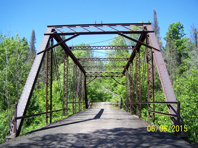
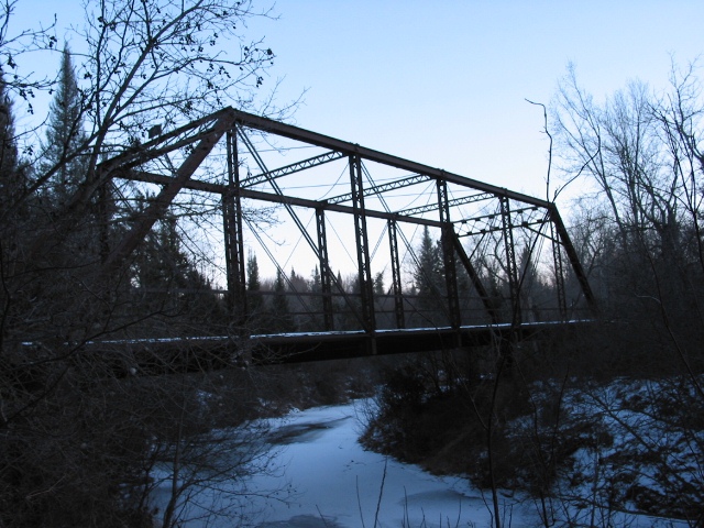
This bridge and the road it carried has been closed to traffic since the early 1950s and is a hidden treasure. The bridge is 17 feet wide center to center of trusses and the truss height is 16.5 feet. The bridge has a 20 foot steel stringer approach span at each end. The bridge has an intact concrete jack-arch deck. The concrete is overlaid with an asphalt wearing surface. Illinois steel brands are present on the bridge. The bridge is a traditionally composed example of an early 20th Century pin-connected truss bridge, and as such a late example of this truss type. It is significant as one of the few remaining through truss highway bridges in Michigan's Upper Peninsula. Further, it is one of only two surviving examples of bridges in Michigan built by the Continental Bridge Company. This company had offices in the Monadnock Block (today called the Monadnock Building) in Chicago. The Monadnock Building was home to a number of bridge companies and engineers. The company works was located at Peotone, Illinois.
This bridge is tagged with the following special condition(s): Unorganized Photos
![]()
![]()
![]()
![]()
![]()
Coordinates (Latitude, Longitude):
Search For Additional Bridge Listings:
Bridgehunter.com: View listed bridges within 0.5 miles (0.8 kilometers) of this bridge.
Bridgehunter.com: View listed bridges within 10 miles (16 kilometers) of this bridge.
Additional Maps:
Google Streetview (If Available)
GeoHack (Additional Links and Coordinates)
Apple Maps (Via DuckDuckGo Search)
Apple Maps (Apple devices only)
Android: Open Location In Your Map or GPS App
Flickr Gallery (Find Nearby Photos)
Wikimedia Commons (Find Nearby Photos)
Directions Via Sygic For Android
Directions Via Sygic For iOS and Android Dolphin Browser
USGS National Map (United States Only)
Historical USGS Topo Maps (United States Only)
Historic Aerials (United States Only)
CalTopo Maps (United States Only)

© Copyright 2003-2024, HistoricBridges.org. All Rights Reserved. Disclaimer: HistoricBridges.org is a volunteer group of private citizens. HistoricBridges.org is NOT a government agency, does not represent or work with any governmental agencies, nor is it in any way associated with any government agency or any non-profit organization. While we strive for accuracy in our factual content, HistoricBridges.org offers no guarantee of accuracy. Information is provided "as is" without warranty of any kind, either expressed or implied. Information could include technical inaccuracies or errors of omission. Opinions and commentary are the opinions of the respective HistoricBridges.org member who made them and do not necessarily represent the views of anyone else, including any outside photographers whose images may appear on the page in which the commentary appears. HistoricBridges.org does not bear any responsibility for any consequences resulting from the use of this or any other HistoricBridges.org information. Owners and users of bridges have the responsibility of correctly following all applicable laws, rules, and regulations, regardless of any HistoricBridges.org information.
![]()