

View Information About HSR Ratings

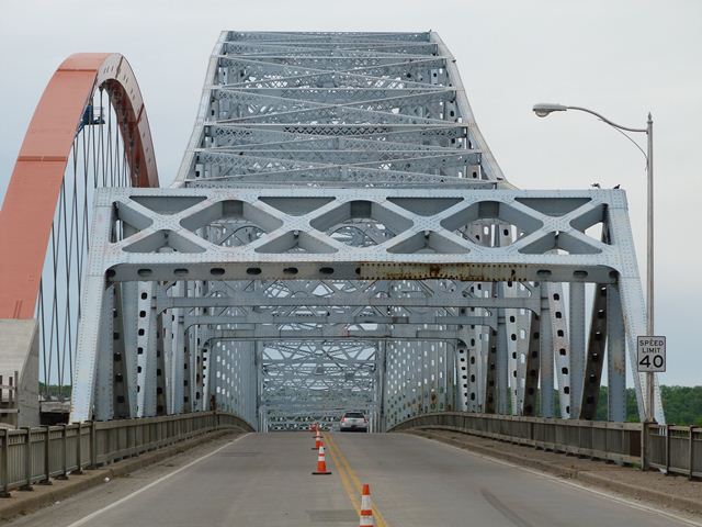
Hastings has twice lost a historic bridge. The first time was when an iconic "Spiral Bridge" was demolished when this historic bridge was completed in 1951. The Spiral Bridge was so named because of its spiral approach ramp that allowed the roadway to reach a high level with a minimal land foot print. The main span of this bridge was a pin-connected through truss span. The bridge is still a well-known memory around town.
The 1951 bridge was a good example of a suspended deck cantilever truss. It looks like a through arch bridge, but because the trusses extend in a continuous
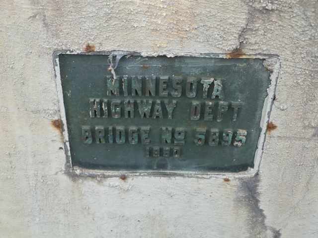
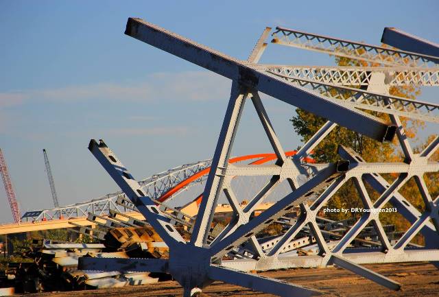
The 1951 bridge was at the time it was replaced an officially recognized historic bridge. Although alternatives to avoid demolition of this historic bridge were officially considered, it is unclear that any fair and serious consideration was given to these alternatives. HistoricBridges.org documented this bridge literally one day before it was closed to traffic. At that time, the replacement bridge was practically completed, immediately west of the historic bridge. Southbound traffic flowed on the new bridge and northbound traffic was on the historic bridge. Although this was a temporary affair, it demonstrates that there was room for two bridges: that this historic bridge could have been preserved by building a new bridge next to the historic bridge and forming a one-way couplet of bridges. Indeed, this alternative would have disturbed less land because the new bridge would not need to be so wide.

Why was such an obvious alternative not given serious consideration? Probably because overly demanding expectations were put on the historic Hastings Bridge if it were to remain open for traffic. Like many historic truss bridges, this bridge is "fracture critical" which means that the bridge uses all of its members together to make the bridge "work" properly. Many agencies claim this is a great reason to bulldoze historic bridges because if one member fails, the entire bridge could (theoretically) collapse, although this is not always the case in reality. Moreover, fracture critical bridges are perfectly safe if built correctly, inspected routinely, and maintained as needed. However, these conditions should be in place for any bridge, whether fracture critical or not. Following the collapse of the I-35W Bridge in Minneapolis, all fracture bridges were inspected to make sure they were not designed with improper gusset plates like the I-35W Bridge. It was found that the Hastings Bridge did not have any similar design defects. Regardless of this fact, in considering alternatives to avoid demolishing this historic bridge, MNDOT demanded that the Hastings Bridge could only be left in place for all traffic if the fracture critical aspects were eliminated. This is a difficult demand to meet and requires massive alterations to the bridge. Furthermore, given that many bridges of similar design safely carry traffic, it is unclear why they are needed. Nevertheless, this is the demand that was placed on the historic bridge in the studies, and because of this it is not surprising that the bridge was swiftly condemned to the dumpster.
Modern bridge design lacks all the creativity and variety that are two of the most fascinating aspects of studying historic bridges. Modern bridge design in the 21st Century can be divided into three categories. If nobody cares about what the new bridge will look like, a beam bridge of some sort will be built. A steel stringer or pre-stressed concrete bridge, most likely. If somebody cares what the new bridge looks like, you get two choices: cable-stayed bridge or tied arch. "Variety" as it passes today is limited to tower design (one or two towers, and one or two posts per tower) in the cable-stayed bridges, and if you want to mix up your tied arch, you can get diagonals and make it a network tied arch, and/or you can make the arches lean inward, forming a basket-handle arch bridge. Thus it is no surprise that the replacement bridge at Hastings is a network tied arch. The tall arches lack struts or sway bracing, making the bridge look unstable visually.
![]()
![]()
![]()
![]()
![]()
![]()
![]()
This historic bridge has been demolished. This map is shown for reference purposes only.
Coordinates (Latitude, Longitude):
Search For Additional Bridge Listings:
Bridgehunter.com: View listed bridges within 0.5 miles (0.8 kilometers) of this bridge.
Bridgehunter.com: View listed bridges within 10 miles (16 kilometers) of this bridge.
Additional Maps:
Google Streetview (If Available)
GeoHack (Additional Links and Coordinates)
Apple Maps (Via DuckDuckGo Search)
Apple Maps (Apple devices only)
Android: Open Location In Your Map or GPS App
Flickr Gallery (Find Nearby Photos)
Wikimedia Commons (Find Nearby Photos)
Directions Via Sygic For Android
Directions Via Sygic For iOS and Android Dolphin Browser
USGS National Map (United States Only)
Historical USGS Topo Maps (United States Only)
Historic Aerials (United States Only)
CalTopo Maps (United States Only)

© Copyright 2003-2024, HistoricBridges.org. All Rights Reserved. Disclaimer: HistoricBridges.org is a volunteer group of private citizens. HistoricBridges.org is NOT a government agency, does not represent or work with any governmental agencies, nor is it in any way associated with any government agency or any non-profit organization. While we strive for accuracy in our factual content, HistoricBridges.org offers no guarantee of accuracy. Information is provided "as is" without warranty of any kind, either expressed or implied. Information could include technical inaccuracies or errors of omission. Opinions and commentary are the opinions of the respective HistoricBridges.org member who made them and do not necessarily represent the views of anyone else, including any outside photographers whose images may appear on the page in which the commentary appears. HistoricBridges.org does not bear any responsibility for any consequences resulting from the use of this or any other HistoricBridges.org information. Owners and users of bridges have the responsibility of correctly following all applicable laws, rules, and regulations, regardless of any HistoricBridges.org information.
![]()