

View Information About HSR Ratings

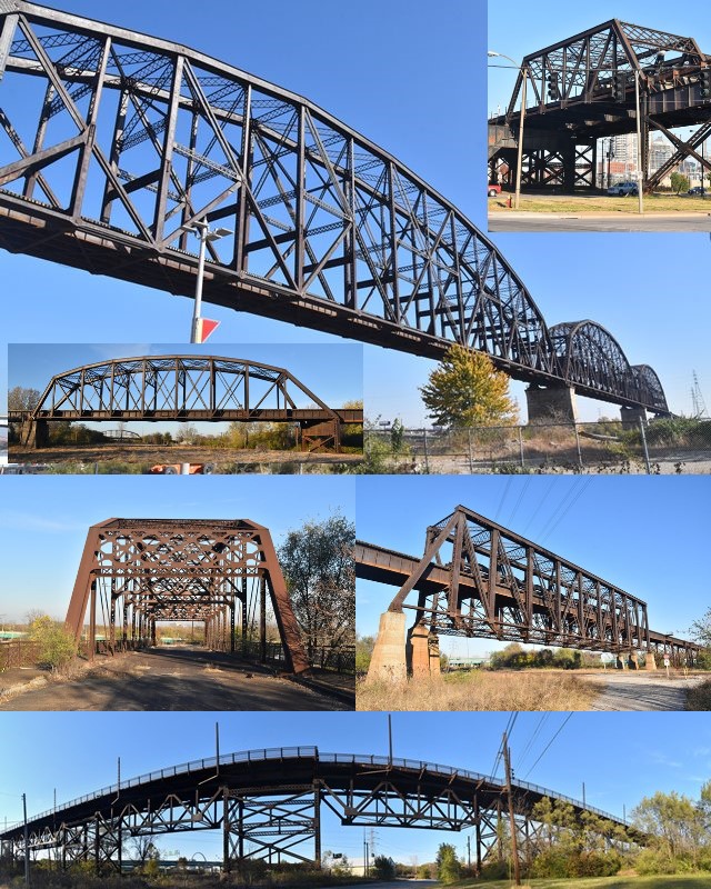
This bridge was originally built as a double-deck bridge with highway (on top) and railroad bridge (on bottom). Unfortunately, by the time this bridge was documented by HistoricBridges.org in 2016, a project to demolish nearly all of the long-abandoned highway deck was nearly completed, although some noteworthy highway portions remained on the approaches. Despite this loss, the remaining bridge is still one of the longest and most complex bridge systems in the country. HistoricBridges.org is proud to offer detailed coverage of not just the well-known Mississippi River spans, but also the lesser known but noteworthy approach sections.
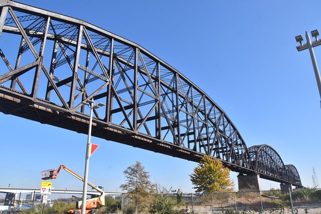
The Mississippi River spans with their 668 foot spans (center to center of pins) or 772 feet (overall length) are among the longest simple truss spans in the entire country. This fact, combined with the unusually heavy double-deck design make this bridge a highly significant engineering feat.

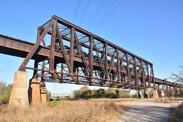
One of the approach spans in particular is extremely unusual: the half-through truss span. The truss span is designed with three truss lines. The two northern truss lines supported the highway deck on top as a true deck truss. The southern two truss lines support the railroad line about halfway up the truss height, forming a rare half-through truss layout. To add to the unique design, the northern truss line is a Baltimore truss, while the other two truss lines are Pratt trusses.
Early investigations for locating this bridge were prepared in 1907 including input from two famous engineering firms, Ralph Modjeski and Waddell and Harrington.

Above: Historical construction photo showing main span construction.
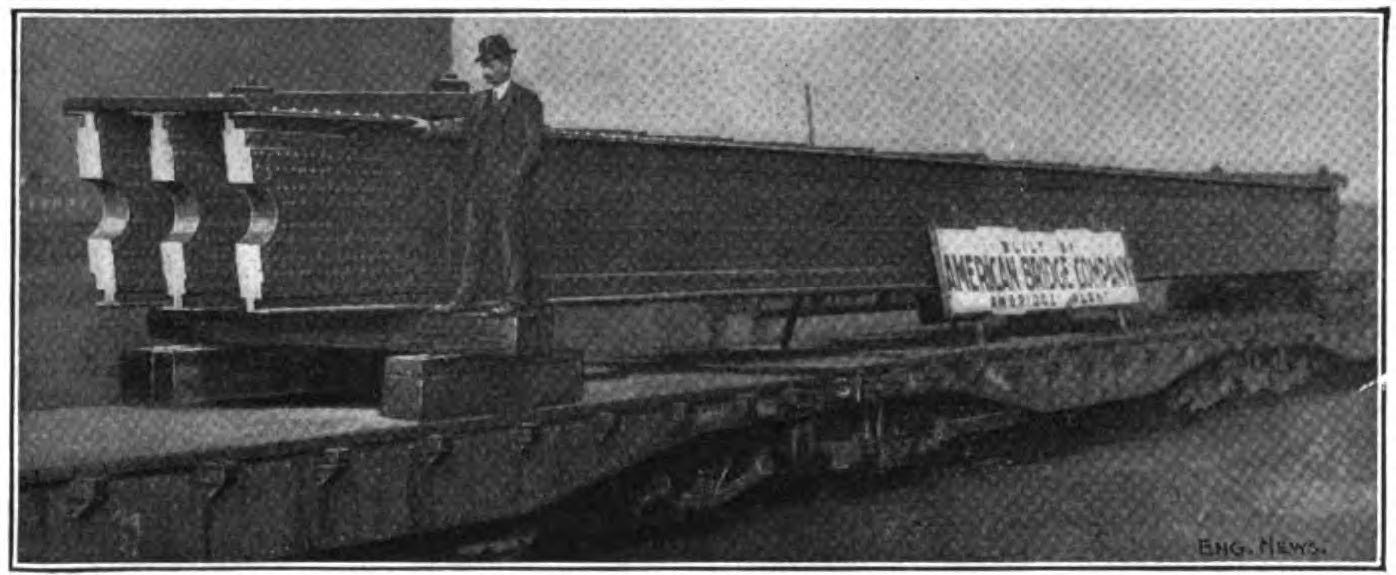
Above: Historical construction photo showing 70 foot end post section shipped to site.
This bridge is tagged with the following special condition(s): Double-Deck
![]()
![]()
![]()
![]()
![]()
Additional Coordinates: Mississippi River Spans: 38.61477, -90.18391 Half-Through Truss Span: 38.61212, -90.17379 Railroad Pennsylvania Truss Span: 38.60988, -90.16562 Highway Pennsylvania Truss Span: 38.61347, -90.16617 Broadway Trusses: 38.61767, -90.19324
Coordinates (Latitude, Longitude):
Search For Additional Bridge Listings:
Bridgehunter.com: View listed bridges within 0.5 miles (0.8 kilometers) of this bridge.
Bridgehunter.com: View listed bridges within 10 miles (16 kilometers) of this bridge.
Additional Maps:
Google Streetview (If Available)
GeoHack (Additional Links and Coordinates)
Apple Maps (Via DuckDuckGo Search)
Apple Maps (Apple devices only)
Android: Open Location In Your Map or GPS App
Flickr Gallery (Find Nearby Photos)
Wikimedia Commons (Find Nearby Photos)
Directions Via Sygic For Android
Directions Via Sygic For iOS and Android Dolphin Browser
USGS National Map (United States Only)
Historical USGS Topo Maps (United States Only)
Historic Aerials (United States Only)
CalTopo Maps (United States Only)

© Copyright 2003-2024, HistoricBridges.org. All Rights Reserved. Disclaimer: HistoricBridges.org is a volunteer group of private citizens. HistoricBridges.org is NOT a government agency, does not represent or work with any governmental agencies, nor is it in any way associated with any government agency or any non-profit organization. While we strive for accuracy in our factual content, HistoricBridges.org offers no guarantee of accuracy. Information is provided "as is" without warranty of any kind, either expressed or implied. Information could include technical inaccuracies or errors of omission. Opinions and commentary are the opinions of the respective HistoricBridges.org member who made them and do not necessarily represent the views of anyone else, including any outside photographers whose images may appear on the page in which the commentary appears. HistoricBridges.org does not bear any responsibility for any consequences resulting from the use of this or any other HistoricBridges.org information. Owners and users of bridges have the responsibility of correctly following all applicable laws, rules, and regulations, regardless of any HistoricBridges.org information.
![]()