

View Information About HSR Ratings
The Historic Bridge Inventory thought that the bridge was built by George Updyke, a member of the county bridge committee as shown on the distinctive plaque on the bridge. But committee members did not build bridges, they bought bridges. In reality, this bridge was built by the Horseheads Bridge Company. Very few bridges survive by this company, making this bridge noteworthy as an example of this company. The unusual top chord mounted plaque is identical to one found on Ebay as shown below. Note that Horseheads Bridge Company was earlier known as the E. A. Perkins & Company. The Horseheads Bridge Company also tended to use a distinctive shaped casting for its pin caps, which this bridge shows, which lends additional support of this bridge's lineage.
Thanks to Jim Stewart and Marc Scotti for providing information and example bridges relating to the Horseheads Bridge Company and E. A. Perkins.

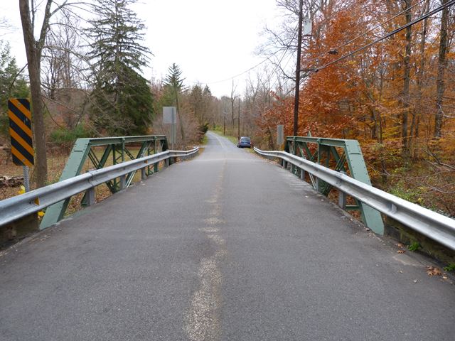
Information and Findings From New Jersey's Historic Bridge InventoryDiscussion of Bridge The light 3-panel pin-connected Pratt half hip pony truss bridge is supported on random ashlar abutments with wingwalls. Pipe railings remain. Alterations are minimal and include concrete seats, plates welded to the lower panel points and end posts, and replacement stringers. The well-preserved bridge was built by George Updyke, a member of the county bridge committee. One of over 20 bridges of its type in the county, the span exhibits no unusual details and is a representative example. Discussion of Surrounding Area The bridge carries one lane of a quiet country road over a minor stream. It is located in a wooded rural setting within sight of scattered modern housing. Bridge Considered Historic By Survey: No |
![]()
![]()
![]()
Coordinates (Latitude, Longitude):
Search For Additional Bridge Listings:
Bridgehunter.com: View listed bridges within 0.5 miles (0.8 kilometers) of this bridge.
Bridgehunter.com: View listed bridges within 10 miles (16 kilometers) of this bridge.
Additional Maps:
Google Streetview (If Available)
GeoHack (Additional Links and Coordinates)
Apple Maps (Via DuckDuckGo Search)
Apple Maps (Apple devices only)
Android: Open Location In Your Map or GPS App
Flickr Gallery (Find Nearby Photos)
Wikimedia Commons (Find Nearby Photos)
Directions Via Sygic For Android
Directions Via Sygic For iOS and Android Dolphin Browser
USGS National Map (United States Only)
Historical USGS Topo Maps (United States Only)
Historic Aerials (United States Only)
CalTopo Maps (United States Only)

© Copyright 2003-2024, HistoricBridges.org. All Rights Reserved. Disclaimer: HistoricBridges.org is a volunteer group of private citizens. HistoricBridges.org is NOT a government agency, does not represent or work with any governmental agencies, nor is it in any way associated with any government agency or any non-profit organization. While we strive for accuracy in our factual content, HistoricBridges.org offers no guarantee of accuracy. Information is provided "as is" without warranty of any kind, either expressed or implied. Information could include technical inaccuracies or errors of omission. Opinions and commentary are the opinions of the respective HistoricBridges.org member who made them and do not necessarily represent the views of anyone else, including any outside photographers whose images may appear on the page in which the commentary appears. HistoricBridges.org does not bear any responsibility for any consequences resulting from the use of this or any other HistoricBridges.org information. Owners and users of bridges have the responsibility of correctly following all applicable laws, rules, and regulations, regardless of any HistoricBridges.org information.
![]()