
View Information About HSR Ratings
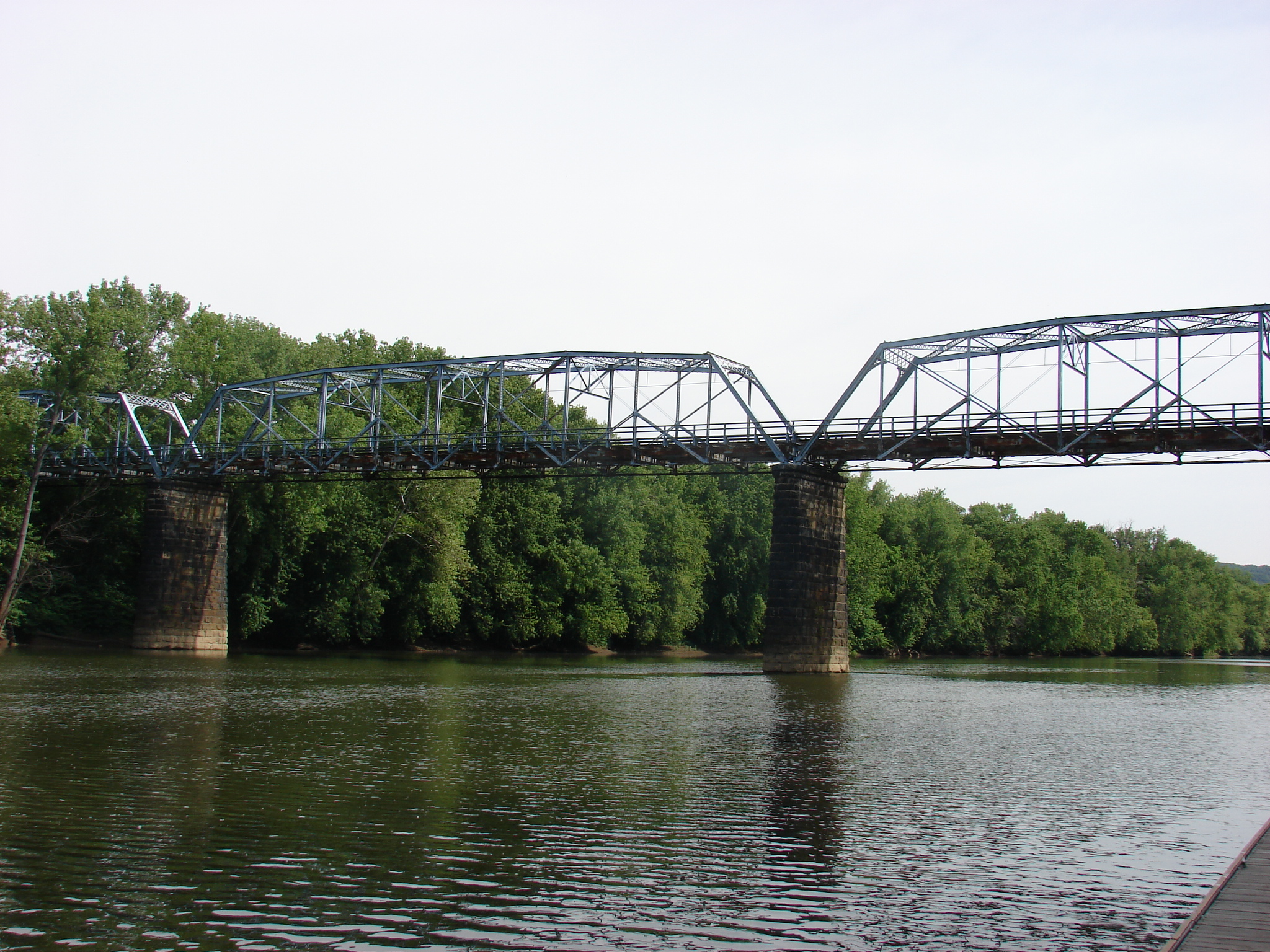
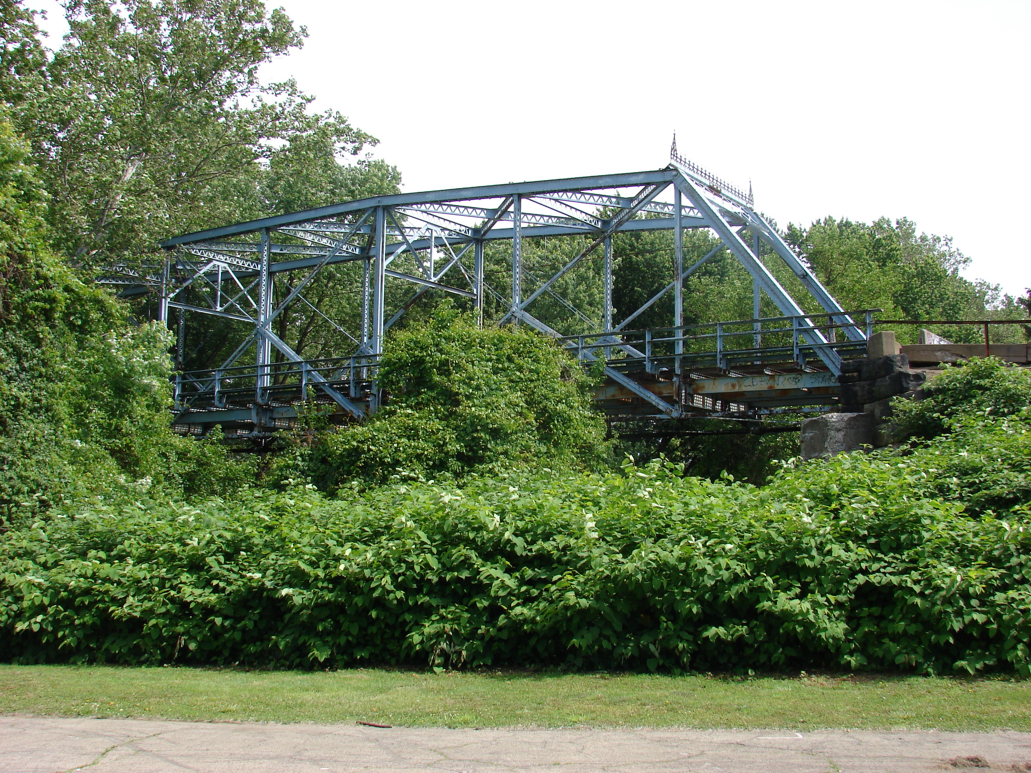
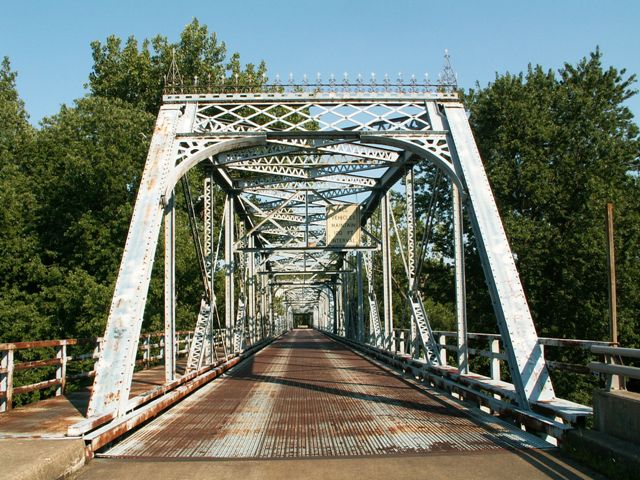
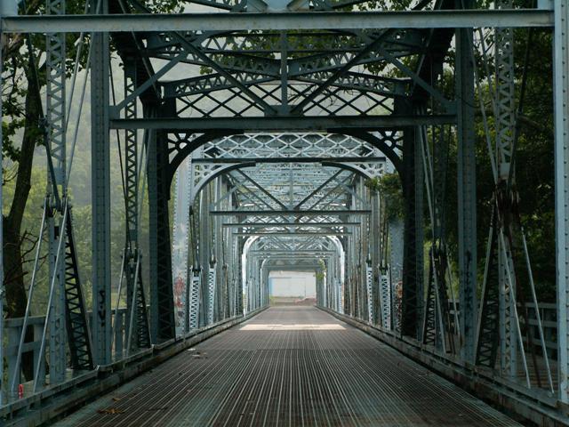
This bridge has been abandoned. Although once arguably outshined by the unique design and stunning beauty of the demolished Bridgeport Bridge, with the Bridgeport Bridge now demolished, this bridge is Wheeling and West Virginia's last chance to save a historic metal truss bridge for Wheeling Island. This bridge is in its own right rare, with its multi-span Pennsylvania truss design, and it has a rare ornate portal bracing cresting. The bridge is closed to traffic, but you can still walk across it and inspect and photograph the beautiful Pennsylvania truss configuration of this magnificent bridge.
Information and Findings From Ohio's Historic Bridge InventorySetting/Context The bridge, which is closed to traffic but not pedestrians, carries a 2 lane street over the Ohio River's back channel at the WV-OH border. The west end of the bridge is in Bridgeport, Ohio, and the east end of the bridge is in Wheeling Island W.Va. At the southeast quadrant is a park and small boat launch. Beyond the east end of the bridge is a residential setting of houses dating ca. 1880-1920. At the west (Ohio) end of the bridge is SR 7, which parallels the river. Georgia Street crosses SR 7 on a modern (post-1960) bridge. Physical Description The 4-span, pin-connected Pennsylvania thru truss is supported on ashlar piers. The bridge is composed of eyebars for the tension members and built-up sections for the compression members. The lower chords and diagonals are eyebars. The upper chords and end posts are composed of built-up, box-shaped members of plates, angles, channels, and bars. The verticals are an uncommon built-up configuration of four Z-bars joined at the flanges to form an I-shaped section. The bridge has lattice portals with "sunburst" decorative brackets and wrought-iron crestline. A sidewalk is cantilevered from the bridge's north elevation. It is supported on built-up lattice brackets. The welded angle railings are not original. The bridge has open-grid steel deck, supported on built-up floorbeams and rolled stringers. Integrity The flooring system (deck/stringers) has been replaced (ca. 1960). The railings have been replaced (ca. 1960). Some eyebar diagonals have been strengthened with the addition of steel cables. Welded upper lateral bracing has been added. Summary of Significance The ca. 1900 pin-connected Pennsylvania thru truss
is in WV jurisdiction and is considered eligible, according to WVDOT's
historic bridge inventory. The bridge retains integrity of design and
materials, although there have been some minor changes to the deck,
railings, and upper lateral bracing. The bridge is 1 of 4 pin-connected
Pennsylvania thru truss bridges dating from 1888 to 1914 in the ODOT
survey. It is a technologically significant example of its type/design.
Justification The pin connected thru truss bridge is one of 13 extant examples of bridges with polygonal upper chords and/or subdivided panels in the state that date from 1888 until 1923. It is of moderate significance given that the numbers in the population. Bridge Considered Historic By Survey: Yes View PDF Historic Bridge Inventory Sheet
|
This bridge is tagged with the following special condition(s): Unorganized Photos
![]()
![]()
![]()
![]()

![]()
![]()
Coordinates (Latitude, Longitude):
Search For Additional Bridge Listings:
Bridgehunter.com: View listed bridges within 0.5 miles (0.8 kilometers) of this bridge.
Bridgehunter.com: View listed bridges within 10 miles (16 kilometers) of this bridge.
Additional Maps:
Google Streetview (If Available)
GeoHack (Additional Links and Coordinates)
Apple Maps (Via DuckDuckGo Search)
Apple Maps (Apple devices only)
Android: Open Location In Your Map or GPS App
Flickr Gallery (Find Nearby Photos)
Wikimedia Commons (Find Nearby Photos)
Directions Via Sygic For Android
Directions Via Sygic For iOS and Android Dolphin Browser
USGS National Map (United States Only)
Historical USGS Topo Maps (United States Only)
Historic Aerials (United States Only)
CalTopo Maps (United States Only)

© Copyright 2003-2024, HistoricBridges.org. All Rights Reserved. Disclaimer: HistoricBridges.org is a volunteer group of private citizens. HistoricBridges.org is NOT a government agency, does not represent or work with any governmental agencies, nor is it in any way associated with any government agency or any non-profit organization. While we strive for accuracy in our factual content, HistoricBridges.org offers no guarantee of accuracy. Information is provided "as is" without warranty of any kind, either expressed or implied. Information could include technical inaccuracies or errors of omission. Opinions and commentary are the opinions of the respective HistoricBridges.org member who made them and do not necessarily represent the views of anyone else, including any outside photographers whose images may appear on the page in which the commentary appears. HistoricBridges.org does not bear any responsibility for any consequences resulting from the use of this or any other HistoricBridges.org information. Owners and users of bridges have the responsibility of correctly following all applicable laws, rules, and regulations, regardless of any HistoricBridges.org information.
![]()