

View Information About HSR Ratings
This bridge had a 1912 construction date given, which appears to be incorrect. The Historic Bridge Inventory also happened upon a 1917 construction date, which they felt referred to the substructure. The reason these dates are assumed incorrect for the bridge superstructure is because the bridge uses rolled beams for all members and chords. The trusses on the bridge appear to retain good historic integrity, however the deck and possibly the entire flooring system appears to have been extensively altered.
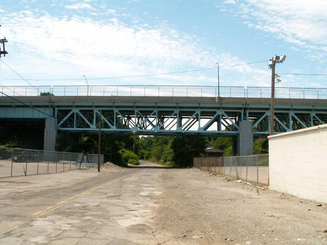
Information and Findings From Ohio's Historic Bridge InventorySetting/Context The viaduct carries a 4-lane arterial street and sidewalks over a local street through an industrial corridor, the N-S RR, and Physical Description The main span of the 10-span, 685'-long bridge is a riveted deck truss main span and girder-floorbeam and stringer approach spans supported on concrete substructure units. It is finished with modern concrete traffic and pedestrian railings/barriers. The 1917 date refers to ashlar substructure units from the previous superstructure at the crossing. Integrity Widened and new barriers in 1994. Summary of Significance It appears that neither the 1917 nor the 1994 dates are correct for the superstructure, which appears to date to ca. 1955 for the riveted and bolt connected truss lines that have rolled section web members. The bridge was widened slightly in 1994. The bridge has no innovative or distinctive details common to the period, and it is not historically or technologically significant. The 1917 date is derived from substructure units. Bridge Considered Historic By Survey: No |
![]()
![]()
Coordinates (Latitude, Longitude):
Search For Additional Bridge Listings:
Bridgehunter.com: View listed bridges within 0.5 miles (0.8 kilometers) of this bridge.
Bridgehunter.com: View listed bridges within 10 miles (16 kilometers) of this bridge.
Additional Maps:
Google Streetview (If Available)
GeoHack (Additional Links and Coordinates)
Apple Maps (Via DuckDuckGo Search)
Apple Maps (Apple devices only)
Android: Open Location In Your Map or GPS App
Flickr Gallery (Find Nearby Photos)
Wikimedia Commons (Find Nearby Photos)
Directions Via Sygic For Android
Directions Via Sygic For iOS and Android Dolphin Browser
USGS National Map (United States Only)
Historical USGS Topo Maps (United States Only)
Historic Aerials (United States Only)
CalTopo Maps (United States Only)

© Copyright 2003-2024, HistoricBridges.org. All Rights Reserved. Disclaimer: HistoricBridges.org is a volunteer group of private citizens. HistoricBridges.org is NOT a government agency, does not represent or work with any governmental agencies, nor is it in any way associated with any government agency or any non-profit organization. While we strive for accuracy in our factual content, HistoricBridges.org offers no guarantee of accuracy. Information is provided "as is" without warranty of any kind, either expressed or implied. Information could include technical inaccuracies or errors of omission. Opinions and commentary are the opinions of the respective HistoricBridges.org member who made them and do not necessarily represent the views of anyone else, including any outside photographers whose images may appear on the page in which the commentary appears. HistoricBridges.org does not bear any responsibility for any consequences resulting from the use of this or any other HistoricBridges.org information. Owners and users of bridges have the responsibility of correctly following all applicable laws, rules, and regulations, regardless of any HistoricBridges.org information.
![]()