

View Information About HSR Ratings
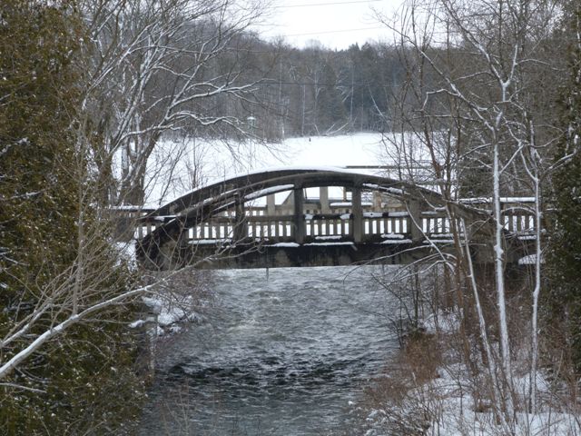
2020 Update: This bridge, seemingly having been preserved for pedestrian use, is now slated for demolition in one of the most senseless acts that shows a complete lack of interest in Ontario's heritage. The county plans to spend $127,500 to demolish this heritage bridge! Why? The reasons are ridiculous. For one, there is a plan to turn the southern approaching roadway over to private ownership. However, people could have still visited the bridge by approaching from the north, so this is not a good excuse to demolish the bridge. Another reason given was that it costs $200 a year to inspect the bridge. This is a tiny amount of money and it would take several centuries of annual inspections to reach the $127,500 being spent to wipe the bridge off the face of the earth. Another reason given for demolition was that people were moving closure barricades at the bridge. Again, it seems likely that for less than $127,500 some permanant barricades could be installed. Indeed, it seems likely that for $127,500, permanant barricades could be installed and the bridge could be inspected for many decades to come. Serving pedestrians only, the bridge need not be repaired to like-new condition to be preserved.
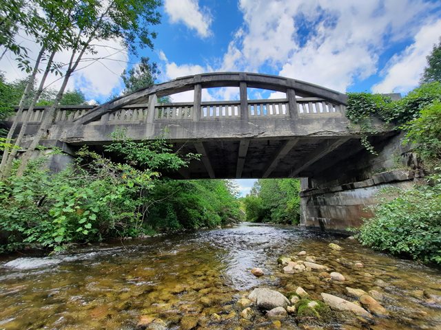
This bridge sits on a road that used to be King's Highway 6, which is now aligned a short distance west of this bridge and crosses the river in what is little more than a large culvert. This heritage bridge has been closed to vehicular traffic but remains open to pedestrians. The concrete shows signs of deterioration, but the bridge is unaltered and retains good historic integrity.
![]()
![]()
![]()
![]()
![]()
Coordinates (Latitude, Longitude):
Search For Additional Bridge Listings:
Additional Maps:
Google Streetview (If Available)
GeoHack (Additional Links and Coordinates)
Apple Maps (Via DuckDuckGo Search)
Apple Maps (Apple devices only)
Android: Open Location In Your Map or GPS App
Flickr Gallery (Find Nearby Photos)
Wikimedia Commons (Find Nearby Photos)
Directions Via Sygic For Android
Directions Via Sygic For iOS and Android Dolphin Browser

© Copyright 2003-2024, HistoricBridges.org. All Rights Reserved. Disclaimer: HistoricBridges.org is a volunteer group of private citizens. HistoricBridges.org is NOT a government agency, does not represent or work with any governmental agencies, nor is it in any way associated with any government agency or any non-profit organization. While we strive for accuracy in our factual content, HistoricBridges.org offers no guarantee of accuracy. Information is provided "as is" without warranty of any kind, either expressed or implied. Information could include technical inaccuracies or errors of omission. Opinions and commentary are the opinions of the respective HistoricBridges.org member who made them and do not necessarily represent the views of anyone else, including any outside photographers whose images may appear on the page in which the commentary appears. HistoricBridges.org does not bear any responsibility for any consequences resulting from the use of this or any other HistoricBridges.org information. Owners and users of bridges have the responsibility of correctly following all applicable laws, rules, and regulations, regardless of any HistoricBridges.org information.
![]()