

View Information About HSR Ratings
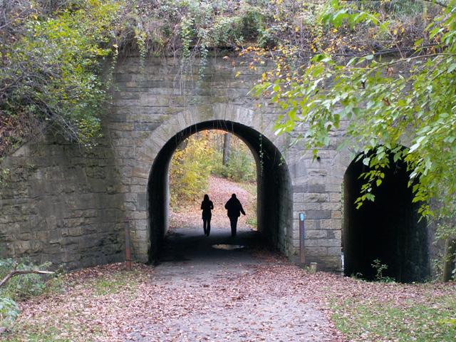
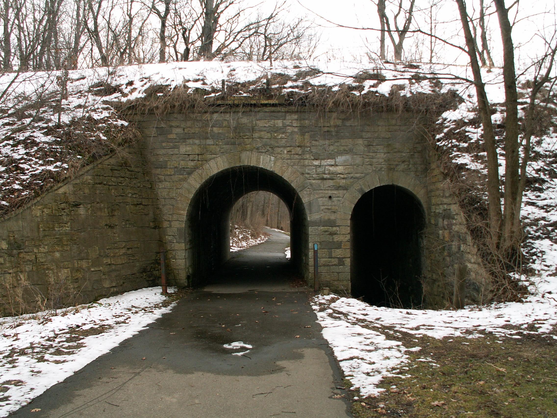
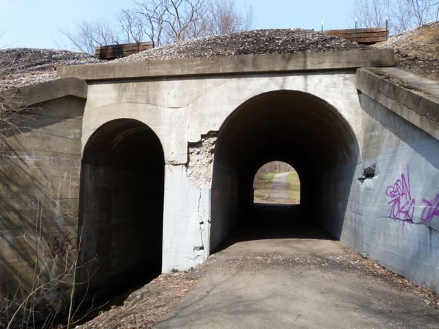
Located in Calhoun County's Historic Bridge Park, this is a bridge that was already here when Historic Bridge Park was created. In fact, with a construction date of 1892, the bridge is among the oldest bridges in Calhoun County. This bridge is very unusual. It appears to have originally been built as a stone arch bridge to carry one set of tracks. Later, when a second set of tracks were added, the bridge was widened on one side using concrete arch construction. 1892 is the date that Calhoun County gives for this bridge, which applies to the stone arch half of this highly unusual bridge. The side shown in the photo above is the stone arch bridge, however the other half of the bridge is concrete, and is likely newer. This bridge is also strange in that it is two span, and each span crosses a separate feature, which happen to be side by side. The large arch spans the road that once ran through here and is now a bike path, while the smaller span goes over the adjacent Dickinson Creek. It is fortunate that this interesting bridge is part of Historic Bridge Park, where people can appreciate it. Amtrak train sightings are common here as Amtrak runs its Detroit-Chicago route on these tracks. Norfolk Southern supposedly also runs on them as well.
Below are historical photos of the bridge from the Willard Library Digital Collections.

Above: This photo was listed as a ca. 1909 photo. Note that the concrete half of the bridge was already in place at this time.


This bridge is tagged with the following special condition(s): Unorganized Photos
![]()
![]()
![]()
![]()
Coordinates (Latitude, Longitude):
Search For Additional Bridge Listings:
Bridgehunter.com: View listed bridges within 0.5 miles (0.8 kilometers) of this bridge.
Bridgehunter.com: View listed bridges within 10 miles (16 kilometers) of this bridge.
Additional Maps:
Google Streetview (If Available)
GeoHack (Additional Links and Coordinates)
Apple Maps (Via DuckDuckGo Search)
Apple Maps (Apple devices only)
Android: Open Location In Your Map or GPS App
Flickr Gallery (Find Nearby Photos)
Wikimedia Commons (Find Nearby Photos)
Directions Via Sygic For Android
Directions Via Sygic For iOS and Android Dolphin Browser
USGS National Map (United States Only)
Historical USGS Topo Maps (United States Only)
Historic Aerials (United States Only)
CalTopo Maps (United States Only)

© Copyright 2003-2024, HistoricBridges.org. All Rights Reserved. Disclaimer: HistoricBridges.org is a volunteer group of private citizens. HistoricBridges.org is NOT a government agency, does not represent or work with any governmental agencies, nor is it in any way associated with any government agency or any non-profit organization. While we strive for accuracy in our factual content, HistoricBridges.org offers no guarantee of accuracy. Information is provided "as is" without warranty of any kind, either expressed or implied. Information could include technical inaccuracies or errors of omission. Opinions and commentary are the opinions of the respective HistoricBridges.org member who made them and do not necessarily represent the views of anyone else, including any outside photographers whose images may appear on the page in which the commentary appears. HistoricBridges.org does not bear any responsibility for any consequences resulting from the use of this or any other HistoricBridges.org information. Owners and users of bridges have the responsibility of correctly following all applicable laws, rules, and regulations, regardless of any HistoricBridges.org information.
![]()