

View Information About HSR Ratings
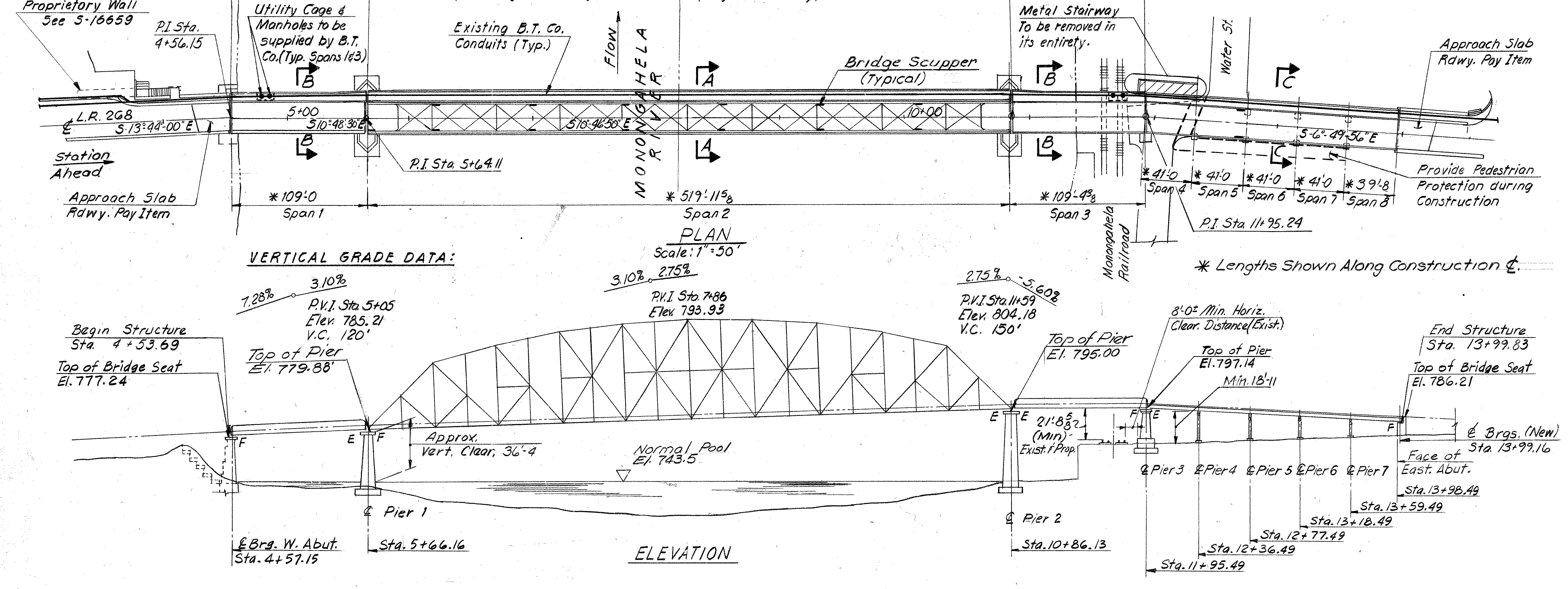
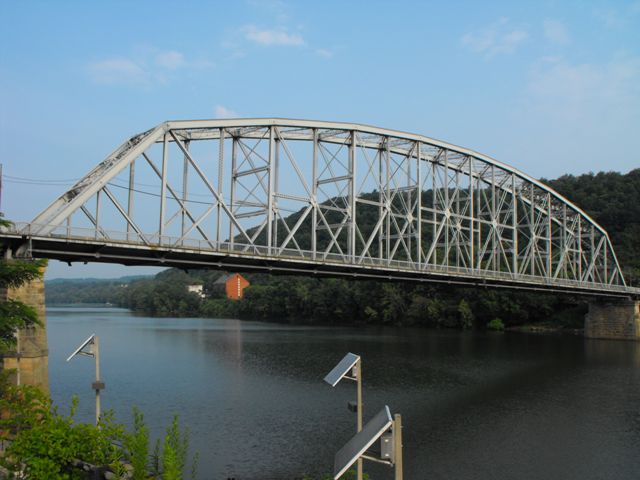
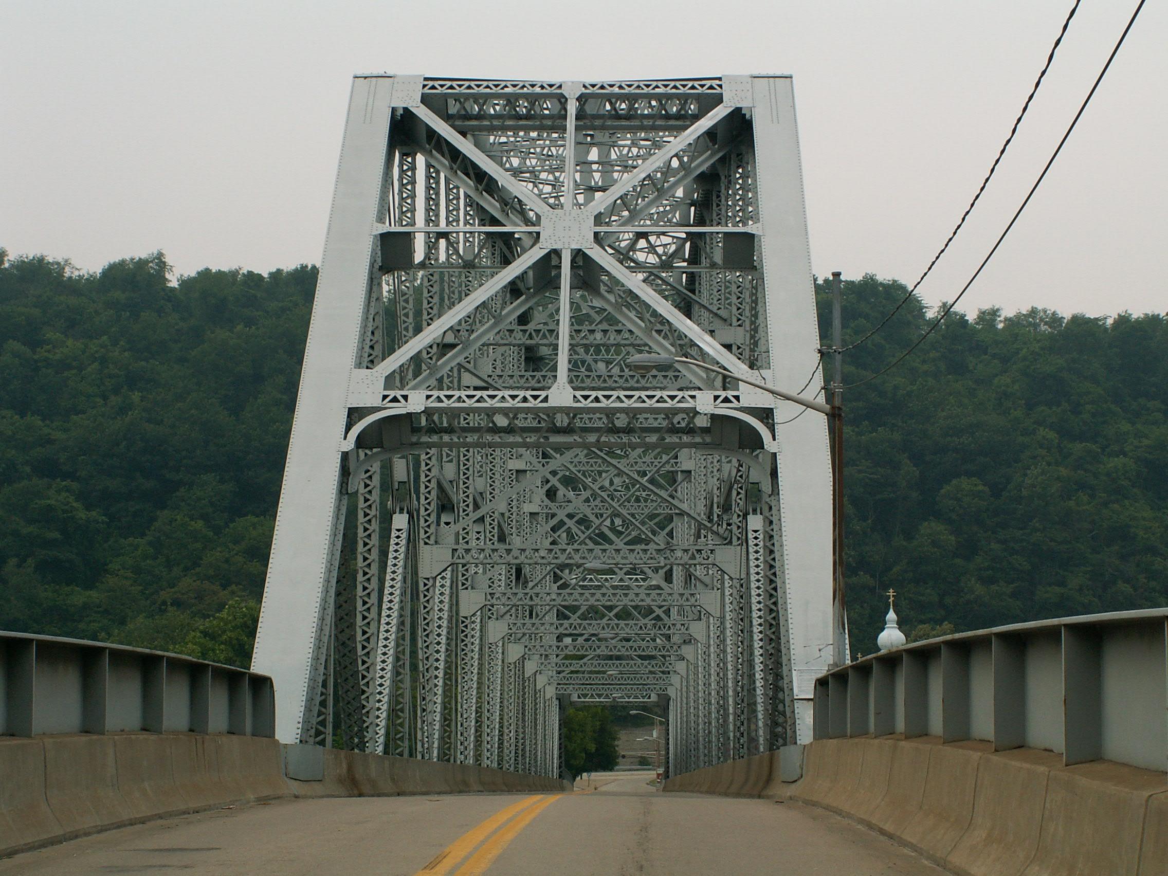
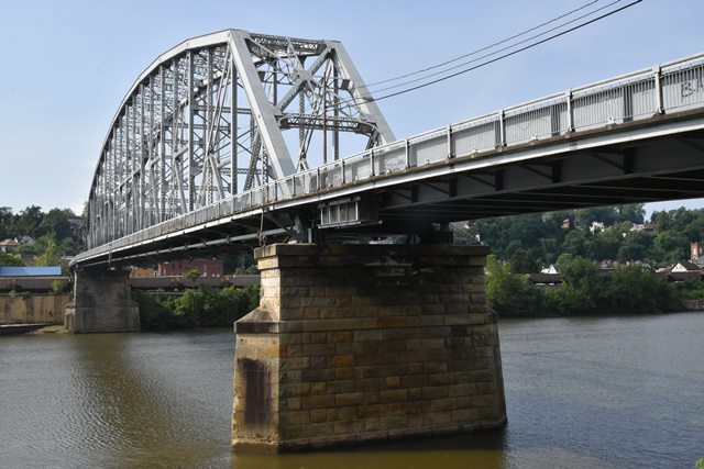
This bridge has a 20 panel 519 foot pin-connected Pennsylvania truss main span.
The shear size of this bridge's main span reminds one of the 460 foot main span of the Blue Rock Road Bridge in Ohio, which was built in the same year as the Brownsville Bridge, 1914. Indeed the Brownsville Bridge's main span is 59 feet longer than Blue Rock's but both are equally impressive structures. This is also a rare case where the Ohio bridge is being demolished, but this Pennsylvania bridge is apparently not threatened... yet. Also as well as lengths are being discussed, this bridge makes an interesting comparison to the massive span of the Hulton Bridge which actually turns out to be the same as Blue Rock at a 460 foot main span. Perhaps the extensive sway bracing on the 1908 Hulton Bridge, which is three latticed "panels" tall instead of two as on the Brownsville Bridge, that gives the illusion of extra size on the Hulton Bridge.

The Brownsville Bridge is indeed historically significant for its span length, which was quite an achievement when it was built. The bridge is aesthetically noted for its impressive span as well, which is complimented by a complex Pennsylvania truss configuration, pinned connections, and extensive v-lacing and lattice. Be sure to read the data pages on the HAER entry for this bridge, which offer a good deal of technical background and history. In modern times, and in a somewhat tragic light, this bridge is significant as one of the last remaining large-span historic bridges remaining over the Ohio/Allegheny/Monongahela Rivers in Pennsylvania. The historic bridges of these waterways, despite their significance as priceless historic landmarks, have been systematically slaughtered by PennDOT. It is unclear what has kept this bridge safe to date.
Other large long-span truss bridges were once present on the Allegheny and Monongahela River in Pennsylvania, but most of these outside of Pittsburgh have either been demolished or are slated for demolition.
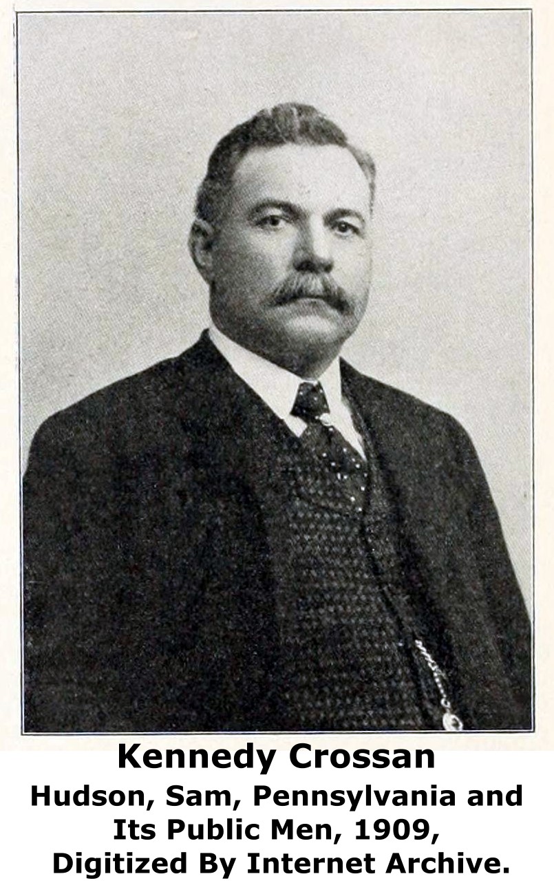
The substructure of the bridge was built by Crossan Construction Company of Philadelphia and Brownsville, Pennsylvania, a company created by Kennedy Crossan.

This bridge is tagged with the following special condition(s): Unorganized Photos
![]()
![]()
![]()
![]()
![]()
![]()
Coordinates (Latitude, Longitude):
Search For Additional Bridge Listings:
Bridgehunter.com: View listed bridges within 0.5 miles (0.8 kilometers) of this bridge.
Bridgehunter.com: View listed bridges within 10 miles (16 kilometers) of this bridge.
Additional Maps:
Google Streetview (If Available)
GeoHack (Additional Links and Coordinates)
Apple Maps (Via DuckDuckGo Search)
Apple Maps (Apple devices only)
Android: Open Location In Your Map or GPS App
Flickr Gallery (Find Nearby Photos)
Wikimedia Commons (Find Nearby Photos)
Directions Via Sygic For Android
Directions Via Sygic For iOS and Android Dolphin Browser
USGS National Map (United States Only)
Historical USGS Topo Maps (United States Only)
Historic Aerials (United States Only)
CalTopo Maps (United States Only)

© Copyright 2003-2024, HistoricBridges.org. All Rights Reserved. Disclaimer: HistoricBridges.org is a volunteer group of private citizens. HistoricBridges.org is NOT a government agency, does not represent or work with any governmental agencies, nor is it in any way associated with any government agency or any non-profit organization. While we strive for accuracy in our factual content, HistoricBridges.org offers no guarantee of accuracy. Information is provided "as is" without warranty of any kind, either expressed or implied. Information could include technical inaccuracies or errors of omission. Opinions and commentary are the opinions of the respective HistoricBridges.org member who made them and do not necessarily represent the views of anyone else, including any outside photographers whose images may appear on the page in which the commentary appears. HistoricBridges.org does not bear any responsibility for any consequences resulting from the use of this or any other HistoricBridges.org information. Owners and users of bridges have the responsibility of correctly following all applicable laws, rules, and regulations, regardless of any HistoricBridges.org information.
![]()