

View Information About HSR Ratings
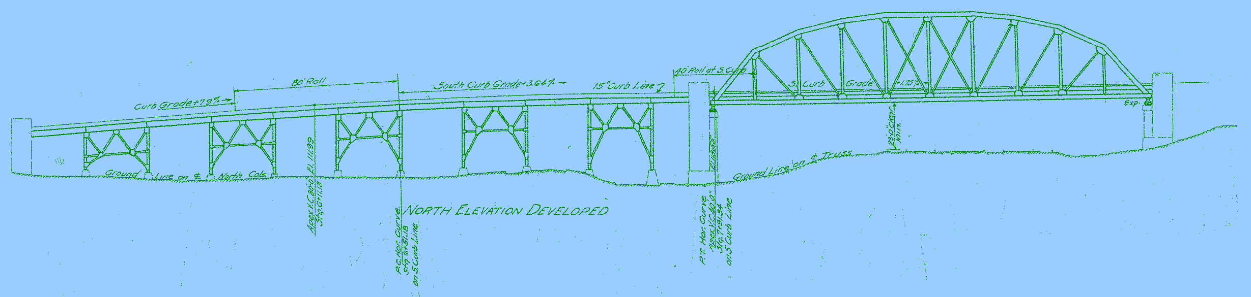
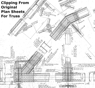
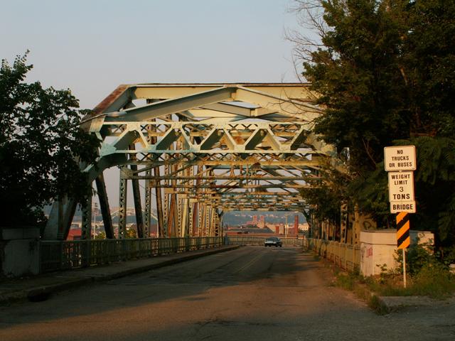
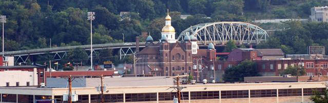
This is a bridge that is truly an example of what makes Pittsburgh the unique city it is, since this is a bridge that was built alongside and runs up a steep hillside, while also crossing railroad tracks along the way, accounting for the Parker truss main span. The ten panel Parker truss is obviously the main attraction, however the curved approach system is very impressive to see as well. Although a smaller bridge than the bridges on the big three rivers in Pittsburgh, this bridge remains a highly visible structure since it is easy to spot from various places in and near downtown as it runs along the hillside. Because it is such a visible and attractive part of the area landscape, the preservation of this structure is essential. Unfortunately, the bridge has not been maintained and the structure is in poor condition, particularly in terms of the steel bent supports for the approach spans. Temporary false work has been added to support parts of this approach spans, and the bridge has been lowered to the 3 ton weight limit which is the lowest weight limit generally seen for a bridge open to traffic. Despite these problems, this bridge could and should be restored. Some parts might require replacement, but if they were done with in-kind materials, and if the main truss span was preserved, this bridge could continue to help define Pittsburgh's landscape as well as serve as a functional structure. The good news is, after some time considering demolition and replacement, Pittsburgh decided to rehabilitate this historic bridge.
This bridge also offers a decent view of the Tenth Street Bridge and much of downtown.
The bridge passes under the McArdle Roadway Pedestrian Overpass.
![]()
![]()
Coordinates (Latitude, Longitude):
Search For Additional Bridge Listings:
Bridgehunter.com: View listed bridges within 0.5 miles (0.8 kilometers) of this bridge.
Bridgehunter.com: View listed bridges within 10 miles (16 kilometers) of this bridge.
Additional Maps:
Google Streetview (If Available)
GeoHack (Additional Links and Coordinates)
Apple Maps (Via DuckDuckGo Search)
Apple Maps (Apple devices only)
Android: Open Location In Your Map or GPS App
Flickr Gallery (Find Nearby Photos)
Wikimedia Commons (Find Nearby Photos)
Directions Via Sygic For Android
Directions Via Sygic For iOS and Android Dolphin Browser
USGS National Map (United States Only)
Historical USGS Topo Maps (United States Only)
Historic Aerials (United States Only)
CalTopo Maps (United States Only)

© Copyright 2003-2024, HistoricBridges.org. All Rights Reserved. Disclaimer: HistoricBridges.org is a volunteer group of private citizens. HistoricBridges.org is NOT a government agency, does not represent or work with any governmental agencies, nor is it in any way associated with any government agency or any non-profit organization. While we strive for accuracy in our factual content, HistoricBridges.org offers no guarantee of accuracy. Information is provided "as is" without warranty of any kind, either expressed or implied. Information could include technical inaccuracies or errors of omission. Opinions and commentary are the opinions of the respective HistoricBridges.org member who made them and do not necessarily represent the views of anyone else, including any outside photographers whose images may appear on the page in which the commentary appears. HistoricBridges.org does not bear any responsibility for any consequences resulting from the use of this or any other HistoricBridges.org information. Owners and users of bridges have the responsibility of correctly following all applicable laws, rules, and regulations, regardless of any HistoricBridges.org information.
![]()