


View Information About HSR Ratings
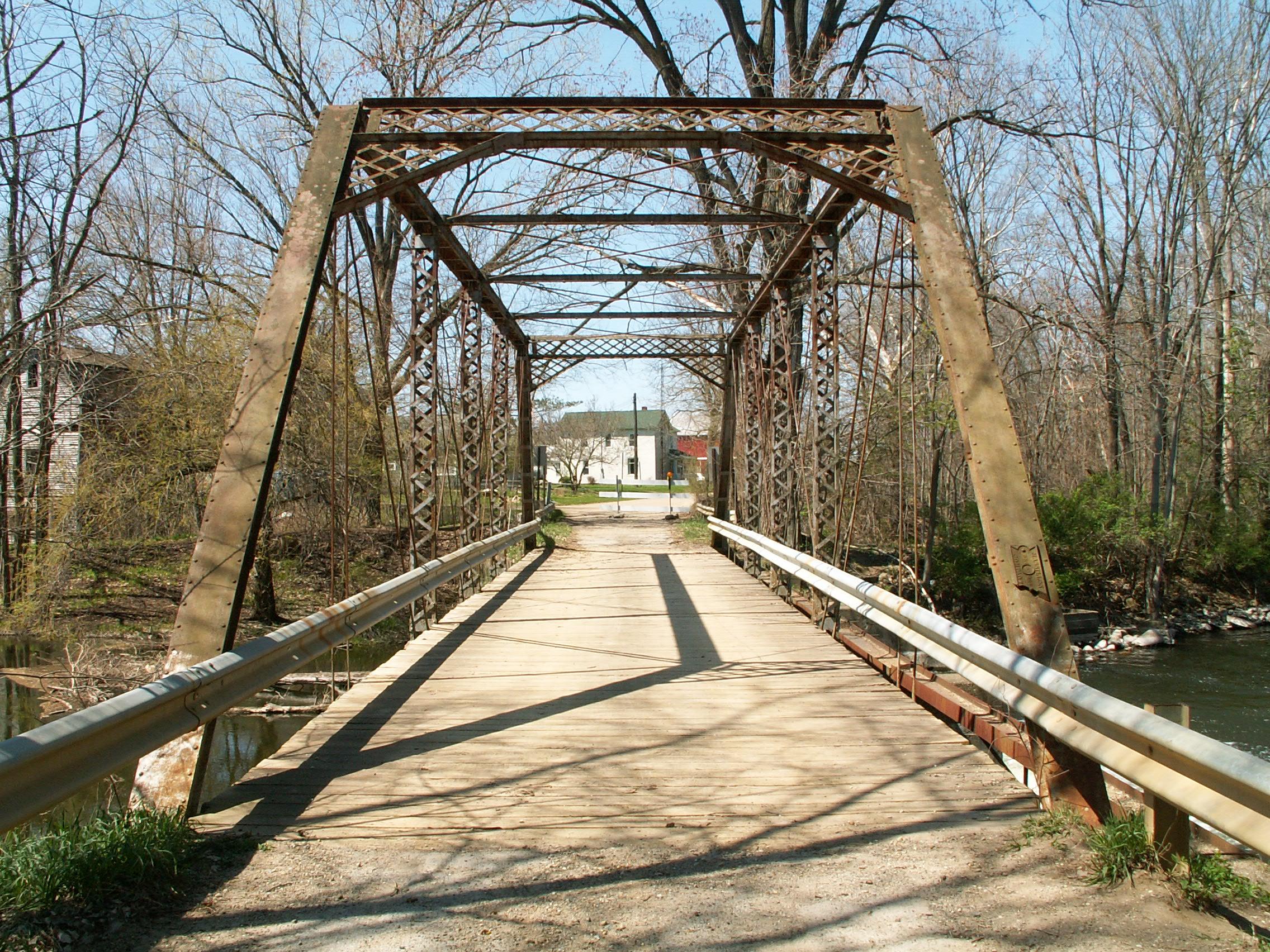
Michigan, unfortunately, has a relatively small number of remaining through truss bridges. Even fewer is the number that remain open to vehicular traffic. The Stancer Road Bridge was significant because until 2018 you could still drive across this beautiful bridge, which was posted at Michigan's minimum weight limit of 3 tons. This bridge is quite old with an 1888 construction date. The bridge was built by the Massillon Bridge Company. Massillon Bridge company was the second most prolific truss bridge builder in Michigan, with Wrought Iron Bridge Company in first place. This bridge, although it has had modern Armco railings added, retains a great deal of historic integrity.
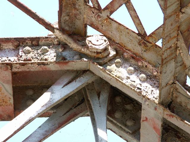
This bridge is a six panel pin connected through truss bridge. V-lacing is present on the vertical members. Lattice is present on the portal bracing. The deck is wooden, and appears to have been redone in the not-so-distant past. At the west end, two stringer spans provide an approach to the bridge. These stringer spans are also wooden decked. Piers and abutments for this bridge are concrete. This bridge sits right beside a small mill/dam like structure that creates a small waterfall under the bridge.
2018 Update: This bridge has been closed to traffic indefinitely with no immediate plans for repair.

Above: Historical photo showing that the stringer span originally was a pony truss span.
Information and Findings From Michigan Historic Bridge InventoryNarrative Description The Stancer Road Bridge is eligible for the National Register as an excellent example of a late nineteenth-century pinned, overhead Pratt truss. This once common bridge type is now becoming rare in Michigan. The number "88" appears in a center circle of the bridge plates, indicating that the bridge was probably constructed in 1888. The bridge plates also show the builder as the Massillon Bridge Company, which was in operation from 1869 to 1901. This firm was one of the most prolific bridge building companies in Michigan and the Midwest during the nineteenth century, and is known to have built at least nineteen structures in the state. This bridge was probably built under township authority. No archival information could be found regarding its construction. The integrity of the structure has been maintained, and the physical condition is good. |
This bridge is tagged with the following special condition(s): Unorganized Photos
![]()

![]()
![]()
![]()
![]()
![]()
Coordinates (Latitude, Longitude):
Search For Additional Bridge Listings:
Bridgehunter.com: View listed bridges within 0.5 miles (0.8 kilometers) of this bridge.
Bridgehunter.com: View listed bridges within 10 miles (16 kilometers) of this bridge.
Additional Maps:
Google Streetview (If Available)
GeoHack (Additional Links and Coordinates)
Apple Maps (Via DuckDuckGo Search)
Apple Maps (Apple devices only)
Android: Open Location In Your Map or GPS App
Flickr Gallery (Find Nearby Photos)
Wikimedia Commons (Find Nearby Photos)
Directions Via Sygic For Android
Directions Via Sygic For iOS and Android Dolphin Browser
USGS National Map (United States Only)
Historical USGS Topo Maps (United States Only)
Historic Aerials (United States Only)
CalTopo Maps (United States Only)

© Copyright 2003-2024, HistoricBridges.org. All Rights Reserved. Disclaimer: HistoricBridges.org is a volunteer group of private citizens. HistoricBridges.org is NOT a government agency, does not represent or work with any governmental agencies, nor is it in any way associated with any government agency or any non-profit organization. While we strive for accuracy in our factual content, HistoricBridges.org offers no guarantee of accuracy. Information is provided "as is" without warranty of any kind, either expressed or implied. Information could include technical inaccuracies or errors of omission. Opinions and commentary are the opinions of the respective HistoricBridges.org member who made them and do not necessarily represent the views of anyone else, including any outside photographers whose images may appear on the page in which the commentary appears. HistoricBridges.org does not bear any responsibility for any consequences resulting from the use of this or any other HistoricBridges.org information. Owners and users of bridges have the responsibility of correctly following all applicable laws, rules, and regulations, regardless of any HistoricBridges.org information.
![]()