

View Information About HSR Ratings
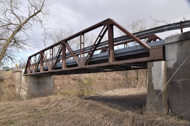
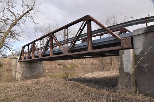
Additional Information: Michael contacted HistoricBridges.org and reports that one of the abutments of the Stanley line bridge has the words (Grant Bridge 1932) stamped into it. As of 2022, the bridge has a new metal grate deck, although the bridge was not repainted like the nearby Pretty Road Bridge. In either case, the work shows an attention toward maintaining this bridge rather than demolishing and replacing it. It would be great to see this bridge painted like Pretty Road Bridge as well!
This bridge is a classic example of a Warren pony truss. It unfortunately has had its railings replaced with modern Armco guardrails, resulting in the only modification to the original truss structure. The deck and abutments are concrete. There is v-lacing on some diagonals on the bridge. The top chord is slightly unusual in that there is nothing on the underside of the top chord spanning the sections of steel in the built-up chord. Usually you will find v-lacing, lattice, or batten plates. The superstructure lacks paint, but is in otherwise good condition. The deck is in fair shape, although the curbs have fallen away in some places.
This bridge is tagged with the following special condition(s): Unorganized Photos
![]()

![]()
![]()
![]()
![]()
Coordinates (Latitude, Longitude):
Search For Additional Bridge Listings:
Additional Maps:
Google Streetview (If Available)
GeoHack (Additional Links and Coordinates)
Apple Maps (Via DuckDuckGo Search)
Apple Maps (Apple devices only)
Android: Open Location In Your Map or GPS App
Flickr Gallery (Find Nearby Photos)
Wikimedia Commons (Find Nearby Photos)
Directions Via Sygic For Android
Directions Via Sygic For iOS and Android Dolphin Browser

© Copyright 2003-2024, HistoricBridges.org. All Rights Reserved. Disclaimer: HistoricBridges.org is a volunteer group of private citizens. HistoricBridges.org is NOT a government agency, does not represent or work with any governmental agencies, nor is it in any way associated with any government agency or any non-profit organization. While we strive for accuracy in our factual content, HistoricBridges.org offers no guarantee of accuracy. Information is provided "as is" without warranty of any kind, either expressed or implied. Information could include technical inaccuracies or errors of omission. Opinions and commentary are the opinions of the respective HistoricBridges.org member who made them and do not necessarily represent the views of anyone else, including any outside photographers whose images may appear on the page in which the commentary appears. HistoricBridges.org does not bear any responsibility for any consequences resulting from the use of this or any other HistoricBridges.org information. Owners and users of bridges have the responsibility of correctly following all applicable laws, rules, and regulations, regardless of any HistoricBridges.org information.
![]()