

View Information About HSR Ratings
Although this bridge has been bypassed by a modern slab and is not in the way of anything, Cabell County demolished this historic bridge, which may be one of West Virginia's most significant historic bridges, and has great significance on a national scale as well.
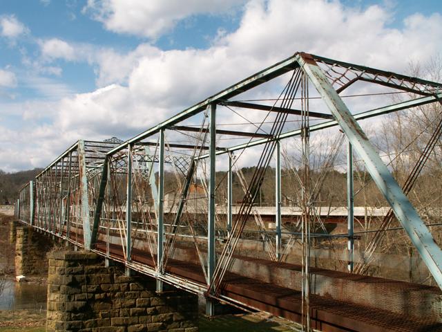
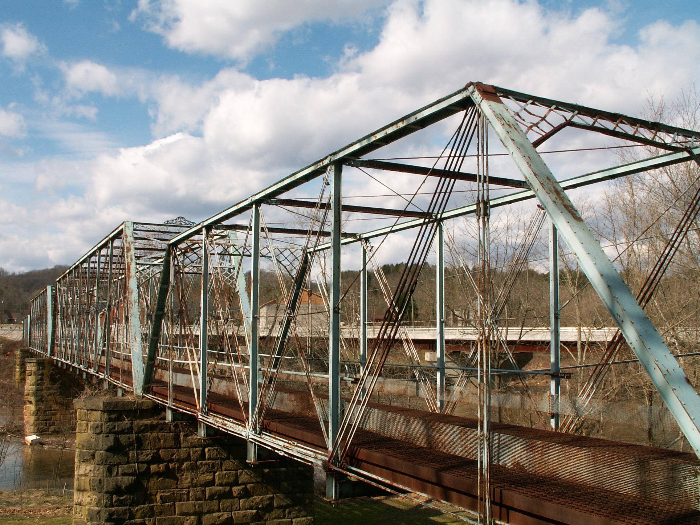
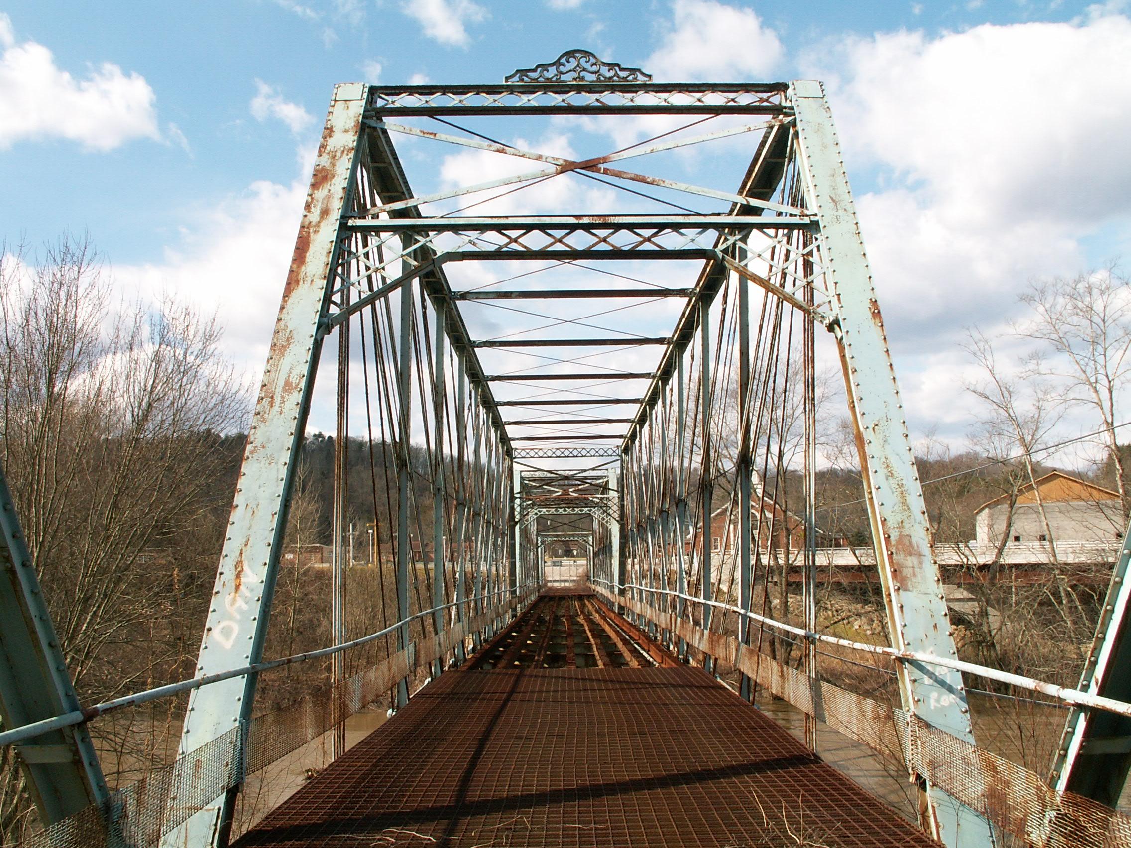
This bridge has a high level of significance because so many different aspects of the bridge are rare or noteworthy. The bridge is unique in its design of spans. It features two main Whipple spans. Any Whipple span is rare, but multi-span examples are extremely rare. In addition, there is one Pratt through truss at each end of the bridge. This variety of span designs, with the smaller spans at the end and the larger spans at the center creates a visually appealing bridge, that builds up to the larger spans for the central crossing of the River. It is also uncommon, particularly with the pin-connected truss bridges, to find bridges that feature multiple truss types in one bridge. Those that do are usually through truss main span(s) with pony truss approaches. Variations with all-through truss spans are rare. Indeed, this bridge is significant for its length alone, regardless of what types of spans are used to achieve that distance. Further historic significance for this bridge comes in the form of association with a prolific builder, the Wrought Iron Bridge Company of Canton, Ohio. The design of both the approach and main spans follows closely some of the company's first patents, dated c.1876, for the pin-connected truss bridges. Any surviving examples of these early bridges are important in documenting the development of the Wrought Iron Bridge Company, and the truss bridge in general. Although the plaques have been removed, the decorative ornamentation has been left on the Whipple spans. The bridge sits on stone piers and abutments.
The only downside to the bridge is the poor historic integrity, however it is important to note that much of this could easily be removed and missing parts replicated in a comprehensive restoration project. Entire sections of the bottom chord are either replaced or supplemented with insensitive rods that look nothing like the original eye bars. Many diagonals have additional rods added to them, although the originals remain as well. Original railings do not remain on the bridge. Plate steel was welded onto a couple small areas of the bridge. The floorbeams and hangers may not be original. While these are serious issues, they could be corrected. It is also noteworthy that with the exception of some missing pieces of the bottom chord, all of the original parts of the truss appear to remain. Most of the alterations are simply add-ons.
A church that is located near this bridge had the audacity to publically mention that they feel the historic bridge is an eyesore and should be demolished. Granted, everyone's opinion on what defines beauty is different. However most religions teach tolerance, acceptance, and not being selfish. Given the high level and historic significance of the Martha Bridge, and also that many people would likely find the bridge quaint and attractive, it seems very un-church-like to condemn this bridge.
![]()
![]()
![]()

![]()
This historic bridge has been demolished. This map is shown for reference purposes only.
Coordinates (Latitude, Longitude):
Search For Additional Bridge Listings:
Bridgehunter.com: View listed bridges within 0.5 miles (0.8 kilometers) of this bridge.
Bridgehunter.com: View listed bridges within 10 miles (16 kilometers) of this bridge.
Additional Maps:
Google Streetview (If Available)
GeoHack (Additional Links and Coordinates)
Apple Maps (Via DuckDuckGo Search)
Apple Maps (Apple devices only)
Android: Open Location In Your Map or GPS App
Flickr Gallery (Find Nearby Photos)
Wikimedia Commons (Find Nearby Photos)
Directions Via Sygic For Android
Directions Via Sygic For iOS and Android Dolphin Browser
USGS National Map (United States Only)
Historical USGS Topo Maps (United States Only)
Historic Aerials (United States Only)
CalTopo Maps (United States Only)

© Copyright 2003-2024, HistoricBridges.org. All Rights Reserved. Disclaimer: HistoricBridges.org is a volunteer group of private citizens. HistoricBridges.org is NOT a government agency, does not represent or work with any governmental agencies, nor is it in any way associated with any government agency or any non-profit organization. While we strive for accuracy in our factual content, HistoricBridges.org offers no guarantee of accuracy. Information is provided "as is" without warranty of any kind, either expressed or implied. Information could include technical inaccuracies or errors of omission. Opinions and commentary are the opinions of the respective HistoricBridges.org member who made them and do not necessarily represent the views of anyone else, including any outside photographers whose images may appear on the page in which the commentary appears. HistoricBridges.org does not bear any responsibility for any consequences resulting from the use of this or any other HistoricBridges.org information. Owners and users of bridges have the responsibility of correctly following all applicable laws, rules, and regulations, regardless of any HistoricBridges.org information.
![]()