HistoricBridges.org Menu: HistoricBridges.org Menu:


HistoricBridges.org: Bridge Browser

Map: Brilliant Suspension Bridge

Google Map: (More Links and Maps Below)

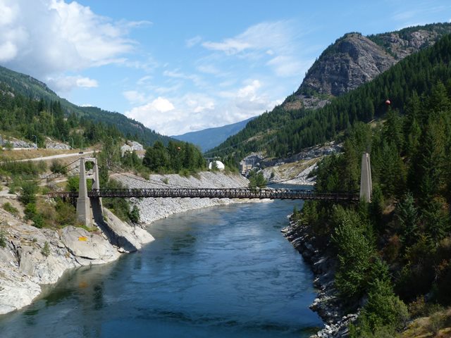
Location: Brilliant Road (Pedestrian Walkway) Over Kootenay River In Brilliant: Central Kootenay District, British Columbia, Canada
Latitude: 49.317330 Longitude: -117.629570 ( 49.317330,-117.629570 )

Note: If approaching this bridge from the south, note that it may look like the trail is fenced off, but it is actually a gate that is left unlocked for the public. A sign simply asks visitors to close the gate behind them.

View Bridge Location In:


Android: Open Location In Your Map or GPS App

Google Maps

Google Streetview (If Available)

Bing Maps

ACME Mapper

OpenStreetMap

Google Earth (KML File)

Flickr Gallery (Find Nearby Photos)

Directions Via Sygic For Android

Directions Via Sygic For iOS and Android Dolphin Browser

MapQuest

HERE We Go Maps

ACME Mapper

Historical USGS Topo Maps (United States Only)

CalTopo Maps (United States Only)

Ordnance Survey Maps (UK Only)

GeoHack Map Links (Enter 49.317330 For Latitude and -117.629570 For Longitude)

Brilliant Suspension Bridge

Divider

Back
Home
Top

Divider

About - Contact

Divider