HistoricBridges.org Menu: HistoricBridges.org Menu:


HistoricBridges.org: Bridge Browser

Map: Niagara Canyon Bridge

Google Map: (More Links and Maps Below)

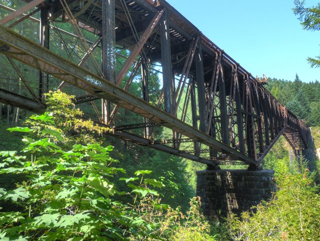
Location: Railroad (Island Corridor Foundation, Southern Railway of British Columbia) Over Niagara Creek In Rural: Capital District, British Columbia, Canada
Latitude: 48.482850 Longitude: -123.557460 ( 48.482850,-123.557460 )

Please note that this railway bridge is privately owned and is located on private property. Please do not approach or attempt to trespass on the bridge deck.

View Bridge Location In:


Android: Open Location In Your Map or GPS App

Google Maps

Google Streetview (If Available)

Bing Maps

ACME Mapper

OpenStreetMap

Google Earth (KML File)

Flickr Gallery (Find Nearby Photos)

Directions Via Sygic For Android

Directions Via Sygic For iOS and Android Dolphin Browser

MapQuest

HERE We Go Maps

ACME Mapper

Historical USGS Topo Maps (United States Only)

CalTopo Maps (United States Only)

Ordnance Survey Maps (UK Only)

GeoHack Map Links (Enter 48.482850 For Latitude and -123.557460 For Longitude)

Niagara Canyon Bridge

Divider

Back
Home
Top

Divider

About - Contact

Divider