HistoricBridges.org Menu: HistoricBridges.org Menu:


HistoricBridges.org: Bridge Browser

Map: Szabadság híd (Liberty Bridge)

Google Map: (More Links and Maps Below)

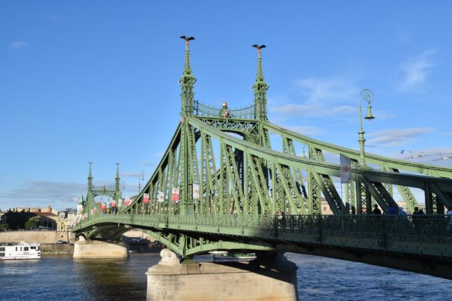
Location: Kelenhegyi út and Vámház körút Over Danube River (Duna) In Budapest: Pest County, Central Hungary (Pest megye, Magyarország), Hungary (Magyarország)
Latitude: 47.485720 Longitude: 19.054950 ( 47.485720,19.054950 )

View Bridge Location In:


Android: Open Location In Your Map or GPS App

Google Maps

Google Streetview (If Available)

Bing Maps

ACME Mapper

OpenStreetMap

Google Earth (KML File)

Flickr Gallery (Find Nearby Photos)

Directions Via Sygic For Android

Directions Via Sygic For iOS and Android Dolphin Browser

MapQuest

HERE We Go Maps

ACME Mapper

Historical USGS Topo Maps (United States Only)

CalTopo Maps (United States Only)

Ordnance Survey Maps (UK Only)

GeoHack Map Links (Enter 47.485720 For Latitude and 19.054950 For Longitude)

Szabadság híd (Liberty Bridge)

Divider

Back
Home
Top

Divider

About - Contact

Divider