
Google Map: (More Links and Maps Below)
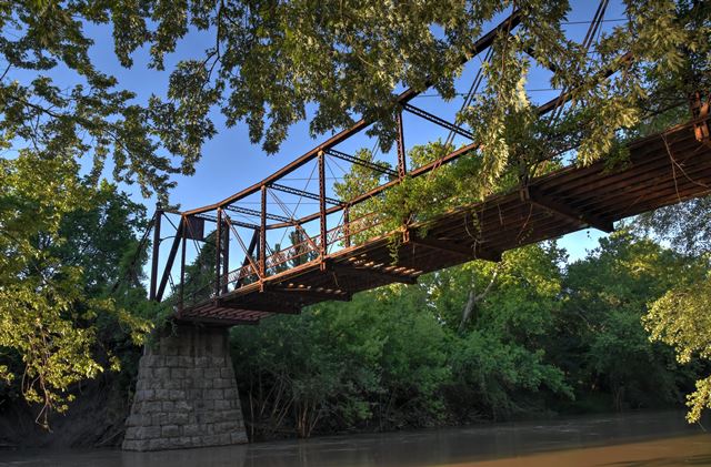
Location: 1st Street (Osawatomie Road) Over Marais Des Cygnes River In Osawatomie: Miami County, Kansas, United States
Latitude: 38.505130 Longitude: -94.941990 ( 38.505130,-94.941990 )
Approach this abandoned bridge from the south.
View Bridge Location In:
Bridgehunter.com: View listed bridges within a half mile of this bridge.
Bridgehunter.com: View listed bridges within 10 miles of this bridge.
Android: Open Location In Your Map or GPS App
![]()
| Back |
| Home |
| Top |

![]()