HistoricBridges.org Menu: HistoricBridges.org Menu:


HistoricBridges.org: Bridge Browser

Map: Southern Villa Bridge

Google Map: (More Links and Maps Below)

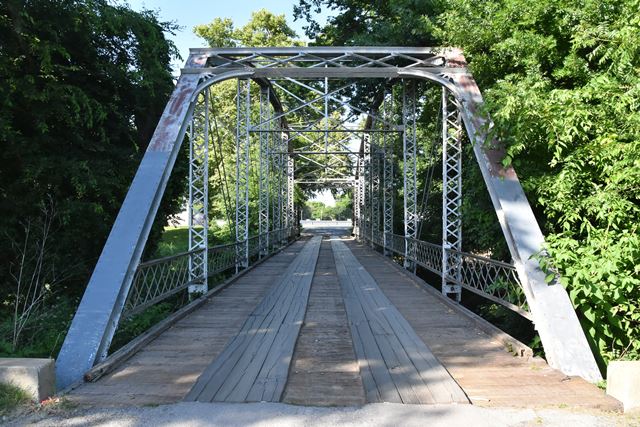
Location: Oak Drive Over Joe Creek In Tulsa: Tulsa County, Oklahoma, United States
Latitude: 36.037730 Longitude: -95.956350 ( 36.037730,-95.956350 )

While ownership of this bridge is private, there were no visible, posted restrictions on public access.

View Bridge Location In:

Bridgehunter.com: View listed bridges within a half mile of this bridge.

Bridgehunter.com: View listed bridges within 10 miles of this bridge.

Android: Open Location In Your Map or GPS App

Google Maps

Google Streetview (If Available)

Bing Maps

ACME Mapper

OpenStreetMap

Google Earth (KML File)

Flickr Gallery (Find Nearby Photos)

Directions Via Sygic For Android

Directions Via Sygic For iOS and Android Dolphin Browser

MapQuest

HERE We Go Maps

ACME Mapper

Historical USGS Topo Maps (United States Only)

CalTopo Maps (United States Only)

Ordnance Survey Maps (UK Only)

GeoHack Map Links (Enter 36.037730 For Latitude and -95.956350 For Longitude)

Southern Villa Bridge

Divider

Back
Home
Top

Divider

About - Contact

Divider