HistoricBridges.org Menu: HistoricBridges.org Menu:


HistoricBridges.org: Bridge Browser

Map: Port Colborne Railway Bridge

Google Map: (More Links and Maps Below)

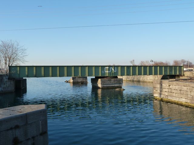
Location: Railroad (Abandoned Canadian National) Over Old Welland Canal In Port Colborne: Niagara Region, Ontario, Canada
Latitude: 42.887260 Longitude: -79.249490 ( 42.887260,-79.249490 )

View Bridge Location In:


Android: Open Location In Your Map or GPS App

Google Maps

Google Streetview (If Available)

Bing Maps

ACME Mapper

OpenStreetMap

Google Earth (KML File)

Flickr Gallery (Find Nearby Photos)

Directions Via Sygic For Android

Directions Via Sygic For iOS and Android Dolphin Browser

MapQuest

HERE We Go Maps

ACME Mapper

Historical USGS Topo Maps (United States Only)

CalTopo Maps (United States Only)

Ordnance Survey Maps (UK Only)

GeoHack Map Links (Enter 42.887260 For Latitude and -79.249490 For Longitude)

Port Colborne Railway Bridge

Divider

Back
Home
Top

Divider

About - Contact

Divider