

View Information About HSR Ratings
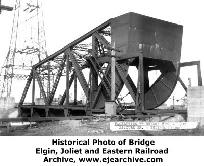
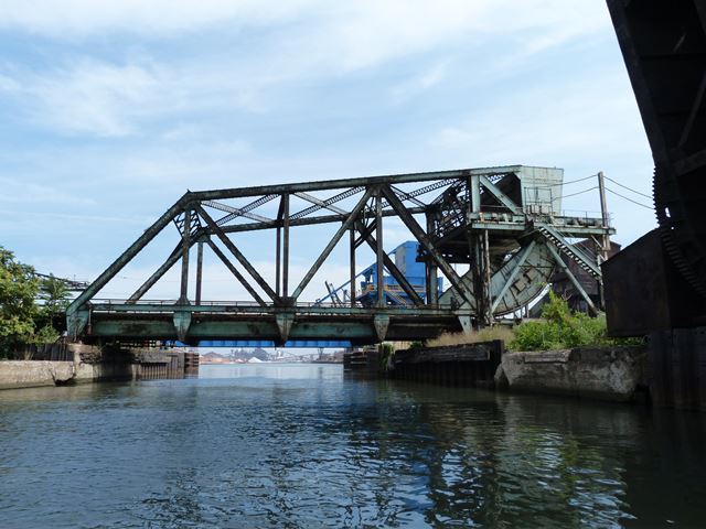
This bridge was originally built for the Chicago, Lake Shore, and Eastern Railway which later became the Elgin, Joliet, and Eastern Lakefront Line. Completed in 1908, this bridge is among the oldest surviving Scherzer Rolling Lift bascule bridges. The other two rolling lift bridges that both survived on the Indiana Harbor and Ship Canal when this bridge was photo-documented were both slightly younger than this bridge. The bridge has the composition of an early 20th Century Scherzer Rolling Lift bascule bridge including the distinctive counterweight that is carefully shaped to visually blend into both the truss and the roller, which helps give the bridge a clean, simple appearance.
In recent years, a new bascule bridge was built immediately northeast of this bridge. The modern bridge lacks the beauty and heritage of a riveted truss leaf and also lacks attractive built-up beams with lattice and v-lacing. However, the design of the machinery is strikingly similar to the 1908 bridge, from the rolling lift design to the shape of the counterweight. The fact that this modern bridge is over 100 years newer than the historic 1908 bridge, yet employs the same type of movable system as the historic bridge is evidence of how reliable and effective the Scherzer Rolling Lift type of bascule bridge is. The Scherzer Rolling Lift bascule was invented by William Scherzer in 1893.
This bridge is located deep within a privately owned area of heavy industry, alongside several other historic railroad bridges at this location. The only reliable, legal way for the public to visit these bridges on the canal is to take a boat on the canal, or briefly glance them out of the typically dirty windows of the Amtrak trains that cross a nearby bridge.
Thanks to Tom Winkle for providing boat transportation to assist in the photo-documentation of this historic bridge.

![]()
![]()
![]()
Coordinates (Latitude, Longitude):
Search For Additional Bridge Listings:
Bridgehunter.com: View listed bridges within 0.5 miles (0.8 kilometers) of this bridge.
Bridgehunter.com: View listed bridges within 10 miles (16 kilometers) of this bridge.
Additional Maps:
Google Streetview (If Available)
GeoHack (Additional Links and Coordinates)
Apple Maps (Via DuckDuckGo Search)
Apple Maps (Apple devices only)
Android: Open Location In Your Map or GPS App
Flickr Gallery (Find Nearby Photos)
Wikimedia Commons (Find Nearby Photos)
Directions Via Sygic For Android
Directions Via Sygic For iOS and Android Dolphin Browser
USGS National Map (United States Only)
Historical USGS Topo Maps (United States Only)
Historic Aerials (United States Only)
CalTopo Maps (United States Only)

© Copyright 2003-2024, HistoricBridges.org. All Rights Reserved. Disclaimer: HistoricBridges.org is a volunteer group of private citizens. HistoricBridges.org is NOT a government agency, does not represent or work with any governmental agencies, nor is it in any way associated with any government agency or any non-profit organization. While we strive for accuracy in our factual content, HistoricBridges.org offers no guarantee of accuracy. Information is provided "as is" without warranty of any kind, either expressed or implied. Information could include technical inaccuracies or errors of omission. Opinions and commentary are the opinions of the respective HistoricBridges.org member who made them and do not necessarily represent the views of anyone else, including any outside photographers whose images may appear on the page in which the commentary appears. HistoricBridges.org does not bear any responsibility for any consequences resulting from the use of this or any other HistoricBridges.org information. Owners and users of bridges have the responsibility of correctly following all applicable laws, rules, and regulations, regardless of any HistoricBridges.org information.
![]()