


View Information About HSR Ratings

This "bridge" is actually two bridges. The original bridge which today carries northbound traffic was completed in 1917, as a riveted Parker truss vertical lift bridge, with Parker truss approach spans of similar design. In 1958, several things happened. A second bridge of nearly identical appearance and design was constructed to carry southbound traffic, forming a one-way couplet of bridges. There were two areas in which the southbound bridge was different from the original 1917 bridge. First, there was a large fixed Pennsylvania through truss span of 531.4 foot span length located south of the lift span. In addition, the elevation of the spans south of the bridge was increased to rise higher, above the elevation of the roadway at the vertical lift span, presumably to allow smaller boats to pass under the bridge without requiring the lift span to operate. At this time, the 1917 northbound bridge was modified to match these changes: the piers were increased in height to match the higher spans on the 1958 bridge, and two of the original fixed Parker truss approach spans were replaced with a 531.4 Pennsylvania through truss to match the southbound span.
Because of this unusual history and design, this bridge is difficult to categorize because it now has an "approach span" that is a fixed Pennsylvania through truss with a 531.4 foot span length (usually the main span of a bridge is the longest), while the "main span" is a Parker truss vertical lift span with a span length of 278.7 feet, and whose lift span is similar to the design of the other shorter fixed Parker truss approach spans. The 531.4 foot truss span is among the longest simple-span trusses in the country, so to try to help that pop up in BridgeSeek search results for anyone researching span lengths, HistoricBridges.org listed the 531.4 foot span as the "main span length" but has listed the main span type as Vertical lift span. The actual span length of the lift span is 278.7 feet.
HistoricBridges.org's extensive photo-documentation is primarily focused on the on the original 1917 (northbound) bridge. Note that most of the details of the southbound span are almost identical, however there are some exceptions. Perhaps one of the more noteworthy and striking differences is that the 1917 bridge has traditional built-up "plate girder" style floorbeams. The 1958 bridge in contrast has very unusual riveted Warren truss floorbeams.
A series of historical photos below show the construction of the 1917 bridge.
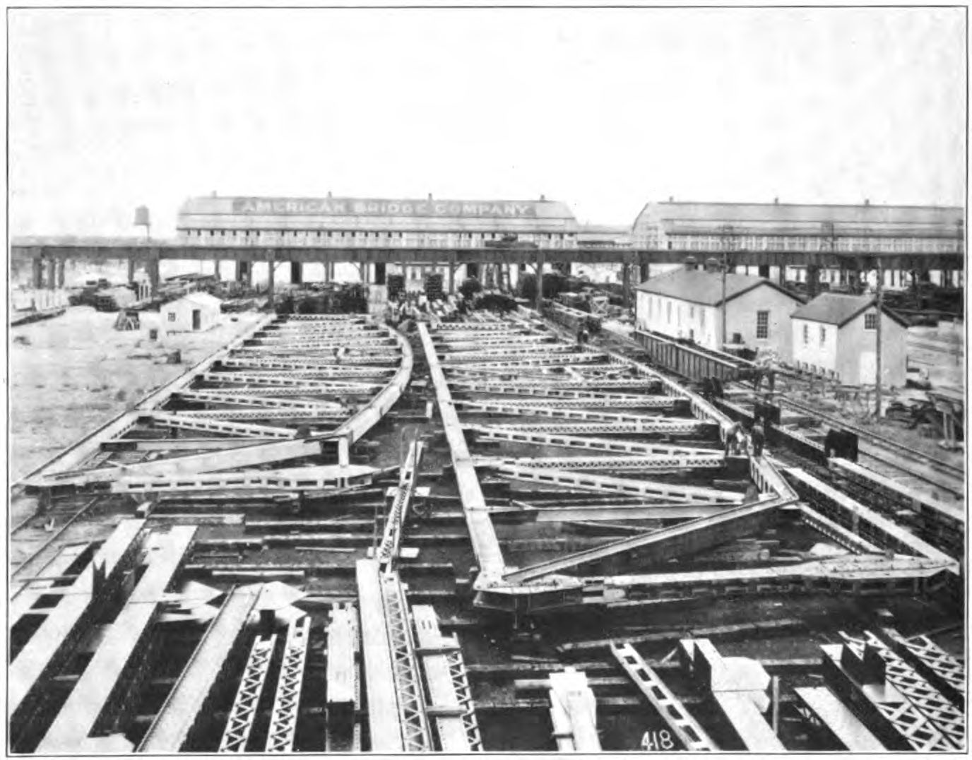
Above: Laying out of trusses in American Bridge Company's yard in Gary, Indiana, which was part of the United States Steel complex.

Above: Erection of truss spans in a nearby location.

Above: Erection of truss spans in a nearby location.

Above: Floating one of the truss spans into position over the river.

Above: Floating the lift span into position over the river.

Above: Historical photo showing newly completed bridge.

Above: Historical photo showing newly completed bridge.

Above: Historical photo showing newly completed bridge.
![]()
![]()
![]()
Coordinates (Latitude, Longitude):
Search For Additional Bridge Listings:
Bridgehunter.com: View listed bridges within 0.5 miles (0.8 kilometers) of this bridge.
Bridgehunter.com: View listed bridges within 10 miles (16 kilometers) of this bridge.
Additional Maps:
Google Streetview (If Available)
GeoHack (Additional Links and Coordinates)
Apple Maps (Via DuckDuckGo Search)
Apple Maps (Apple devices only)
Android: Open Location In Your Map or GPS App
Flickr Gallery (Find Nearby Photos)
Wikimedia Commons (Find Nearby Photos)
Directions Via Sygic For Android
Directions Via Sygic For iOS and Android Dolphin Browser
USGS National Map (United States Only)
Historical USGS Topo Maps (United States Only)
Historic Aerials (United States Only)
CalTopo Maps (United States Only)

© Copyright 2003-2024, HistoricBridges.org. All Rights Reserved. Disclaimer: HistoricBridges.org is a volunteer group of private citizens. HistoricBridges.org is NOT a government agency, does not represent or work with any governmental agencies, nor is it in any way associated with any government agency or any non-profit organization. While we strive for accuracy in our factual content, HistoricBridges.org offers no guarantee of accuracy. Information is provided "as is" without warranty of any kind, either expressed or implied. Information could include technical inaccuracies or errors of omission. Opinions and commentary are the opinions of the respective HistoricBridges.org member who made them and do not necessarily represent the views of anyone else, including any outside photographers whose images may appear on the page in which the commentary appears. HistoricBridges.org does not bear any responsibility for any consequences resulting from the use of this or any other HistoricBridges.org information. Owners and users of bridges have the responsibility of correctly following all applicable laws, rules, and regulations, regardless of any HistoricBridges.org information.
![]()