

View Information About HSR Ratings

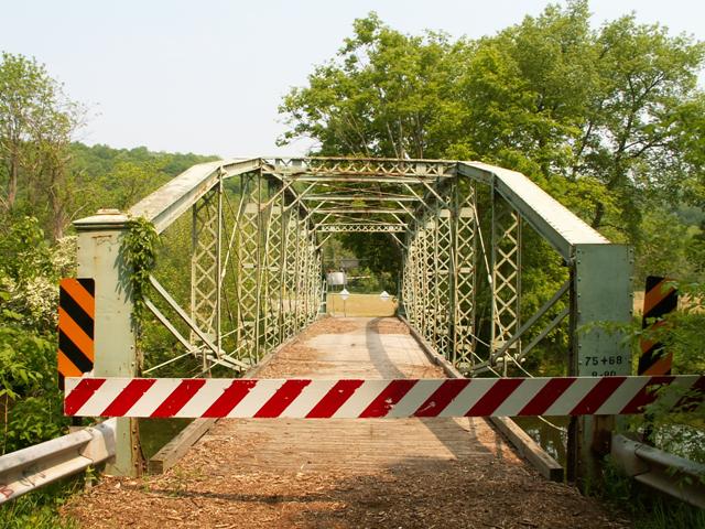
This bridge has been relocated and preserved for pedestrian use in Lazy Brook Park. Please also see HistoricBridges.org's page for photos and documentation of the bridge in its current location at Lazy Brook Park.
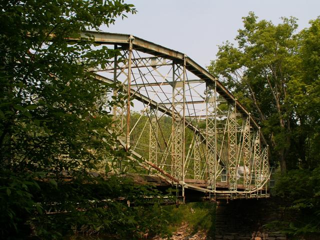
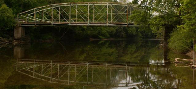
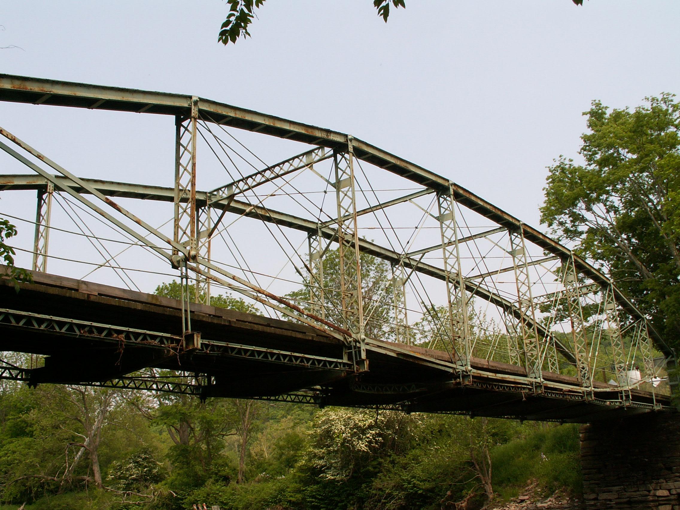
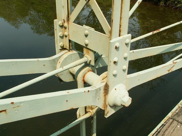
This eight panel structure was built by the Corrugated Metal Company, which later became the Berlin Iron Bridge Company. These companies are known for bridges such as the Pierceville Bridge, a patented type of truss known today as the lenticular truss. These bridges feature a beautiful and distinctive shape to them that is unique enough that they can be considered among the rarest types of bridges remaining in the country. The preservation of each surviving lenticular truss bridge is absolutely essential. Having been built by the Corrugated Metal Company, this is among the earliest examples of a lenticular through truss. It is also remarkably complete, with very few alterations. This is also one of the only bridges where the Historic Bridge Inventory itself strongly advocates for the preservation of the bridge. Be sure to review the HAER page for this bridge as it contains drawings and data pages that provide an informative historical narrative for this structure.
In June, 2015, a project to relocate and restore this historic bridge to nearby Lazy Brook Park for non-motorized traffic began. As of summer 2018 the project is complete and the bridge is open.
The preservation of the Pierceville Bridge is truly a historic moment for Pennsylvania. The Pierceville Bridge preservation project was an in-kind restoration of the bridge, the first of its kind in Pennsylvania. It is also believed to be the first PennDOT contract in decades to include riveting as part of the contract, and certainly the first PennDOT project to specify riveting for preservation work. Pennsylvania joins a growing number of states that understand the importance and feasibility of in-kind restoration and use of riveting in preservation work. Rivets were replaced with rivets rather than bolts. Any bridge parts that were beyond repair were replaced with replicas. In particular the edge bracing which had been damaged by floods, was replicated, as were the deteriorated end posts.
The general contractor for this project was Kriger Construction. The disassembly, restoration, and reassembly of the lenticular truss bridge was subcontracted to Bach Steel. McCormick Taylor was the engineer for the project.
View A June 11, 2015 Press Release By HistoricBridges.org Rergarding This Project: View in PDF Format or Microsoft Word Format.
Information and Findings From Pennsylvania's Historic Bridge InventoryDiscussion of Bridge There have been no changes in the bridge's status since the previous survey. This is an exceptionally important bridge and should be given the highest preservation priority. Spectacular. Bridge Considered Historic By Survey: Yes |
![]()
![]()
![]()
![]()
This historic bridge has been relocated and is no longer at this location. See the main bridge page for a link to the new bridge location. This map is shown for reference purposes only.
Coordinates (Latitude, Longitude):
Search For Additional Bridge Listings:
Bridgehunter.com: View listed bridges within 0.5 miles (0.8 kilometers) of this bridge.
Bridgehunter.com: View listed bridges within 10 miles (16 kilometers) of this bridge.
Additional Maps:
Google Streetview (If Available)
GeoHack (Additional Links and Coordinates)
Apple Maps (Via DuckDuckGo Search)
Apple Maps (Apple devices only)
Android: Open Location In Your Map or GPS App
Flickr Gallery (Find Nearby Photos)
Wikimedia Commons (Find Nearby Photos)
Directions Via Sygic For Android
Directions Via Sygic For iOS and Android Dolphin Browser
USGS National Map (United States Only)
Historical USGS Topo Maps (United States Only)
Historic Aerials (United States Only)
CalTopo Maps (United States Only)

© Copyright 2003-2024, HistoricBridges.org. All Rights Reserved. Disclaimer: HistoricBridges.org is a volunteer group of private citizens. HistoricBridges.org is NOT a government agency, does not represent or work with any governmental agencies, nor is it in any way associated with any government agency or any non-profit organization. While we strive for accuracy in our factual content, HistoricBridges.org offers no guarantee of accuracy. Information is provided "as is" without warranty of any kind, either expressed or implied. Information could include technical inaccuracies or errors of omission. Opinions and commentary are the opinions of the respective HistoricBridges.org member who made them and do not necessarily represent the views of anyone else, including any outside photographers whose images may appear on the page in which the commentary appears. HistoricBridges.org does not bear any responsibility for any consequences resulting from the use of this or any other HistoricBridges.org information. Owners and users of bridges have the responsibility of correctly following all applicable laws, rules, and regulations, regardless of any HistoricBridges.org information.
![]()