

View Information About HSR Ratings

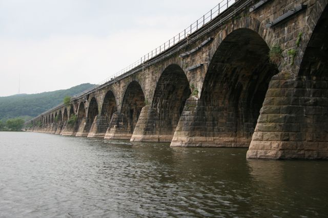
This amazing bridge was the longest stone arch bridge in the entire world when built and research appears to show that it remains the longest stone arch bridge in the world even today. As such, this bridge has national (and indeed global) significance as a bridge of record length, both when built and still today. It is also a significant monument to the might of the Pennsylvania Railroad, one of the most noteworthy railroad companies of its time. The bridge also retains excellent historic integrity with no major alteration aside from the addition of a plate girder at one end and repair of a spandrel wall with concrete toward the center of the bridge.
The stone arches are built with Clearfield County sandstone. The bridge has a concrete interior which was employed to reduce costs and increase construction speed.
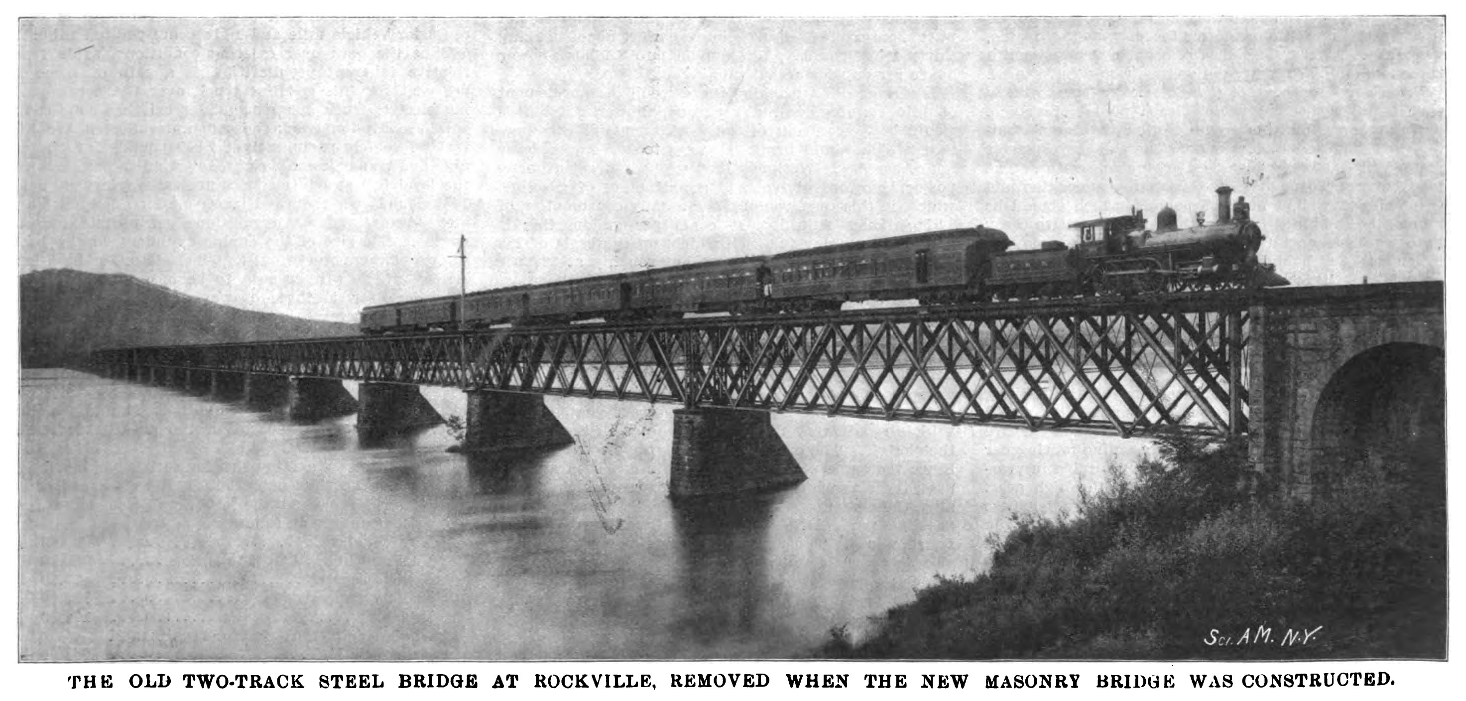
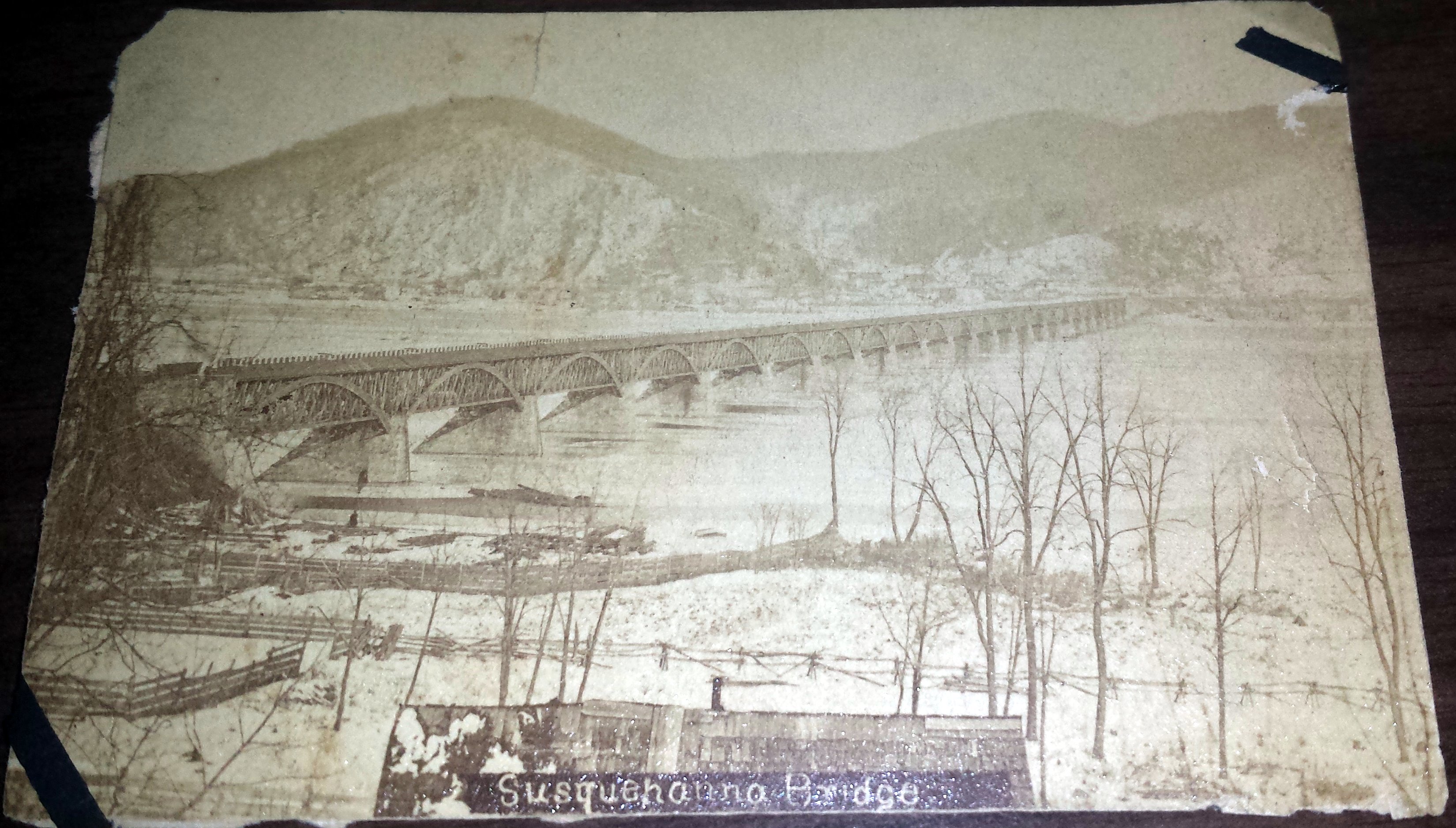
Is is known that earlier bridges at this location, also undoubtedly among the longest of their kind, existing here. One was built in 1849 and was a wooden bridge following Theodor Burr's Burr Arch type. A number of Burr Arch bridges were built on the Susquehanna River. However, it is believed that the below unidentified photo may be the Rockville Bridge. This bridge was replaced in 1877 by a metal truss bridge, also shown below.
![]()
![]()
![]()
Coordinates (Latitude, Longitude):
Search For Additional Bridge Listings:
Bridgehunter.com: View listed bridges within 0.5 miles (0.8 kilometers) of this bridge.
Bridgehunter.com: View listed bridges within 10 miles (16 kilometers) of this bridge.
Additional Maps:
Google Streetview (If Available)
GeoHack (Additional Links and Coordinates)
Apple Maps (Via DuckDuckGo Search)
Apple Maps (Apple devices only)
Android: Open Location In Your Map or GPS App
Flickr Gallery (Find Nearby Photos)
Wikimedia Commons (Find Nearby Photos)
Directions Via Sygic For Android
Directions Via Sygic For iOS and Android Dolphin Browser
USGS National Map (United States Only)
Historical USGS Topo Maps (United States Only)
Historic Aerials (United States Only)
CalTopo Maps (United States Only)

© Copyright 2003-2024, HistoricBridges.org. All Rights Reserved. Disclaimer: HistoricBridges.org is a volunteer group of private citizens. HistoricBridges.org is NOT a government agency, does not represent or work with any governmental agencies, nor is it in any way associated with any government agency or any non-profit organization. While we strive for accuracy in our factual content, HistoricBridges.org offers no guarantee of accuracy. Information is provided "as is" without warranty of any kind, either expressed or implied. Information could include technical inaccuracies or errors of omission. Opinions and commentary are the opinions of the respective HistoricBridges.org member who made them and do not necessarily represent the views of anyone else, including any outside photographers whose images may appear on the page in which the commentary appears. HistoricBridges.org does not bear any responsibility for any consequences resulting from the use of this or any other HistoricBridges.org information. Owners and users of bridges have the responsibility of correctly following all applicable laws, rules, and regulations, regardless of any HistoricBridges.org information.
![]()