

View Information About HSR Ratings
2019 Update: As of March 11, 2019 this bridge has been closed to traffic, and is now barricaded off.
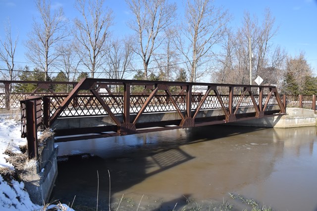
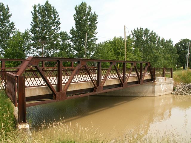
This bridge is a Warren pony truss with riveted connections. It features large lattice railings, that use a design seen often in Ontario, that consists of using angle-shaped steel to form the lattice, resulting in a more durable design. Ontario bridges also seem to extend the railings down the abutment wingwalls quite often as well. The bridge is skewed. The deck is concrete, and appears to be original. This is the last surviving highway pony truss that is on public roads in the Chatham-Kent Region. As such, the preservation of this bridge is essential, to retain any local memory from this important and beautiful period in bridge design history. The bridge would be a great candidate for relocation and reuse in a new location, perhaps for pedestrian use in a park or trail setting.
This bridge is tagged with the following special condition(s): Unorganized Photos
![]()
![]()
![]()
![]()
![]()
Coordinates (Latitude, Longitude):
Search For Additional Bridge Listings:
Additional Maps:
Google Streetview (If Available)
GeoHack (Additional Links and Coordinates)
Apple Maps (Via DuckDuckGo Search)
Apple Maps (Apple devices only)
Android: Open Location In Your Map or GPS App
Flickr Gallery (Find Nearby Photos)
Wikimedia Commons (Find Nearby Photos)
Directions Via Sygic For Android
Directions Via Sygic For iOS and Android Dolphin Browser

© Copyright 2003-2024, HistoricBridges.org. All Rights Reserved. Disclaimer: HistoricBridges.org is a volunteer group of private citizens. HistoricBridges.org is NOT a government agency, does not represent or work with any governmental agencies, nor is it in any way associated with any government agency or any non-profit organization. While we strive for accuracy in our factual content, HistoricBridges.org offers no guarantee of accuracy. Information is provided "as is" without warranty of any kind, either expressed or implied. Information could include technical inaccuracies or errors of omission. Opinions and commentary are the opinions of the respective HistoricBridges.org member who made them and do not necessarily represent the views of anyone else, including any outside photographers whose images may appear on the page in which the commentary appears. HistoricBridges.org does not bear any responsibility for any consequences resulting from the use of this or any other HistoricBridges.org information. Owners and users of bridges have the responsibility of correctly following all applicable laws, rules, and regulations, regardless of any HistoricBridges.org information.
![]()