

View Information About HSR Ratings
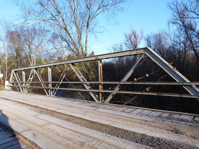
This bridge is a traditionally composed example of a rivet-connected Warren pony truss situated on the state line. In this region, both in the contexts of Michigan and Wisconsin, the bridge type is locally rare. This bridge appears to have been closed for a number of years (many maps show the road as not crossing the river) but it is open to traffic today. Some unusual cable stays have been added into the truss web as alterations, and these may have been added to reopen the bridge to traffic. Despite the alterations, the bridge remains a noteworthy example of its type in this region, given that so few truss bridges remain here.

Above: Aerial view of bridge, August 27, 2020. Click for enlargement. Photo Credit: Doug Heim, Angelcopter, LLC
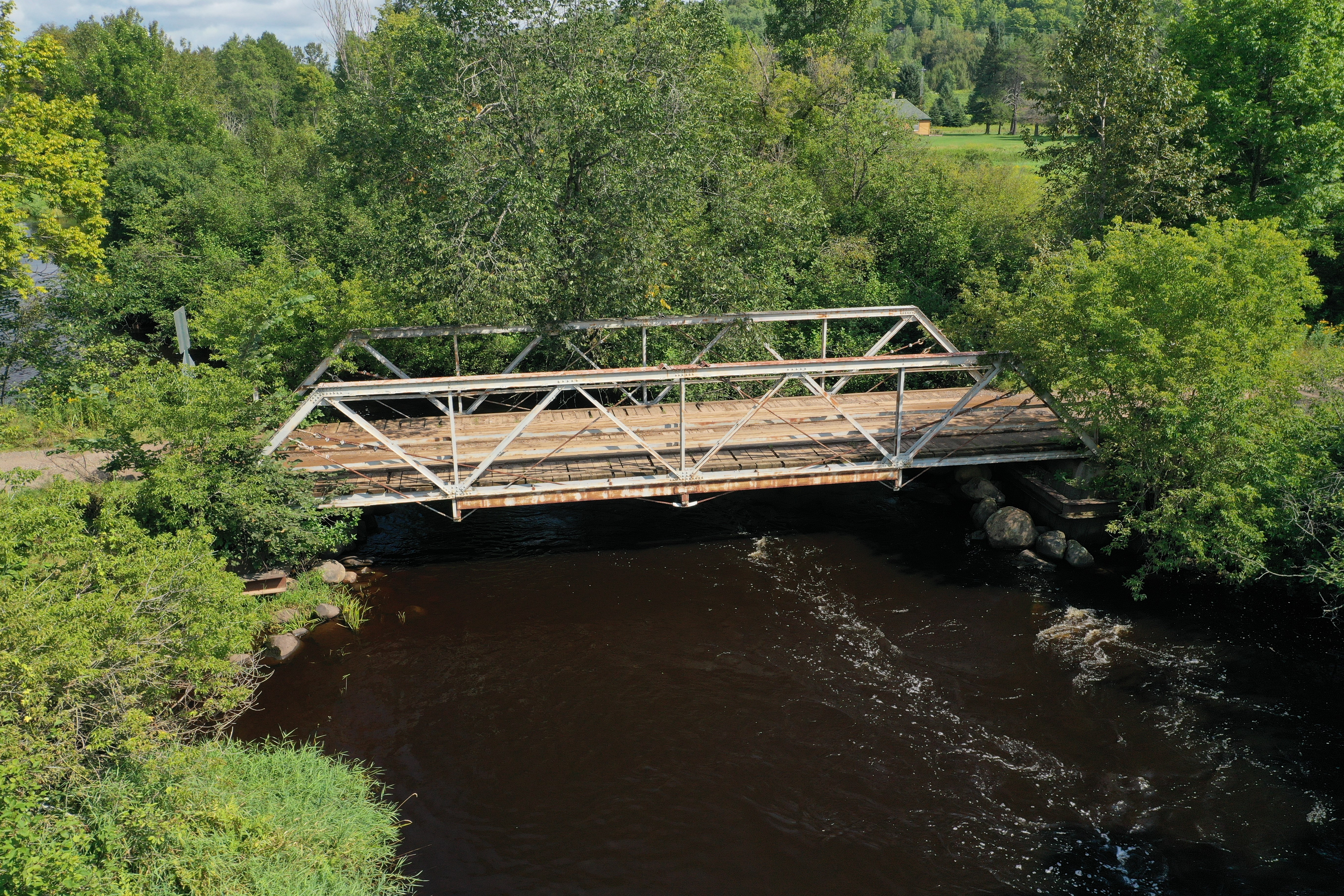
Above: Aerial view of bridge, August 27, 2020. Click for enlargement. Photo Credit: Doug Heim, Angelcopter, LLC

Above: Aerial view of bridge, August 27, 2020. Click for enlargement. Photo Credit: Doug Heim, Angelcopter, LLC
![]()
![]()
![]()

![]()
![]()
Coordinates (Latitude, Longitude):
Search For Additional Bridge Listings:
Bridgehunter.com: View listed bridges within 0.5 miles (0.8 kilometers) of this bridge.
Bridgehunter.com: View listed bridges within 10 miles (16 kilometers) of this bridge.
Additional Maps:
Google Streetview (If Available)
GeoHack (Additional Links and Coordinates)
Apple Maps (Via DuckDuckGo Search)
Apple Maps (Apple devices only)
Android: Open Location In Your Map or GPS App
Flickr Gallery (Find Nearby Photos)
Wikimedia Commons (Find Nearby Photos)
Directions Via Sygic For Android
Directions Via Sygic For iOS and Android Dolphin Browser
USGS National Map (United States Only)
Historical USGS Topo Maps (United States Only)
Historic Aerials (United States Only)
CalTopo Maps (United States Only)

© Copyright 2003-2024, HistoricBridges.org. All Rights Reserved. Disclaimer: HistoricBridges.org is a volunteer group of private citizens. HistoricBridges.org is NOT a government agency, does not represent or work with any governmental agencies, nor is it in any way associated with any government agency or any non-profit organization. While we strive for accuracy in our factual content, HistoricBridges.org offers no guarantee of accuracy. Information is provided "as is" without warranty of any kind, either expressed or implied. Information could include technical inaccuracies or errors of omission. Opinions and commentary are the opinions of the respective HistoricBridges.org member who made them and do not necessarily represent the views of anyone else, including any outside photographers whose images may appear on the page in which the commentary appears. HistoricBridges.org does not bear any responsibility for any consequences resulting from the use of this or any other HistoricBridges.org information. Owners and users of bridges have the responsibility of correctly following all applicable laws, rules, and regulations, regardless of any HistoricBridges.org information.
![]()