HistoricBridges.org Menu: HistoricBridges.org Menu:


HistoricBridges.org: Bridge Browser

Map: Daggett Road Bridge

Google Map: (More Links and Maps Below)

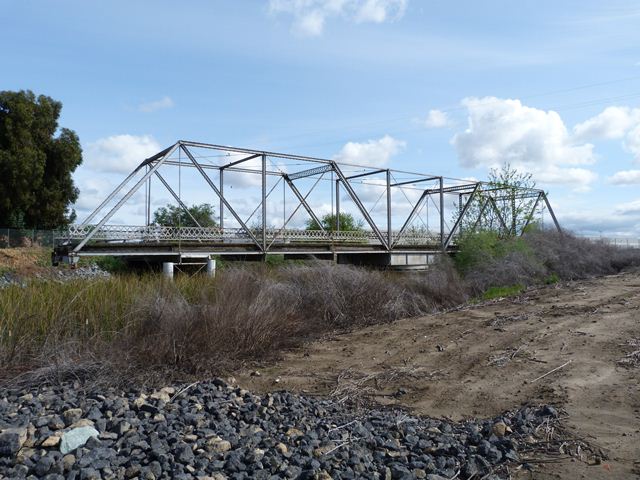
Location: Daggett Road Over San Joaquin River (Burns Cutoff) In Stockton: San Joaquin County, California, United States
Latitude: 37.941120 Longitude: -121.358110 ( 37.941120,-121.358110 )

This bridge and the highway next to it are guarded and patrolled private property.

View Bridge Location In:

Bridgehunter.com: View listed bridges within a half mile of this bridge.

Bridgehunter.com: View listed bridges within 10 miles of this bridge.

Android: Open Location In Your Map or GPS App

Google Maps

Google Streetview (If Available)

Bing Maps

ACME Mapper

OpenStreetMap

Google Earth (KML File)

Flickr Gallery (Find Nearby Photos)

Directions Via Sygic For Android

Directions Via Sygic For iOS and Android Dolphin Browser

MapQuest

HERE We Go Maps

ACME Mapper

Historical USGS Topo Maps (United States Only)

CalTopo Maps (United States Only)

Ordnance Survey Maps (UK Only)

GeoHack Map Links (Enter 37.941120 For Latitude and -121.358110 For Longitude)

Daggett Road Bridge

Divider

Back
Home
Top

Divider

About - Contact

Divider