
Google Map: (More Links and Maps Below)
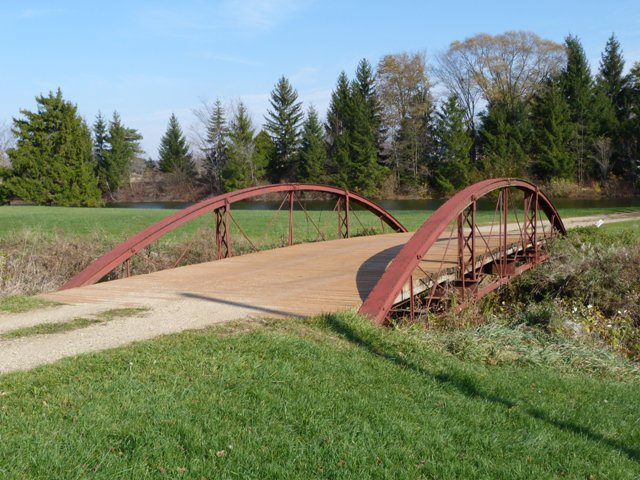
Location: Private Drive Over Townline Brook In Rural: Eaton County, Michigan, United States
Latitude: 42.545400 Longitude: -84.834240 ( 42.545400,-84.834240 )
This map shows the park in which the bridge was located until 1967. The map is shown for reference purposes only. The bridge today is located on private property. The exact location of the bridge is not being displayed online at this time out of respect for the owner. Please contact HistoricBridges.org using the contact link at the bottom of this page if you have any questions.
View Bridge Location In:
Bridgehunter.com: View listed bridges within a half mile of this bridge.
Bridgehunter.com: View listed bridges within 10 miles of this bridge.
Android: Open Location In Your Map or GPS App
![]()
| Back |
| Home |
| Top |

![]()