HistoricBridges.org Menu: HistoricBridges.org Menu:


HistoricBridges.org: Bridge Browser

Map: Andrewsville Bridge

Google Map: (More Links and Maps Below)

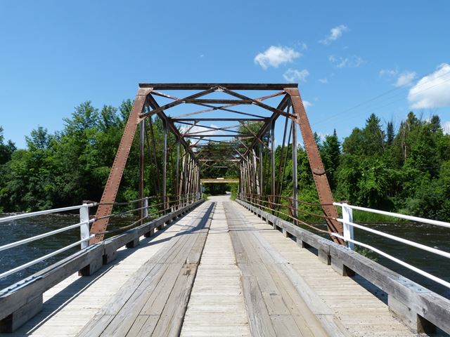
Location: Andrewsville Road Over Rideau River In Rural: Lanark County, Ontario and Leeds and Grenville United Counties, Ontario, Canada
Latitude: 44.951170 Longitude: -75.819480 ( 44.951170,-75.819480 )

View Bridge Location In:


Android: Open Location In Your Map or GPS App

Google Maps

Google Streetview (If Available)

Bing Maps

ACME Mapper

OpenStreetMap

Google Earth (KML File)

Flickr Gallery (Find Nearby Photos)

Directions Via Sygic For Android

Directions Via Sygic For iOS and Android Dolphin Browser

MapQuest

HERE We Go Maps

ACME Mapper

Historical USGS Topo Maps (United States Only)

CalTopo Maps (United States Only)

Ordnance Survey Maps (UK Only)

GeoHack Map Links (Enter 44.951170 For Latitude and -75.819480 For Longitude)

Andrewsville Bridge

Divider

Back
Home
Top

Divider

About - Contact

Divider