HistoricBridges.org Menu: HistoricBridges.org Menu:


HistoricBridges.org: Bridge Browser

Map: Balls Falls Bridge

Google Map: (More Links and Maps Below)

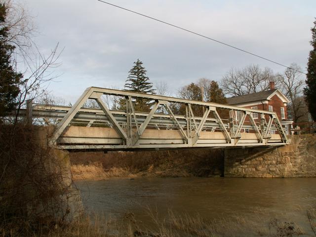
Location: 6th Avenue Over 20 Mile Creek In Rural: Niagara Region, Ontario, Canada
Latitude: 43.133390 Longitude: -79.383410 ( 43.133390,-79.383410 )

View Bridge Location In:


Android: Open Location In Your Map or GPS App

Google Maps

Google Streetview (If Available)

Bing Maps

ACME Mapper

OpenStreetMap

Google Earth (KML File)

Flickr Gallery (Find Nearby Photos)

Directions Via Sygic For Android

Directions Via Sygic For iOS and Android Dolphin Browser

MapQuest

HERE We Go Maps

ACME Mapper

Historical USGS Topo Maps (United States Only)

CalTopo Maps (United States Only)

Ordnance Survey Maps (UK Only)

GeoHack Map Links (Enter 43.133390 For Latitude and -79.383410 For Longitude)

Balls Falls Bridge

Divider

Back
Home
Top

Divider

About - Contact

Divider