

View Information About HSR Ratings
This bridge's song is:
The Farm Lane Bridge in the heart of Michigan State University is a bridge that today as it stands is altered and has limited historic significance. Nevertheless, the bridge as originally designed is noteworthy in the context of Michigan bridges, and the crossing is also a historical one for the university.
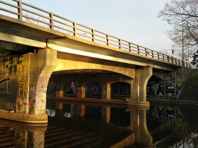
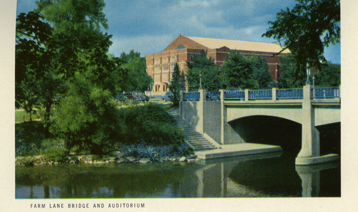
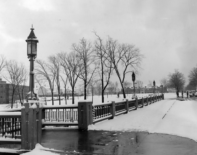
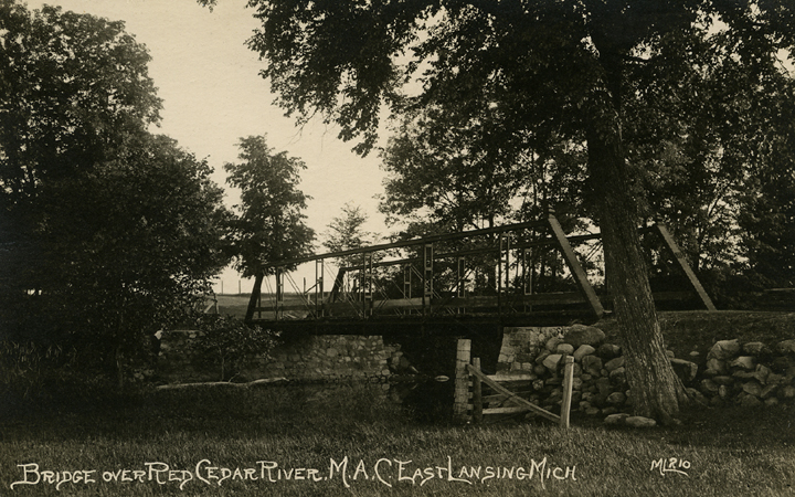
The bridge seen today reportedly dates to 1926. If this date is correct the bridge would have originally had a railing of unknown design. Historical photos of this bridge (see photo above and below) shows that at one time it had Michigan's unique Type R4 railings on it with concrete railing posts using the keyhole style architectural detailing. The Type R4 railing was not used before 1932, and the keyhole style concrete posts were not used until ca. 1940 and they continued to be used until ca. 1963. The bridge is a concrete t-beam bridge with the interior beams being straight, but the exterior beams being curved t-beams. If the 1926 date is accurate this is an early use of curved t-beams in Michigan. In either case, this combination of straight and curved t-beams is unusual and may have been for aesthetic purposes given the bridge's location in the university. As originally designed, the bridge had stairways at all four corners leading down to a sidewalk passing under the bridge. Today, the south sidewalk under the bridge is closed but intact, while the north sidewalk was widened which resulted in the removal of a portion of the north stairways which are closed today.
At some time in the bridge's history, steel beams were added on either side of the bridge to widen it. The concrete piers had concrete added to support these as well. More recently another major alteration took place when the north sidewalk under the bridge was widened. This result in the removal of a portion of the north stairways. Additionally because the wider sidewalk required a longer north span of the bridge, the original concrete t-beams were removed and replaced with pre-stressed concrete adjacent box beams.
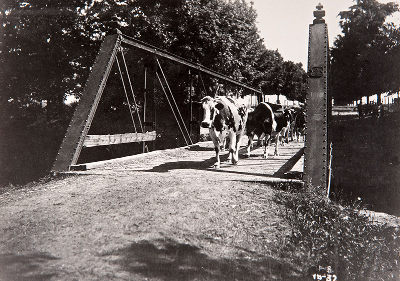
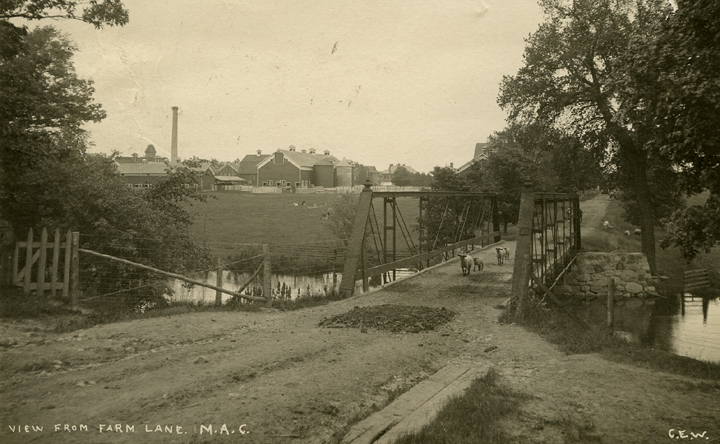
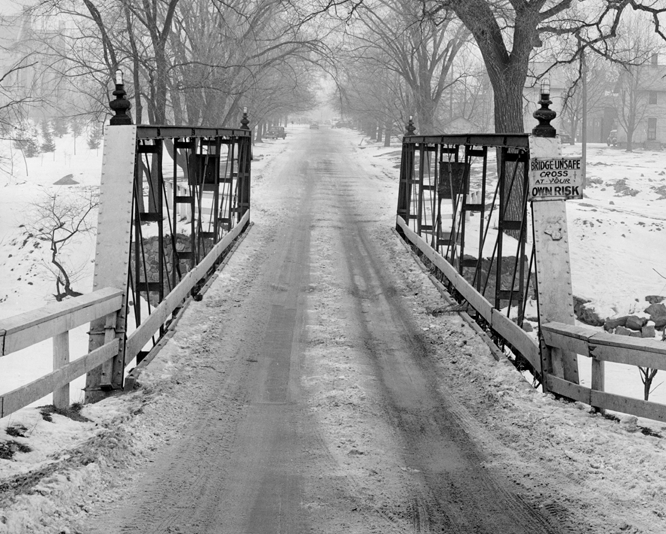
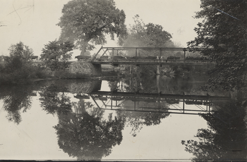
Historical photos also reveal the previous bridge at this location. The above photos show the bridge in an intact state with critical details used to identify the history of the bridge visible. The previous bridge was a six panel pin-connected Pratt half-hip pony truss. Historical photos clearly show a plaque on the end post and decorative finials at all four corners. The shape of the finials and plaques, as well as the built-up vertical members that use only battens and do not have v-lacing clearly indicate this bridge was the product of the Smith Bridge Company of Toledo, Ohio. The company built bridges of this design in the 1880s and early 1890s. A surprising number of historical photos of this bridge exist, showing the rural and agricultural setting of the bridge, which served what was then called Michigan Agricultural College. The setting at this time is unrecognizable as the same location today. Below, another photo of the bridge shows the bridge in its later years. In this later photo the setting is still largely unrecognizable, however note that the plaque has been broken and the finials have had lights added to them. Also note that by this time the bridge had a sign reading "Bridge Unsafe Cross At Your Own Risk."
It is worth noting that there are a limited number of surviving Smith Bridge Company truss bridges with details matching the bridge in these photos. Some of these bridges may be available for relocation and reuse. If the university wanted, it could resurrect this early piece of its history by relocating a Smith Bridge Company pony truss for use as a pedestrian crossing over the river.
![]()
![]()
![]()
Coordinates (Latitude, Longitude):
Search For Additional Bridge Listings:
Bridgehunter.com: View listed bridges within 0.5 miles (0.8 kilometers) of this bridge.
Bridgehunter.com: View listed bridges within 10 miles (16 kilometers) of this bridge.
Additional Maps:
Google Streetview (If Available)
GeoHack (Additional Links and Coordinates)
Apple Maps (Via DuckDuckGo Search)
Apple Maps (Apple devices only)
Android: Open Location In Your Map or GPS App
Flickr Gallery (Find Nearby Photos)
Wikimedia Commons (Find Nearby Photos)
Directions Via Sygic For Android
Directions Via Sygic For iOS and Android Dolphin Browser
USGS National Map (United States Only)
Historical USGS Topo Maps (United States Only)
Historic Aerials (United States Only)
CalTopo Maps (United States Only)

© Copyright 2003-2024, HistoricBridges.org. All Rights Reserved. Disclaimer: HistoricBridges.org is a volunteer group of private citizens. HistoricBridges.org is NOT a government agency, does not represent or work with any governmental agencies, nor is it in any way associated with any government agency or any non-profit organization. While we strive for accuracy in our factual content, HistoricBridges.org offers no guarantee of accuracy. Information is provided "as is" without warranty of any kind, either expressed or implied. Information could include technical inaccuracies or errors of omission. Opinions and commentary are the opinions of the respective HistoricBridges.org member who made them and do not necessarily represent the views of anyone else, including any outside photographers whose images may appear on the page in which the commentary appears. HistoricBridges.org does not bear any responsibility for any consequences resulting from the use of this or any other HistoricBridges.org information. Owners and users of bridges have the responsibility of correctly following all applicable laws, rules, and regulations, regardless of any HistoricBridges.org information.
![]()