

View Information About HSR Ratings
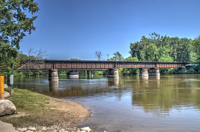
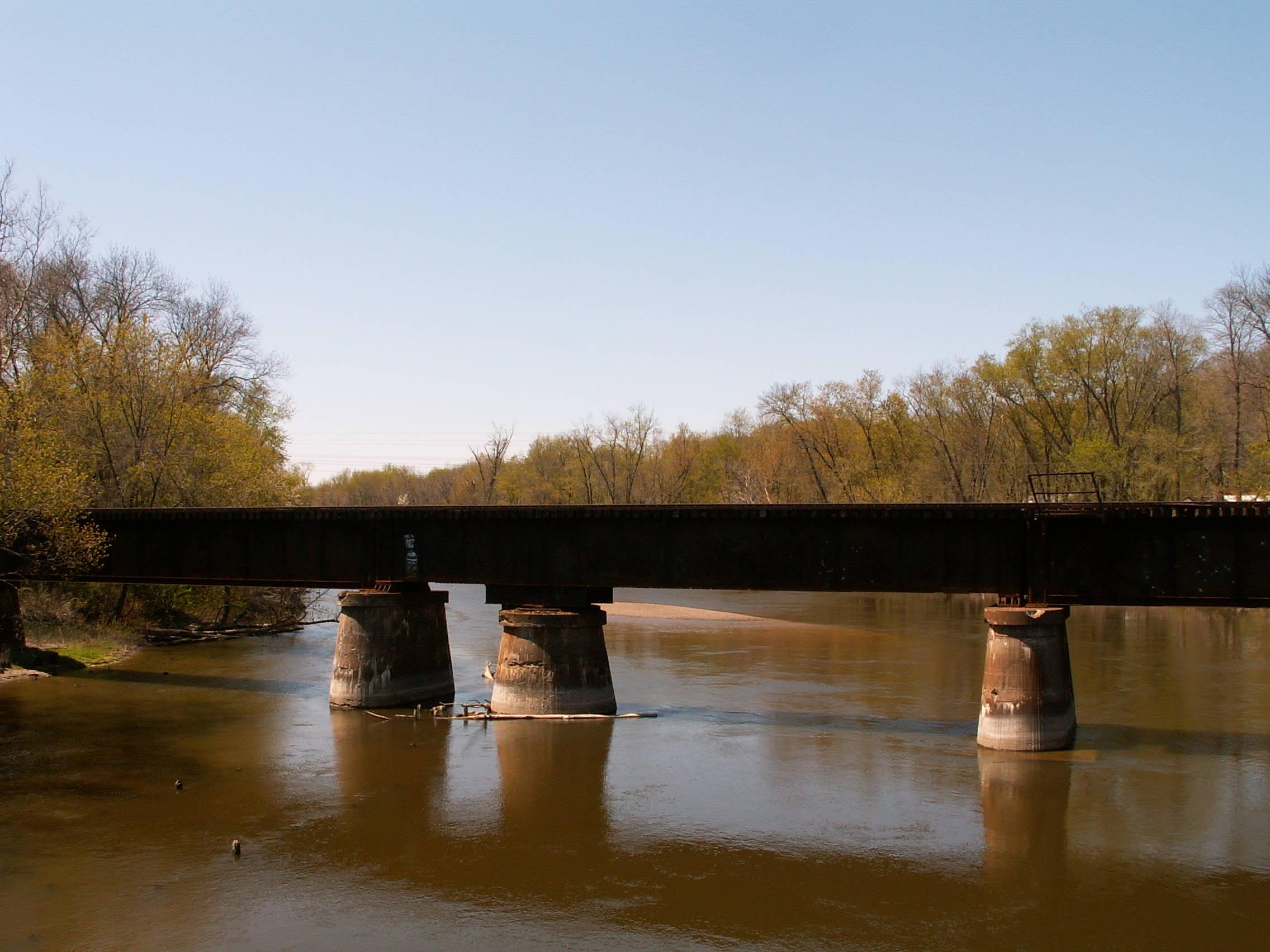
This bridge is next to the restored 57th Street Bridge. It, like the 57th Street Bridge, was a swing bridge. The mechanics have long since been removed however, and to the casual onlooker it has the appearance of a simple deck plate girder bridge. Only an extra pier under one of the spans, which was the swing pier, gives away this bridge's past. The main gear is also under this bridge at that pier as well, but can be difficult to see. The bridge was built in 1907 by the American Bridge Company according to a plaque on the bridge. The bridge is still used by trains.
Jim Thias contacted HistoricBridges.org with an additional discovery. He has found an additional builder plaque on this plaque, a 1896 Detroit Bridge and Iron Works plaque, located on the east side of the bridge, closer to the south side of the river. It is likely when the railroad built this bridge in 1907, they reused this 1896 span, perhaps salvaged from a bridge elsewhere.

Above: The 1907 American Bridge Company plaque.
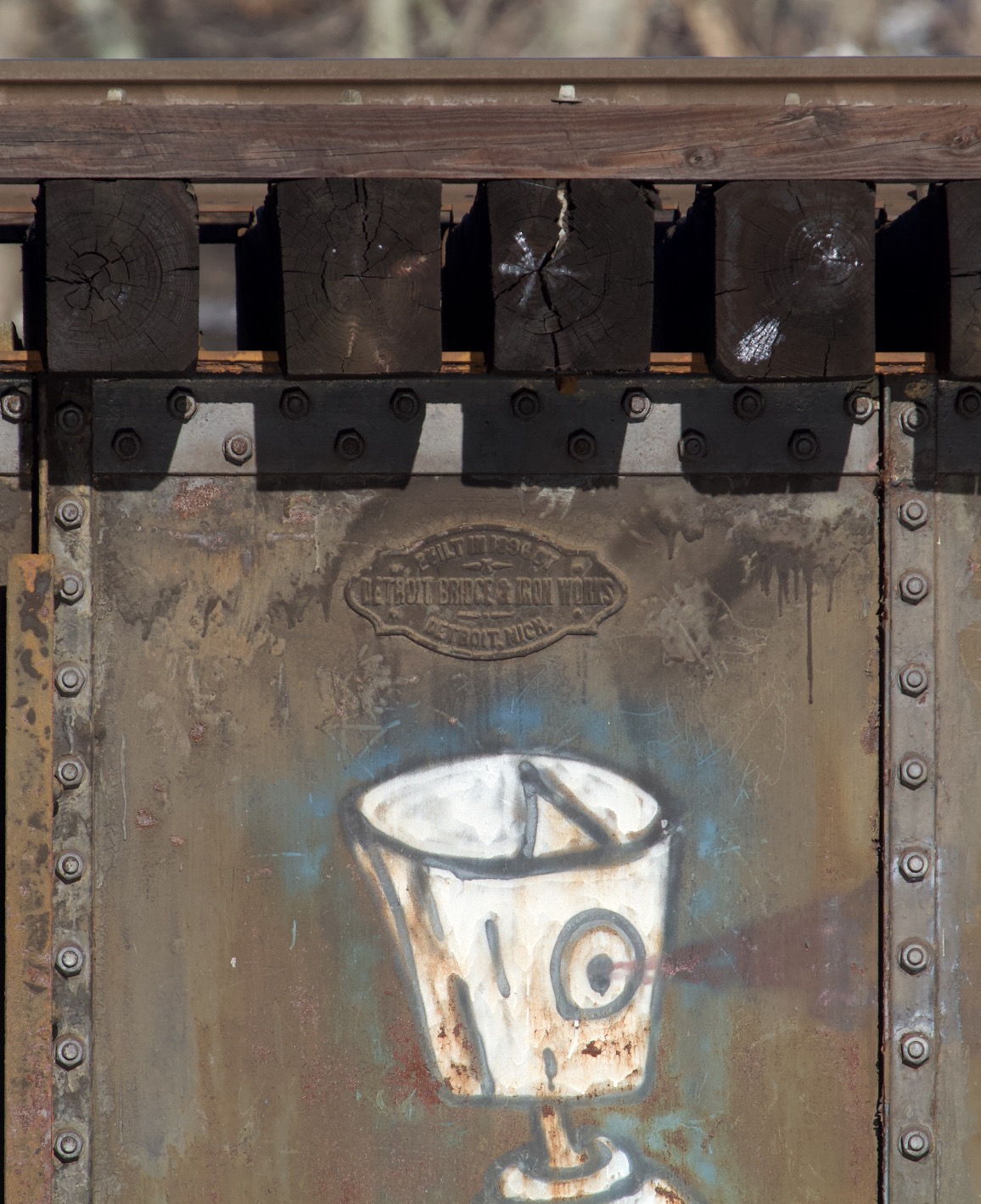
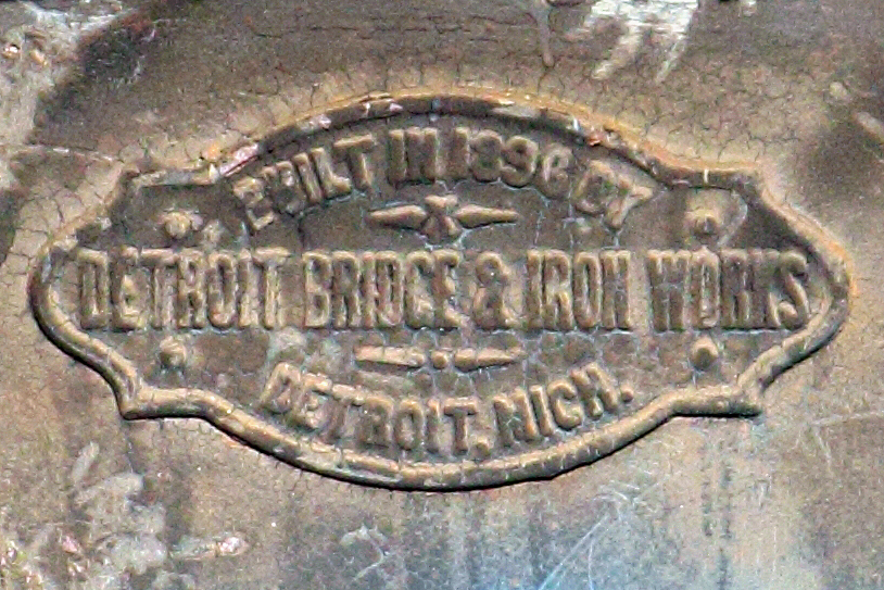
Above: Views of the 1896 Detroit Bridge and Iron Works builder plaque. Photo Credit: Jim Thias
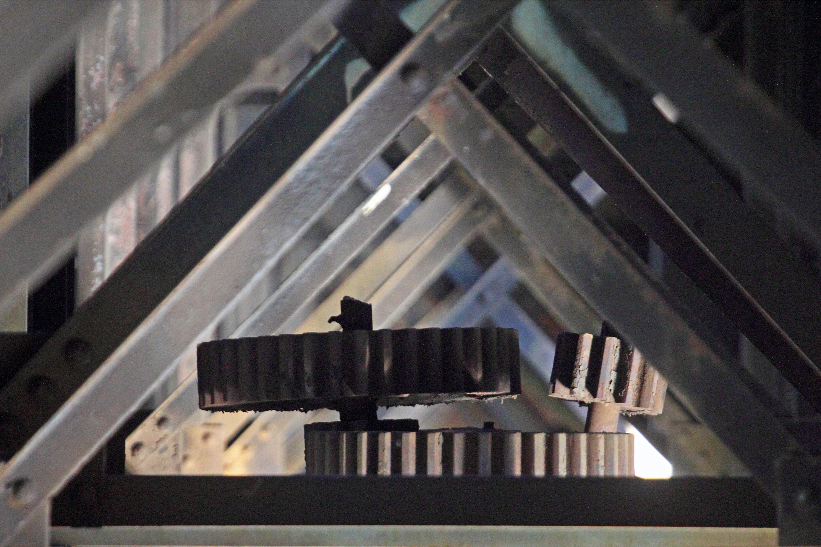
Above: Photo of surviving swing span gears. Photo Credit: Jim Thias
This bridge is tagged with the following special condition(s): Unorganized Photos
![]()
![]()
![]()
![]()
Coordinates (Latitude, Longitude):
Search For Additional Bridge Listings:
Bridgehunter.com: View listed bridges within 0.5 miles (0.8 kilometers) of this bridge.
Bridgehunter.com: View listed bridges within 10 miles (16 kilometers) of this bridge.
Additional Maps:
Google Streetview (If Available)
GeoHack (Additional Links and Coordinates)
Apple Maps (Via DuckDuckGo Search)
Apple Maps (Apple devices only)
Android: Open Location In Your Map or GPS App
Flickr Gallery (Find Nearby Photos)
Wikimedia Commons (Find Nearby Photos)
Directions Via Sygic For Android
Directions Via Sygic For iOS and Android Dolphin Browser
USGS National Map (United States Only)
Historical USGS Topo Maps (United States Only)
Historic Aerials (United States Only)
CalTopo Maps (United States Only)

© Copyright 2003-2024, HistoricBridges.org. All Rights Reserved. Disclaimer: HistoricBridges.org is a volunteer group of private citizens. HistoricBridges.org is NOT a government agency, does not represent or work with any governmental agencies, nor is it in any way associated with any government agency or any non-profit organization. While we strive for accuracy in our factual content, HistoricBridges.org offers no guarantee of accuracy. Information is provided "as is" without warranty of any kind, either expressed or implied. Information could include technical inaccuracies or errors of omission. Opinions and commentary are the opinions of the respective HistoricBridges.org member who made them and do not necessarily represent the views of anyone else, including any outside photographers whose images may appear on the page in which the commentary appears. HistoricBridges.org does not bear any responsibility for any consequences resulting from the use of this or any other HistoricBridges.org information. Owners and users of bridges have the responsibility of correctly following all applicable laws, rules, and regulations, regardless of any HistoricBridges.org information.
![]()