

View Information About HSR Ratings
This is an uncommon multi-span example of a concrete through girder. The ends are tapered slightly for as slight arched appearance.
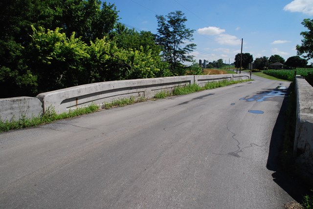
Information and Findings From Pennsylvania's Historic Bridge InventoryDiscussion of Bridge The 3-span, 118'-long ,reinforced concrete thru girder bridge built in 1923 is composed of paired girders with an integral slab deck and concrete substructure. The paneled girders also serve as parapets. The girders of the end spans are slightly tapered at the abutment ends. The flared paneled wingwalls are finished with concrete parapets. The underside of the slab deck has been coated in gunite (ca. 1975). The bridge is an example of one of the least successful standardized reinforce concrete bridges types developed during the first decade of the 20th century. At least 65 thru girder bridges from 1906 to 1930 have been identified with more than one-third of the examples in Lancaster County where their use was forwarded by county engineer F. H. Shaw beginning before 1910. The bridge is not historically or technologically distinguished by its setting or context. Discussion of Surrounding Area The bridge carries a 2 lane road over a stream in a rural area of active farms. The setting does not appear to have historic district potential. Bridge Considered Historic By Survey: No |
This bridge is tagged with the following special condition(s): Unorganized Photos
![]()
![]()
![]()
Coordinates (Latitude, Longitude):
Search For Additional Bridge Listings:
Bridgehunter.com: View listed bridges within 0.5 miles (0.8 kilometers) of this bridge.
Bridgehunter.com: View listed bridges within 10 miles (16 kilometers) of this bridge.
Additional Maps:
Google Streetview (If Available)
GeoHack (Additional Links and Coordinates)
Apple Maps (Via DuckDuckGo Search)
Apple Maps (Apple devices only)
Android: Open Location In Your Map or GPS App
Flickr Gallery (Find Nearby Photos)
Wikimedia Commons (Find Nearby Photos)
Directions Via Sygic For Android
Directions Via Sygic For iOS and Android Dolphin Browser
USGS National Map (United States Only)
Historical USGS Topo Maps (United States Only)
Historic Aerials (United States Only)
CalTopo Maps (United States Only)

© Copyright 2003-2024, HistoricBridges.org. All Rights Reserved. Disclaimer: HistoricBridges.org is a volunteer group of private citizens. HistoricBridges.org is NOT a government agency, does not represent or work with any governmental agencies, nor is it in any way associated with any government agency or any non-profit organization. While we strive for accuracy in our factual content, HistoricBridges.org offers no guarantee of accuracy. Information is provided "as is" without warranty of any kind, either expressed or implied. Information could include technical inaccuracies or errors of omission. Opinions and commentary are the opinions of the respective HistoricBridges.org member who made them and do not necessarily represent the views of anyone else, including any outside photographers whose images may appear on the page in which the commentary appears. HistoricBridges.org does not bear any responsibility for any consequences resulting from the use of this or any other HistoricBridges.org information. Owners and users of bridges have the responsibility of correctly following all applicable laws, rules, and regulations, regardless of any HistoricBridges.org information.
![]()