
View Information About HSR Ratings
This bridge is next to the Sterling Road Bridge, which is a relocated truss bridge.
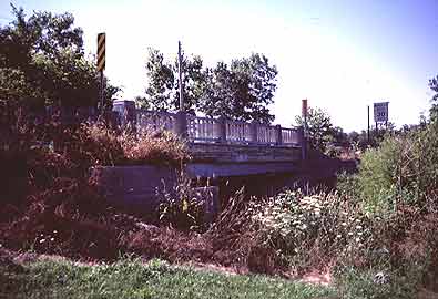
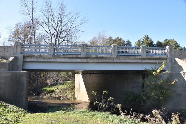
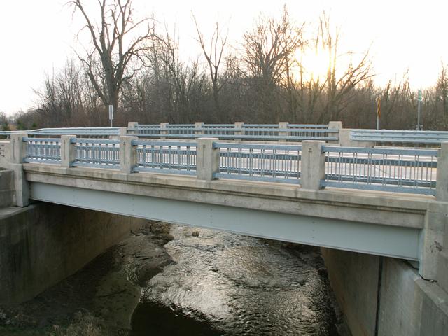
The M-156 Bridge is a historic steel stringer bridge that was rehabilitated in 2000. While the original metal railing panels remain, modern two tube railings have been bolted onto them in the front. MDOT selected two tube railings that blocked less of the original railings than the big, ugly Armco railings which are usually used. This is a process that they have used on other historic bridge projects. The railing panels are the Type R4 style used in Michigan from 1932 through 1963. The concrete posts for the railings have a less-common decorative design set into on them used on the earliest R4 railings only up until around 1940. After 1940 they switched to a keyhole design on the railing posts. The bridge itself, structurally is really not that noteworthy, and is a relatively short example, although it is one of the few preserved pre-1940 bridges with R4 railings on them. As nice as this bridge is, it would be nice to see MDOT restore some of the larger or more unusual stringers on trunk line roads in a similar fashion.
Information and Findings From Michigan Historic Bridge InventoryNarrative Description
The city of Morenci, which was platted in 1852 and incorporated as a
village in 1871, served the county early on as an important industrial
and grain mill center. The present bridge over Silver Creek was
constructed in 1935 at a cost of $35,700 by the W.H. Knapp Company, a
contractor based in Monroe. The bridge replaced an older 40-foot Pratt
pony truss at the site that was in very poor condition. Funding for new
construction came from the Hayden-Cartwright program, a national federal
relief effort. As a part of a larger national development of the Taft
Memorial Highway, the bridge project represented a cooperative venture
by the state highway department and the Taft Memorial Highway
Association. The association had been established in 1930 to honor the
nation's twenty-seventh president by creating a memorial highway
extending from Florida to Michigan. Statement of Significance The Murray D. Van Wagoner Memorial Bridge is eligible for the National Register for its association with a memorial highway and the related tourism industry, and as a named bridge at a state border. Information and Findings From Michigan Historic Sites OnlineNarrative Description Lying just south of the central district of Morenci, this bridge is skewed 30 degrees to follow the curve of the two-lane highway as it approaches the Ohio border immediately south of the crossing. The bridge's substructure consists of concrete abutments and decorative stepped wingwalls. These wingwalls are flared at the northeast and southwest corners, and U-form on the northwest and southeast. The roadway over the bridge is edged by railings formed from ornamental metal lattice sections fixed between concrete posts accented by recessed panels. Flexible-metal approach rails are bolted to inner face of each end post. Concrete sidewalks run along each side of the structure. Markers Taft Memorial Hwy Murray D. Van Wagoner Memorial Bridge |
This bridge is tagged with the following special condition(s): Unorganized Photos
![]()
![]()
![]()
![]()
Coordinates (Latitude, Longitude):
Search For Additional Bridge Listings:
Bridgehunter.com: View listed bridges within 0.5 miles (0.8 kilometers) of this bridge.
Bridgehunter.com: View listed bridges within 10 miles (16 kilometers) of this bridge.
Additional Maps:
Google Streetview (If Available)
GeoHack (Additional Links and Coordinates)
Apple Maps (Via DuckDuckGo Search)
Apple Maps (Apple devices only)
Android: Open Location In Your Map or GPS App
Flickr Gallery (Find Nearby Photos)
Wikimedia Commons (Find Nearby Photos)
Directions Via Sygic For Android
Directions Via Sygic For iOS and Android Dolphin Browser
USGS National Map (United States Only)
Historical USGS Topo Maps (United States Only)
Historic Aerials (United States Only)
CalTopo Maps (United States Only)

© Copyright 2003-2025, HistoricBridges.org. All Rights Reserved. Disclaimer: HistoricBridges.org is a volunteer group of private citizens. HistoricBridges.org is NOT a government agency, does not represent or work with any governmental agencies, nor is it in any way associated with any government agency or any non-profit organization. While we strive for accuracy in our factual content, HistoricBridges.org offers no guarantee of accuracy. Information is provided "as is" without warranty of any kind, either expressed or implied. Information could include technical inaccuracies or errors of omission. Opinions and commentary are the opinions of the respective HistoricBridges.org member who made them and do not necessarily represent the views of anyone else, including any outside photographers whose images may appear on the page in which the commentary appears. HistoricBridges.org does not bear any responsibility for any consequences resulting from the use of this or any other HistoricBridges.org information. Owners and users of bridges have the responsibility of correctly following all applicable laws, rules, and regulations, regardless of any HistoricBridges.org information.
![]()