HistoricBridges.org Menu: HistoricBridges.org Menu:


HistoricBridges.org: Bridge Browser

Map: Blue Creek Road Driveway Bridge

Google Map: (More Links and Maps Below)

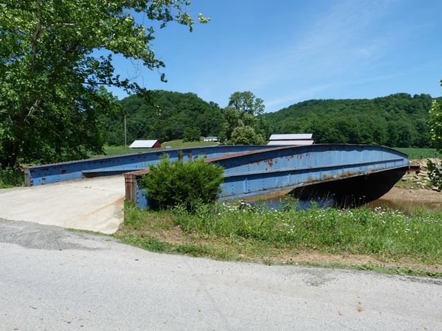
Location: Private Driveway Over South Fork Scioto Brush Creek In Rural: Adams County, Ohio, United States
Latitude: 38.782370 Longitude: -83.322370 ( 38.782370,-83.322370 )

This bridge is located on a private driveway but is viewable from the nearby public road.

View Bridge Location In:

Bridgehunter.com: View listed bridges within a half mile of this bridge.

Bridgehunter.com: View listed bridges within 10 miles of this bridge.

Android: Open Location In Your Map or GPS App

Google Maps

Google Streetview (If Available)

Bing Maps

ACME Mapper

OpenStreetMap

Google Earth (KML File)

Flickr Gallery (Find Nearby Photos)

Directions Via Sygic For Android

Directions Via Sygic For iOS and Android Dolphin Browser

MapQuest

HERE We Go Maps

ACME Mapper

Historical USGS Topo Maps (United States Only)

CalTopo Maps (United States Only)

Ordnance Survey Maps (UK Only)

GeoHack Map Links (Enter 38.782370 For Latitude and -83.322370 For Longitude)

Blue Creek Road Driveway Bridge

Divider

Back
Home
Top

Divider

About - Contact

Divider