HistoricBridges.org Menu: HistoricBridges.org Menu:


HistoricBridges.org: Bridge Browser

Map: Charlotte Highway Bridge

Google Map: (More Links and Maps Below)

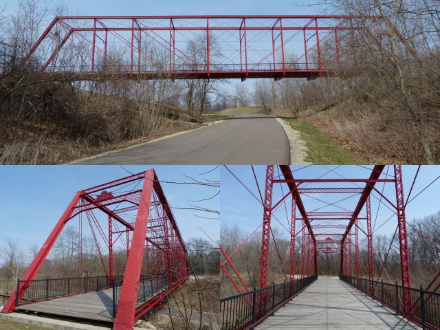
Location: Bridge Park Trail Over Bridge Park Drive In Rural: Calhoun County, Michigan, United States
Latitude: 42.291340 Longitude: -85.114920 ( 42.291340,-85.114920 )

The above map shows the current location of the bridge. The bridge originally crossed the Grand River on Charlotte Highway, Ionia County, Michigan,

View Bridge Location In:

Bridgehunter.com: View listed bridges within a half mile of this bridge.

Bridgehunter.com: View listed bridges within 10 miles of this bridge.

Android: Open Location In Your Map or GPS App

Google Maps

Google Streetview (If Available)

Bing Maps

ACME Mapper

OpenStreetMap

Google Earth (KML File)

Flickr Gallery (Find Nearby Photos)

Directions Via Sygic For Android

Directions Via Sygic For iOS and Android Dolphin Browser

MapQuest

HERE We Go Maps

ACME Mapper

Historical USGS Topo Maps (United States Only)

CalTopo Maps (United States Only)

Ordnance Survey Maps (UK Only)

GeoHack Map Links (Enter 42.291340 For Latitude and -85.114920 For Longitude)

Charlotte Highway Bridge

Divider

Back
Home
Top

Divider

About - Contact

Divider