HistoricBridges.org Menu: HistoricBridges.org Menu:


HistoricBridges.org: Bridge Browser

Map: Miscauno Island Bridge West

Google Map: (More Links and Maps Below)

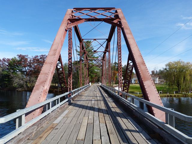
Location: Shoreline Drive (Miscauno Island Lane) Over Menominee River Channel In Rural: Marinette County, Wisconsin, United States
Latitude: 45.567620 Longitude: -87.840310 ( 45.567620,-87.840310 )

This bridge is private property, but is open to anyone visiting the Four Seasons Island Resort.

View Bridge Location In:

Bridgehunter.com: View listed bridges within a half mile of this bridge.

Bridgehunter.com: View listed bridges within 10 miles of this bridge.

Android: Open Location In Your Map or GPS App

Google Maps

Google Streetview (If Available)

Bing Maps

ACME Mapper

OpenStreetMap

Google Earth (KML File)

Flickr Gallery (Find Nearby Photos)

Directions Via Sygic For Android

Directions Via Sygic For iOS and Android Dolphin Browser

MapQuest

HERE We Go Maps

ACME Mapper

Historical USGS Topo Maps (United States Only)

CalTopo Maps (United States Only)

Ordnance Survey Maps (UK Only)

GeoHack Map Links (Enter 45.567620 For Latitude and -87.840310 For Longitude)

Miscauno Island Bridge West

Divider

Back
Home
Top

Divider

About - Contact

Divider