Bridges Found: 23
![]()
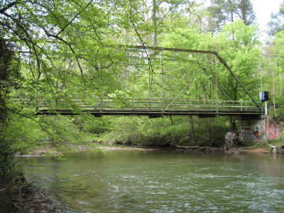
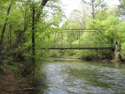
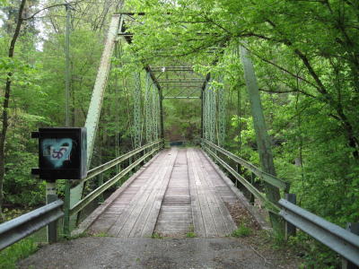
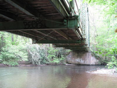
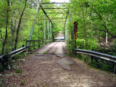
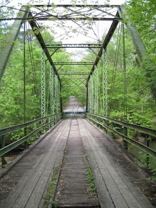
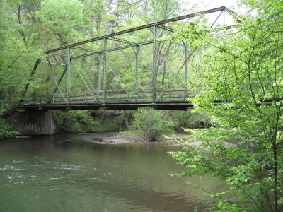
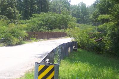
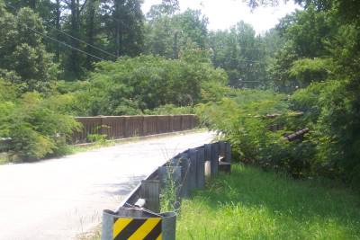
Cahaba Beach Road Bridge
Status: Open to pedestrians only
Slated for replacement
Location: 33.439947,-86.699166
Carries Cahaba Beach Road over Little Cahaba River
Design: truss/through/pratt
Design Details: Pin-connected Pratt through truss
Total Length: 109.9 Feet
Span Length: 109.9 Feet
Overview: Pratt through truss bridge over Little Cahaba River on Cahaba Beach Road in Shelby County, just outside Birmingham
History: Built 1904
Built: 1904
Location: Shelby County
View Bridge Information In Wayback Machine
![]()
139133
Cahaba Beach Road Bridge
Photo taken by C Hanchey in April 2009
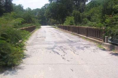
139134
Cahaba Beach Road Bridge
Photo taken by C Hanchey in April 2009
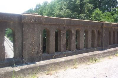
139135
Cahaba Beach Road Bridge
Photo taken by C Hanchey in April 2009
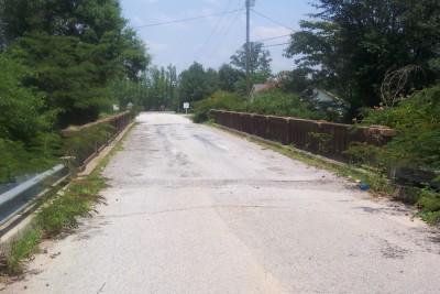
139136
Cahaba Beach Road Bridge
Photo taken by C Hanchey in April 2009
139139
Cahaba Beach Road Bridge
Photo taken by C Hanchey in April 2009
139140
Cahaba Beach Road Bridge
Photo taken by C Hanchey in April 2009
139141
Cahaba Beach Road Bridge
Photo taken by C Hanchey in April 2009
![]()
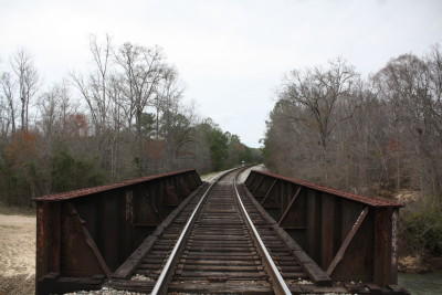
NS - CR 62 Overpass
Status: Open to traffic
Location: 33.371413,-86.402731
Carries Central Georgia Railroad over CR 62
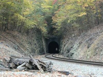
Design: tunnel
Design Details: Tunnel
Total Length: 78.1 Feet
Span Length: 78.1 Feet
Overview: Tunnel over a county road on the Central Georgia Railroad
History: Built 1926
Built: 1926
Location: Shelby County
View Bridge Information In Wayback Machine
![]()
![]()
Kelly Creek Bridge
Status: Closed to all traffic
Location: 33.478462,-86.406140
Carries CR 57 over Kelly Creek
Design: truss/through
Design Details: Through truss
Total Length: 129.9 Feet
Span Length: 129.9 Feet
Overview: Through truss bridge over Kelly Creek on CR 57
History: Built 1915
Built: 1915
Location: Shelby County
View Bridge Information In Wayback Machine
![]()
![]()
North Fork Yellowleaf Creek Bridge
Status: Open to traffic
Location: 33.311912,-86.591637
Carries CR 32 over North Fork Yellowleaf Creek
Design: truss/pony/warren
Design Details: Warren pony truss
Total Length: 101.7 Feet
Span Length: 101.7 Feet
Overview: Warren pony truss bridge over North Fork Yellowleaf Creek on CR 32 in Chelsea
History: Built 1996
Built: 1996
Location: Shelby County
View Bridge Information In Wayback Machine
![]()
![]()
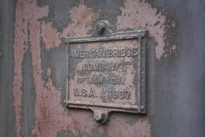
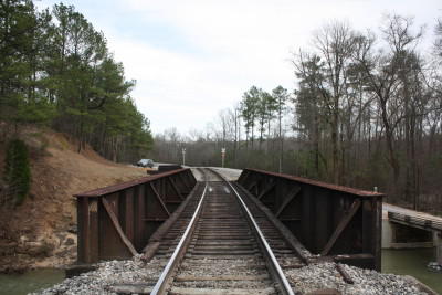
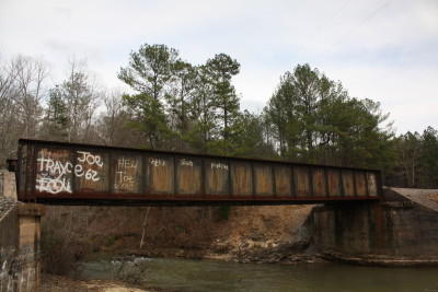
CSX - Muddy Prong Bridge
Status: Open to traffic
Location: 33.335440,-86.516990
Carries CSX Railroad (formerly Atlantic Coast Line Railroad) over Muddy Prong
Design: girder/pony/plate
Design Details: Pony Plate Girder
Total Length: 0.0 Feet
Span Length: 0.0 Feet
Overview: Pony plate girder bridge over Muddy Prong on CSX Railroad (formerly Atlantic Coast Line Railroad)
History: Built 1907 by the American Bridge Co.
Built: 1907
Location: Shelby County
View Bridge Information In Wayback Machine
![]()
195259
Muddy Prong ACL Railroad Bridge
Photo taken by C Hanchey in March 2011
195260
Muddy Prong ACL Railroad Bridge
Photo taken by C Hanchey in March 2011
195261
Muddy Prong ACL Railroad Bridge
Photo taken by C Hanchey in March 2011
195262
Muddy Prong Railroad Bridge
Photo taken by C Hanchey in March 2011
![]()
Old US 31 Bridge
Status: Open to traffic
Location: 33.126389,-86.753611
Carries Co. Hwy. 211 over CSX Railroad
Design: beam/stringer
Design Details: Stringer
Total Length: 87.9 Feet
Span Length: 42.0 Feet
Overview: Stringer bridge over CSX Railroad on Co. Hwy. 211
History: Built 1922
Built: 1922
Location: Shelby County
View Bridge Information In Wayback Machine
![]()
203361
Looking Southwest
Photo taken by James McCray
203362
Looking Southwest
Photo taken by James McCray
203363
Looking West
Photo taken by James McCray
203364
Railing Detail
Photo taken by James McCray
203365
Looking East
Photo taken by James McCray
203366
Looking East
Photo taken by James McCray
![]()
Yellowleaf Creek Bridge
Status: Open to traffic
Location: 33.327500,-86.617222
Carries Whisenhunt Road over Yellowleaf Creek
Design: truss/pony
Design Details: Pony truss
Total Length: 75.1 Feet
Span Length: 75.1 Feet
Overview: Pony truss bridge over Yellowleaf Creek on Whisenhunt Road
History: Built 1983
Built: 1983
Location: Shelby County
View Bridge Information In Wayback Machine
![]()
![]()
Lafarge Quarry Road Bridge
Status: Open to traffic
Location: 33.119722,-86.792778
Carries Cr 16 over Lafarge Quarry Road
Design: truss/pony/warren
Design Details: Warren pony truss
Total Length: 244.4 Feet
Span Length: 171.9 Feet
Overview: Warren pony truss bridge over Lafarge Quarry Road on Cr 16
History: Built 2009
Built: 2009
Location: Shelby County
View Bridge Information In Wayback Machine
![]()
![]()
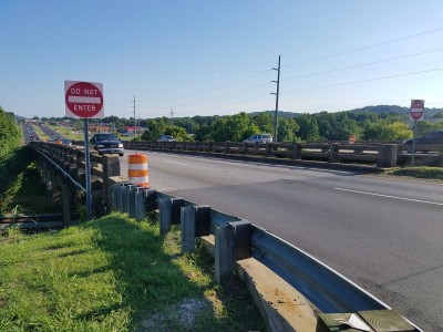
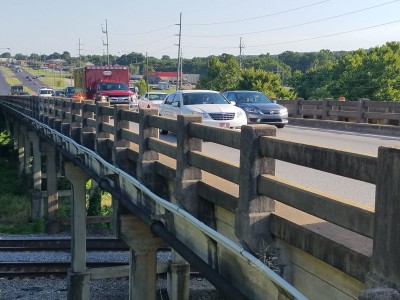
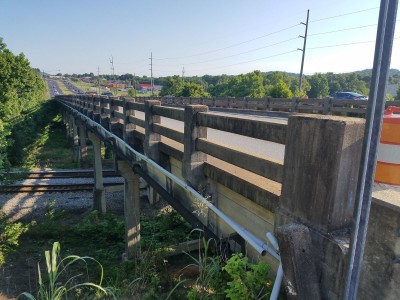
Peavine Ck & Acl Rr Bridge
Status: Open to traffic
Location: 33.282812,-86.810610
Carries US 31 over Peavine Ck & Acl Rr
Design: beam/tee
Design Details: Concrete tee beam
Total Length: 469.2 Feet
Span Length: 44.0 Feet
Overview: Concrete tee beam bridge over Peavine Ck & Acl Rr on US 31
History: Built 1924; rehabilitated 1940
Built: 1924
Location: Shelby County
View Bridge Information In Wayback Machine
![]()
430015
Photo taken by James McCray in July 2018
430016
Photo taken by James McCray in July 2018
430017
Photo taken by James McCray in July 2018
![]()
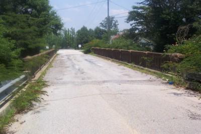
Old Co Hwy 32 Bridge
Status: Replaced by a new bridge
Location: 33.311667,-86.591667
Carries Co Hwy 32 over N. Fork Yellowleaf Creek
Design: truss/deck
Design Details: Deck truss
Total Length: 100.1 Feet
Span Length: 49.9 Feet
Overview: Lost Deck truss bridge over N. Fork Yellowleaf Creek on Co Hwy 32
History: Built 1905; Replaced 1996
Built: 1905
Location: Shelby County
View Bridge Information In Wayback Machine
![]()
![]()
Shoals Creek Bridge
Status: Replaced by new bridge
Location: 33.096108,-86.861322
Carries Morgan Street over Shoals Creek
Design: truss/deck
Design Details: Deck truss
Total Length: 0.0 Feet
Span Length: 0.0 Feet
Overview: Lost Deck truss bridge over Shoals Creek on Morgan Street
History: Built 1915; Replaced 1994
Built: 1915
Location: Shelby County
View Bridge Information In Wayback Machine
![]()
![]()
Shoals Creek Bridge
Status: Open to traffic
Location: 33.108163,-86.847091
Carries Overland Road over Shoals Creek
Design: beam/stringer/steel
Design Details: Steel stringer
Total Length: 78.1 Feet
Span Length: 45.9 Feet
Overview: Steel stringer bridge over Shoals Creek on Overland Road
History: Built 1919; rehabilitated 1989; Replaced 11994
Built: 1919
Location: Shelby County
View Bridge Information In Wayback Machine
![]()
![]()
Old Fourmile Creek
Status: Derelict/abandoned
Location: 33.255574,-86.488023
Carries Hwy 61 over Fourmile Creek
Design: unknown
Design Details:
Total Length: 0.0 Feet
Span Length: 0.0 Feet
Overview: Abandoned bridge over Fourmile Creek on Hwy 61
History: Bypassed 1958
Built:
Location: Shelby County
View Bridge Information In Wayback Machine
![]()
![]()
Yellowleaf Creek Bridge
Status:
Location: 33.268788,-86.462873
Carries Robertson Rd over Yellowleaf Creek
Design: truss/through
Design Details: Through truss
Total Length: 0.0 Feet
Span Length: 0.0 Feet
Overview: Through truss bridge over Yellowleaf Creek on Robertson Rd
History:
Built:
Location: Shelby County
View Bridge Information In Wayback Machine
![]()
![]()
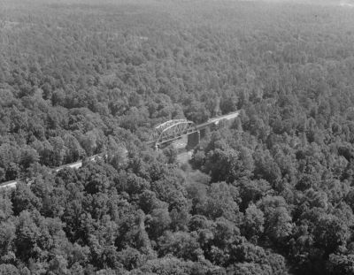
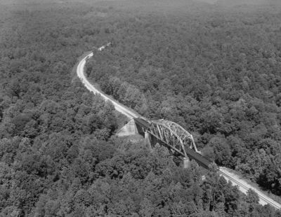
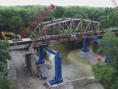
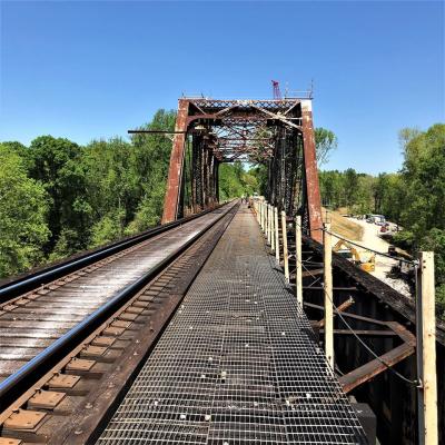
CSX - Cahaba River Parker Truss
Status: Open to traffic
Location: 33.308141,-86.860356
Carries CSX Railroad over Cahaba River
Design: truss/through/parker
Design Details: Parker through truss
Total Length: 0.0 Feet
Span Length: 0.0 Feet
Overview: Parker through truss bridge over Cahaba River on CSX Railroad
History: Built 1906; Replaced 2018
Built: 1906
Location: Shelby County
View Bridge Information In Wayback Machine
![]()
259125
Aerial View
Photo taken by David Deising for the Historic American Engineering Record
259126
Aerial View
Photo taken by David Deising for the Historic American Engineering Record
462590
CSX - Cahaba River Parker Truss
during truss replacement
Photo from Enerpac
462591
CSX - Cahaba River Parker Truss
Photo from Brasfield & Gorrie
![]()
CSX - Siluria Mill Bridge
Status: Demolished, but piers remain
Location: 33.233683,-86.828347
Carries Spur of CSX/LN RR (abandoned) over Buck Creek
Design: unknown
Design Details:
Total Length: 0.0 Feet
Span Length: 0.0 Feet
Overview: Lost Bridge over Buck Creek on Spur of CSX/LN RR (abandoned)
History:
Built:
Location: Shelby County
View Bridge Information In Wayback Machine
![]()
![]()
CSX - Cahaba River Deck Truss
Status: Open to traffic
Location: 33.301144,-86.877133
Carries CSX Railroad over Cahaba River
Design: truss/deck/warren
Design Details: Warren deck truss
Total Length: 0.0 Feet
Span Length: 0.0 Feet
Overview: Warren deck truss bridge over Cahaba River on CSX Railroad
History:
Built:
Location: Shelby County
View Bridge Information In Wayback Machine
![]()
![]()
LN - Buck Creek Bridge
Status: Lost
Location: 33.307125,-86.855303
Carries S&NA (L&N) RR over Buck Creek
Design: unknown
Design Details:
Total Length: 0.0 Feet
Span Length: 0.0 Feet
Overview: Lost Bridge over Buck Creek on S&NA (L&N) RR
History: Built c. 1872, abandoned c. 1914
Built:
Location: Shelby County
View Bridge Information In Wayback Machine
![]()
![]()
NS - Piney Woods Creek Trestle
Status: Open to traffic
Location: 33.209108,-86.954869
Carries NS Railway over Piney Woods Creek
Design: girder/deck/plate
Design Details: Deck plate girder
Total Length: 0.0 Feet
Span Length: 0.0 Feet
Overview: Deck plate girder bridge over Piney Woods Creek on NS Railway
History:
Built:
Location: Shelby County
View Bridge Information In Wayback Machine
![]()
![]()
NS - Oak Mountain Tunnel
Status: Open to traffic
Location: 33.517367,-86.547622
Carries NS over
Design: tunnel
Design Details: Tunnel
Total Length: 0.0 Feet
Span Length: 0.0 Feet
Overview: Tunnel on NS
History:
Built:
Location: Shelby County
View Bridge Information In Wayback Machine
![]()
489690
NS - Oak Mountain Tunnel
Photo from Remax Alabama
![]()
NS Coosa Tunnel
Status: Open to traffic
Location: 33.486694,-86.535469
Carries NS over
Design: tunnel
Design Details: Tunnel
Total Length: 0.0 Feet
Span Length: 0.0 Feet
Overview: Tunnel on NS
History:
Built:
Location: Shelby County
View Bridge Information In Wayback Machine
![]()
![]()
L&N Alabama Mineral RR Bridge #1
Status:
Location: 33.098585,-86.751182
Carries L&N railroad over Buxahatchee Creek
Design: beam/stringer/wood
Design Details: Timber stringer
Total Length: 0.0 Feet
Span Length: 0.0 Feet
Overview: Lost Timber stringer bridge over Buxahatchee Creek on L&N railroad
History: Built 1891, dismantled somewhere in the 50's-70's when the south leg of the wye in Calera was removed
Built: 1891
Location: Shelby County
View Bridge Information In Wayback Machine
![]()
![]()
L&N Alabama Mineral RR Bridge #2
Status: Open to traffic
Location: 33.098510,-86.748543
Carries L&N railroad over Buxahatchee Creek
Design: beam/stringer/wood
Design Details: Timber stringer
Total Length: 0.0 Feet
Span Length: 0.0 Feet
Overview: Bridge over Buxahatchee Creek on L&N railroad
History: Built 1891 as part of the Alabama Mineral RR, came under L&N ownership in 1914, sold to the Heart of Dixie RR Museum in the 80's. Bridge is still in service carrying passengers for the Calera and Shelby tourist line.
Built: 1891
Location: Shelby County
View Bridge Information In Wayback Machine
![]()
Special Bridge Conditions Legend: R - Former location of relocated bridge. ! - At risk for demolition or destruction. X - Confirmed demolished or collapsed. S - Dismantled and/or in storage. L - Severe loss of historic integrity due to alteration.
![]()
About - Contact
![]()

