![]()
![]()
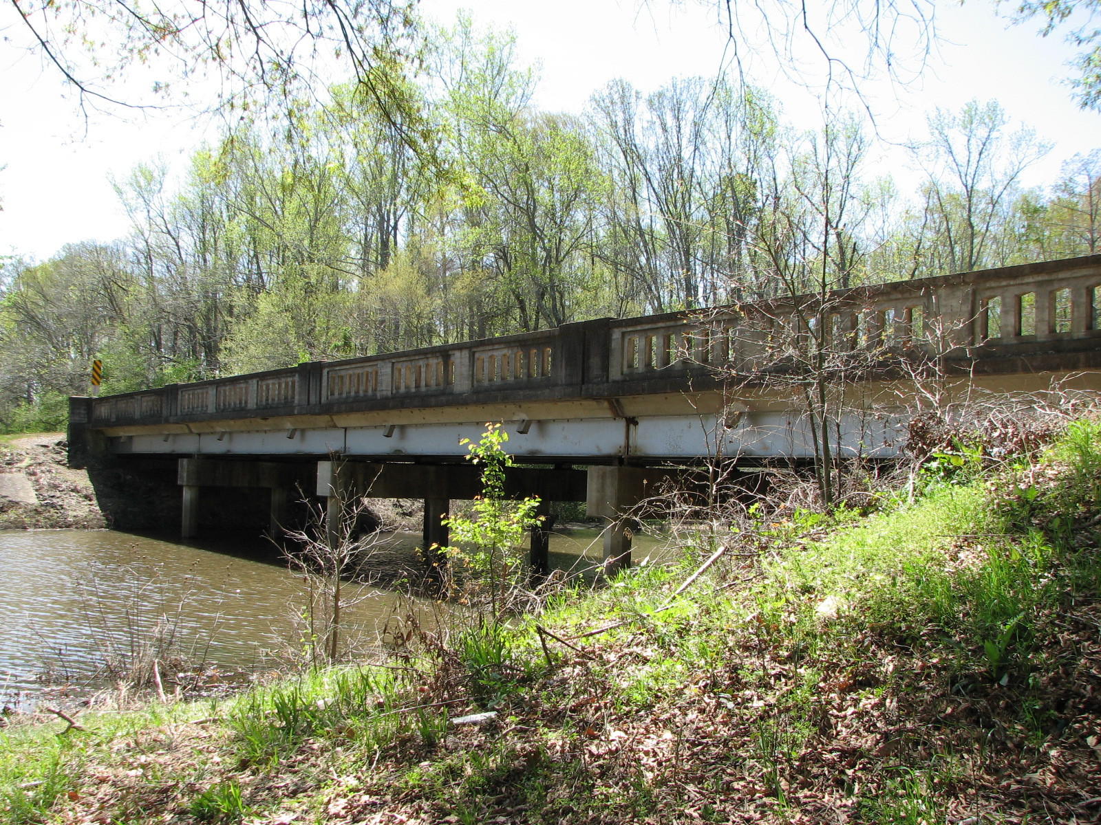
Status: Open to traffic
Location: 34.631449,-91.782580
Carries CR 44 over Branch of Bayou Meto
Design: beam/stringer/steel
Design Details: Steel stringer
Total Length: 102.0 Feet
Span Length: 16.0 Feet
Overview: Wooden bridge over a branch of Bayou Meto on CR 44
History: Built 1958; rehabilitated 1976
Built: 1958
Location: Lonoke County
View Bridge Information In Wayback Machine
![]()
![]()
Status: Closed to all traffic
Location: 0.000000,0.000000
Carries CR 219 over Bayou Meto
Design: beam/stringer/steel
Design Details: Steel stringer
Total Length: 117.1 Feet
Span Length: 15.1 Feet
Overview: Wooden bridge over Bayou Meto on CR 219
History: Built 1948; rehabilitated 1974
Built: 1948
Location: Lonoke County
View Bridge Information In Wayback Machine
![]()
![]()
Status: No longer exists
Location: 0.000000,0.000000
Carries Loftis Lane (CR 233) over Bayou Meto
Design: beam/stringer/steel
Design Details: Steel stringer
Total Length: 109.9 Feet
Span Length: 15.0 Feet
Overview: Lost wooden bridge over Bayou Meto on Loftis Lane (CR 233)
History: Built 1954; rehabilitated 1976; replaced 2004
Built: 1954
Location: Lonoke County
View Bridge Information In Wayback Machine
![]()
![]()
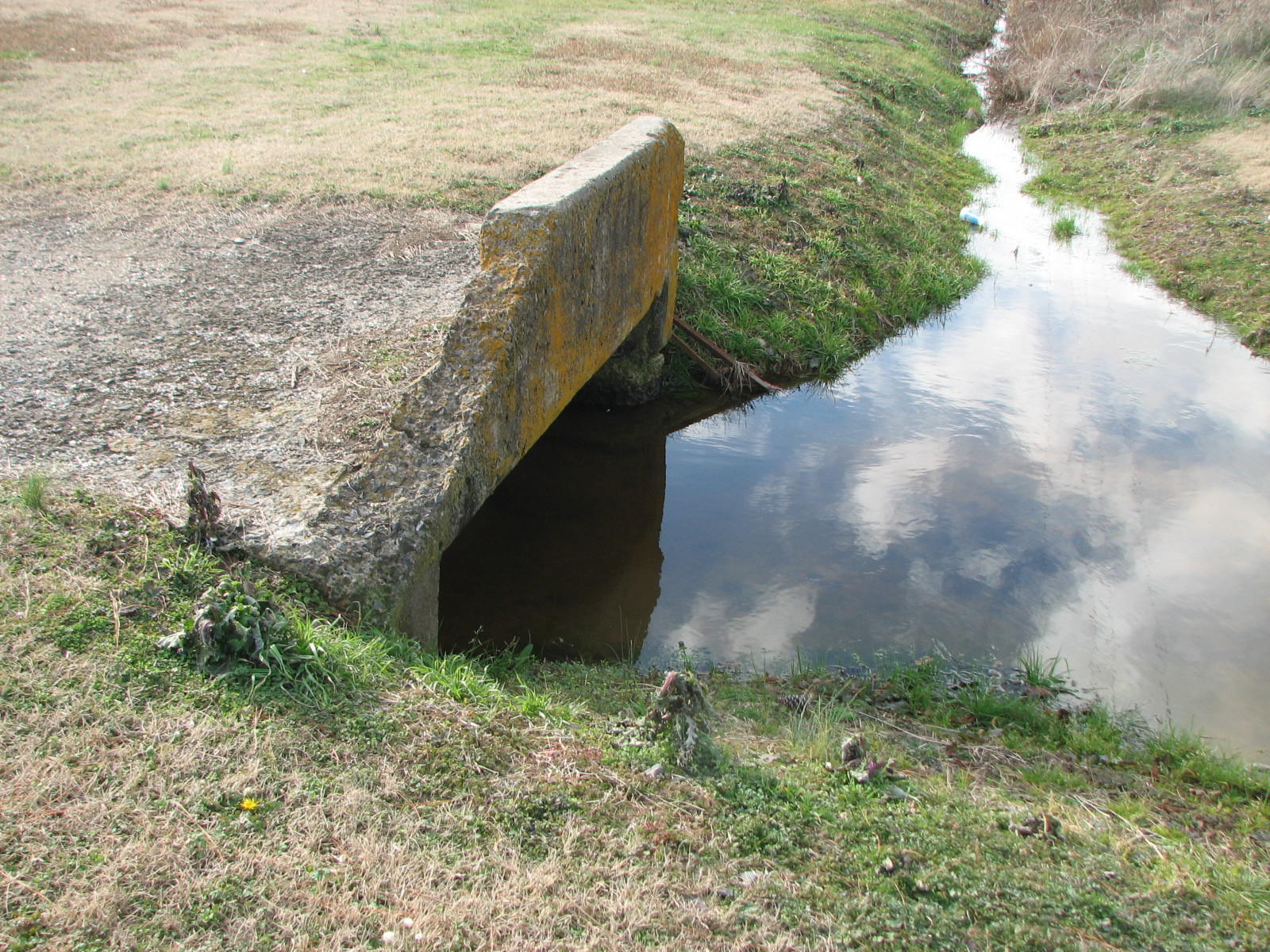
Status: Abandoned
Location: 34.764605,-92.061881
Carries US 70 over Branch of Indian Bayou
Design: culvert/concrete
Design Details: Concrete culvert
Total Length: 0.0 Feet
Span Length: 0.0 Feet
Overview: Abandoned concrete culvert bridge over Branch of Indian Bayou on US 70
History: Built 1913
Built: 1913
Location: Lonoke County
View Bridge Information In Wayback Machine
![]()
127096
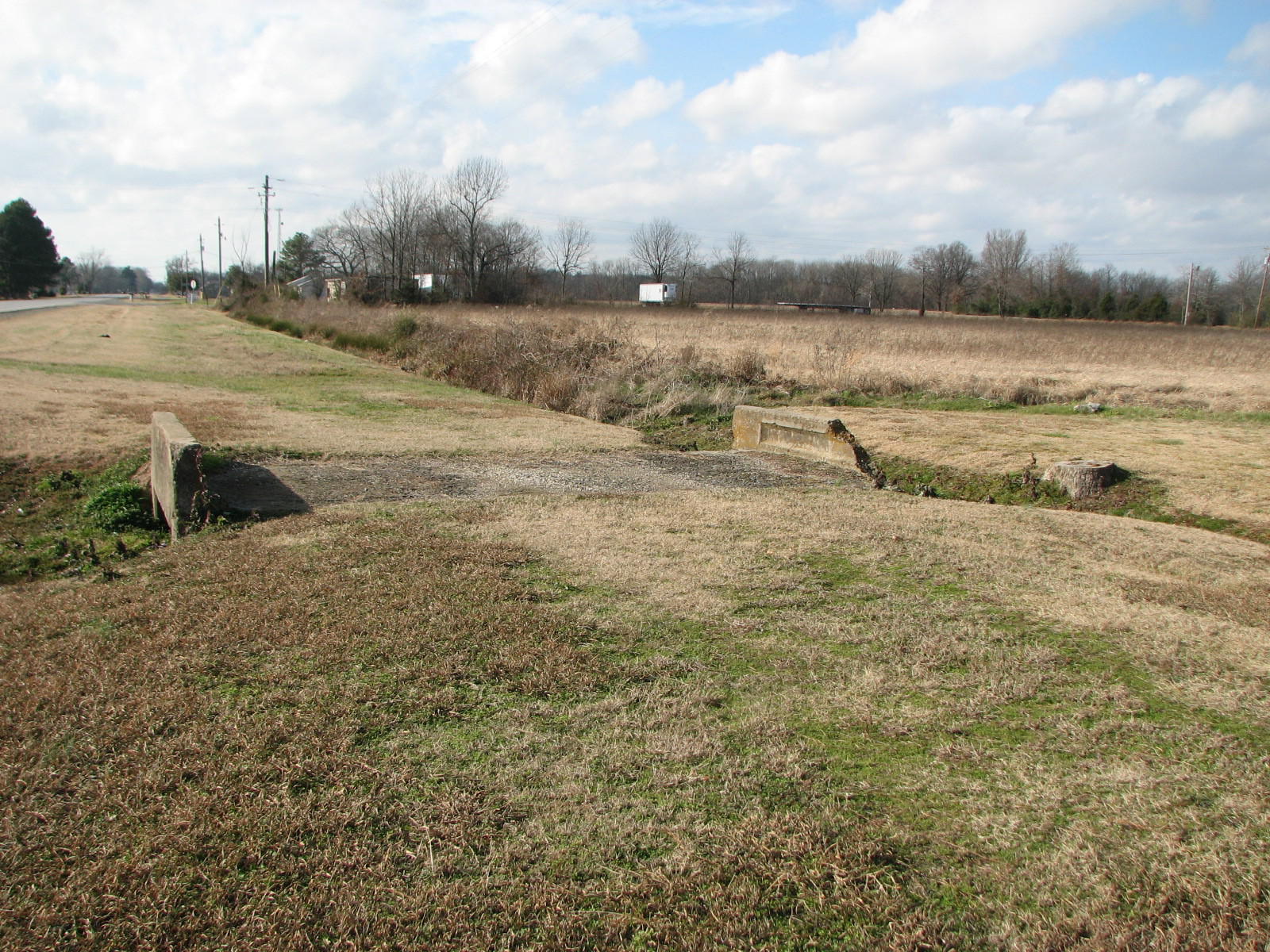
East Approach
Photo taken by David Backlin in January 2008
127097
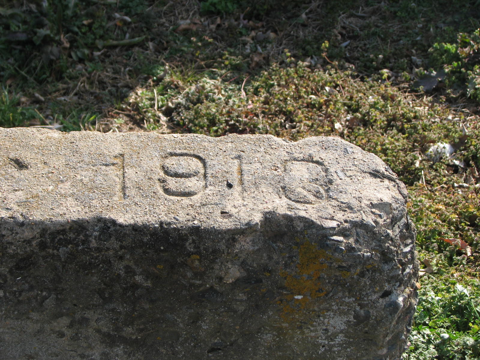
Date Stamp
Photo taken by David Backlin in January 2008
127098
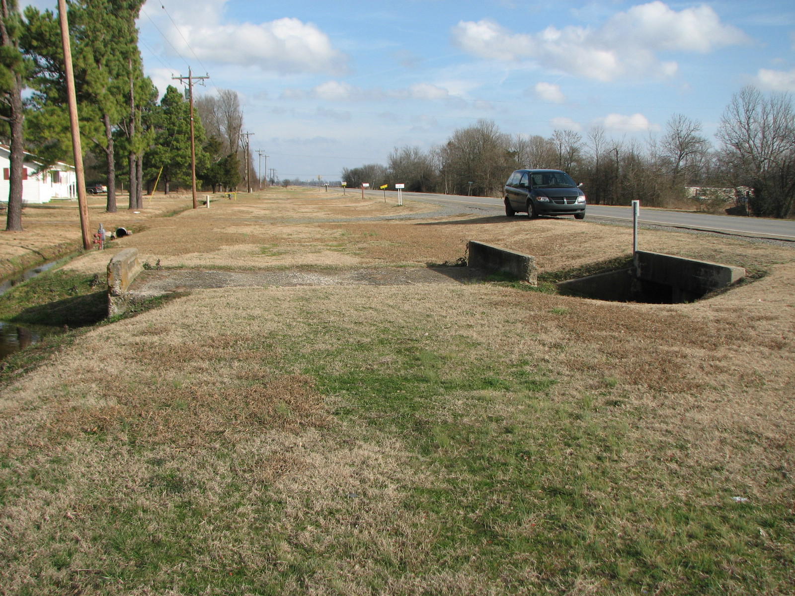
West Approach
Photo taken by David Backlin in January 2008
127099
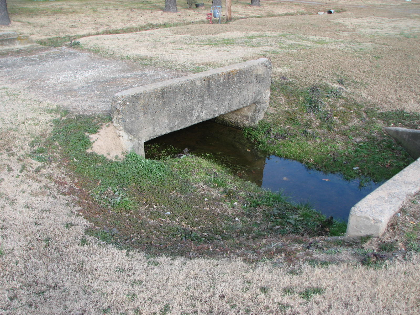
Side View from South
Photo taken by David Backlin in January 2008
127100
Damaged North Wall
Photo taken by David Backlin in January 2008
127101
Oblique View
Photo taken by David Backlin in January 2008
127102
Inside North Wall
Photo taken by David Backlin in January 2008
![]()
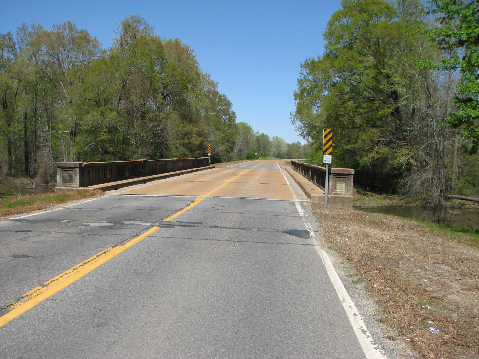
Status: Open to traffic
Location: 35.038611,-91.945278
Carries SH 367 (old US 67) over Cypress Relief
Design: beam/stringer/steel
Design Details: Steel stringer
Total Length: 128.0 Feet
Span Length: 32.2 Feet
Overview: Steel stringer bridge over Cypress Relief on SH 367 (old US 67)
History: Built 1939
Built: 1939
Location: Lonoke County
View Bridge Information In Wayback Machine
![]()
136691
North Approach
Photo taken by David Backlin in April 2009
136692
South Approach
Photo taken by David Backlin in April 2009
136693
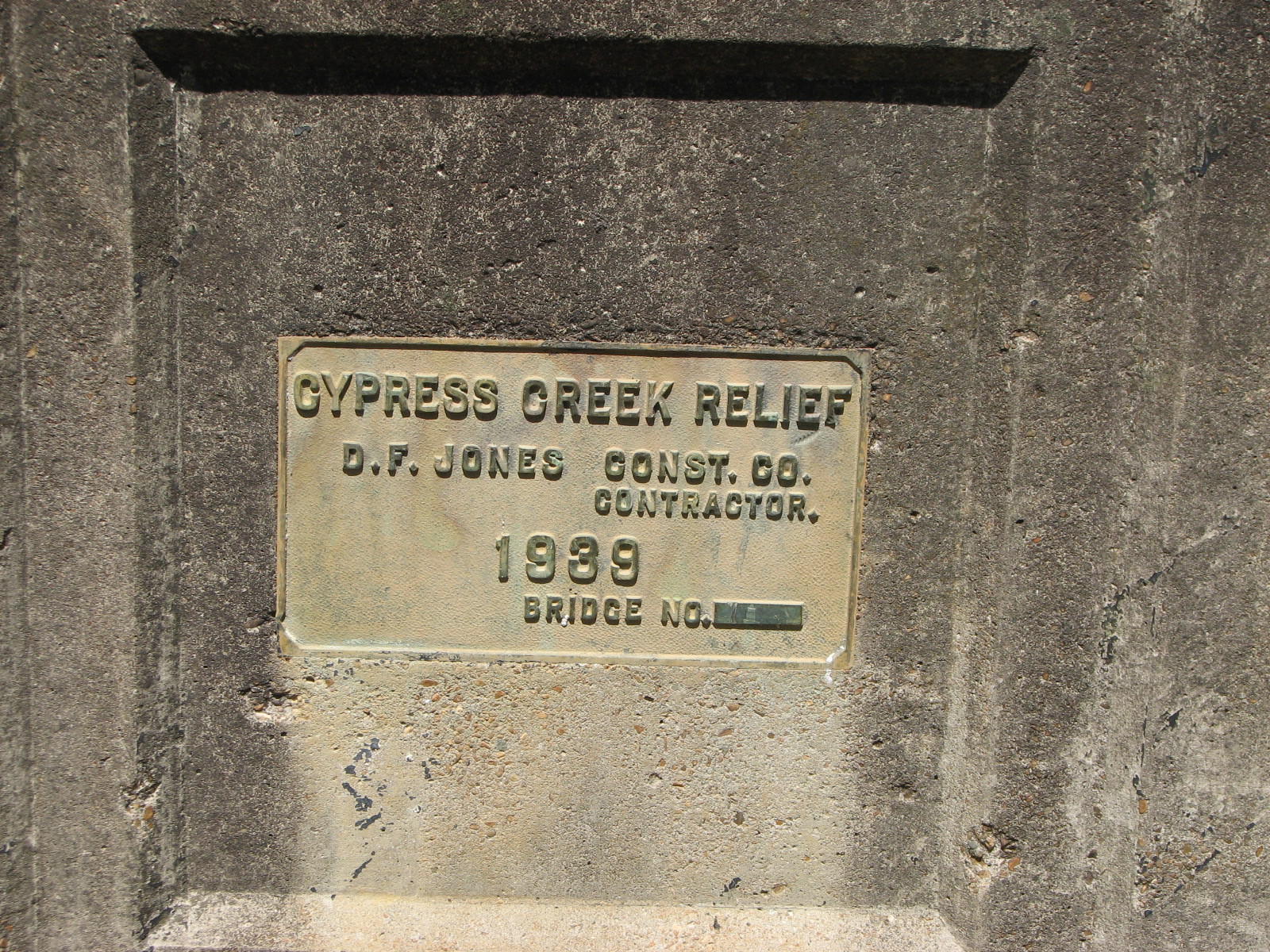
Plaque
Photo taken by David Backlin in April 2009
136694
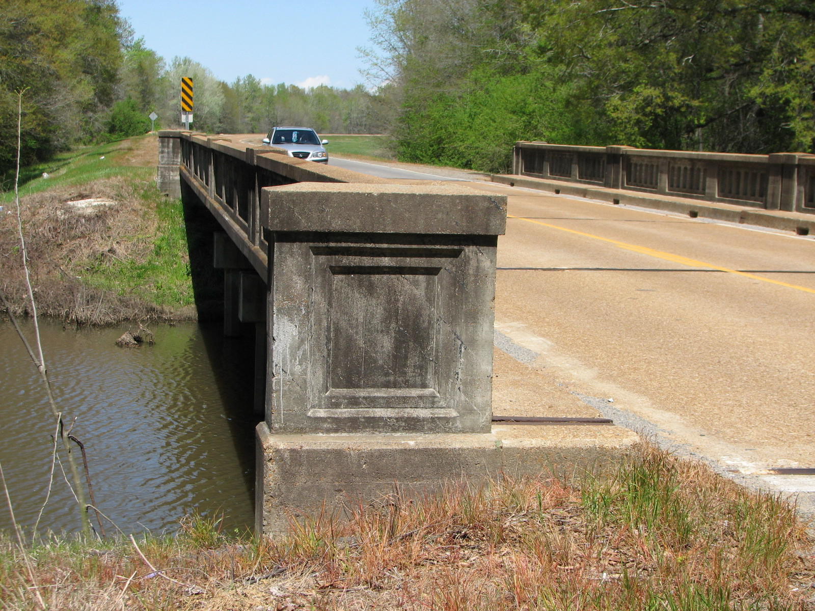
End Cap
Photo taken by David Backlin in April 2009
136695
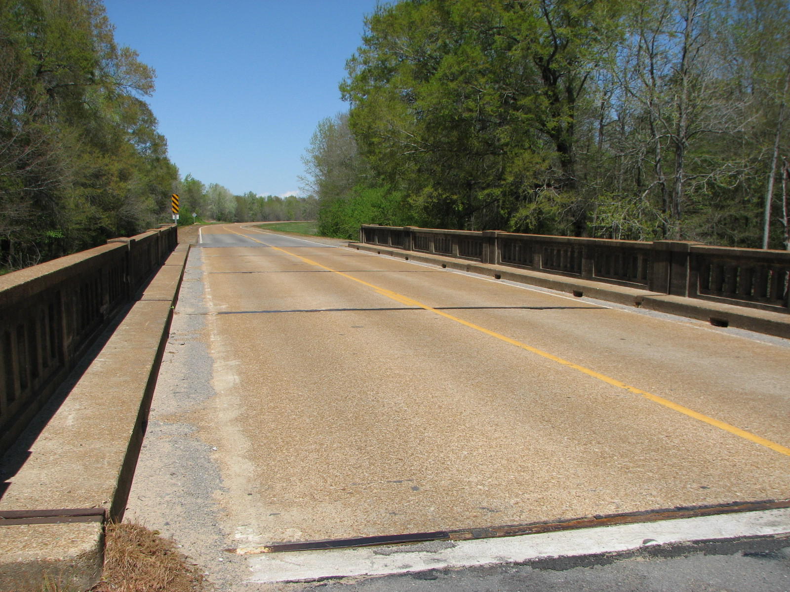
Deck View
Photo taken by David Backlin in April 2009
136696
Side View
Photo taken by David Backlin in April 2009
![]()
Status: Open to traffic
Location: 34.956667,-92.043333
Carries AR 367 (old US 67) over Dredge Ditch
Design: beam/tee
Design Details: Concrete tee beam
Total Length: 105.0 Feet
Span Length: 44.9 Feet
Overview: Concrete tee beam bridge over Dredge Ditch on AR 367
History: Built 1928
Built: 1928
Location: Lonoke County
View Bridge Information In Wayback Machine
![]()
![]()
Status: Open to traffic
Location: 35.005833,-91.974444
Carries AR 367 over Four Mile Creek
Design: beam/tee
Design Details: Concrete tee beam
Total Length: 35.1 Feet
Span Length: 35.1 Feet
Overview: Concrete tee beam bridge over Four Mile Creek on AR 367 (old US 67)
History: Built 1930
Built: 1930
Location: Lonoke County
View Bridge Information In Wayback Machine
![]()
![]()
Status: Open to traffic
Location: 34.957005,-92.043213
Carries AR 367 (old US 67) over Bayou Two Prairie
Design: beam/tee
Design Details: Concrete tee beam
Total Length: 60.0 Feet
Span Length: 29.9 Feet
Overview: Concrete tee beam bridge over Bayou Two Prairie on AR 367
History: Built 1930
Built: 1930
Location: Lonoke County
View Bridge Information In Wayback Machine
![]()
![]()
Status: Open to traffic
Location: 34.941390,-92.072640
Carries TP White Dr (old US 67) over Glade Branch
Design: beam/tee
Design Details: Concrete tee beam
Total Length: 35.1 Feet
Span Length: 35.1 Feet
Overview: Concrete tee beam bridge over Glade Branch on TP White Dr (old US 67)
History: Built 1930
Built: 1930
Location: Lonoke County
View Bridge Information In Wayback Machine
![]()
![]()
Status: Abandoned
Location: 34.782348,-91.728961
Carries CRI&P railroad over Unnamed creek/drainage ditch
Design: unknown
Design Details:
Total Length: 0.0 Feet
Span Length: 0.0 Feet
Overview: Abandoned bridge over Unnamed creek/drainage ditch on CRI&P railroad
History:
Built:
Location: Lonoke County
View Bridge Information In Wayback Machine
![]()
269846
Photo taken by Shane Passmore on 6/14/2013
269847
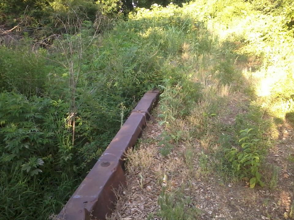
Photo taken by Shane Passmore on 6/14/2013
269848
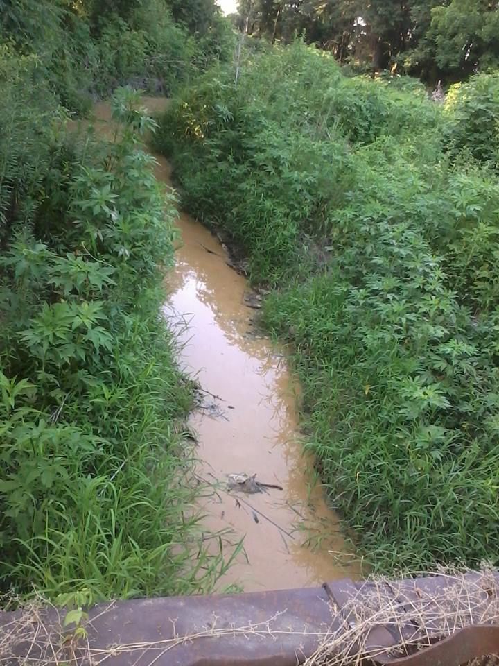
Photo taken by Shane Passmore on 6/14/2013
![]()
Status: Open to traffic
Location: 34.778889,-91.770556
Carries US 70 over Bayou Two Prairie
Design: beam/tee
Design Details: Concrete tee beam
Total Length: 103.0 Feet
Span Length: 34.1 Feet
Overview: Concrete tee beam bridge over Bayou Two Prairie on US 70
History: Built 1931
Built: 1931
Location: Lonoke County
View Bridge Information In Wayback Machine
![]()
![]()
Status: Open to traffic
Location: 34.778889,-91.779444
Carries US 70 over White Oak Ditch
Design: beam/tee
Design Details: Concrete tee beam
Total Length: 65.0 Feet
Span Length: 35.1 Feet
Overview: Concrete tee beam bridge over White Oak Ditch on US 70
History: Built 1931
Built: 1931
Location: Lonoke County
View Bridge Information In Wayback Machine
![]()
![]()
Status: Open to traffic
Location: 34.763889,-92.027778
Carries Us 70 over Hall Creek
Design: beam/tee
Design Details: Concrete tee beam
Total Length: 35.1 Feet
Span Length: 32.2 Feet
Overview: Concrete tee beam bridge over Hall Creek on Us 70
History: Built 1931
Built: 1931
Location: Lonoke County
View Bridge Information In Wayback Machine
![]()
![]()
Status: Open to traffic
Location: 34.762491,-91.929405
Carries Us 70 over Bayou Meto
Design: beam/tee
Design Details: Concrete tee beam
Total Length: 307.1 Feet
Span Length: 34.1 Feet
Overview: Concrete tee beam bridge over Bayou Meto on Us 70
History: Built 1931
Built: 1931
Location: Lonoke County
View Bridge Information In Wayback Machine
![]()
![]()
Status: Open to traffic
Location: 34.778889,-91.766389
Carries US 70 over Bayou Two Prairie
Design: beam/tee
Design Details: Concrete tee beam
Total Length: 137.1 Feet
Span Length: 34.1 Feet
Overview: Concrete tee beam bridge over Bayou Two Prairie on US 70
History: Built 1931
Built: 1931
Location: Lonoke County
View Bridge Information In Wayback Machine
![]()
![]()
Status: Open to traffic
Location: 34.778889,-91.768889
Carries US 70 over Bayou Two Prairie
Design: beam/tee
Design Details: Concrete tee beam
Total Length: 103.0 Feet
Span Length: 34.1 Feet
Overview: Concrete tee beam bridge over Bayou Two Prairie on US 70
History: Built 1931
Built: 1931
Location: Lonoke County
View Bridge Information In Wayback Machine
![]()
![]()
Status: Open to traffic
Location: 34.954722,-92.047417
Carries Sh 367 over Duff Creek
Design: beam/tee
Design Details: Concrete tee beam
Total Length: 34.1 Feet
Span Length: 34.1 Feet
Overview: Concrete tee beam bridge over Duff Creek on Sh 367
History: Built 1930
Built: 1930
Location: Lonoke County
View Bridge Information In Wayback Machine
![]()
Special Bridge Conditions Legend: R - Former location of relocated bridge. ! - At risk for demolition or destruction. X - Confirmed demolished or collapsed. S - Dismantled and/or in storage. L - Severe loss of historic integrity due to alteration.
![]()

![]()