![]()
![]()
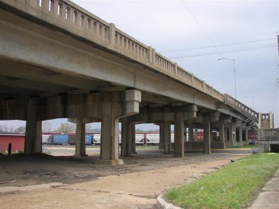
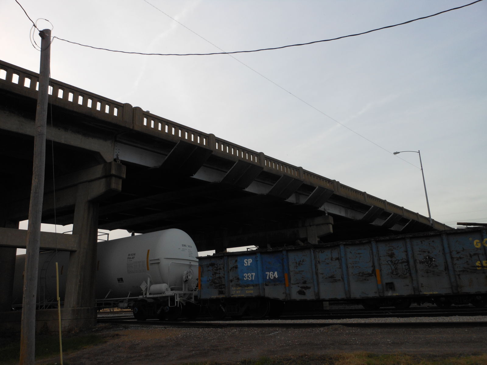
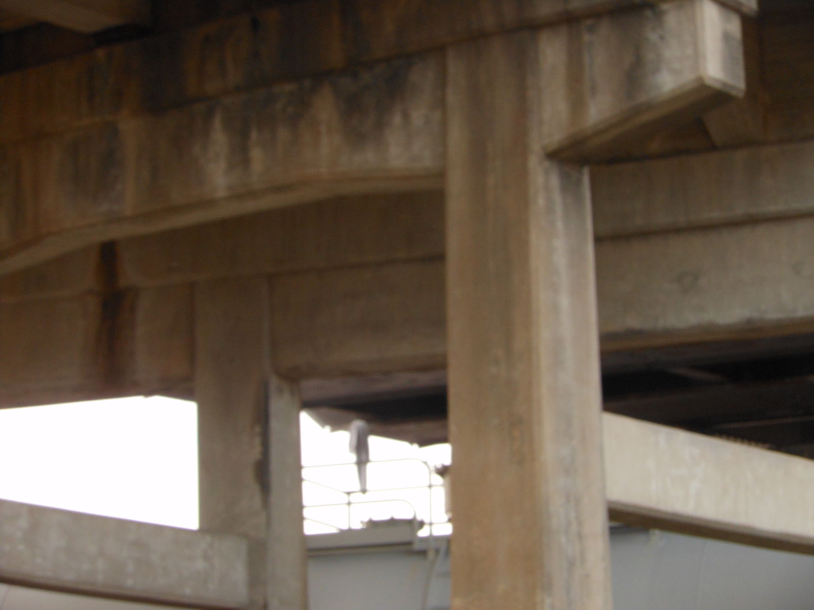
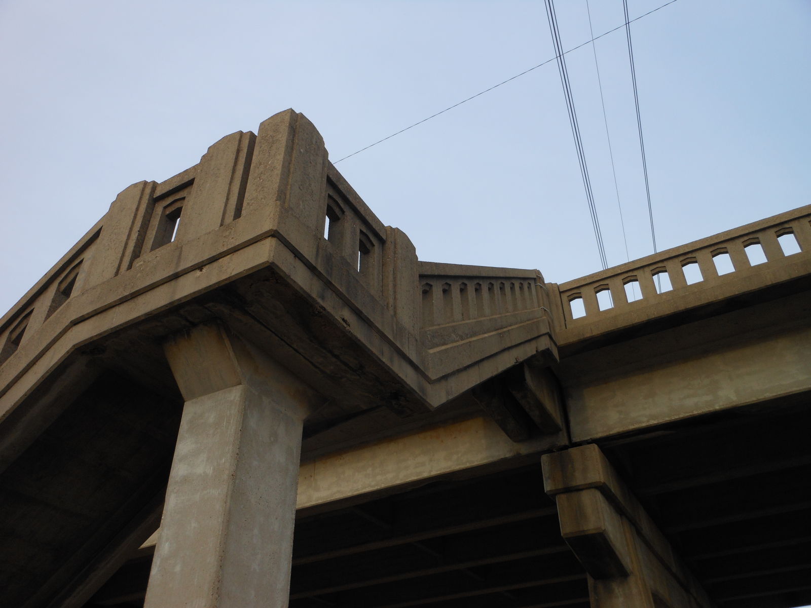
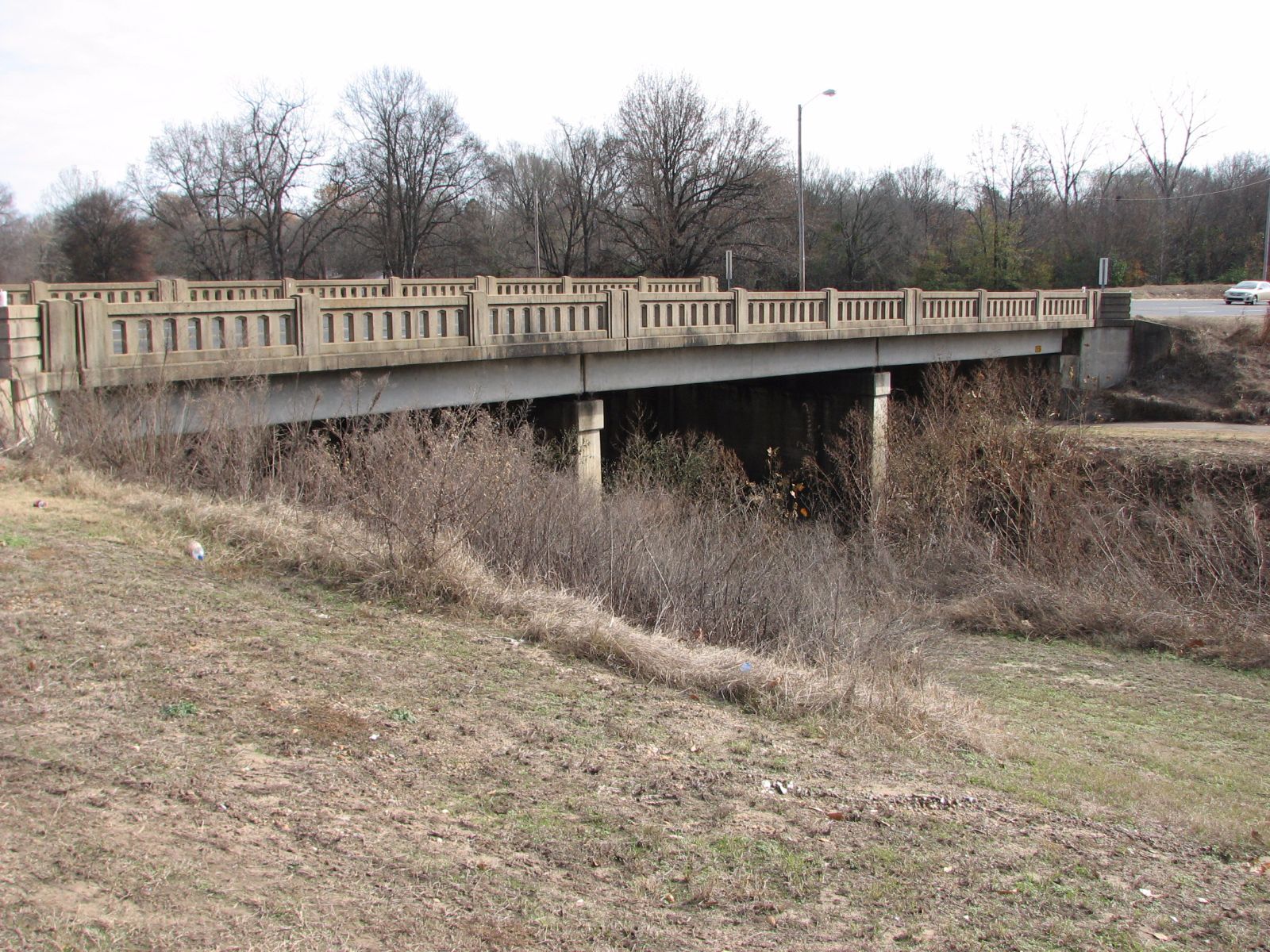
Status: Replaced by a new bridge
Location: 33.425000,-94.031667
Carries US 71 (Hickory Street) over Union Pacific Railroad
Design: beam/tee
Design Details: Concrete tee beam
Total Length: 617.2 Feet
Span Length: 75.1 Feet
Overview: Concrete tee beam bridge over the Union Pacific Railroad on US 71 (Hickory Street) in Texarkana
History: Built 1939: Replaced 2015
Built: 1939
Location: Miller County
View Bridge Information In Wayback Machine
![]()
109121
Overview
Photos taken by Wayne Kizziar
109122
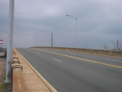
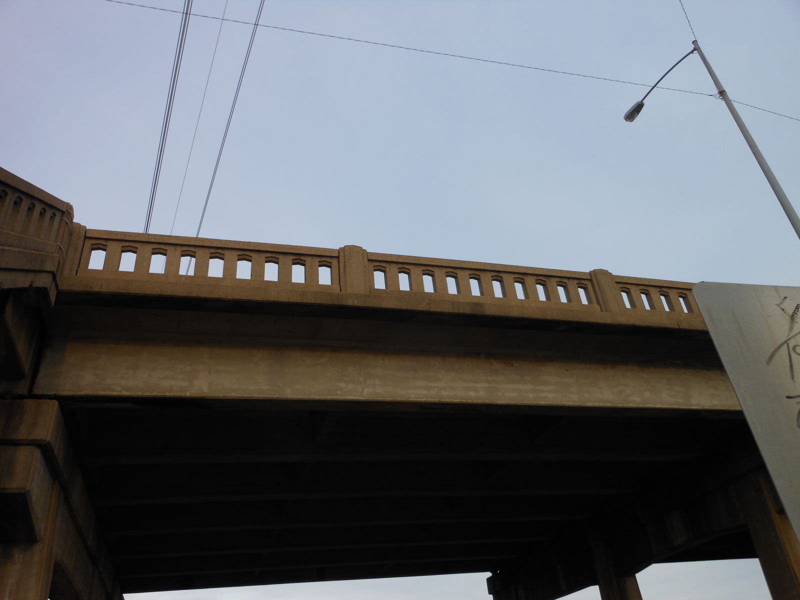
Deck view
109123
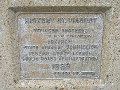
Plaque
109124
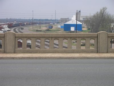
Railing
109125
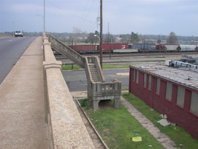
Stairs
245164
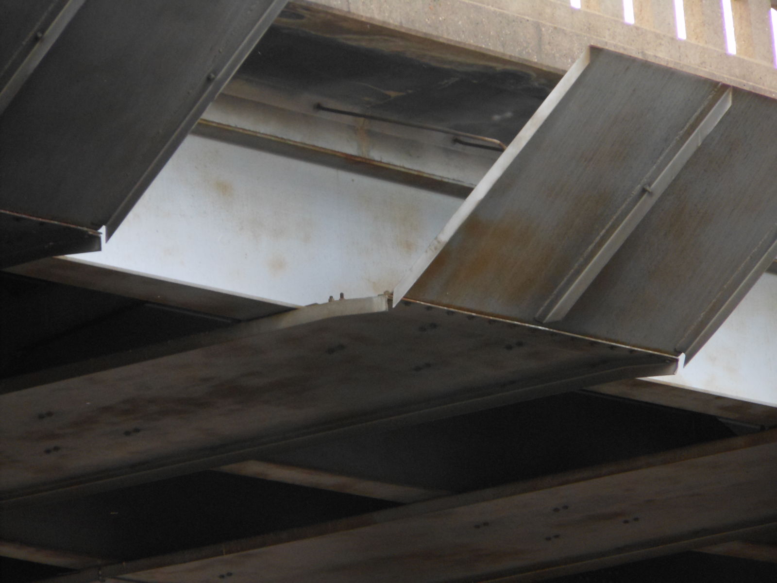
There are deflectors over each rail lane.
Photo taken by Brad Smith in December 2012
245165
From SE to NW
Photo taken by Brad Smith in December 2012
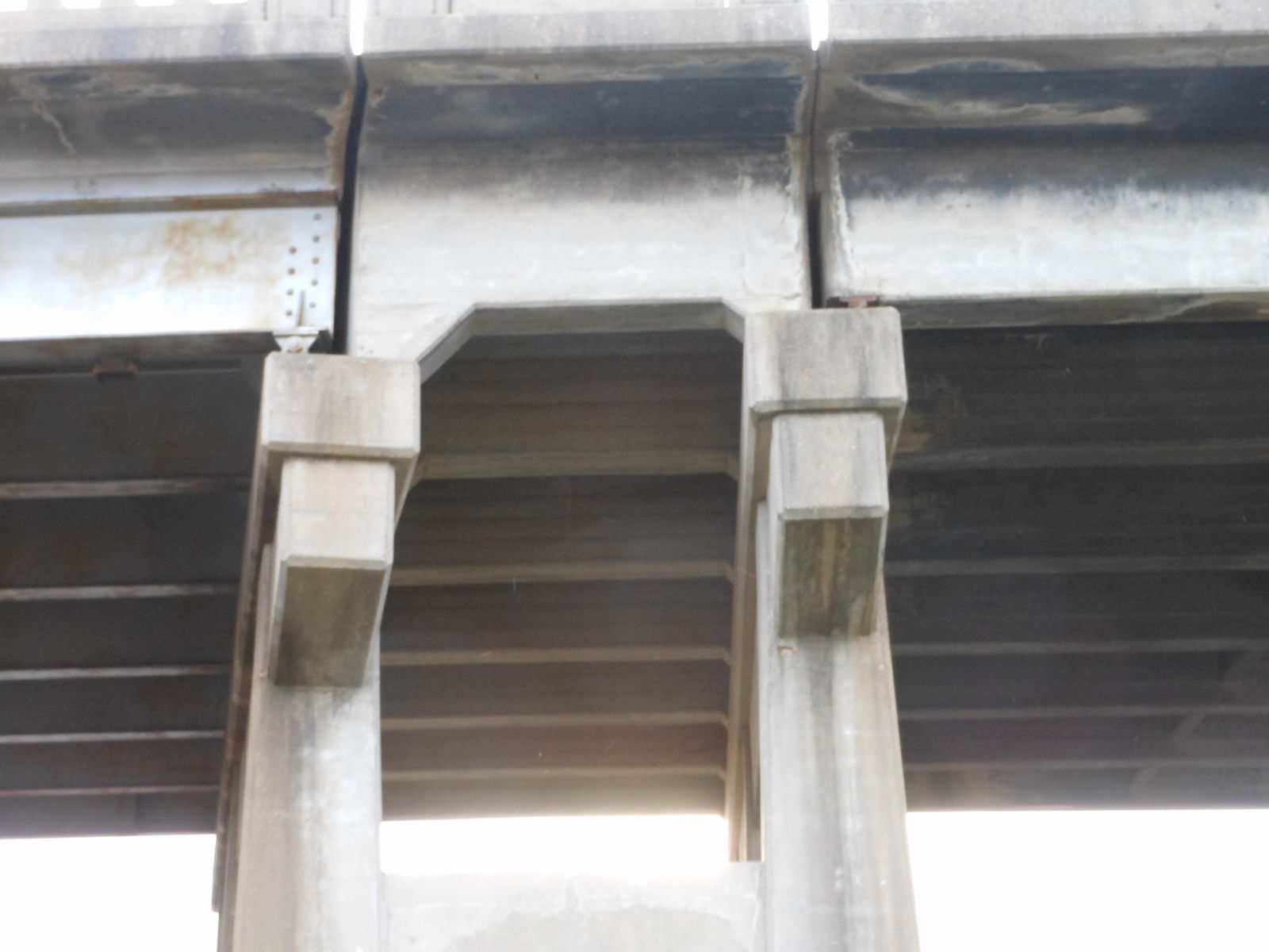
245166
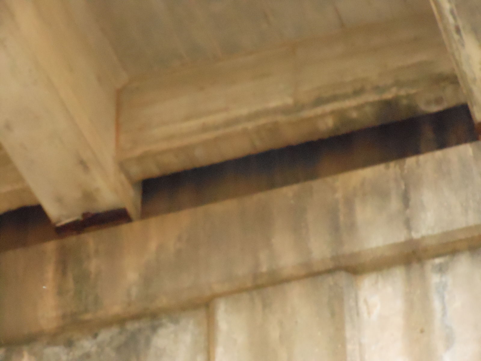
Concrete T Junction
Photo taken by Brad Smith in December 2012
245167
Concrete T Support
Photo taken by Brad Smith in December 2012
245168
From Southwest (By the animal Shelter)
Photo taken by Brad Smith in December 2012
245169
NE to SW standing on Broad Street
Photo taken by Brad Smith in December 2012
245170
NE to SW a little further S
Photo taken by Brad Smith in December 2012
245171
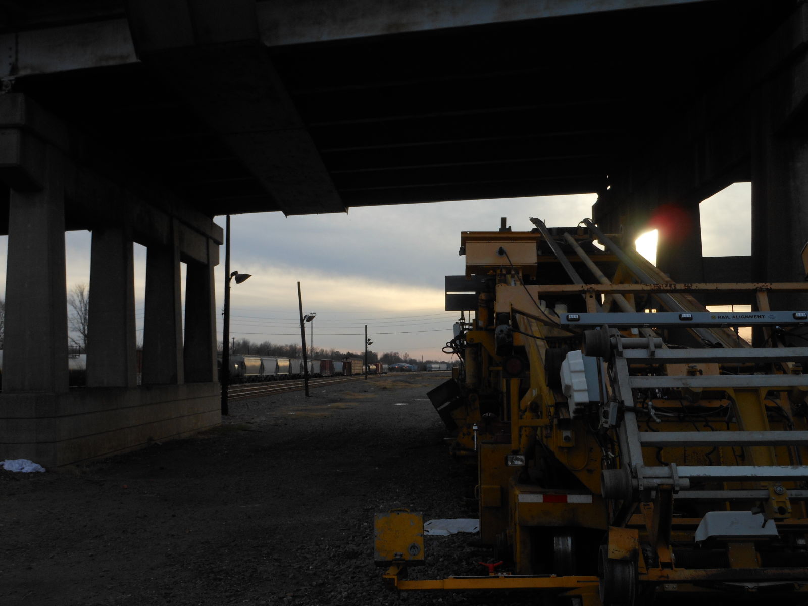
Track machine parked under the bridge
Photo taken by Brad Smith in December 2012
245172
Transition between the Concrete Beams and The Steel Ones
Photo taken by Brad Smith in December 2012
245173
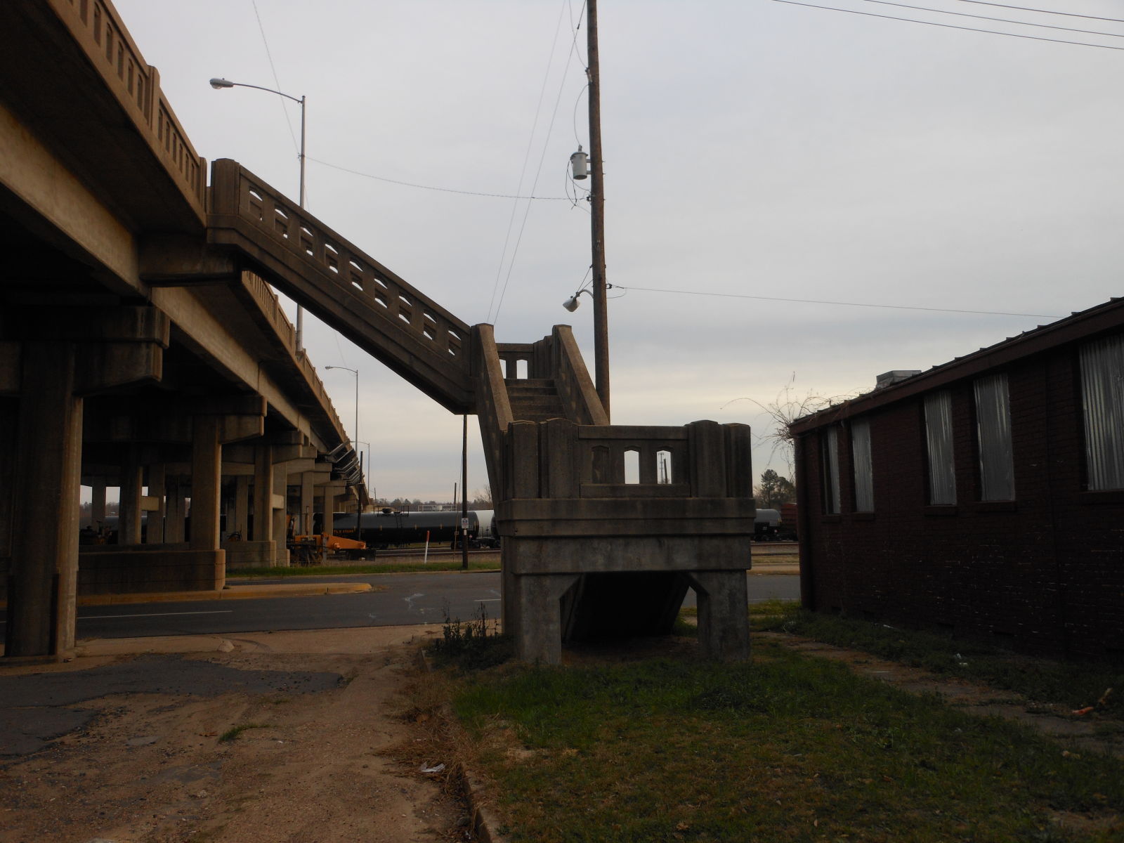
Stairs Taken From N to S
Although people still use the sidewalks. The stairs no longer actually open on the bridge.
Photo taken by Brad Smith in December 2012
245174
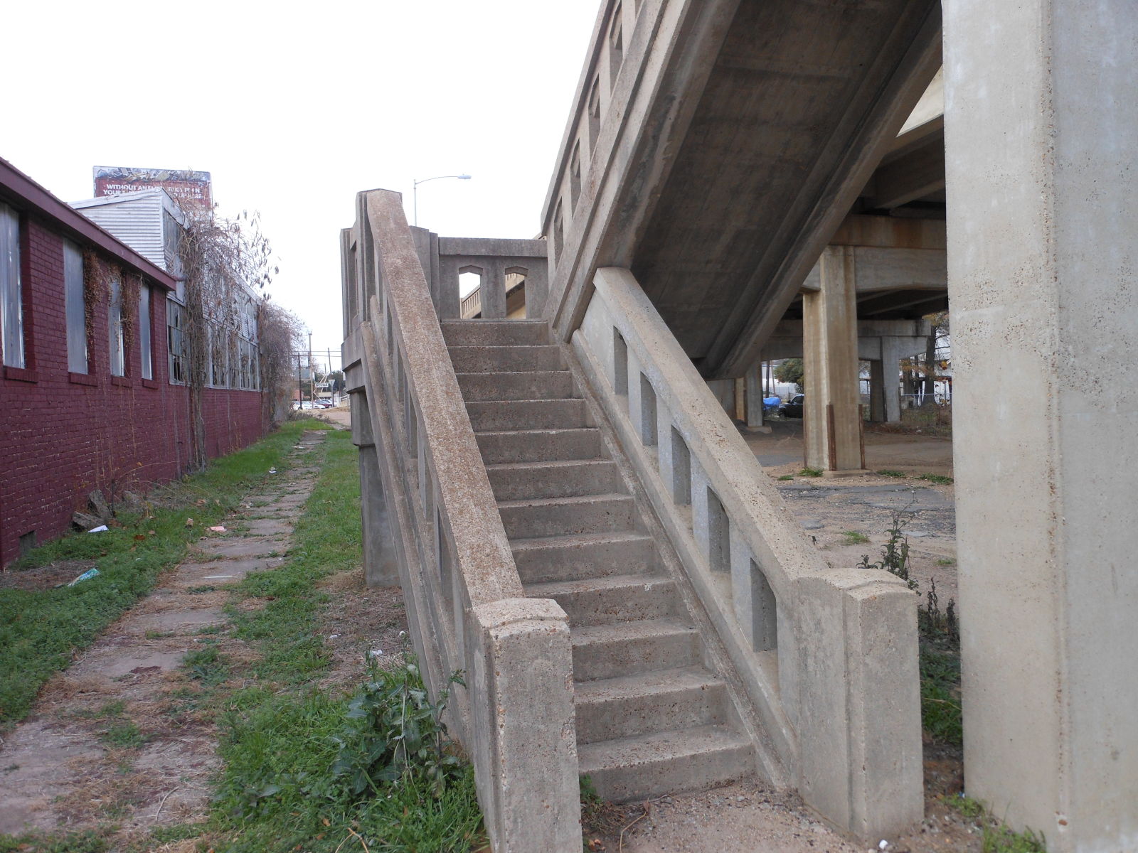
First few steps taken from the south
Photo taken by Brad Smith in December 2012
245175
Top of the stairs from the ground
Photo taken by Brad Smith in December 2012
245176
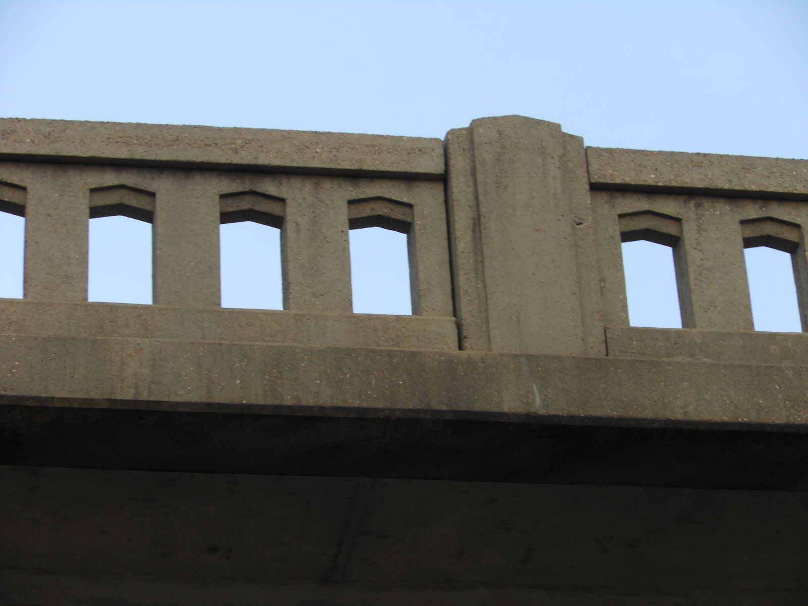
A sample of the railing
Photo taken by Brad Smith in December 2012
245177
Wider view of the railing
Photo taken by Brad Smith in December 2012
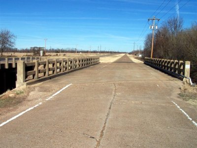
![]()
Status: Open to traffic on a frontage road
Location: 33.494098,-93.950812
Carries Old US 67 over McKinney Bayou
Design: beam/tee
Design Details: Concrete tee beam
Total Length: 103.0 Feet
Span Length: 34.5 Feet
Overview: Concrete bridge over McKinney Bayou on Old US 67 northeast of Texarkana
History: Built 1929 by contractor McGuire & Cavender. Made obsolete 1954 by a new parallel alignment of US 67.
Built: 1929
Location: Miller County
View Bridge Information In Wayback Machine
![]()
100694
Overview
Photo taken January 2006 by Wayne Kizziar
100695
Deck view
Photo taken January 2006 by Wayne Kizziar
100696
Close-up of bridge's skew
Photo taken January 2006 by Wayne Kizziar
100697
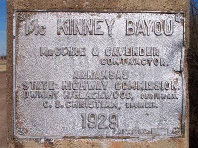
Plaque
Photo taken January 2006 by Wayne Kizziar
203116
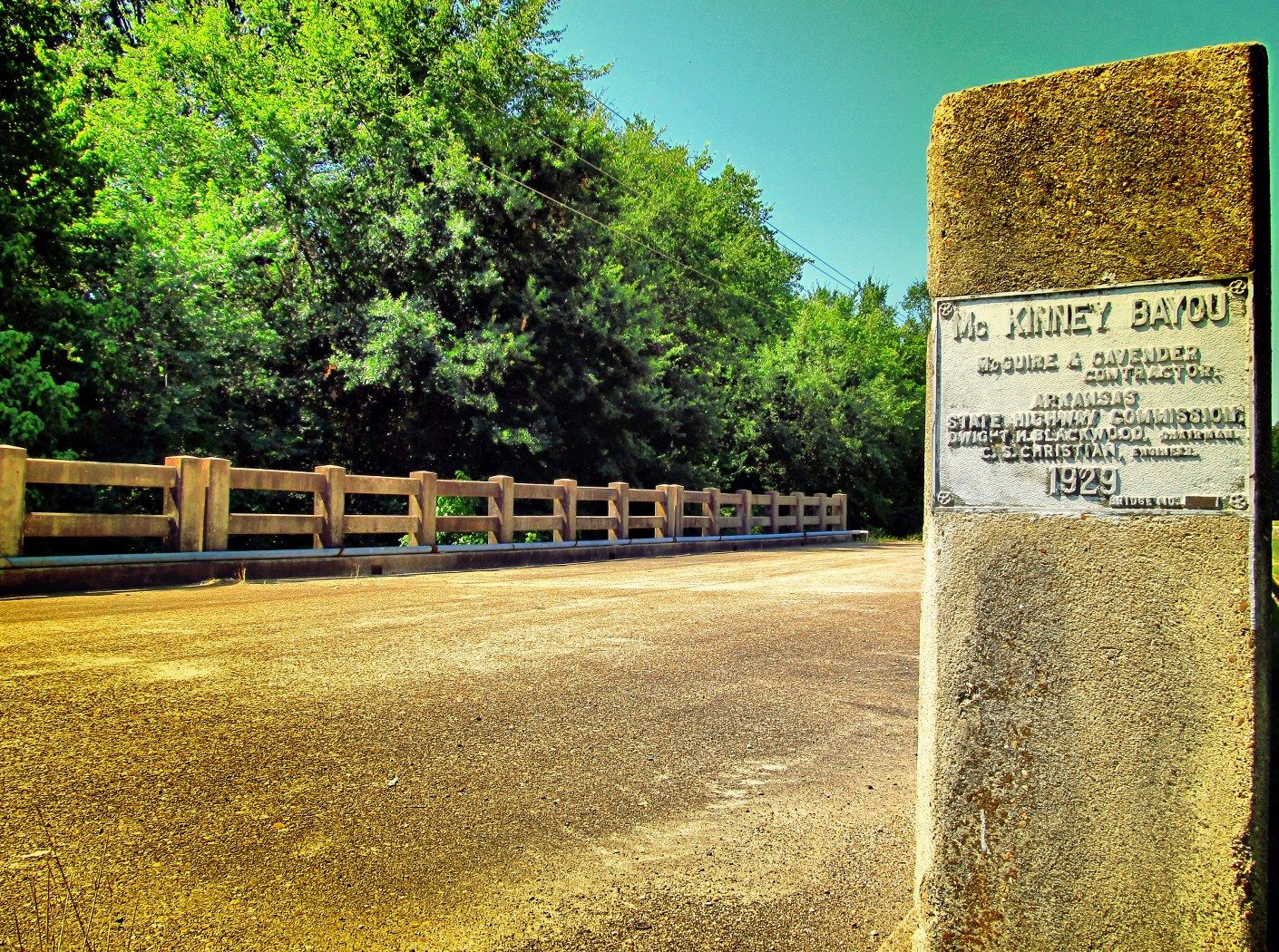
View of endpost looking south west
Photo taken by Wayne Kizziar in July 2011
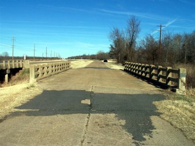
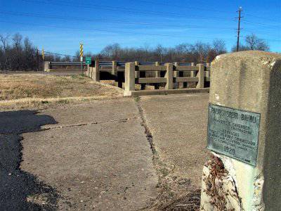
![]()
Status: Open to traffic on a frontage road
Location: 33.501389,-93.951667
Carries CR 138 (formerly US 67) over Paup's Spur Bayou
Design: beam/tee
Design Details: Concrete tee beam
Total Length: 71.9 Feet
Span Length: 34.1 Feet
Overview: Concrete bridge over Paup's Spur Bayou on CR 138 (Old US 67) northeast of Texarkana
History: Built 1929 by contractor McGuire & Cavender. Made obsolete 1954 by a new parallel alignment of US 67.
Built: 1929
Location: Miller County
View Bridge Information In Wayback Machine
![]()
100698
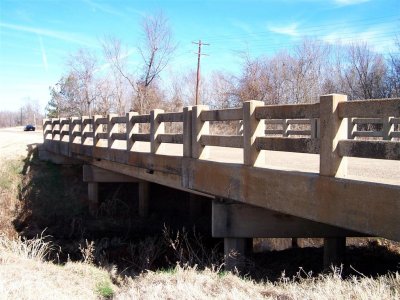
Overview
Photo taken January 2006 by Wayne Kizziar
100699
Deck view
Photo taken January 2006 by Wayne Kizziar
100700
Both bridges
Photo taken January 2006 by Wayne Kizziar
100701
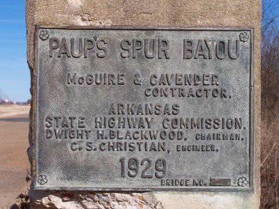
Plaque
Photo taken January 2006 by Wayne Kizziar
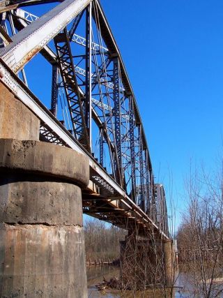
![]()
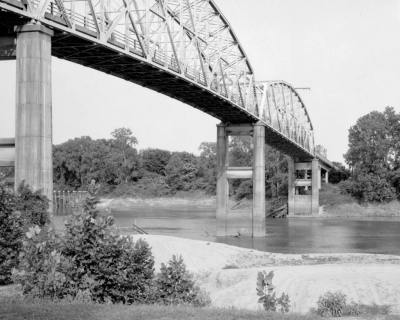
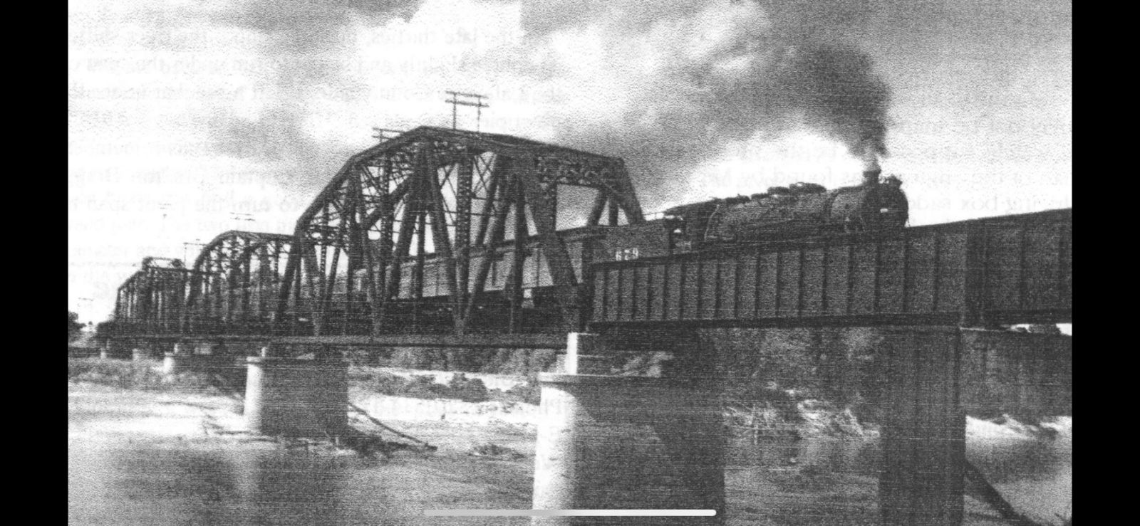
Status: Replaced by a new bridge about 1/2 mile upstream
Location: 33.355883,-93.706122
Carries US 82 over Red River
Design: truss/through/pennsylvania
Design Details: Three riveted, 14-panel Pennsylvania through trusses
Total Length: 1849.0 Feet
Span Length: 0.0 Feet
Overview: Lost through truss over Red River on US 82 at Garland City in Garland
History: Built 1931; replaced 1990
Built: 1931
Location: Miller County
View Bridge Information In Wayback Machine
![]()
129676
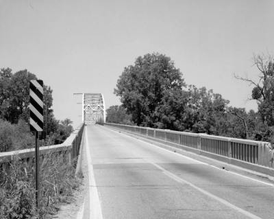
General View Of Pennsylvania Truss Bridge From Roadbed, Looking Northwest
Photo taken July 1988 by Louise T. Taft for the Historic American Engineering Record
129677
Three-Quarter View From Adjacent Access Road Showing Three Spans And Northwest Approach Spans, Looking Southeast
Photo taken July 1988 by Louise T. Taft for the Historic American Engineering Record
129678
Elevation View Of Bridge From River Bank, Looking Northeast
Photo taken July 1988 by Louise T. Taft for the Historic American Engineering Record
129679
Three-Quarter View Of Bridge From River Bank, Looking East
Photo taken July 1988 by Louise T. Taft for the Historic American Engineering Record
129680
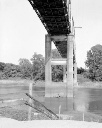
View Of Deck Support System From Underneath Bridge, Looking Southeast
Photo taken July 1988 by Louise T. Taft for the Historic American Engineering Record
129681
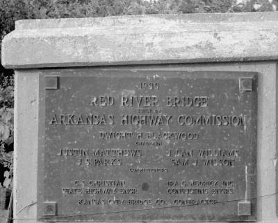
Detail Of Bridge Dateplate Which Reads '1930, Red River Bridge, Arkansas Highway Commission'
Photo taken July 1988 by Louise T. Taft for the Historic American Engineering Record
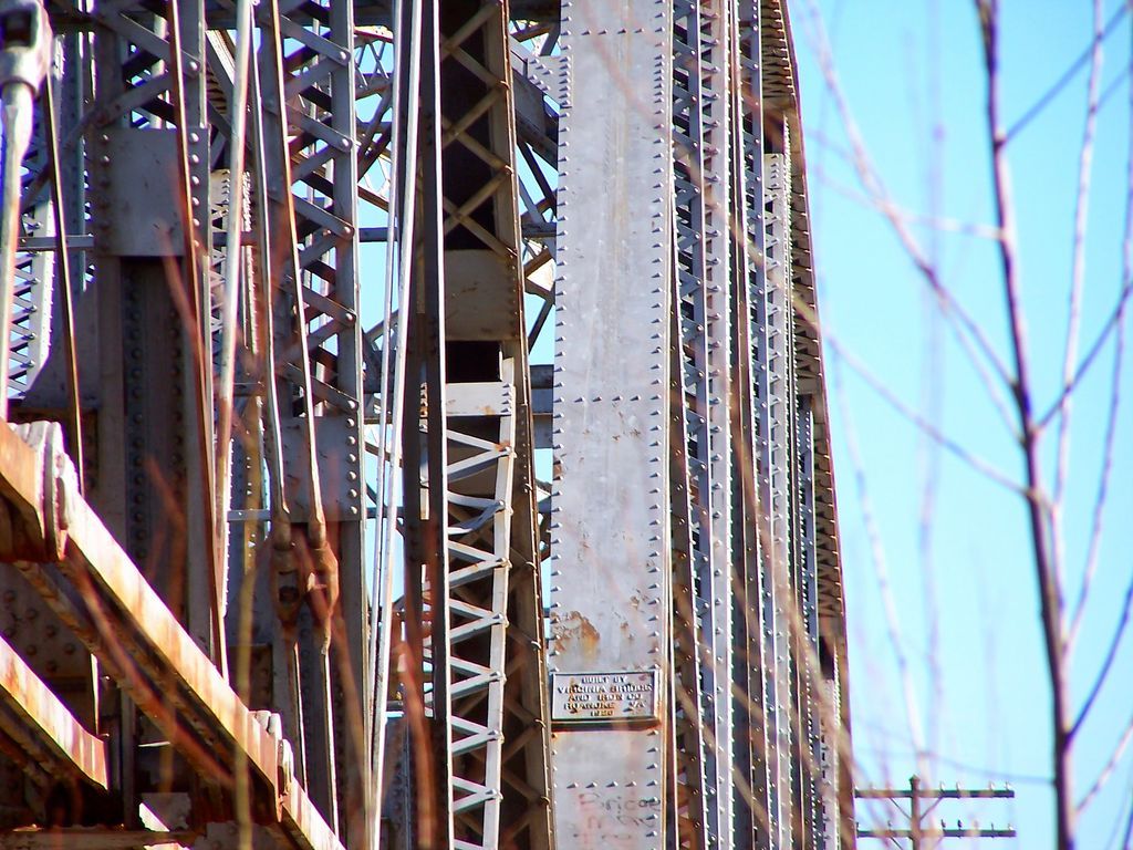
![]()
Status: Open to traffic
Location: 33.430828,-94.029136
Carries East 9th Street / US 82 over Nix Creek
Design: beam/stringer
Design Details: Stringer
Total Length: 0.0 Feet
Span Length: 50.0 Feet
Overview: Stringer bridge over Nix Creek on East 9th Street / US 82
History: Nix Creek Bridge east 9th street Texarkana Arkansas. Built 1950 by Clark Brothers Construction Company.
Built: 1950
Location: Miller County
View Bridge Information In Wayback Machine
![]()
111877
Oblique from the north
All Photos February '07
Photo taken by Wayne Kizziar
111878
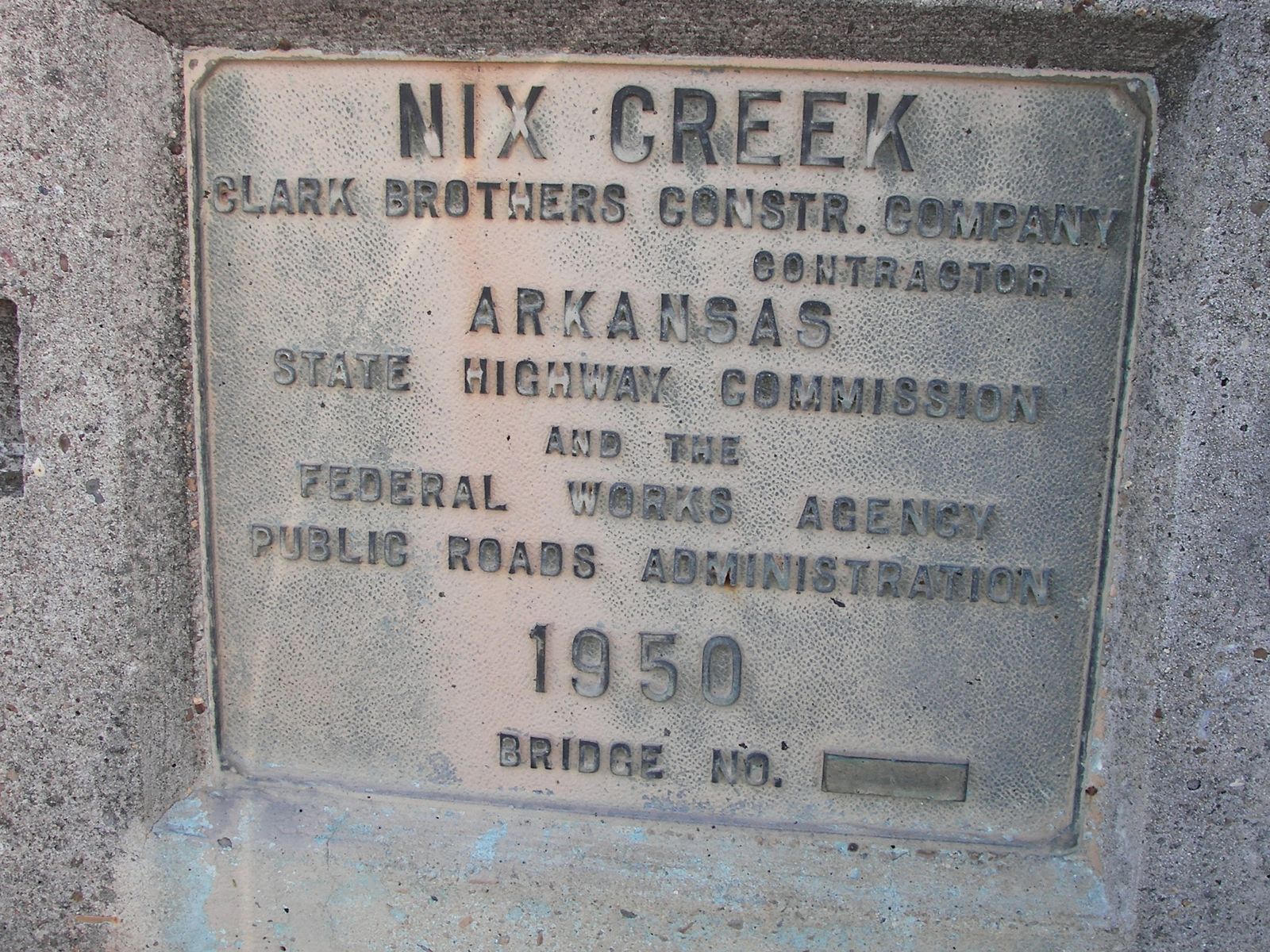
Builders plate
Nix Creek Clark Brothers Constr. Company Contractor Arkansas State Highway Commission And The Federal Works Agency Public Roads Administration 1950 Bridge No.______
Photo taken by Wayne Kizziar
111879
Railing detail
Photo taken by Wayne Kizziar
111880
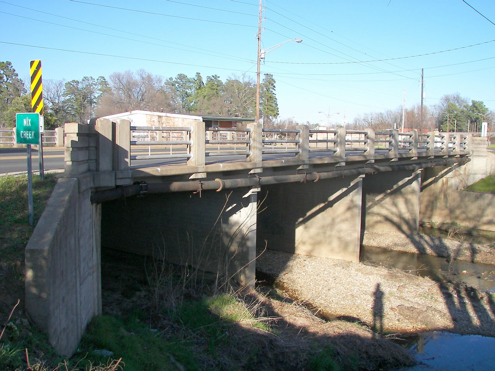
Oblique from the south
Photo taken by Wayne Kizziar
![]()
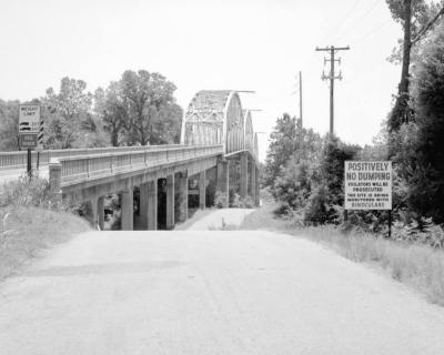
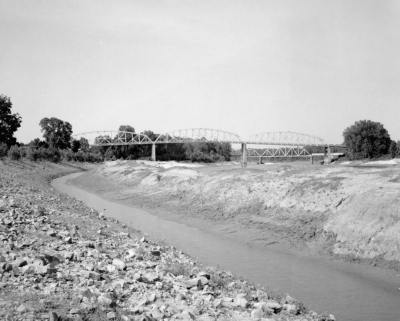
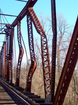
Status: Open to traffic-Swing Span removed 2010
Location: 33.357383,-93.703807
Carries Union Pacific Railroad over Red River
Design: truss/through
Design Details: Through truss
Total Length: 0.0 Feet
Span Length: 0.0 Feet
Overview: Through truss bridge over Red River on Union Pacific Railroad in Garland City
History: Built 1926 Virginia Bridge & Iron Company
Built: 1926
Location: Miller County
View Bridge Information In Wayback Machine
![]()
113527
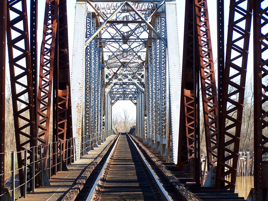
Barrel Shot
Bridge consists of three plate girder approach spans and three through trusses one of which is a non-functional swing span with heavy damage. This view is looking east from the end of the swing span to the over water spans.
Photo taken by Wayne Kizziar 2-21-04
113528
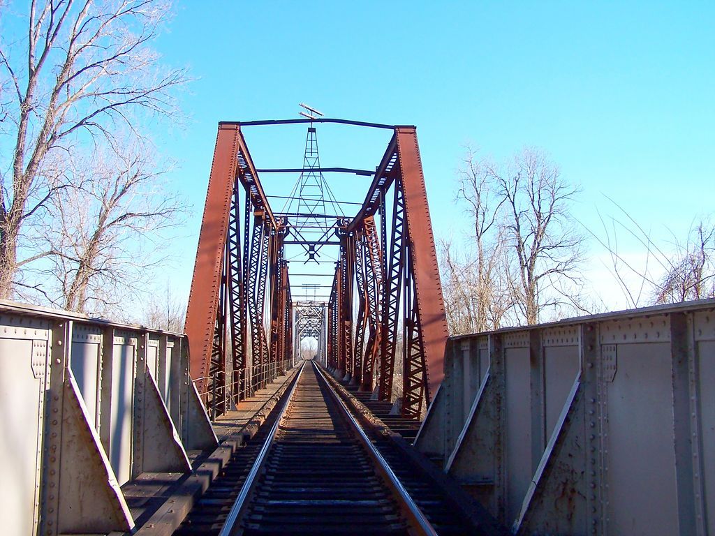
Plate Girder and Swing Span
Looking east from plate girder approach to beginning of swing span. Notice lack of overhead and portal bracing on swing span. Some of it looked to be torn out and other sections cut out.
Photo taken by Wayne Kizziar 2-21-04
113529
Close up of turntable
Photo taken by Wayne Kizziar 2-21-04
113530
Date Plate
Built by Virginia Bridge and Iron Company Roanoke Virginia 1926
Photo taken by Wayne Kizziar 2-21-04
113531
Oblique view
Photo taken by Wayne Kizziar 2-21-04
113532
Transition from swing span to through span
Photo taken by Wayne Kizziar 2-21-04
113533
Damage
Photo taken by Wayne Kizziar 2-21-04
113534
Side view
Side view taken from the new Red River US 82 bridge
Photo taken by Wayne Kizziar 5-6-07
263972
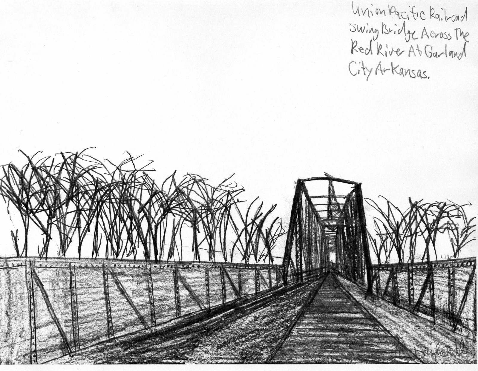
Photo taken by Douglas Butler
456463
Southwest Arkansas Regional Archives
![]()
Status: Open to traffic
Location: 33.407617,-94.030376
Carries US 71 over Texas and Pacific Railway (now Union Pacific RR)
Design: beam/stringer/steel
Design Details: Steel stringer
Total Length: 173.9 Feet
Span Length: 45.9 Feet
Overview: The bridge carries US 71 but there is no rails or traffic below the roadaway
History: Built 1929; rehabilitated 1963
Built: 1929
Location: Miller County
View Bridge Information In Wayback Machine
![]()
245159
Under from the Northwest
Photo taken by Brad Smith in December 2012
245160
Labeling stenciled on Northwest Corner
Photo taken by Brad Smith in December 2012
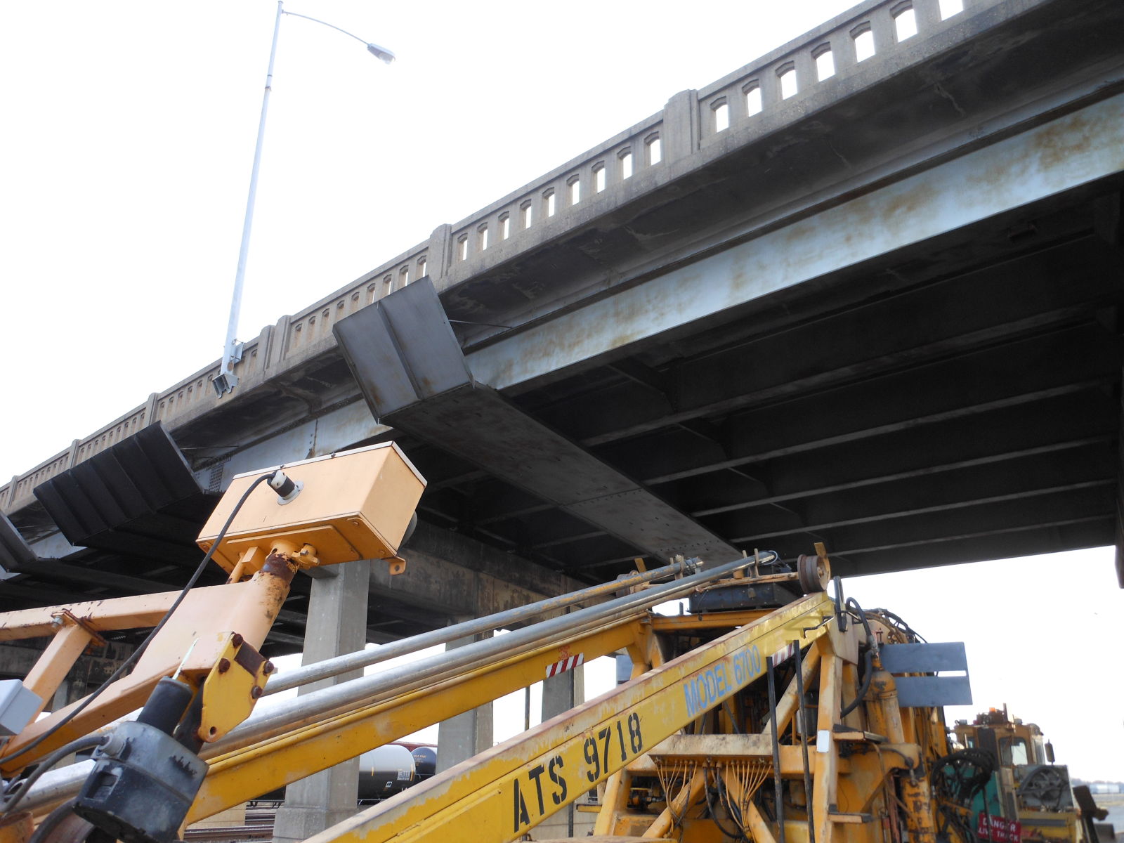
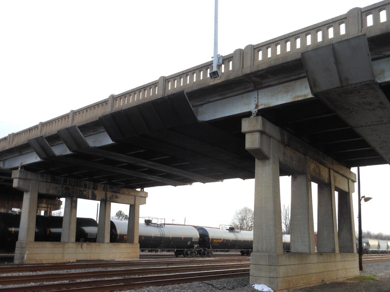
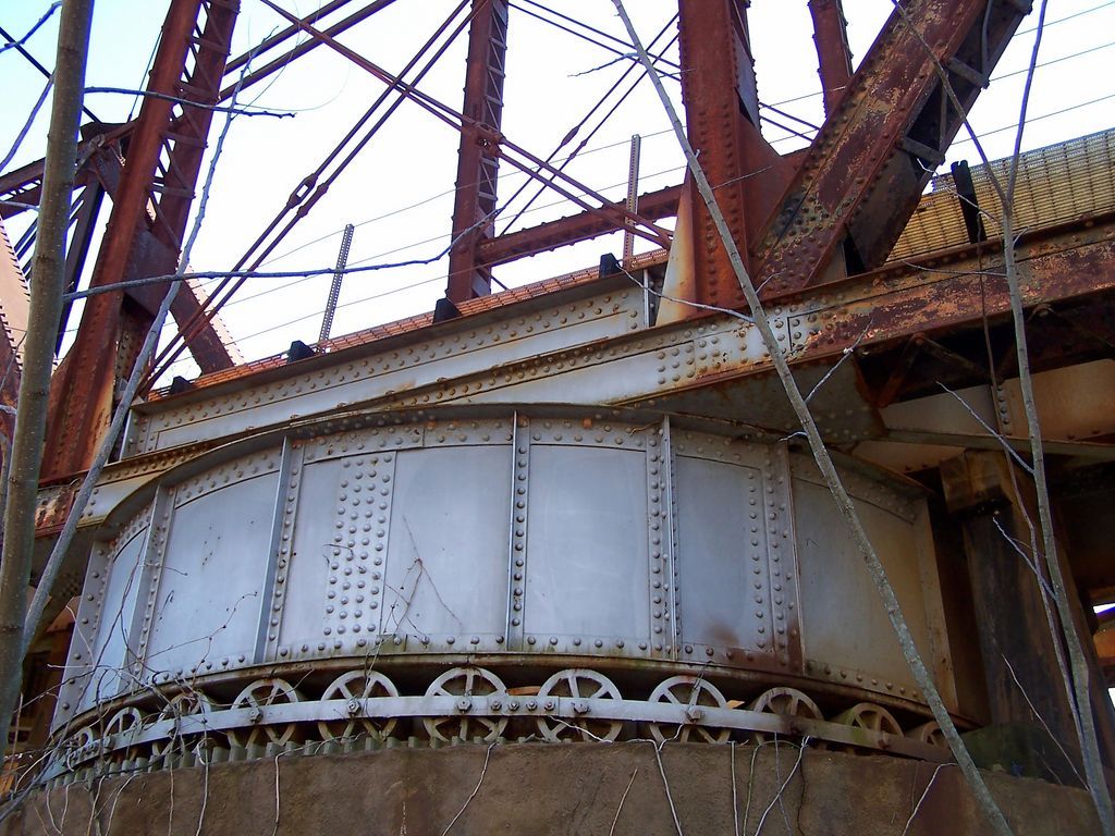
![]()
Status: Open to traffic
Location: 33.425742,-94.032752
Carries Southern Pacific RR (now Union Pacific RR) over US 71
Design: beam/stringer/steel
Design Details: Steel stringer
Total Length: 64.0 Feet
Span Length: 64.0 Feet
Overview: Steel stringer bridge over US 71 on Southern Pacific RR (now Union Pacific RR)
History: Built 1940
Built: 1940
Location: Miller County
View Bridge Information In Wayback Machine
![]()
245161
Man it was getting too dark
Photo taken by Brad Smith in December 2012
245162
From the North
Photo taken by Brad Smith in March 2011
245163
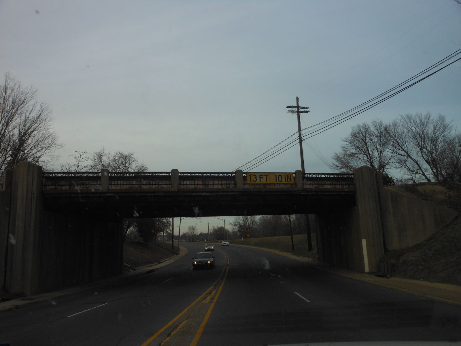
Photo taken by Brad Smith in March 2011
376204

Looking North
Photo taken by David Backlin in December 2016
![]()
Status: Replaced by new bridge
Location: 33.149444,-93.892056
Carries US 71 over Sulphur River
Design: truss/through/k-parker
Design Details: K-Parker through truss
Total Length: 462.0 Feet
Span Length: 225.0 Feet
Overview: Lost Through truss bridge over Sulphur River on US 71
History: Built 1930-31
Built: ca. 1930
Location: Miller County
View Bridge Information In Wayback Machine
![]()
375215
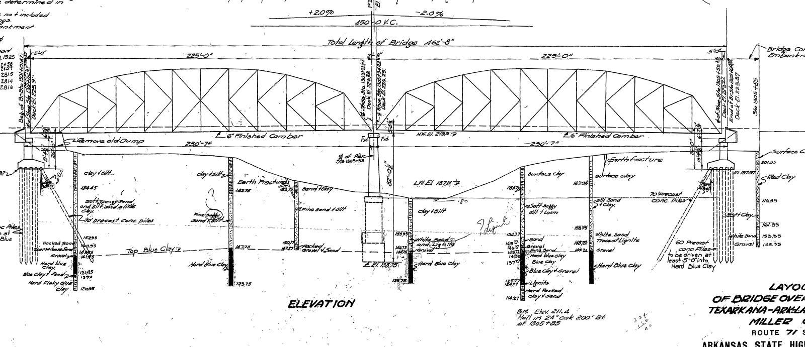
Original Drawing
Original Drawing
![]()
Status: Open to traffic
Location: 33.575000,-93.853333
Carries US 67 over Gillespie Ditch
Design: beam/tee
Design Details: Concrete tee beam
Total Length: 71.9 Feet
Span Length: 34.1 Feet
Overview: Concrete tee beam bridge on US 67
History: Built 1929
Built: 1929
Location: Miller County
View Bridge Information In Wayback Machine
![]()
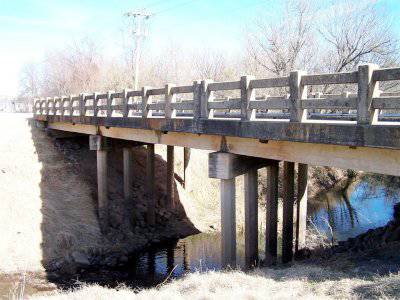
193270
Side Elevation Looking South West
Photo taken by Wayne Kizziar in January 2011
193271
Side Elevation Looking South East
Photo taken by Wayne Kizziar in January 2011
193272
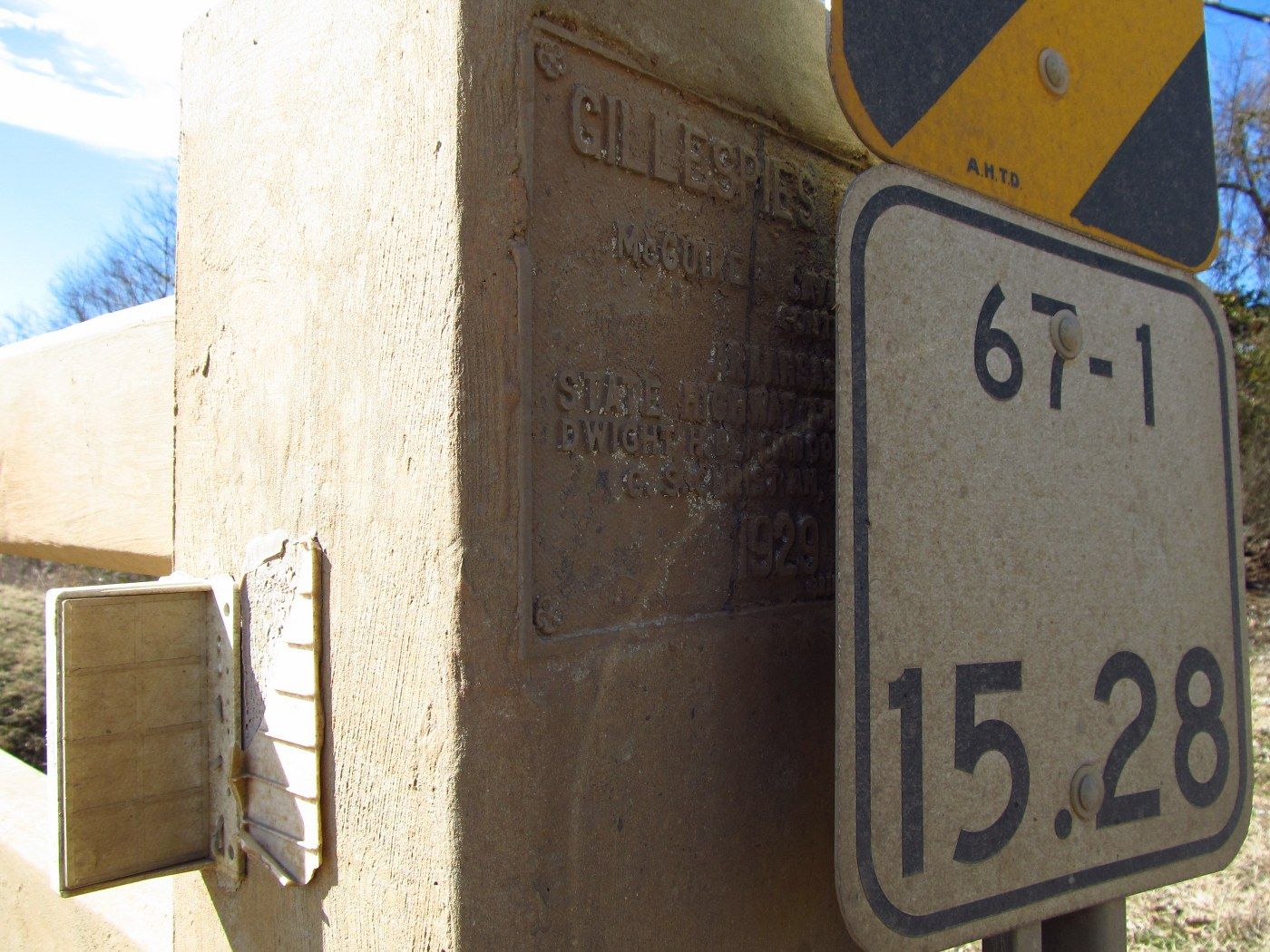
Partially Hidden Plaque
Photo taken by Wayne Kizziar in January 2011
![]()
Status: Open to traffic
Location: 33.136056,-93.895440
Carries US 71 over Sulphur River Relief
Design: beam/stringer/steel
Design Details: Steel stringer
Total Length: 392.1 Feet
Span Length: 44.9 Feet
Overview: Steel stringer bridge over Sulphur River Relief on US 71
History: Built 1942
Built: 1942
Location: Miller County
View Bridge Information In Wayback Machine
![]()
![]()
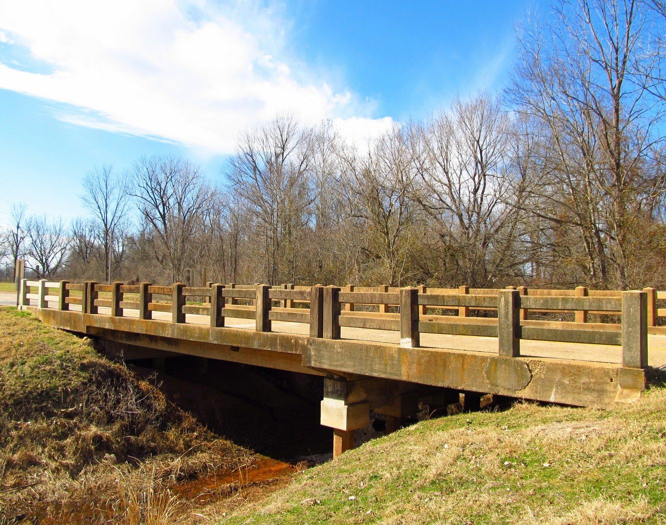
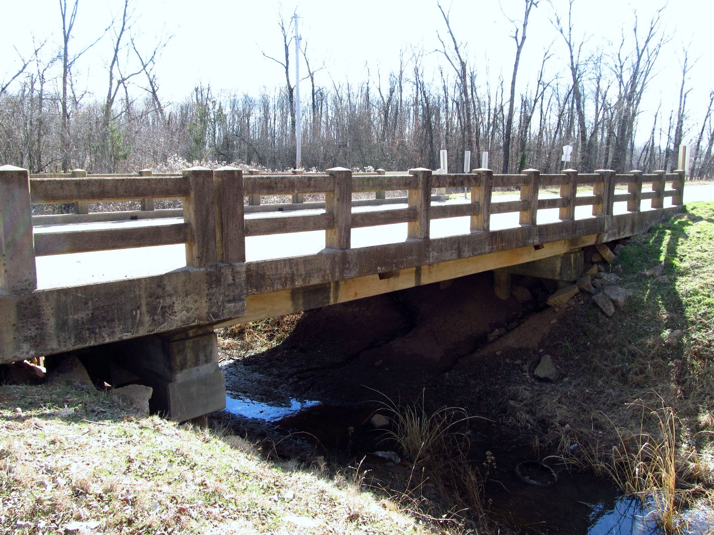
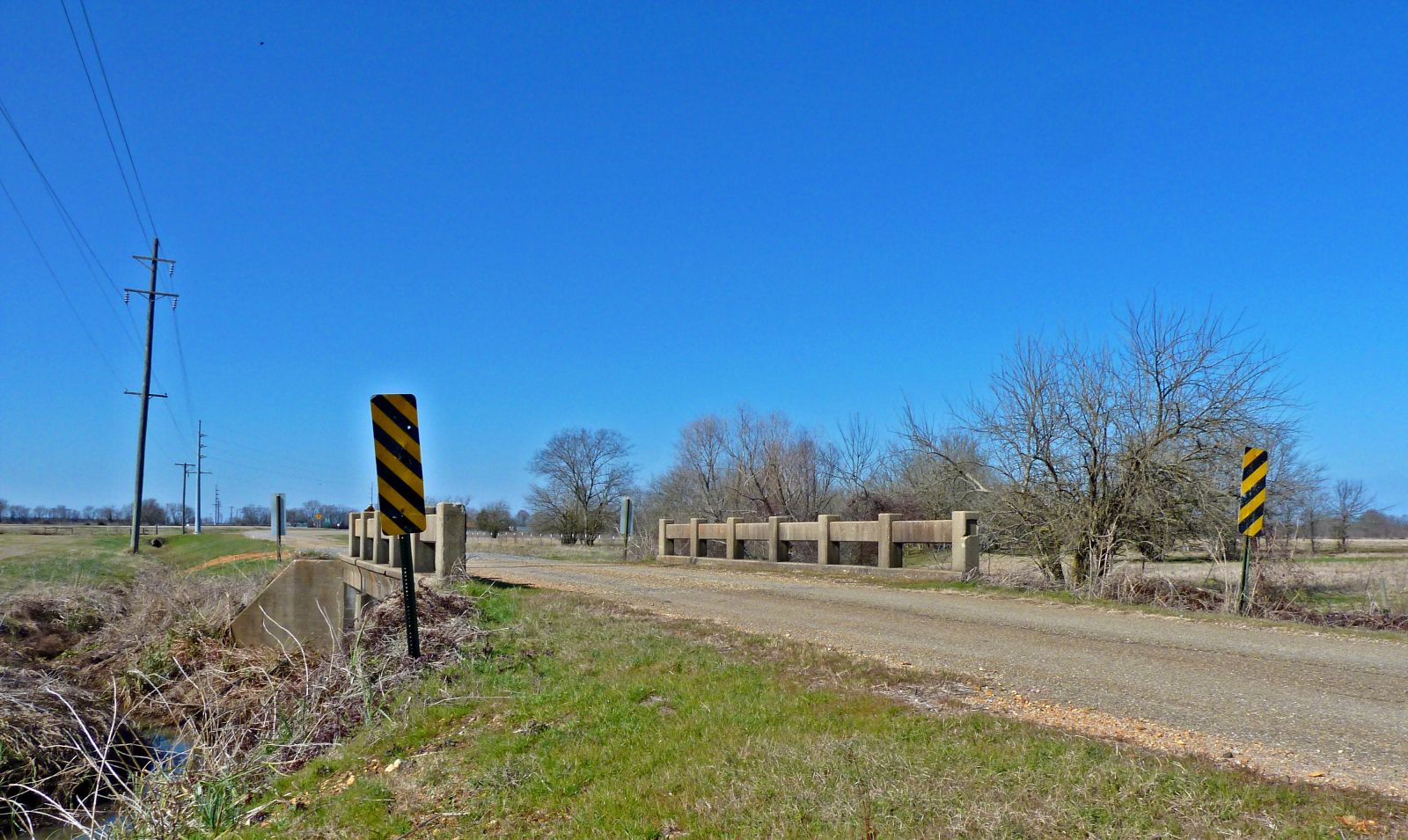
Status: Open to traffic
Location: 33.518522,-94.038161
Carries Springer Rd (CR 55) over Branch of McKinney Bayou
Design: slab
Design Details: Slab
Total Length: 34.1 Feet
Span Length: 11.2 Feet
Overview: Slab bridge over Branch of McKinney Bayou on Springer Rd (CR 55)
History: Built 1933
Built: 1933
Location: Miller County
View Bridge Information In Wayback Machine
![]()
244298
East Approach
Photo taken by David Backlin in November 2012
244299
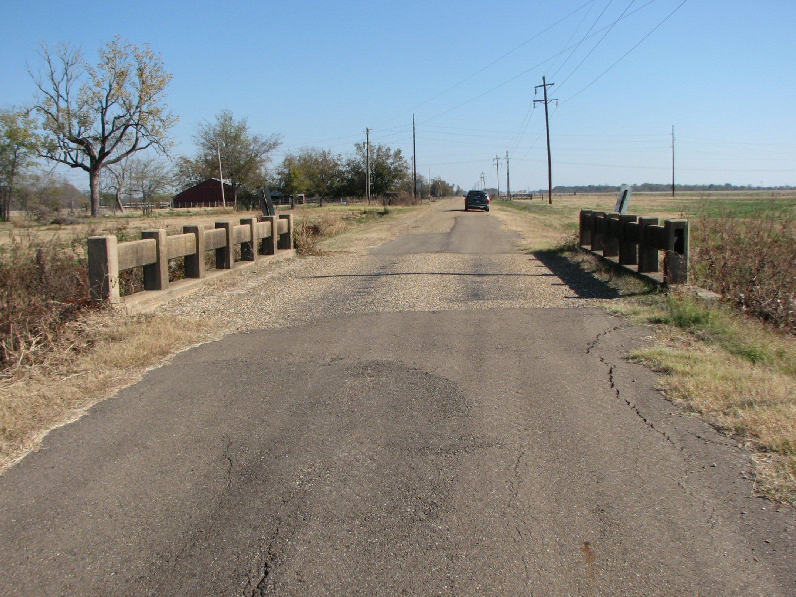
West Approach
Photo taken by David Backlin in November 2012
346269
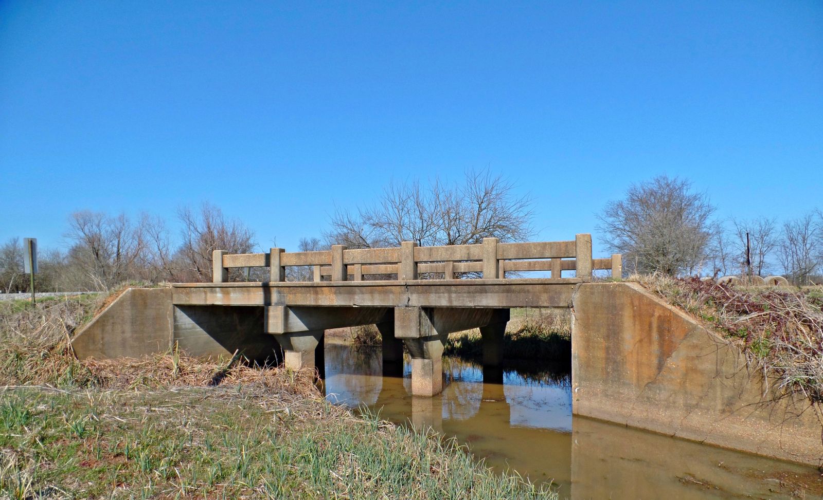
Side Elevation
Sturdy little bridge. I did not expect the double piers underneath.
Photo taken by Wayne Kizziar in January 2016
346270
Oblique View
Photo taken by Thomas Kizziar in January 2016
![]()
Status: Open to traffic
Location: 33.025833,-93.892222
Carries US 71 over Westfork Kelly Bayou
Design: beam/tee
Design Details: Concrete tee beam
Total Length: 151.9 Feet
Span Length: 24.9 Feet
Overview: Concrete tee beam bridge over Westfork Kelly Bayou on US 71
History: Built 1927; rehabilitated 1942
Built: 1927
Location: Miller County
View Bridge Information In Wayback Machine
![]()
259045
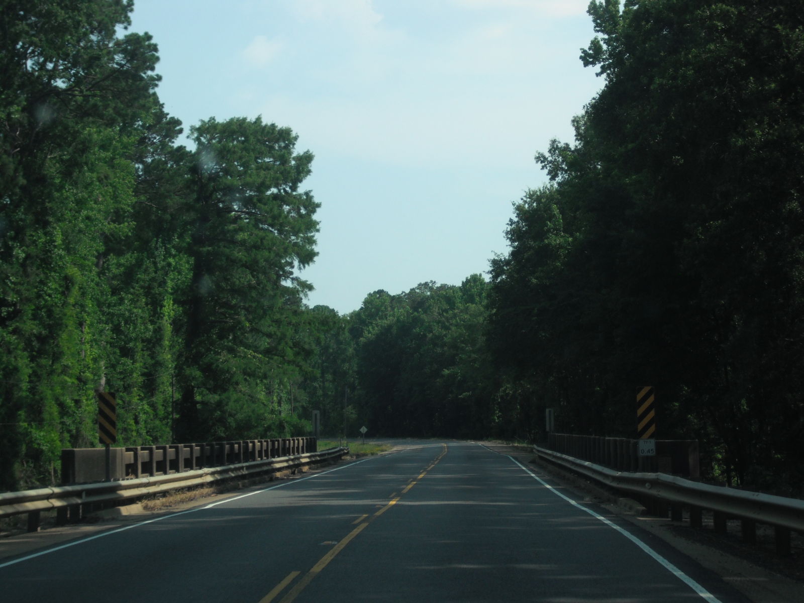
Photo taken by in July 2013
![]()
Status: Open to traffic
Location: 33.090644,-93.902303
Carries Us 71 over East Fork Kelly Bayou
Design: beam/tee
Design Details: Concrete tee beam
Total Length: 100.1 Feet
Span Length: 24.9 Feet
Overview: Concrete tee beam bridge over East Fork Kelly Bayou on Us 71
History: Built 1942
Built: 1942
Location: Miller County
View Bridge Information In Wayback Machine
![]()
![]()
Status: No longer exists
Location: 33.089637,-93.858633
Carries AR 160 over Red River
Design: ferry
Design Details: Ferry crossing
Total Length: 0.0 Feet
Span Length: 0.0 Feet
Overview: Lost Ferry across Red River on AR 160
History: Built 1834; taken over by state in 1964; replaced by bridge 1995
Built: 1834
Location: Miller County
View Bridge Information In Wayback Machine
![]()
456461
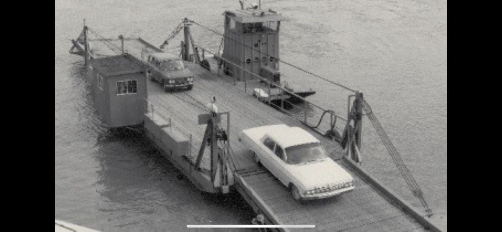
Arkansas Department of Transportation
456462
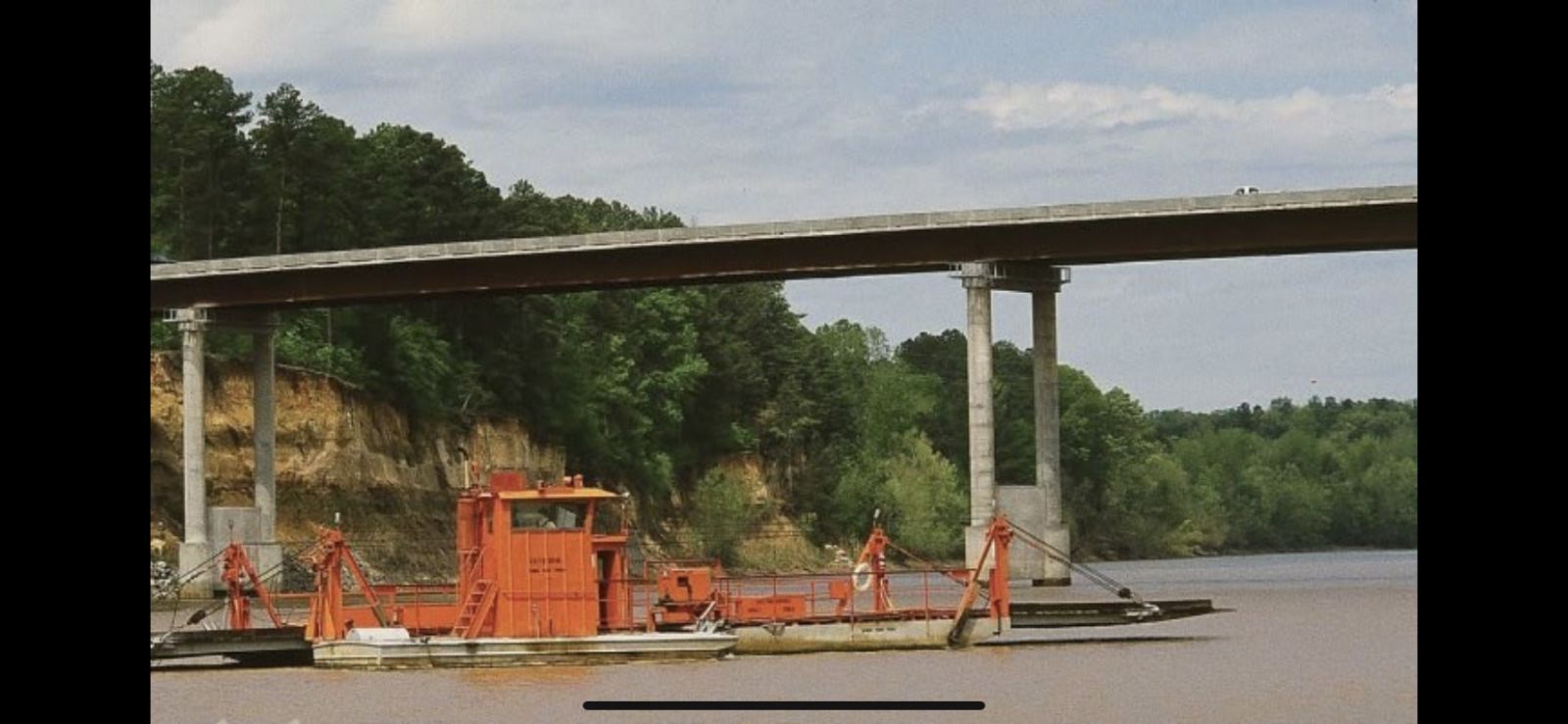
Arkansas Department of Transportation
![]()
Status: Replaced by a new bridge
Location: 33.610097,-93.815491
Carries Cairo & Fulton Railroad over Red River
Design: truss/through
Design Details: Through truss
Total Length: 0.0 Feet
Span Length: 0.0 Feet
Overview: Lost Through truss bridge over Red River on Cairo & Fulton Railroad
History: Built 1874, Replaced 1890
Built: 1874
Location: Miller County
View Bridge Information In Wayback Machine
![]()
![]()
Status: Replaced by a new bridge
Location: 33.609704,-93.815576
Carries Missouri Pacific Railroad over Red River
Design: truss/through
Design Details: Through truss
Total Length: 0.0 Feet
Span Length: 0.0 Feet
Overview: Lost Through truss bridge over Red River on Missouri Pacific Railroad
History: Built 1890, destroyed in 1927 flood.
Built: 1890
Location: Miller County
View Bridge Information In Wayback Machine
![]()
![]()
Status: Open to traffic
Location: 33.428889,-93.900556
Carries Us 82 over Mill Creek
Design: beam/stringer/steel
Design Details: Steel stringer
Total Length: 123.0 Feet
Span Length: 29.9 Feet
Overview: Steel stringer bridge over Mill Creek on Us 82
History: Built 1948
Built: 1948
Location: Miller County
View Bridge Information In Wayback Machine
![]()
![]()
Status: Open to traffic
Location: 33.169167,-94.014722
Carries Sh 237 over Turkey Creek
Design: beam/stringer/steel
Design Details: Steel stringer
Total Length: 46.9 Feet
Span Length: 23.0 Feet
Overview: Steel stringer bridge over Turkey Creek on Sh 237
History: Built 1948
Built: 1948
Location: Miller County
View Bridge Information In Wayback Machine
![]()
![]()
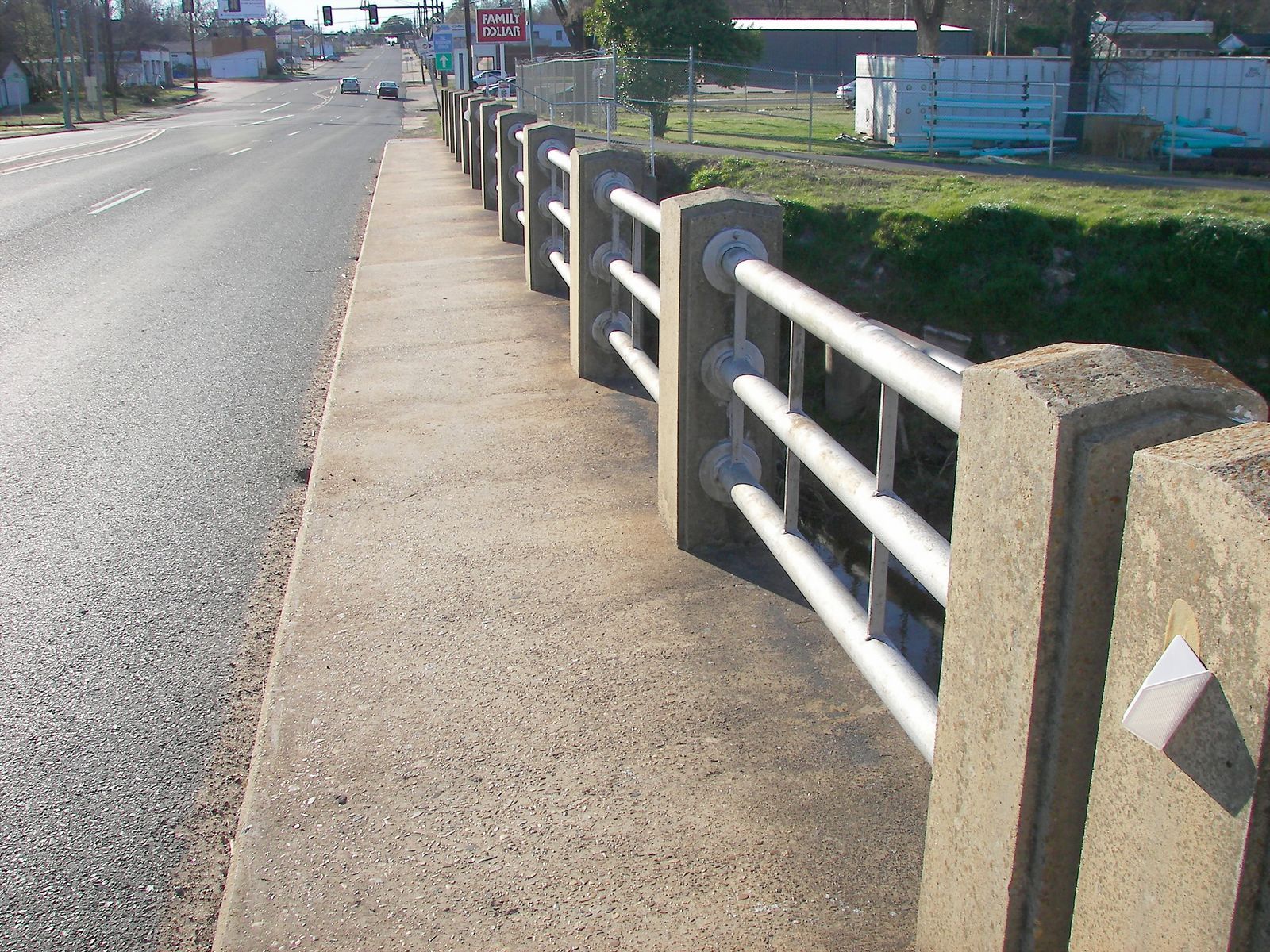
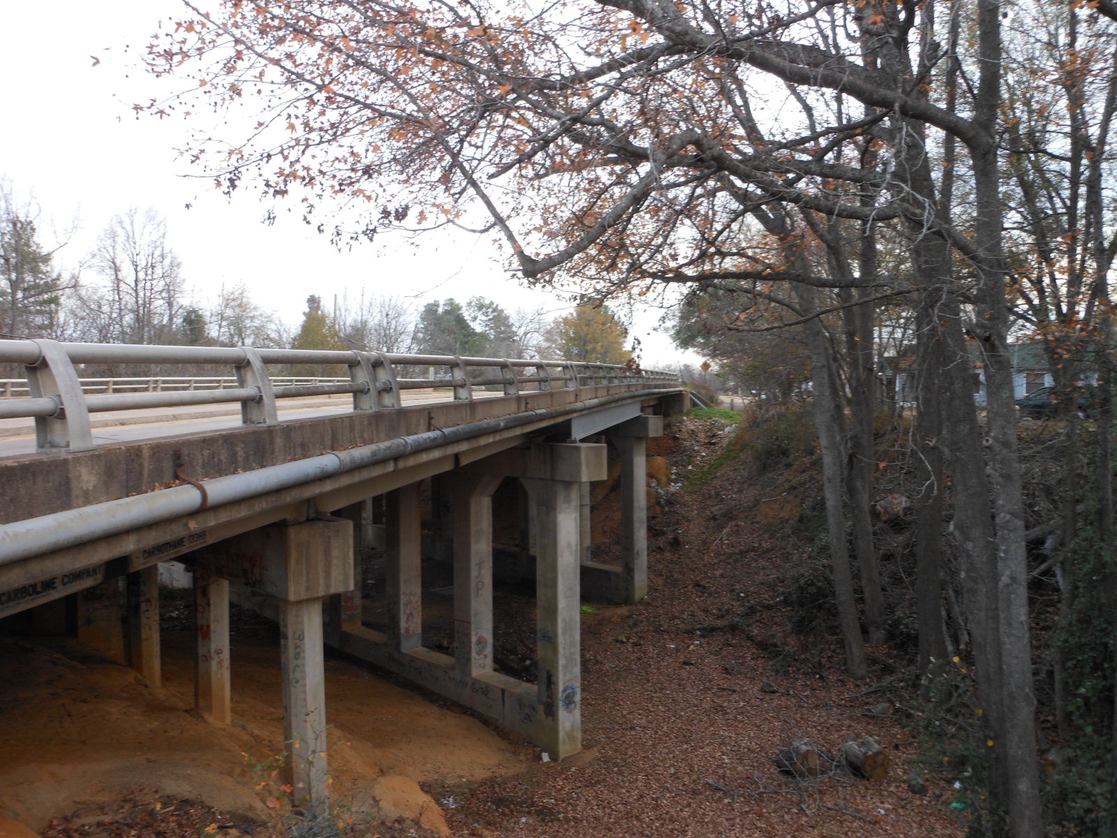
Status: Open to traffic
Location: 33.422500,-94.030278
Carries Us 71 over Nix Creek; Preston St Trail
Design: beam/tee
Design Details: Concrete tee beam
Total Length: 122.1 Feet
Span Length: 40.0 Feet
Overview: Concrete tee beam bridge over Nix Creek on Us 71
History: Built 1939
Built: 1939
Location: Miller County
View Bridge Information In Wayback Machine
![]()
376206
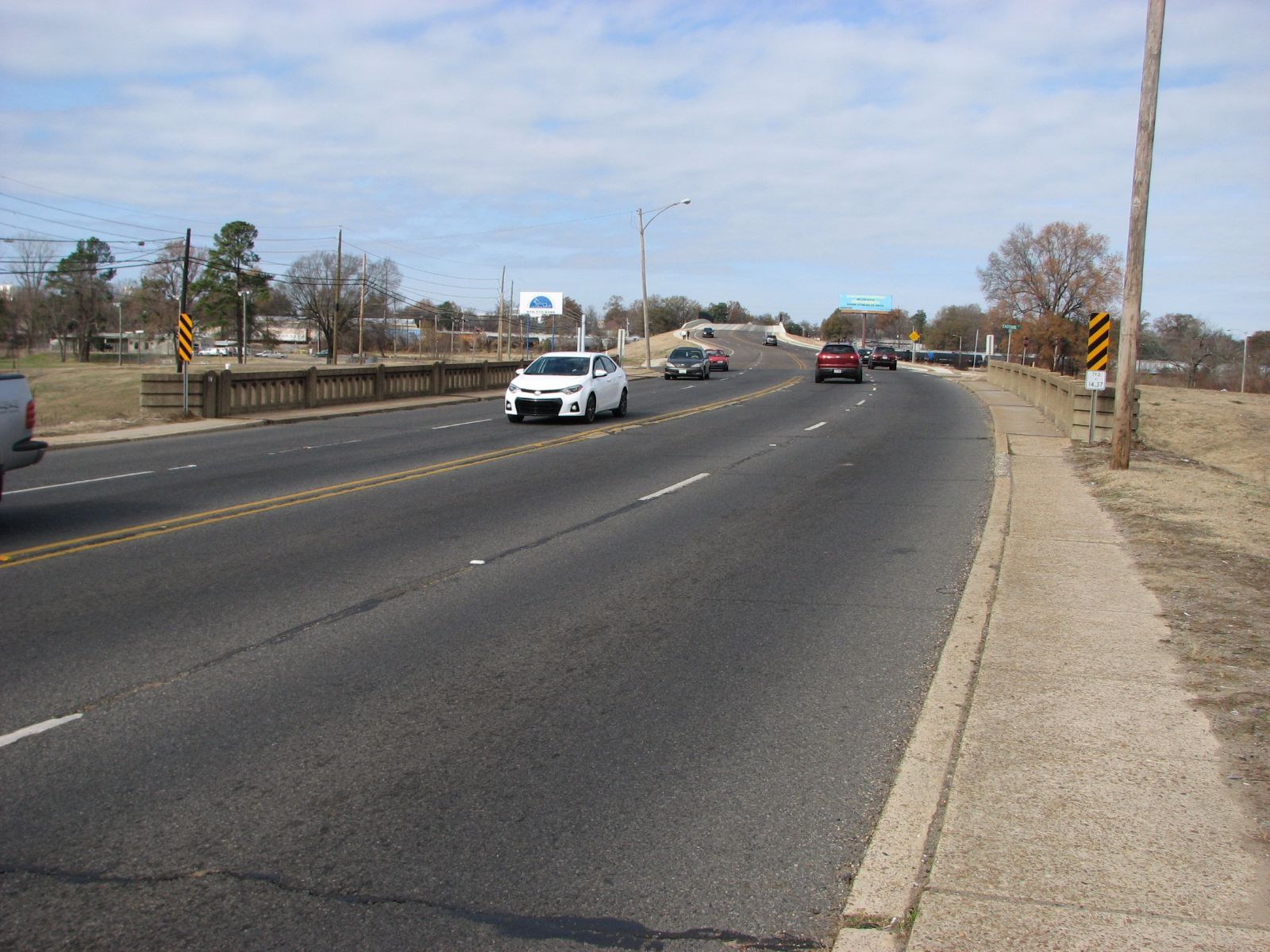
South Approach
Photo taken by David Backlin in December 2016
376205
Side View
Photo taken by David Backlin in December 2016
Special Bridge Conditions Legend: R - Former location of relocated bridge. ! - At risk for demolition or destruction. X - Confirmed demolished or collapsed. S - Dismantled and/or in storage. L - Severe loss of historic integrity due to alteration.
![]()

![]()