![]()
![]()
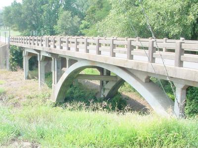
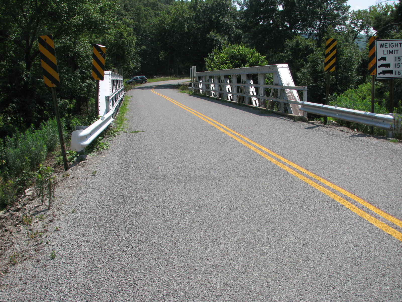
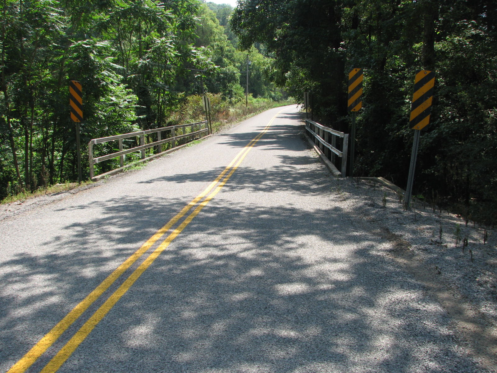
Status: Open to traffic
Location: 35.270000,-92.935000
Carries AR 105 over Alewine Creek
Design: arch/deck
Design Details: Arch
Total Length: 28.8 Feet
Span Length: 26.9 Feet
Overview: Small arch bridge over Alewine Creek on AR 105
History: Built 1928; rehabilitated 1973
Built: 1928
Location: Pope County
View Bridge Information In Wayback Machine
![]()
![]()
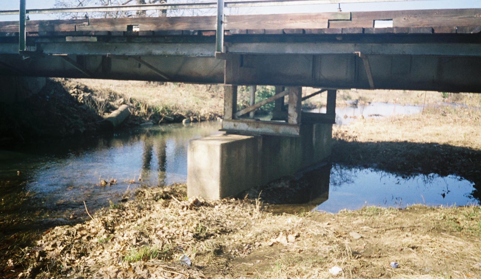
Status: Open to traffic
Location: 35.361190,-92.901941
Carries Buttermilk Road (CR 48) over Branch of Isabell Creek
Design: beam/stringer/steel
Design Details: Steel stringer
Total Length: 24.0 Feet
Span Length: 24.0 Feet
Overview: Stringer bridge over a branch of Isabell Creek on Buttermilk Road (CR 48)
History: Built 1941 by the Works Progress Administration
Built: 1941
Location: Pope County
View Bridge Information In Wayback Machine
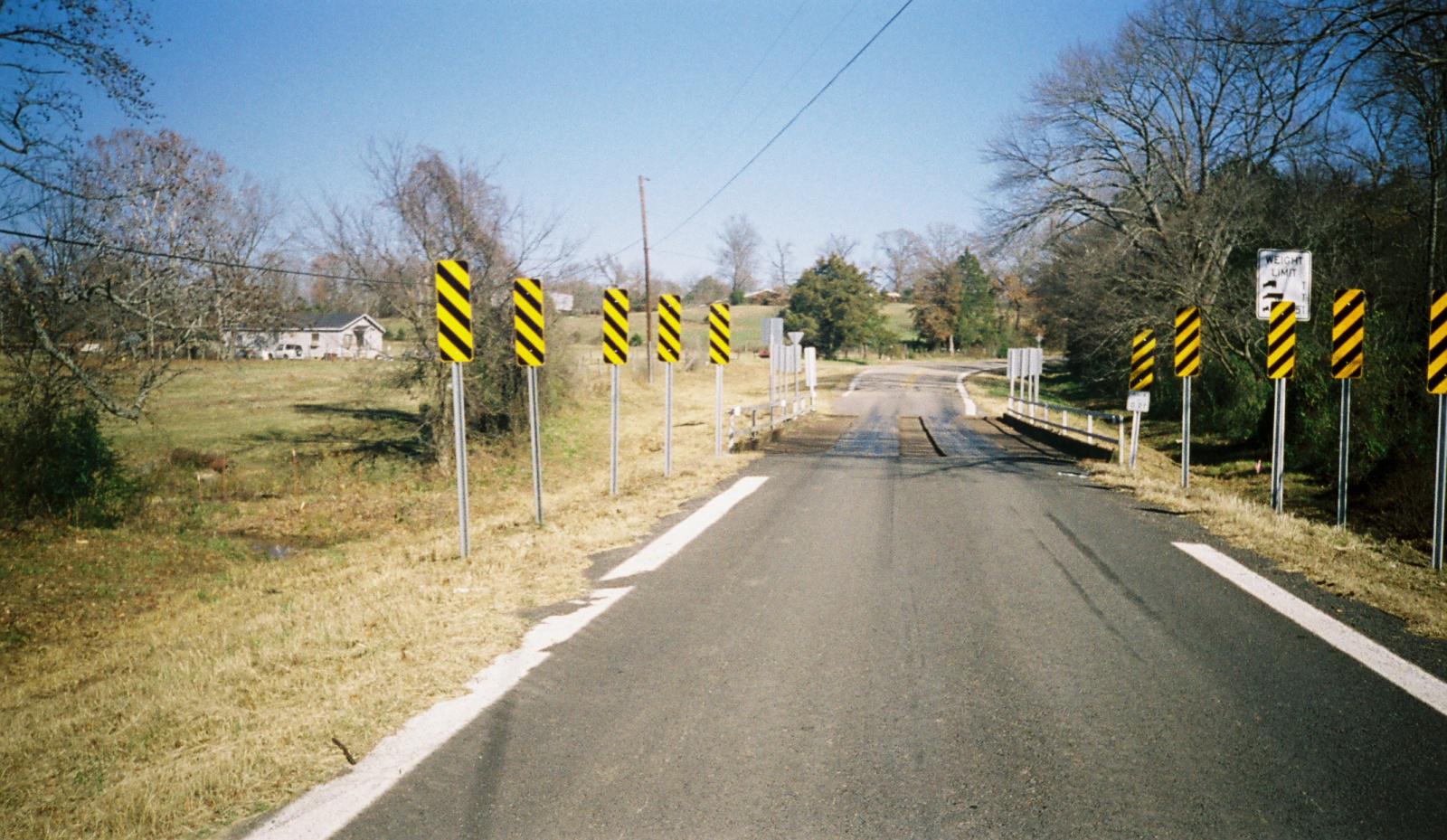
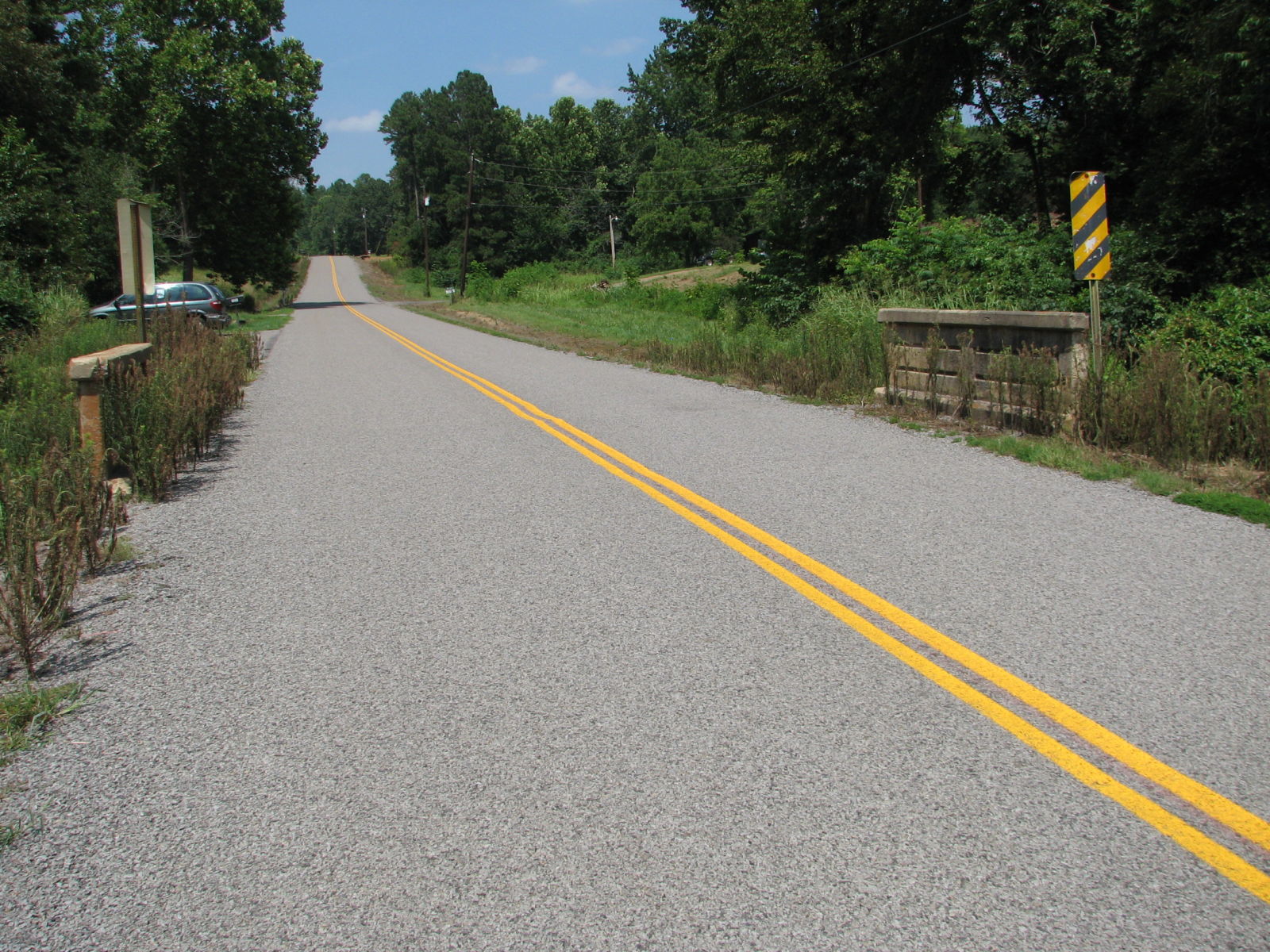
![]()
![]()
Status: Open to traffic
Location: 35.482110,-93.100890
Carries Broomfield Road (CR 23) over Branch of Little Creek
Design: slab
Design Details: Concrete slab
Total Length: 0.0 Feet
Span Length: 0.0 Feet
Overview: Concrete and stone bridge over a branch of Little Creek on Broomfield Road (CR 23)
History: Built 1941 by the Works Progress Administration
Built: 1941
Location: Pope County
View Bridge Information In Wayback Machine
![]()
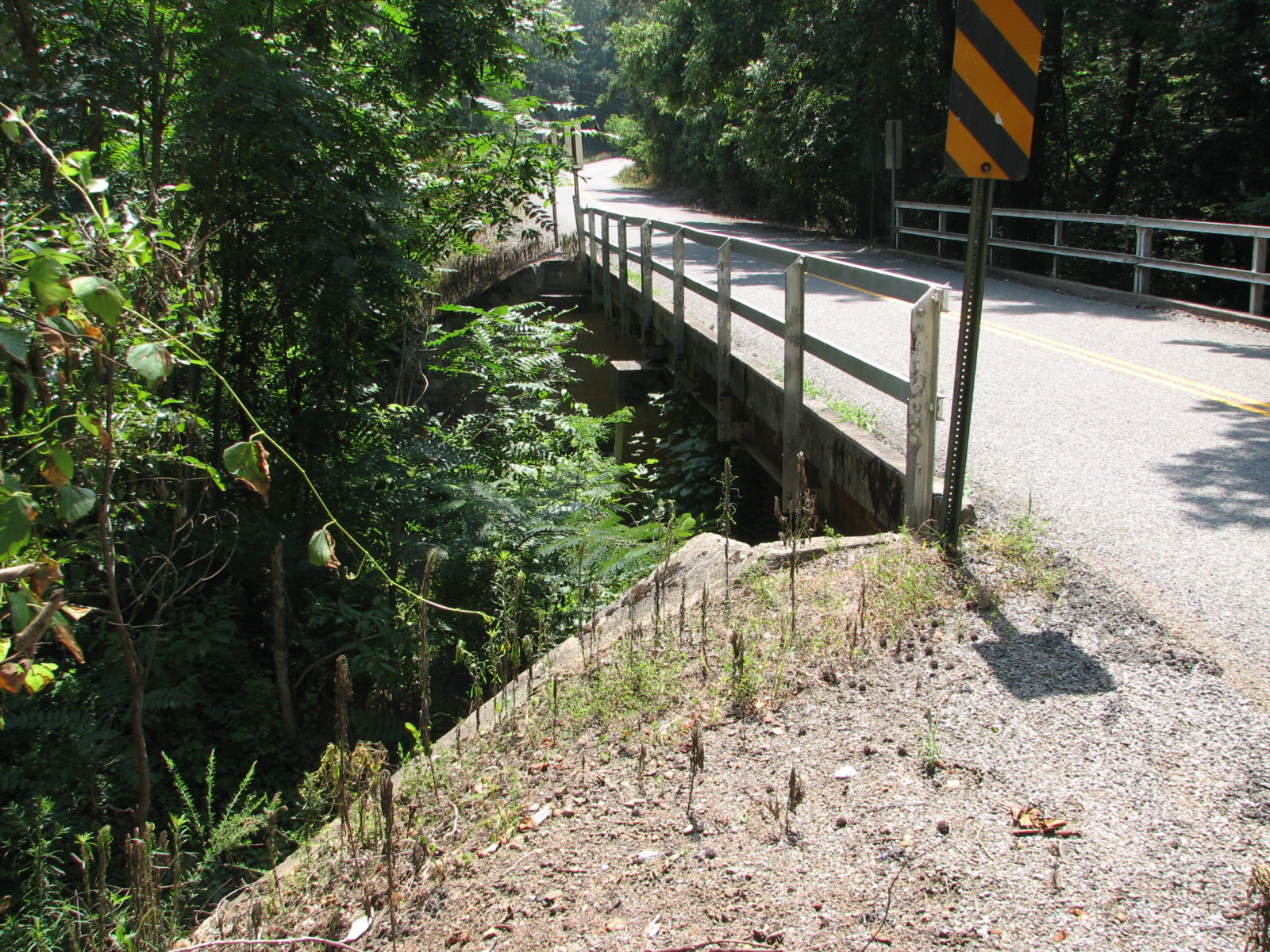
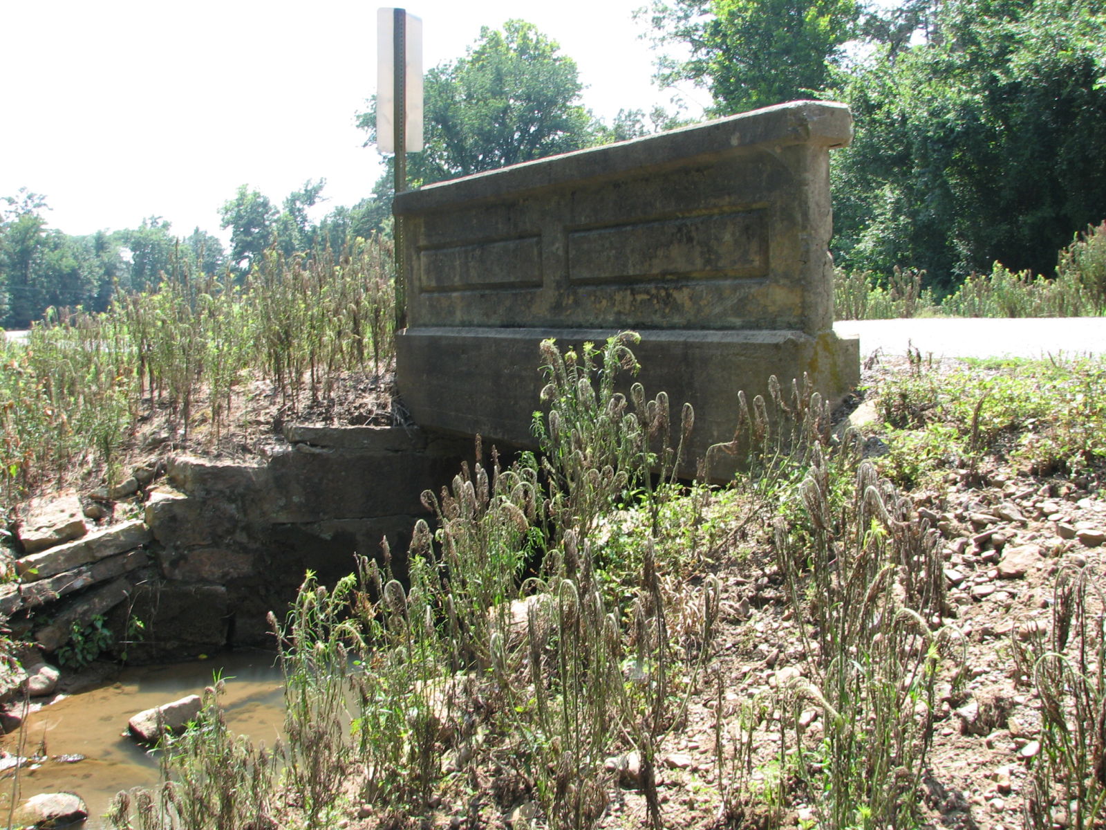
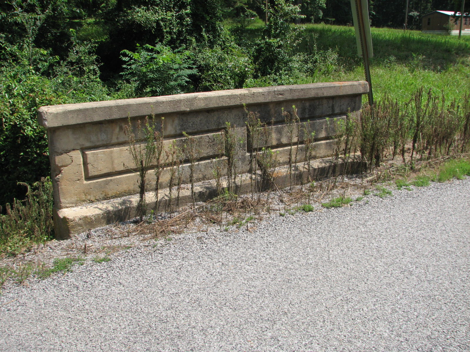
100873
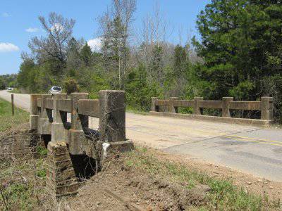
Overview
Photo taken by Katherine Etris
100874
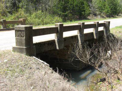
Railing
Photo taken by Katherine Etris
100875
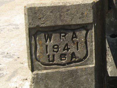
WPA marker
Photo taken by Katherine Etris
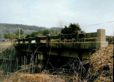
![]()
Status: Open to traffic
Location: 35.400278,-92.905556
Carries Buttermilk Road (CR 48) over Branch of Hackers Creek
Design: slab
Design Details: Concrete slab
Total Length: 24.0 Feet
Span Length: 12.1 Feet
Overview: Concrete slab bridge over branch of Hackers Creekon Buttermilk Road (CR 48)
History: Built 1941 by the Works Progress Administration
Built: 1941
Location: Pope County
View Bridge Information In Wayback Machine
![]()
![]()
Status: Open to traffic
Location: 35.468889,-93.065278
Carries Broomfield Road (CR 23) over Clear Creek
Design: slab
Design Details: Concrete slab
Total Length: 27.9 Feet
Span Length: 14.1 Feet
Overview: Concrete slab bridge over Clear Creek on Broomfield Road (CR 23)
History: Built 1939 by the Works Progress Administration
Built: 1939
Location: Pope County
View Bridge Information In Wayback Machine
![]()
![]()
Status: Replaced by a new bridge
Location: 35.248311,-93.041459
Carries Old US 64 over Galla Creek
Design: truss/through/pratt
Design Details: 6-panel Pratt through truss
Total Length: 122.0 Feet
Span Length: 120.0 Feet
Overview: Lost through truss bridge over Galla Creek on Old US 64 at Pottsville
History: Built 1920; made obsolete by a new US 64 alignment in 1936; replaced 1998
Built: 1920
Location: Pope County
View Bridge Information In Wayback Machine
![]()
100876
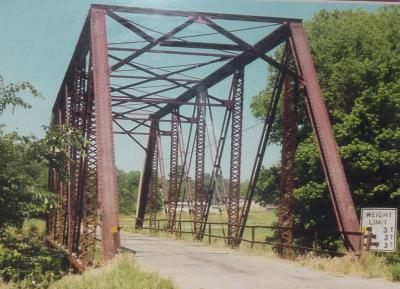
Overview
Photo provided by the Arkansas Highway & Transportation Department
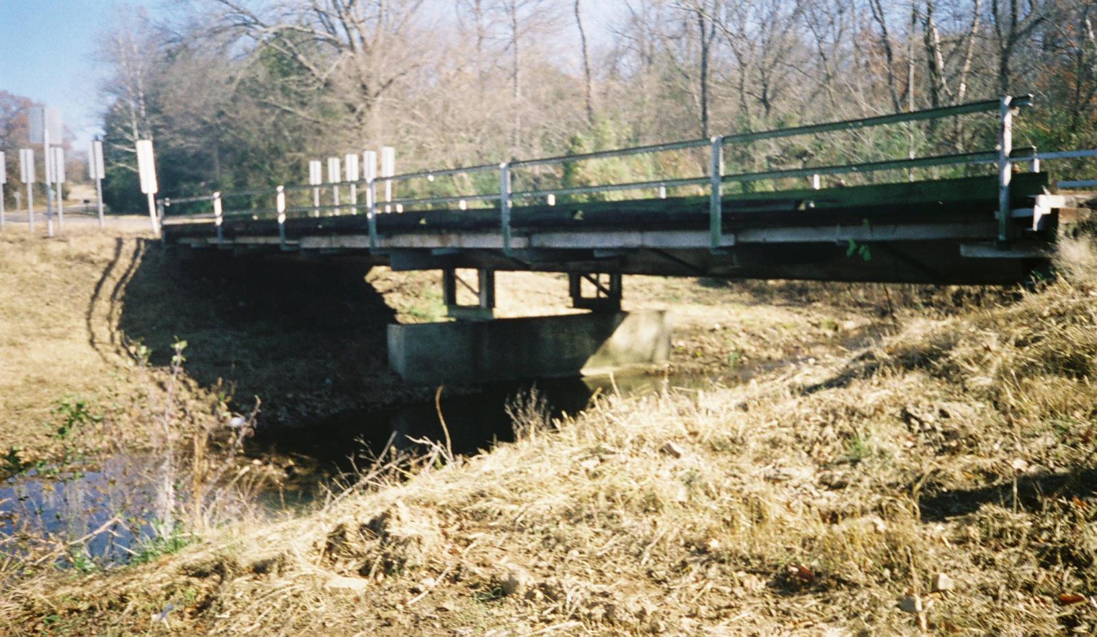
![]()
Status: Open to traffic
Location: 35.408889,-92.904722
Carries Buttermilk Road (CR 48) over Hackers Creek
Design: beam/stringer/steel
Design Details: Steel stringer
Total Length: 66.9 Feet
Span Length: 36.1 Feet
Overview: Stringer bridge over Hackers Creek on Buttermilk Road (CR 48)
History: Built 1941 by the Works Progress Administration
Built: 1941
Location: Pope County
View Bridge Information In Wayback Machine
![]()
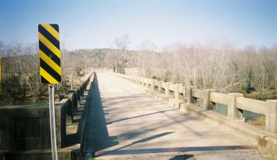
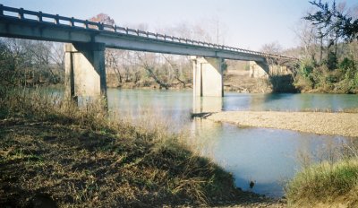
![]()
Status: Replaced by a new bridge
Location: 35.466667,-93.041667
Carries AR 164 over Illinois Bayou
Design: beam/tee
Design Details: Concrete tee beam
Total Length: 404.9 Feet
Span Length: 101.1 Feet
Overview: Lost Concrete bridge over Illinois Bayou on AR 164
History: Built 1940; rehabilitated 1974; replaced 2011
Built: 1940
Location: Pope County
View Bridge Information In Wayback Machine
![]()
109260
Looking north
Photos taken by Charles Bowden
109261
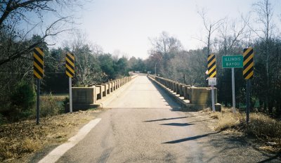
Looking south
109262
Overview
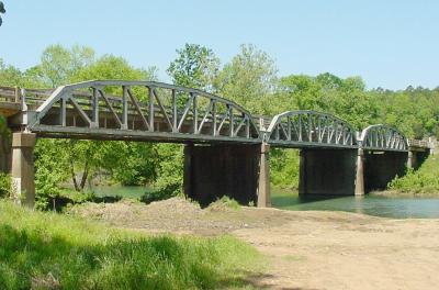
![]()
Status: Replaced by a new bridge
Location: 35.410923,-93.133876
Carries AR 7 over Illinois Bayou
Design: truss/pony/parker
Design Details: Three riveted, 10-panel Parker pony trusses
Total Length: 444.8 Feet
Span Length: 102.0 Feet
Overview: Lost three-span pony truss bridge over Illinois Bayou on AR 7 just northwest of Dover
History: Built 1933; replaced 2003
Built: 1933
Location: Pope County
View Bridge Information In Wayback Machine
![]()
100877
Overview
Photo provided by the Arkansas Highway & Transportation Department
100878
Other side
Photo provided by the Arkansas Highway & Transportation Department
100879
Center span
Photo provided by the Arkansas Highway & Transportation Department
100880
Deck view
Photo provided by the Arkansas Highway & Transportation Department
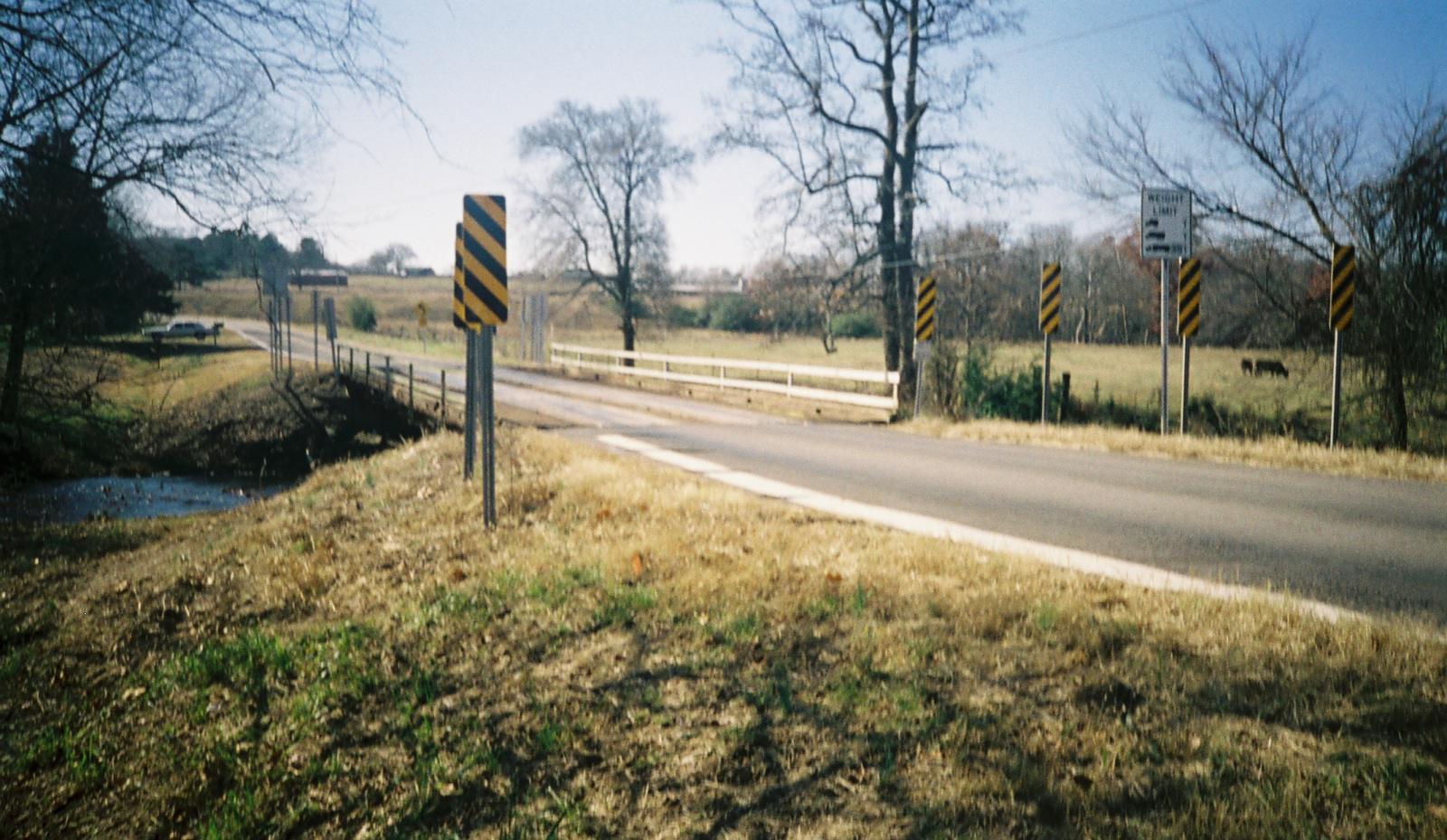
![]()
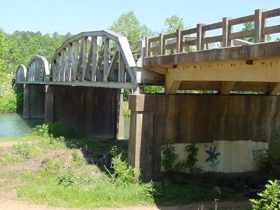
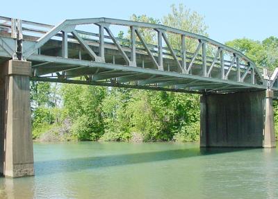
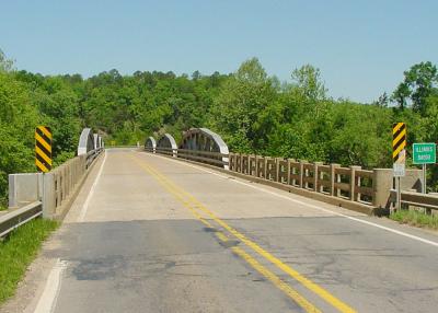
Status: Replaced by new bridge
Location: 35.358887,-92.958895
Carries AR 105 over Isabell Creek
Design: arch/deck/open
Design Details: Open-spandrel arch
Total Length: 179.1 Feet
Span Length: 69.9 Feet
Overview: Open-spandrel arch bridge over Isabell Creek on AR 105 near Oak Grove
History: Built 1928 by the Maxwell Construction Co.; Replaced 2021
Built: 1928
Location: Pope County
View Bridge Information In Wayback Machine
![]()
100881
Overview
Photo provided by the Arkansas Highway & Transportation Department
100882
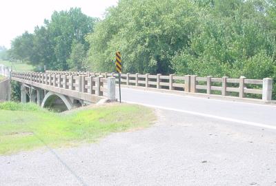
View from a distance
Photo provided by the Arkansas Highway & Transportation Department
100883
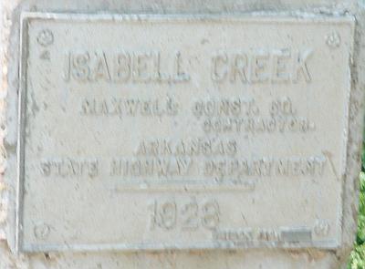
Plaque
Photo provided by the Arkansas Highway & Transportation Department
132927
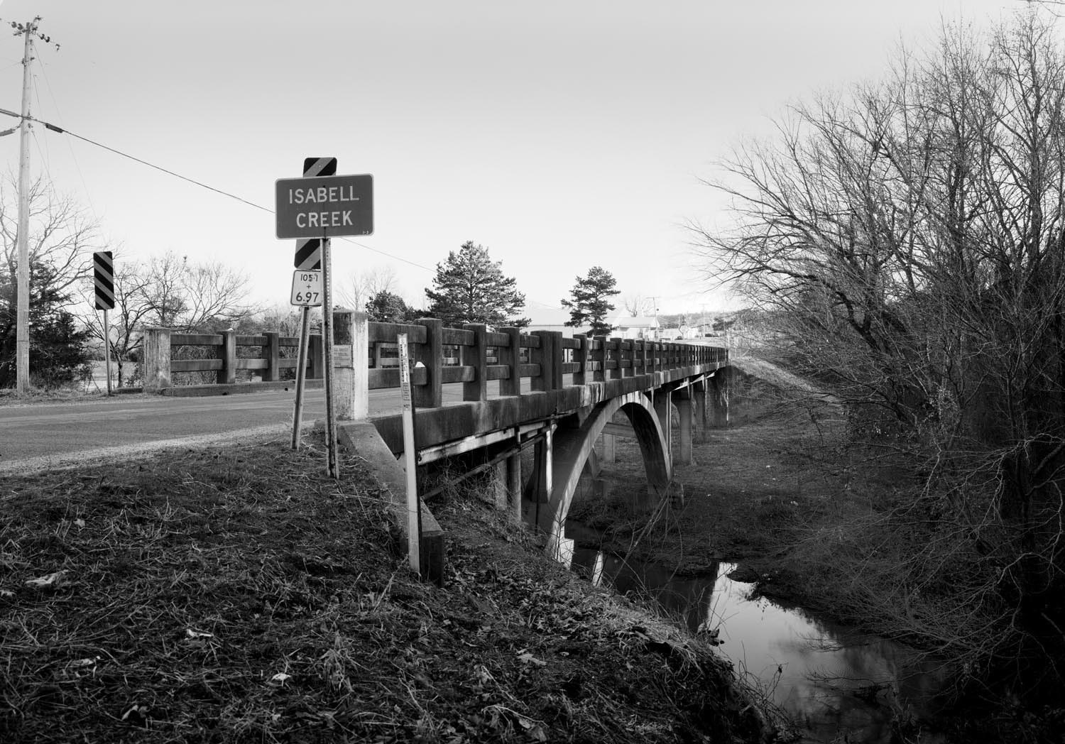
Photo taken by Gene McCluney in February 2009
![]()
Status: Open to traffic
Location: 35.348600,-92.906060
Carries Buttermilk Road (CR 48) over Isabell Creek
Design: beam/stringer/steel
Design Details: Steel stringer
Total Length: 70.9 Feet
Span Length: 35.1 Feet
Overview: Stringer bridge over Isabell Creek on Buttermilk Road (CR 48)
History: Built 1941 by the Works Progress Administration
Built: 1941
Location: Pope County
View Bridge Information In Wayback Machine
![]()
![]()
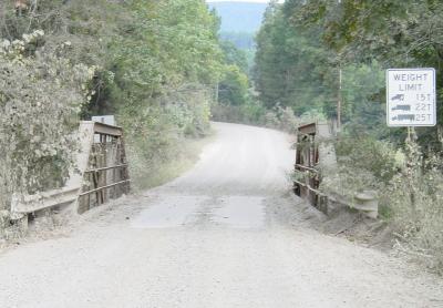
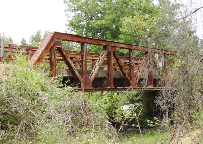
Status: Open to traffic
Location: 35.518543,-93.181956
Carries Pilot Rock Mountain Road (CR 16) over Jakes Creek
Design: truss/pony/pratt
Design Details: Riveted, 4-panel Pratt pony truss
Total Length: 63.0 Feet
Span Length: 60.0 Feet
Overview: Pony truss bridge over Jakes Creek on Pilot Rock Mountain Road (CR 16)
History: Built ca. 1930
Built: ca. 1930
Location: Pope County
View Bridge Information In Wayback Machine
![]()
100884
Side view
Photo provided by the Arkansas Highway & Transportation Department
100885
Deck view
Photo provided by the Arkansas Highway & Transportation Department
296407
South Approach
Photo taken by David Backlin in September 2014
296408
Close-up of Truss
Photo taken by David Backlin in September 2014
296409
North Approach
Photo taken by David Backlin in September 2014
![]()
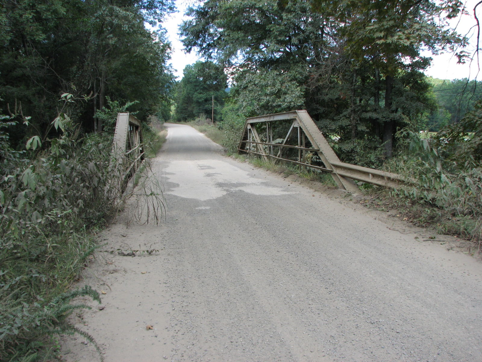
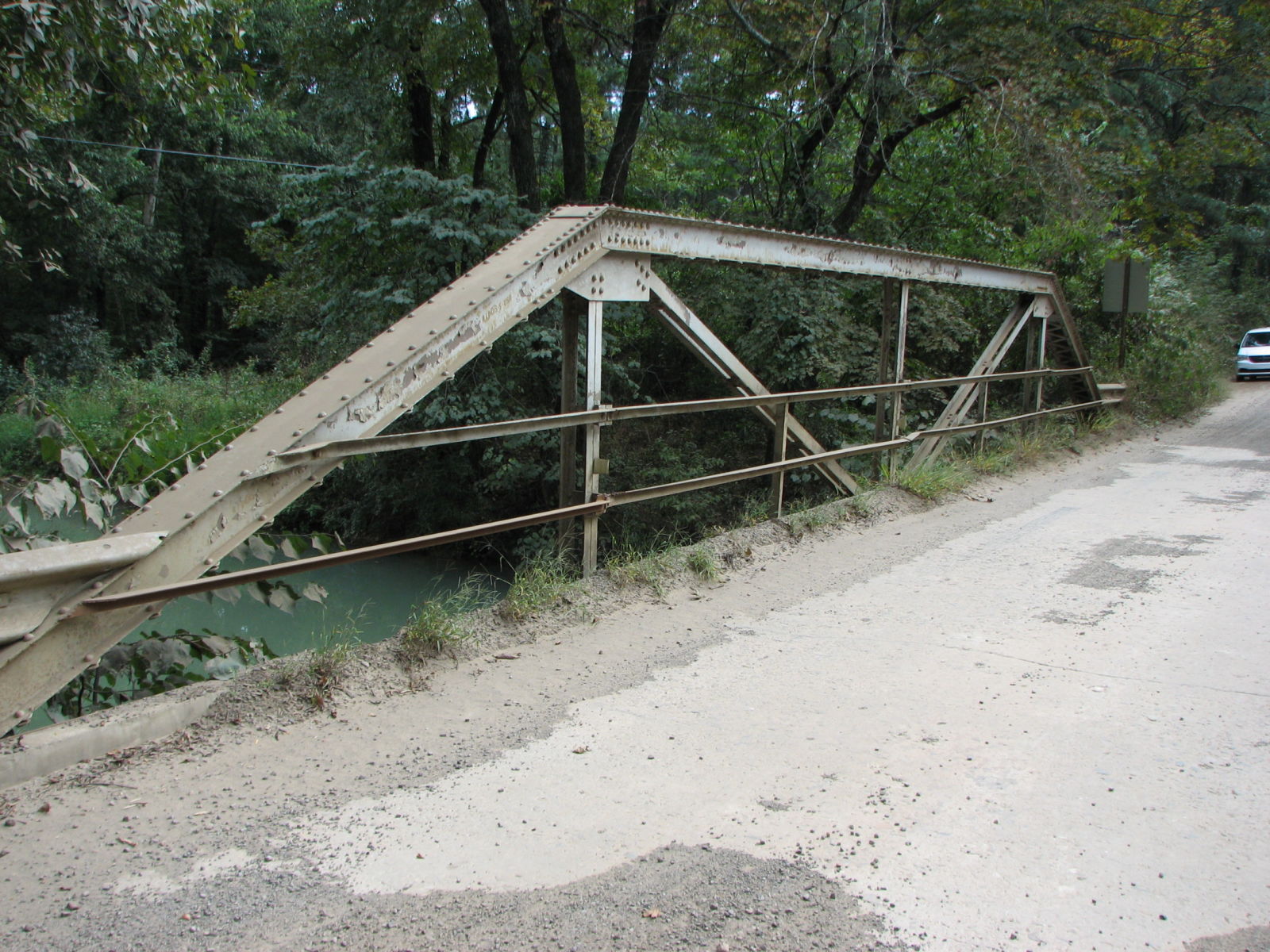
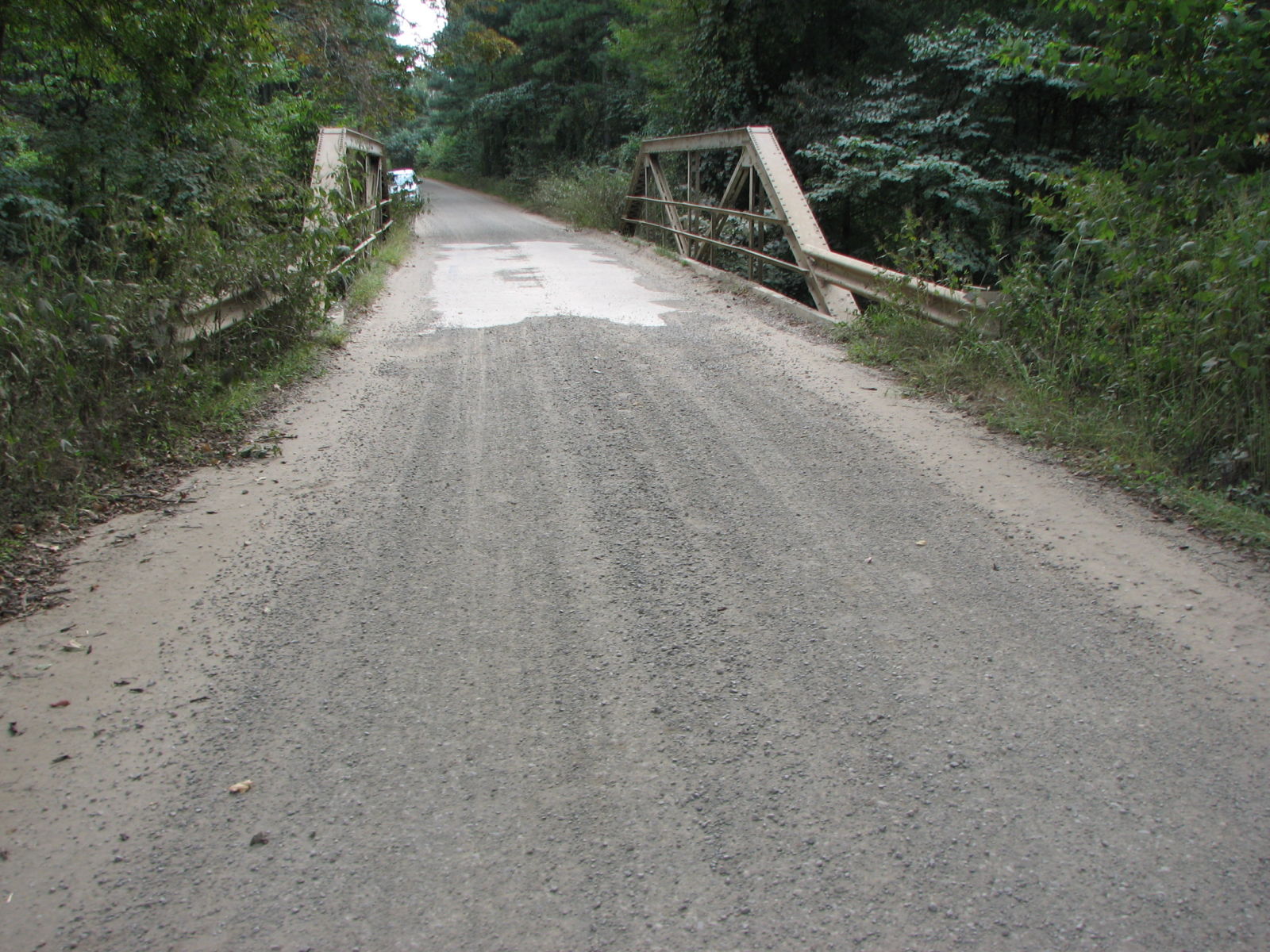
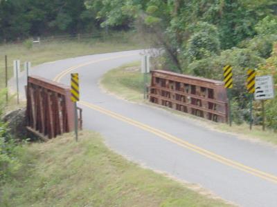
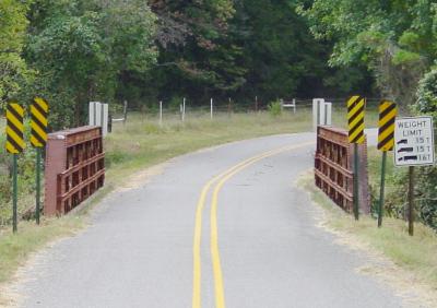
Status: Open to traffic
Location: 35.519331,-93.147275
Carries CR 14 (formerly AR 7) over Levi Branch
Design: truss/pony/warren
Design Details: Warren pony truss
Total Length: 82.0 Feet
Span Length: 80.0 Feet
Overview: Pony truss bridge over Levi Branch on CR 14 (Old AR 7)
History: Built ca. 1940
Built: ca. 1940
Location: Pope County
View Bridge Information In Wayback Machine
![]()
100886
Overview
Photo provided by the Arkansas Highway & Transportation Department
100887
View from a distance
Photo provided by the Arkansas Highway & Transportation Department
100888
Deck view
Photo provided by the Arkansas Highway & Transportation Department
289454
South Approach
Photo taken by David Backlin in July 2014
289455
North Approach
Photo taken by David Backlin in July 2014
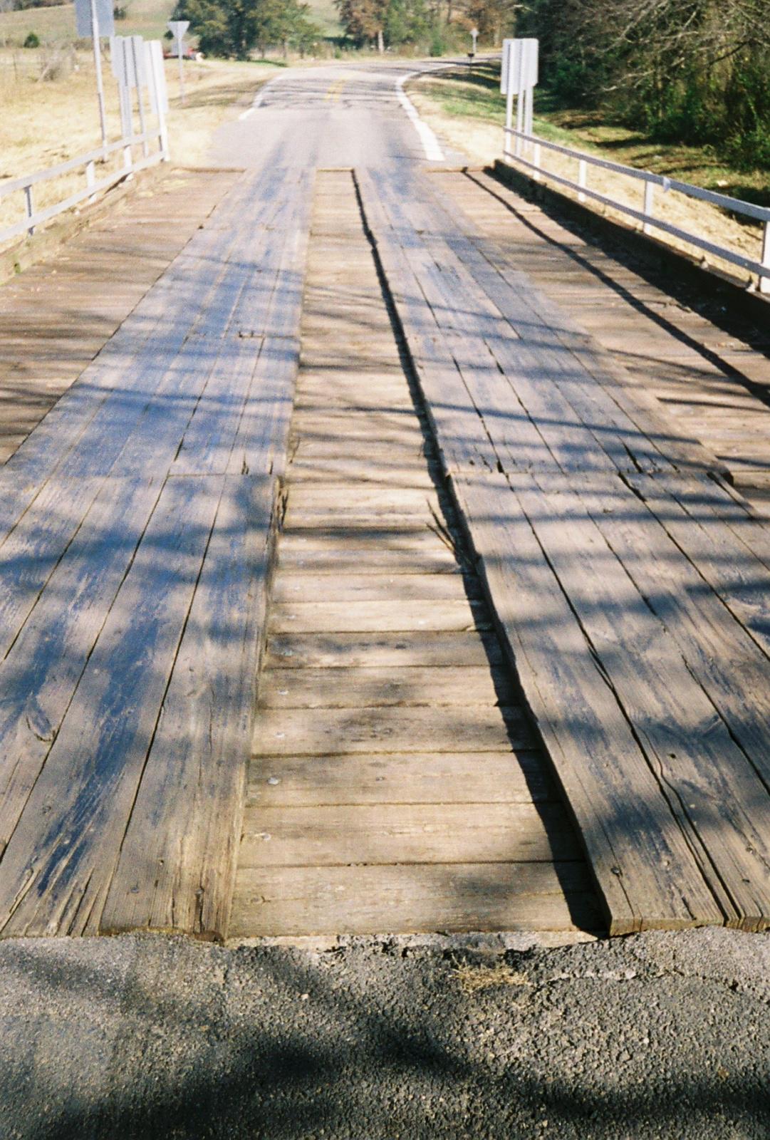
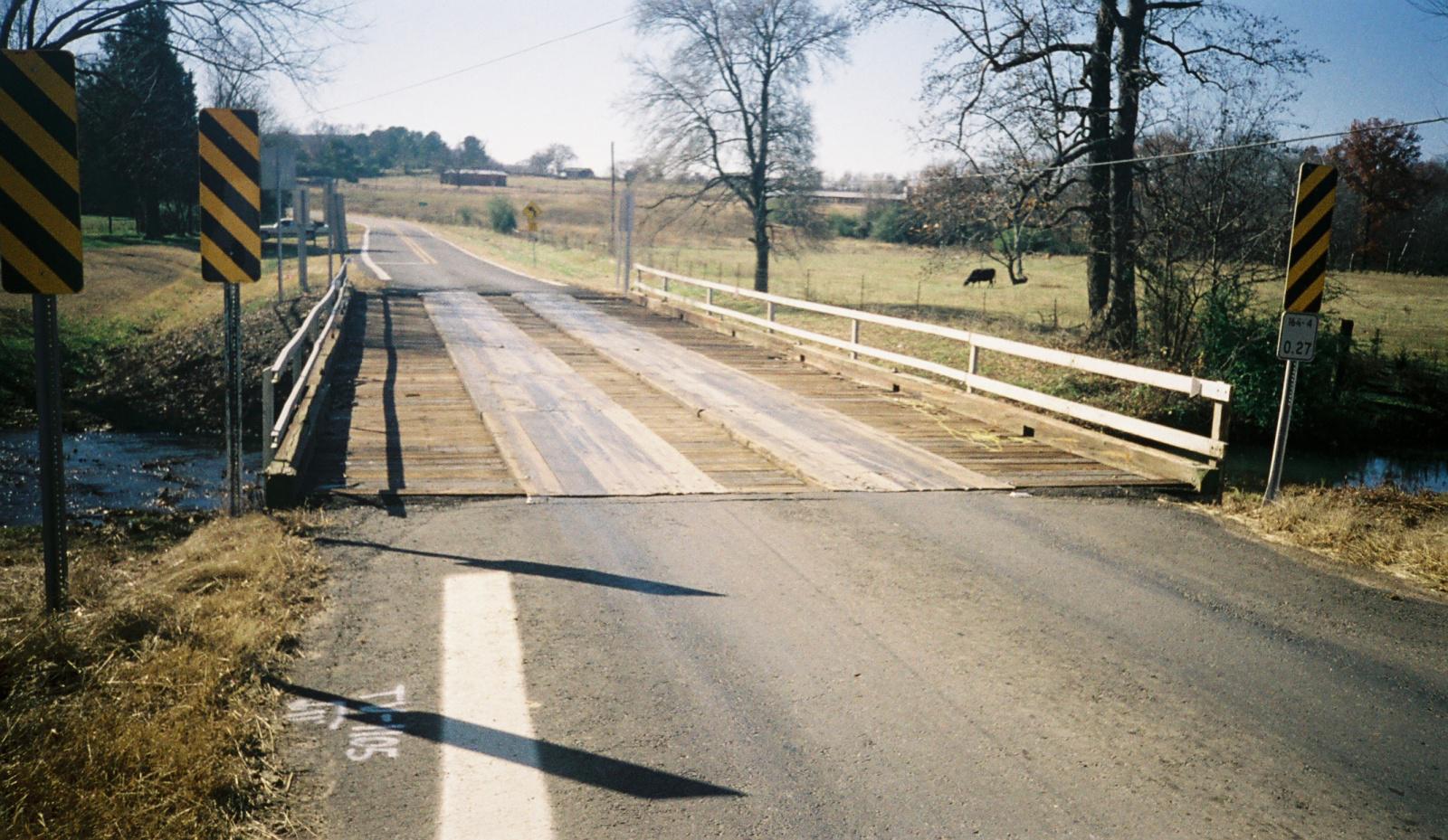
![]()
Status: Replaced by a new bridge
Location: 35.451667,-93.045000
Carries AR 164 over Little Creek
Design: beam/stringer/steel
Design Details: Steel stringer
Total Length: 71.8 Feet
Span Length: 36.0 Feet
Overview: Wooden bridge over Little Creek on AR 164
History: Built 1946, replaced 2012
Built: 1946
Location: Pope County
View Bridge Information In Wayback Machine
![]()
113332
overview from the north
Photo taken by Charles Bowden
113333
deck
Photo taken by Charles Bowden
113334
north approach
Photo taken by Charles Bowden
113335
eastside
Photo taken by Charles Bowden
113336
south approach
Photo taken by Charles Bowden
113337
west side
Photo taken by Charles Bowden
![]()
Status: Open to traffic
Location: 35.226944,-93.033333
Carries Pine Ridge Road (CR 43) over Branch of Galla Creek
Design: beam/stringer/steel
Design Details: Steel stringer
Total Length: 23.0 Feet
Span Length: 22.0 Feet
Overview: Stringer bridge over a branch of Galla Creek on Pine Ridge Road (CR 43) in Pottsville
History: Built 1941 by the Works Progress Administration
Built: 1941
Location: Pope County
View Bridge Information In Wayback Machine
![]()
![]()
Status: Open to traffic
Location: 35.378056,-93.008333
Carries Buck Mountain Road (CR 26) over Isabell Creek
Design: beam/tee
Design Details: Concrete tee beam
Total Length: 51.8 Feet
Span Length: 25.9 Feet
Overview: Two-span concrete tee beam bridge over Isabell Creek on Buck Mountain Road (CR 26)
History: Built 1942 by the Works Progress Administration
Built: 1942
Location: Pope County
View Bridge Information In Wayback Machine
![]()
122488
Overview
Photo taken by AHTD
![]()
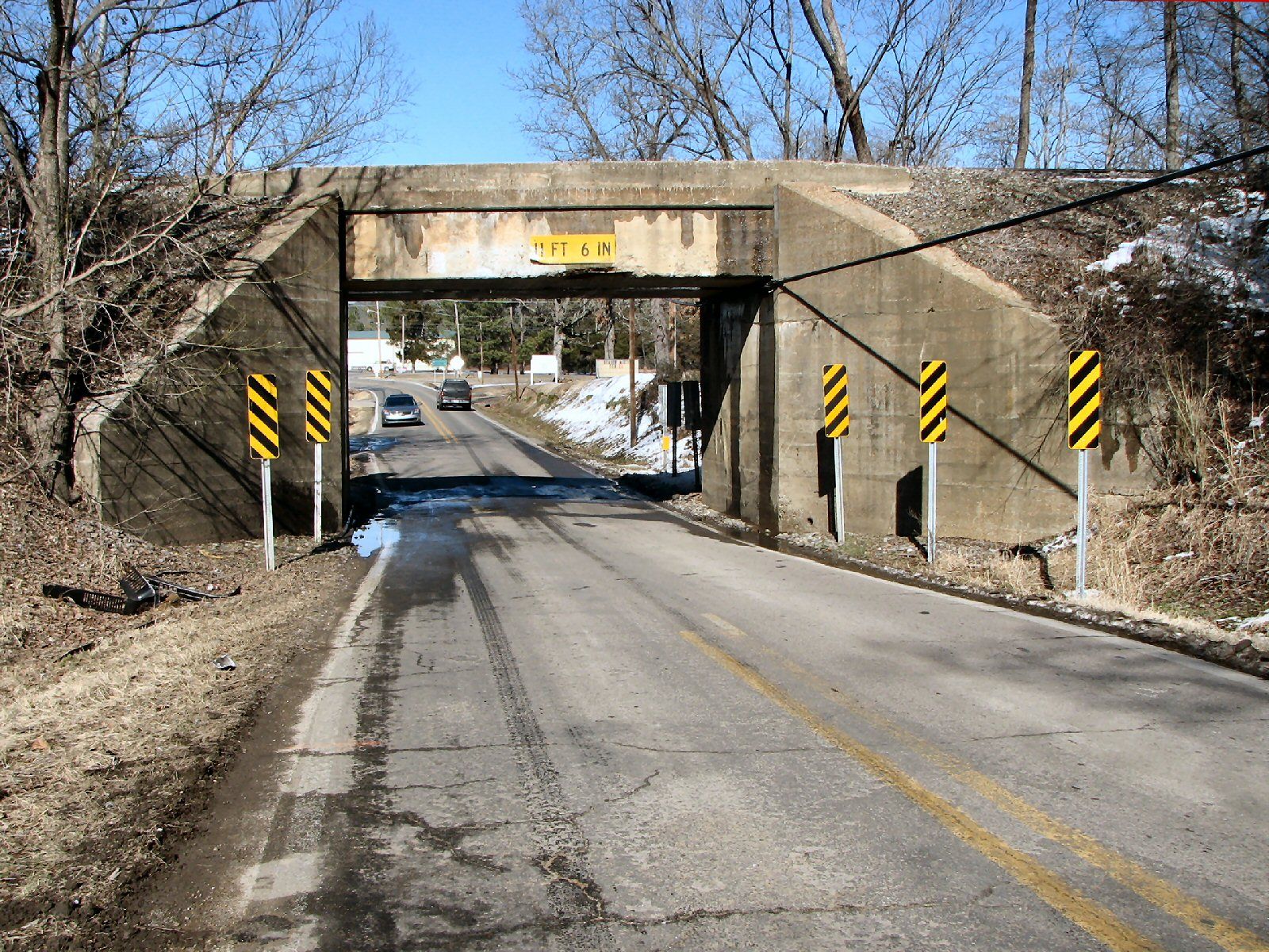
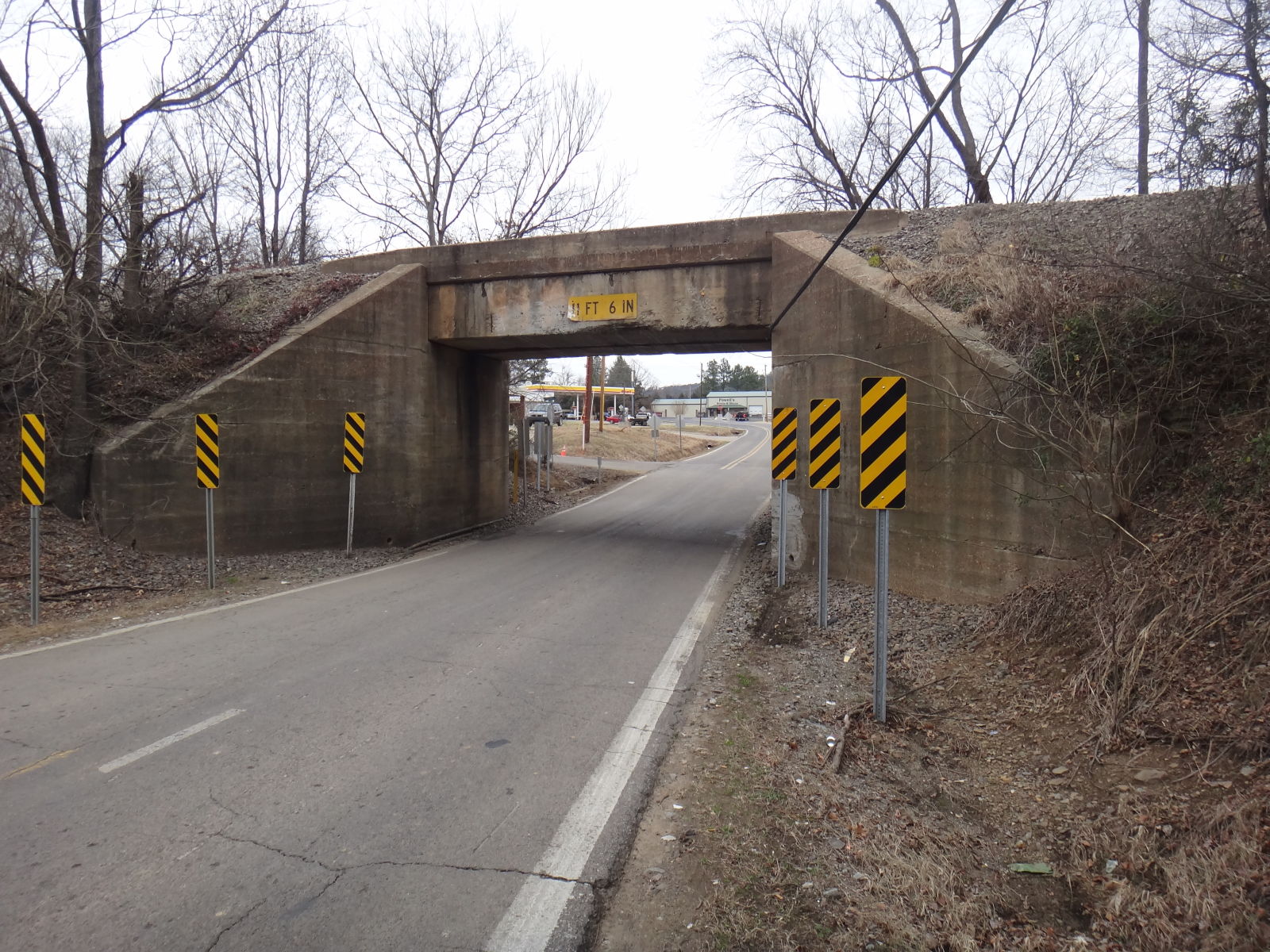
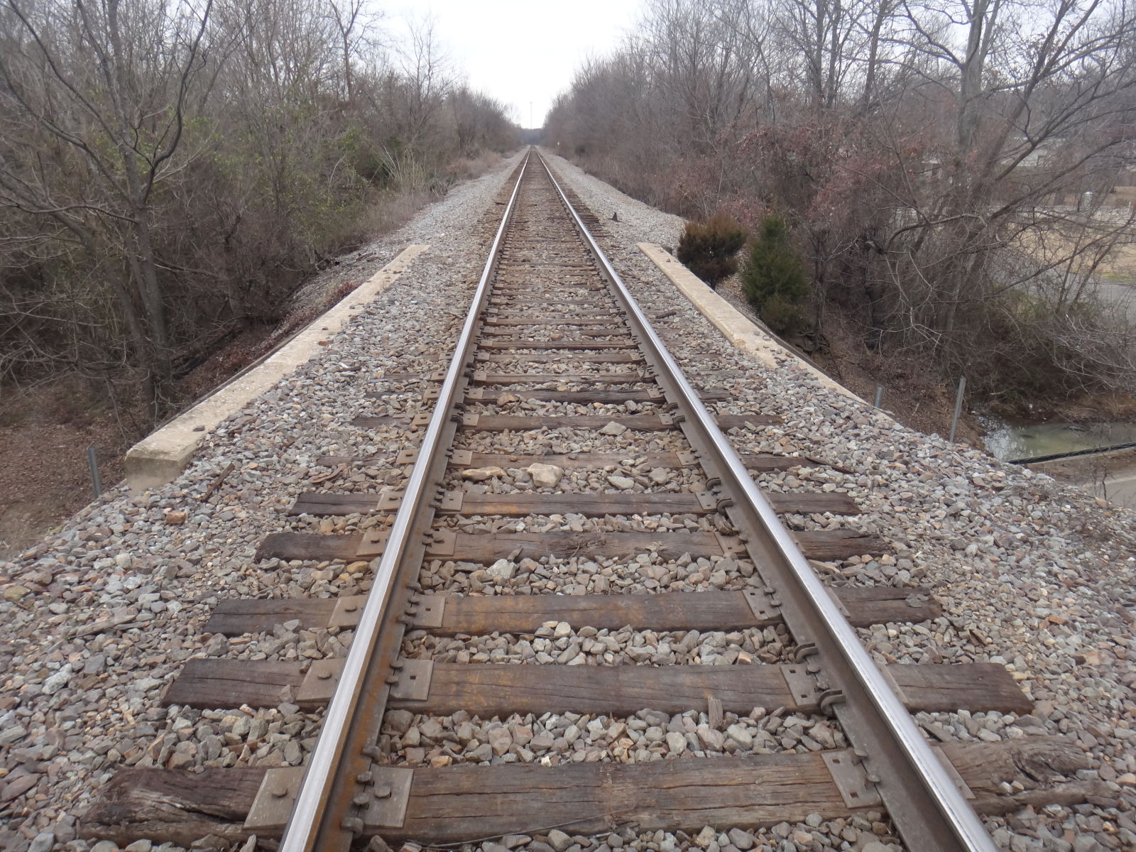
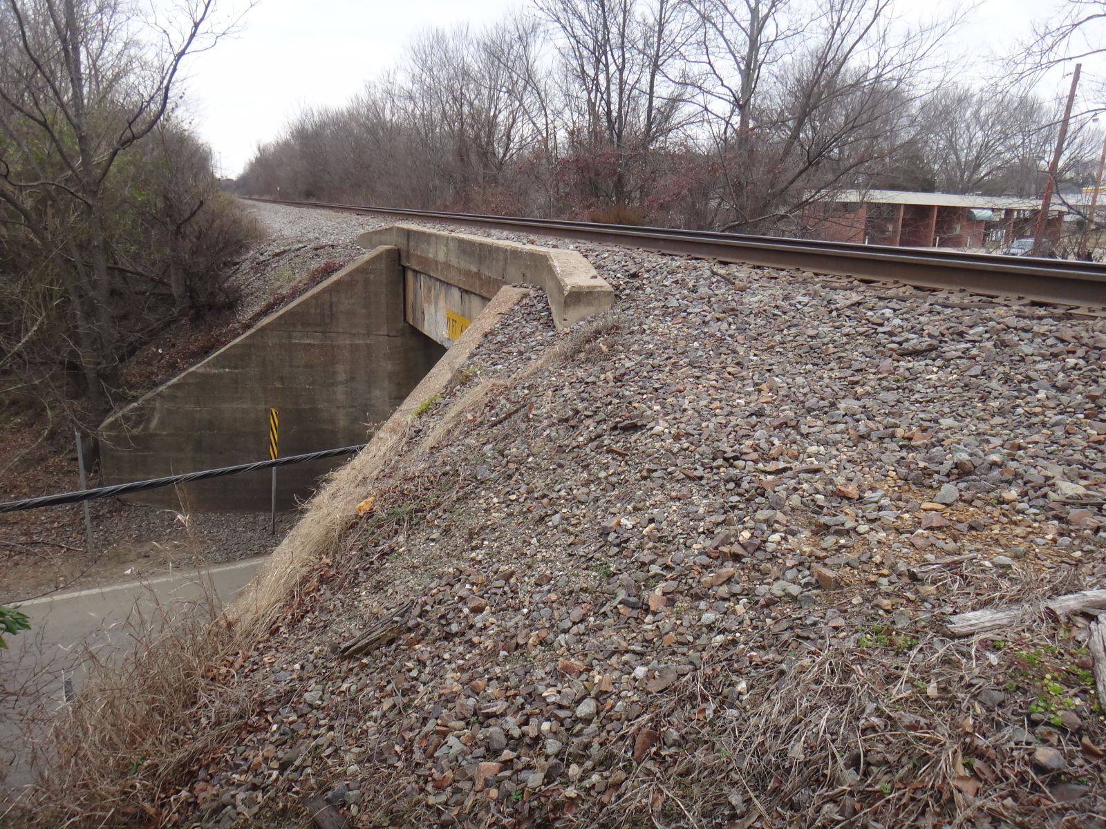
Status: Open to traffic
Location: 35.259613,-93.076682
Carries Tyler Road over Union Pacific Railroad
Design: beam/stringer/wood
Design Details: Timber stringer
Total Length: 103.0 Feet
Span Length: 24.9 Feet
Overview: Wooden stringer bridge over the Union Pacific Railroad on Tyler Road
History: Built 1937
Built: 1937
Location: Pope County
View Bridge Information In Wayback Machine
![]()
![]()
Status: Closed to all traffic
Location: 35.371415,-92.871921
Carries Old abandoned alignment Griffin Flat Road over Cedar Creek
Design: truss/pony/pratt
Design Details:
Riveted, 4-panel Pratt pony truss
Total Length: 0.0 Feet
Span Length: 0.0 Feet
Overview: Pony truss bridge over Cedar Creek on Old abandoned alignment Griffin Flat Road
History:
Built:
Location: Pope County
View Bridge Information In Wayback Machine
![]()
130281
Replaced by a culvert on current alignment of road.
Photo taken by Gene McCluney in December 2007
130282
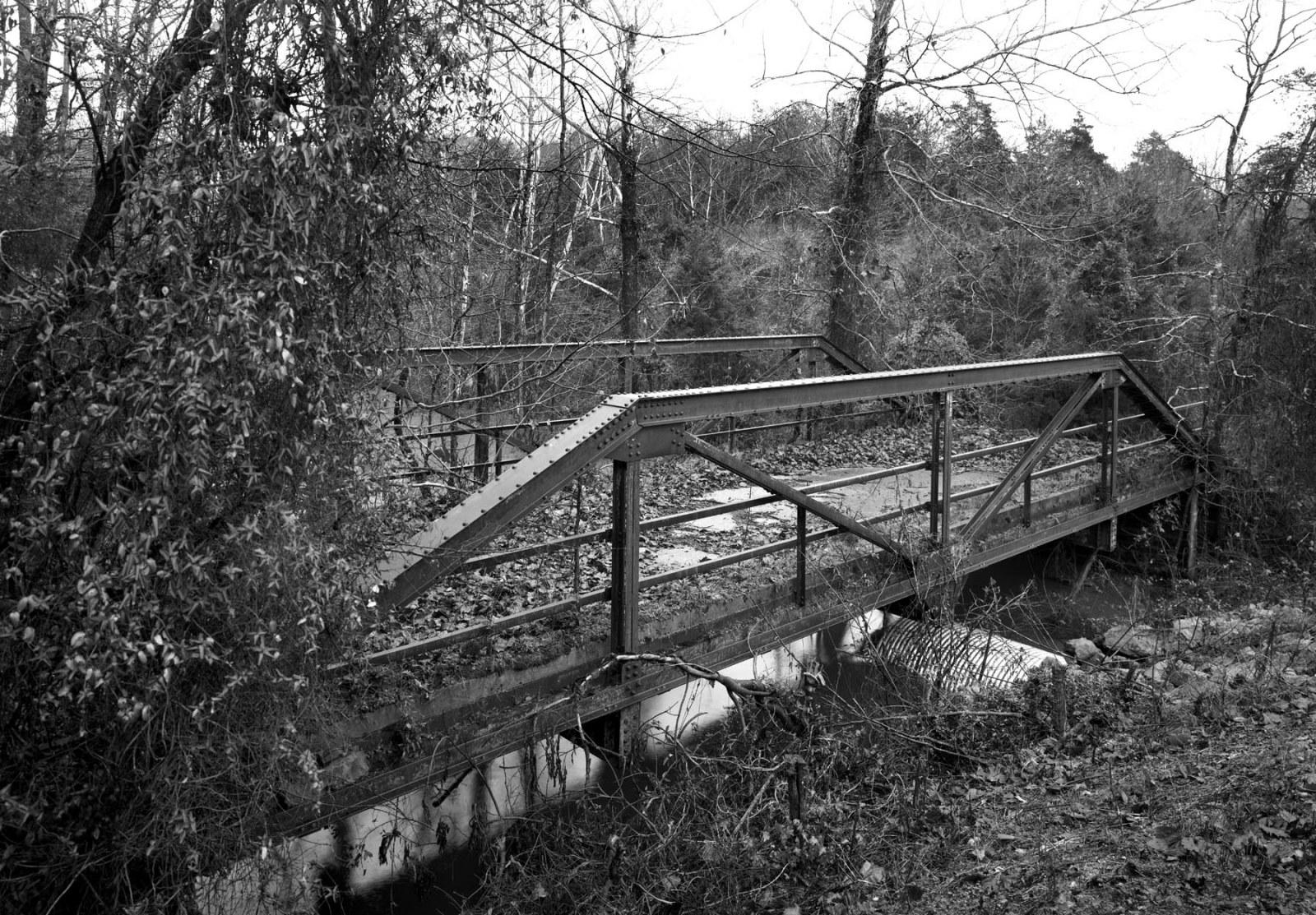
Photo taken by Gene McCluney in December 2007
130283
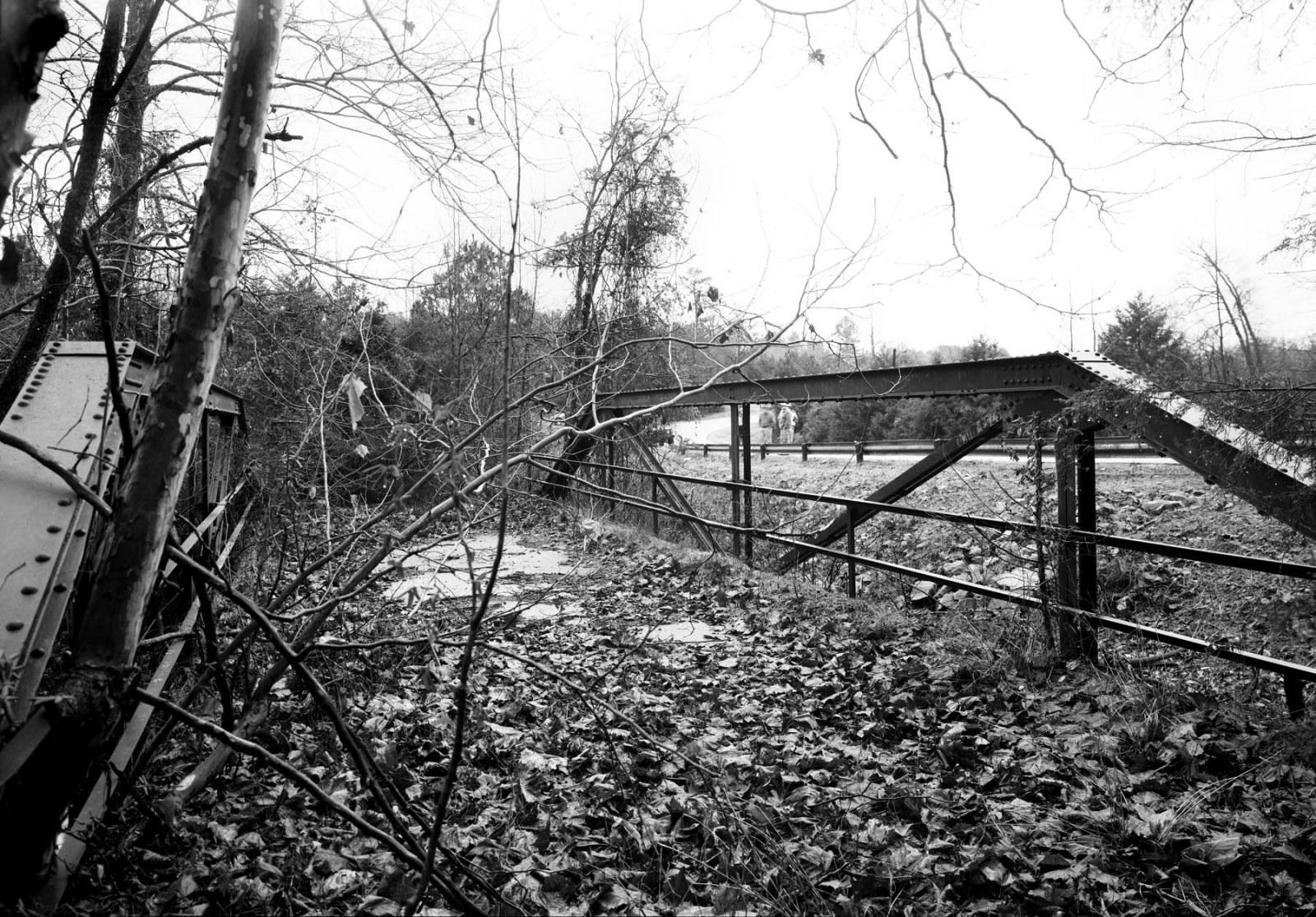
Photo taken by Gene McCluney in December 2007
![]()
Status: Abandoned
Location: 35.281500,-92.862710
Carries Talley Road (abandoned) over West Fork Point Remove Creek
Design: truss/through/pratt
Design Details: Pratt through truss
Total Length: 0.0 Feet
Span Length: 0.0 Feet
Overview: Abandoned through truss bridge over West Fork Point Remove Creek on private stretch of Talley Road.
History:
Built:
Location: Pope County
View Bridge Information In Wayback Machine
![]()
130508
It's there, can you see it? You can estimate how long it has been abandoned by the size of the big tree to the left of the bridge in the original roadway.
Photo taken by Gene McCluney in December 2007
130509
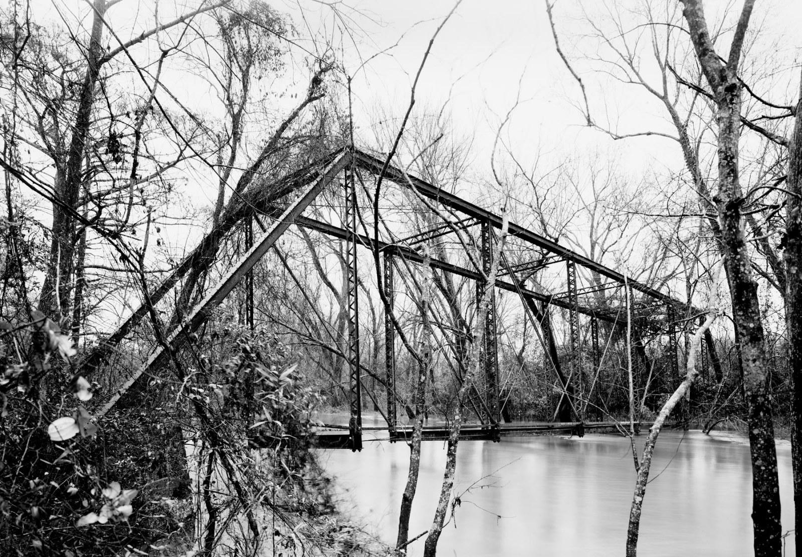
Either the water was high, or this bridge was low.
Photo taken by Gene McCluney in December 2007
130510
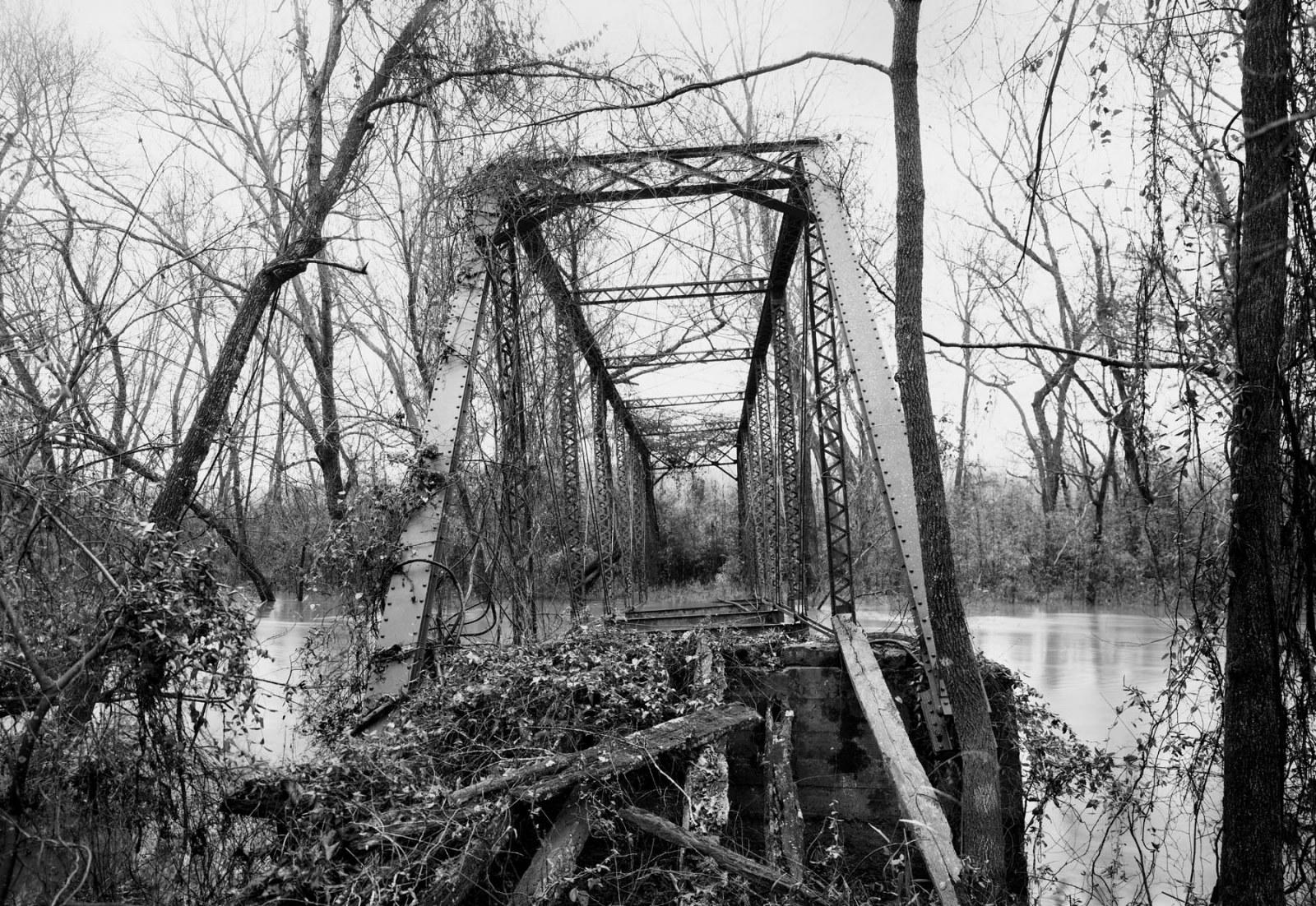
Yes, it leans, off pier.
Photo taken by Gene McCluney in December 2007
130511
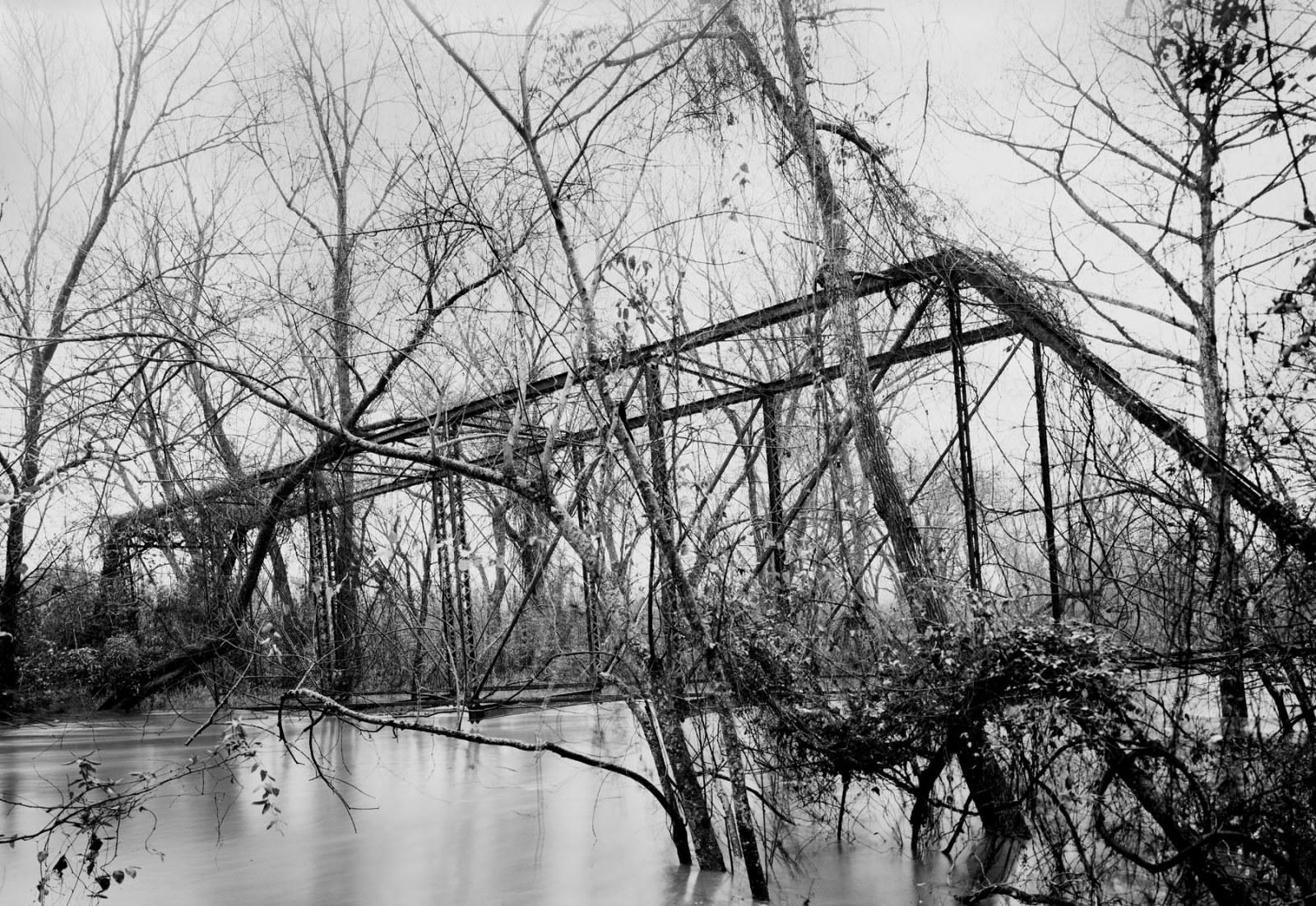
Photo taken by Gene McCluney in December 2007
![]()
Status: Open to traffic
Location: 35.303193,-93.170599
Carries W Main St (US 64) over Union Pacific Railroad
Design: beam/tee
Design Details: Concrete tee beam
Total Length: 207.0 Feet
Span Length: 46.9 Feet
Overview: Concrete tee beam bridge over Union Pacific Railroad on W Main St (US 64)
History: Built 1936
Built: 1936
Location: Pope County
View Bridge Information In Wayback Machine
![]()
![]()
Status: Open to traffic
Location: 35.242012,-92.920063
Carries US 64 over White Oak Creek
Design: other
Design Details:
Total Length: 45.9 Feet
Span Length: 23.0 Feet
Overview: Bridge over White Oak Creek on US 64
History: Built 1931
Built: 1931
Location: Pope County
View Bridge Information In Wayback Machine
![]()
![]()
Status: Replaced by a new bridge
Location: 35.250346,-93.040127
Carries US 64 over Galla Creek
Design: beam/tee
Design Details: Concrete tee beam
Total Length: 200.1 Feet
Span Length: 40.0 Feet
Overview: Concrete tee beam bridge over Galla Creek on US 64
History: Built 1934; Replaced 2012
Built: 1934
Location: Pope County
View Bridge Information In Wayback Machine
![]()
![]()
Status: Replaced by new bridge
Location: 35.318056,-93.185278
Carries Us 64 over Illinois Bayou
Design: truss/pony
Design Details: Pony truss
Total Length: 0.0 Feet
Span Length: 0.0 Feet
Overview: Lost Pony truss bridge over Illinois Bayou on Us 64
History: Built circa 1935 ; Replaced 1964
Built: ca. 1935
Location: Pope County
View Bridge Information In Wayback Machine
![]()
![]()
Status: Open to traffic
Location: 35.311755,-93.182792
Carries UP Railroad over Lake Dardanelle
Design: girder/deck/plate
Design Details: Deck plate girder
Total Length: 0.0 Feet
Span Length: 0.0 Feet
Overview: Girder bridge over Lake Dardanelle on UP Railroad
History:
Built:
Location: Pope County
View Bridge Information In Wayback Machine
![]()
179071
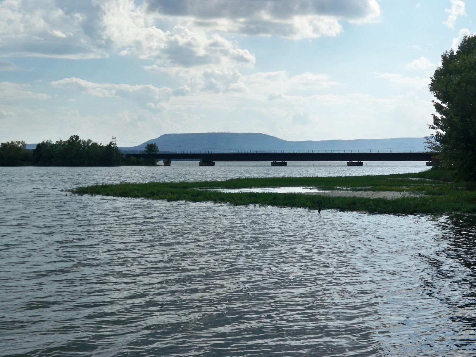
Looking south from US Hwy 64
Photo taken by Nathan Morton in Sept. 10
![]()
Status: Open to traffic
Location: 35.251910,-93.048220
Carries Missouri Pacific Railroad over River Road (formerly AR 247)
Design: slab
Design Details: Slab
Total Length: 24.9 Feet
Span Length: 22.0 Feet
Overview: Concrete slab bridge over River Road on Missouri Pacific Railroad
History: Built circa 1960
Built: ca. 1960
Location: Pope County
View Bridge Information In Wayback Machine
![]()
193581
South Approach
Photo taken by David Backlin in February 2011
273688
River Road Bridge
Looking south on Arkansas 247.
Photo taken by J. Randall Houp in January 2012
273689
River Road Bridge
Top of railroad bridge looking west.
Photo taken by J. Randall Houp in January 2012
273690
River Road Bridge
Photo showing south side of railroad bridge looking west.
Photo taken by J. Randall Houp in January 2012
![]()
Status: Open to traffic
Location: 35.251380,-93.048498
Carries River Road (formerly AR 247) over Creek
Design: beam/stringer/steel
Design Details: Steel stringer
Total Length: 23.0 Feet
Span Length: 23.0 Feet
Overview: Steel stringer bridge over Creek on River Road (formerly AR 247)
History: Built 1952
Built: 1952
Location: Pope County
View Bridge Information In Wayback Machine
![]()
![]()
Status: Replaced by a new bridge
Location: 35.336798,-93.132786
Carries AR-7 over Bakers Creek
Design: truss/pony
Design Details: Pony truss
Total Length: 132.9 Feet
Span Length: 111.9 Feet
Overview: Lost Pony truss bridge over Bakers Creek on AR-7
History: Built 1970
Built: 1970
Location: Pope County
View Bridge Information In Wayback Machine
![]()
![]()
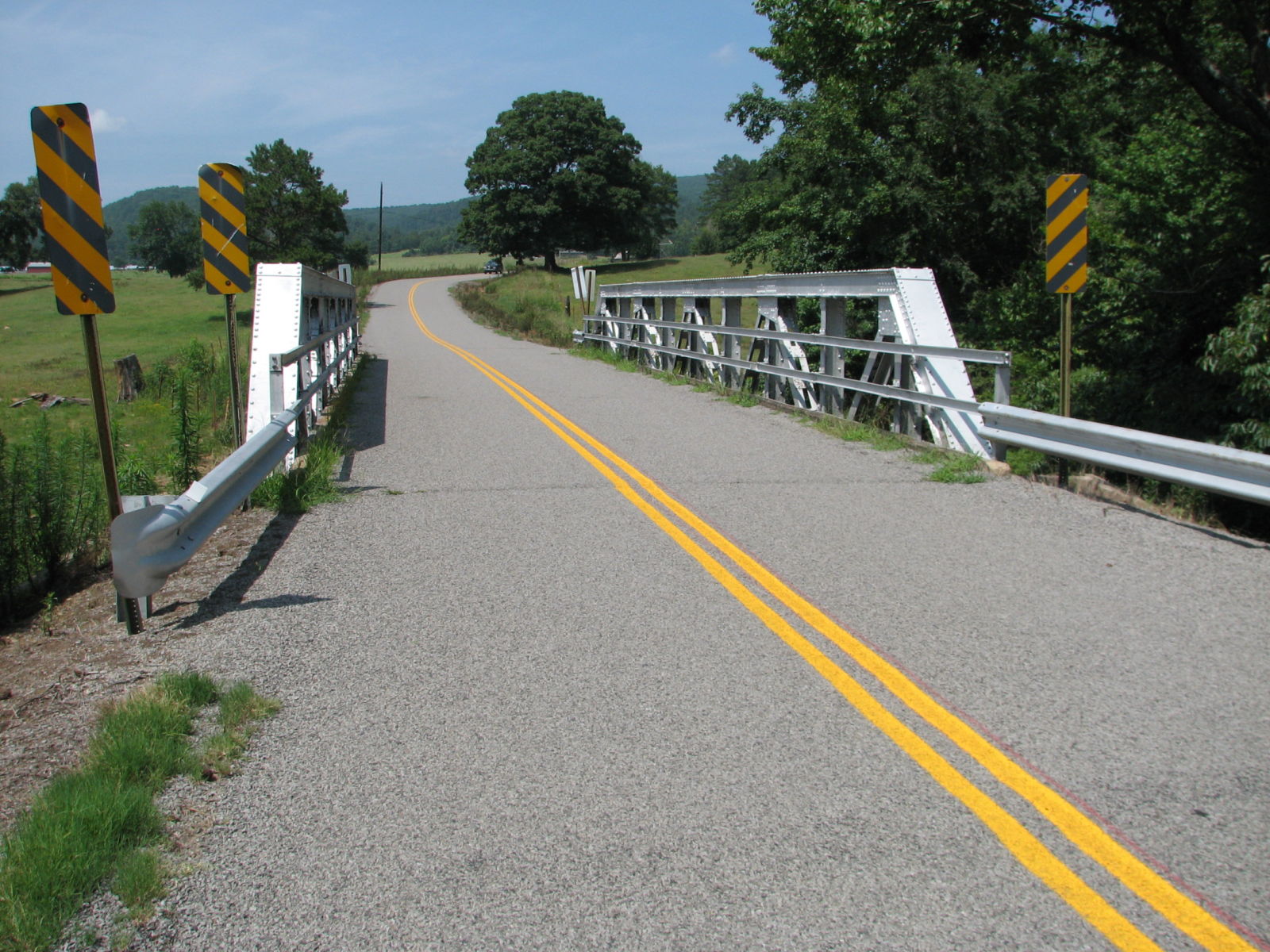
Status: Open to traffic
Location: 35.511667,-93.155833
Carries CR 14 (Old Hwy 7) over Branch
Design: beam/stringer/steel
Design Details: Steel stringer
Total Length: 65.0 Feet
Span Length: 32.2 Feet
Overview: Steel stringer bridge over Branch on CR 14 (Old Hwy 7)
History: Built 1940
Built: 1940
Location: Pope County
View Bridge Information In Wayback Machine
![]()
289452
North Approach
Photo taken by David Backlin in July 2014
289453
Side View
Photo taken by David Backlin in July 2014
![]()
Status: Open to traffic
Location: 35.503650,-93.166980
Carries CR 14 (Old Hwy 7) over Drainage Ditch
Design: slab
Design Details: Slab
Total Length: 0.0 Feet
Span Length: 0.0 Feet
Overview: Slab bridge over Drainage Ditch on CR 14 (Old Hwy 7)
History:
Built:
Location: Pope County
View Bridge Information In Wayback Machine
![]()
289449
South Approach
Photo taken by David Backlin in July 2014
289450
Below East Side
Photo taken by David Backlin in July 2014
289451
Close-up East Side
Photo taken by David Backlin in July 2014
![]()
Status: No longer exists
Location: 35.411723,-93.146902
Carries Hwy 333 over Branch of Illinois Bayou
Design: unknown
Design Details:
Total Length: 0.0 Feet
Span Length: 0.0 Feet
Overview: Bridge on Hwy 333 over Branch of Illinois Bayou
History:
Built:
Location: Pope County
View Bridge Information In Wayback Machine
![]()
339201
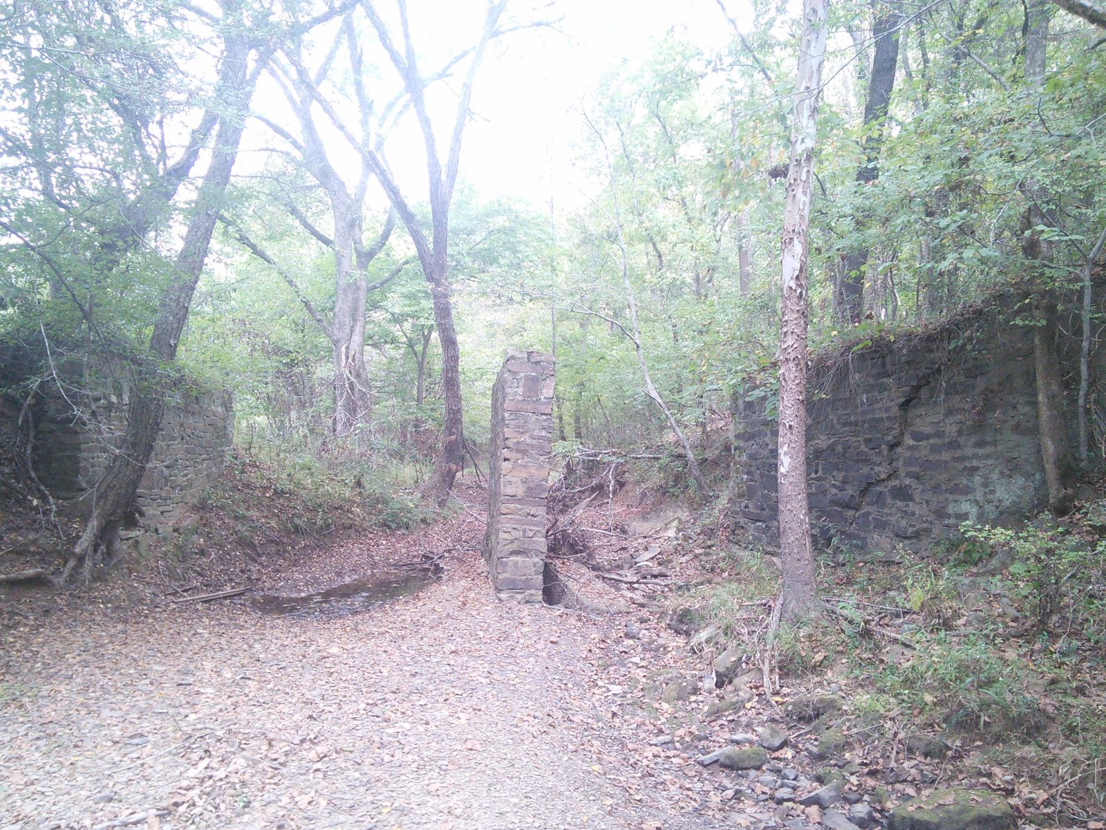
Photo taken by Nathan teaff in October 2015
339202
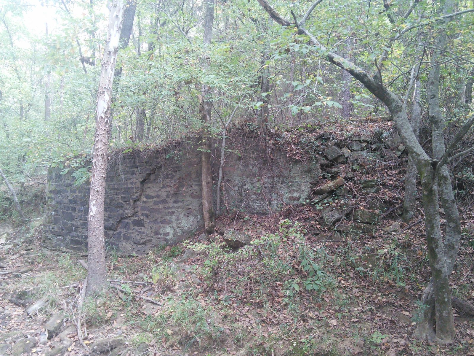
Photo taken by Nathan teaff in October 2015
339203

Photo taken by Nathan teaff in October 2015
339204
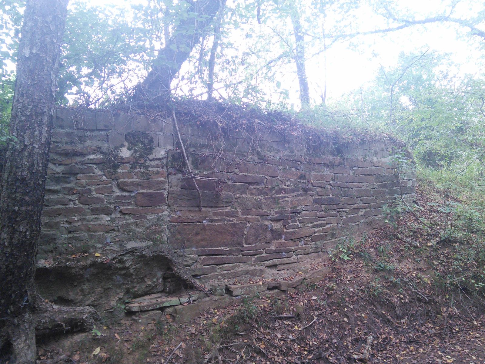
Photo taken by Nathan teaff in October 2015
339205
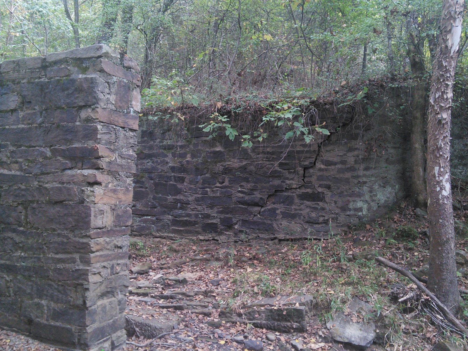
Photo taken by Nathan teaff in October 2015
339206
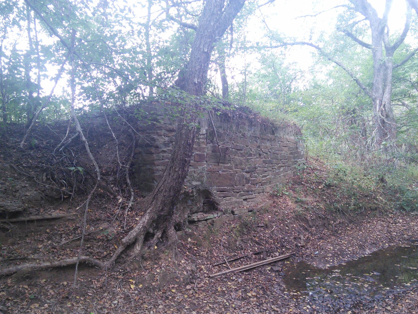
Photo taken by Nathan teaff in October 2015
![]()
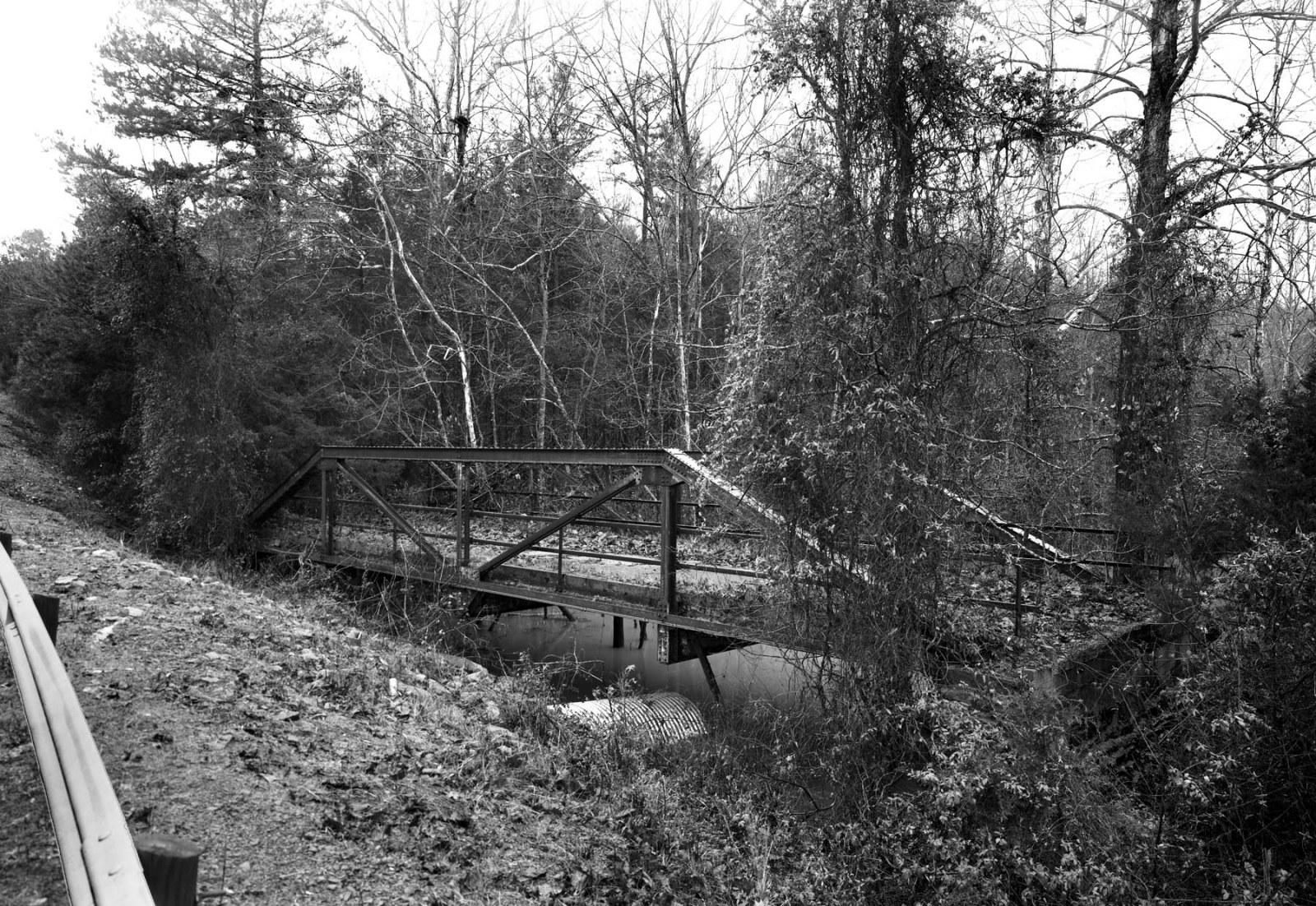
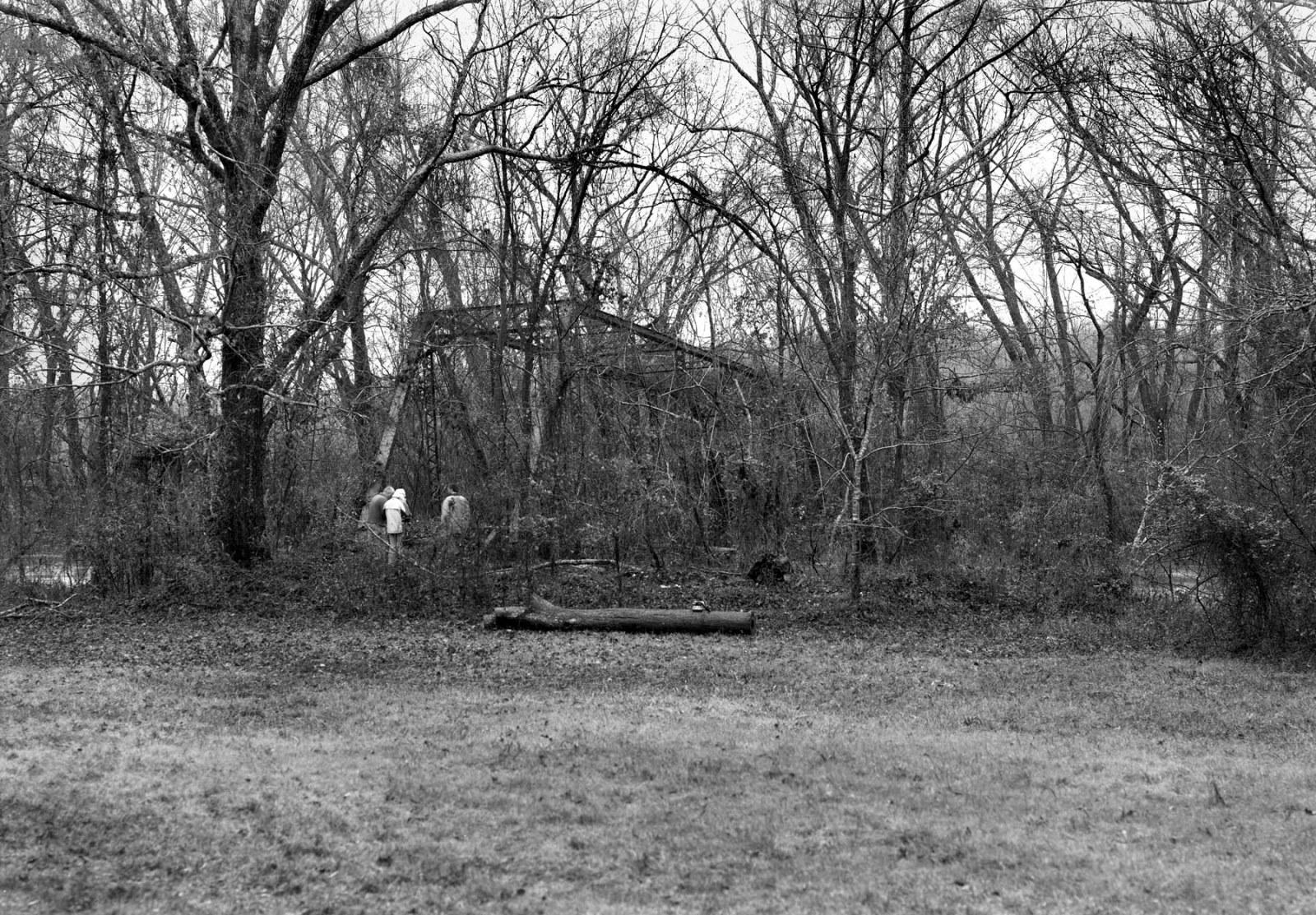
Status: Open to pedestrians only
Location: 35.278808,-93.132884
Carries Unknown over
Design: beam/stringer/steel
Design Details: Steel stringer
Total Length: 0.0 Feet
Span Length: 0.0 Feet
Overview: Unknown
History:
Built:
Location: Pope County
View Bridge Information In Wayback Machine
![]()
339545
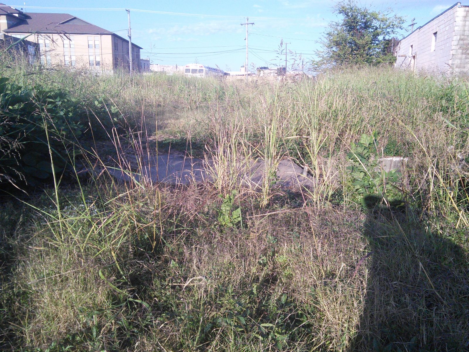
Photo taken by Nathan teaff in October 2015
339546
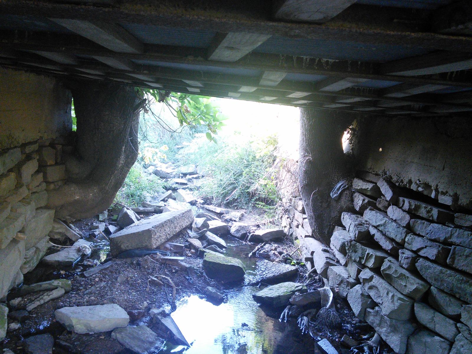
Photo taken by Nathan teaff in October 2015
339547
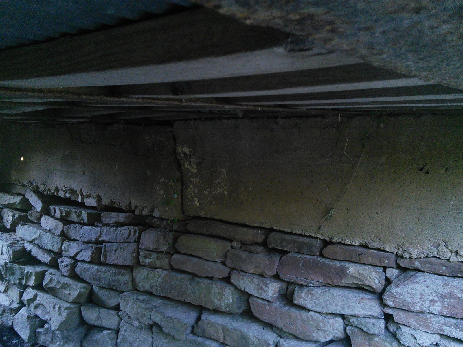
Photo taken by Nathan teaff in October 2015
339548
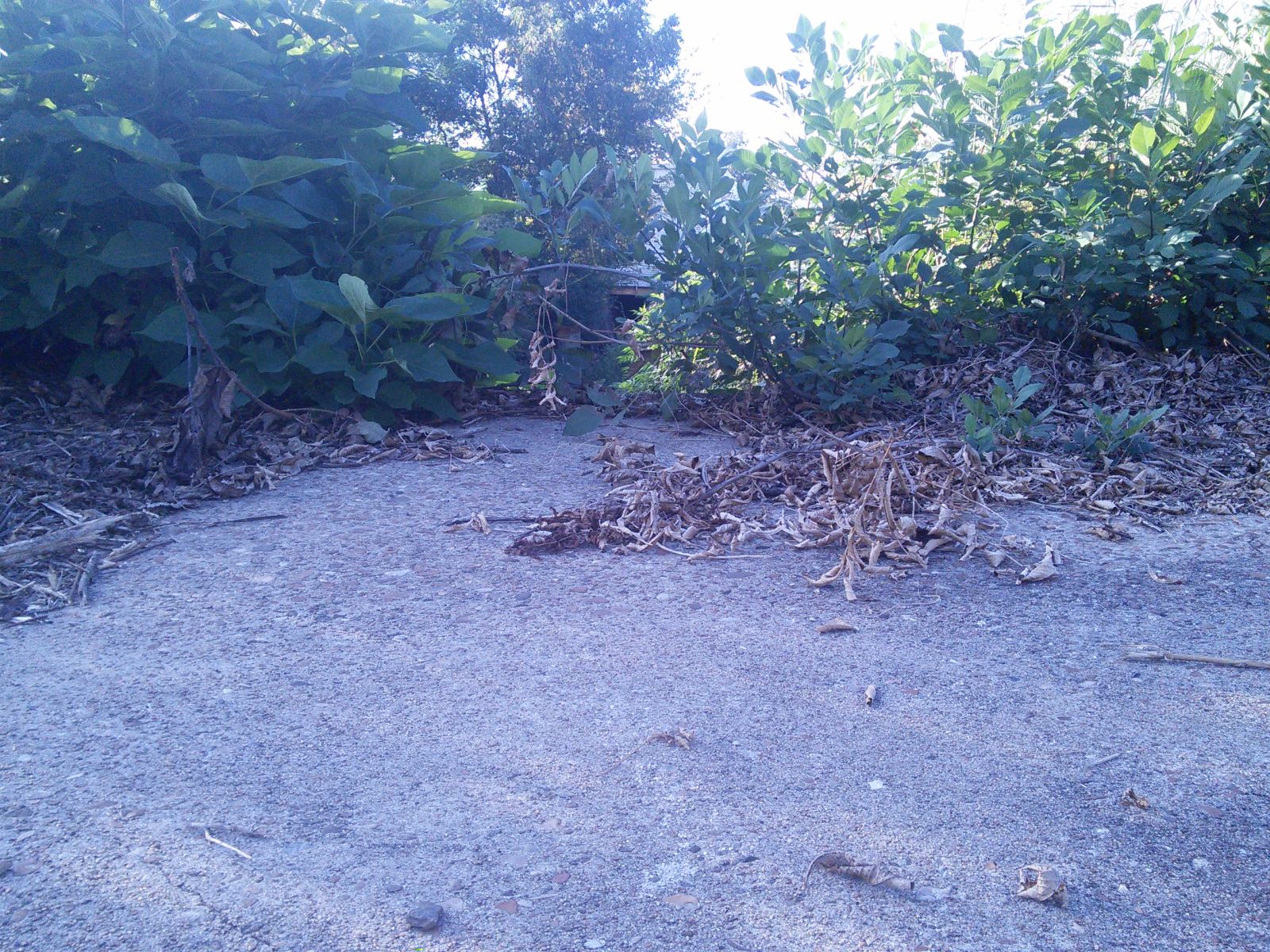
Photo taken by Nathan teaff in October 2015
339549
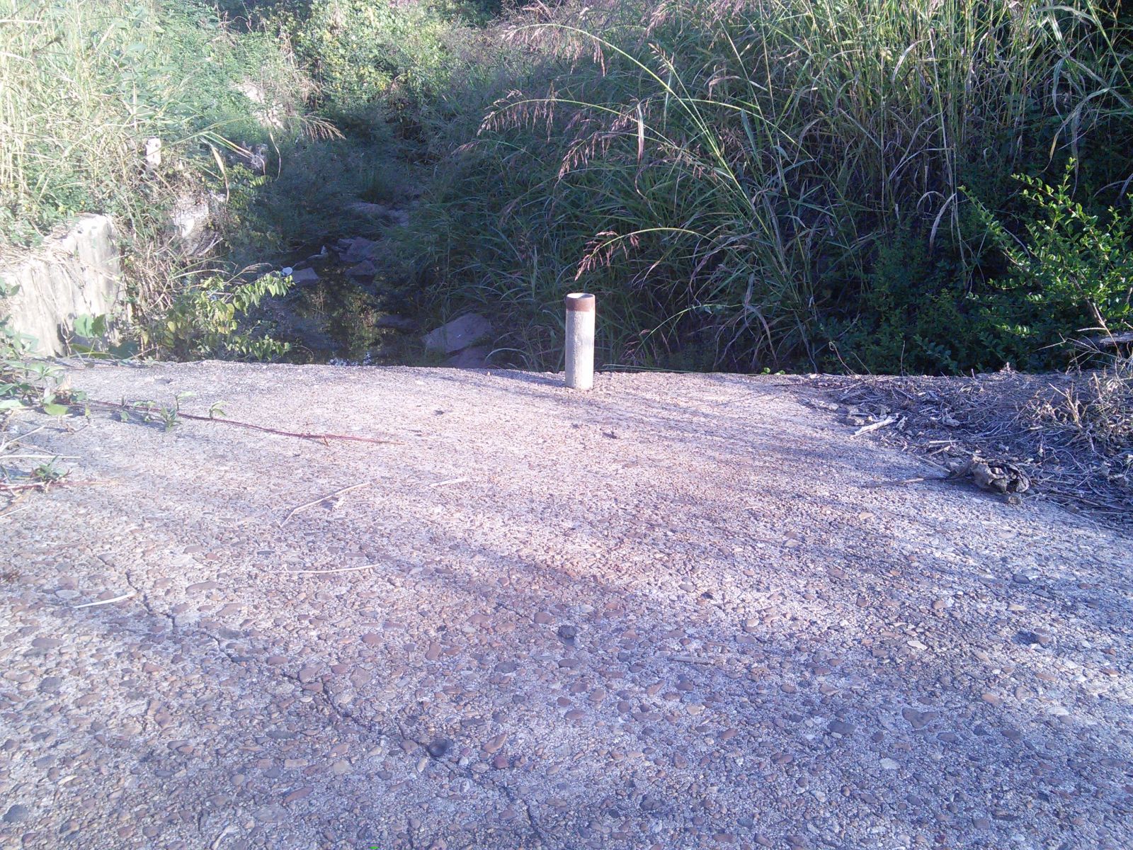
Photo taken by Nathan teaff in October 2015
339550
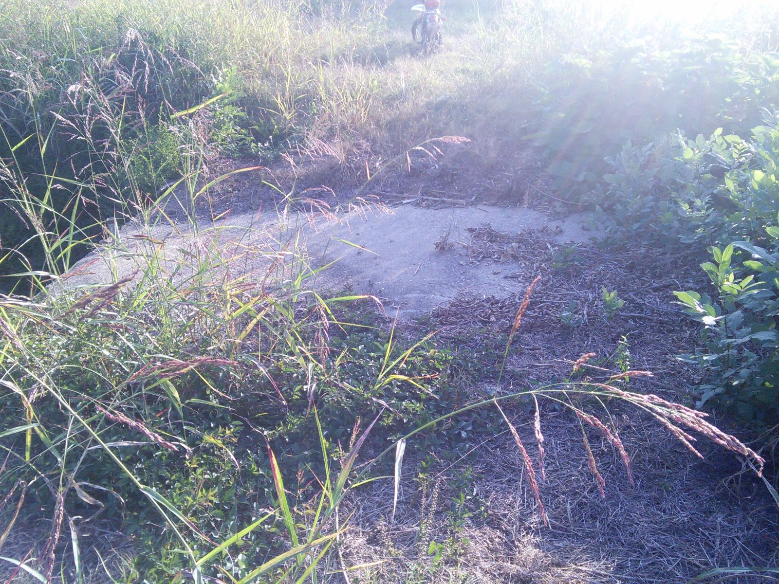
Photo taken by Nathan teaff in October 2015
Special Bridge Conditions Legend: R - Former location of relocated bridge. ! - At risk for demolition or destruction. X - Confirmed demolished or collapsed. S - Dismantled and/or in storage. L - Severe loss of historic integrity due to alteration.
![]()

![]()