![]()
![]()
Status: Open to traffic
Location: 43.687346,-114.373061
Carries Broadway Blvd. over Big Wood River
Design: arch/through/wood
Design Details: Wooden tied through arch
Total Length: 116.1 Feet
Span Length: 116.1 Feet
Overview: Timber through arch bridge over Big Wood River on Broadway Blvd. in Ketchum
History: Built 2001
Built: 2001
Location: Blaine County
View Bridge Information In Wayback Machine
![]()
![]()
Status: Open to traffic
Location: 43.301944,-113.938056
Carries City street over Little Wood River
Design: beam/stringer/wood
Design Details: Timber stringer
Total Length: 25.9 Feet
Span Length: 23.0 Feet
Overview: Wooden bridge over Little Wood River on a city street in Carey
History: Built 1940; rehabilitated 1991
Built: 1940
Location: Blaine County
View Bridge Information In Wayback Machine
![]()
![]()
Status: Open to traffic
Location: 43.497238,-114.058315
Carries High Five Road over Little Wood River
Design: truss/through
Design Details: Through truss
Total Length: 64.0 Feet
Span Length: 60.0 Feet
Overview: Through truss bridge over Little Wood River on High Five Road
History: Built 1986
Built: 1986
Location: Blaine County
View Bridge Information In Wayback Machine
![]()
![]()
Status: Open to traffic
Location: 43.504273,-114.057172
Carries Muldoon Canyon Road over Little Wood River
Design: beam/stringer/wood
Design Details: Timber stringer
Total Length: 26.9 Feet
Span Length: 24.9 Feet
Overview: Wooden bridge over Little Wood River on Muldoon Canyon Road
History: Built 1935; rehabilitated 1980
Built: 1935
Location: Blaine County
View Bridge Information In Wayback Machine
![]()
![]()
Status: Open to pedestrians
Location: 43.654028,-114.349444
Carries Wood River Line over Big Wood River
Design: truss/through/pegram
Design Details: Pegram through truss
Total Length: 0.0 Feet
Span Length: 0.0 Feet
Overview: Pegram through truss bridge over Big Wood River on a pedestrian trail
History: Built 1894 as part of a five-span bridge at Ontario, Oregon; one span relocated here 1917; rail line discontinued 1981; converted to pedestrian use 1984
Built: 1894
Location: Blaine County
View Bridge Information In Wayback Machine
![]()
196171
File:Cold-Springs-Bridge.JPG
This file is licensed under the Creative Commons Attribution-Share Alike 3.0 Unported license.
This is a file from the Wikimedia Commons.
200313
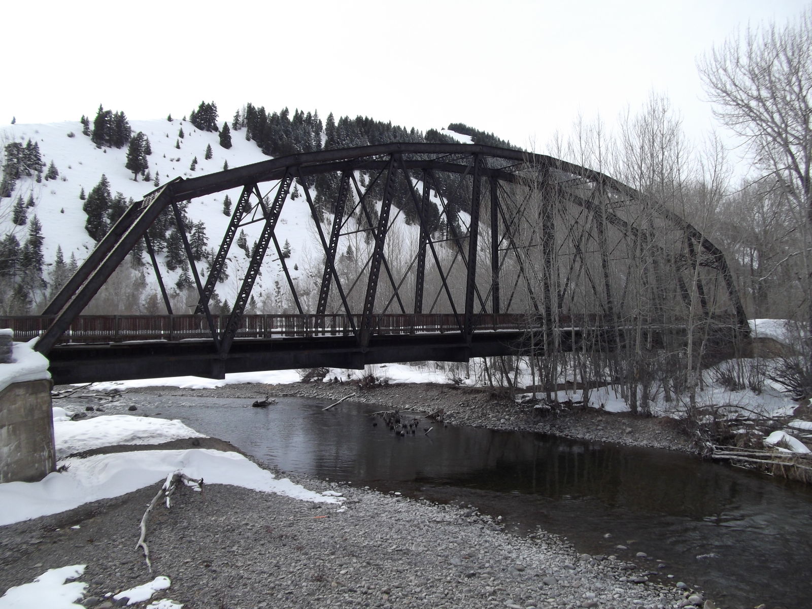
Photo taken by Elizabeth and Don DeLambert in March 2011
200314
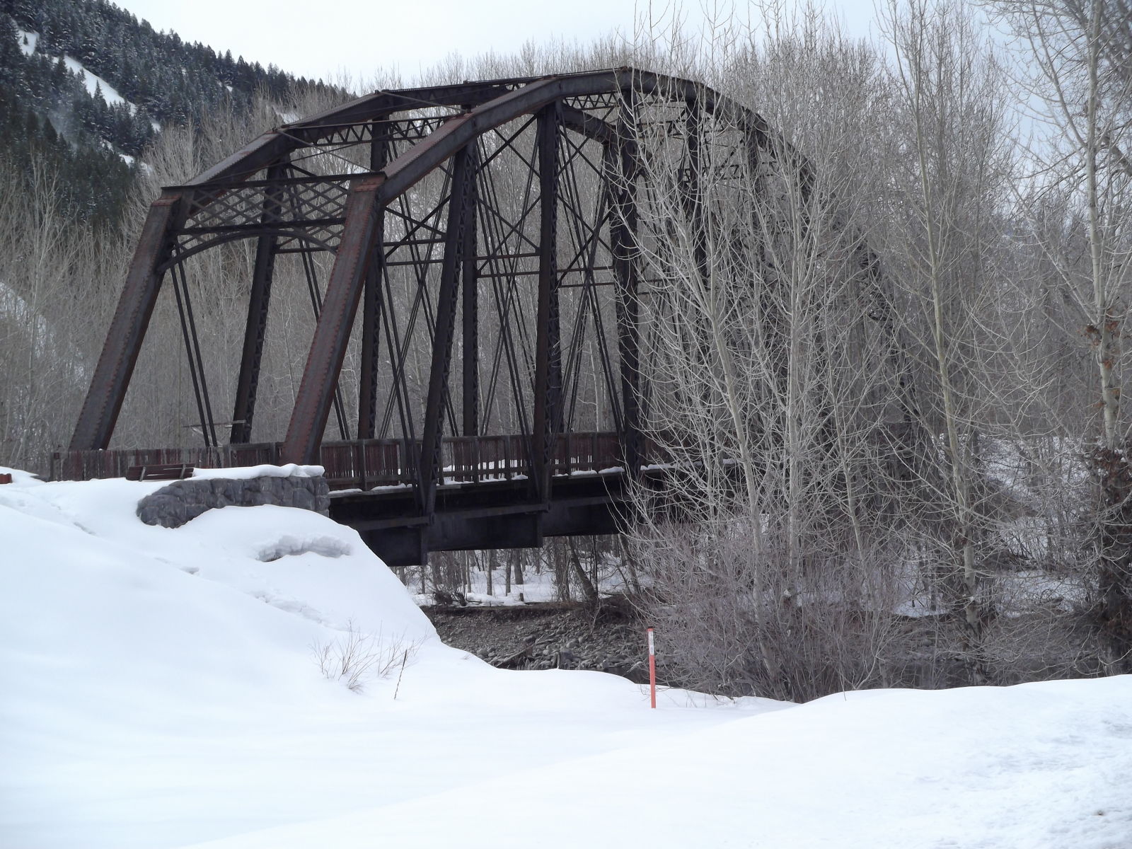
Photo taken by Elizabeth and Don DeLambert in March 2011
200315
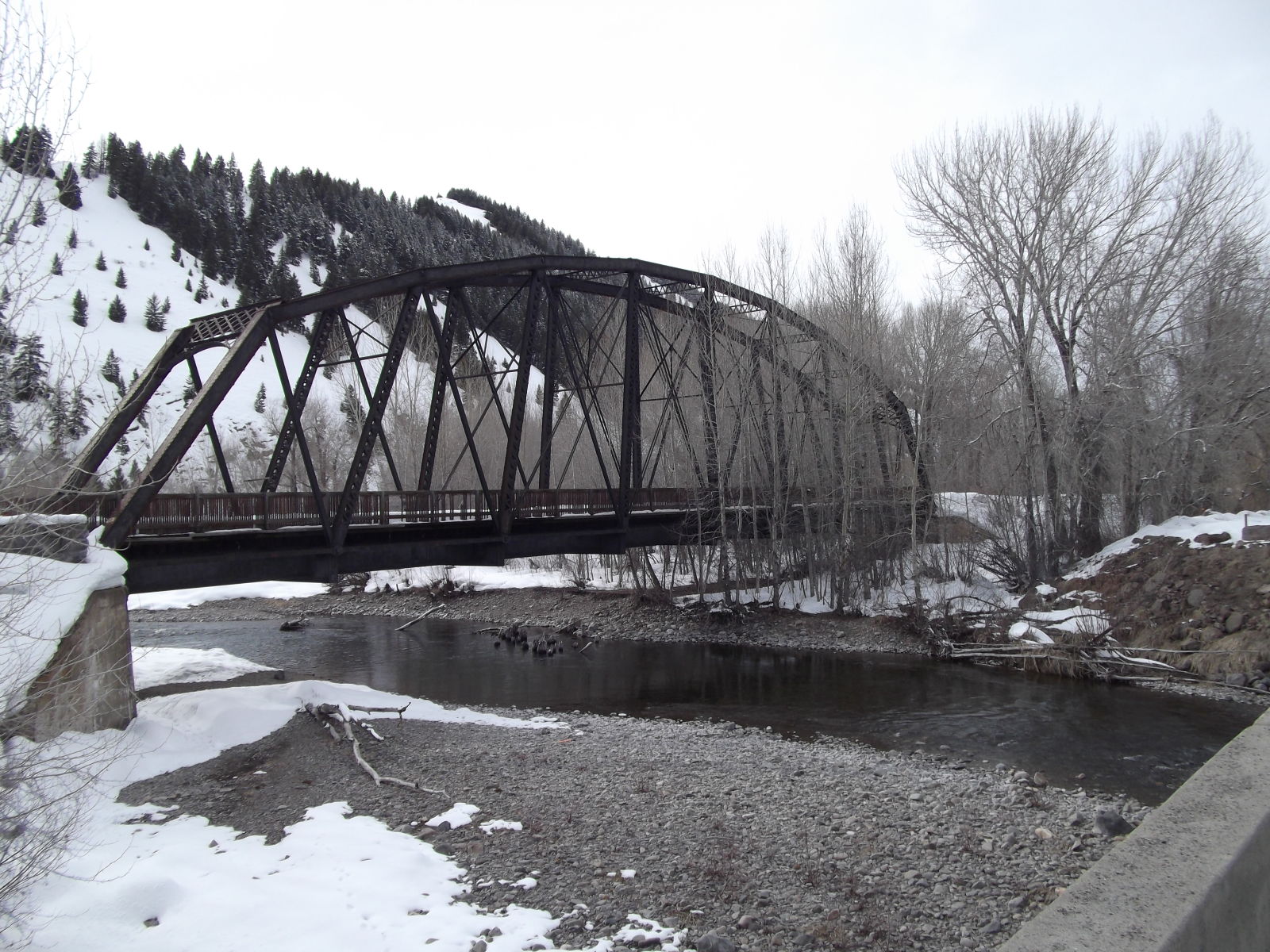
Photo taken by Elizabeth and Don DeLambert in March 2011
![]()
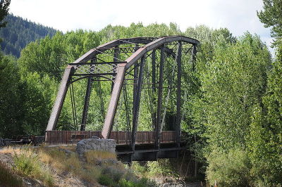
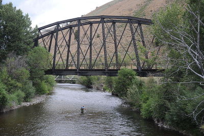
Status: Open to pedestrians; This one is reccomended for hikers/equestrians.
Location: 43.597861,-114.346194
Carries Union Pacific Railroad over Big Wood River
Design: truss/through/pegram
Design Details: Pegram through truss
Total Length: 0.0 Feet
Span Length: 0.0 Feet
Overview: Pegram through truss bridge over Big Wood River on Union Pacific Railroad
History: Built 1894 as part of a five-span bridge at Ontario, Oregon; One span relocated here 1914; Rail line discontinued 1981; Converted to pedestrian use 1984
Built: 1894
Location: Blaine County
View Bridge Information In Wayback Machine
![]()
196172
File:Gimlet-Bridge.jpg
This file is licensed under the Creative Commons Attribution-Share Alike 3.0 Unported license.
This is a file from the Wikimedia Commons.
200277
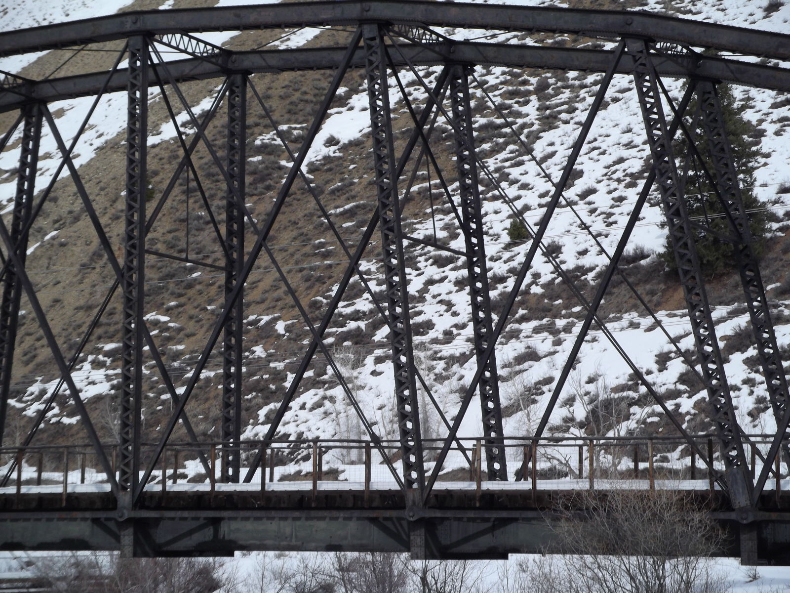
Photo taken by Elizabeth and Don DeLambert in March 2011
200278
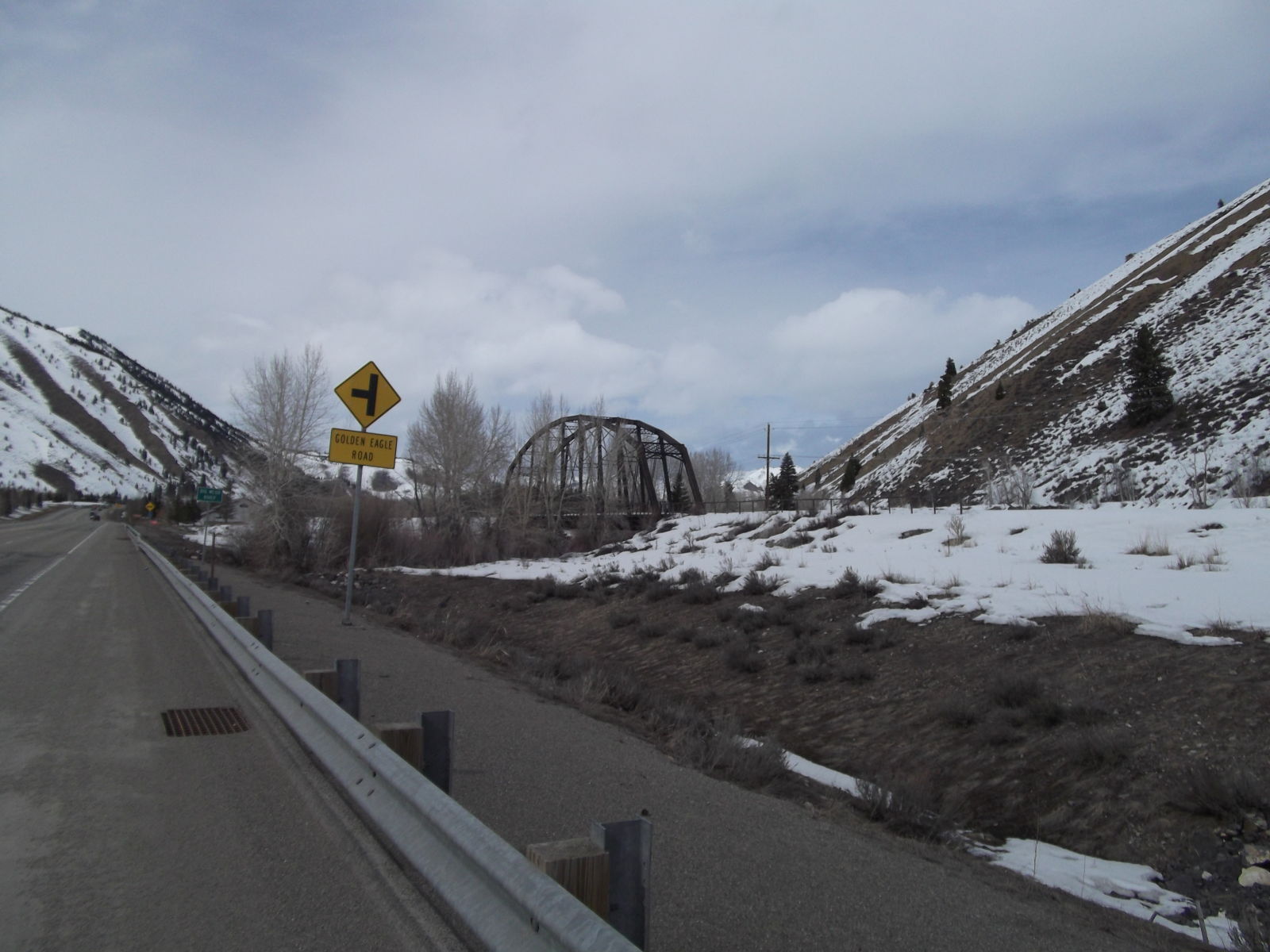
Photo taken by Elizabeth and Don DeLambert in March 2011
200279
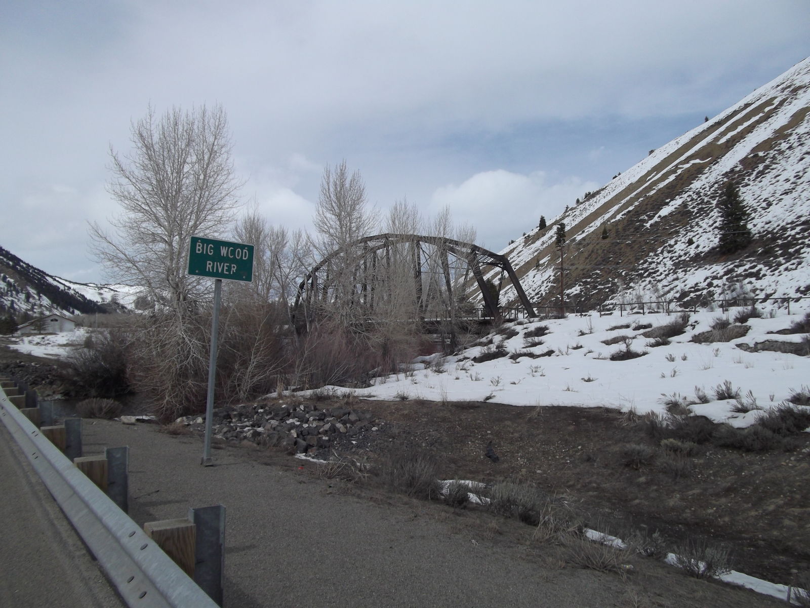
Photo taken by Elizabeth and Don DeLambert in March 2011
200280
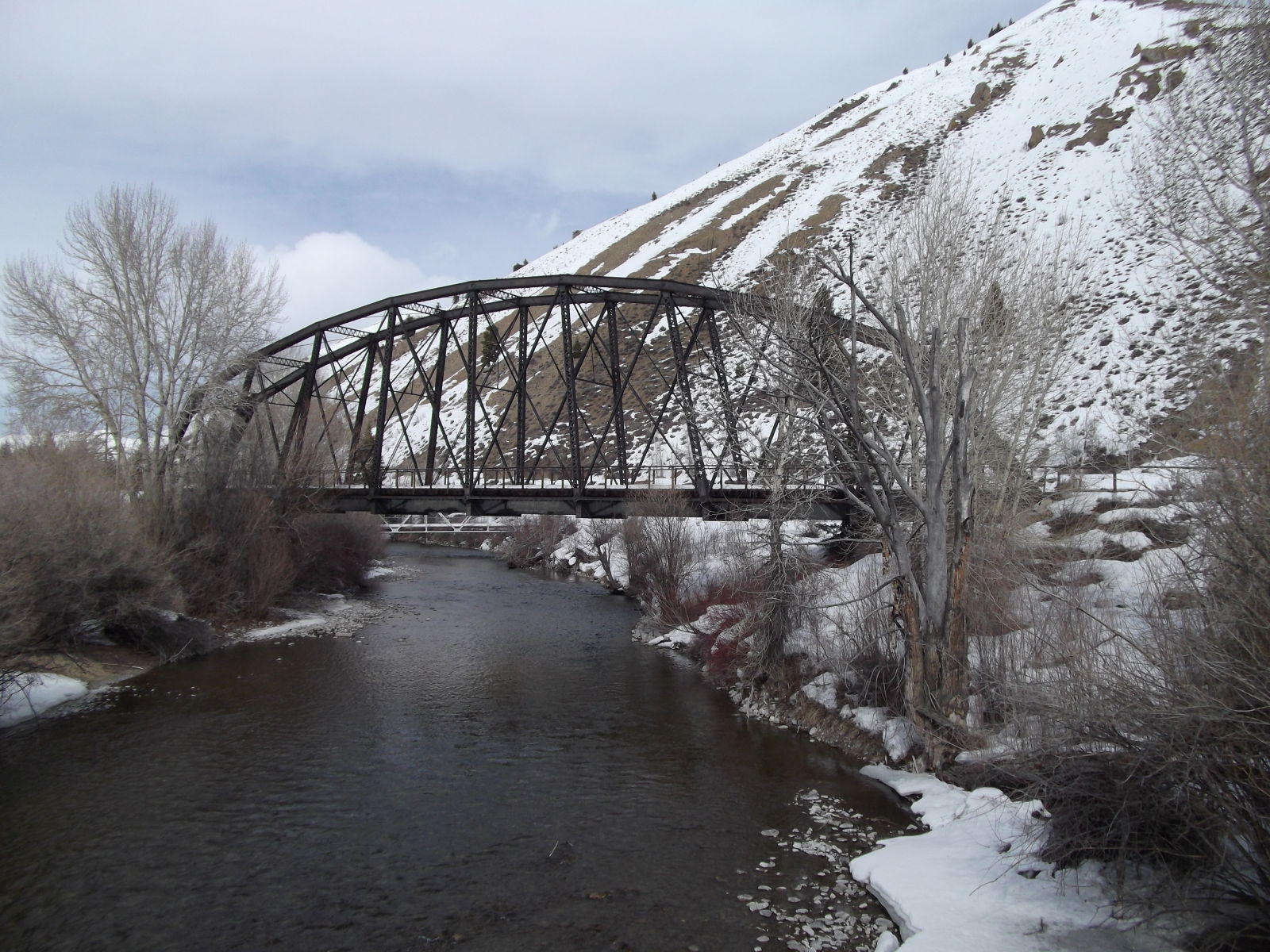
Photo taken by Elizabeth and Don DeLambert in March 2011
![]()
Status: Open to traffic
Location: 43.201080,-114.316500
Carries Burma Road (Old Highway 93) over Richfield Canal
Design: beam/tee
Design Details: Concrete tee beam
Total Length: 102.0 Feet
Span Length: 32.2 Feet
Overview: Concrete tee beam bridge over Richfield Canal on Burma Road (Old Highway 93)
History: Built 1932
Built: 1932
Location: Blaine County
View Bridge Information In Wayback Machine
![]()
![]()
Status: Open to traffic
Location: 43.640967,-114.488719
Carries Warm Springs Road over Warm Springs Creek
Design: truss/pony/warren/verticals
Design Details: Warren pony truss with all verticals
Total Length: 81.7 Feet
Span Length: 0.0 Feet
Overview: Warren pony truss with all verticals bridge over Warm Springs Creek on Warm Springs Road
History: Built 1991
Built: 1991
Location: Blaine County
View Bridge Information In Wayback Machine
![]()
Special Bridge Conditions Legend: R - Former location of relocated bridge. ! - At risk for demolition or destruction. X - Confirmed demolished or collapsed. S - Dismantled and/or in storage. L - Severe loss of historic integrity due to alteration.
![]()

![]()