![]()
![]()
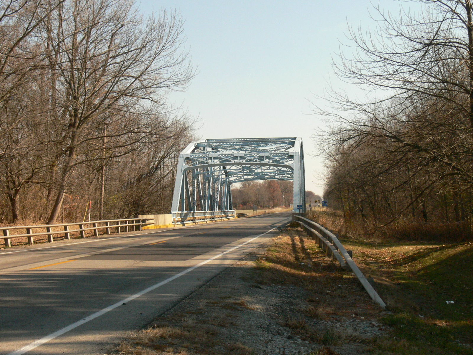
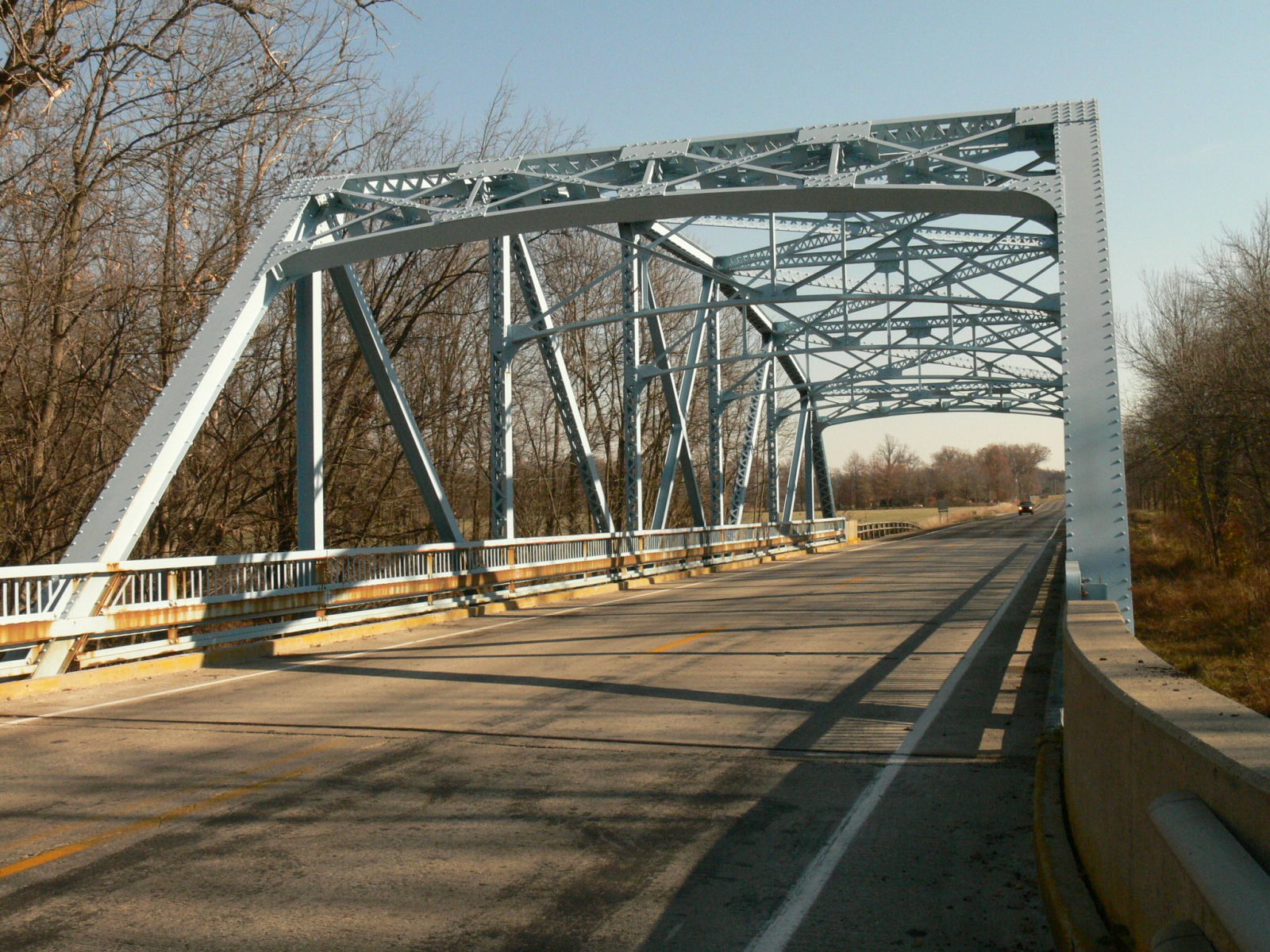
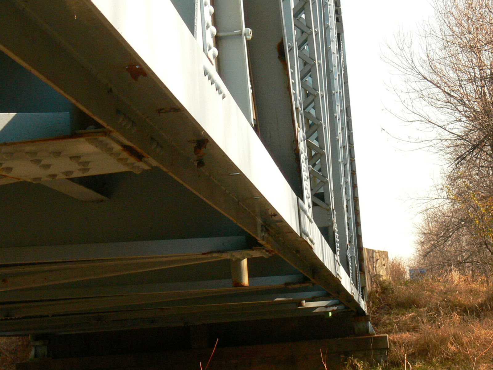
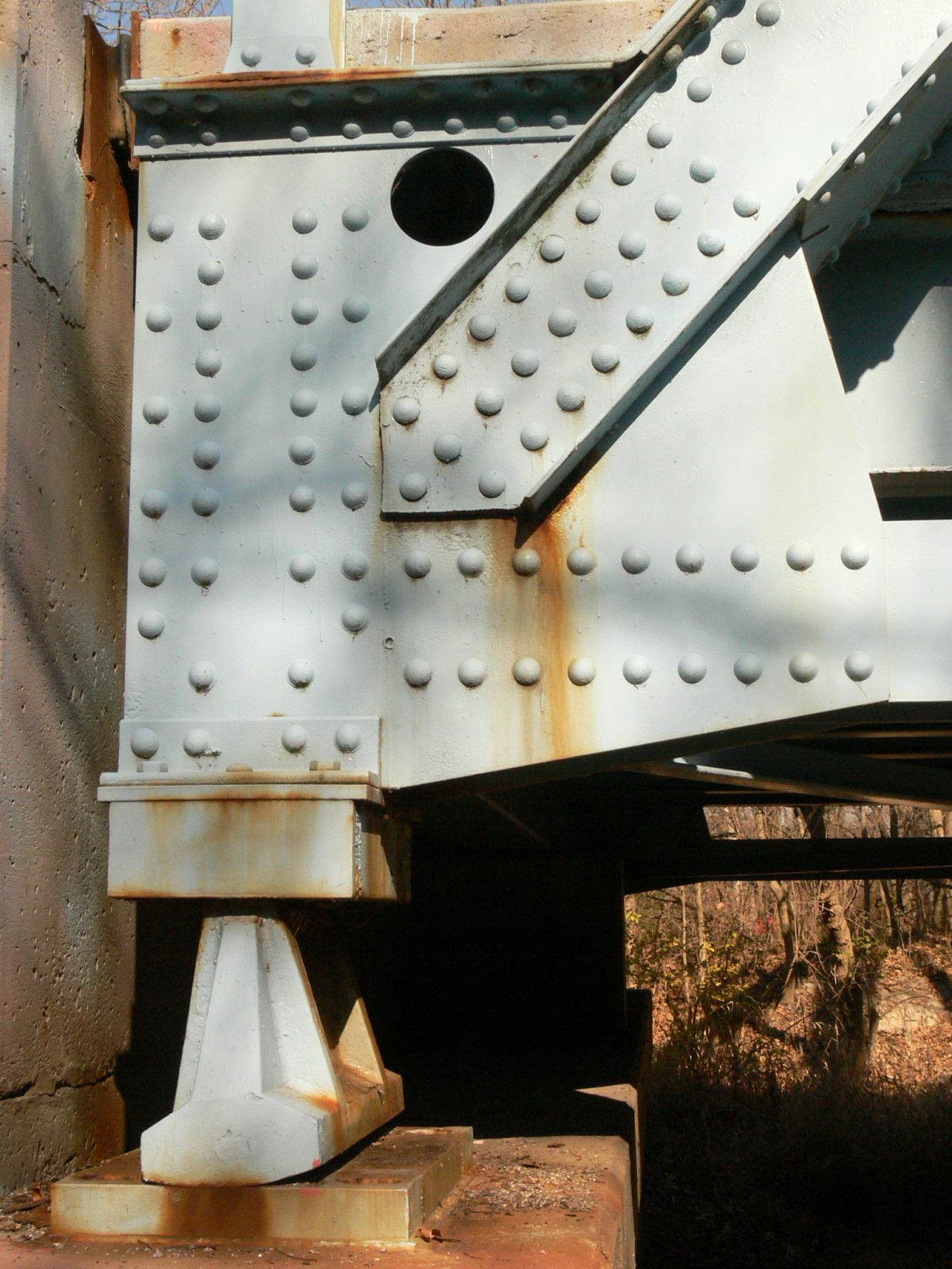
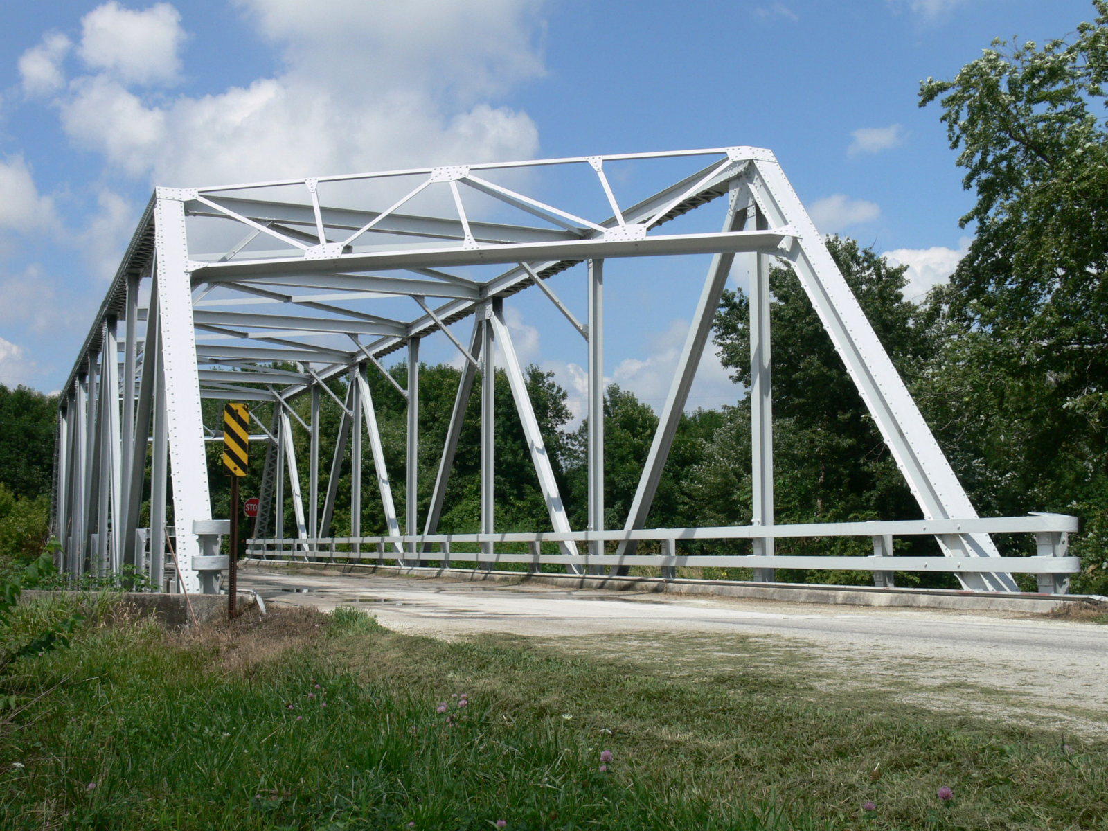
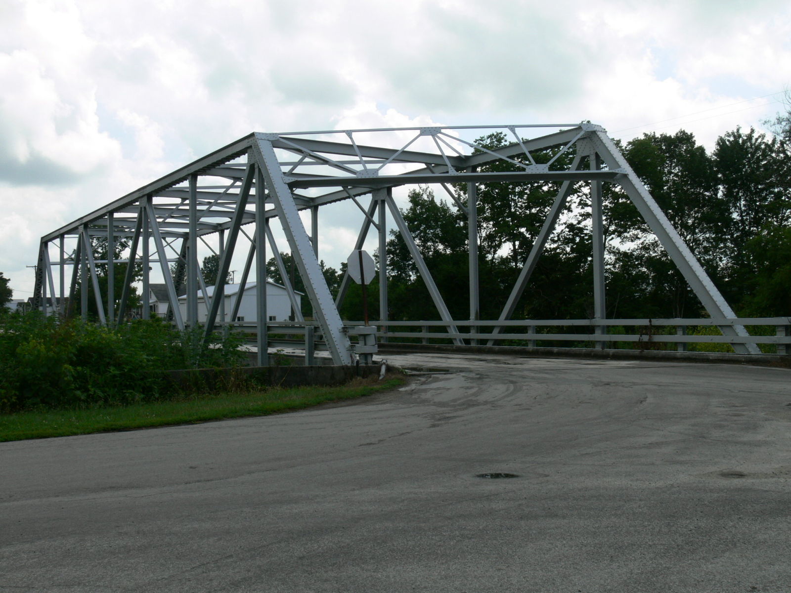
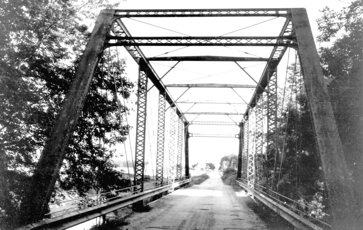
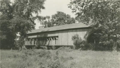
Status: Replaced by a new bridge
Location: 40.511667,-84.971667
Carries CR 500 North over Bear Creek
Design: truss/pony/warren
Design Details: Riveted Warren pony truss
Total Length: 77.1 Feet
Span Length: 71.8 Feet
Overview: Lost Pony truss bridge over Bear Creek on CR 500 North
History: Built 1962
Built: 1962
Location: Jay County
View Bridge Information In Wayback Machine
![]()
143462
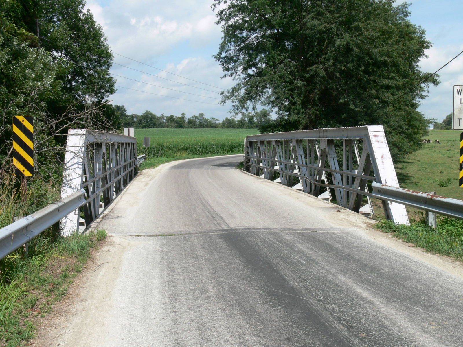
Photo taken by Anthony Dillon in July 2009
143463
Photo taken by Anthony Dillon in July 2009
154217
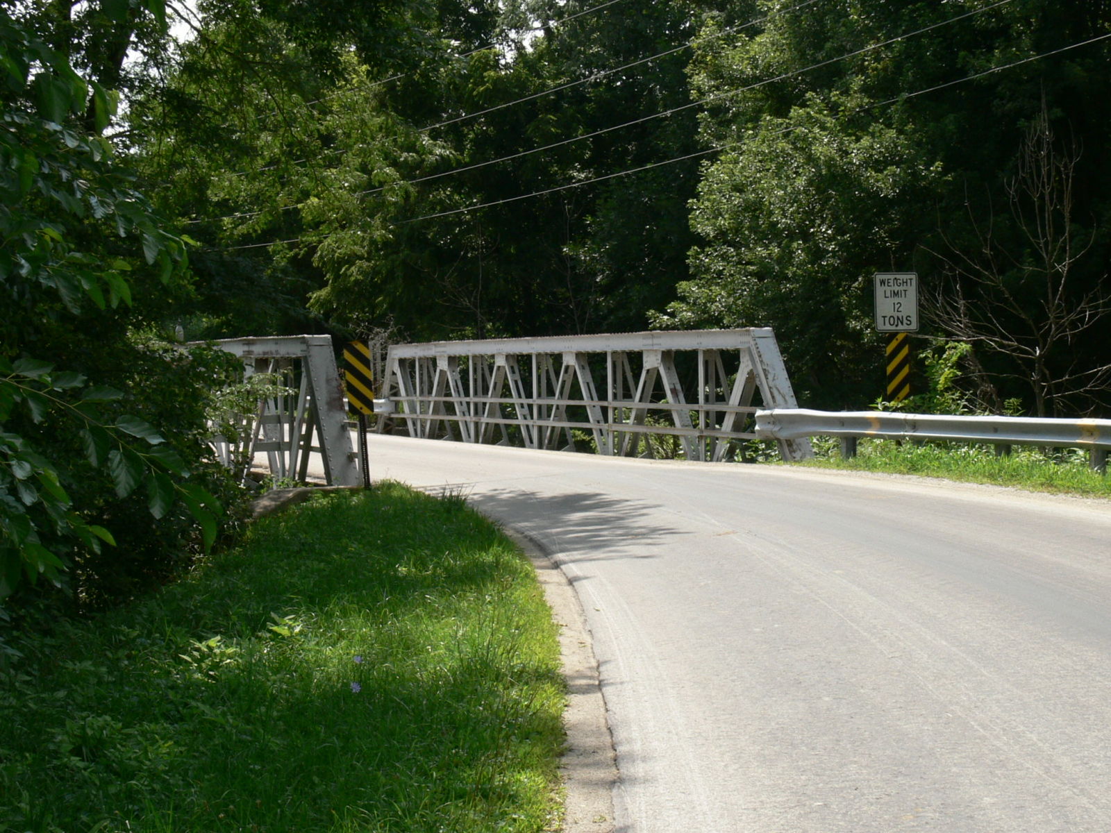
Photo taken by Anthony Dillon in July 2009
154218
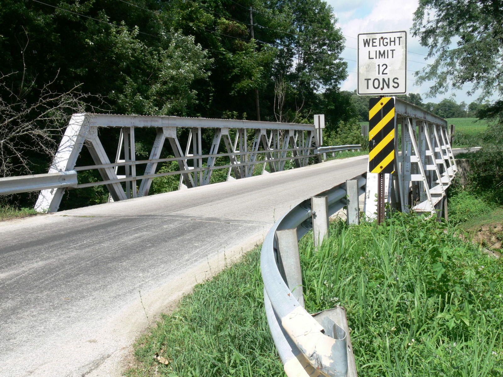
Photo taken by Anthony Dillon in July 2009
154219
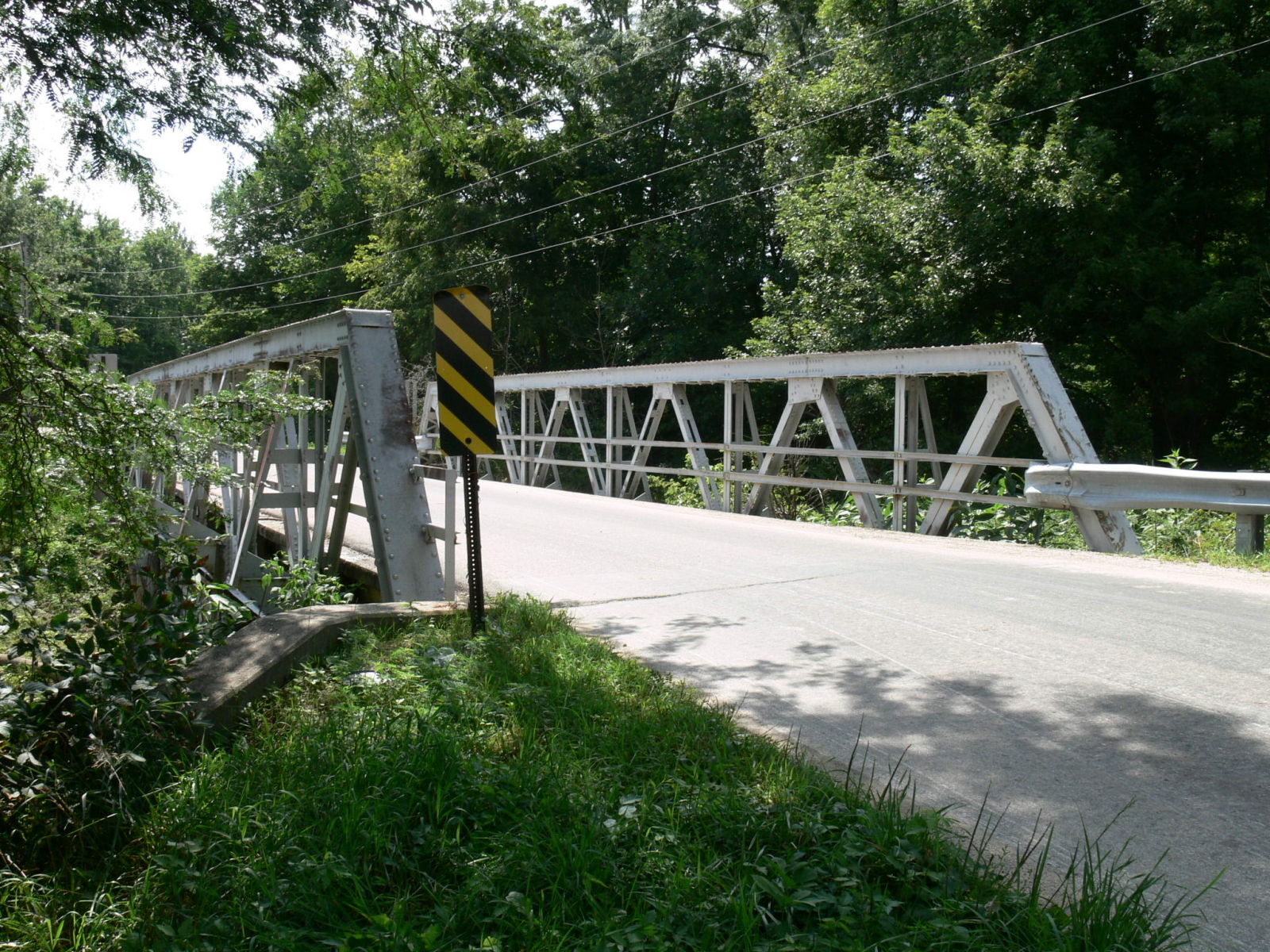
Photo taken by Anthony Dillon in July 2009
186826
Photo taken by Anthony Dillon in November 2010
186827
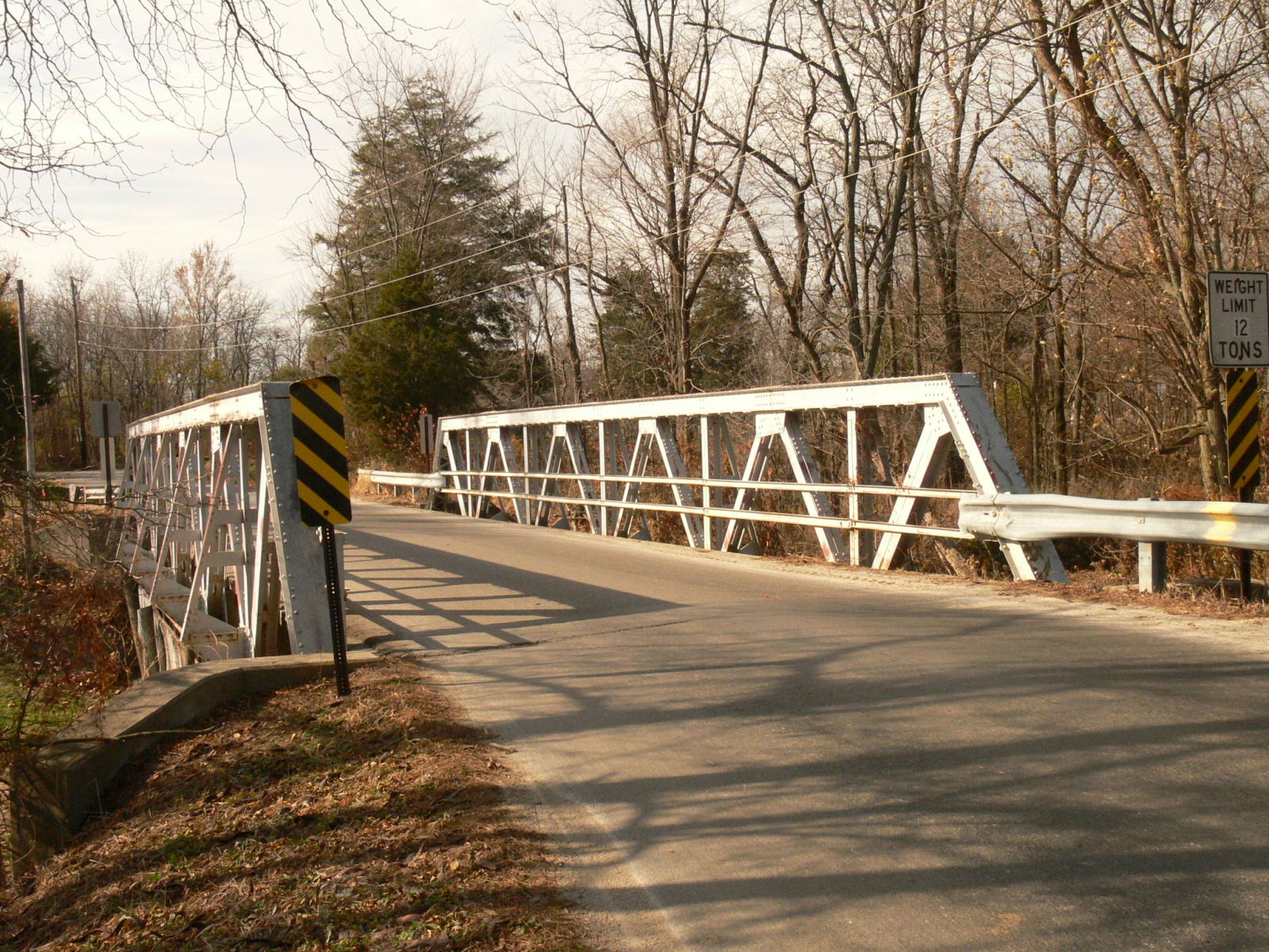
Photo taken by Anthony Dillon in November 2010
186828
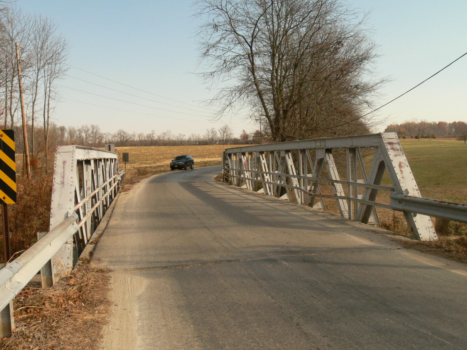
Photo taken by Anthony Dillon in November 2010
186829
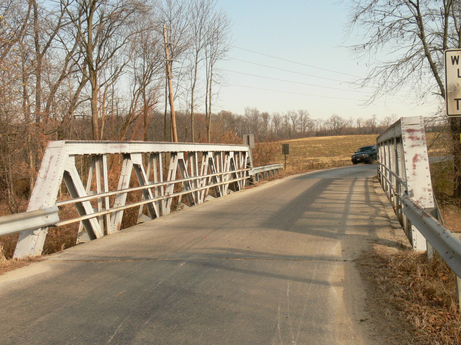
Photo taken by Anthony Dillon in November 2010
186830
Photo taken by Anthony Dillon in November 2010
186831
Not what you want to see near a historic bridge!
Photo taken by Anthony Dillon in November 2010
186832
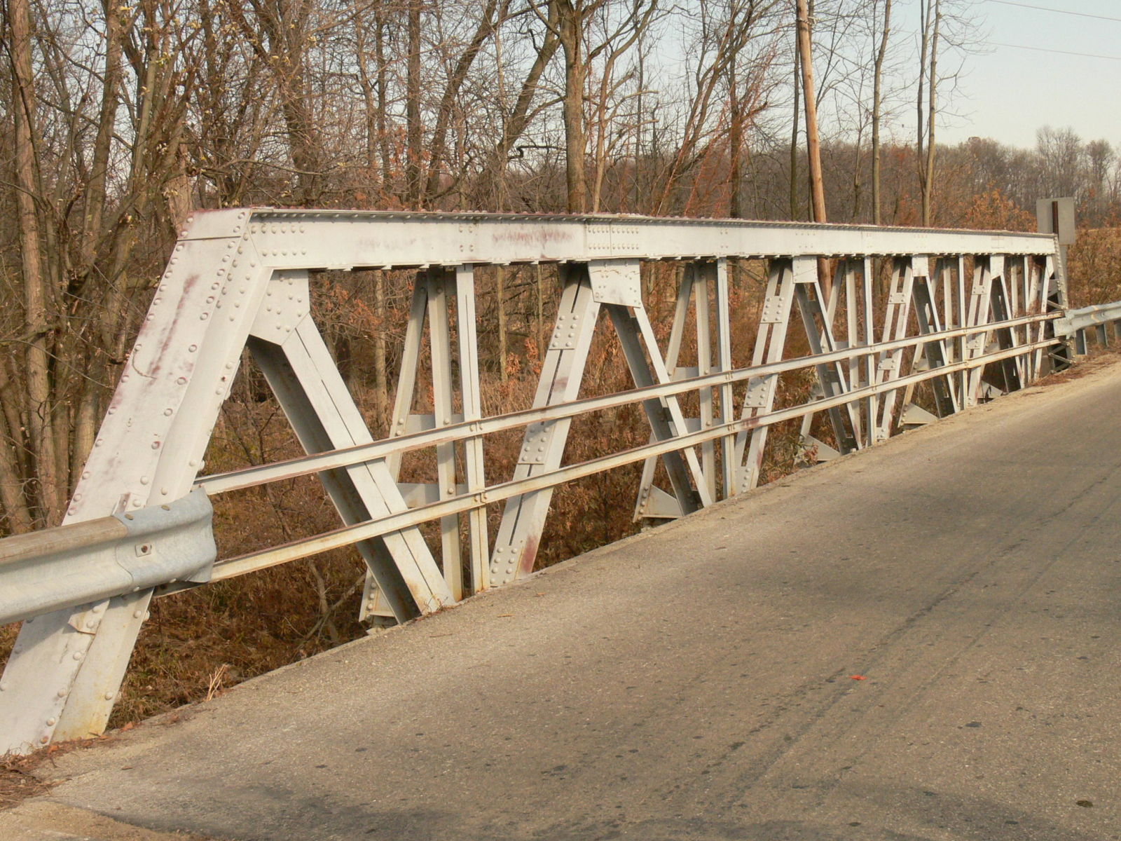
Photo taken by Anthony Dillon in November 2010
186833
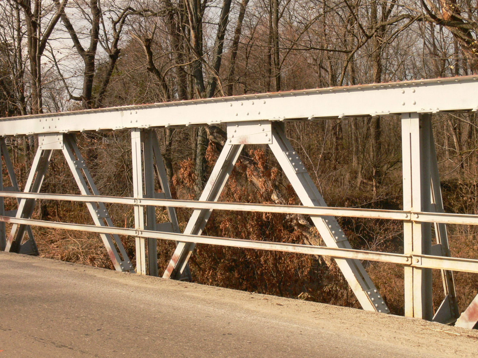
Photo taken by Anthony Dillon in November 2010
186834
Photo taken by Anthony Dillon in November 2010
186835
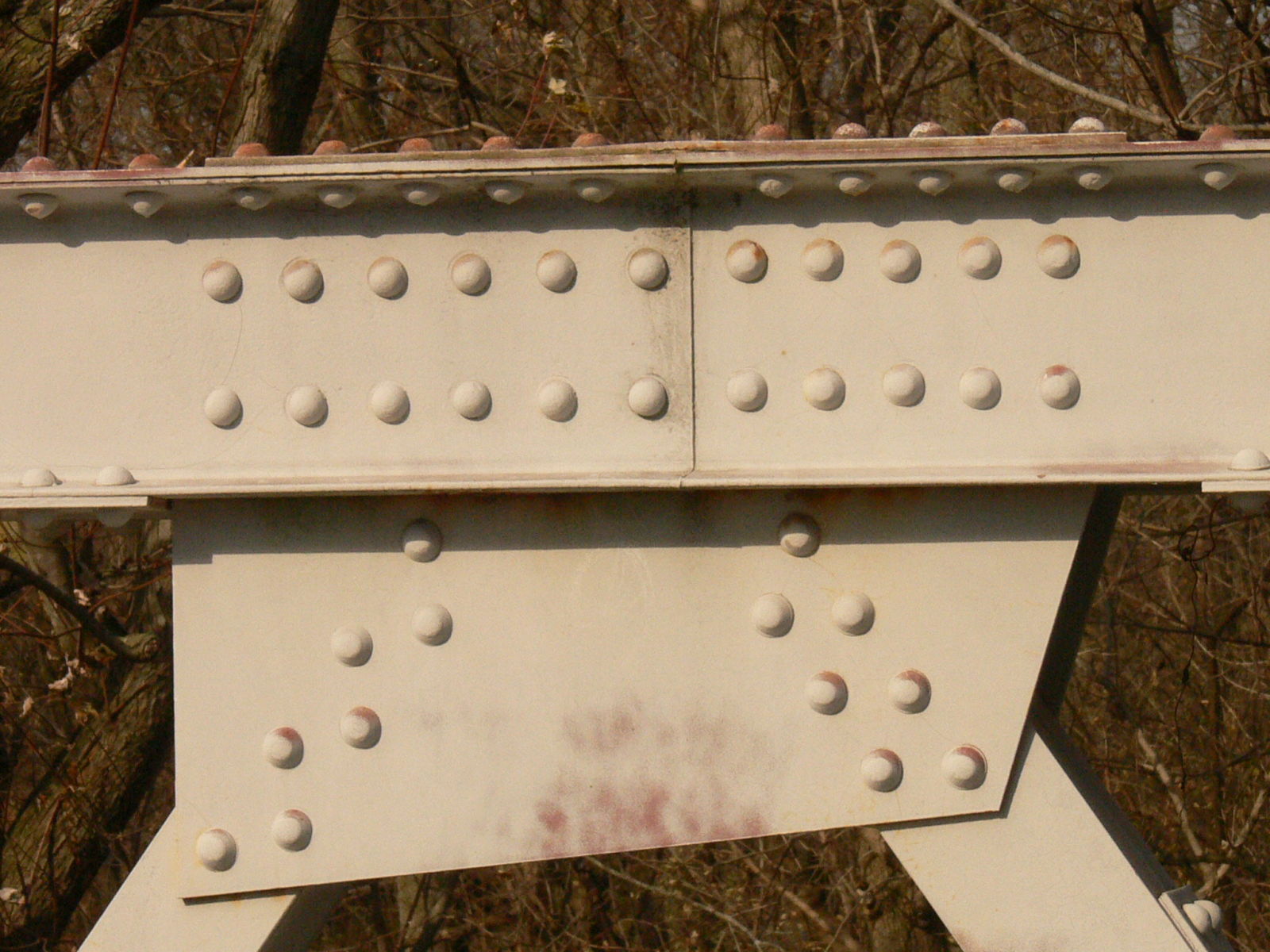
Photo taken by Anthony Dillon in November 2010
186836
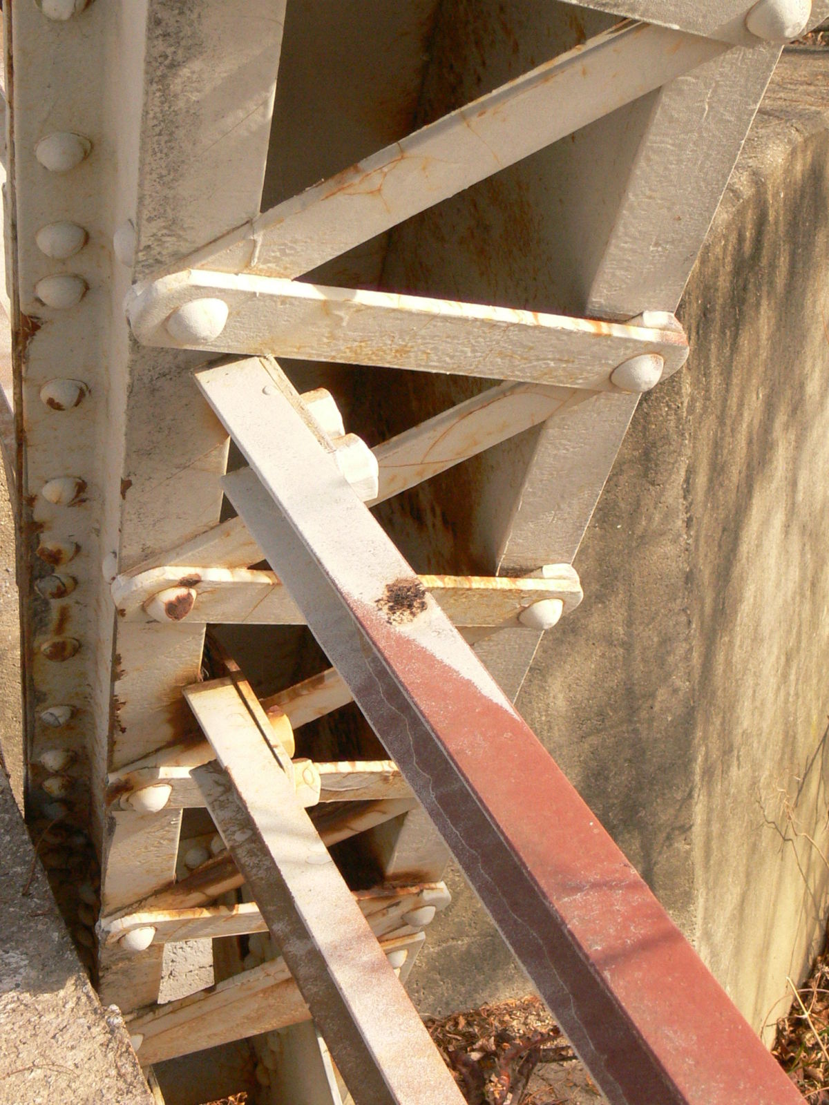
Photo taken by Anthony Dillon in November 2010
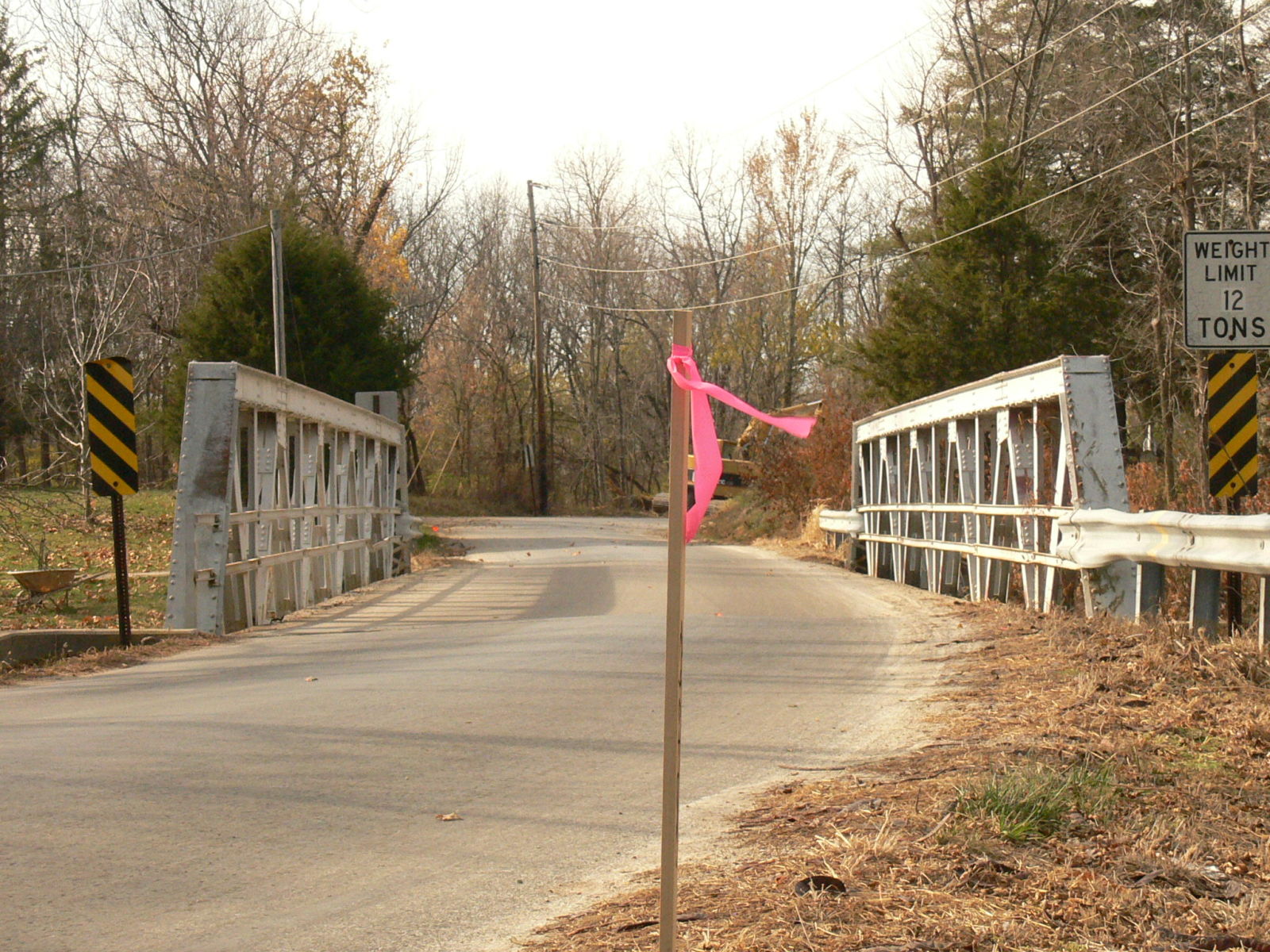
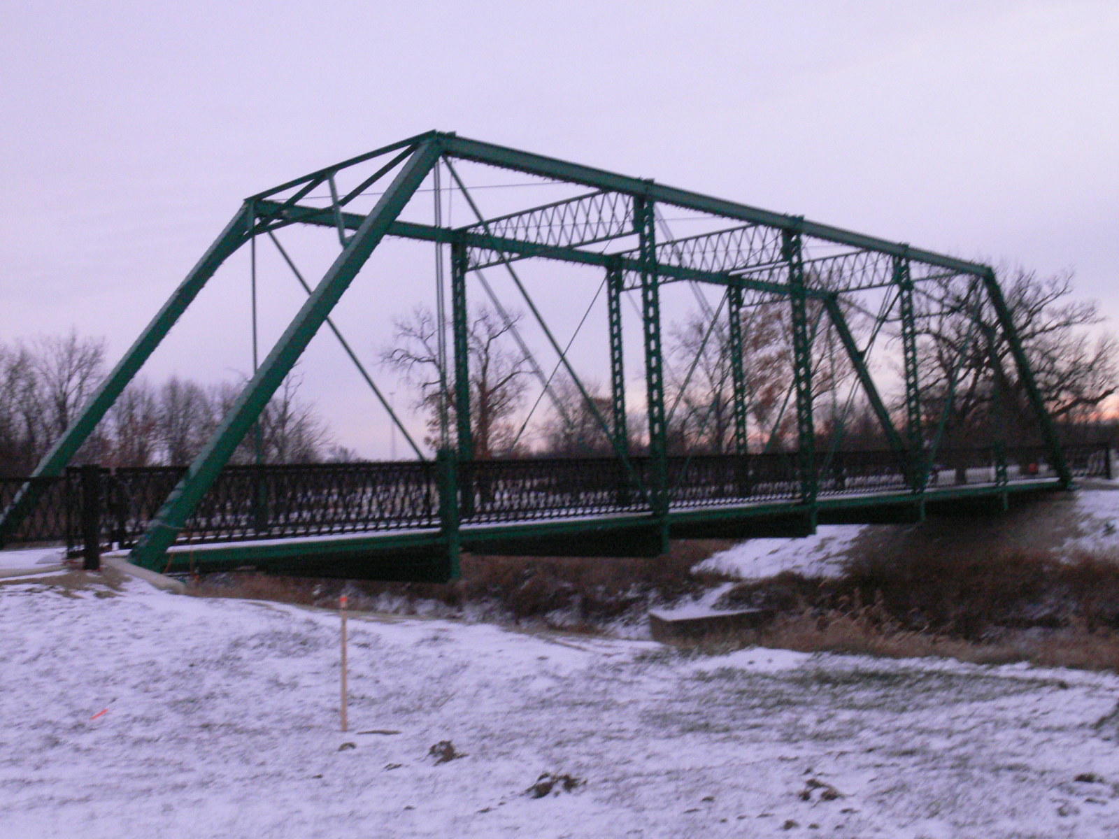
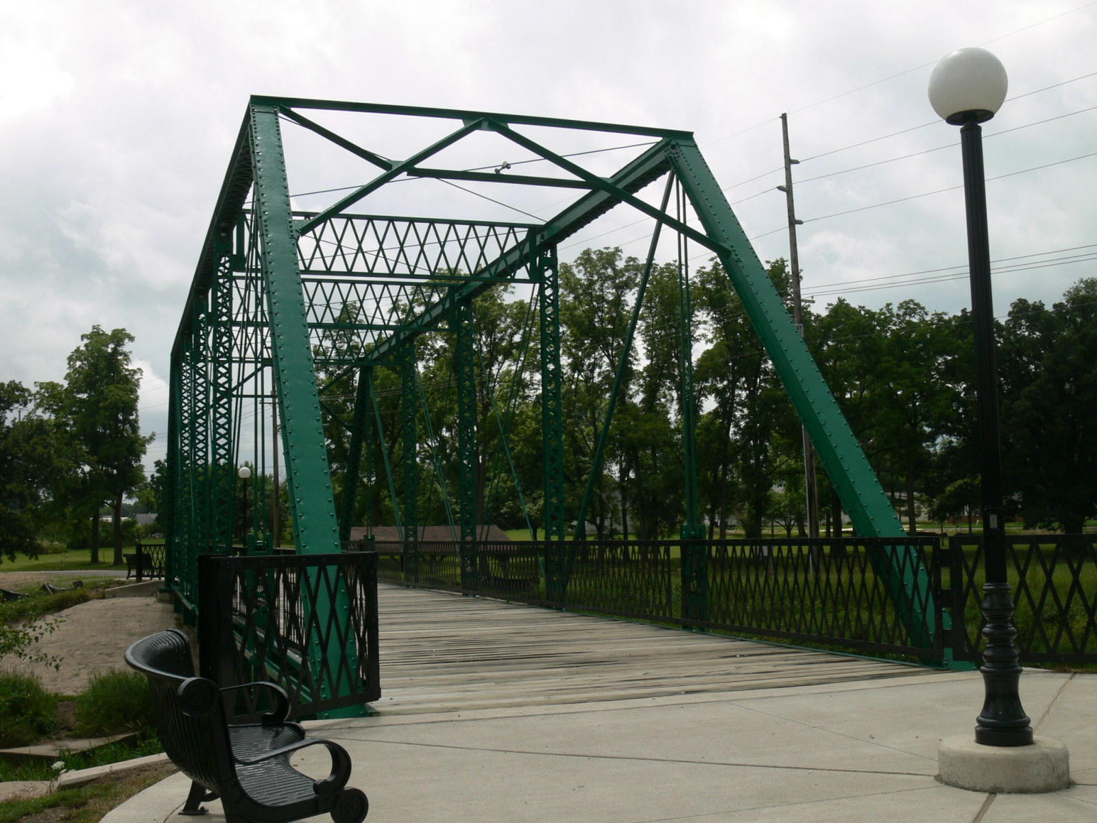
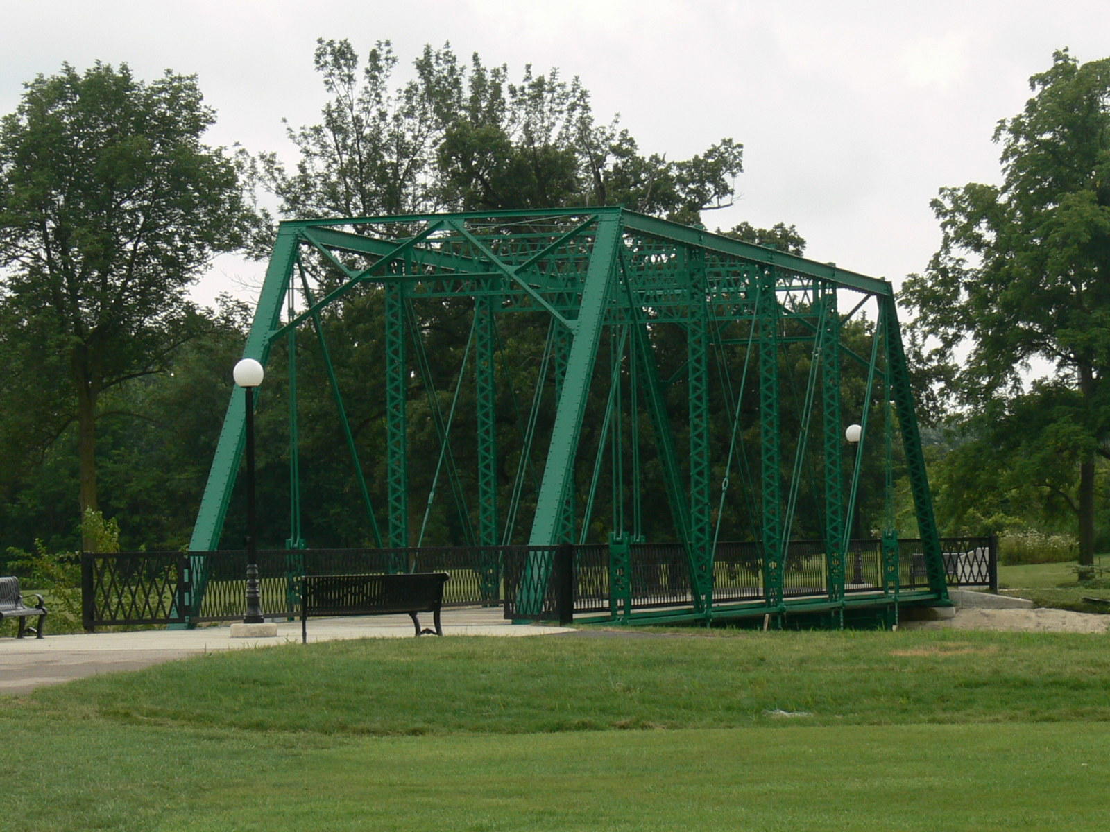
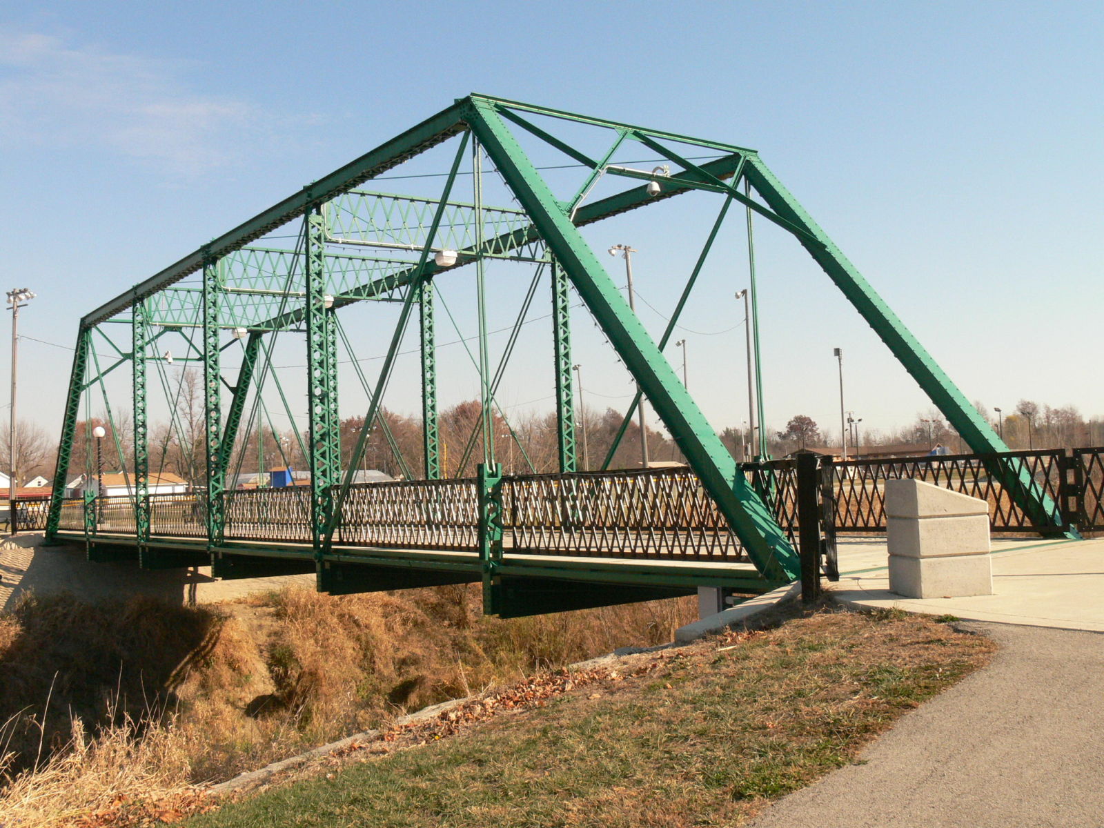
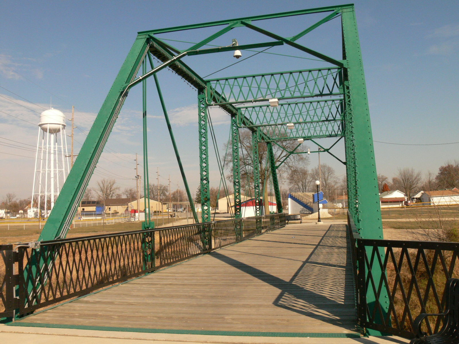
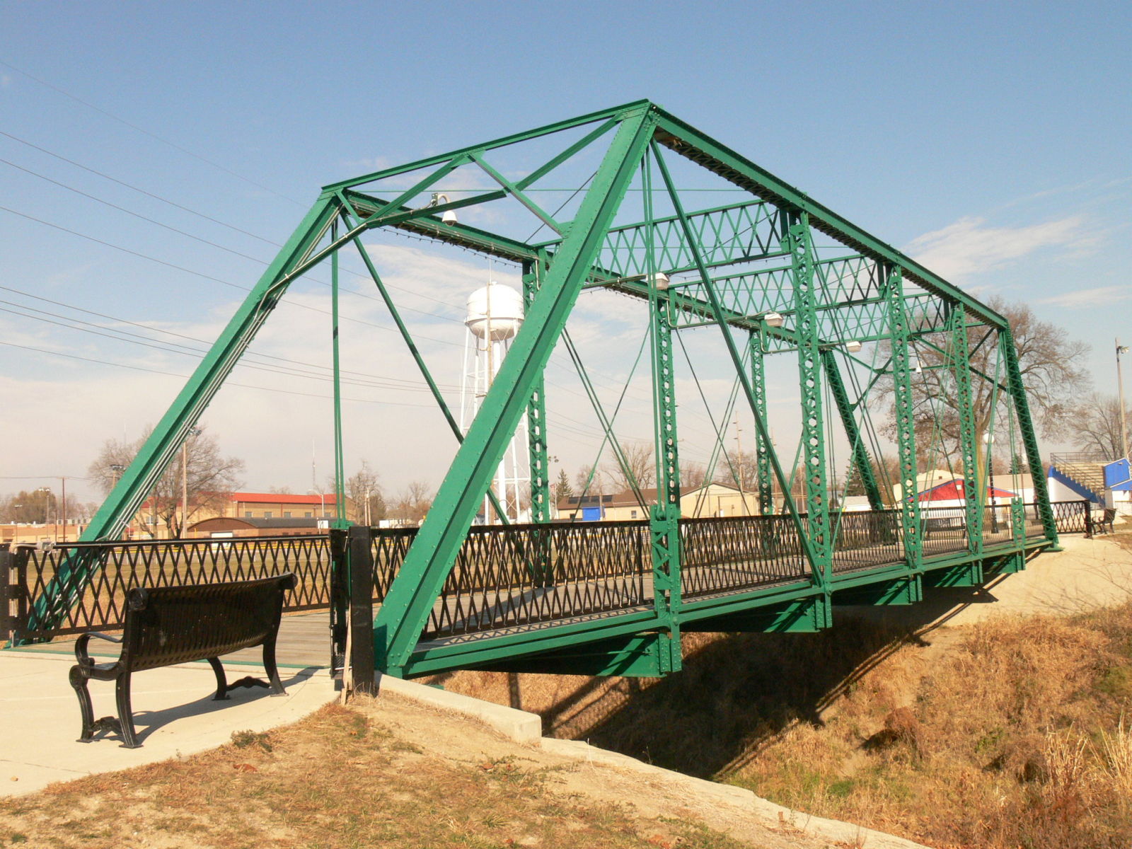
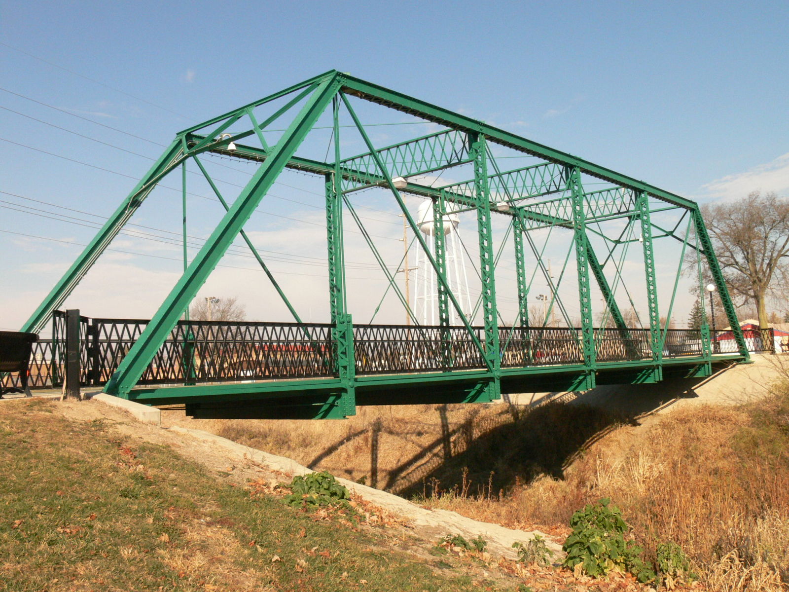
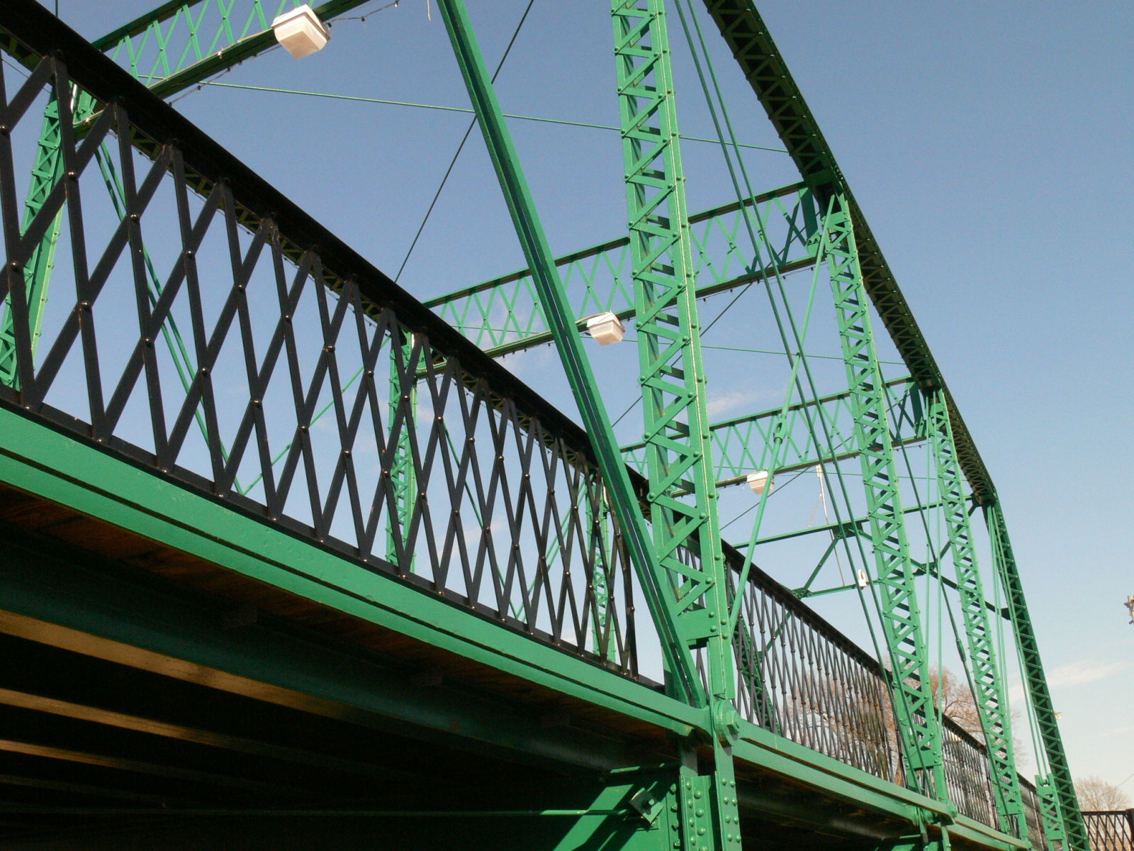
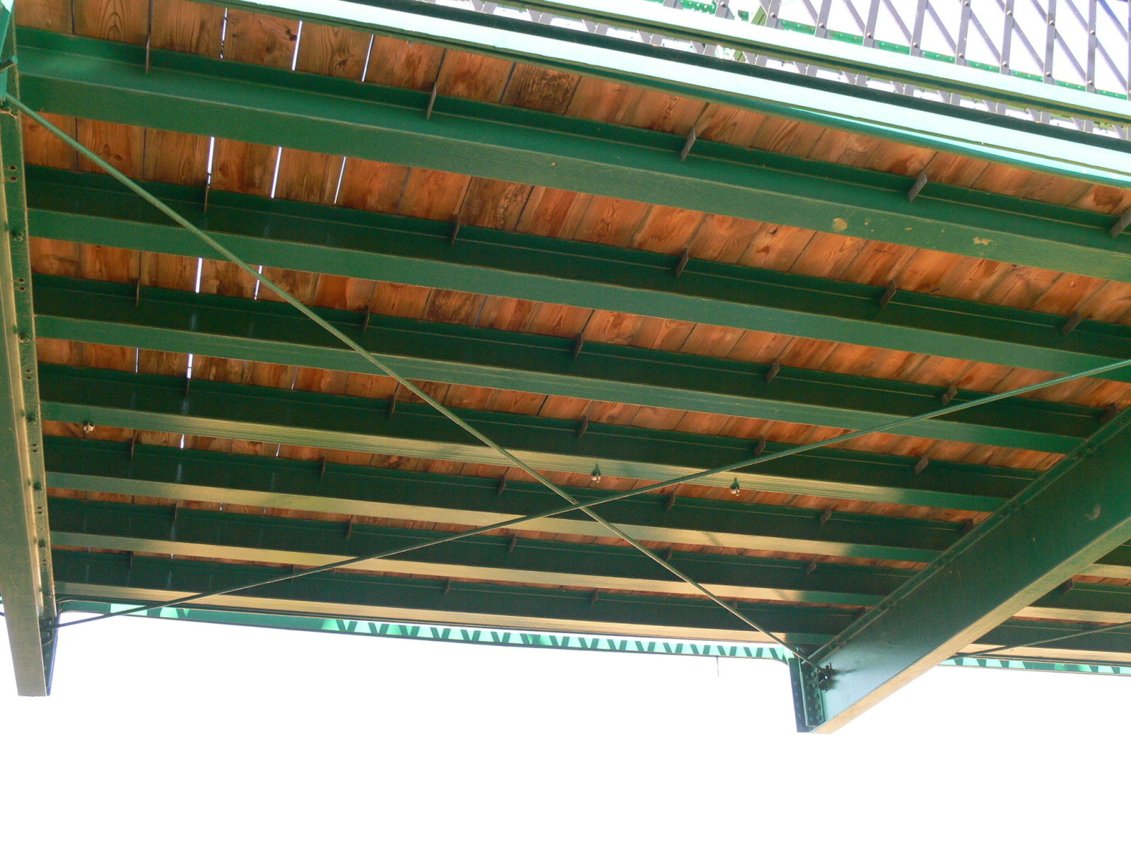
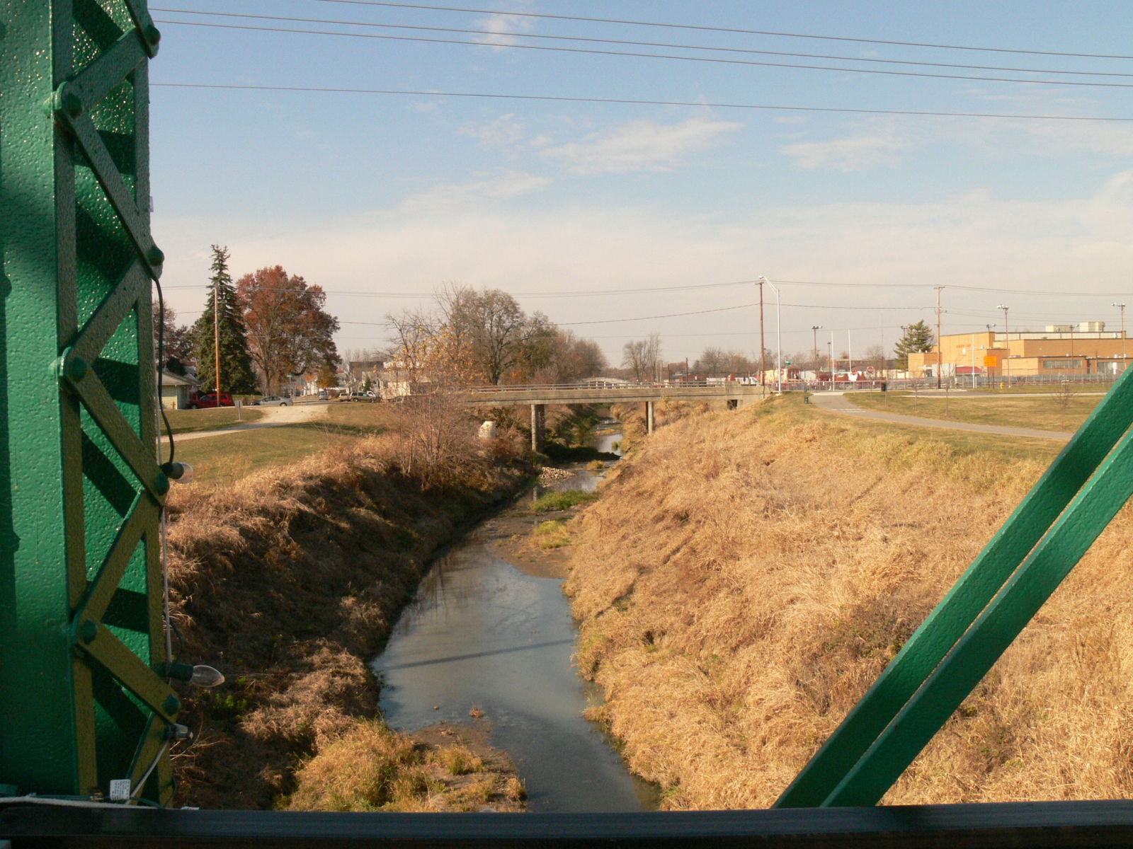
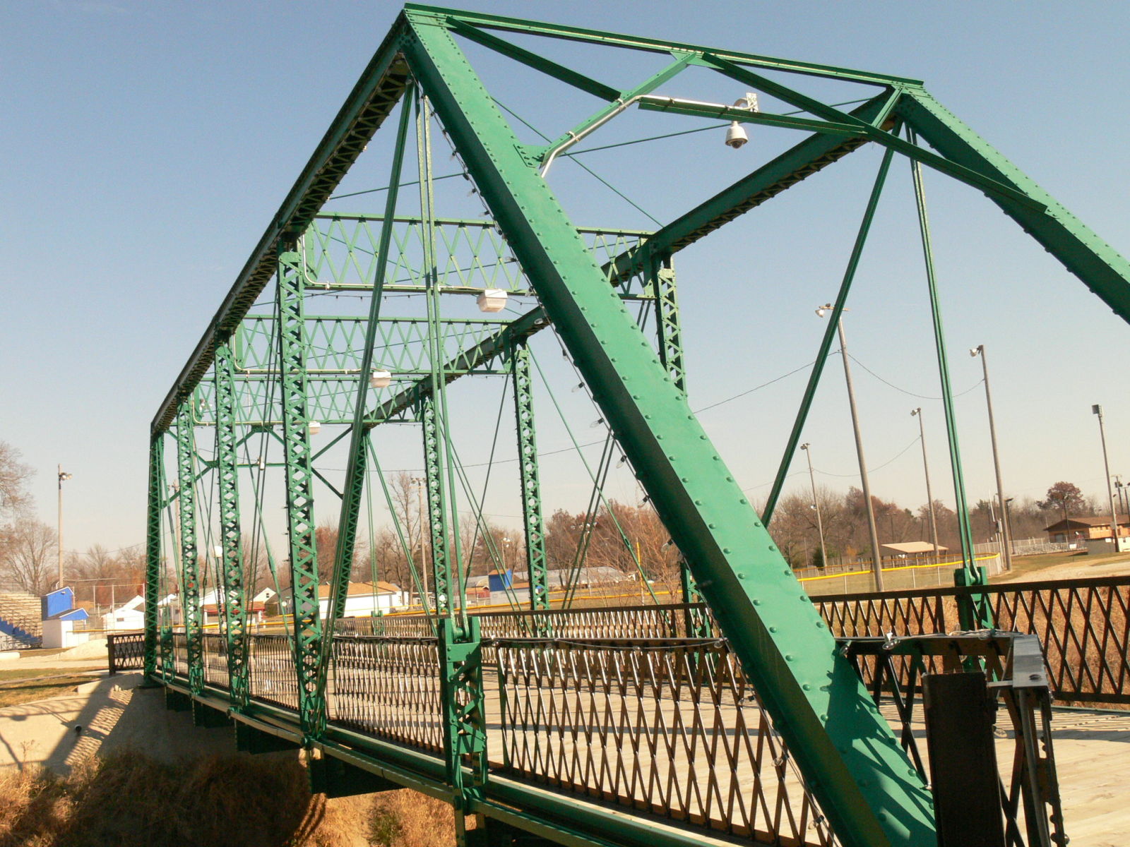
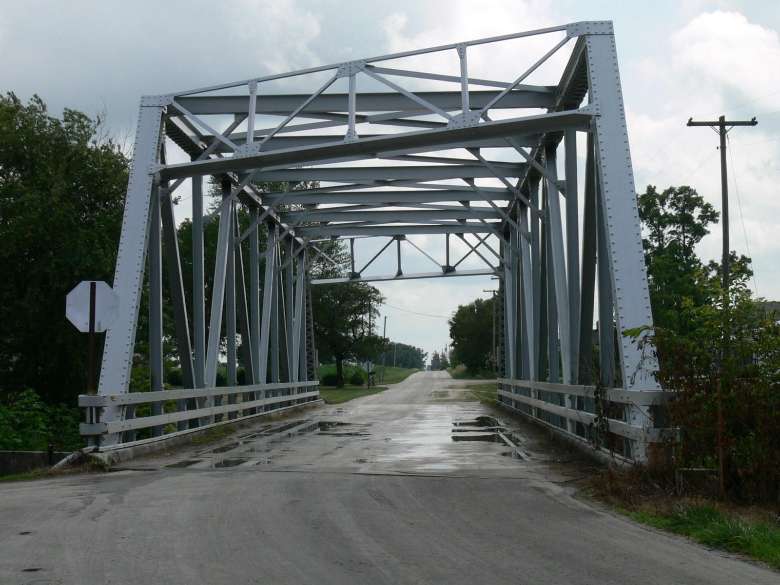
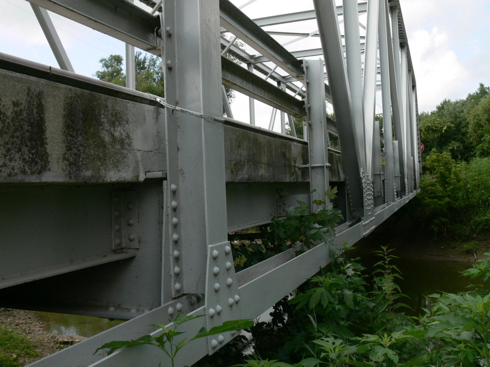
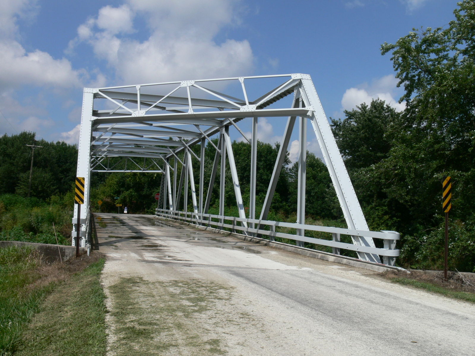
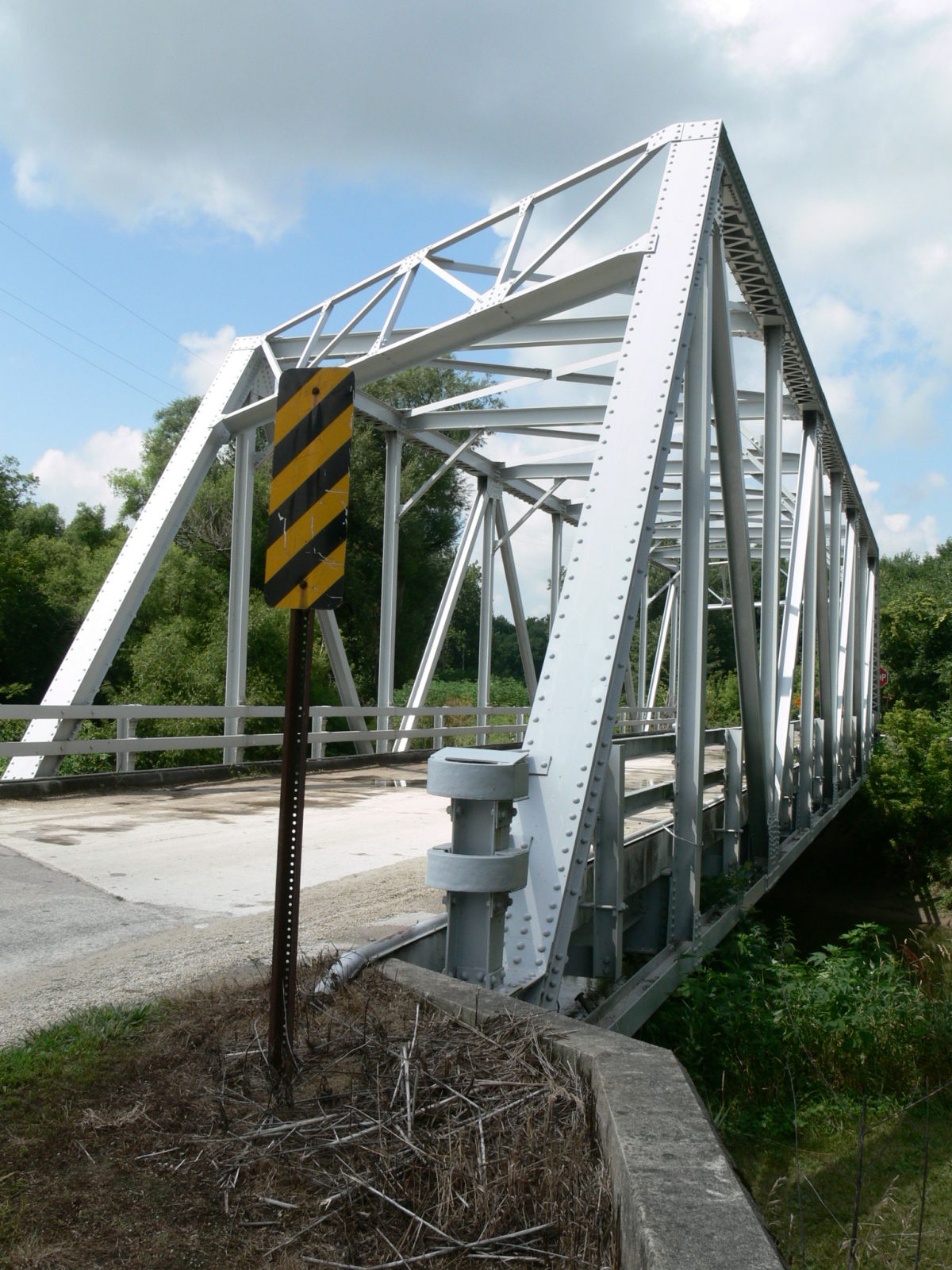
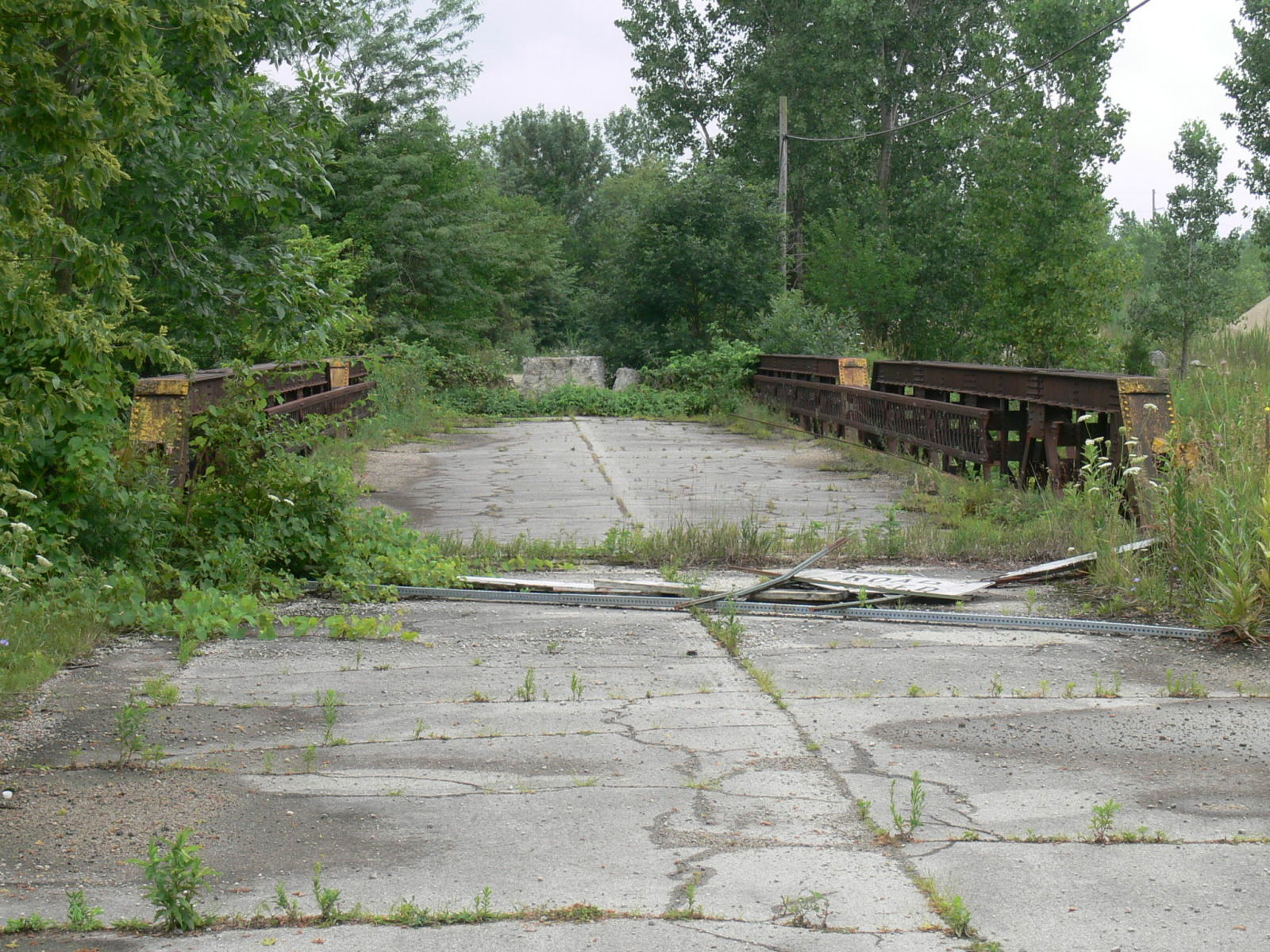
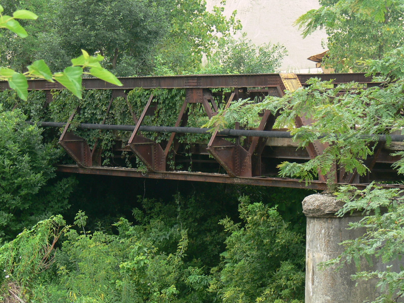
![]()
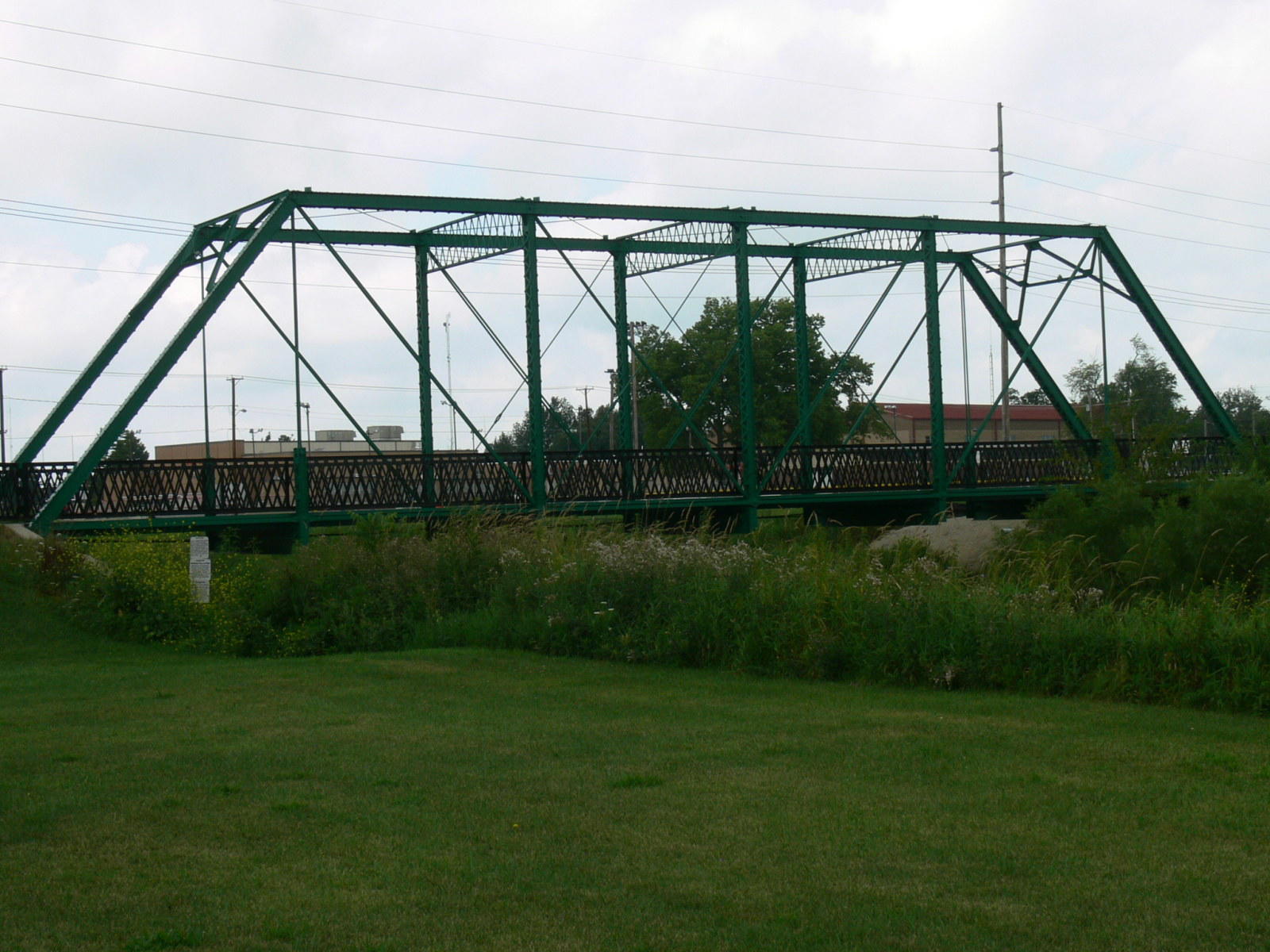
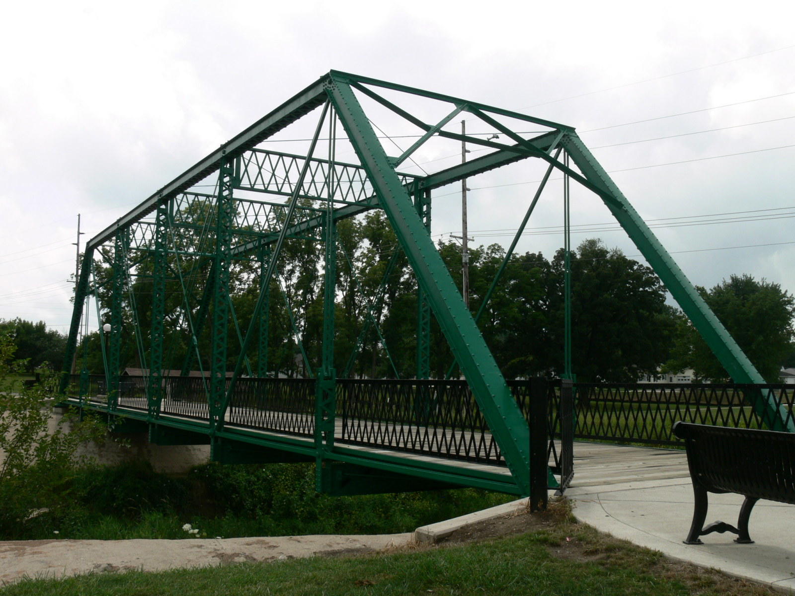
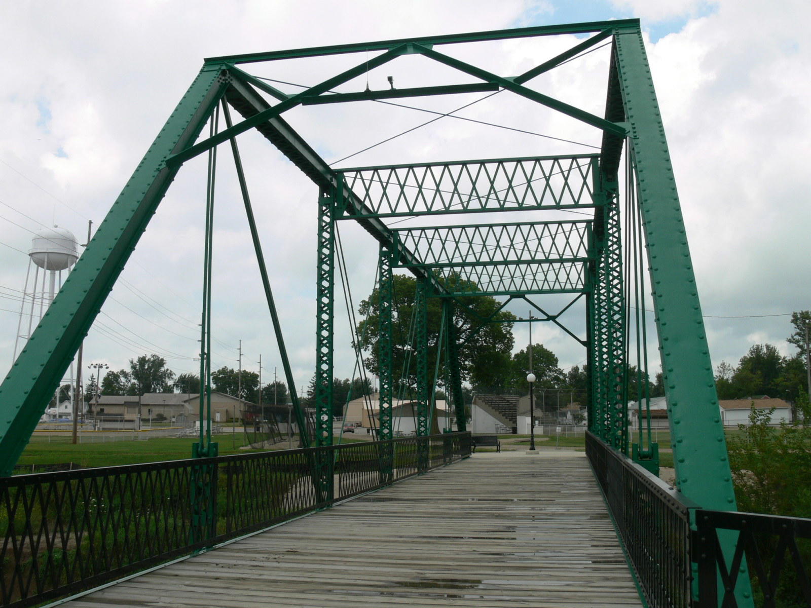
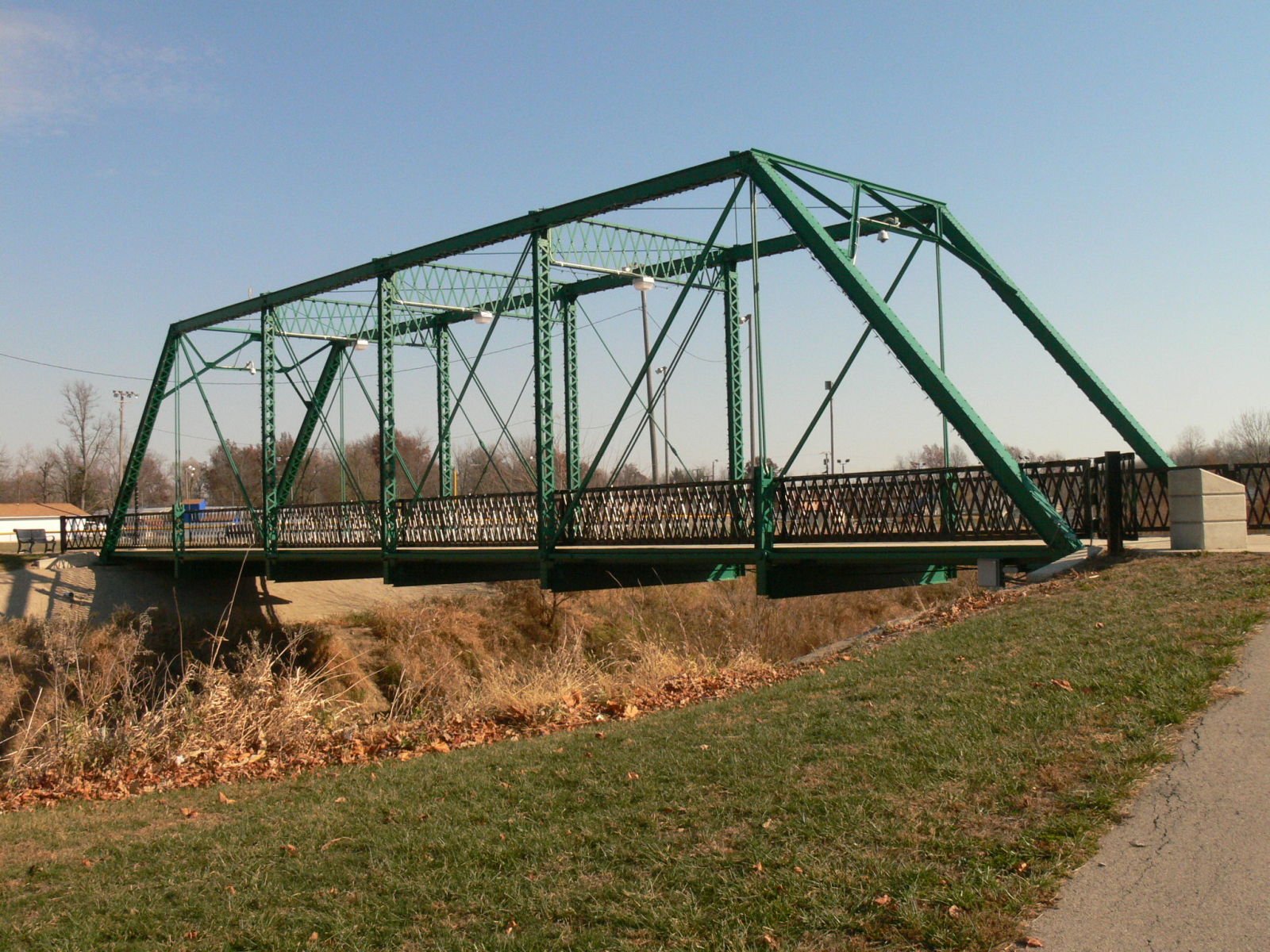
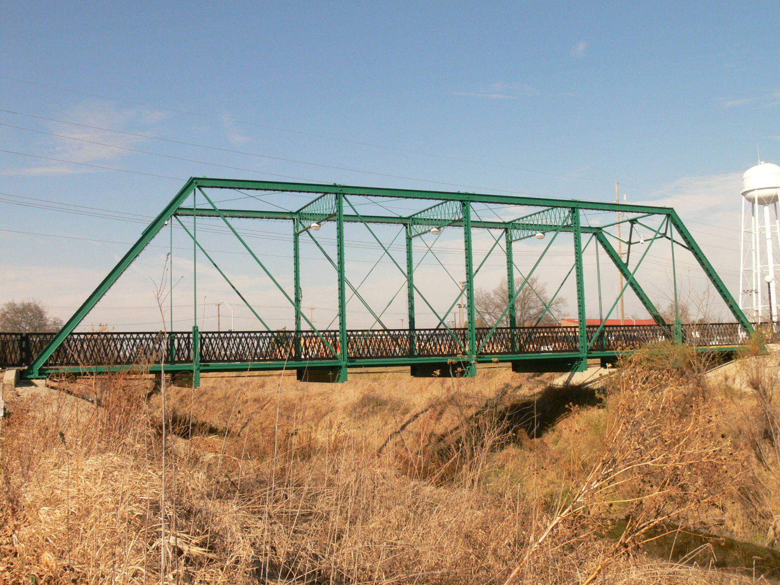
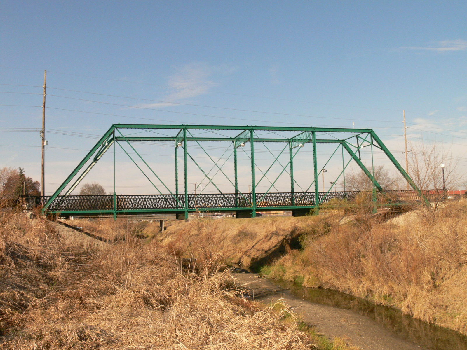
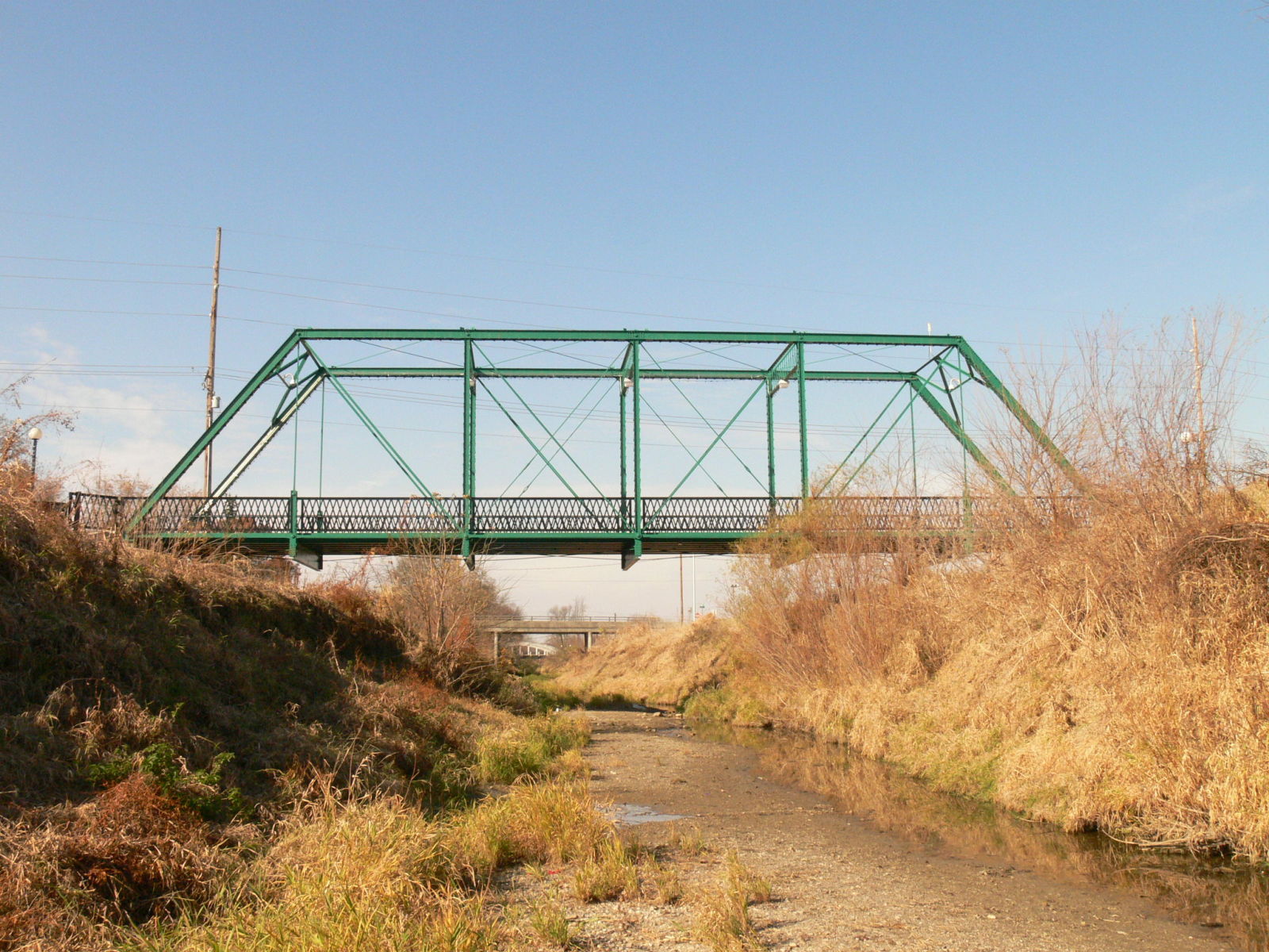
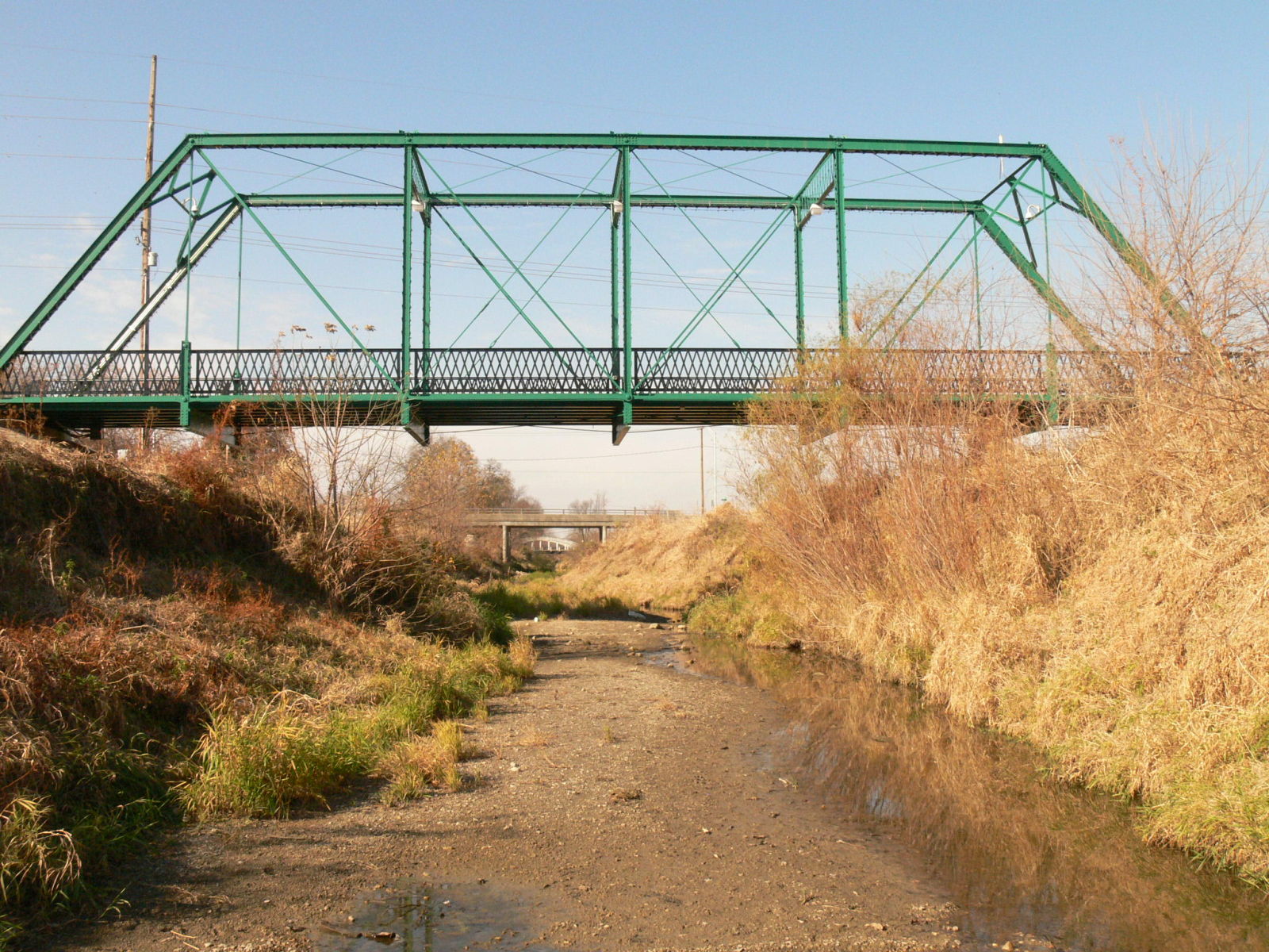
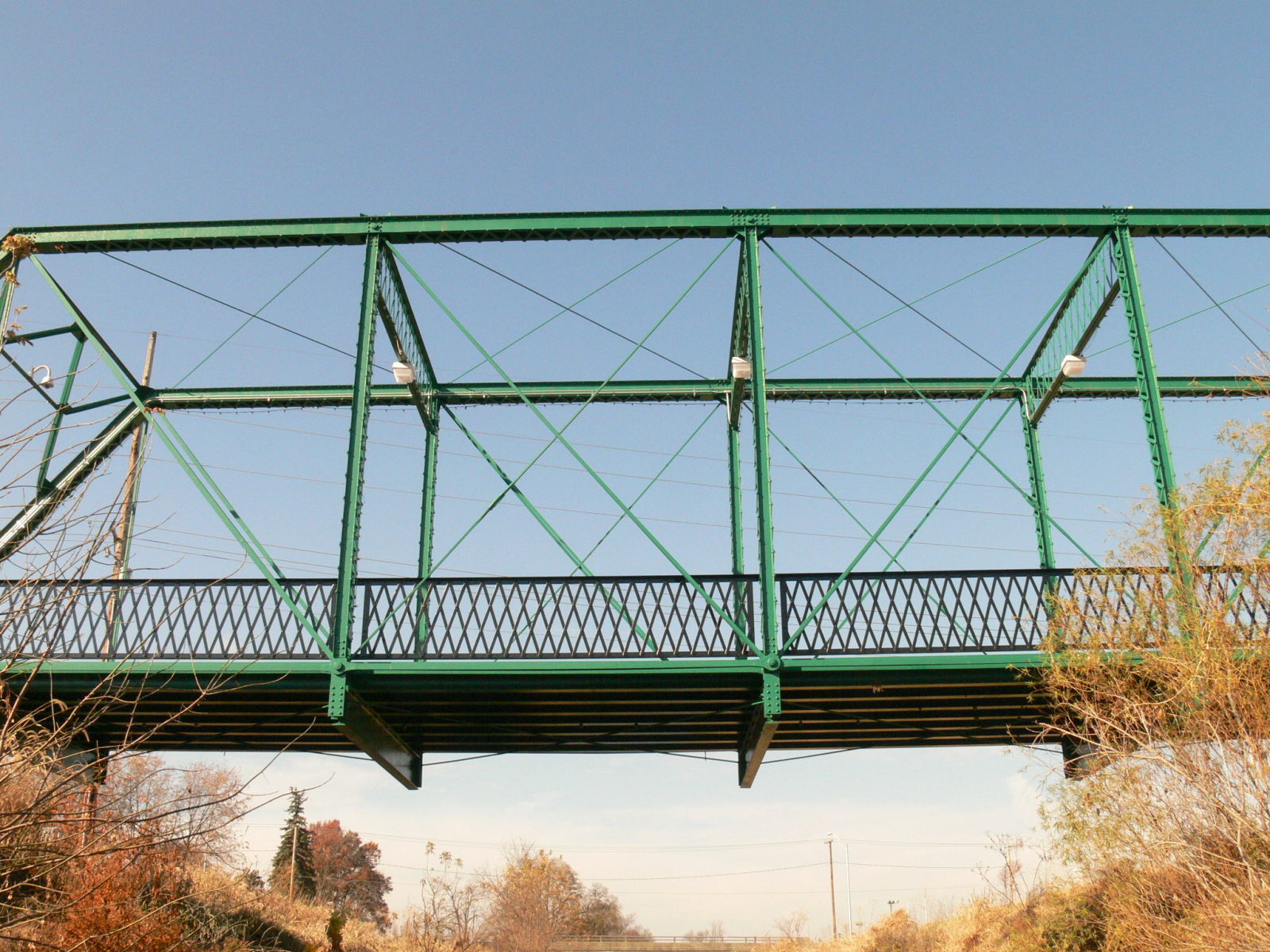
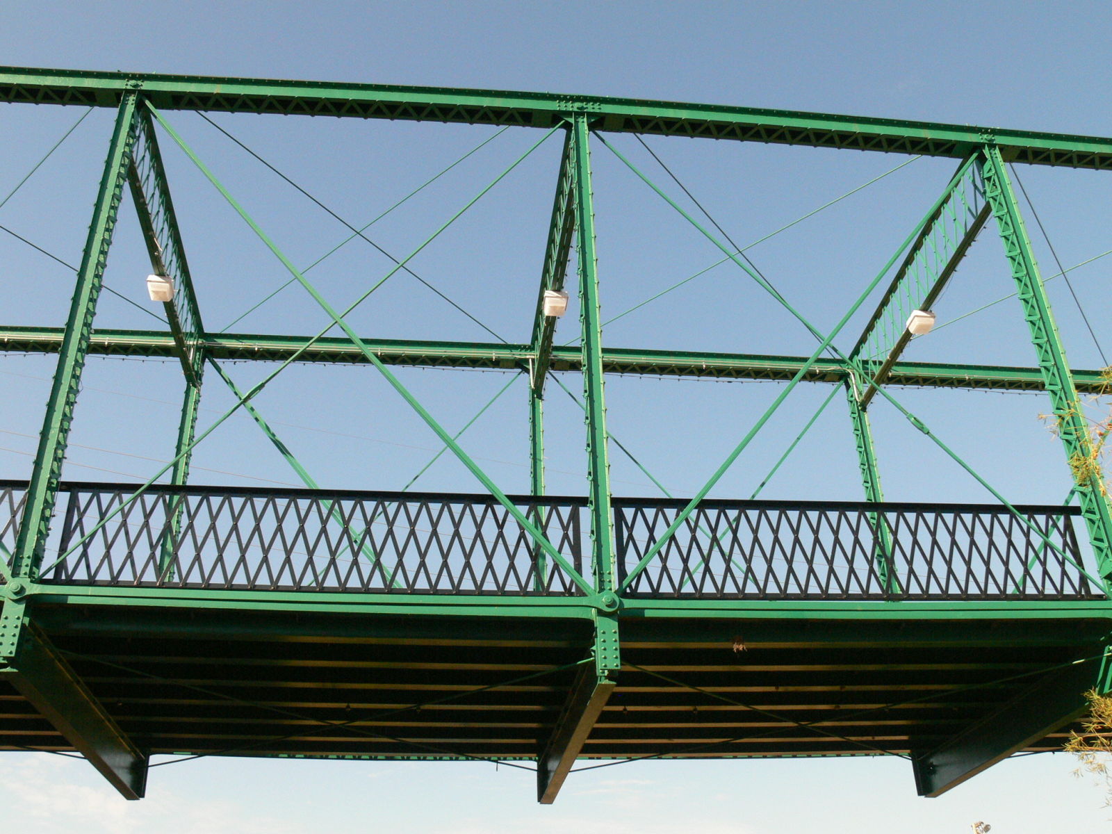
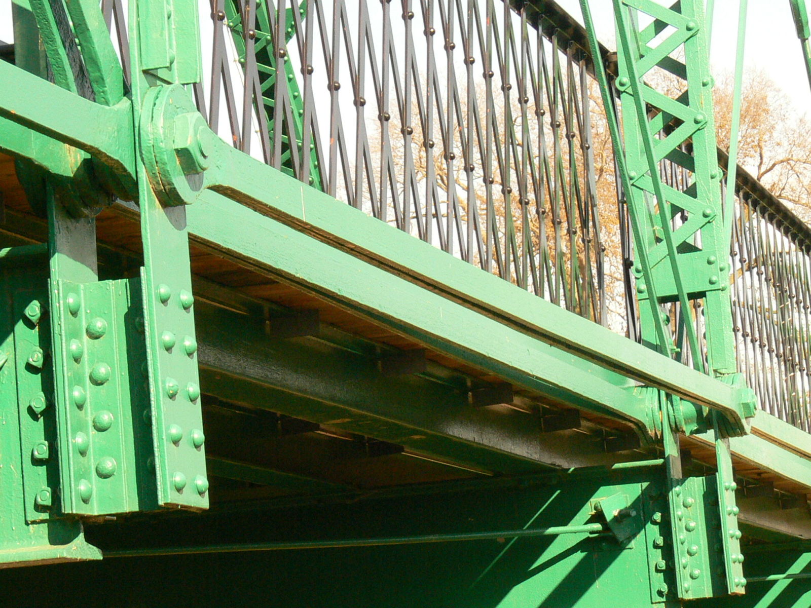
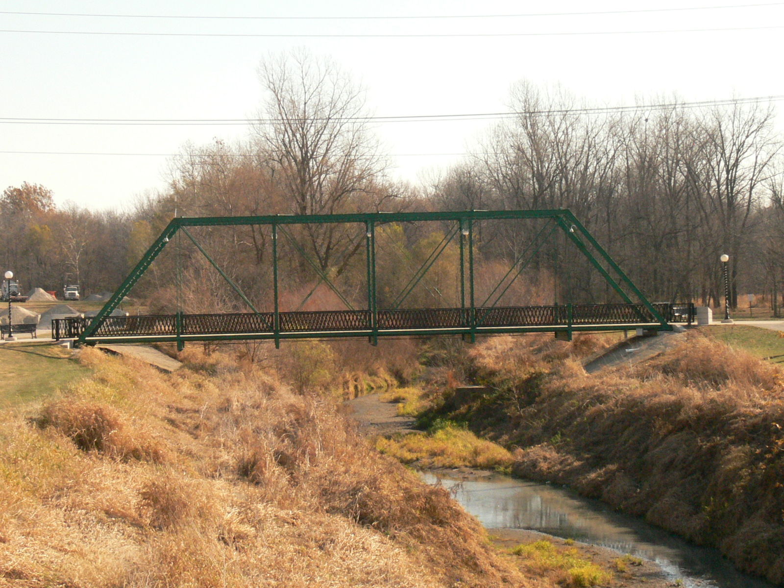
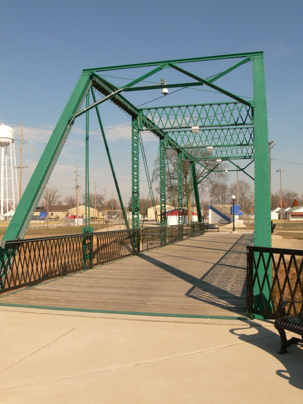
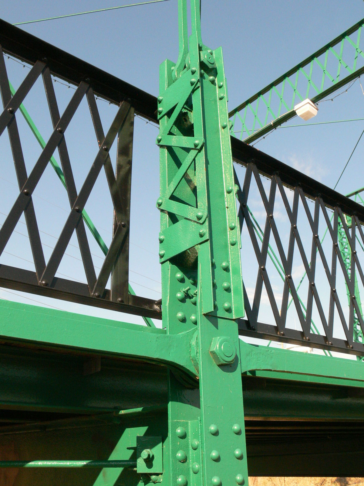
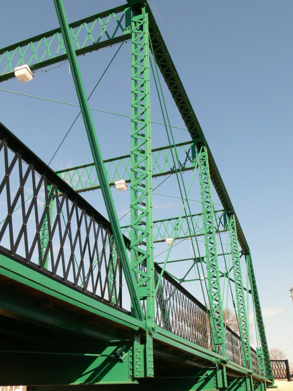
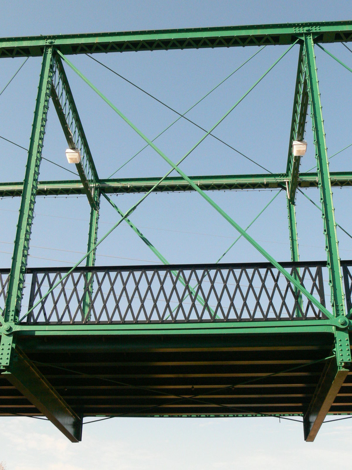
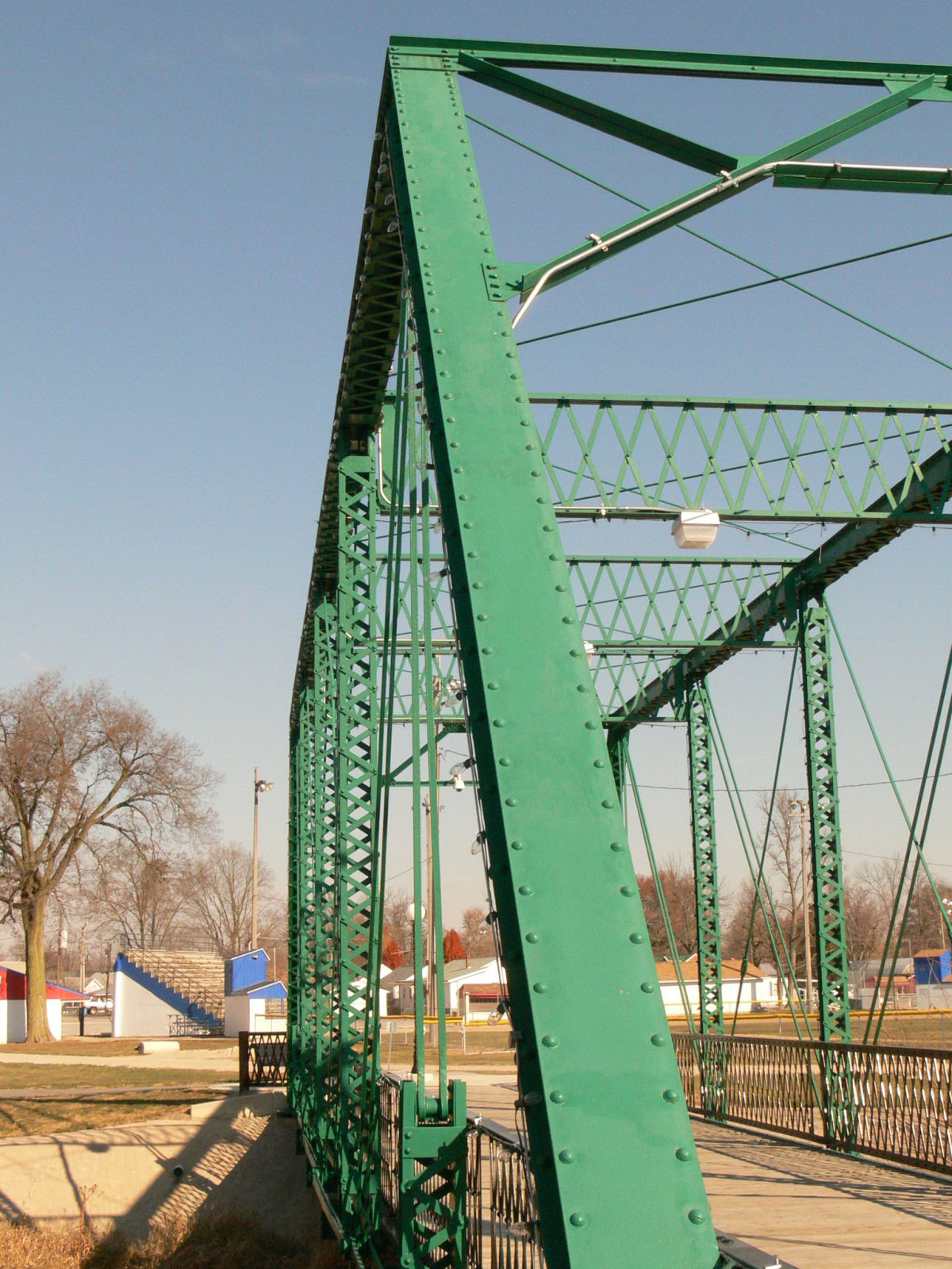
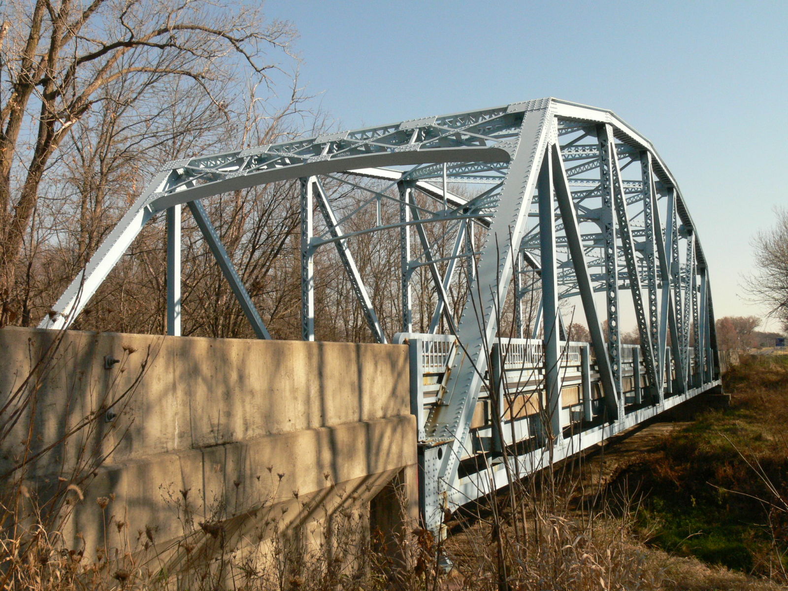
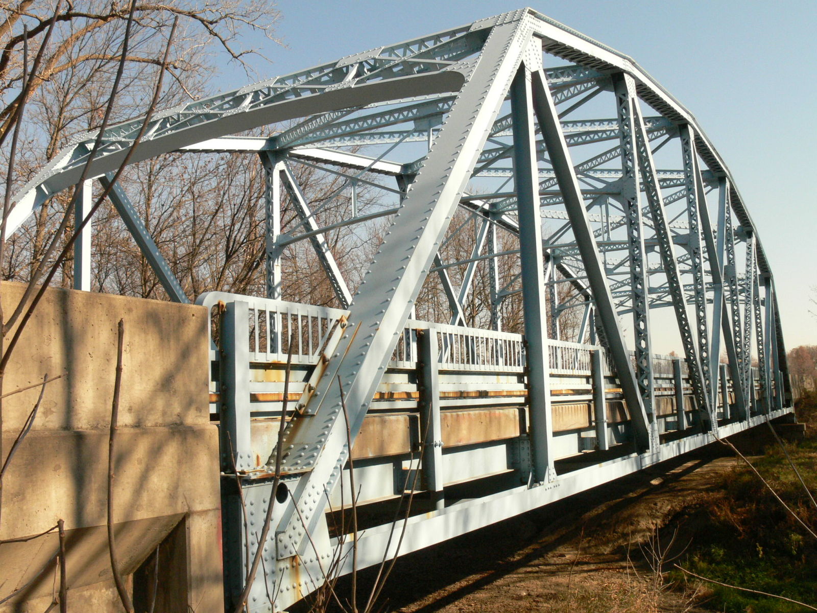
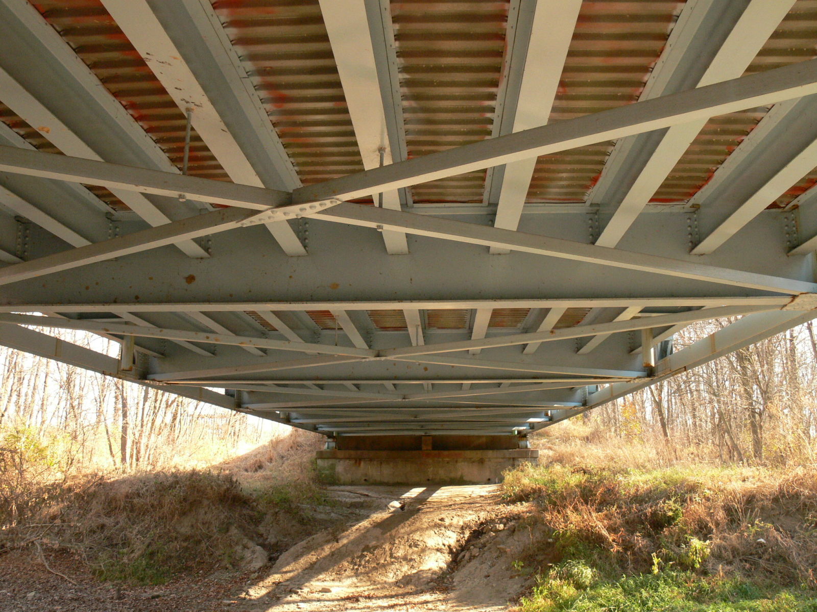
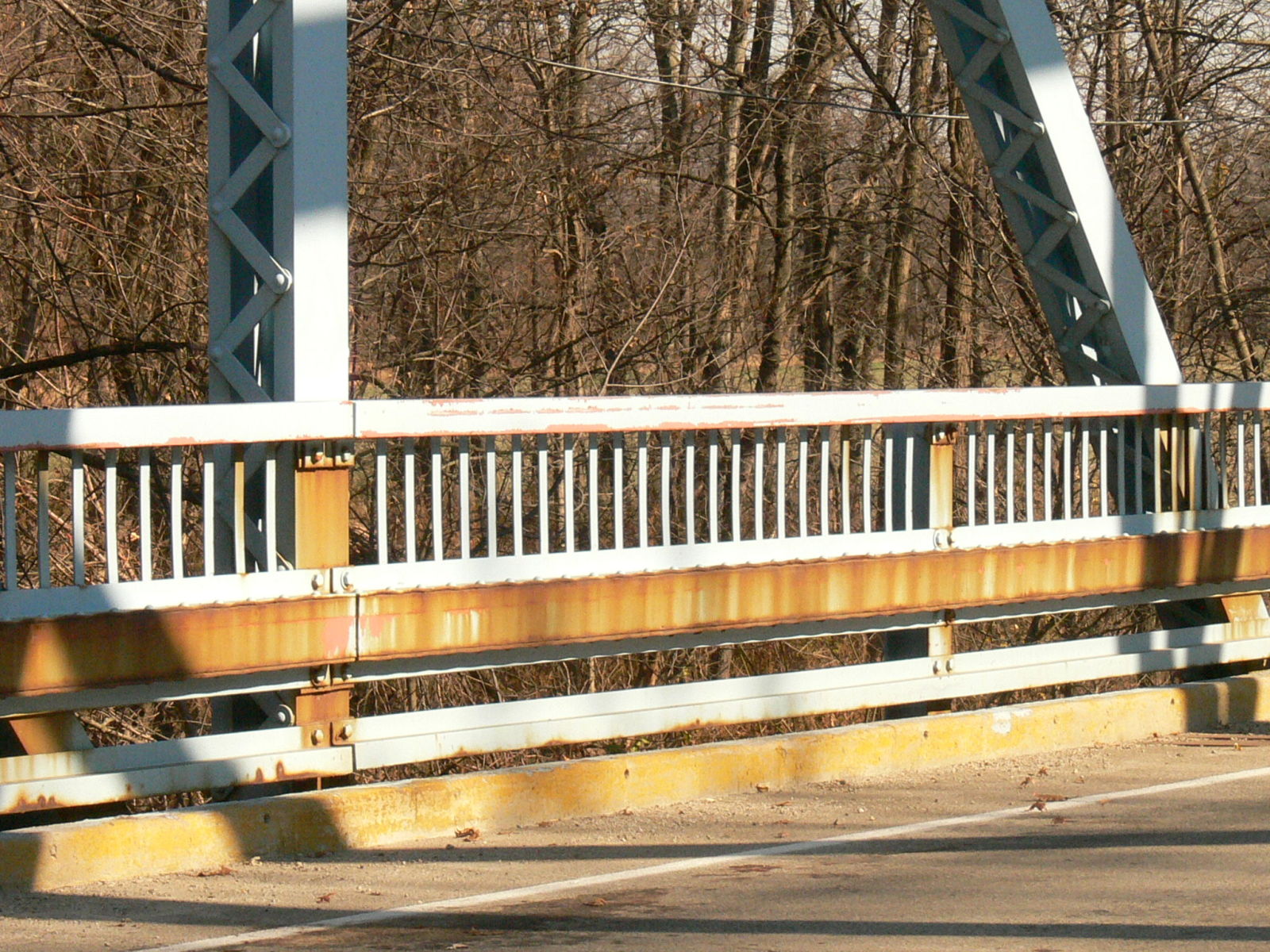
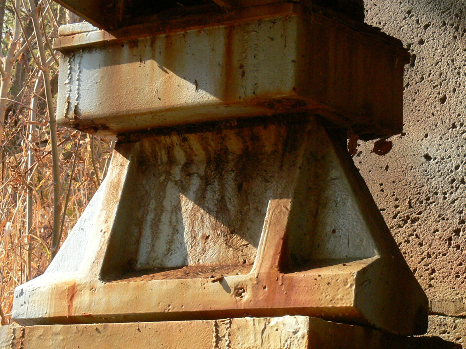
Status: Relocated to a walking trail in Portland
Location: 40.429729,-84.972742
Carries Trail over Salamonie River
Design: truss/through/pratt
Design Details: Pinned Pratt through truss
Total Length: 102.0 Feet
Span Length: 95.4 Feet
Overview: Originally located over Brooks Creek on Division Road, relocated to a park in Portland.
History: Built in 1908 by the Attica Bridge Company, relocated to park in 2006.
Built: 1908
Location: Jay County
View Bridge Information In Wayback Machine
![]()
130729
Late on a very cold afternoon
Photo taken by Anthony Dillon in December 2008
130730
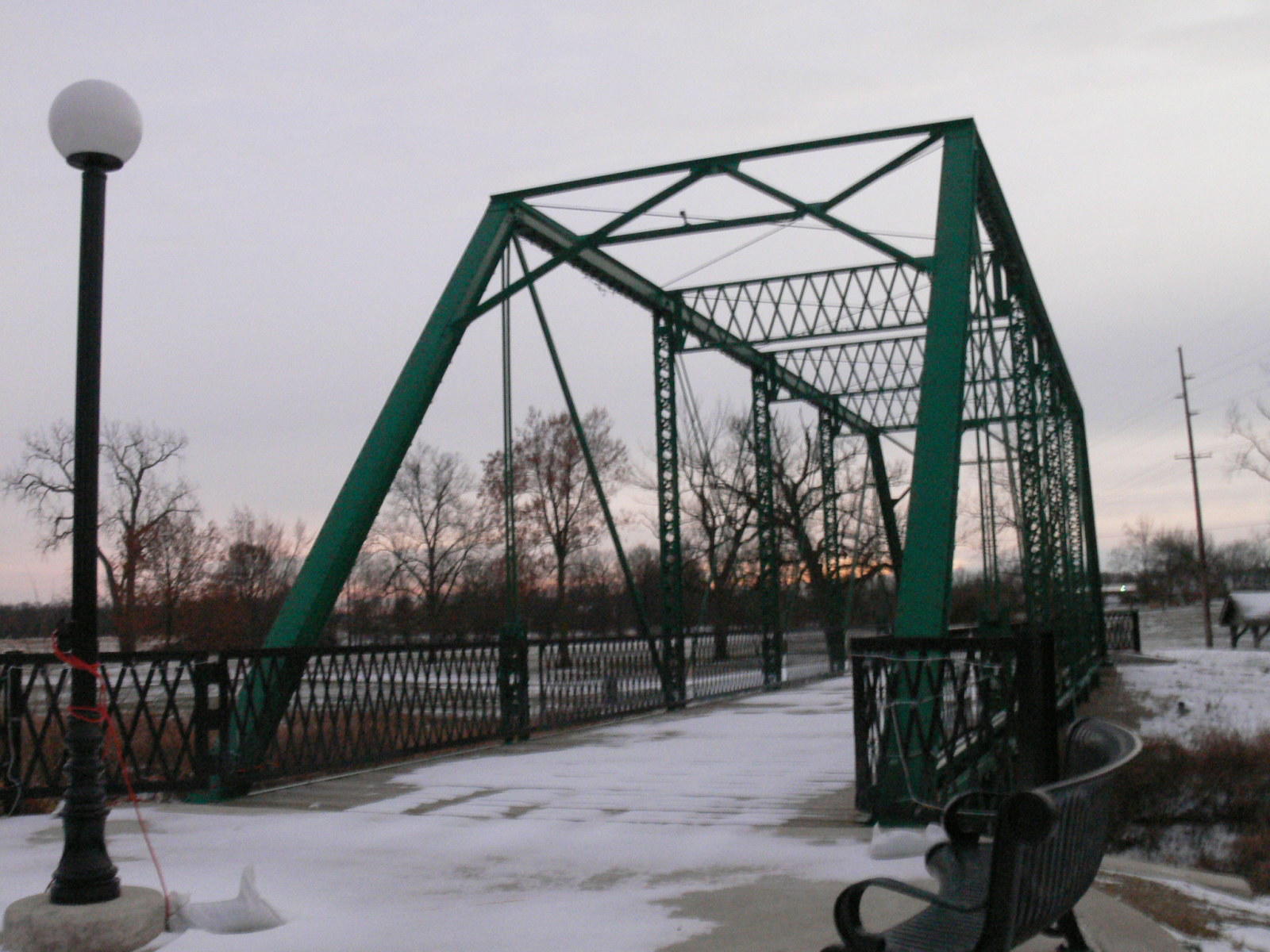
Photo taken by Anthony Dillon in December 2008
130731

Sway bracing common to Attica Bridge Co.
Photo taken by Anthony Dillon in December 2008
143477
North end
Photo taken by Anthony Dillon in July 2009
143478
Northwest corner
Photo taken by Anthony Dillon in July 2009
143479
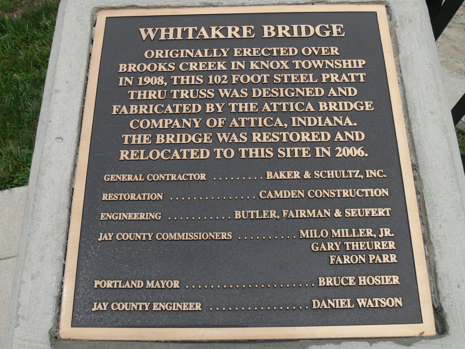
Plaque
Photo taken by Anthony Dillon in July 2009
143480
East side
Photo taken by Anthony Dillon in July 2009
143481
Southwest corner
Photo taken by Anthony Dillon in July 2009
143482
End detail showing unique Attica sway bracing.
Photo taken by Anthony Dillon in July 2009
143483
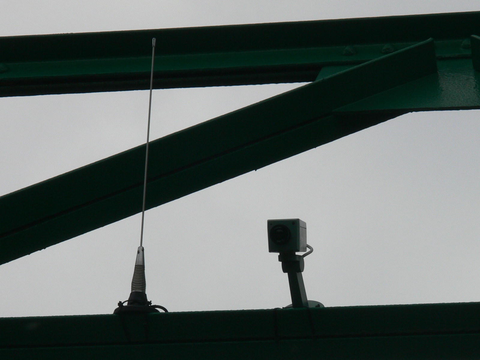
Surveillance camera......this is a first!
Photo taken by Anthony Dillon in July 2009
155902
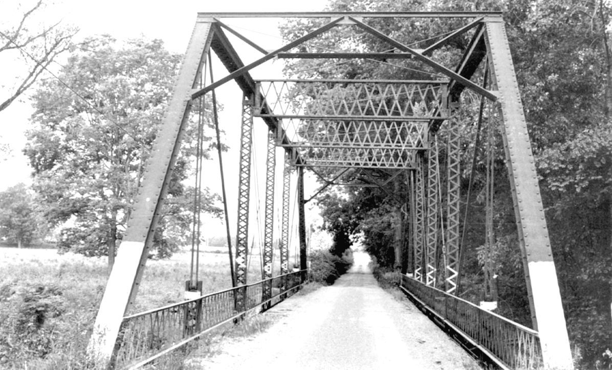
the next 2 photos are of the bridge at it's original location.
Photo from SHAARD
155903
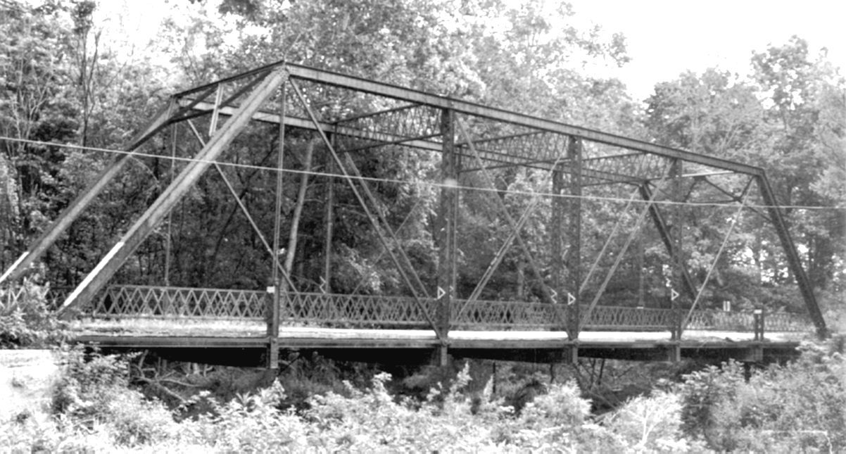
Photo from SHAARD
186336
West side
Photo taken by Anthony Dillon in November 2010
186337
Side oblique
Photo taken by Anthony Dillon in November 2010
186338
South end
Photo taken by Anthony Dillon in November 2010
186339
Southeast corner oblique
Photo taken by Anthony Dillon in November 2010
186340
East side oblique
Photo taken by Anthony Dillon in November 2010
186341
View from SE bank
Photo taken by Anthony Dillon in November 2010
186342
Wide shot from bank
Photo taken by Anthony Dillon in November 2010
186343
Wide view looking up from stream level
Photo taken by Anthony Dillon in November 2010
186344
same view zoomed in
Photo taken by Anthony Dillon in November 2010
186361
Truss detail from below
Photo taken by Anthony Dillon in November 2010
186362
Center panels with counters
Photo taken by Anthony Dillon in November 2010
186363
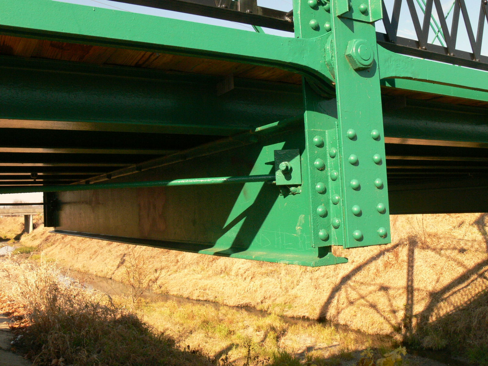
Floor beam connection
Photo taken by Anthony Dillon in November 2010
186364
Lower chord eyebars
Photo taken by Anthony Dillon in November 2010
186365
Verticals
Photo taken by Anthony Dillon in November 2010
186366
Stringers and lower lateral bracing
Photo taken by Anthony Dillon in November 2010
186367
Looking out to the North
Photo taken by Anthony Dillon in November 2010
186368
Looking down the West side
Photo taken by Anthony Dillon in November 2010
186369
View from the Wayne Street Bridge
Photo taken by Anthony Dillon in November 2010
186379
Verticals
South end
Photo taken by Anthony Dillon in November 2010
186380
Built-up member of end vertical eyebar
Photo taken by Anthony Dillon in November 2010
186381
Verticals
Photo taken by Anthony Dillon in November 2010
186382
Panel
Photo taken by Anthony Dillon in November 2010
186383
Looking down the side
Photo taken by Anthony Dillon in November 2010
186384
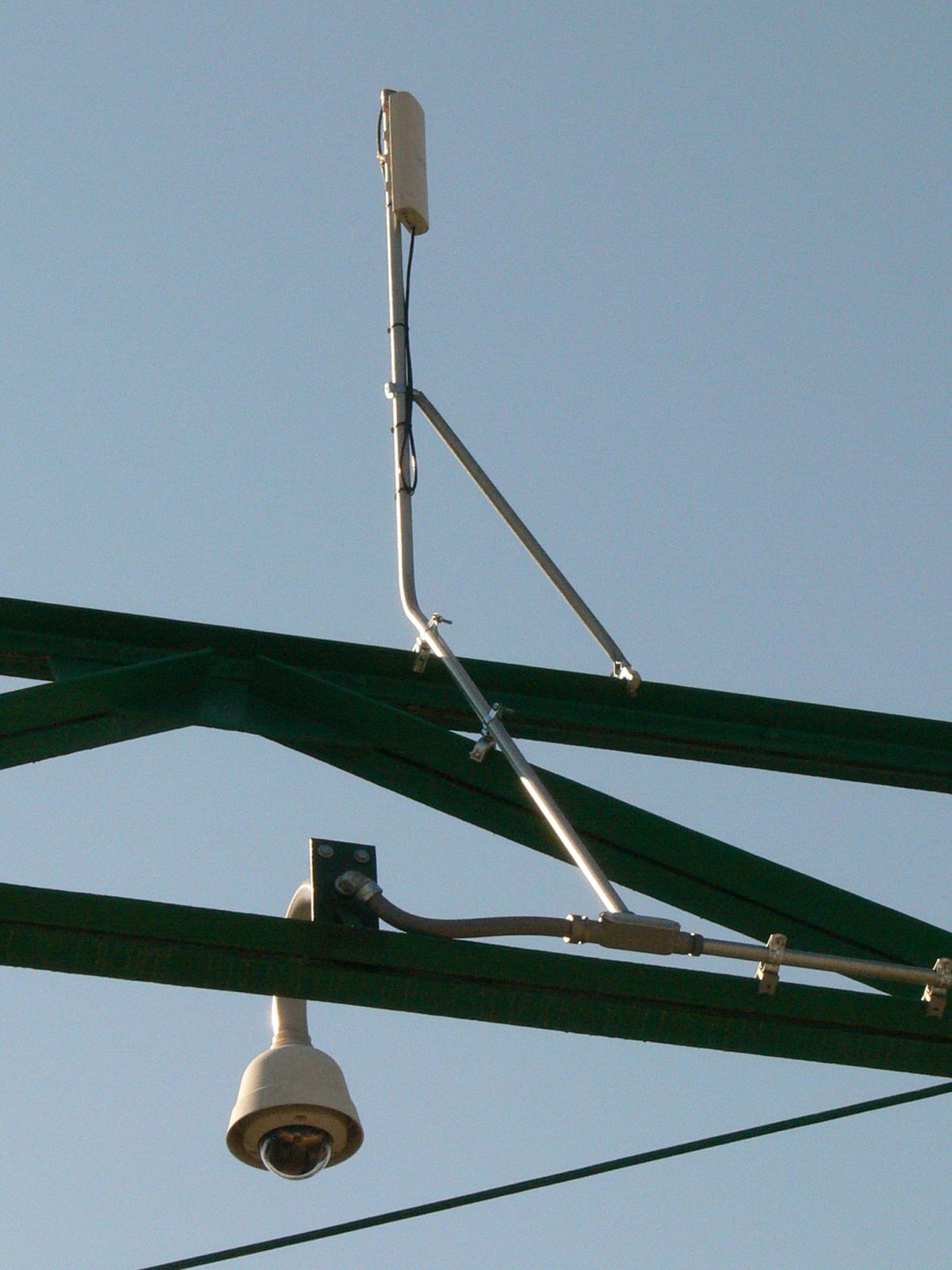
Upgraded surveillance system. Although I like the fact that they want to protect their investment with lights and cameras, I would love to see it camouflaged some. Maybe they could replicate some nice Attica plaques and hide this behind one and then paint all the conduit to match the bridge.
Photo taken by Anthony Dillon in November 2010
443705
Photo taken by Mike Daffron in February 2019
443706
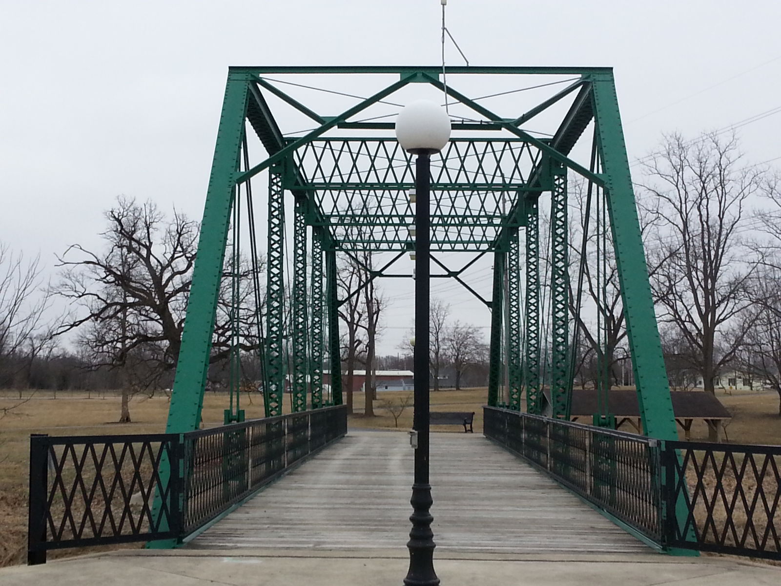
Photo taken by Mike Daffron in February 2019
443707
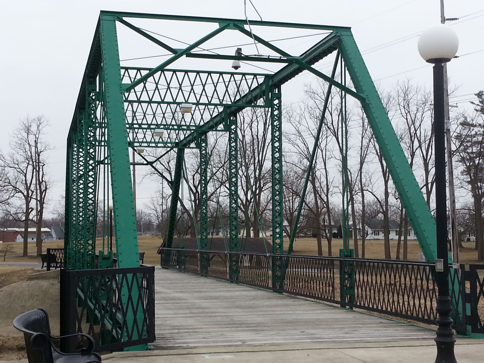
Photo taken by Mike Daffron in February 2019
443708
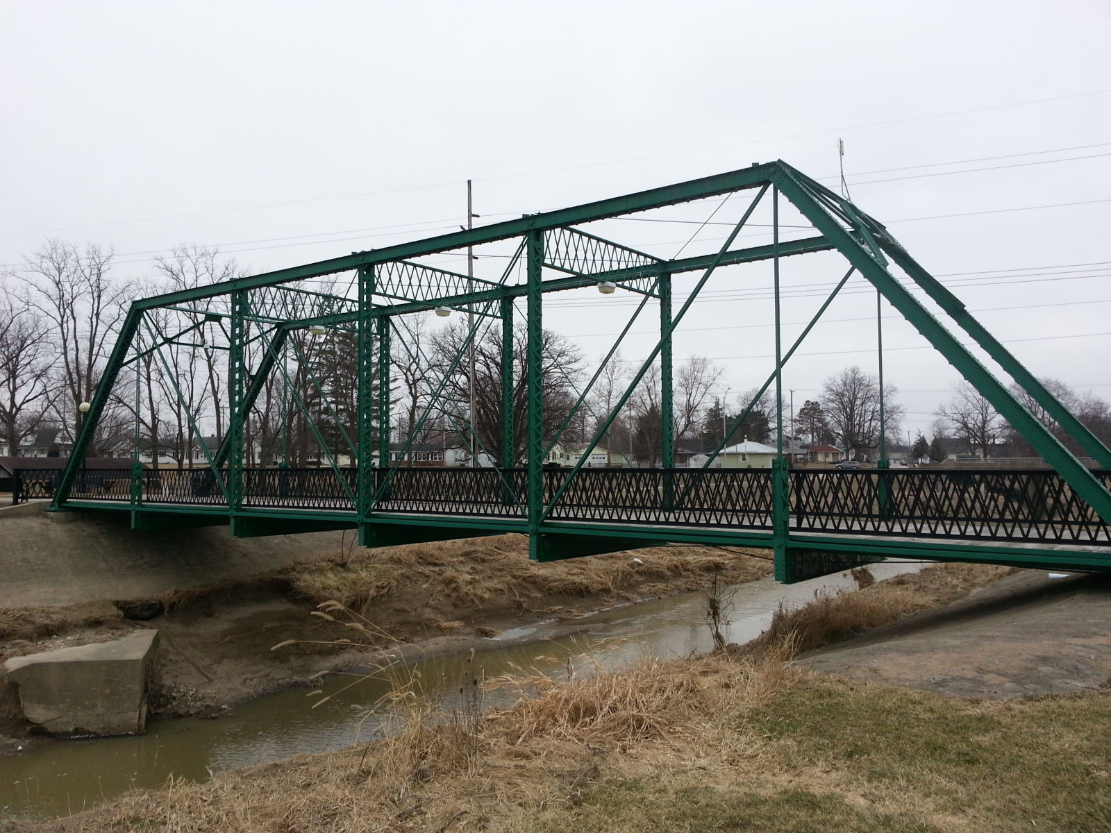
Photo taken by Mike Daffron in February 2019
443709
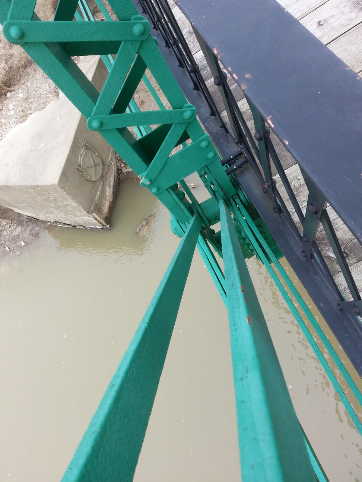
Photo taken by Mike Daffron in February 2019
443710
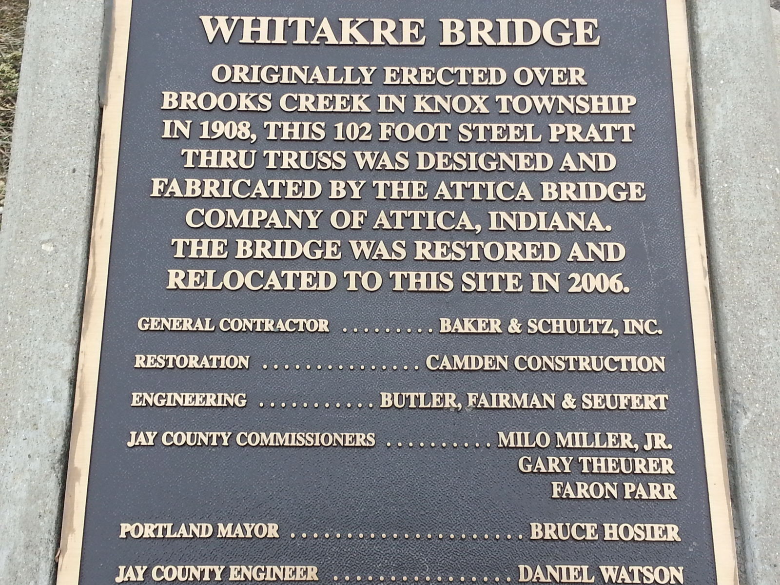
Photo taken by Mike Daffron in February 2019
443711
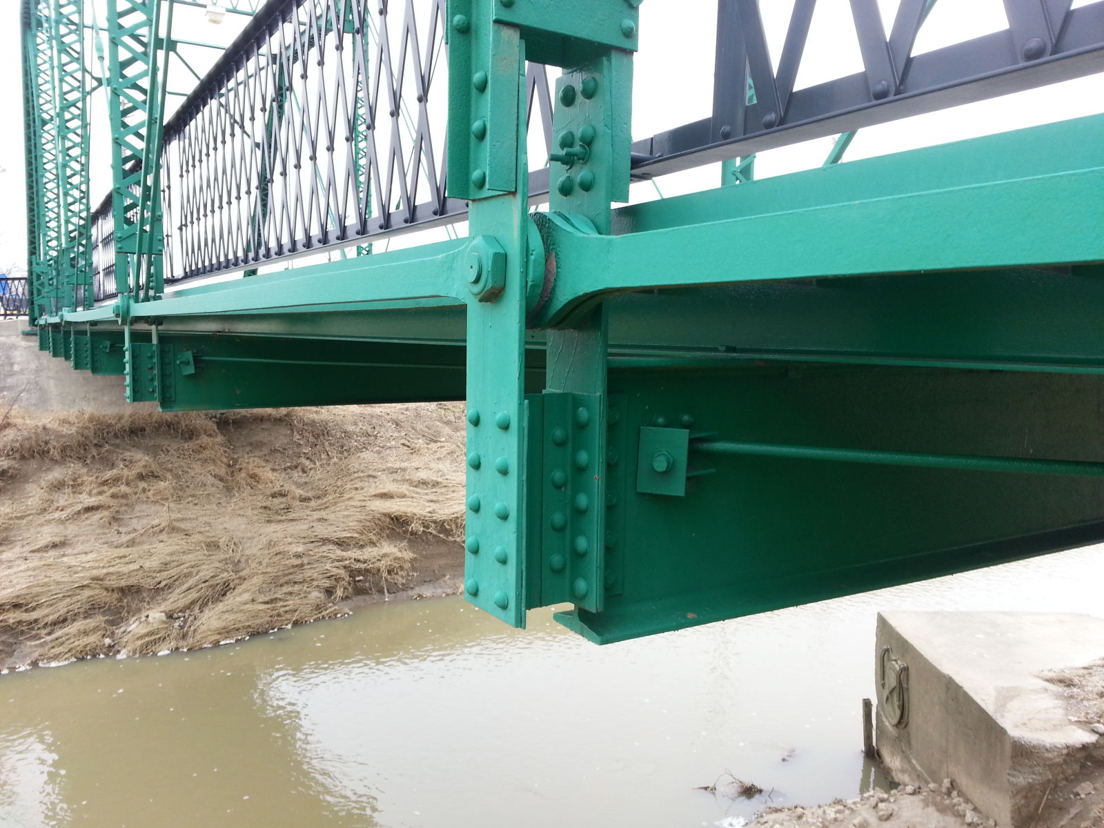
Photo taken by Mike Daffron in February 2019
443712
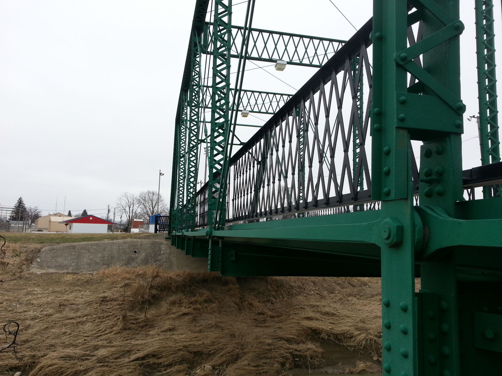
Photo taken by Mike Daffron in February 2019
454080
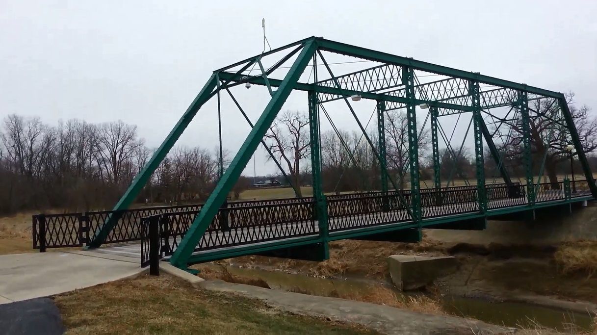
Photo taken by Mike Daffron in February 2019
454081
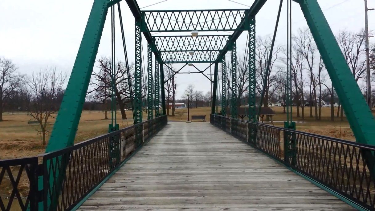
Photo taken by Mike Daffron in February 2019
454082
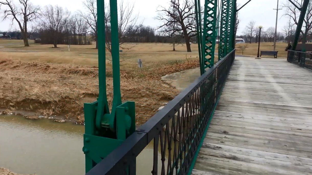
Photo taken by Mike Daffron in February 2019
454083
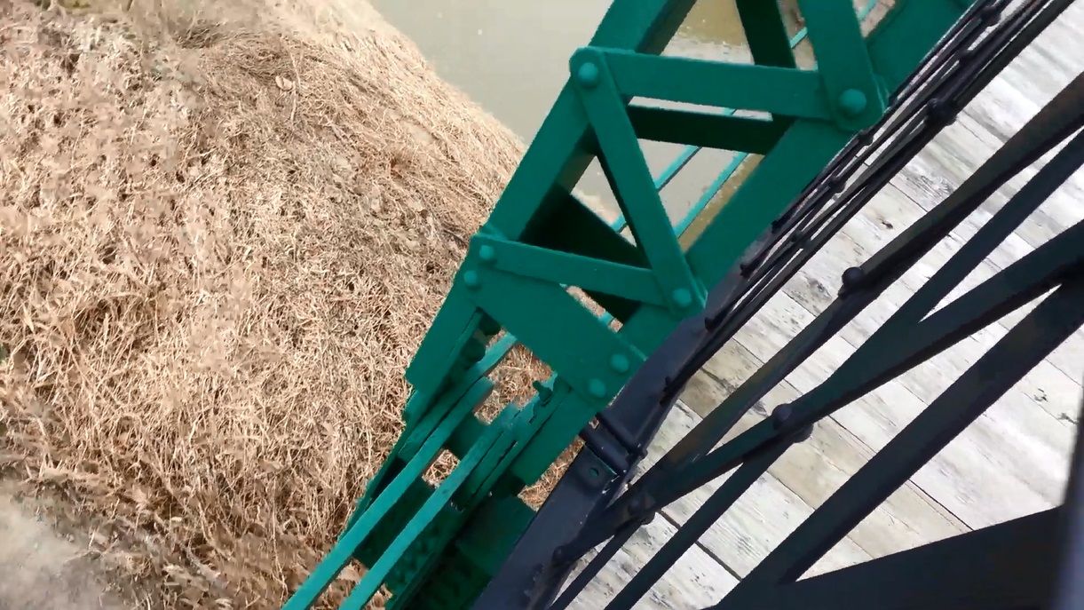
Photo taken by Mike Daffron in February 2019
454084
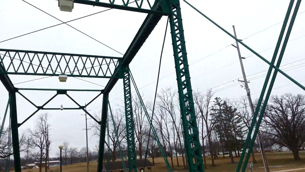
Photo taken by Mike Daffron in February 2019
454085
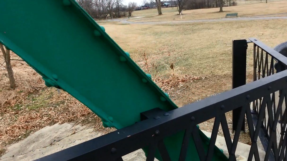
Photo taken by Mike Daffron in February 2019
454086
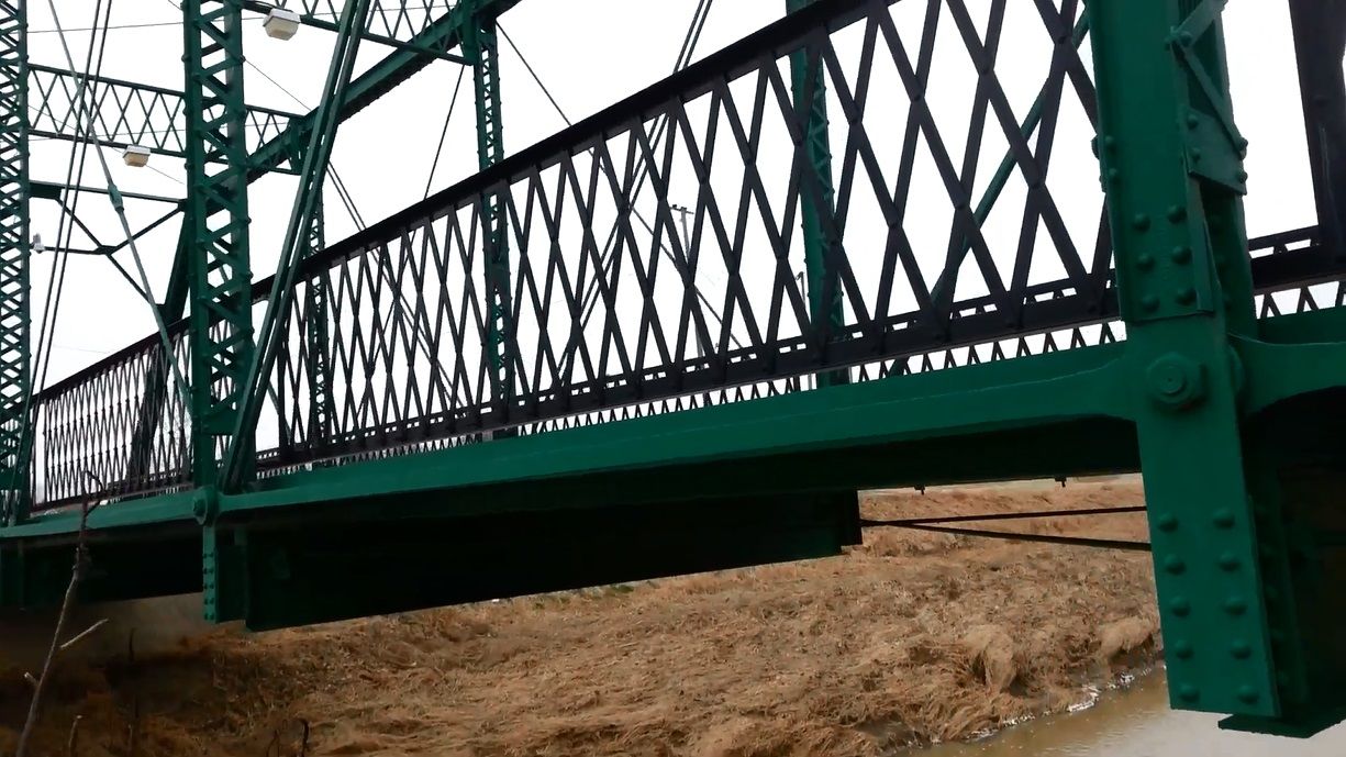
Photo taken by Mike Daffron in February 2019
454087
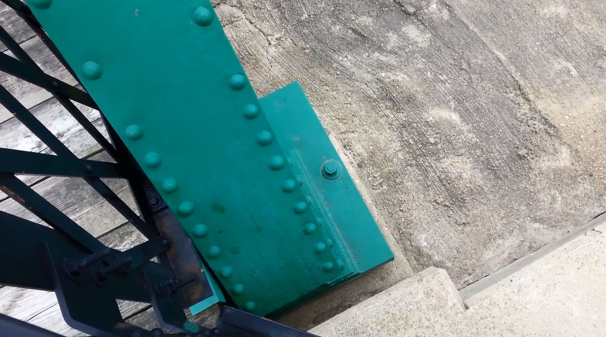
Photo taken by Mike Daffron in February 2019
![]()
Status: Removed and replaced
Location: 40.512778,-84.898611
Carries CR 500 North over Limberlost Creek
Design: truss/pony/warren
Design Details: 7-panel Warren pony truss
Total Length: 87.9 Feet
Span Length: 84.0 Feet
Overview: Pony truss bridge over Limberlost Creek on CR 500 North
History: Built ca. 1928; rehabilitated 1968
Built: ca. 1940
Location: Jay County
View Bridge Information In Wayback Machine
![]()
392075
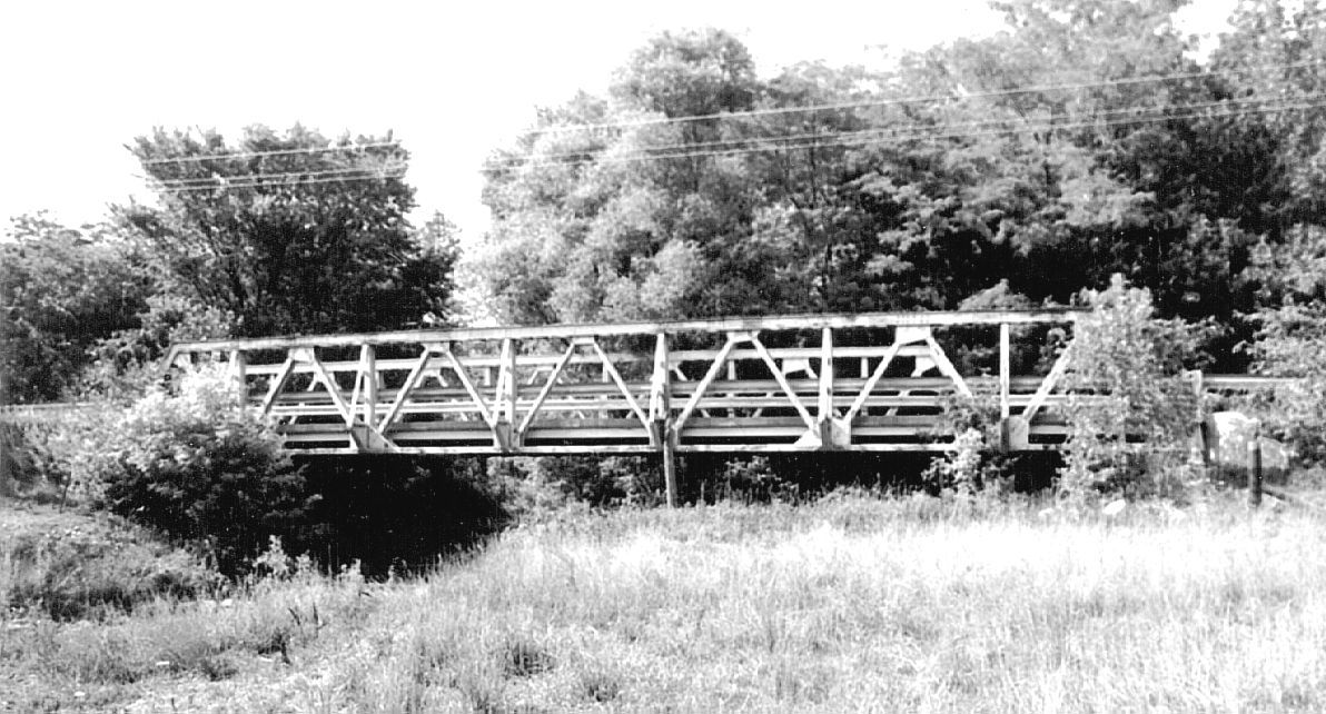
Photo courtesy of the Indiana State Department of Natural Resource, Division of Historic Preservation and Archaeology.
392076
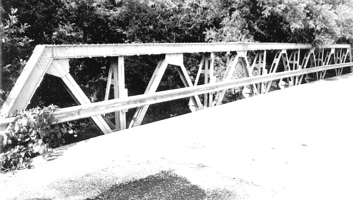
Photo courtesy of the Indiana State Department of Natural Resource, Division of Historic Preservation and Archaeology.
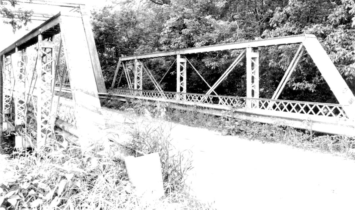
![]()
Status: Removed and replaced
Location: 40.498889,-84.830556
Carries CR 400 North over Limberlost Creek
Design: truss/pony/warren
Design Details: 4-panel Warren pony truss
Total Length: 51.8 Feet
Span Length: 47.9 Feet
Overview: Pony truss bridge over Limberlost Creek on CR 400 North
History: Built ca. 1920
Built: ca. 1920
Location: Jay County
View Bridge Information In Wayback Machine
![]()
392077
Photo courtesy of the Indiana State Department of Natural Resource, Division of Historic Preservation and Archaeology.
![]()
Status: Replaced by a new bridge
Location: 40.493056,-84.819167
Carries County Road 850 East over Limberlost Creek
Design: arch/deck/closed
Design Details: Closed-spandrel concrete arch
Total Length: 53.1 Feet
Span Length: 50.5 Feet
Overview: Lost concrete arch bridge over Limberlost Creek on County Road 850 East
History: Built ca. 1940; replaced 2012
Built: ca. 1940
Location: Jay County
View Bridge Information In Wayback Machine
![]()
392103
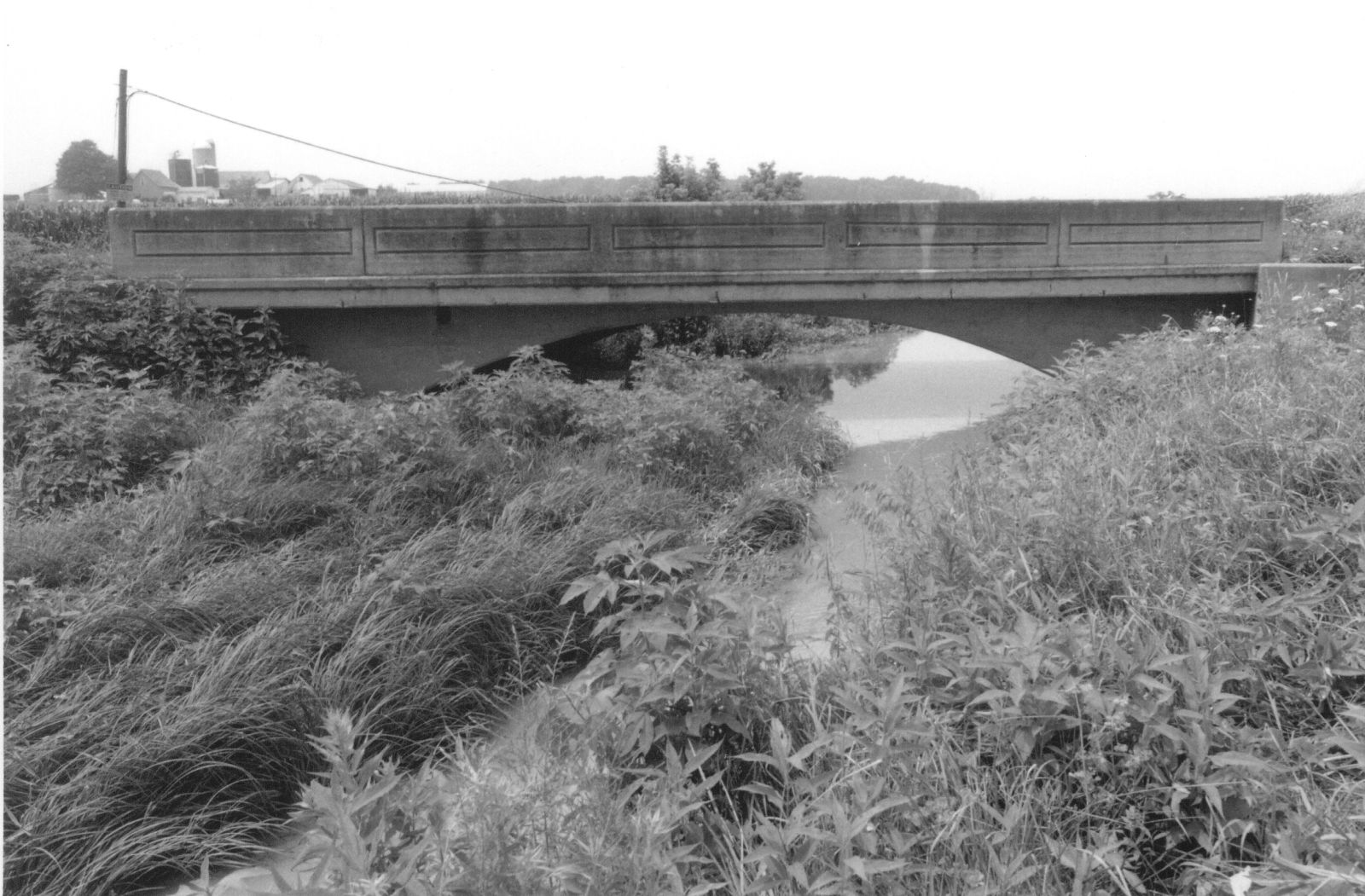
Photo courtesy of the Indiana State Department of Natural Resource, Division of Historic Preservation and Archaeology.
392104
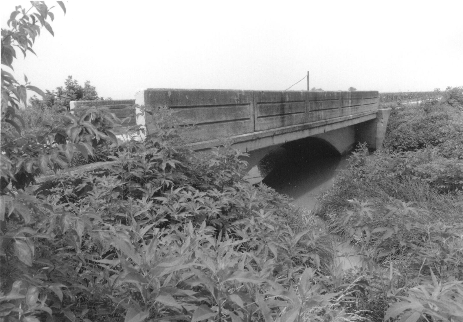
Photo courtesy of the Indiana State Department of Natural Resource, Division of Historic Preservation and Archaeology.
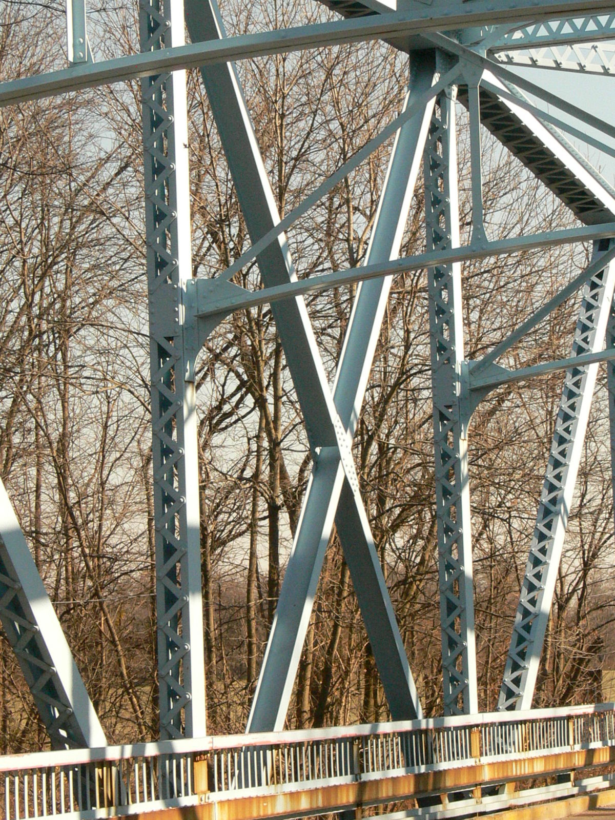
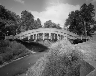
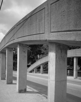
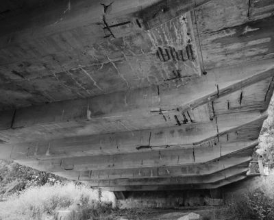
![]()
Status: Open to traffic
Location: 40.486667,-85.150000
Carries IN 1 over Salamonie River
Design: arch/deck
Design Details: Arch
Total Length: 336.9 Feet
Span Length: 85.0 Feet
Overview: Concrete arch bridge over Salamonie River on IN 1 in Pennville
History: Built 1952; rehabilitated 1978
Built: 1952
Location: Jay County
View Bridge Information In Wayback Machine
![]()
![]()
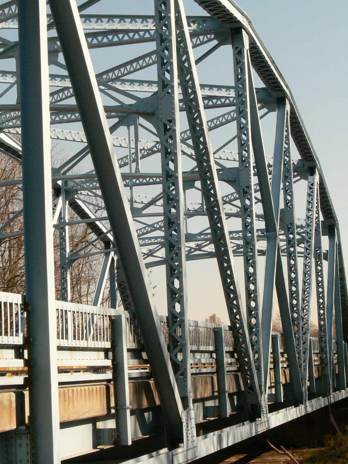
Status: Open to traffic
Slated for demolition and replacement. As of 2020 Section 106 finds no alternative to demolition unless a new owner takes the bridge.
Location: 40.432500,-84.963333
Carries IN 26 over Salamonie River
Design: truss/through/parker
Design Details: Riveted Parker through truss
Total Length: 154.8 Feet
Span Length: 149.9 Feet
Overview: Through truss bridge over Salamonie River on IN 26 in Portland
History: Built 1941; rehabilitated 1979
Built: 1941
Location: Jay County
View Bridge Information In Wayback Machine
![]()
130727
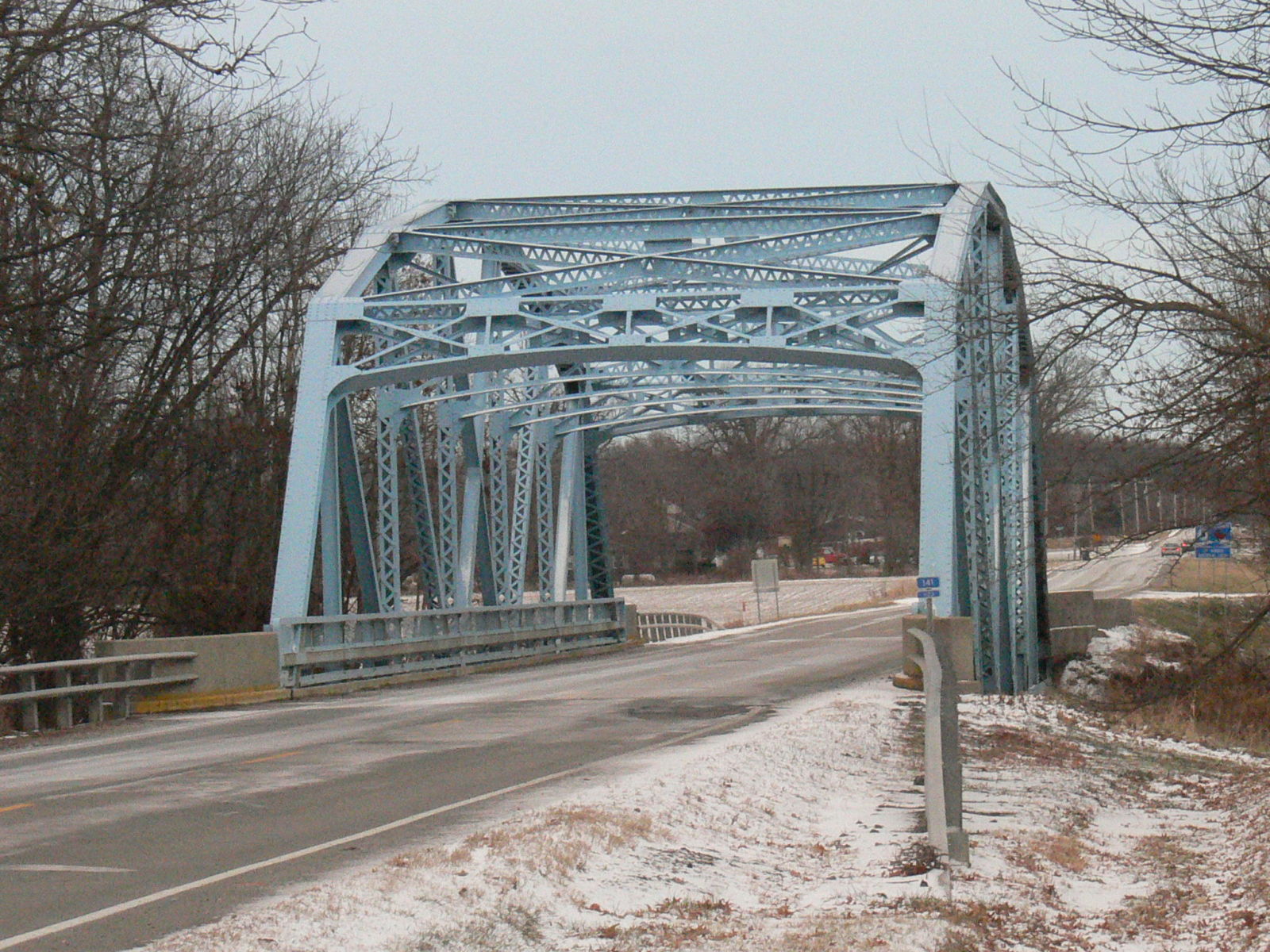
Photo taken by Anthony Dillon in December 2008
130728
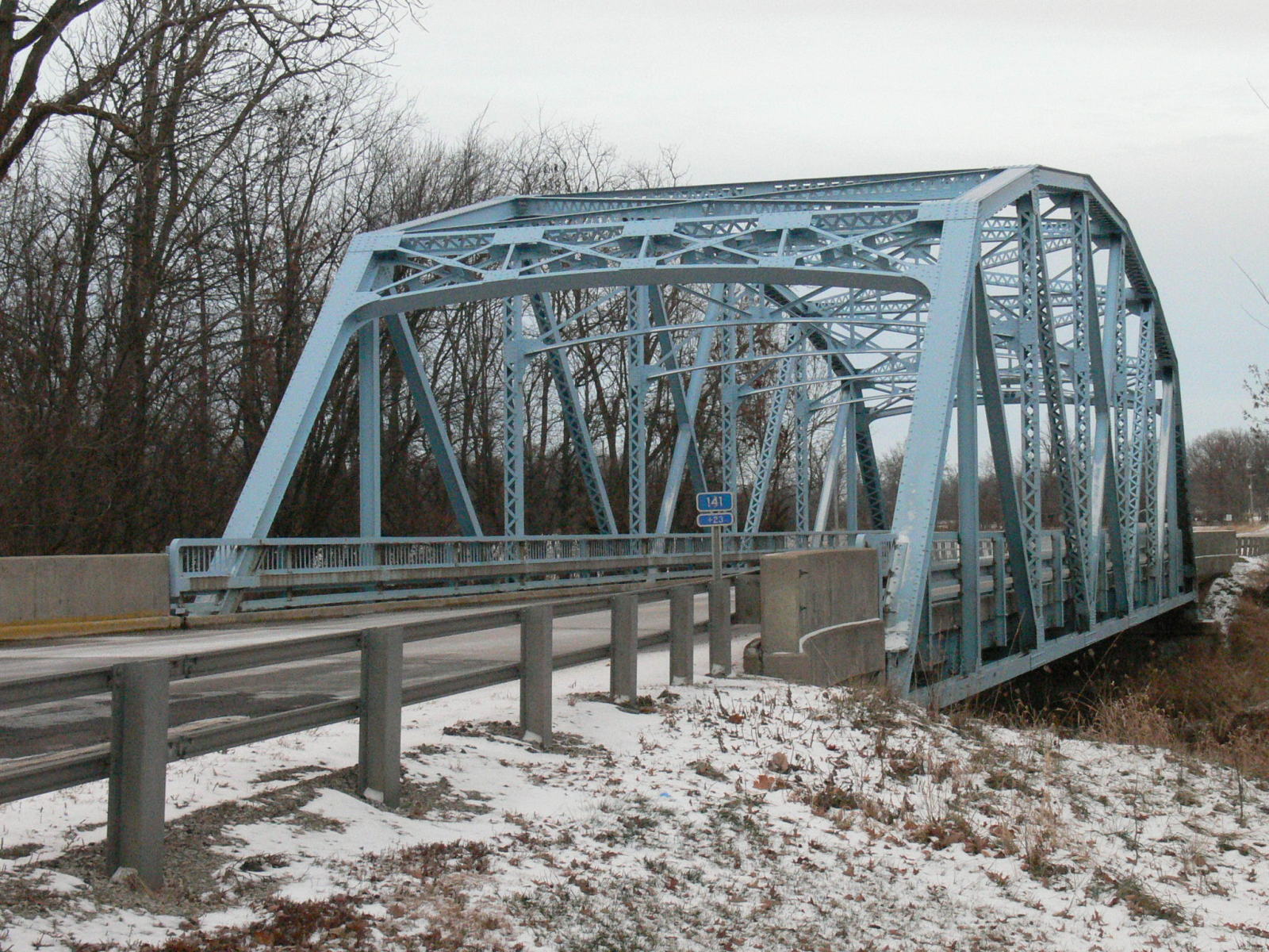
Photo taken by Anthony Dillon in December 2008
186792
Approaching from the West
Photo taken by Anthony Dillon in November 2010
186793
West end
Photo taken by Anthony Dillon in November 2010
186794
Barrel shot
Photo taken by Anthony Dillon in November 2010
186795
Interior truss and bracing
Photo taken by Anthony Dillon in November 2010
186796
Looking East
Photo taken by Anthony Dillon in November 2010
186797
Oblique
Photo taken by Anthony Dillon in November 2010
186798
Low oblique
Photo taken by Anthony Dillon in November 2010
186799
Southwest corner
Photo taken by Anthony Dillon in November 2010
186800
Truss detail
Photo taken by Anthony Dillon in November 2010
186818
Floor system
Photo taken by Anthony Dillon in November 2010
186819
Lower chord
Photo taken by Anthony Dillon in November 2010
186820
Guardrail
Photo taken by Anthony Dillon in November 2010
186821
Rocker
Photo taken by Anthony Dillon in November 2010
186822
Vertical views
Truss detail
Photo taken by Anthony Dillon in November 2010
186823
Lower chord/endpost connection and rocker
Photo taken by Anthony Dillon in November 2010
186824
Underside
Photo taken by Anthony Dillon in November 2010
186825
Center panel
Photo taken by Anthony Dillon in November 2010
443702
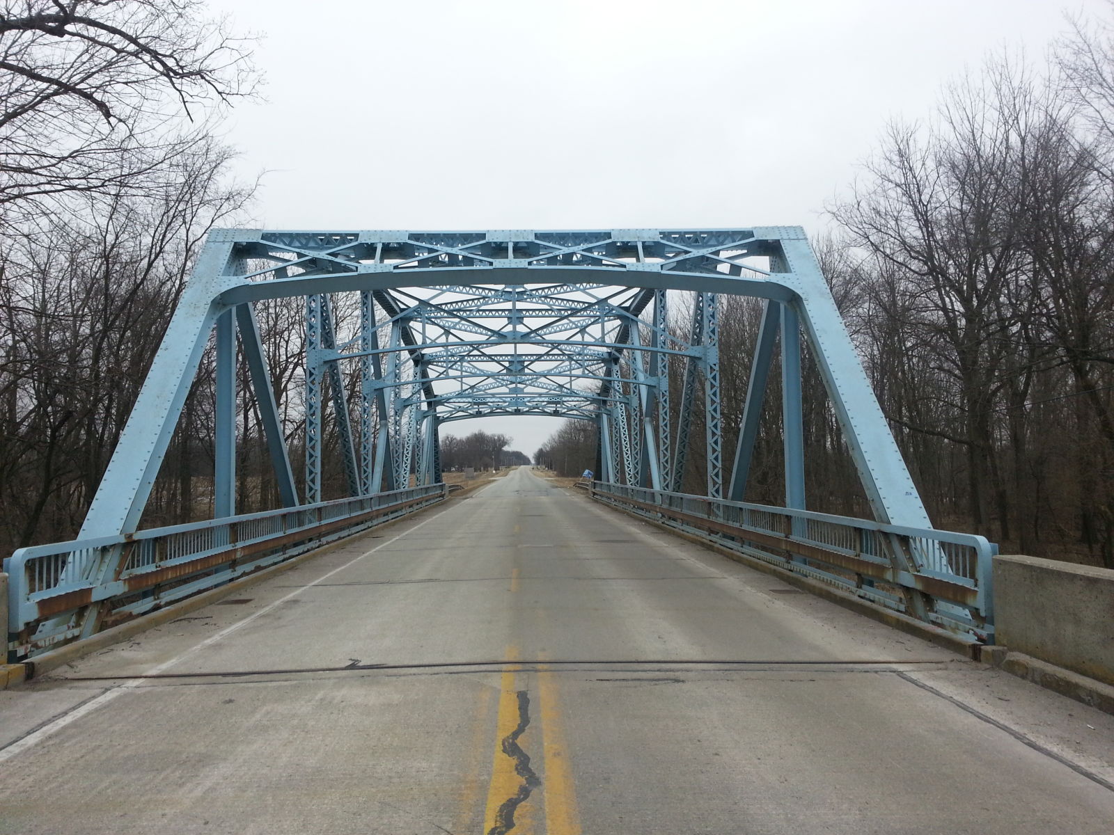
Photo taken by Mike Daffron in February 2019
443703
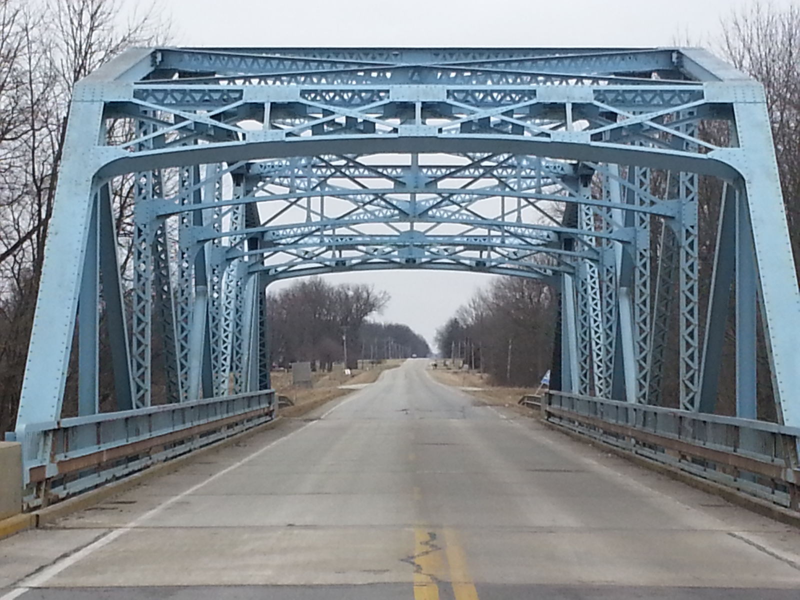
Photo taken by Mike Daffron in February 2019
443704
Photo taken by Mike Daffron in February 2019
454068
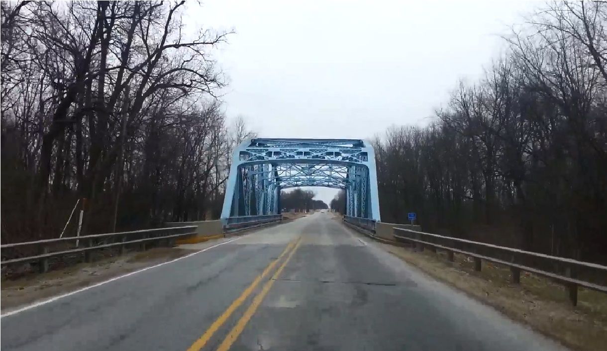
Photo taken by Mike Daffron in February 2019
454069
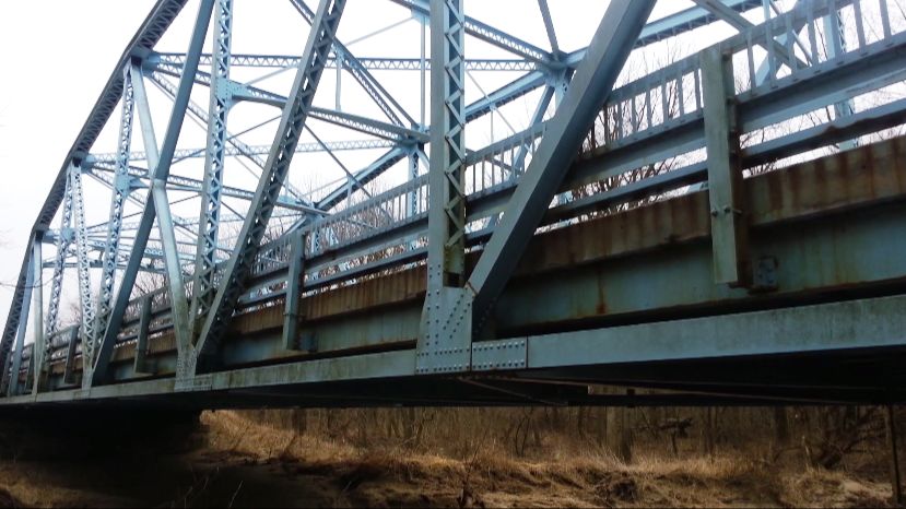
Photo taken by Mike Daffron in February 2019
454070
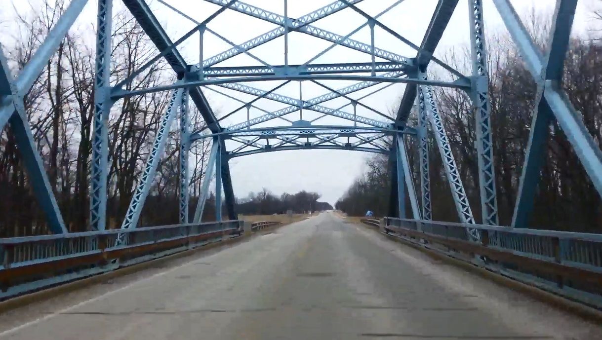
Photo taken by Mike Daffron in February 2019
454071
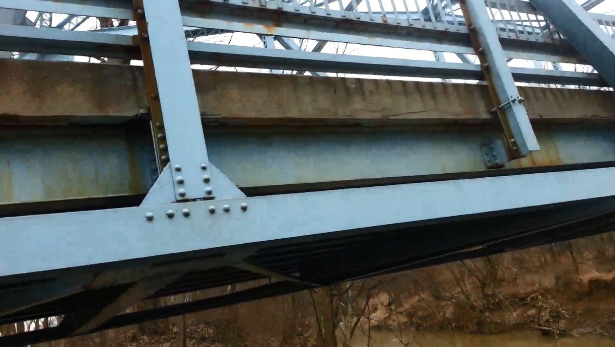
Photo taken by Mike Daffron in February 2019
454072
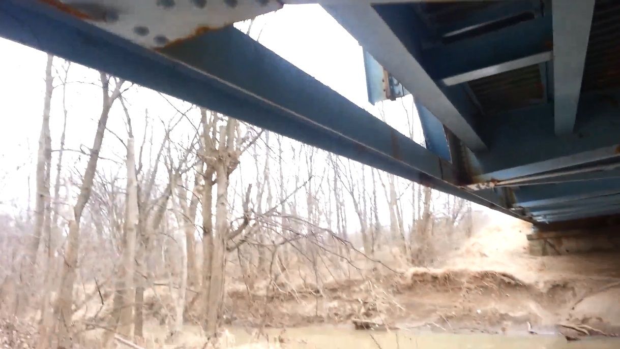
Photo taken by Mike Daffron in February 2019
454073
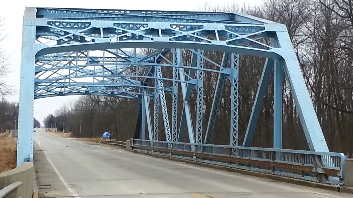
Photo taken by Mike Daffron in February 2019
454074
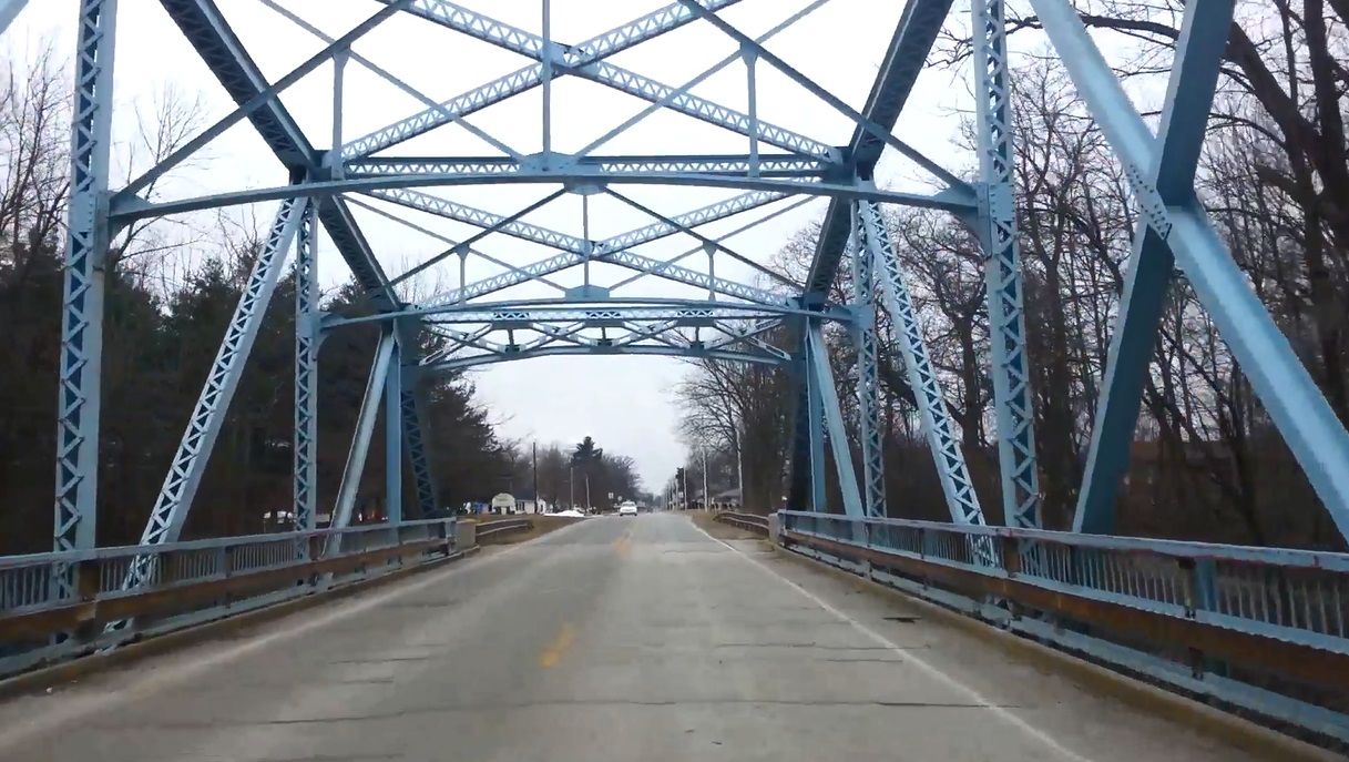
Photo taken by Mike Daffron in February 2019
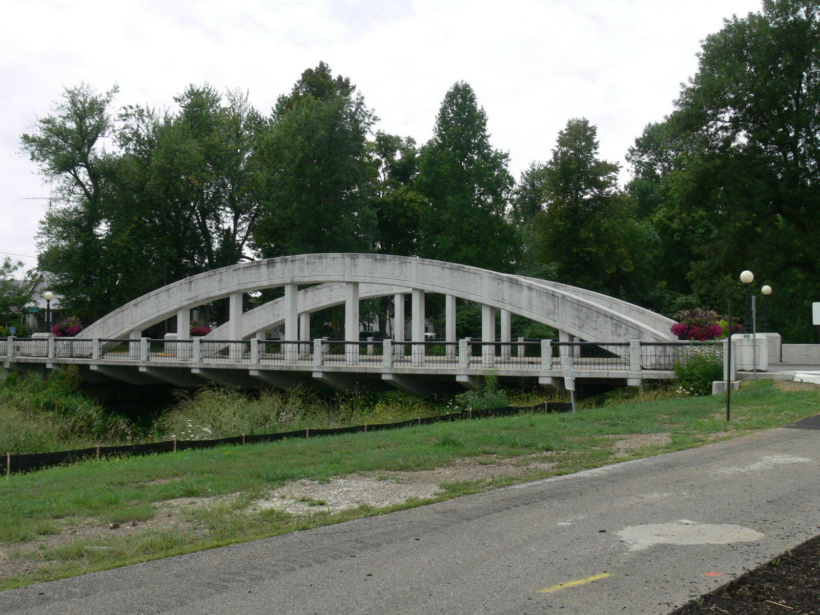
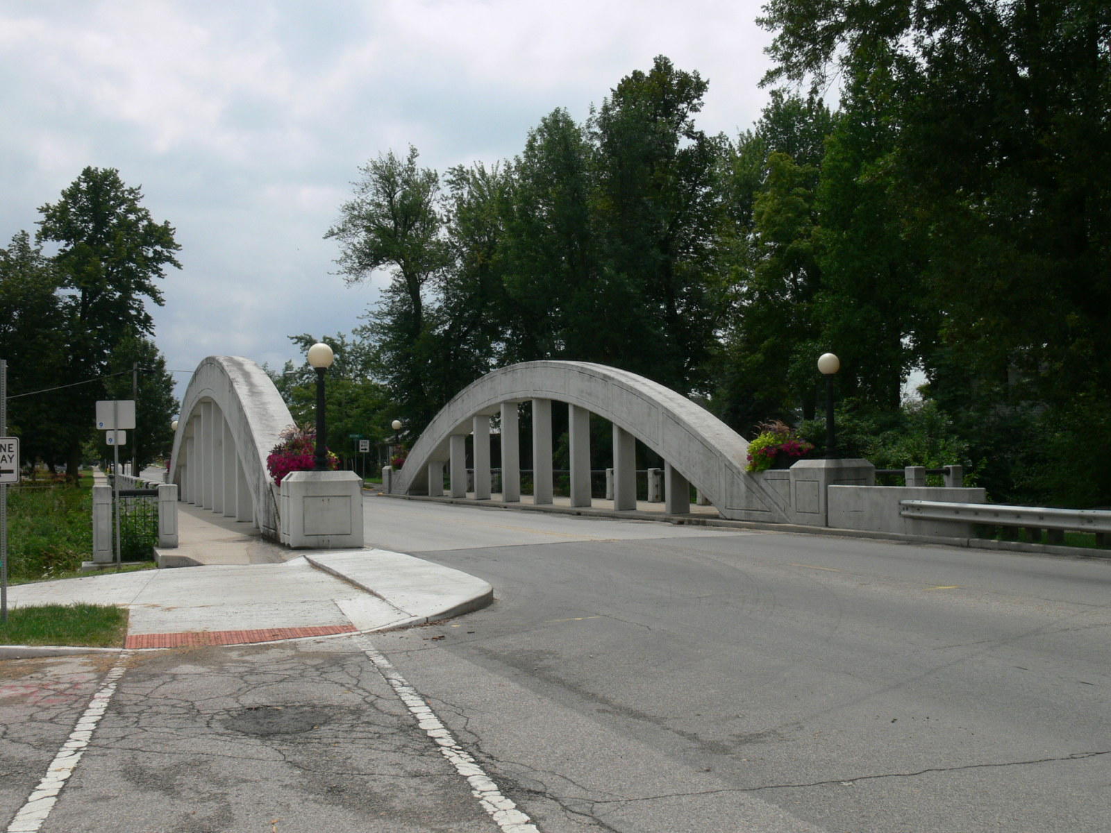
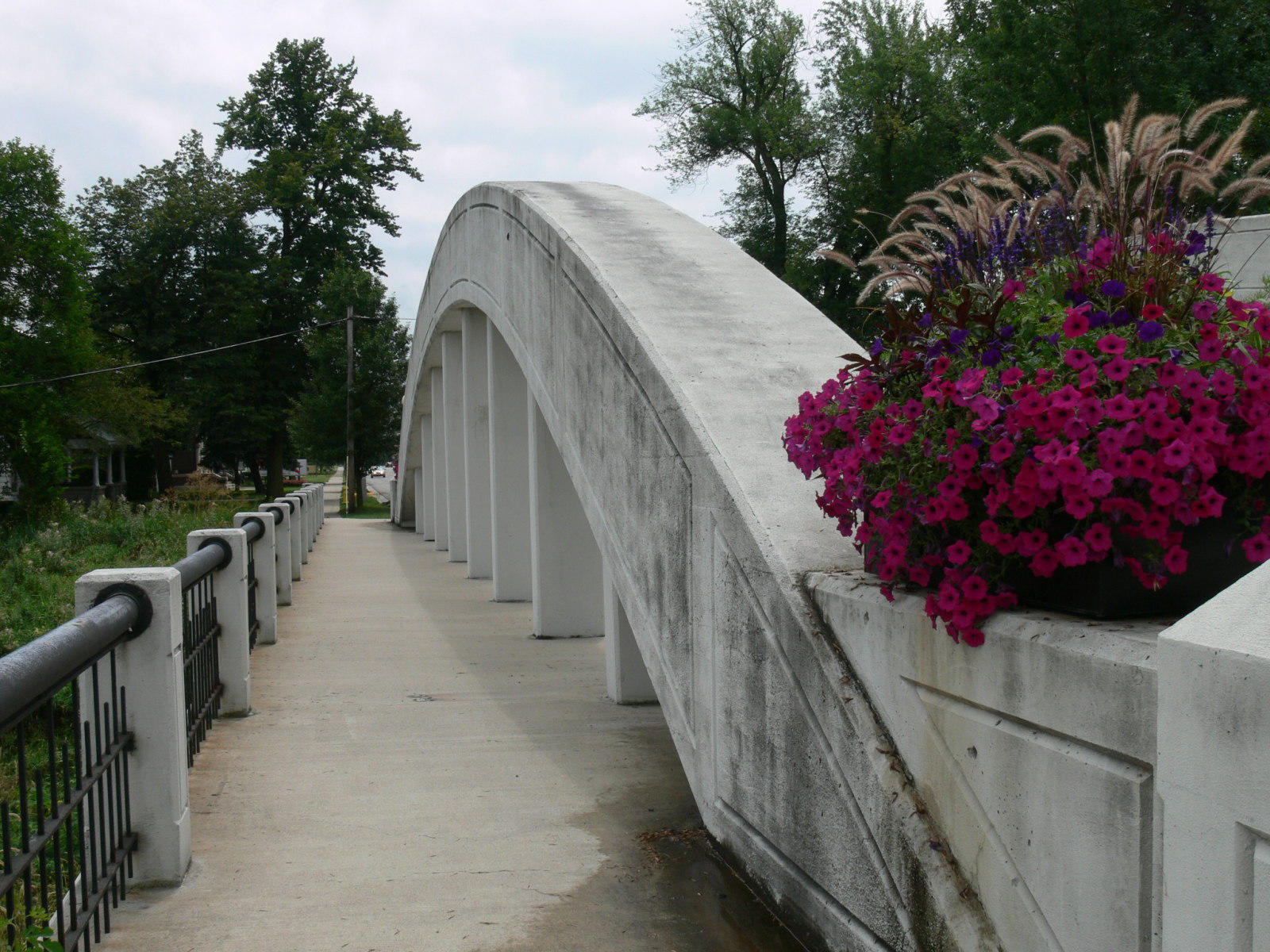
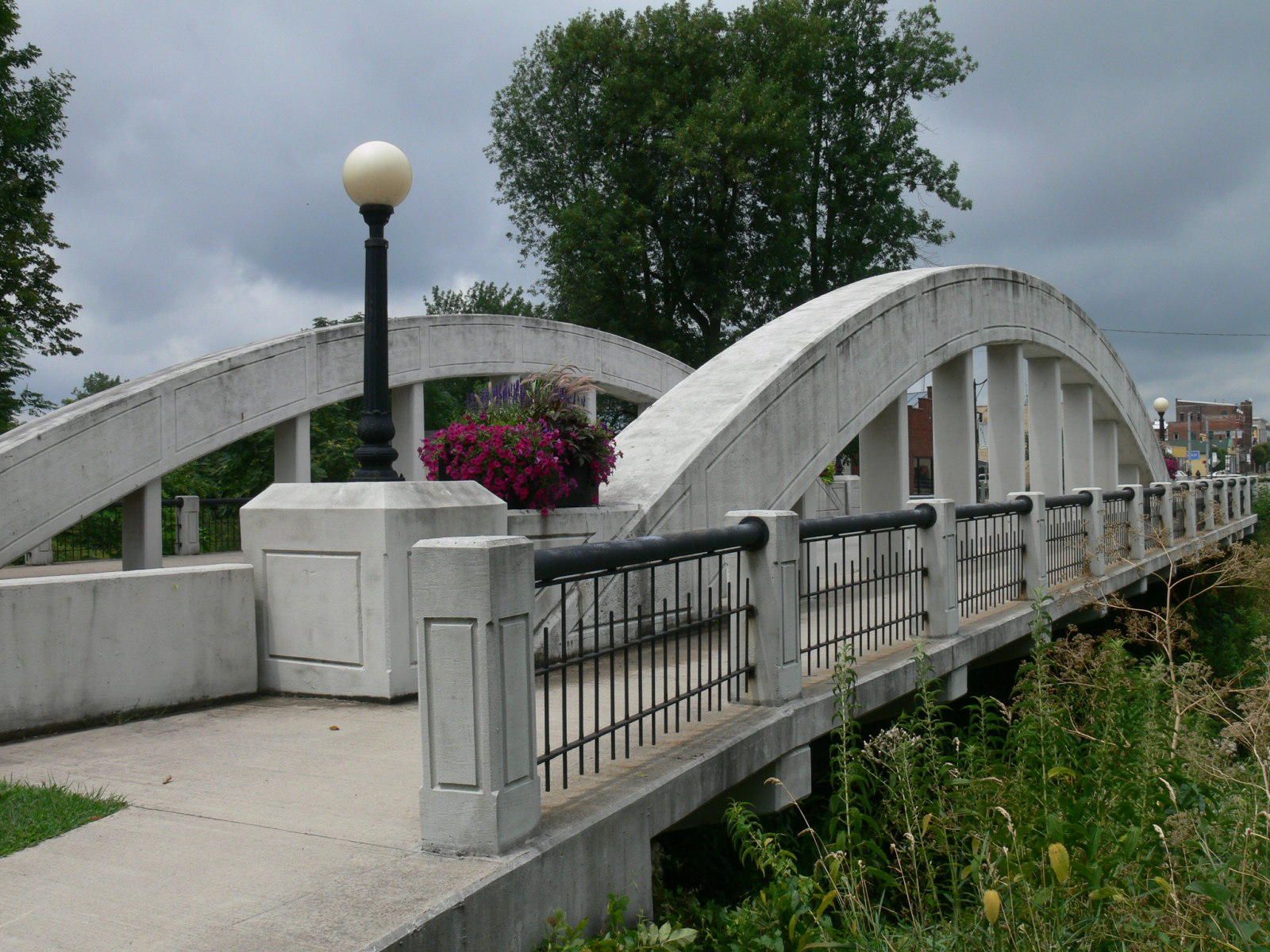
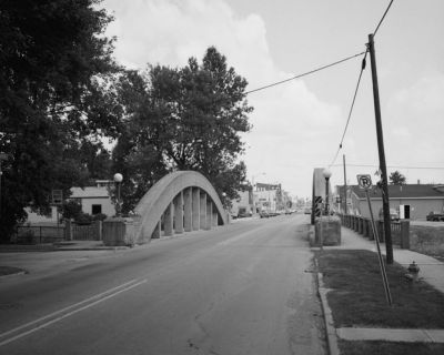
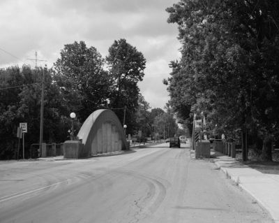
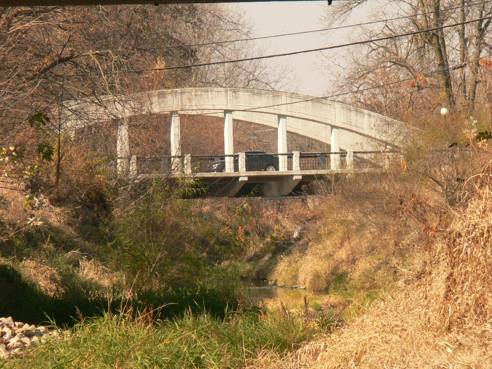
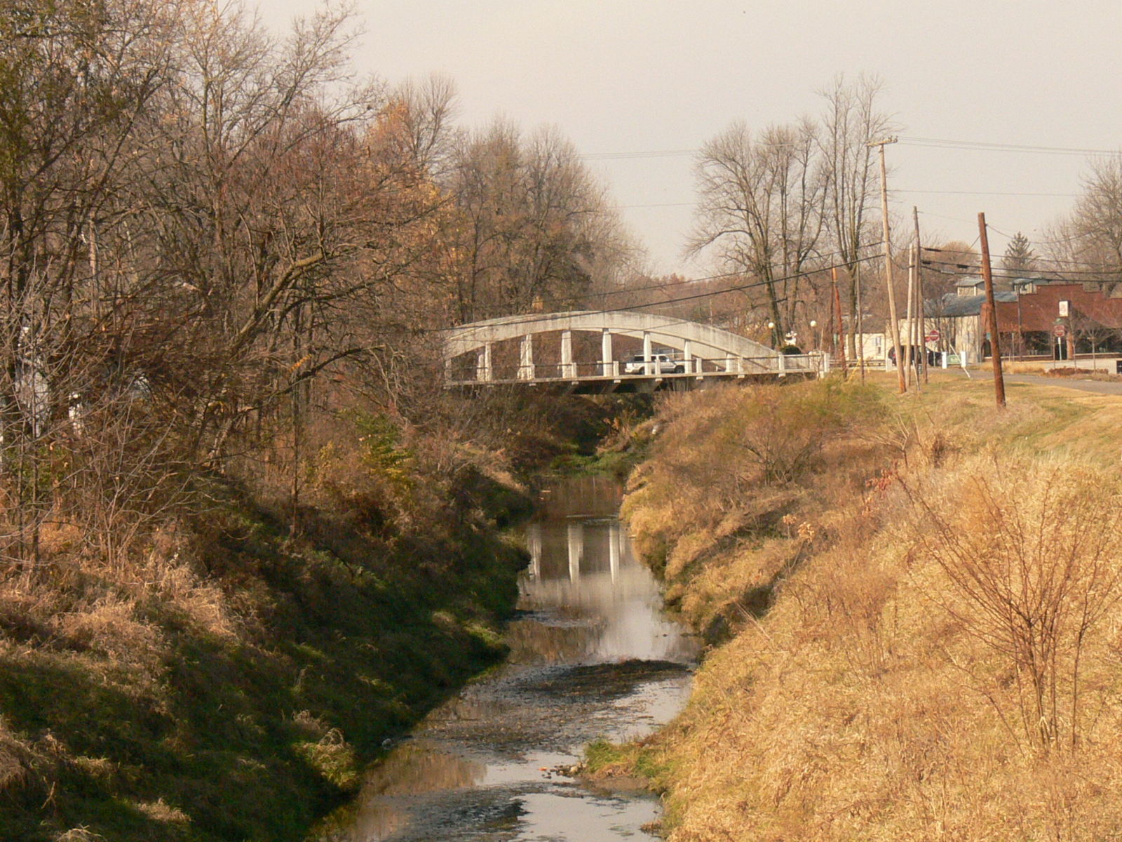
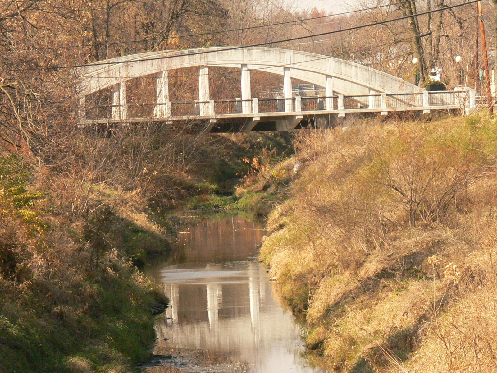
![]()
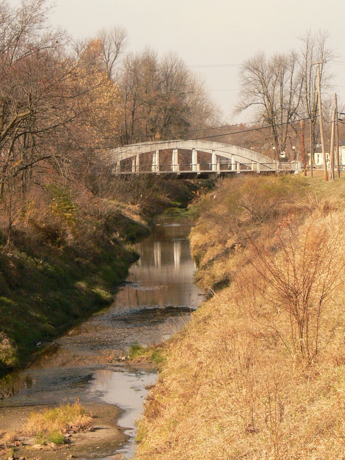
Status: Open to traffic
Location: 40.430833,-84.977778
Carries US 27 over Salamonie River
Design: arch/pony/concrete
Design Details: Concrete Rainbow Arch
Total Length: 119.7 Feet
Span Length: 109.9 Feet
Overview: Arch bridge over Salamonie River on US 27 in Portland
History: Built 1914; rehabilitated 1997
Built: 1914
Location: Jay County
View Bridge Information In Wayback Machine
![]()
130723
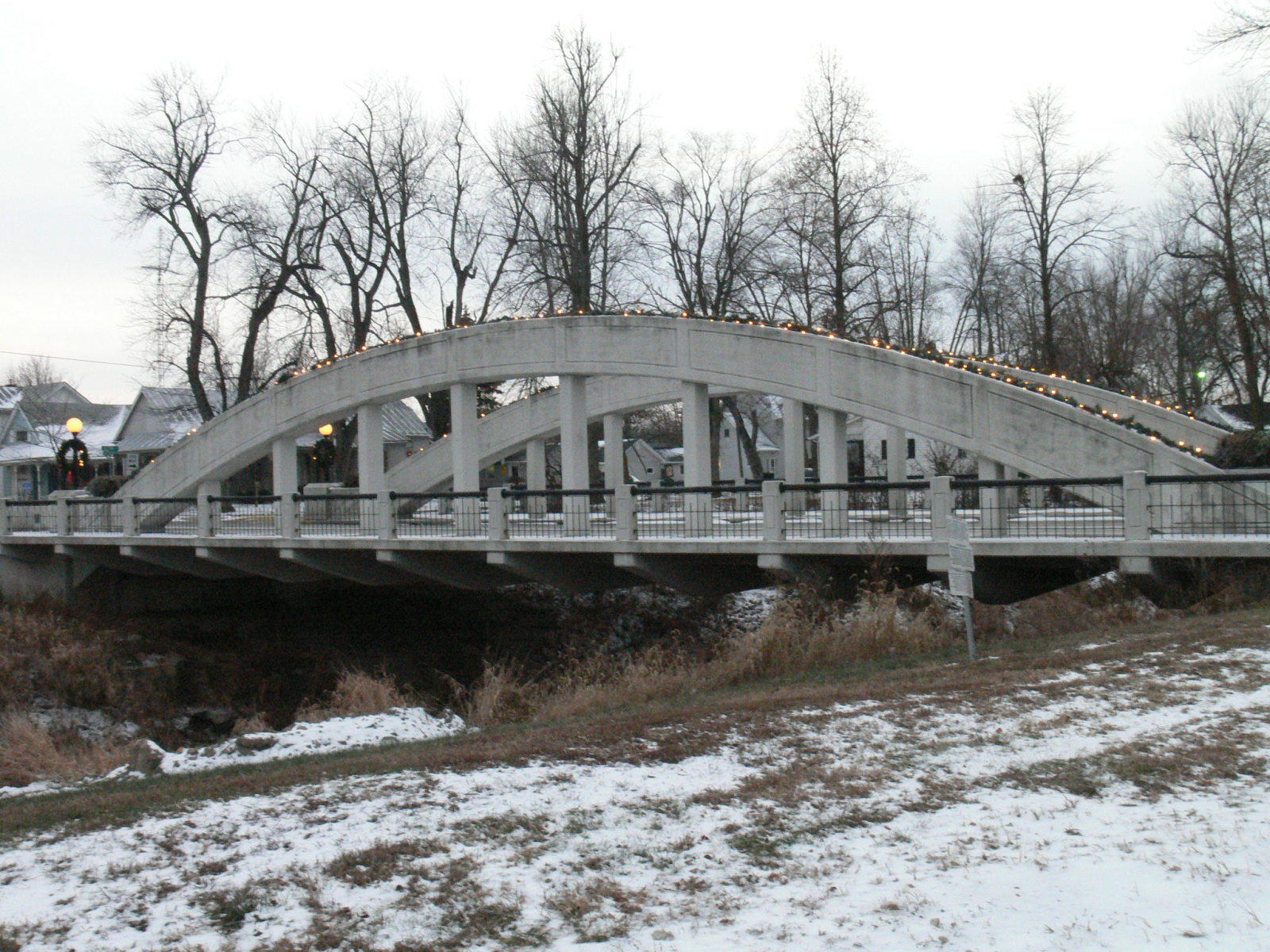
Photo taken by Anthony Dillon in December 2008
130724
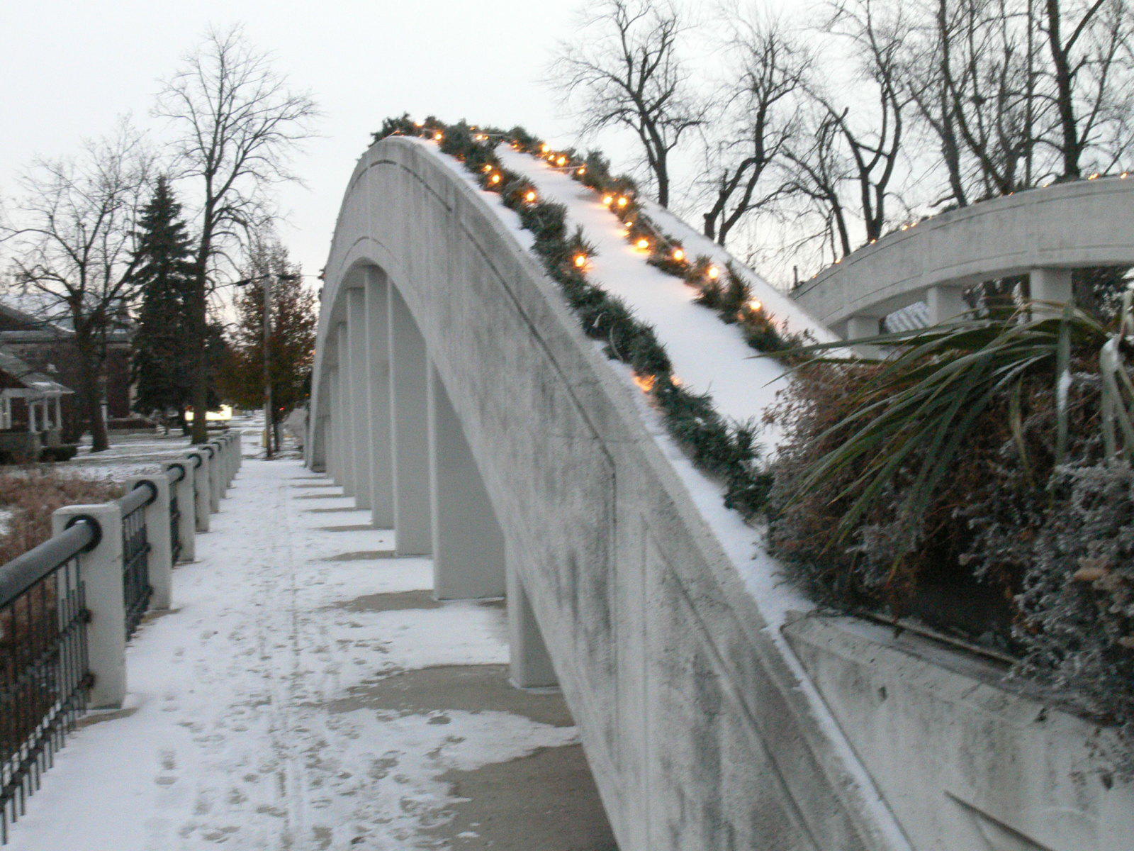
Photo taken by Anthony Dillon in December 2008
130725
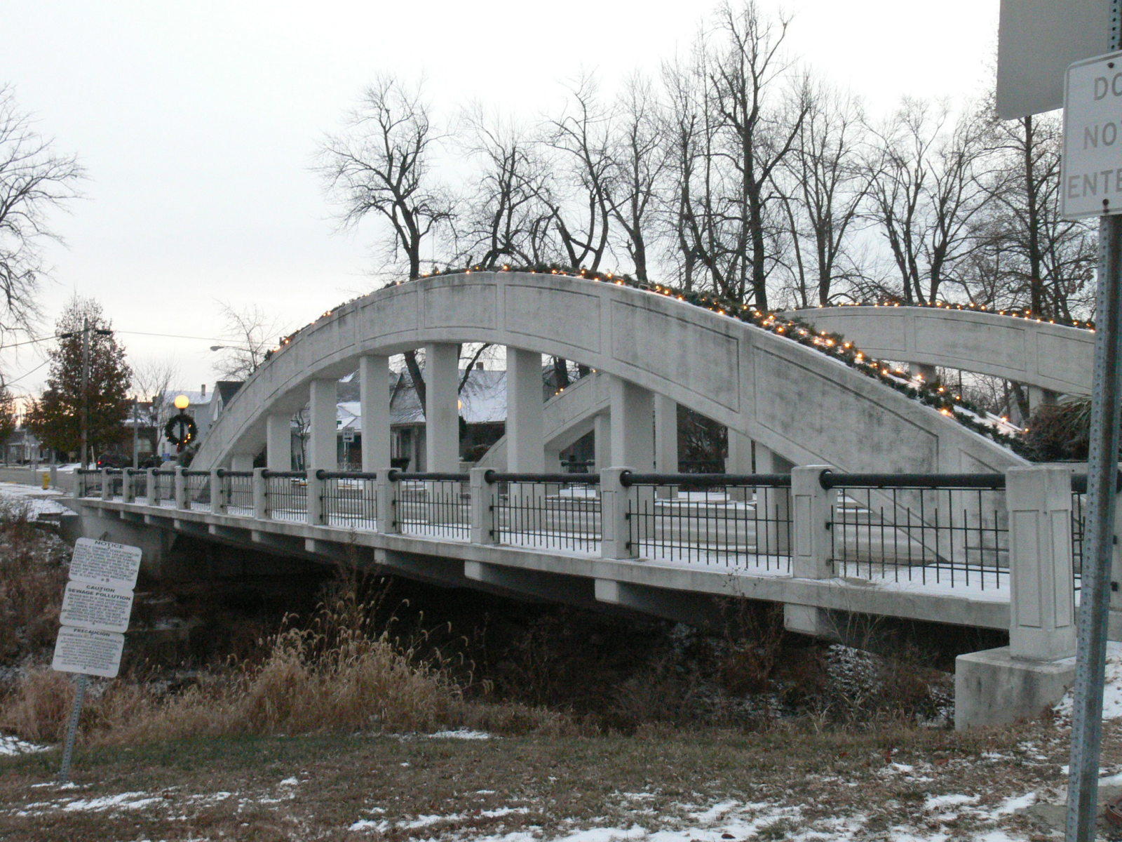
Photo taken by Anthony Dillon in December 2008
130726
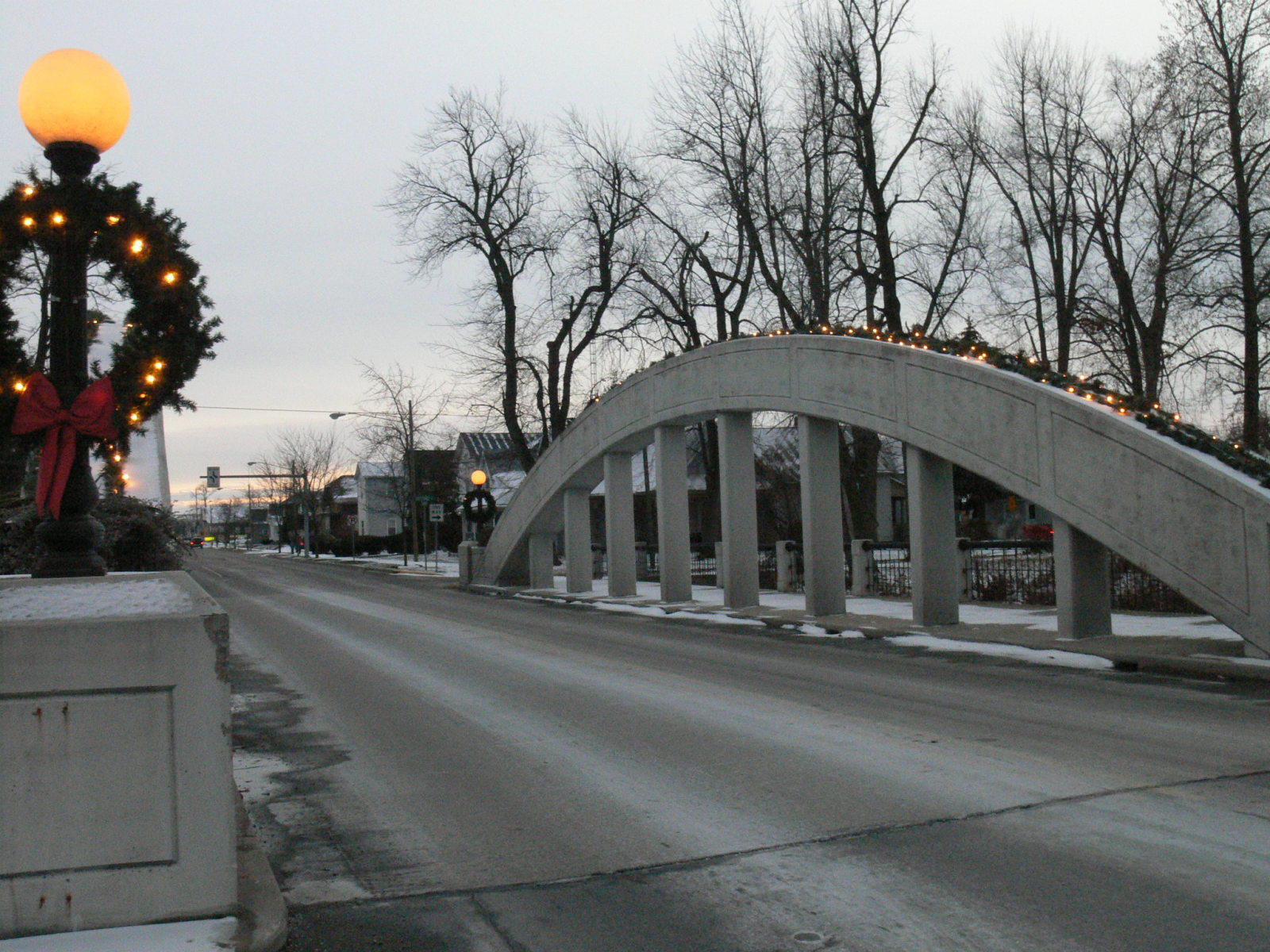
Photo taken by Anthony Dillon in December 2008
143468
East side
Photo taken by Anthony Dillon in July 2009
143469
North end
Photo taken by Anthony Dillon in July 2009
143470
East arch
Photo taken by Anthony Dillon in July 2009
143471
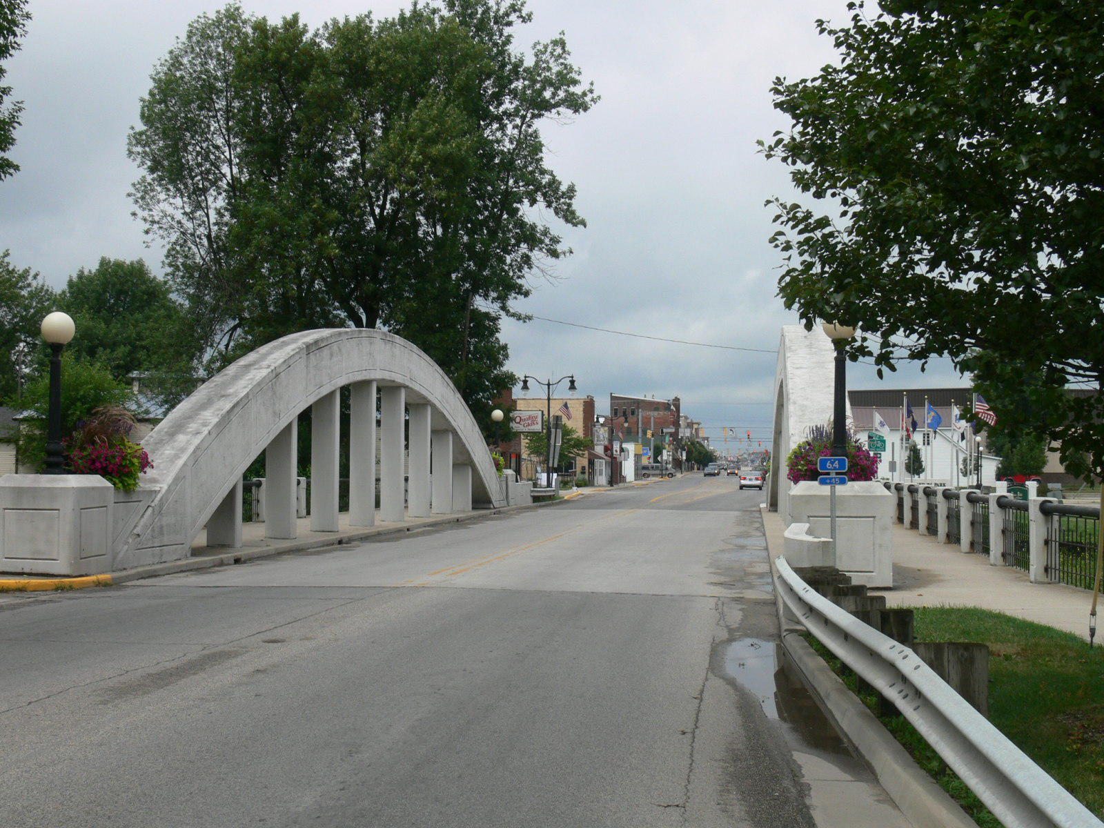
South end showing downtown Portland.
Photo taken by Anthony Dillon in July 2009
143472
Southeast corner
Photo taken by Anthony Dillon in July 2009
143473
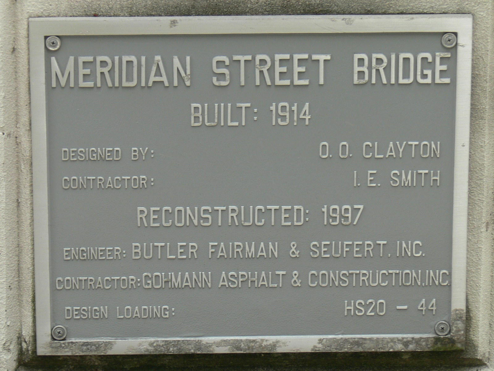
Plaque placed at reconstruction.
Photo taken by Anthony Dillon in July 2009
153518
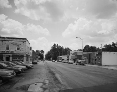
Looking South Along Meridian Street Showing The Bridge Location Just South Of The Downtown Commercial Area
Photo taken by Historic American Engineering Record
153519
Looking North Along Meridian Street Showing The View Through The Bridge
Photo taken by Historic American Engineering Record
153520
Looking South Along Meridian Street Showing The View Through The Bridge
Photo taken by Historic American Engineering Record
153521
Looking West At The Bridge Showing A Side View Of The Bridge In Its Natural Setting
Photo taken by Historic American Engineering Record
153522
Looking Southwest Through The Bridge Arches Showing The Concrete Pillars And Detail On The Arches
Photo taken by Historic American Engineering Record
153523
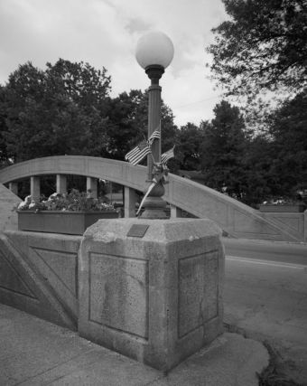
Looking At The Northeast Corner Of The Bridge And Showing A Lamp Post, Planter, And Plaque
Photo taken by Historic American Engineering Record
153524
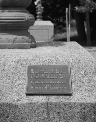
View Of Plaque Located At The Northeast Corner
Photo taken by Historic American Engineering Record
153525
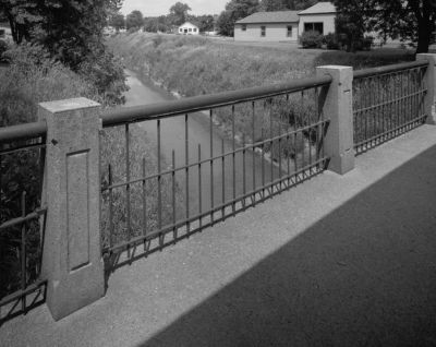
View Of Steel Sidewalk Railing
Photo taken by Historic American Engineering Record
153526
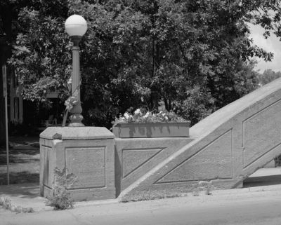
Looking West At The Southwest Bridge Corner Showing The Lamp Post And Planter
Photo taken by Historic American Engineering Record
153527
View Of Underside Of Bridge Showing The Floor Beams
Photo taken by Historic American Engineering Record
186671

Framed under the Wayne Street Bridge
Photo taken by Anthony Dillon in November 2010
186672
Zoomed from same location
Photo taken by Anthony Dillon in November 2010
186673
Wide view taken from Wayne Street Bridge
Photo taken by Anthony Dillon in November 2010
186674
Zoomed in with reflection
Photo taken by Anthony Dillon in November 2010
186675
Vertical from upstream
Photo taken by Anthony Dillon in November 2010
443713
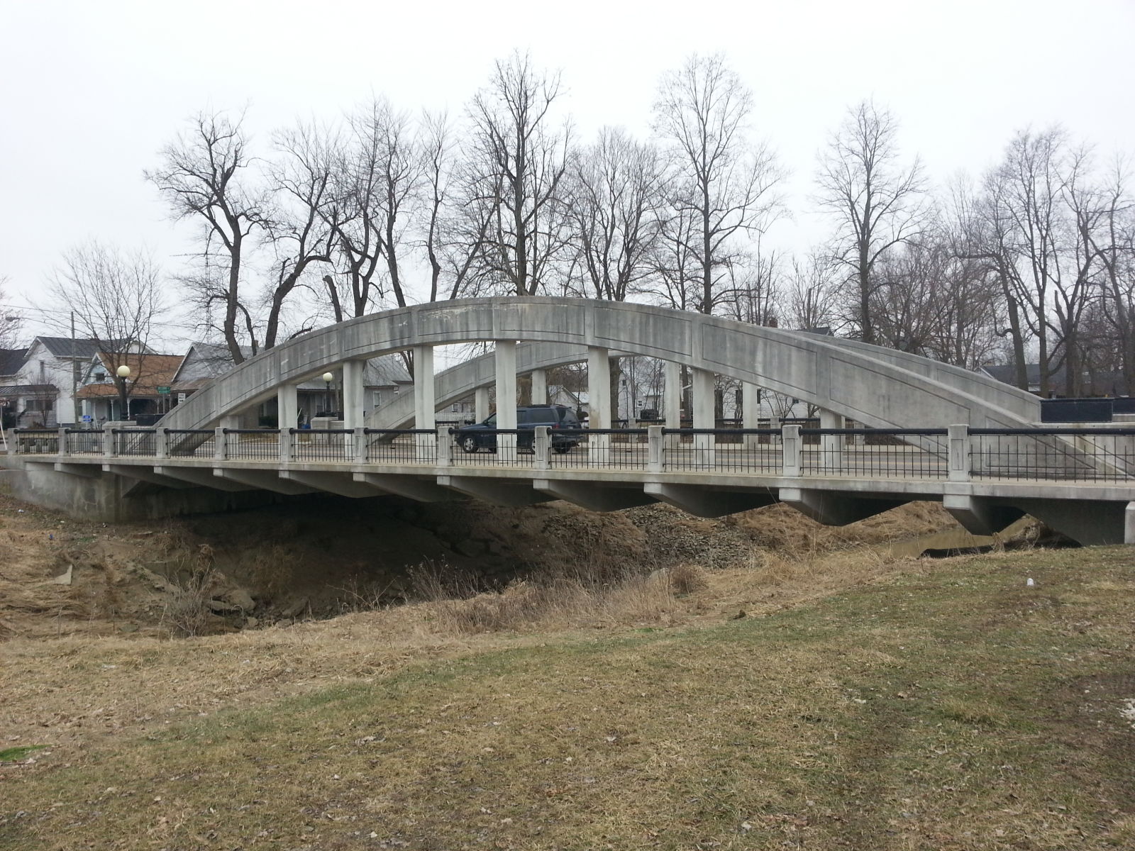
Photo taken by Mike Daffron in February 2019
443714
Photo taken by Mike Daffron in February 2019
443715
Photo taken by Mike Daffron in February 2019
443716
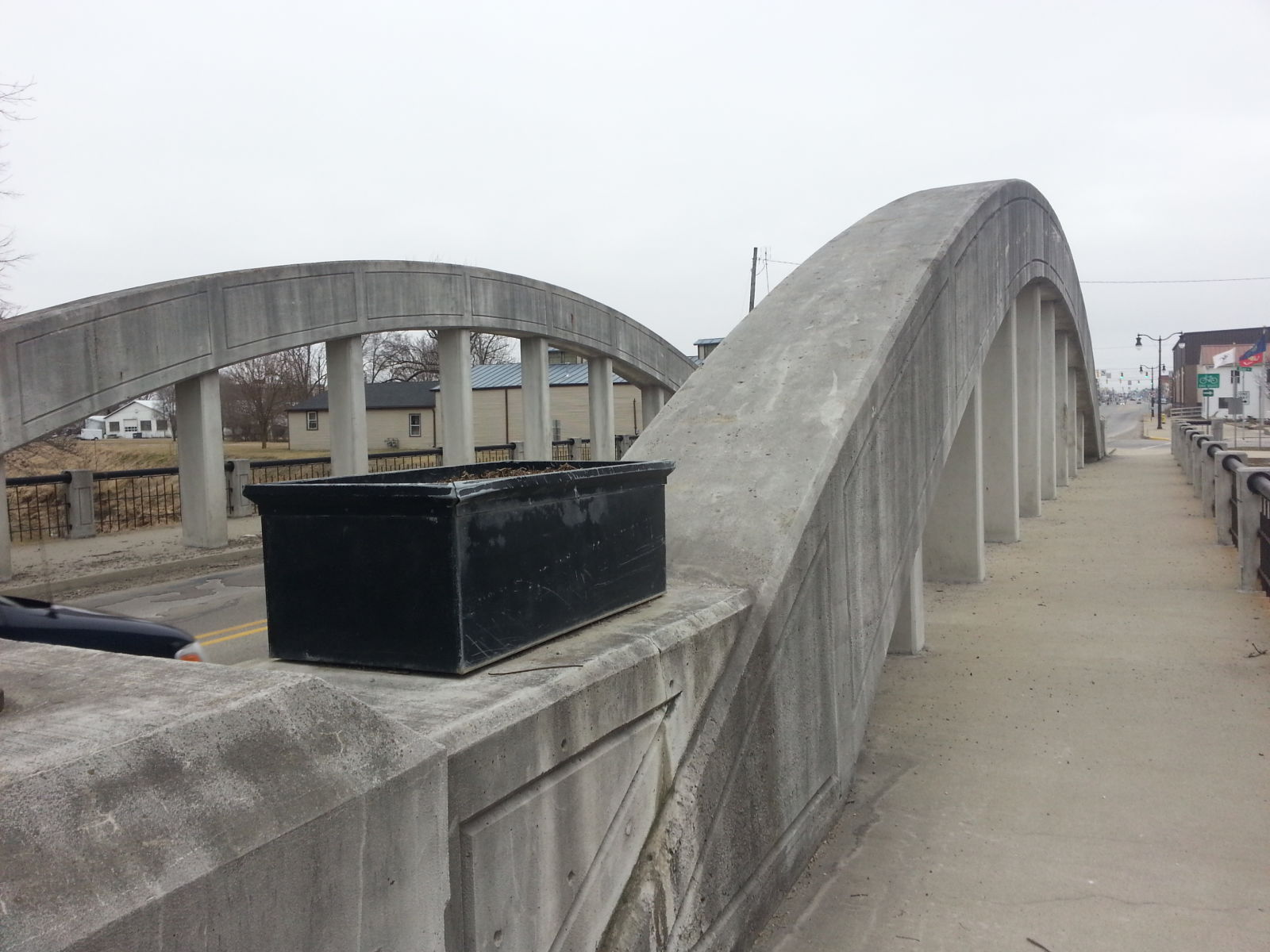
Photo taken by Mike Daffron in February 2019
443717
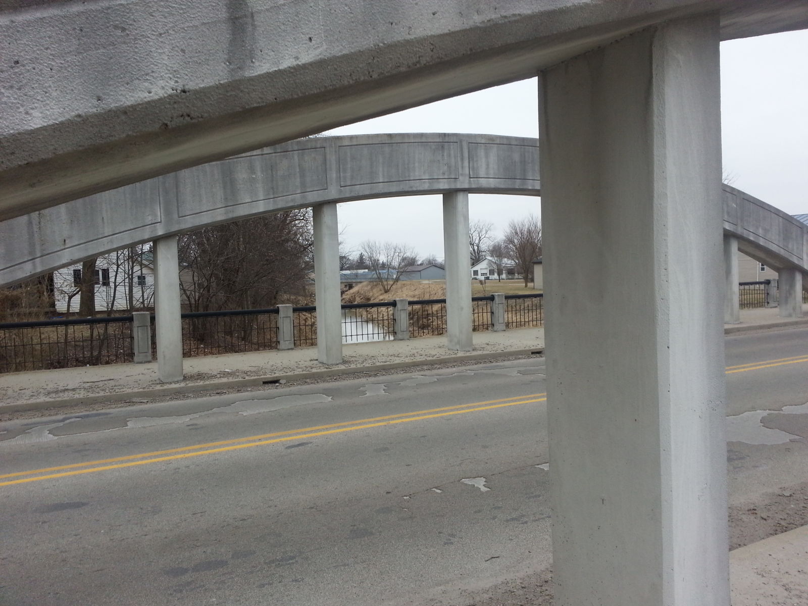
Photo taken by Mike Daffron in February 2019
454075
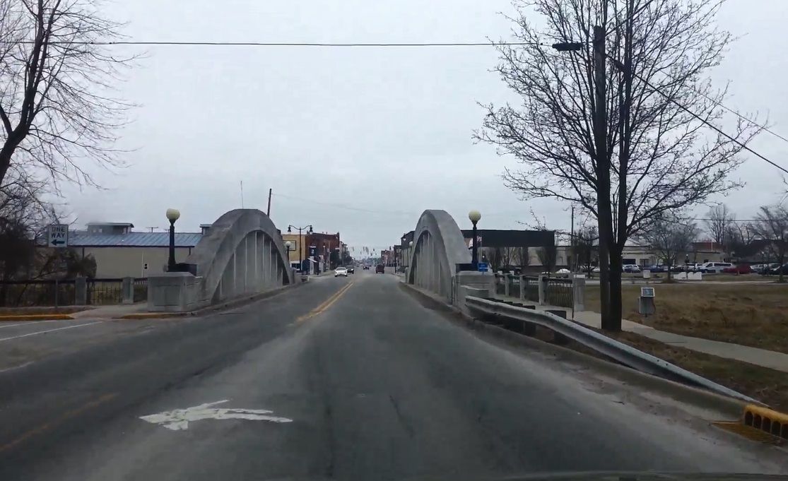
Photo taken by Mike Daffron in February 2019
454076
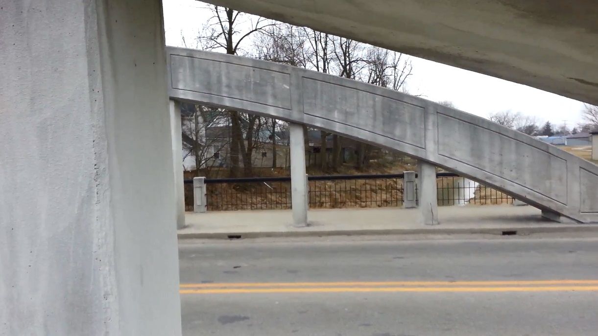
Photo taken by Mike Daffron in February 2019
454077
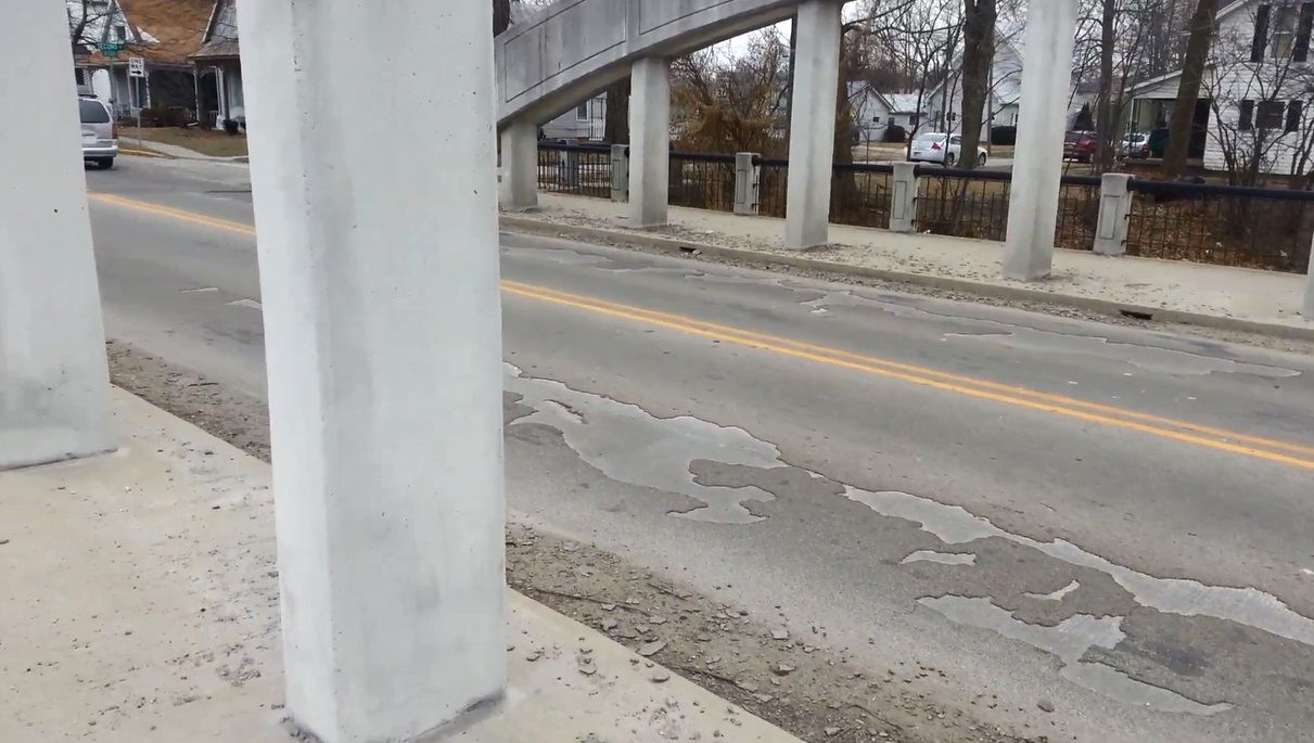
Photo taken by Mike Daffron in February 2019
454078
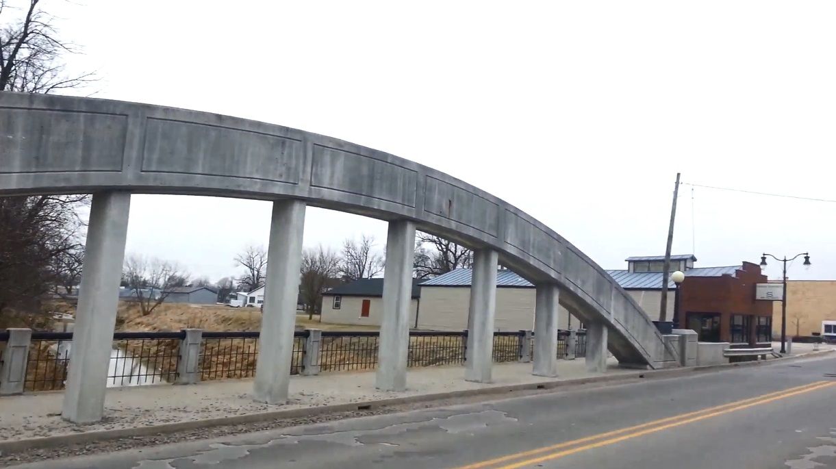
Photo taken by Mike Daffron in February 2019
454079
Photo taken by Mike Daffron in February 2019
487844
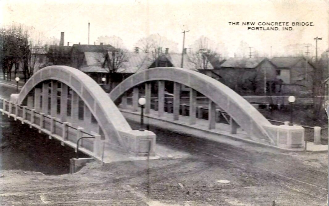
The New Concrete Bridge, Portland, Ind.
ca. 1914 postcard
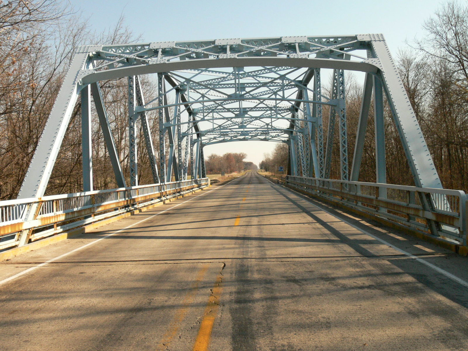
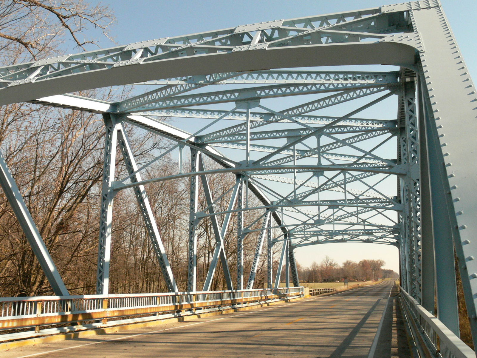
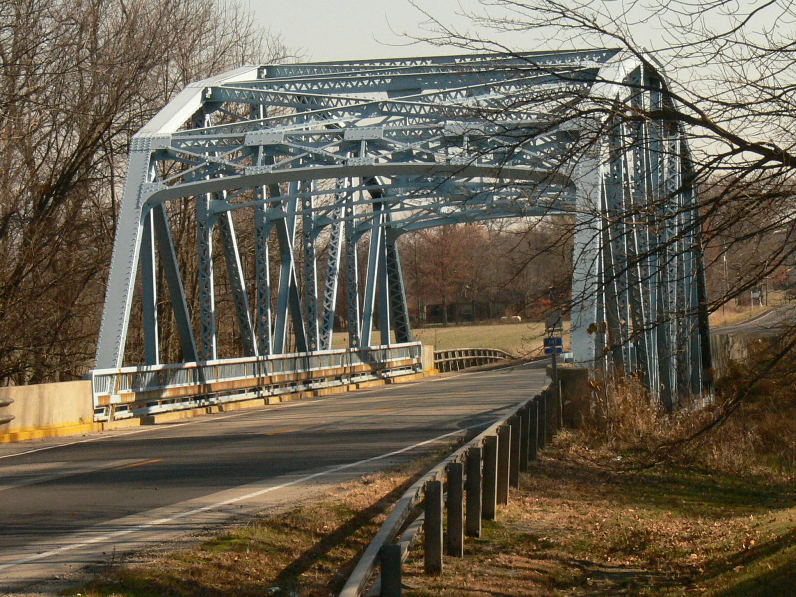
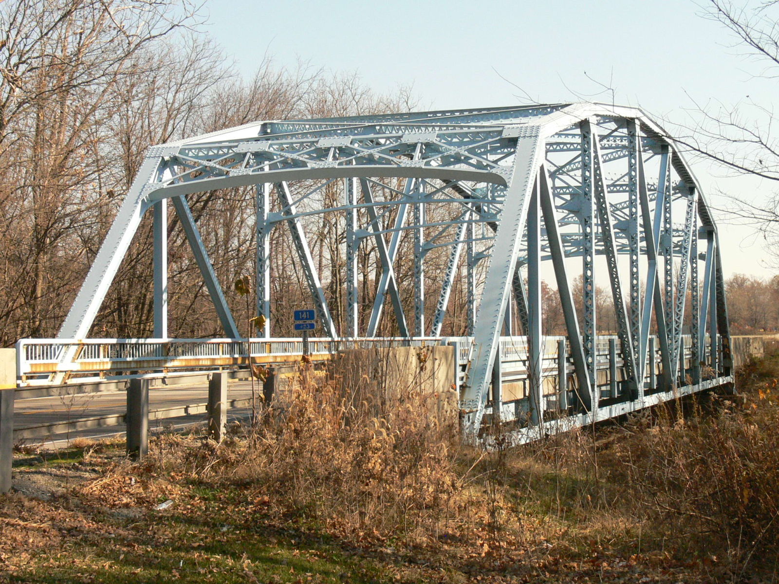
![]()
Status: Open to traffic
Location: 40.568150,-84.848553
Carries CR 700 East over Wabash River
Design: truss/through/warren
Design Details: Riveted Warren through truss
Total Length: 145.0 Feet
Span Length: 140.1 Feet
Overview: Through truss bridge over Wabash River on CR 700 East
History: Built ca. 1950
Built: ca. 1950
Location: Jay County
View Bridge Information In Wayback Machine
![]()
143464
Southwest corner
Photo taken by Anthony Dillon in July 2009
143465
East side.
Photo taken by Anthony Dillon in July 2009
143466
North. Skewed bridges like this are common in Pennsylvania....but not Indiana.
Photo taken by Anthony Dillon in July 2009
143467
Lower chord and truss connections. This bridge is built like a state highway bridge, but on a county road.
Photo taken by Anthony Dillon in July 2009
154220
Curve at Northeast corner.
Photo taken by Anthony Dillon in July 2009
154221
North end.
Photo taken by Anthony Dillon in July 2009
154222
South end.
Photo taken by Anthony Dillon in July 2009
154223
Southeast corner. Skew gives bridge a "trapezoidal" effect.
Photo taken by Anthony Dillon in July 2009
443691
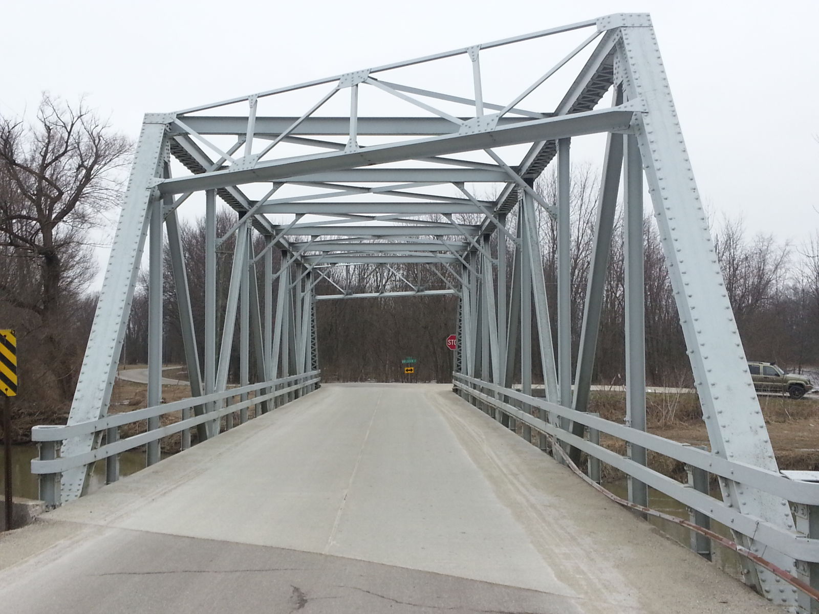
Photo taken by Mike Daffron in February 2019
443692
A weird point of view
Photo taken by Mike Daffron in February 2019
443693
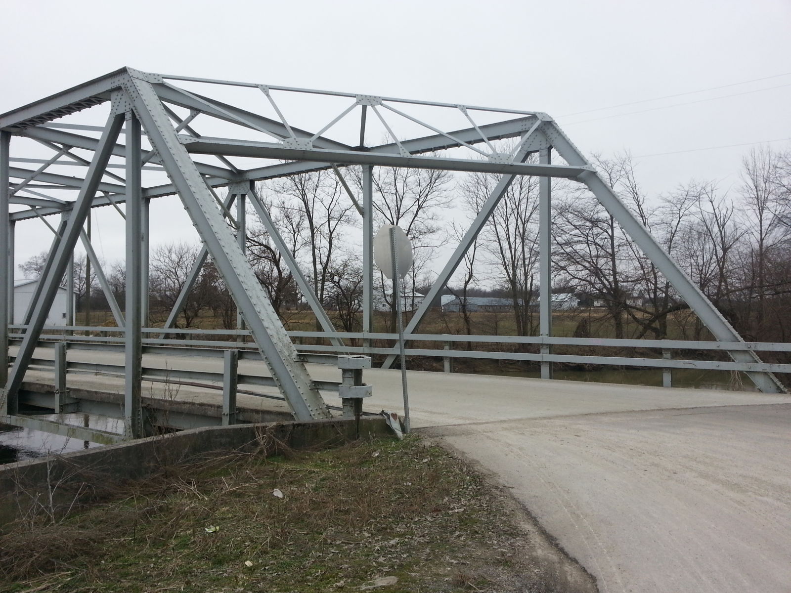
Photo taken by Mike Daffron in February 2019
443694
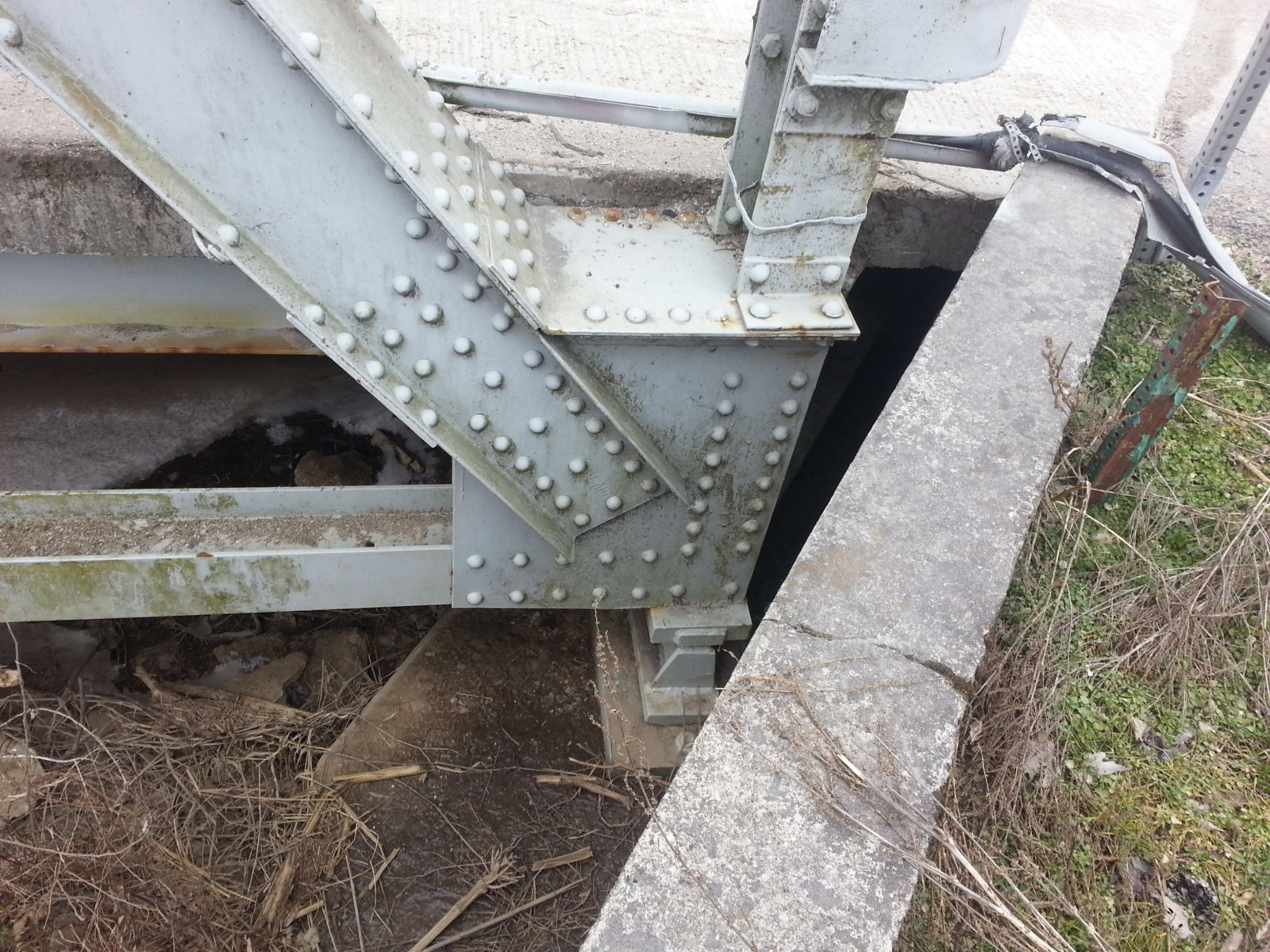
Photo taken by Mike Daffron in February 2019
443695
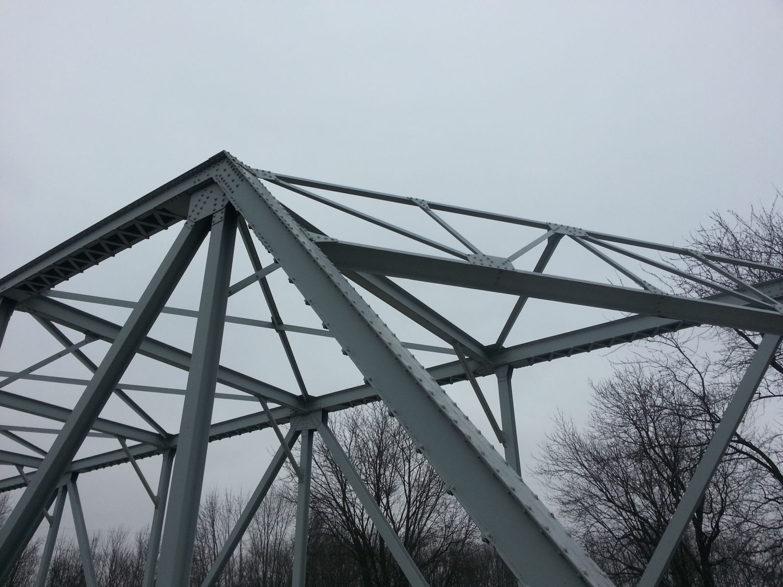
Photo taken by Mike Daffron in February 2019
454057
Photo taken by Mike Daffron in February 2019
454058
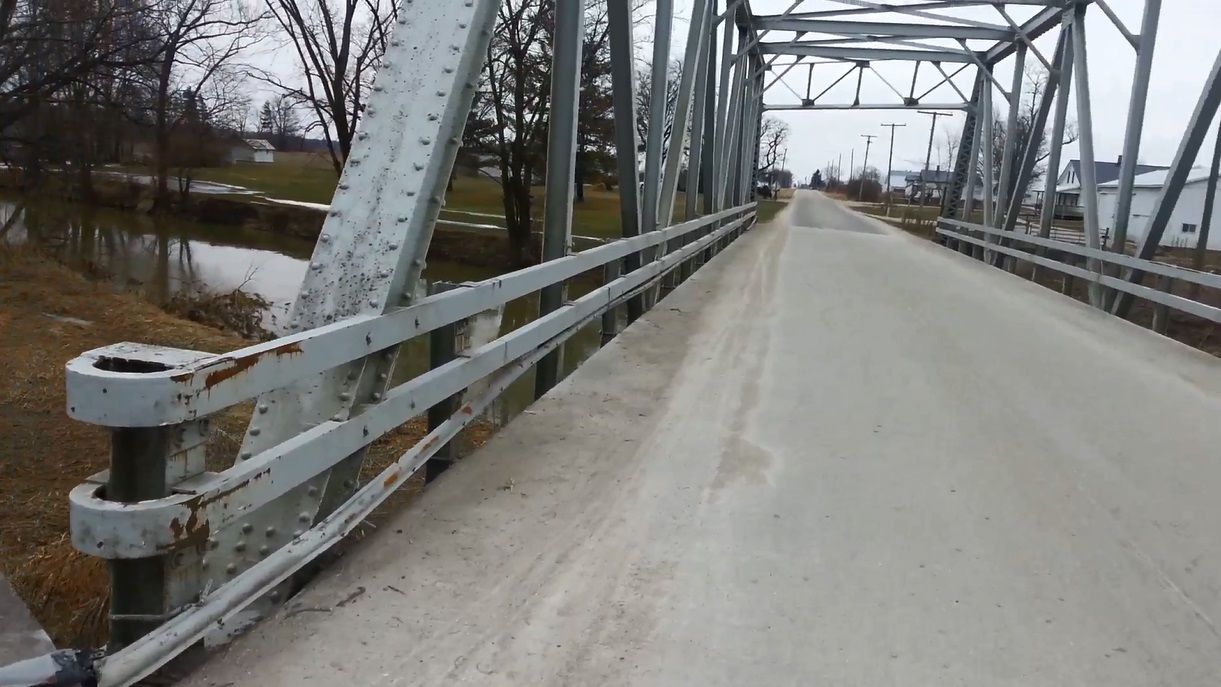
Photo taken by Mike Daffron in February 2019
454059
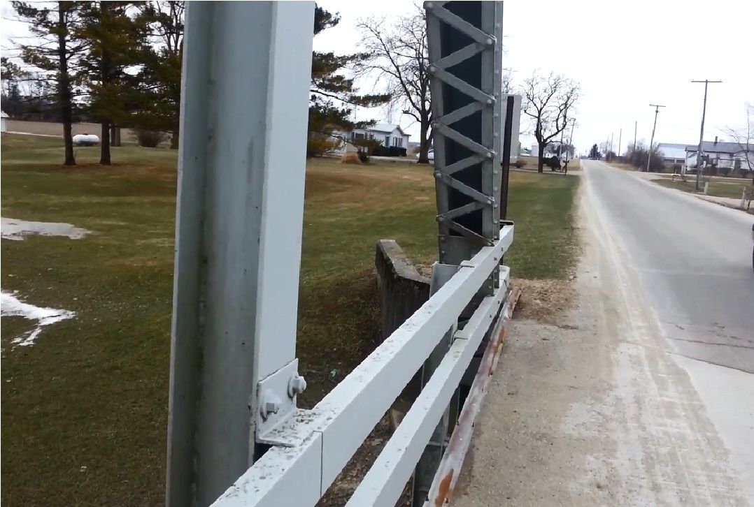
Photo taken by Mike Daffron in February 2019
454060
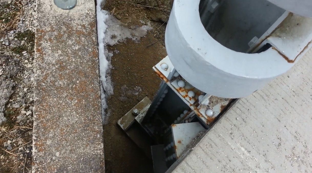
Photo taken by Mike Daffron in February 2019
454061
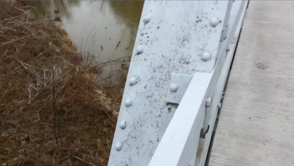
Photo taken by Mike Daffron in February 2019
454062
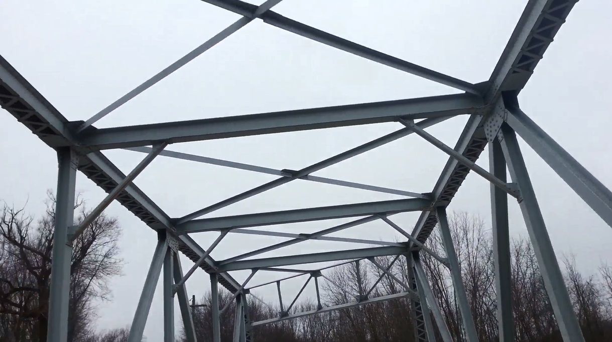
Photo taken by Mike Daffron in February 2019
454063
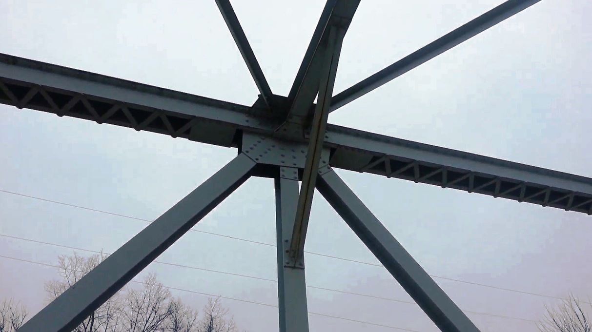
Photo taken by Mike Daffron in February 2019
454064
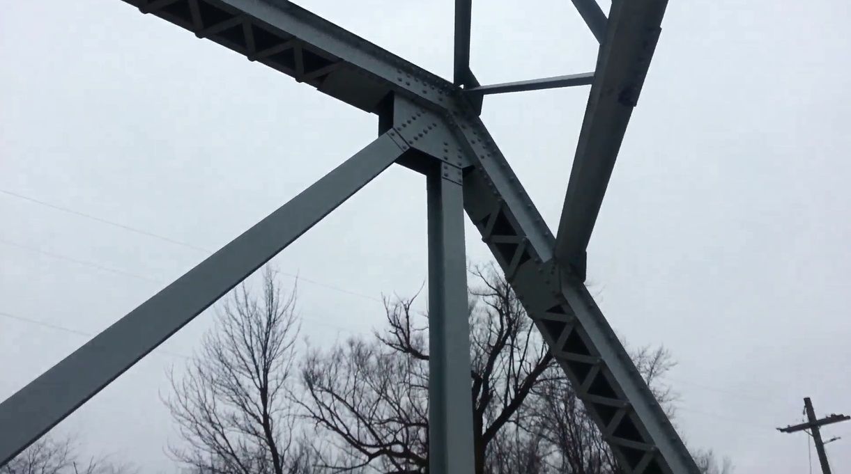
Photo taken by Mike Daffron in February 2019
![]()
Status: Replaced by new bridge
Location: 40.326956,-85.215612
Carries County Road 1250 West over Halfway Creek
Design: truss/pony/pratt-half
Design Details: 5-panel, pinned Half-hip Pratt pony truss
Total Length: 62.0 Feet
Span Length: 60.0 Feet
Overview: Lost pony truss bridge over Halfway Creek on County Road 1250 West
History: Built ca. 1900; replaced 1998
Built: ca. 1900
Location: Jay County
View Bridge Information In Wayback Machine
![]()
392101
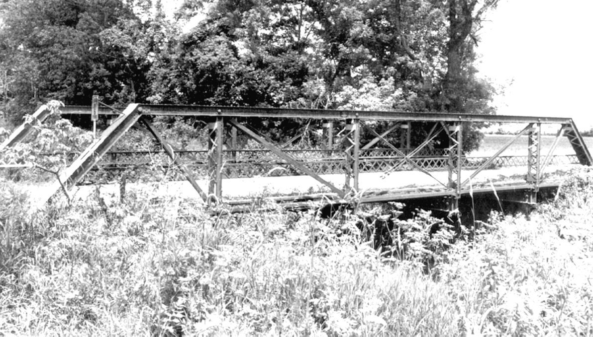
Photo courtesy of the Indiana State Department of Natural Resource, Division of Historic Preservation and Archaeology.
![]()
Status: Removed and replaced
Location: 40.339463,-85.168471
Carries CR 1000W over Halfway Creek
Design: truss/bedstead/pratt
Design Details: 2-panel Pinned, Pratt bedstead pony truss
Total Length: 34.1 Feet
Span Length: 32.2 Feet
Overview: Lost Pony truss bridge over Halfway Creek on CR 43 East (1000W)
History: Built ca. 1880
Built: ca. 1880
Location: Jay County
View Bridge Information In Wayback Machine
![]()
171080
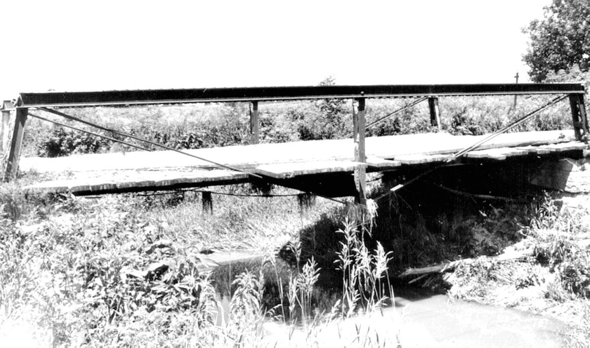
Photo courtesy of the Indiana State Department of Natural Resource, Division of Historic Preservation and Archaeology.
171081
Photo courtesy of the Indiana State Department of Natural Resource, Division of Historic Preservation and Archaeology.
![]()
Status: Replaced by new bridge
Location: 40.420000,-84.881667
Carries County Road 500 East over Bailey Ditch
Design: truss/pony/warren/alt-verticals
Design Details: 4-panel Warren pony truss
Total Length: 53.2 Feet
Span Length: 50.9 Feet
Overview: Lost pony truss bridge over Bailey Ditch on County Road 500 East
History: Built 1925; replaced 2000
Built: 1925
Location: Jay County
View Bridge Information In Wayback Machine
![]()
392092
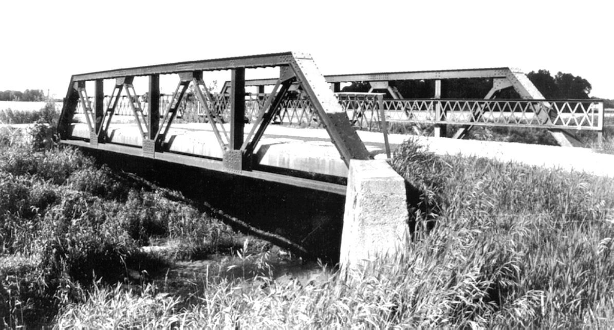
Photo courtesy of the Indiana State Department of Natural Resource, Division of Historic Preservation and Archaeology.
392093

Photo courtesy of the Indiana State Department of Natural Resource, Division of Historic Preservation and Archaeology.
![]()
Status: Road closed off, bridge in poor condition.
Location: 40.424144,-85.019850
Carries CR 200W (closed) over Salamonie River
Design: truss/pony/warren/alt-verticals
Design Details: 2X5-panel Riveted Warren pony truss
Total Length: 125.0 Feet
Span Length: 60.0 Feet
Overview: Pony truss bridge over Salamonie River on CR 200W (abandoned)
History: Built ca. 1930
Built: ca. 1930
Location: Jay County
View Bridge Information In Wayback Machine
![]()
143474
Street view....or what's left of it.
Photo taken by Anthony Dillon in July 2009
143475

Truss detail. Sections of guardrail have been cut out with torches.
Photo taken by Anthony Dillon in July 2009
143476
Side detail showing outriggers.
Photo taken by Anthony Dillon in July 2009
192948
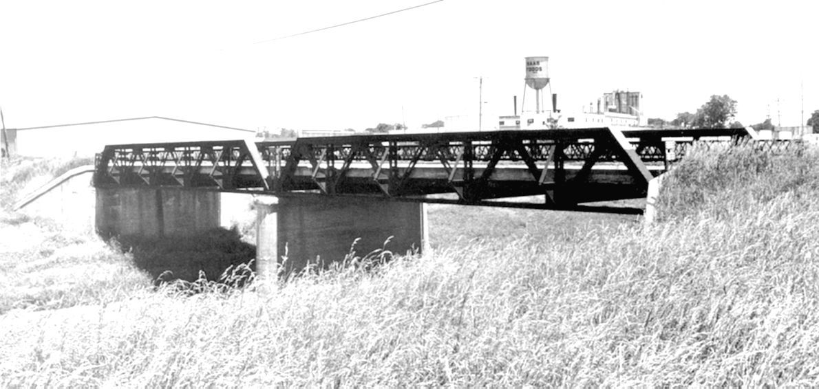
Photo courtesy of the Indiana State Department of Natural Resource, Division of Historic Preservation and Archaeology.
SHAARD photo
443696
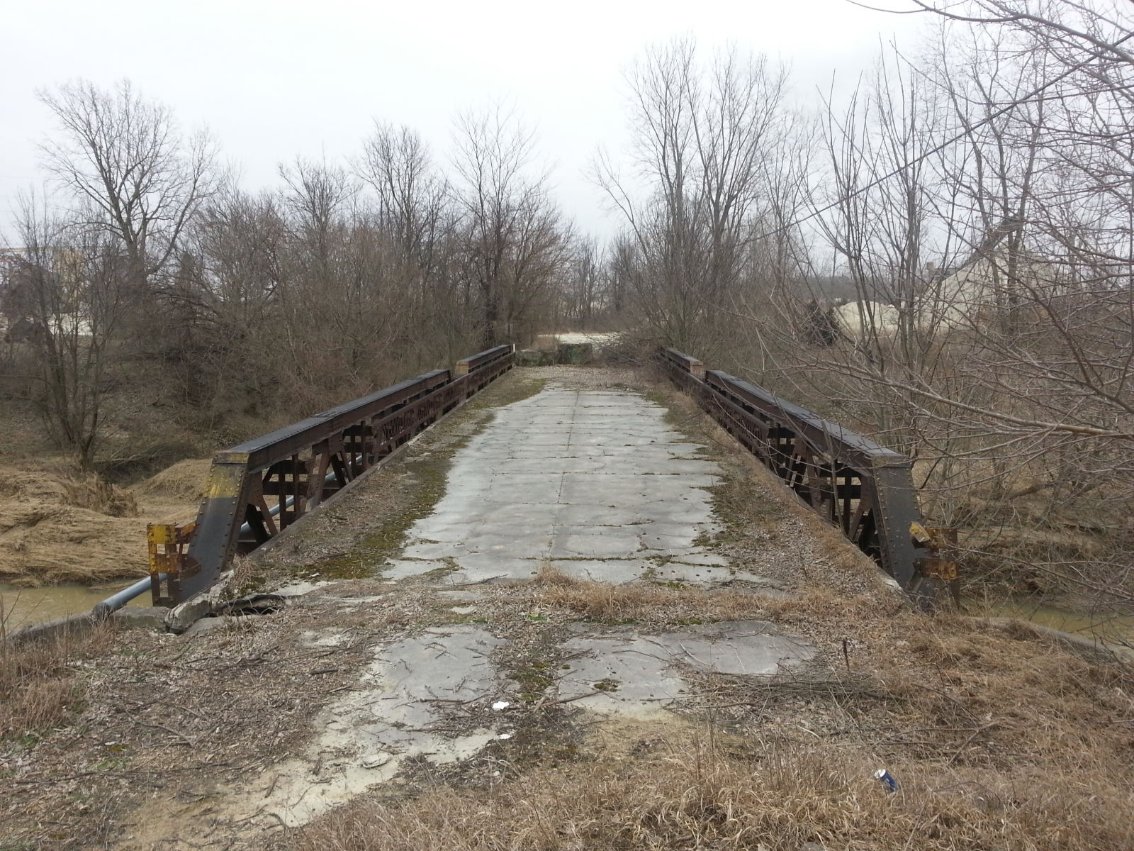
Photo taken by Mike Daffron in February 2019
443697
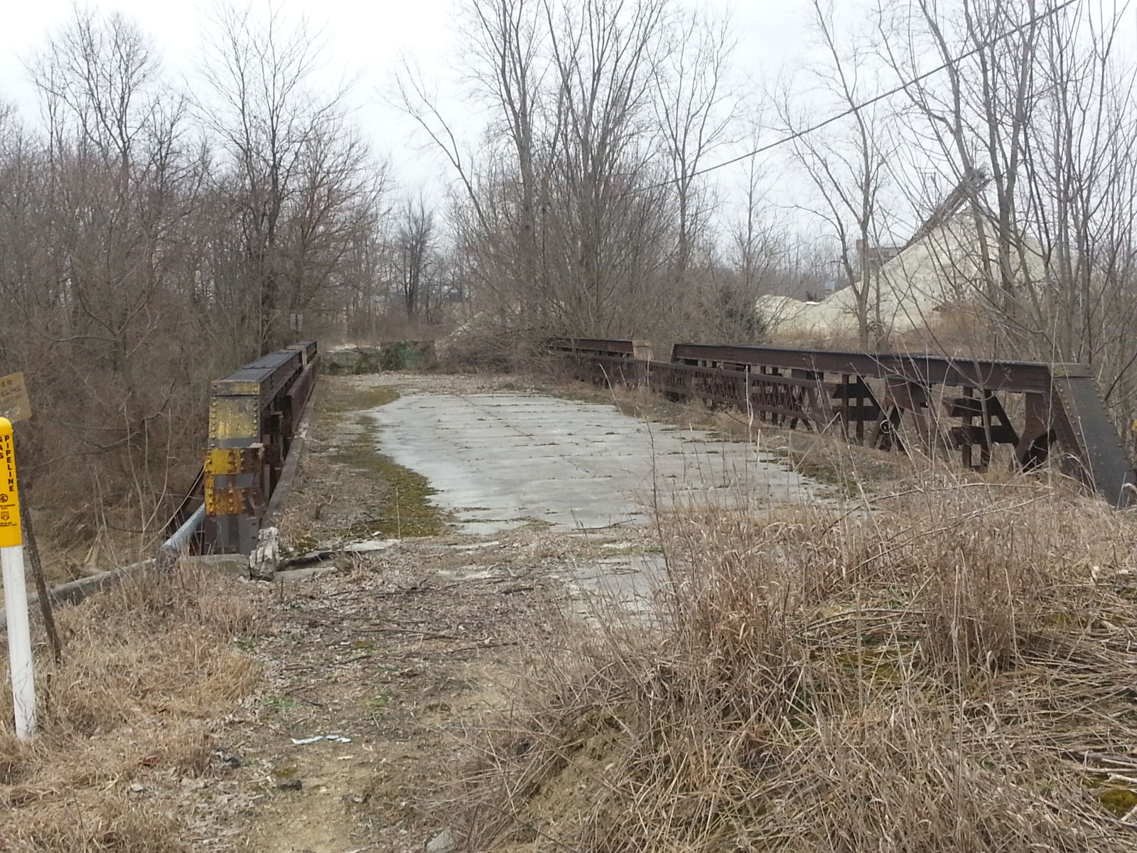
Photo taken by Mike Daffron in February 2019
443698
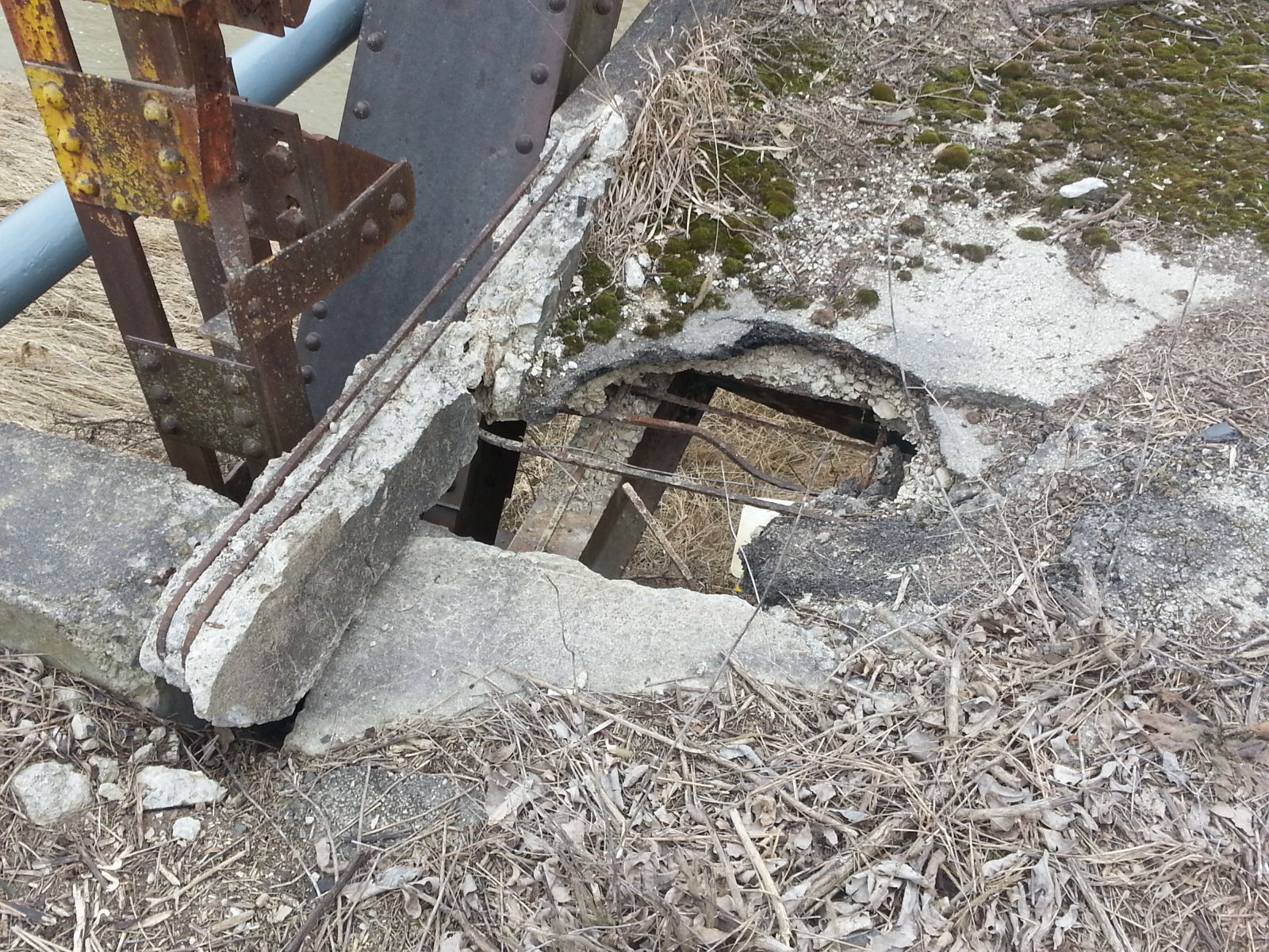
Photo taken by Mike Daffron in February 2019
443699
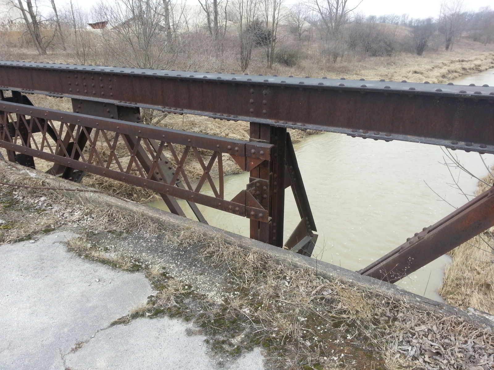
Photo taken by Mike Daffron in February 2019
443700
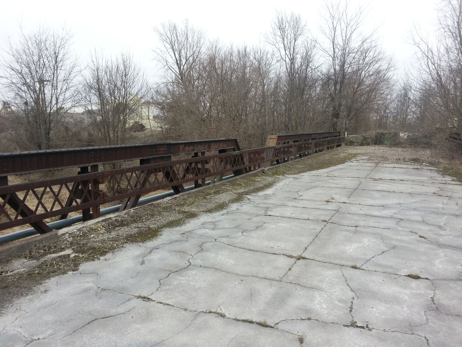
Photo taken by Mike Daffron in February 2019
443701
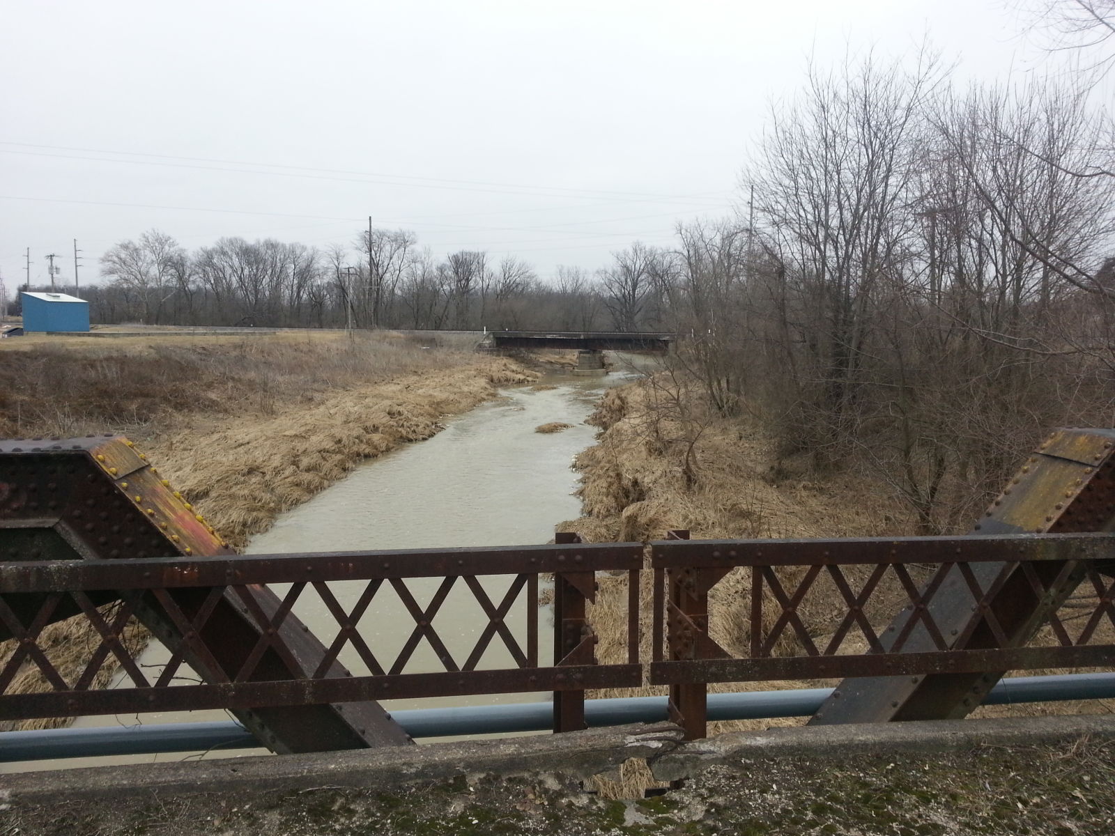
Photo taken by Mike Daffron in February 2019
454065
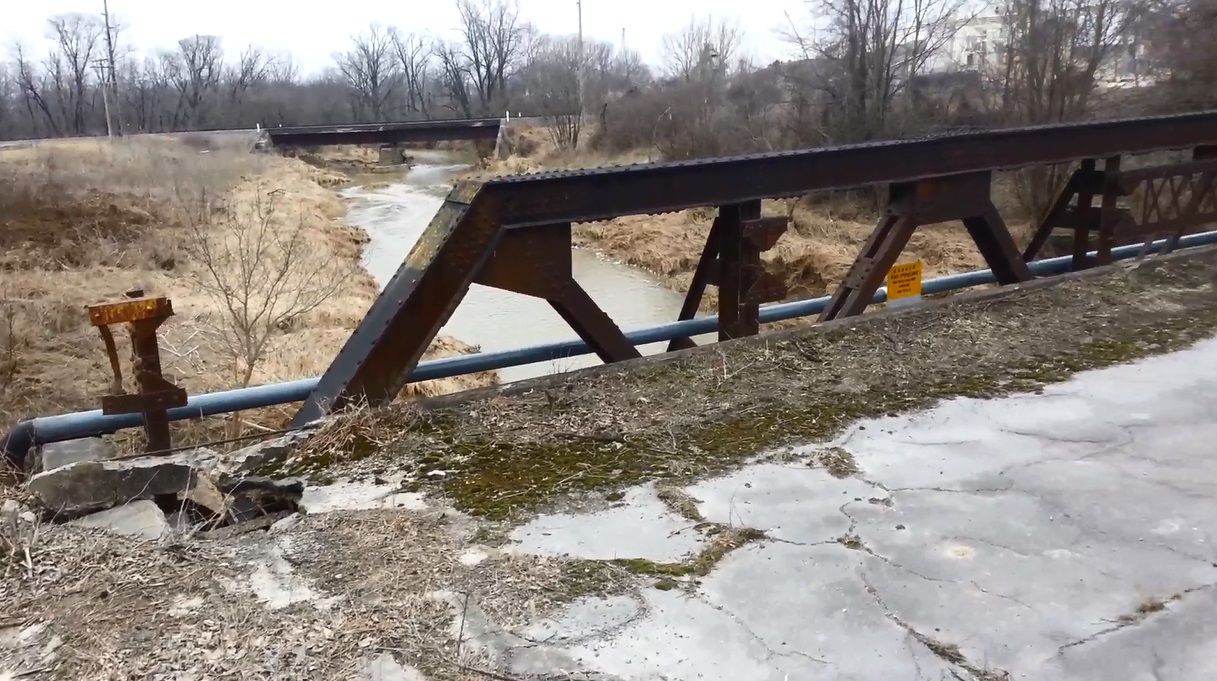
Photo taken by Mike Daffron in February 2019
454066
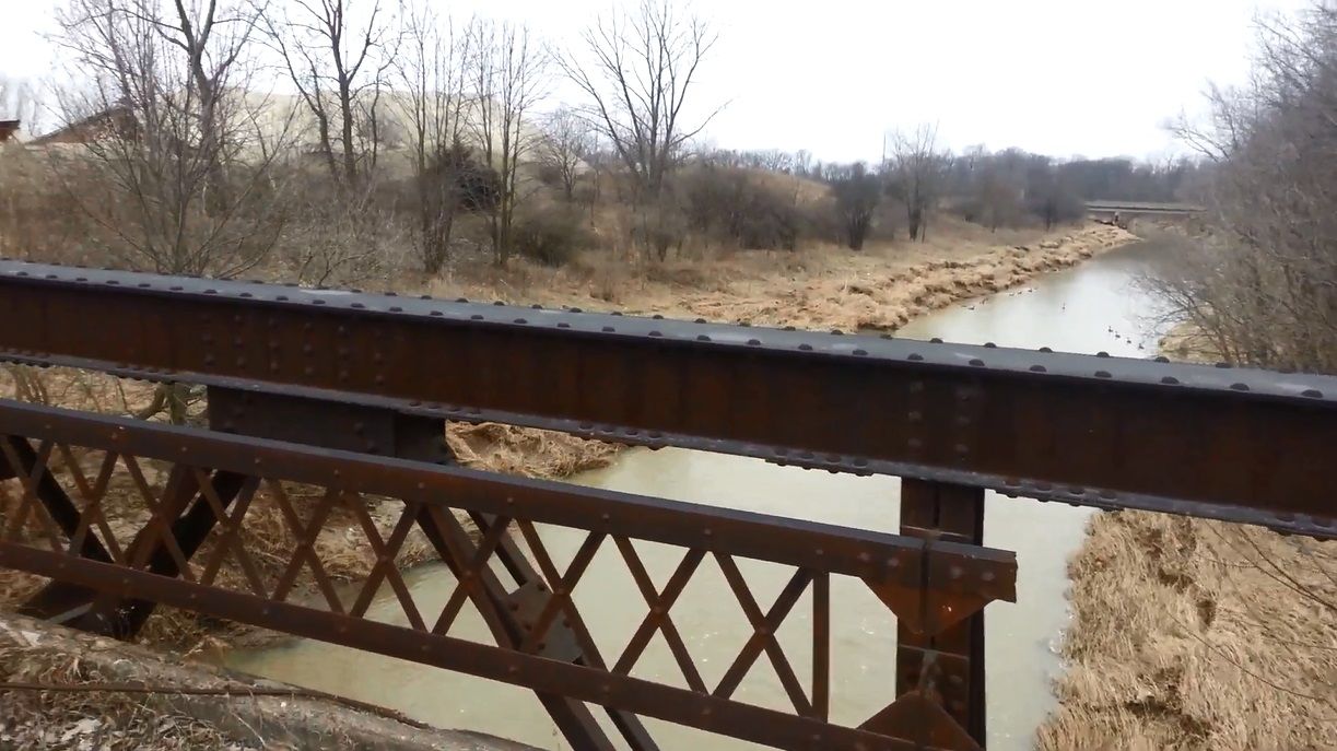
Photo taken by Mike Daffron in February 2019
454067
Photo taken by Mike Daffron in February 2019
![]()
Status: Replaced by new bridge
Location: 40.424876,-84.984000
Carries CR 100 S over Salamonie River
Design: truss/pony
Design Details: Pony truss
Total Length: 98.1 Feet
Span Length: 67.9 Feet
Overview: Lost pony truss bridge over Salamonie River on CR 100 S
History: Replaced 1998
Built: ca.1885
Location: Jay County
View Bridge Information In Wayback Machine
![]()
171082
Photo courtesy of the Indiana State Department of Natural Resource, Division of Historic Preservation and Archaeology.
171083
Photo courtesy of the Indiana State Department of Natural Resource, Division of Historic Preservation and Archaeology.
![]()
Status: Replaced by new bridge
Location: 40.430738,-85.064378
Carries CR 104 S over Wikel Ditch
Design: truss/bedstead/pratt
Design Details: Pinned, Pratt bedstead pony truss
Total Length: 36.1 Feet
Span Length: 35.1 Feet
Overview: Lost pony truss bridge over Wikel Ditch on CR 104 S
History: Built ca. 1910; replaced 1991
Built: ca. 1910
Location: Jay County
View Bridge Information In Wayback Machine
![]()
171079
Photo courtesy of the Indiana State Department of Natural Resource, Division of Historic Preservation and Archaeology.
![]()
Status: Replaced by new bridge
Location: 40.458398,-85.095840
Carries CR 77 E over Salamonie River
Design: truss/through/pratt
Design Details: Pinned Pratt through truss
Total Length: 141.1 Feet
Span Length: 139.1 Feet
Overview: Lost through truss bridge over Salamonie River on CR 77 E
History: Built ca. 1920; replaced 1994
Built: ca. 1920
Location: Jay County
View Bridge Information In Wayback Machine
![]()
156499
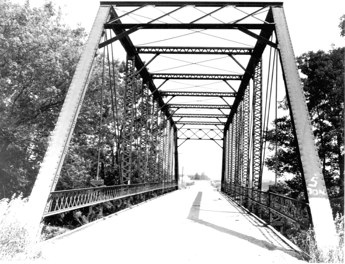
Photo courtesy of the Indiana State Department of Natural Resource, Division of Historic Preservation and Archaeology.
156500
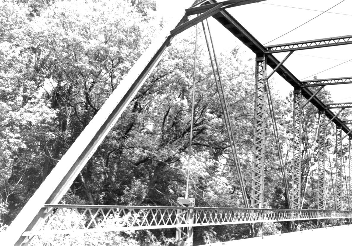
Photo courtesy of the Indiana State Department of Natural Resource, Division of Historic Preservation and Archaeology.
![]()
Status: Replaced by new bridge
Location: 40.501271,-85.177045
Carries County Road 450 North over Salamonie River
Design: truss/through/pratt
Design Details: Pinned Pratt through truss
Total Length: 144.0 Feet
Span Length: 142.1 Feet
Overview: Lost through truss bridge over Salamonie River on County Road 450 North
History: Built 1895; replaced 1992
Built: 1895
Location: Jay County
View Bridge Information In Wayback Machine
![]()
156501
Photo courtesy of the Indiana State Department of Natural Resource, Division of Historic Preservation and Archaeology.
156502
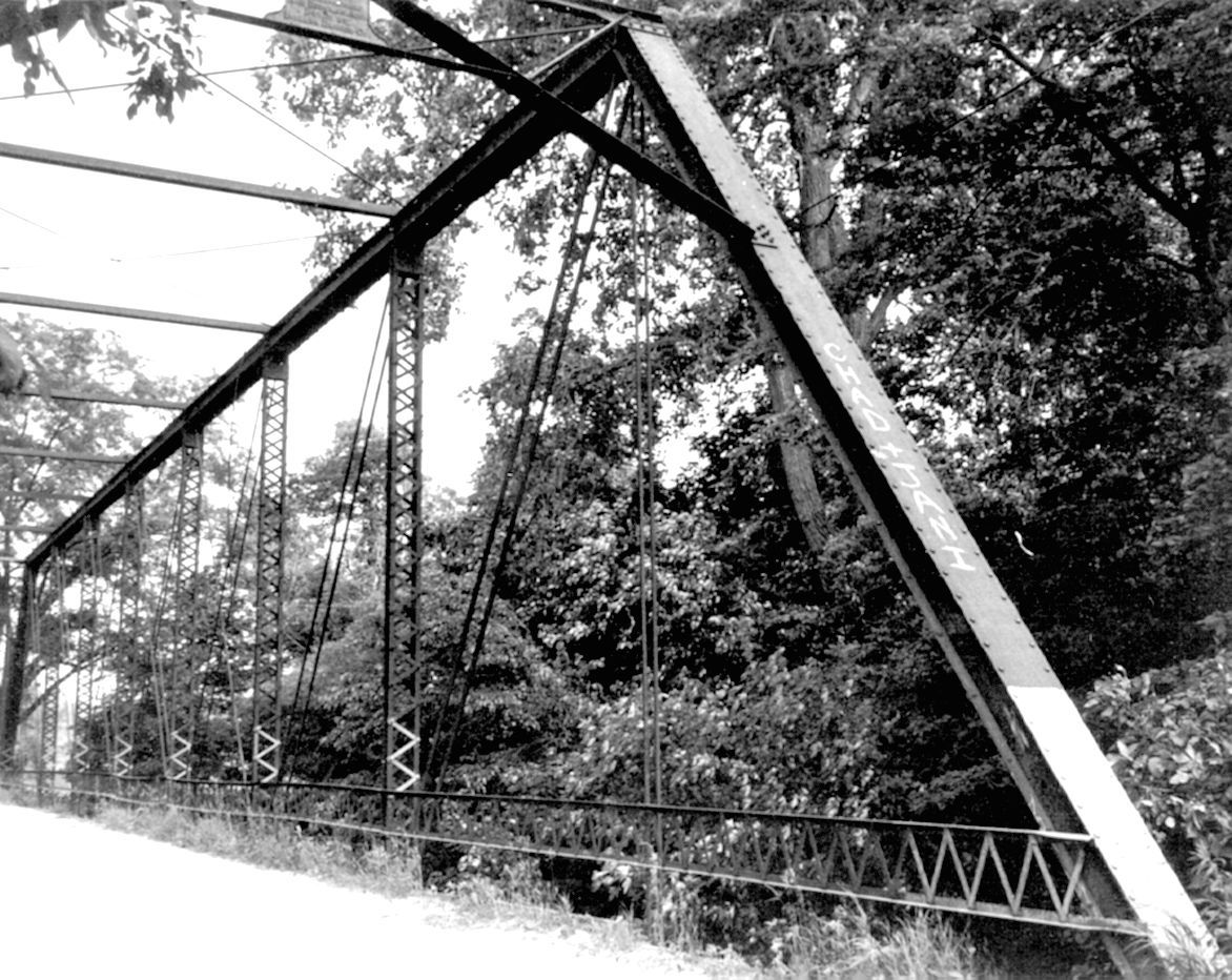
Photo courtesy of the Indiana State Department of Natural Resource, Division of Historic Preservation and Archaeology.
![]()
Status: Replaced by new bridge
Location: 40.425000,-85.145000
Carries County Road 50 South over Brooks Creek
Design: truss/through/pratt
Design Details: Pinned Pratt through truss
Total Length: 100.1 Feet
Span Length: 98.1 Feet
Overview: Lost through truss bridge over Brooks Creek on County Road 50 South
History: Built 1892; replaced 1992
Built: 1892
Location: Jay County
View Bridge Information In Wayback Machine
![]()
155895
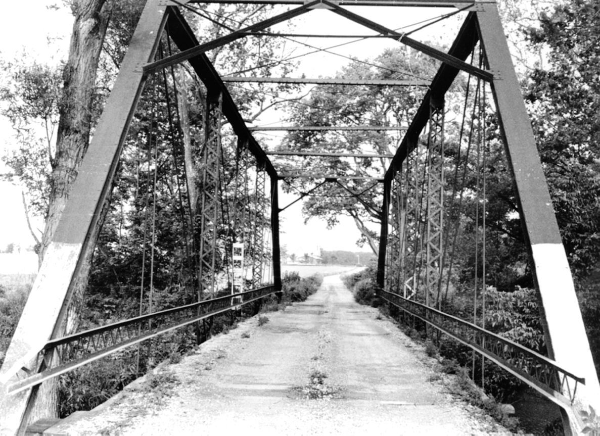
Photo from SHAARD
155896
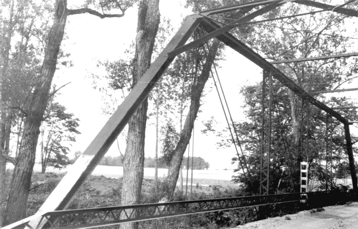
Photo from SHAARD
![]()
Status: Replaced by new bridge
Location: 40.545264,-84.934151
Carries County Road 250 East over Limberlost Creek
Design: truss/pony/pratt
Design Details: 4-panel, bolted and pinned Pratt pony truss
Total Length: 100.1 Feet
Span Length: 74.2 Feet
Overview: Lost pony truss bridge over Limberlost Creek on County Road 250 East.
History: Built ca. 1910; replaced 1996
Built: ca. 1910
Location: Jay County
View Bridge Information In Wayback Machine
![]()
392071
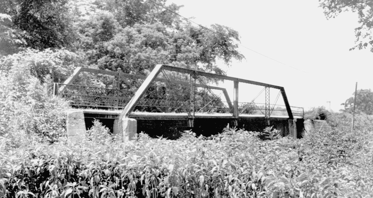
Photo courtesy of the Indiana State Department of Natural Resource, Division of Historic Preservation and Archaeology.
392072

Photo courtesy of the Indiana State Department of Natural Resource, Division of Historic Preservation and Archaeology.
![]()
Status: Replaced by new bridge
Location: 40.563704,-84.802544
Carries State Line Road (CR 235E) over Wabash River
Design: truss/through/pratt
Design Details: Pinned Pratt through truss
Total Length: 174.9 Feet
Span Length: 124.0 Feet
Overview: Lost through truss bridge over Wabash River on State Line Road.
History: Built ca. 1890; replaced 1996
Built: ca. 1890
Location: Jay County
View Bridge Information In Wayback Machine
![]()
155263
Indiana State Historical Society photo.
155264
Indiana State Historical Society photo.
![]()
Status: Replaced by new bridge
Location: 40.567689,-84.838585
Carries CR 750E over Wabash River
Design: truss/through/whipple
Design Details: Pinned, Whipple through truss
Total Length: 122.0 Feet
Span Length: 122.0 Feet
Overview: Lost Whipple through truss bridge over Wabash River on CR 750E
History: Built ca. 1887 by H.P. Hepburn
Built: ca.1887
Location: Jay County
View Bridge Information In Wayback Machine
![]()
171077
Photo courtesy of the Indiana State Department of Natural Resource, Division of Historic Preservation and Archaeology.
171078
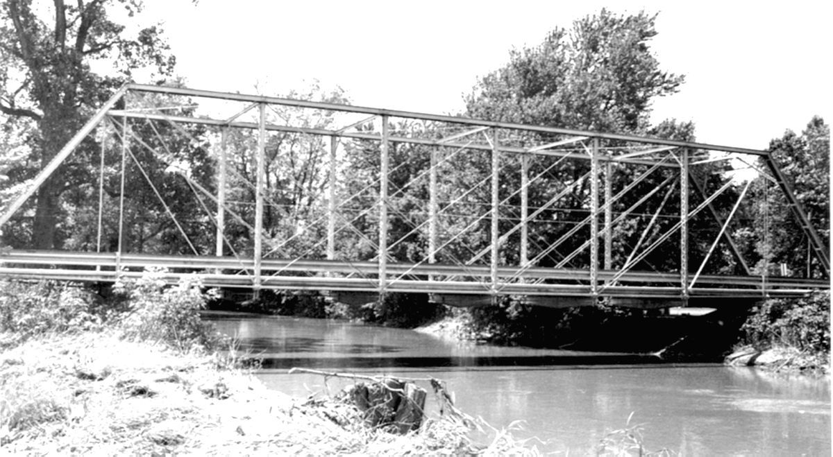
Photo courtesy of the Indiana State Department of Natural Resource, Division of Historic Preservation and Archaeology.
359741
Historic photo
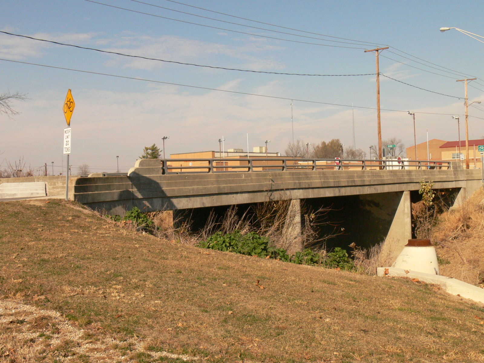
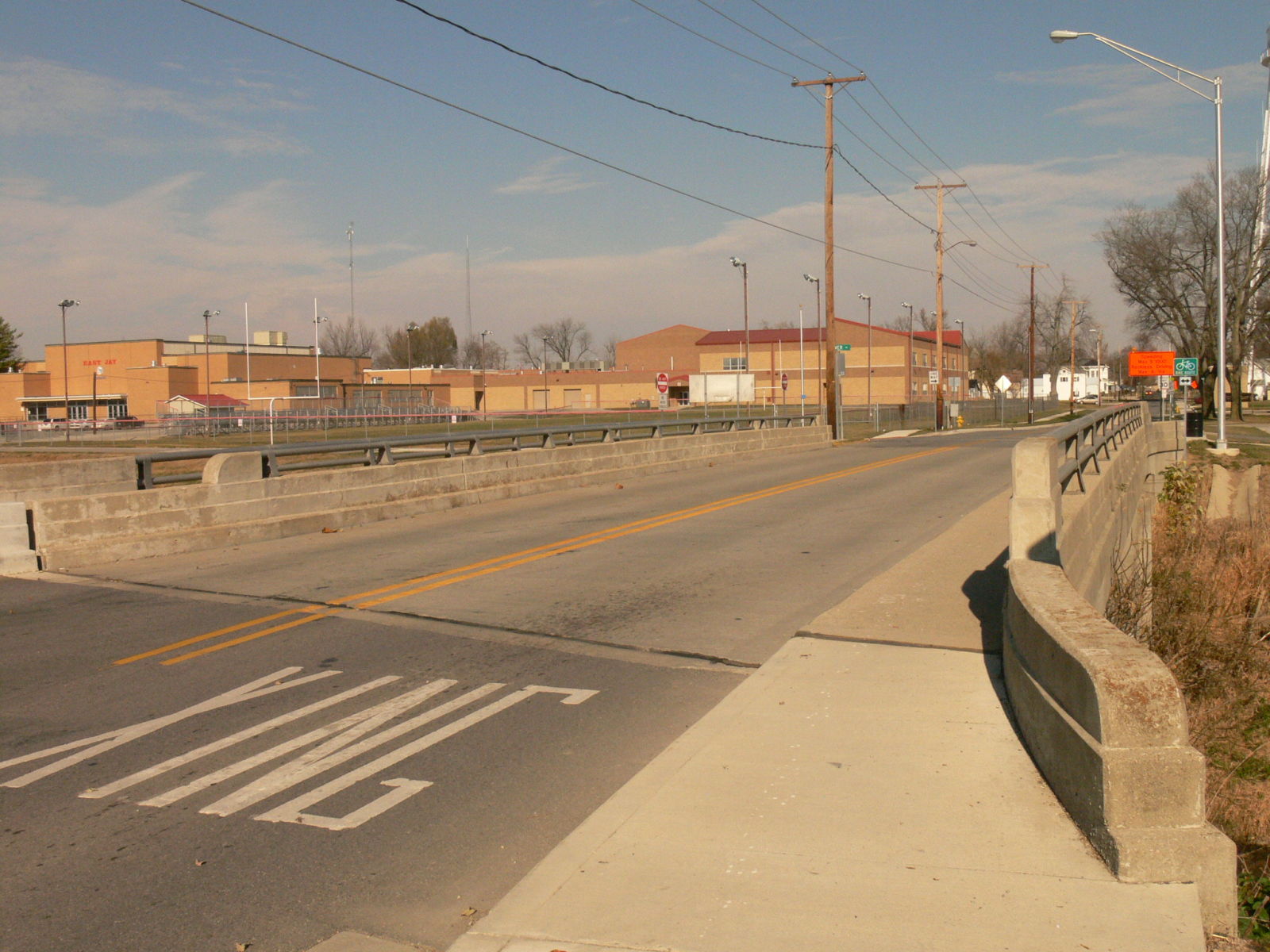
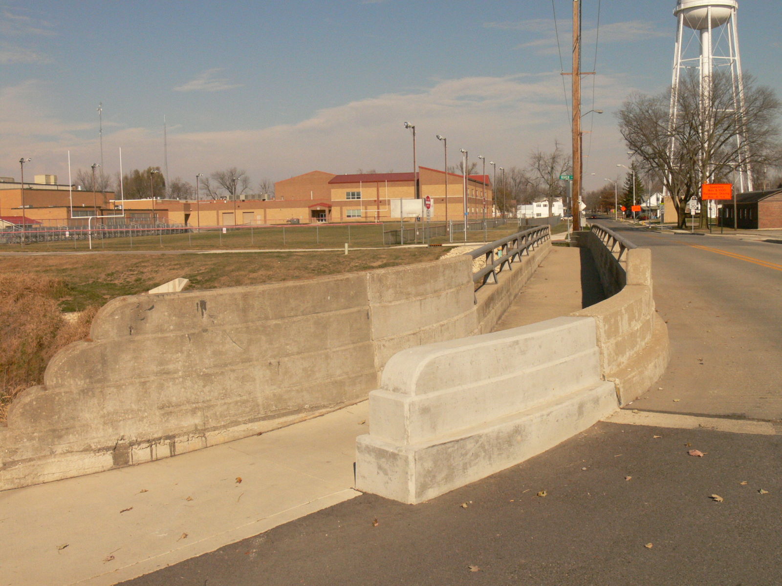
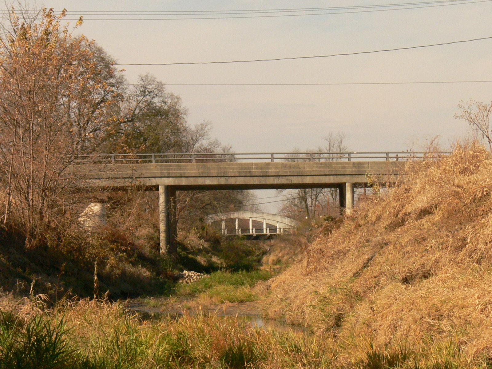
![]()
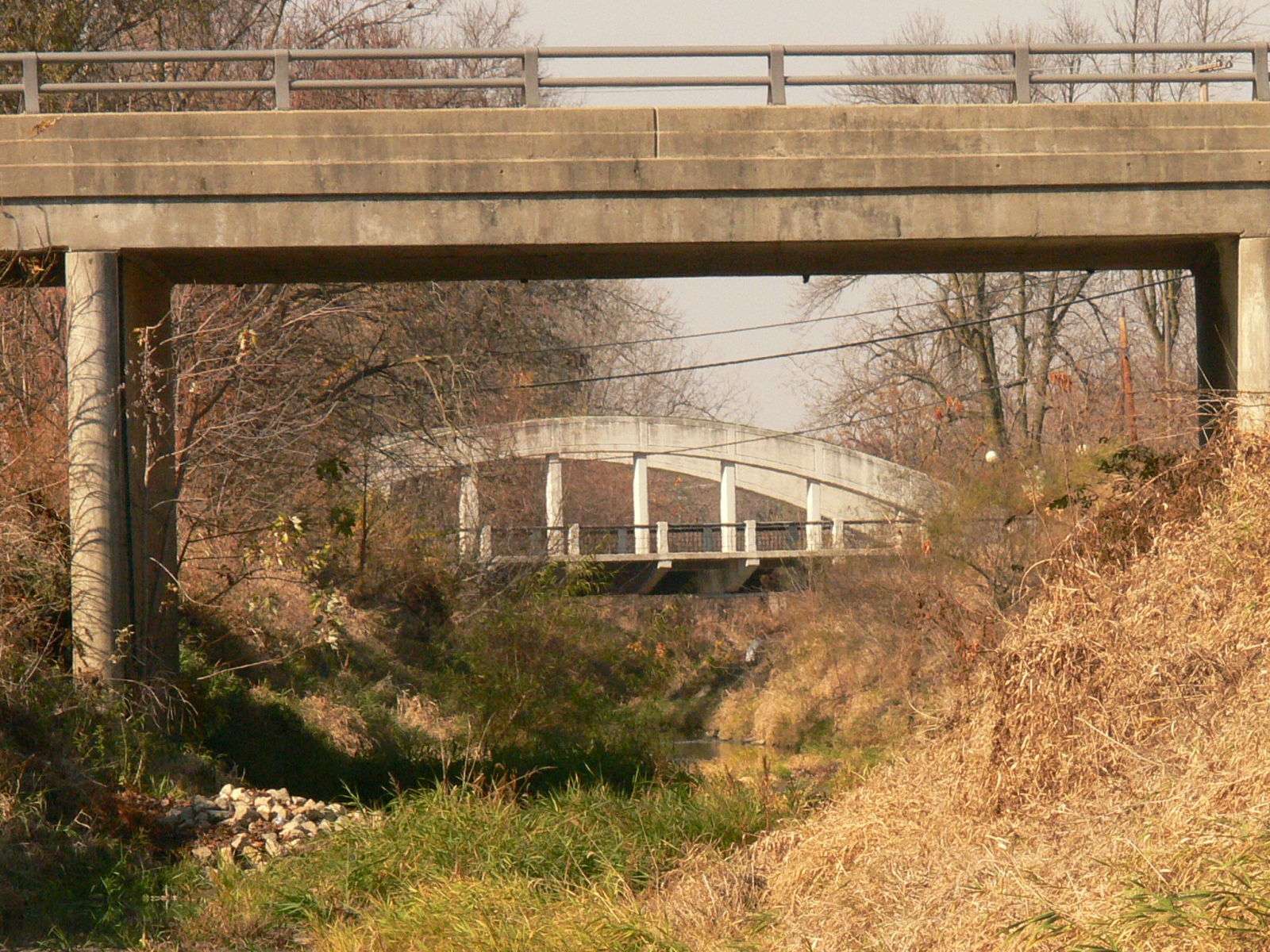
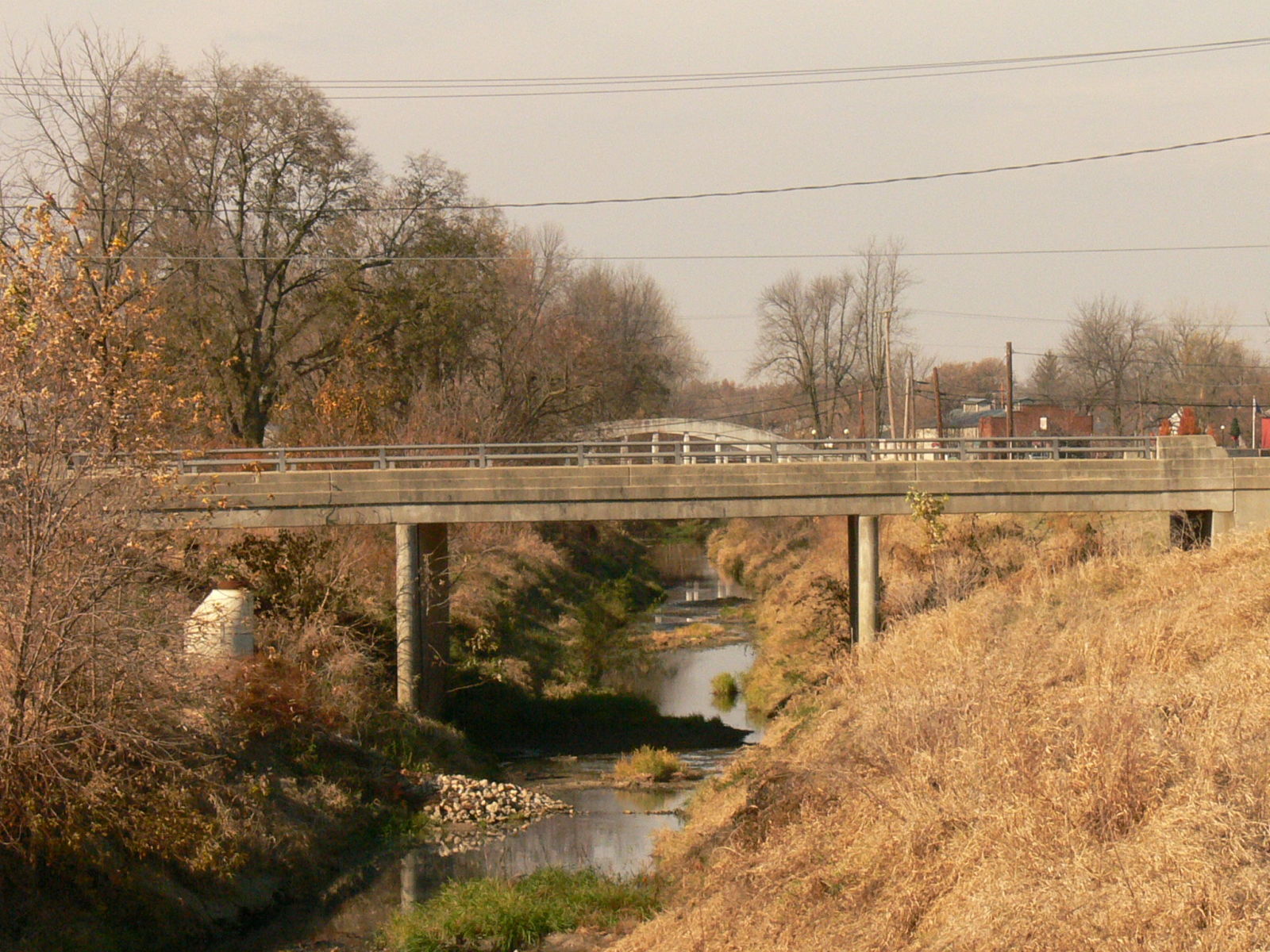
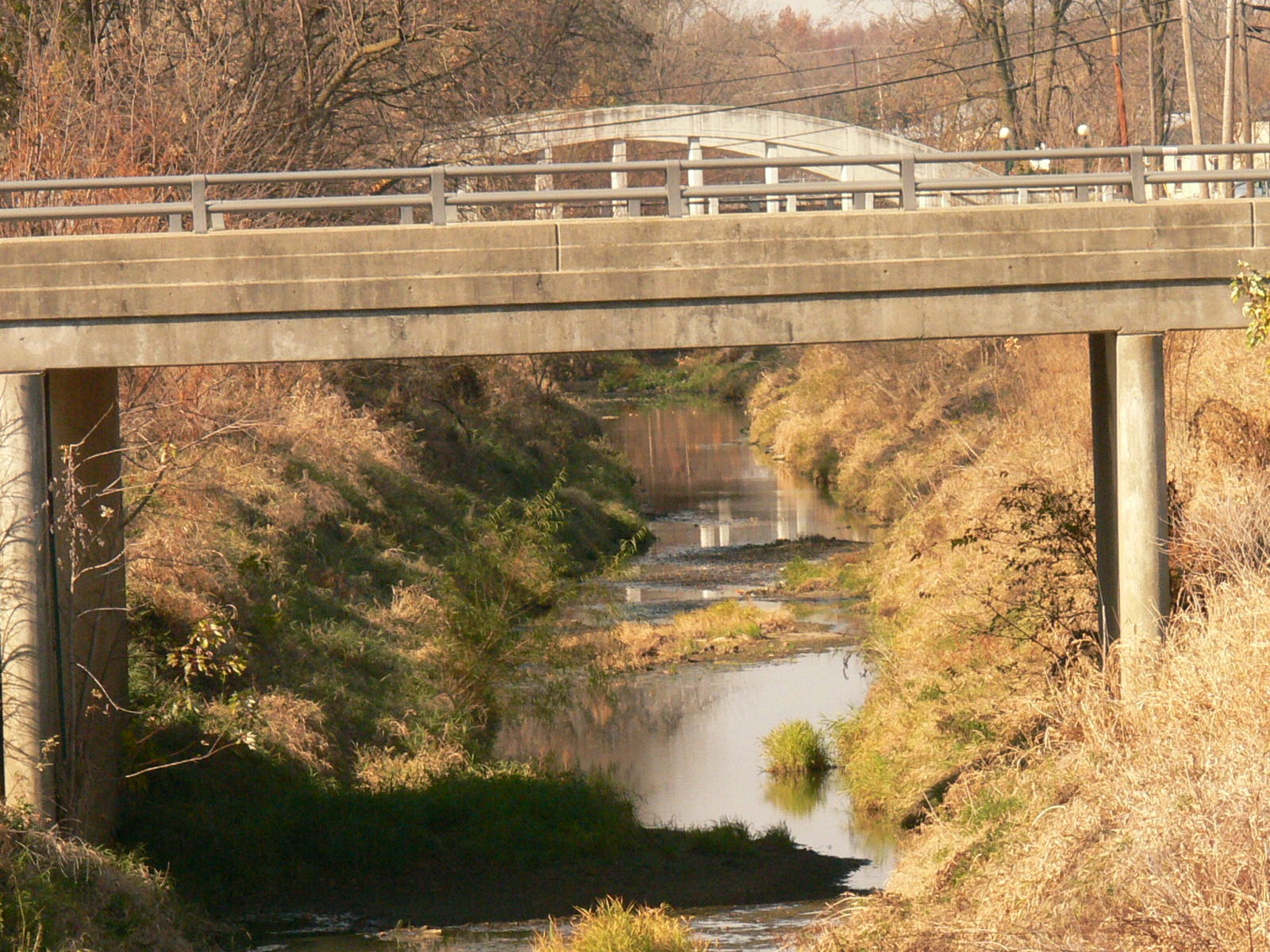
Status: Open to traffic
Location: 40.430032,-84.974097
Carries Wayne Street over Salamonie River
Design: slab
Design Details: Concrete slab
Total Length: 98.8 Feet
Span Length: 36.7 Feet
Overview: Concrete stringer bridge over Salamonie River on Wayne Street
History: Built in 1963
Built: 1963
Location: Jay County
View Bridge Information In Wayback Machine
![]()
186316
Looking Northwest
Photo taken by Anthony Dillon in November 2010
186317
Roadway
Photo taken by Anthony Dillon in November 2010
186318
Sidewalk
Photo taken by Anthony Dillon in November 2010
186319
Distant view from underneath Whitacre Bridge
Photo taken by Anthony Dillon in November 2010
186320
.....same view zoomed in
Photo taken by Anthony Dillon in November 2010
186321
View standing on Whitacre Bridge
Photo taken by Anthony Dillon in November 2010
186322
....again zoomed in
Photo taken by Anthony Dillon in November 2010
186323
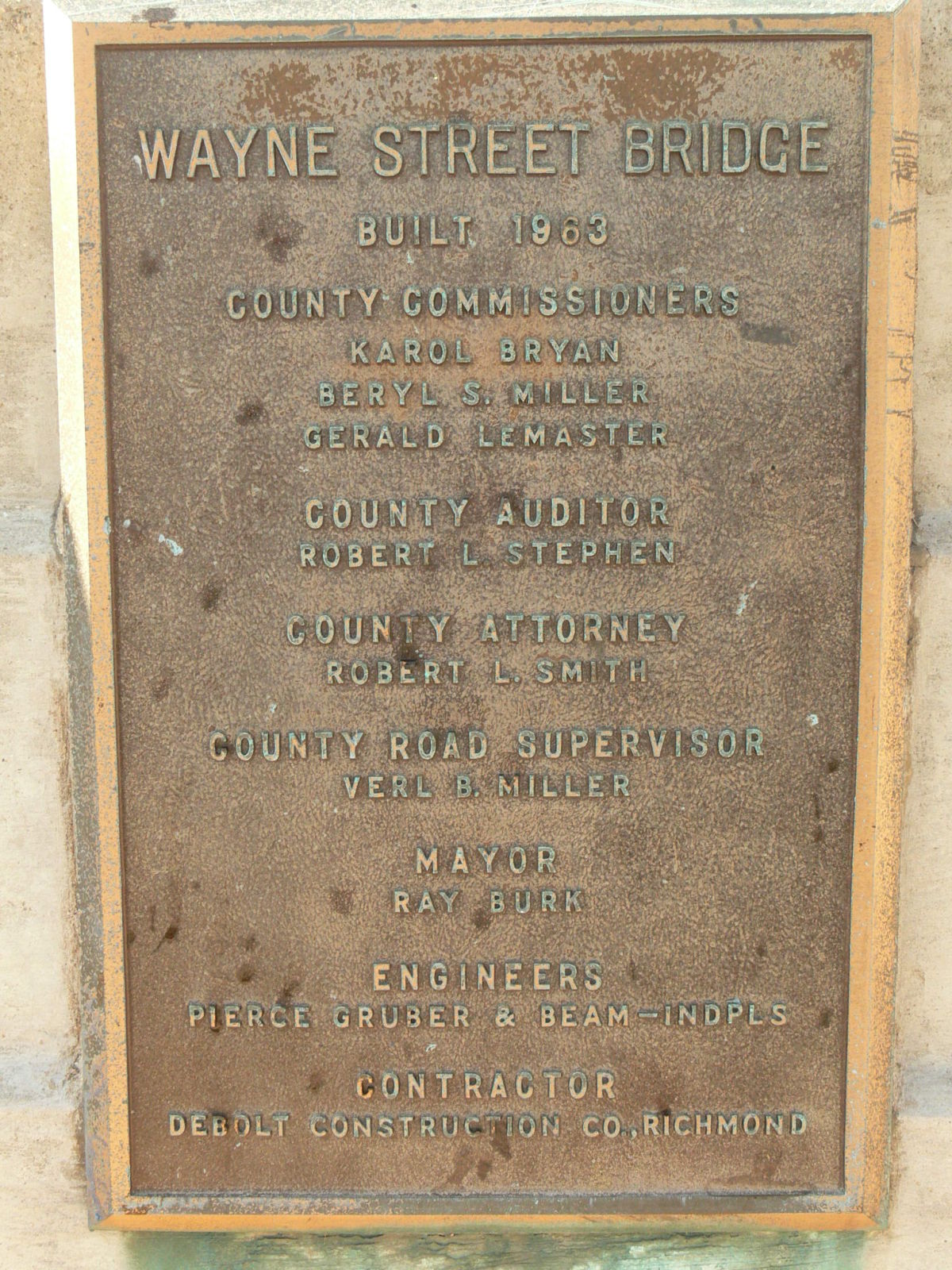
Plaque
Photo taken by Anthony Dillon in November 2010
186324

Looking West at the Meridian Street Bridge...aka "Portland Arch"
Photo taken by Anthony Dillon in November 2010
![]()
Status: Abandoned
Location: 40.367664,-84.812405
Carries Abandoned section of CR 500S over Simpson Creek
Design: truss/bedstead/pratt
Design Details: Pinned Pratt bedstead pony truss
Total Length: 49.0 Feet
Span Length: 47.0 Feet
Overview: Abandoned Pratt Bedstead pony truss bridge over Simpson Creek on Abandoned section of CR 500S
History: Built ca.1895
Built: ca.1895
Location: Jay County
View Bridge Information In Wayback Machine
![]()
192946
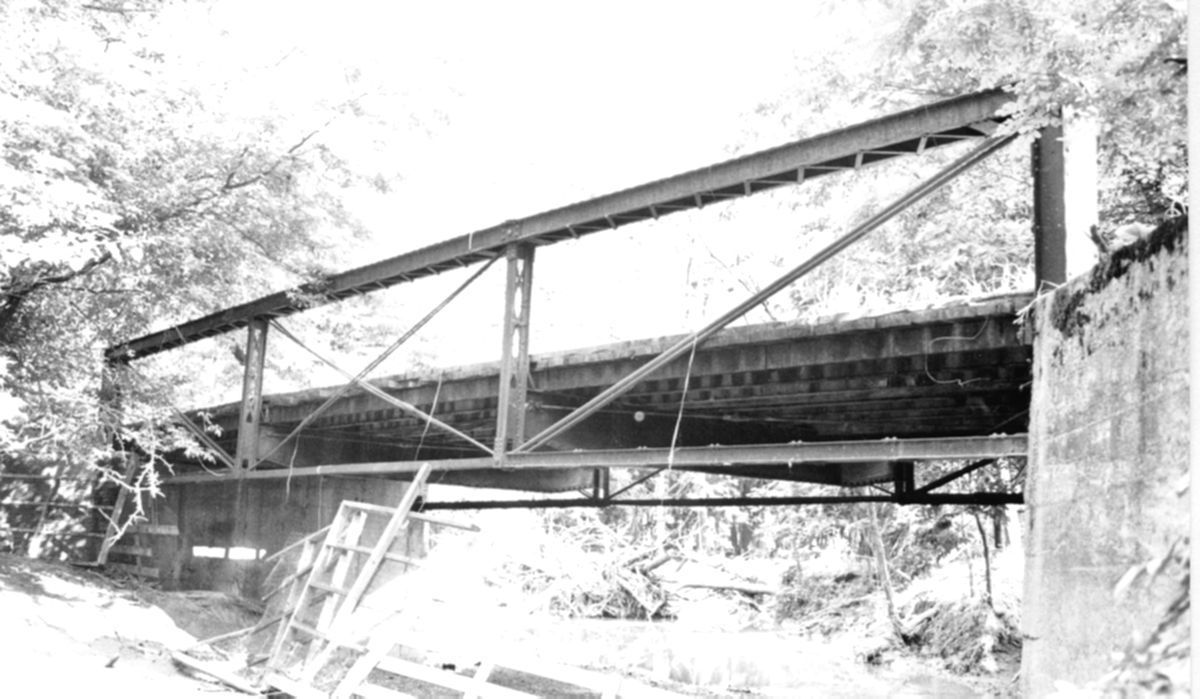
Photo courtesy of the Indiana State Department of Natural Resource, Division of Historic Preservation and Archaeology.
SHAARD photo
![]()
Status: Derelict/abandoned
Location: 40.308634,-85.066892
Carries Abandoned Pennsylvania Railroad over Flesher Creek
Design: arch/deck/stone
Design Details: Stone arch
Total Length: 0.0 Feet
Span Length: 0.0 Feet
Overview: Abandoned Stone Arch Bridge on Abandoned Pennsylvania Railroad over Flesher Creek
History:
Built:
Location: Jay County
View Bridge Information In Wayback Machine
![]()
![]()
Status: Replaced by a new bridge
Location: 40.561280,-85.074053
Carries County Road 850 North over Camp Run Creek
Design: truss/bedstead/pratt
Design Details: 3-panel, pinned Bedstead Pratt pony truss
Total Length: 30.0 Feet
Span Length: 30.0 Feet
Overview: Lost Bedstead Pratt pony truss bridge over Camp Run Creek on County Road 850 North
History: Built ca. 1905
Built: ca. 1905
Location: Jay County
View Bridge Information In Wayback Machine
![]()
392069
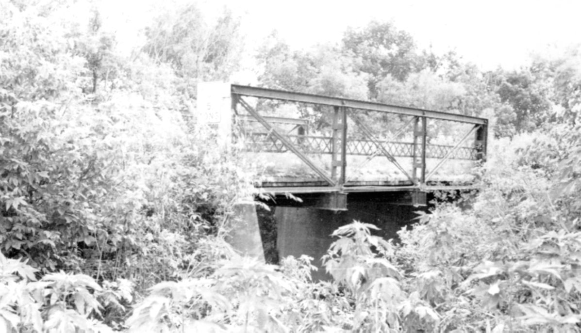
Photo courtesy of the Indiana State Department of Natural Resource, Division of Historic Preservation and Archaeology.
![]()
Status: Replaced by a new bridge
Location: 40.528622,-84.802688
Carries State Line Road (CR 235E) over Scherman Ditch (Branch of Wabash River)
Design: truss/pony/pratt
Design Details: 3-panel, pinned Pratt pony truss
Total Length: 40.0 Feet
Span Length: 39.0 Feet
Overview: Lost Pratt pony truss bridge over Scherman Ditch on State Line Road (CR 235E)
History: Built ca. 1905
Built: ca. 1905
Location: Jay County
View Bridge Information In Wayback Machine
![]()
392070
Photo courtesy of the Indiana State Department of Natural Resource, Division of Historic Preservation and Archaeology.
![]()
Status: Replaced by a new bridge
Location: 40.554078,-85.069372
Carries County Road 800 North over Camp Run Creek
Design: truss/pony/pratt
Design Details: 4-panel, pinned Pratt pony truss
Total Length: 45.0 Feet
Span Length: 45.0 Feet
Overview: Lost Pratt pony truss bridge over Camp Run Creek on County Road 800 North
History: Built ca. 1900
Built: ca. 1900
Location: Jay County
View Bridge Information In Wayback Machine
![]()
392073
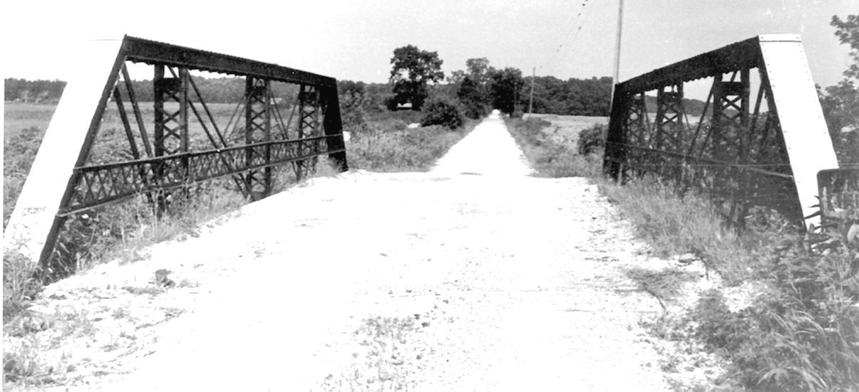
Photo courtesy of the Indiana State Department of Natural Resource, Division of Historic Preservation and Archaeology.
![]()
Status: Replaced by a new bridge
Location: 40.505185,-84.952677
Carries County Road 150 East over Bear Creek
Design: truss/pony/pratt
Design Details: 3-panel, pinned Pratt pony truss
Total Length: 51.0 Feet
Span Length: 51.0 Feet
Overview: Lost Pratt pony truss bridge over Bear Creek on County Road 150 East
History: Built ca. 1900
Built: ca. 1900
Location: Jay County
View Bridge Information In Wayback Machine
![]()
392074
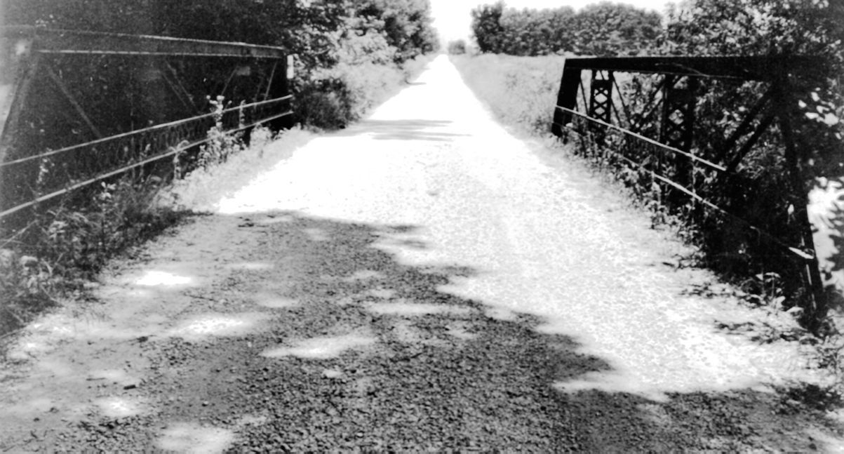
Photo courtesy of the Indiana State Department of Natural Resource, Division of Historic Preservation and Archaeology.
![]()
Status: No longer exists
Location: 40.474328,-85.144557
Carries County Road 250 North over Brooks Creek
Design: truss/bedstead/warren
Design Details: Warren Cantilever Bedstead pony truss
Total Length: 133.0 Feet
Span Length: 69.0 Feet
Overview: Lost Bedstead Warren pony truss bridge over Brooks Creek on County Road 250 North
History: Built 1892
Built: 1892
Location: Jay County
View Bridge Information In Wayback Machine
![]()
392078
Photo courtesy of the Indiana State Department of Natural Resource, Division of Historic Preservation and Archaeology.
![]()
Status: Replaced by a new bridge
Location: 40.477187,-85.101817
Carries Walnut Corner Road over Walling Ditch
Design: girder
Design Details: Patented IBCo Plate Leg Girder
Total Length: 44.0 Feet
Span Length: 43.0 Feet
Overview: Lost Girder bridge over Walling Ditch on Walnut Corner Road
History: Built 1891
Built: 1891
Location: Jay County
View Bridge Information In Wayback Machine
![]()
392079

Photo courtesy of the Indiana State Department of Natural Resource, Division of Historic Preservation and Archaeology.
392080
Photo courtesy of the Indiana State Department of Natural Resource, Division of Historic Preservation and Archaeology.
![]()
Status: No longer exists
Location: 40.451417,-85.169456
Carries County Road 1000 West over Mud Creek
Design: truss/pony/pratt
Design Details: 3-panel, riveted Pratt pony truss
Total Length: 41.0 Feet
Span Length: 40.0 Feet
Overview: Lost Pratt pony truss bridge over Mud Creek on County Road 1000 West
History: Built 1895
Built: 1895
Location: Jay County
View Bridge Information In Wayback Machine
![]()
392081
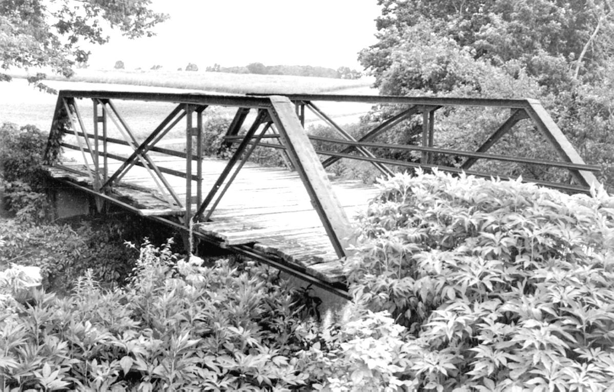
Photo courtesy of the Indiana State Department of Natural Resource, Division of Historic Preservation and Archaeology.
![]()
Status: Replaced by a new bridge
Location: 40.451997,-85.038975
Carries County Road 300 West over Sipe Ditch
Design: truss/bedstead/pratt
Design Details: 2-panel, pinned Bedstead Pratt pony truss
Total Length: 30.0 Feet
Span Length: 30.0 Feet
Overview: Lost Bedstead Pratt pony truss bridge over Sipe Ditch on County Road 300 West
History: Built ca. 1900
Built: ca. 1900
Location: Jay County
View Bridge Information In Wayback Machine
![]()
392082
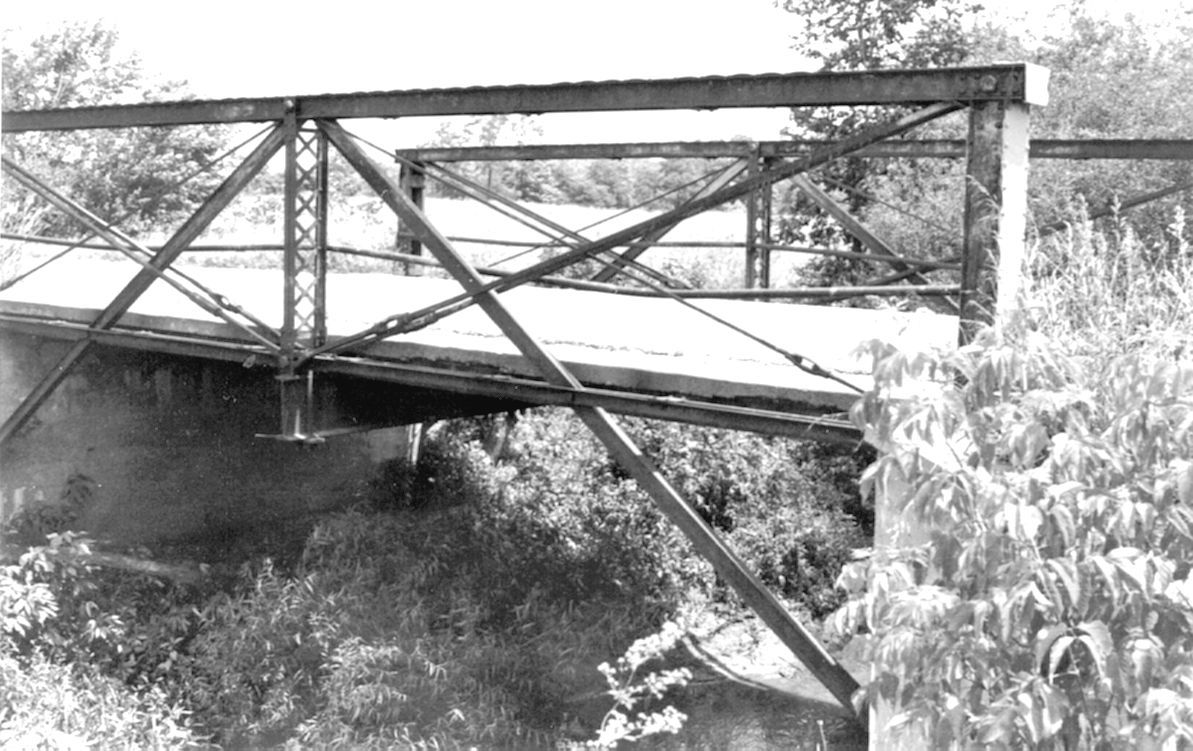
Photo courtesy of the Indiana State Department of Natural Resource, Division of Historic Preservation and Archaeology.
392083
Photo courtesy of the Indiana State Department of Natural Resource, Division of Historic Preservation and Archaeology.
![]()
Status: Replaced by a new bridge
Location: 40.380697,-84.865981
Carries Harrison St. (Treaty Line Road) over Salamonie River
Design: girder
Design Details: Patented Plate Leg Girder
Total Length: 36.0 Feet
Span Length: 36.0 Feet
Overview: Lost Girder bridge over Salamonie River on Harrison St. (Treaty Line Road)
History: Built ca. 1890
Built: ca. 1890
Location: Jay County
View Bridge Information In Wayback Machine
![]()
392102
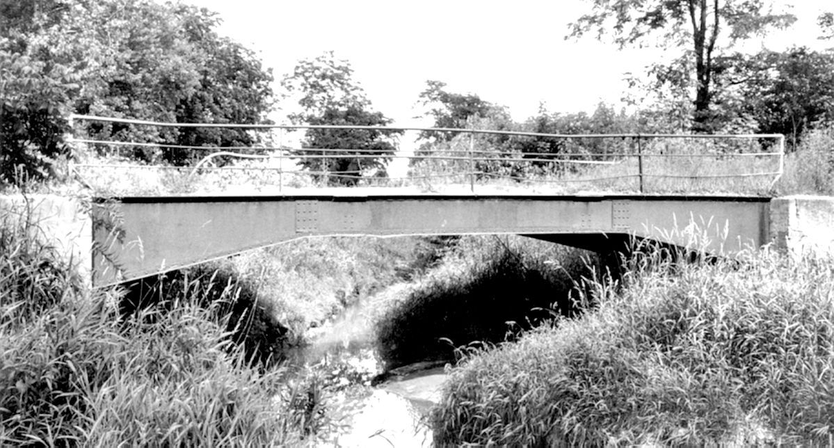
Photo courtesy of the Indiana State Department of Natural Resource, Division of Historic Preservation and Archaeology.
![]()
Status: Replaced by a new bridge
Location: 40.416244,-85.057125
Carries County Road 400 West over Wikel Ditch (Blaine Run)
Design: truss/pony/pratt
Design Details: 2-panel, pinned and bolted Pratt pony truss
Total Length: 34.0 Feet
Span Length: 34.0 Feet
Overview: Lost Pratt pony truss bridge over Wikel Ditch (Blaine Run) on County Road 400 West
History: Built ca. 1885
Built: ca. 1885
Location: Jay County
View Bridge Information In Wayback Machine
![]()
392089
Photo courtesy of the Indiana State Department of Natural Resource, Division of Historic Preservation and Archaeology.
![]()
Status: Replaced by a new bridge
Location: 40.423195,-84.896736
Carries County Road 425 East over Salamonie River
Design: truss/pony/pratt
Design Details: 4-panel, pinned Pratt pony truss
Total Length: 72.0 Feet
Span Length: 72.0 Feet
Overview: Lost Pratt pony truss bridge over Salamonie River on County Road 425 East
History: Built ca. 1885
Built: ca. 1885
Location: Jay County
View Bridge Information In Wayback Machine
![]()
392090
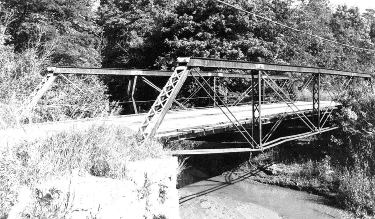
Photo courtesy of the Indiana State Department of Natural Resource, Division of Historic Preservation and Archaeology.
392091
Photo courtesy of the Indiana State Department of Natural Resource, Division of Historic Preservation and Archaeology.
![]()
Status: Replaced by a new bridge
Location: 40.387759,-85.076199
Carries County Road 350 South over Brooks Creek
Design: girder
Design Details: IBCo patented Plate Leg Girder
Total Length: 45.0 Feet
Span Length: 44.0 Feet
Overview: Lost Girder bridge over Brooks Creek on County Road 350 South
History: Built 1889
Built: 1889
Location: Jay County
View Bridge Information In Wayback Machine
![]()
392094
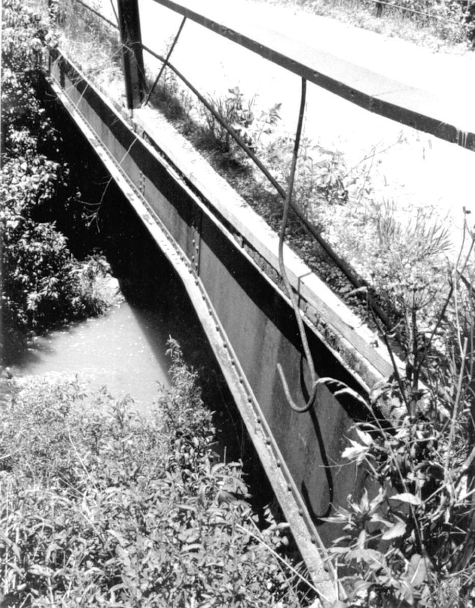
Photo courtesy of the Indiana State Department of Natural Resource, Division of Historic Preservation and Archaeology.
![]()
Status: Replaced by a new bridge
Location: 40.388695,-85.007699
Carries County Road 350 South over Butternut Creek
Design: truss/bedstead/pratt
Design Details: 4-panel, pinned and bolted Bedstead Pratt pony truss
Total Length: 50.0 Feet
Span Length: 50.0 Feet
Overview: Lost Bedstead Pratt pony truss bridge over Butternut Creek on County Road 350 South
History: Built ca. 1900
Built: ca. 1900
Location: Jay County
View Bridge Information In Wayback Machine
![]()
392095
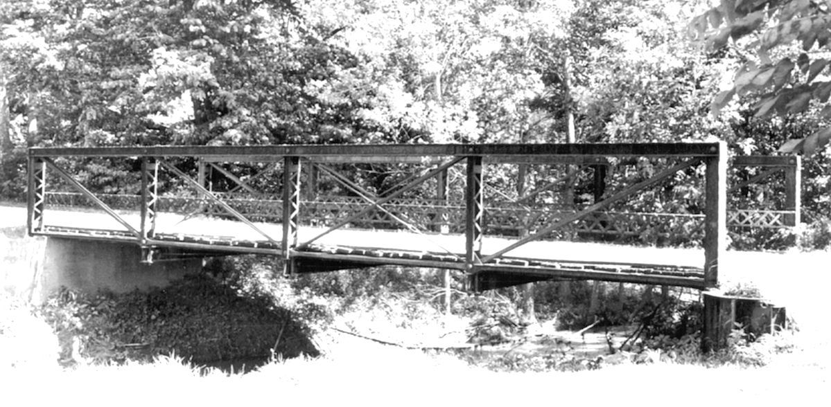
Photo courtesy of the Indiana State Department of Natural Resource, Division of Historic Preservation and Archaeology.
![]()
Status: Replaced by a new bridge
Location: 40.396545,-84.957787
Carries County Road 300 South over Little Salamonie River
Design: truss/bedstead/warren
Design Details: Warren Cantilever Bedstead pony truss (IBCo patented)
Total Length: 70.0 Feet
Span Length: 70.0 Feet
Overview: Lost Bedstead Warren pony truss bridge over Little Salamonie River on County Road 300 South
History: Built 1893
Built: 1893
Location: Jay County
View Bridge Information In Wayback Machine
![]()
392096
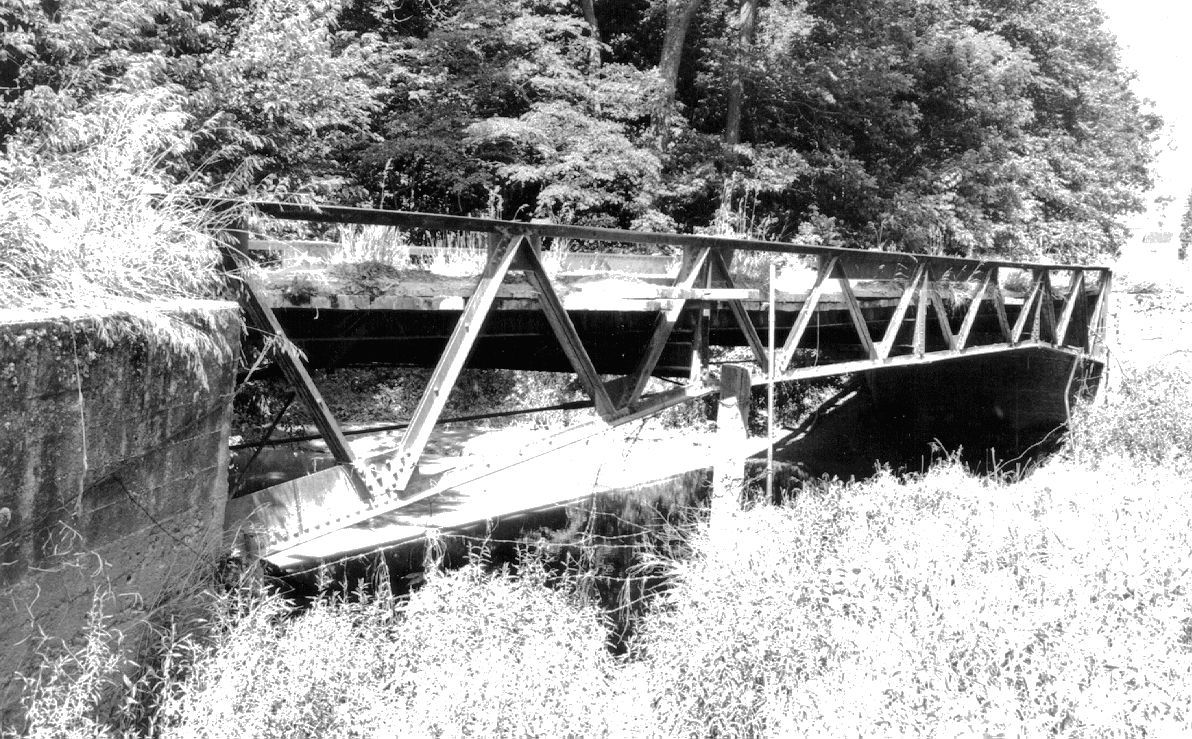
Photo courtesy of the Indiana State Department of Natural Resource, Division of Historic Preservation and Archaeology.
![]()
Status: Replaced by a new bridge
Location: 40.397034,-84.884002
Carries County Road 300 South over Salamonie River
Design: girder
Design Details: IBCo patented Plate Leg Girder
Total Length: 50.0 Feet
Span Length: 50.0 Feet
Overview: Lost Girder bridge over Salamonie River on County Road 300 South
History: Built 1893
Built: 1893
Location: Jay County
View Bridge Information In Wayback Machine
![]()
392097
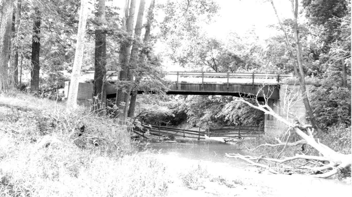
Photo courtesy of the Indiana State Department of Natural Resource, Division of Historic Preservation and Archaeology.
![]()
Status: Replaced by a new bridge
Location: 40.380964,-84.871964
Carries County Road 550 East over Salamonie River
Design: truss/bedstead/pratt
Design Details: 3-panel Bedstead Pratt pony truss
Total Length: 50.0 Feet
Span Length: 50.0 Feet
Overview: Lost Bedstead Pratt pony truss bridge over Salamonie River on County Road 550 East
History: Built ca. 1900
Built: ca. 1900
Location: Jay County
View Bridge Information In Wayback Machine
![]()
392098
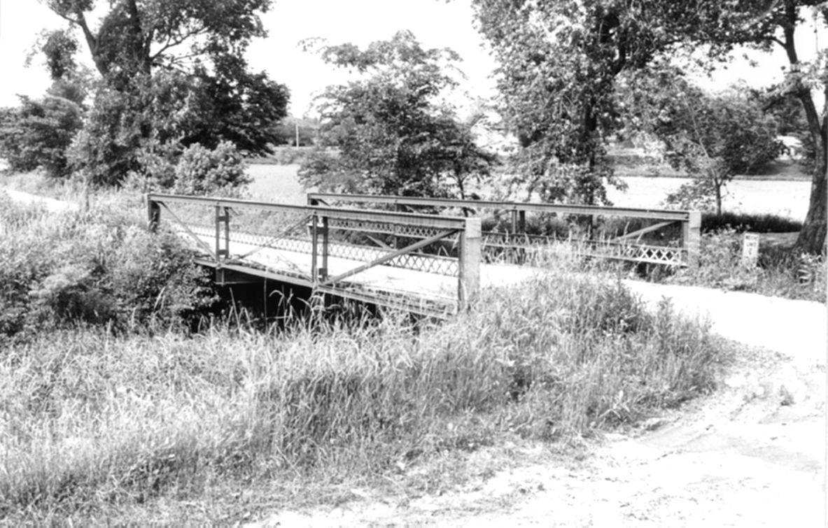
Photo courtesy of the Indiana State Department of Natural Resource, Division of Historic Preservation and Archaeology.
![]()
Status: Replaced by a new bridge
Location: 40.360512,-84.996552
Carries County Road 100 West over Butternut Creek
Design: truss/pony/warren
Design Details: 3-panel, bolted Warren pony truss
Total Length: 41.0 Feet
Span Length: 41.0 Feet
Overview: Lost Warren pony truss bridge over Butternut Creek on County Road 100 West
History: Built ca. 1905
Built: ca. 1905
Location: Jay County
View Bridge Information In Wayback Machine
![]()
392100
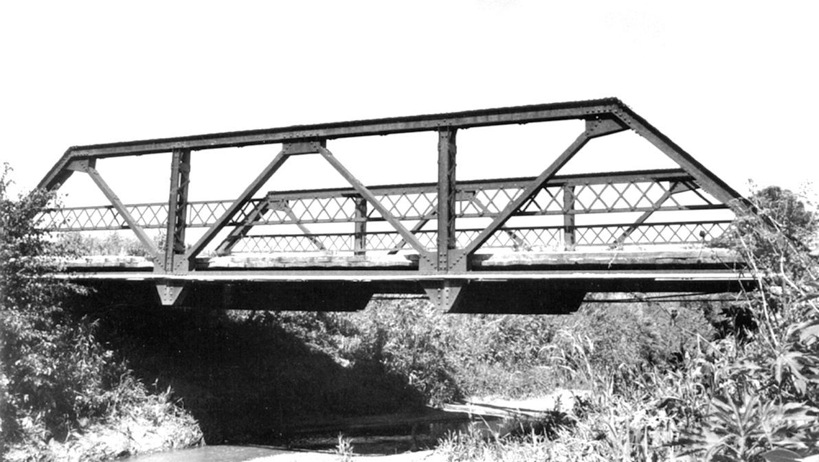
Photo courtesy of the Indiana State Department of Natural Resource, Division of Historic Preservation and Archaeology.
![]()
Status: No longer exists
Location: 40.430388,-84.976175
Carries over
Design: truss/through/childs
Design Details: Childs through truss
Total Length: 0.0 Feet
Span Length: 0.0 Feet
Overview: Lost Childs through truss bridge
History: Built ca. 1890's
Built: ca. 1890's
Location: Jay County
View Bridge Information In Wayback Machine
![]()
446459
Indiana Historical Society
![]()
Status: Replaced by a new bridge
Location: 40.458030,-85.076965
Carries County Road 500 West over Salamonie River
Design: truss/through/pratt
Design Details: 8-panel, riveted Pratt through truss
Total Length: 0.0 Feet
Span Length: 0.0 Feet
Overview: Lost Pratt through truss bridge over Salamonie River on County Road 500 West
History: Built ca. 1905
Built: ca. 1905
Location: Jay County
View Bridge Information In Wayback Machine
![]()
456654
Photo courtesy of the Indiana State Department of Natural Resource, Division of Historic Preservation and Archaeology.
456655
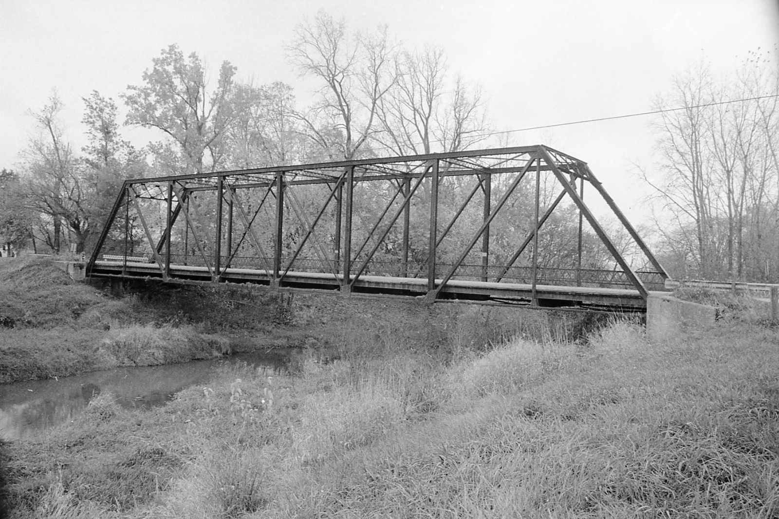
Photo courtesy of the Indiana State Department of Natural Resource, Division of Historic Preservation and Archaeology.
Special Bridge Conditions Legend: R - Former location of relocated bridge. ! - At risk for demolition or destruction. X - Confirmed demolished or collapsed. S - Dismantled and/or in storage. L - Severe loss of historic integrity due to alteration.
![]()

![]()