![]()
![]()
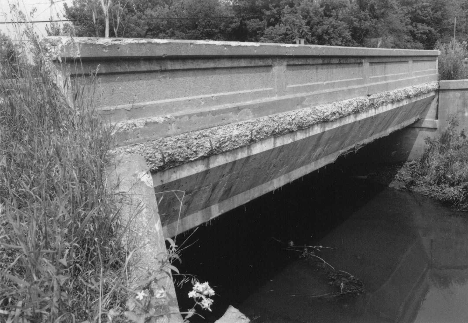
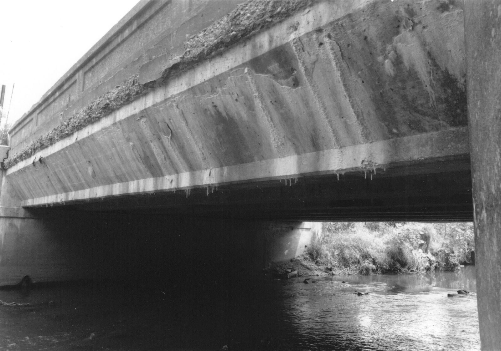
Status: Open to traffic
Location: 41.651389,-85.174444
Carries IN 327 over Pigeon Creek
Design: arch/deck
Design Details: Arch
Total Length: 84.0 Feet
Span Length: 44.9 Feet
Overview: Concrete arch bridge over Pigeon Creek on IN 327
History: Built 1937; rehabilitated 1984
Built: 1937
Location: Steuben County
View Bridge Information In Wayback Machine
![]()
309738
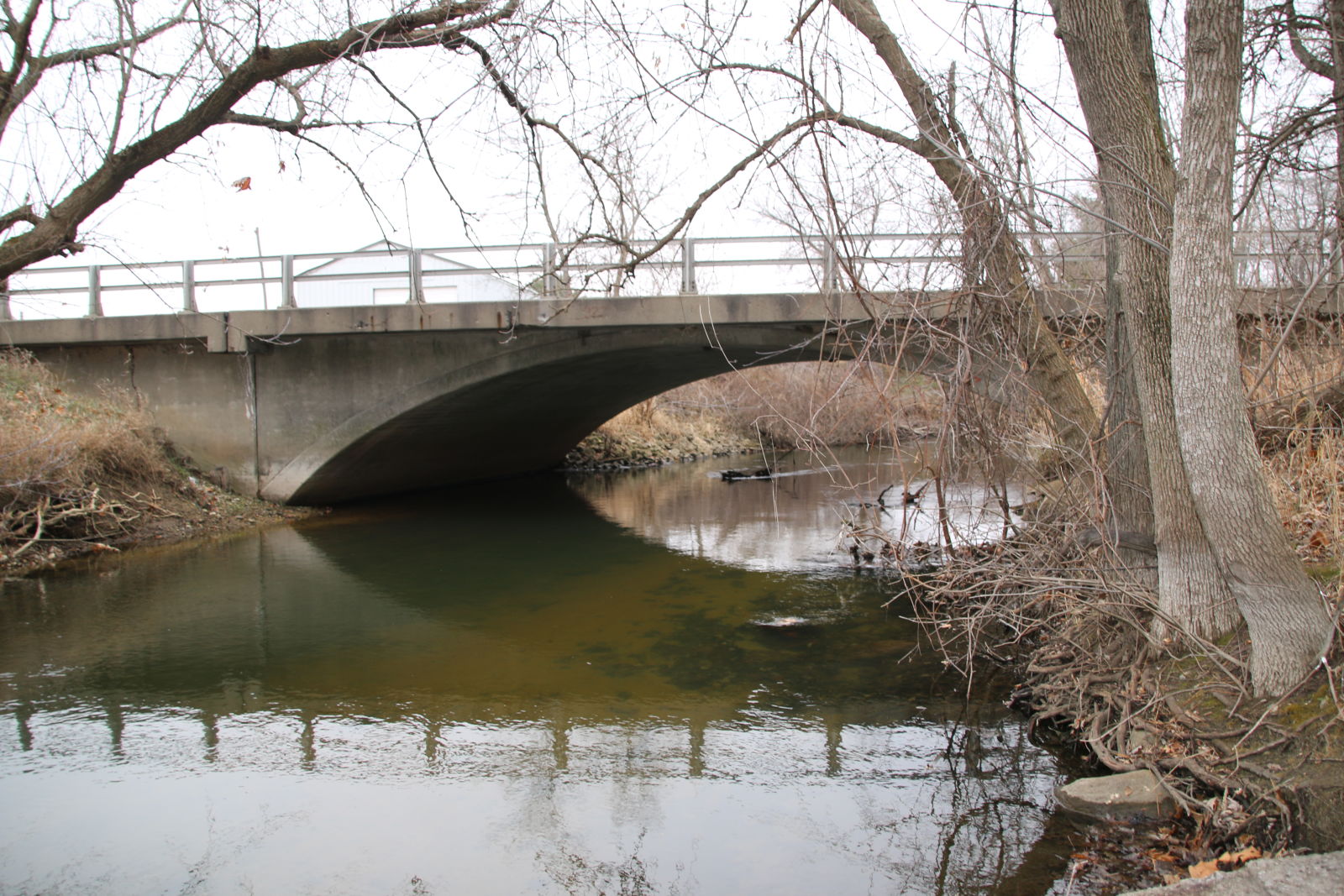
Photo taken by Byron Miller in December 2014
309739
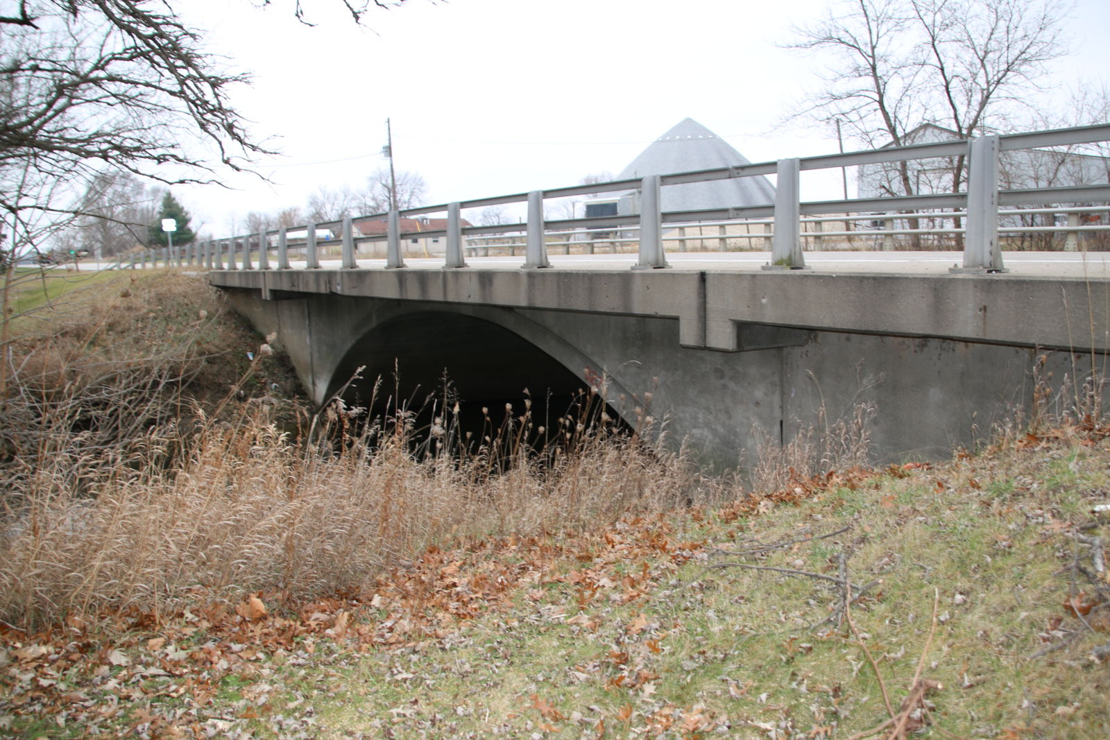
Photo taken by Byron Miller in December 2014
309740
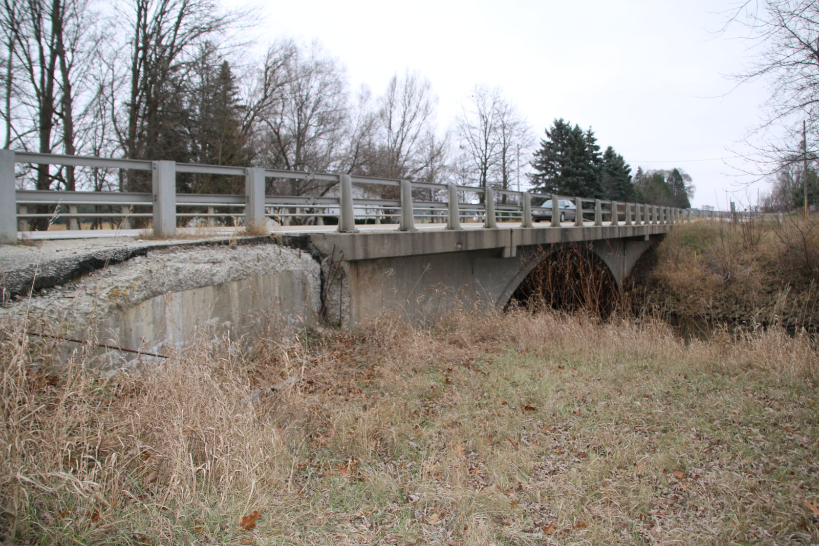
Photo taken by Byron Miller in December 2014
309741
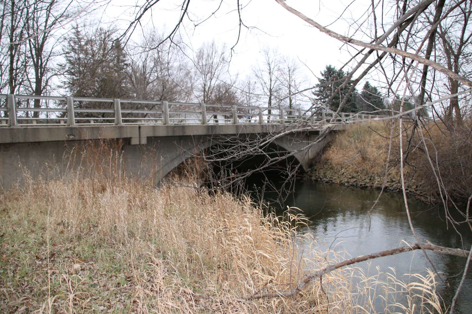
Photo taken by Byron Miller in December 2014
![]()
Status: Replaced by new bridge
Location: 41.543333,-84.973333
Carries CR 100 E over Fish Creek
Design: arch/deck/closed
Design Details: Closed-spandrel arch
Total Length: 25.9 Feet
Span Length: 20.0 Feet
Overview: Lost concrete arch bridge over Fish Creek on CR 100 E
History: Built ca. 1940; replaced 1996
Built: ca. 1940
Location: Steuben County
View Bridge Information In Wayback Machine
![]()
![]()
Status: Intact but closed to all traffic
Location: 41.534261,-84.890488
Carries Old County Road over Indiana Northeastern Railroad
Design: beam/stringer/wood
Design Details: Timber stringer
Total Length: 0.0 Feet
Span Length: 0.0 Feet
Overview: Timber stringer bridge over Indiana Northeastern Railroad on Old County Road
History:
Built:
Location: Steuben County
View Bridge Information In Wayback Machine
![]()
![]()
Status: Open to traffic
Location: 41.707869,-85.032333
Carries CR 196 over Park Road
Design: slab
Design Details: Timber slab (?)
Total Length: 69.9 Feet
Span Length: 27.9 Feet
Overview: Timber bridge over Park Road on CR 196
History: Built 1938; rehabilitated 2000
Built: 1938
Location: Steuben County
View Bridge Information In Wayback Machine
![]()
![]()
Status: Replaced with culverts and fill
Location: 41.530805,-84.903351
Carries Indiana Northeastern Railroad over Hiram Sweet Ditch
Design: girder/deck/concrete
Design Details: Concrete deck girder
Total Length: 150.0 Feet
Span Length: 30.0 Feet
Overview: Concrete deck girder bridge over Hiram Sweet Ditch on Indiana Northeastern Railroad
History: Built 1916; Replaced 2014
Built: 1916
Location: Steuben County
View Bridge Information In Wayback Machine
![]()
![]()
Status: Derelict/abandoned
Location: 41.638262,-84.844641
Carries Abandoned St Joseph Valley Railroad over Tributary of West Branch Fish Creek
Design: arch/deck/closed
Design Details: Closed-spandrel arch
Total Length: 0.0 Feet
Span Length: 0.0 Feet
Overview: Abandoned closed-spandrel arch bridge over Tributary of West Branch Fish Creek on Abandoned St Joseph Valley Railroad
History:
Built:
Location: Steuben County
View Bridge Information In Wayback Machine
![]()
![]()
Status: Abandoned
Location: 41.636819,-84.830871
Carries St Joseph Valley Railroad over West Branch Fish Creek
Design: arch/deck/closed
Design Details: Closed-spandrel arch
Total Length: 0.0 Feet
Span Length: 0.0 Feet
Overview: Abandoned closed-spandrel arch bridge over West Branch Fish Creek on St Joseph Valley Railroad
History:
Built:
Location: Steuben County
View Bridge Information In Wayback Machine
![]()
![]()
Status: Replaced by a new bridge
Location: 41.576913,-85.008685
Carries Old US 27 over Pigeon Creek
Design: beam/tee
Design Details: Tee beam
Total Length: 0.0 Feet
Span Length: 0.0 Feet
Overview: Lost Concrete tee beam bridge over Pigeon Creek on Old US 27
History: Built 1927; replaced somewhere between 1994 and 1996
Built: 1927
Location: Steuben County
View Bridge Information In Wayback Machine
![]()
414879
Steuben 1
Photo courtesy of the Indiana State Department of Natural Resource, Division of Historic Preservation and Archaeology.
414880
Teuben 2
Photo courtesy of the Indiana State Department of Natural Resource, Division of Historic Preservation and Archaeology.
![]()
Status: Replaced by new bridge
Location: 41.599566,-85.058917
Carries Golden Lake Road over Pigeon Creek
Design: truss/bedstead/pratt
Design Details: 4-panel, pinned Pratt Bedstead pony truss
Total Length: 0.0 Feet
Span Length: 0.0 Feet
Overview: Lost Pratt Bedstead pony truss bridge over Pigeon Creek on Golden Lake Road
History: Replaced 1939
Built: ca. 1900
Location: Steuben County
View Bridge Information In Wayback Machine
![]()
472991
1920 postcard view
![]()
Status: No longer exists
Location: 41.613525,-85.076457
Carries Road over Creek
Design: truss/pony/pratt
Design Details: Pinned Pratt pony truss
Total Length: 0.0 Feet
Span Length: 0.0 Feet
Overview: Lost Pratt pony truss bridge over Creek on Road
History: Unknown
Built:
Location: Steuben County
View Bridge Information In Wayback Machine
![]()
473509
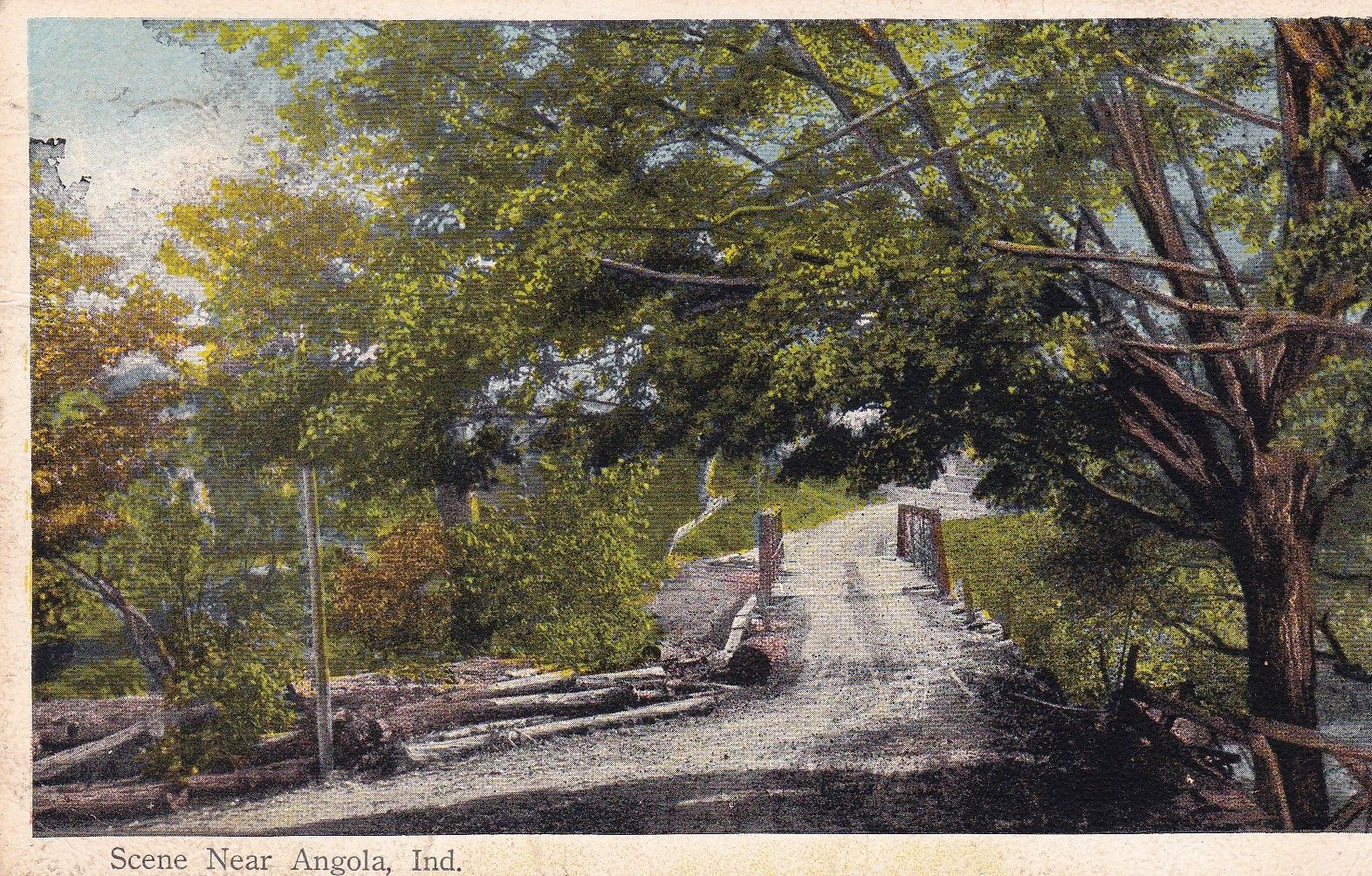
1916 Postcard view
![]()
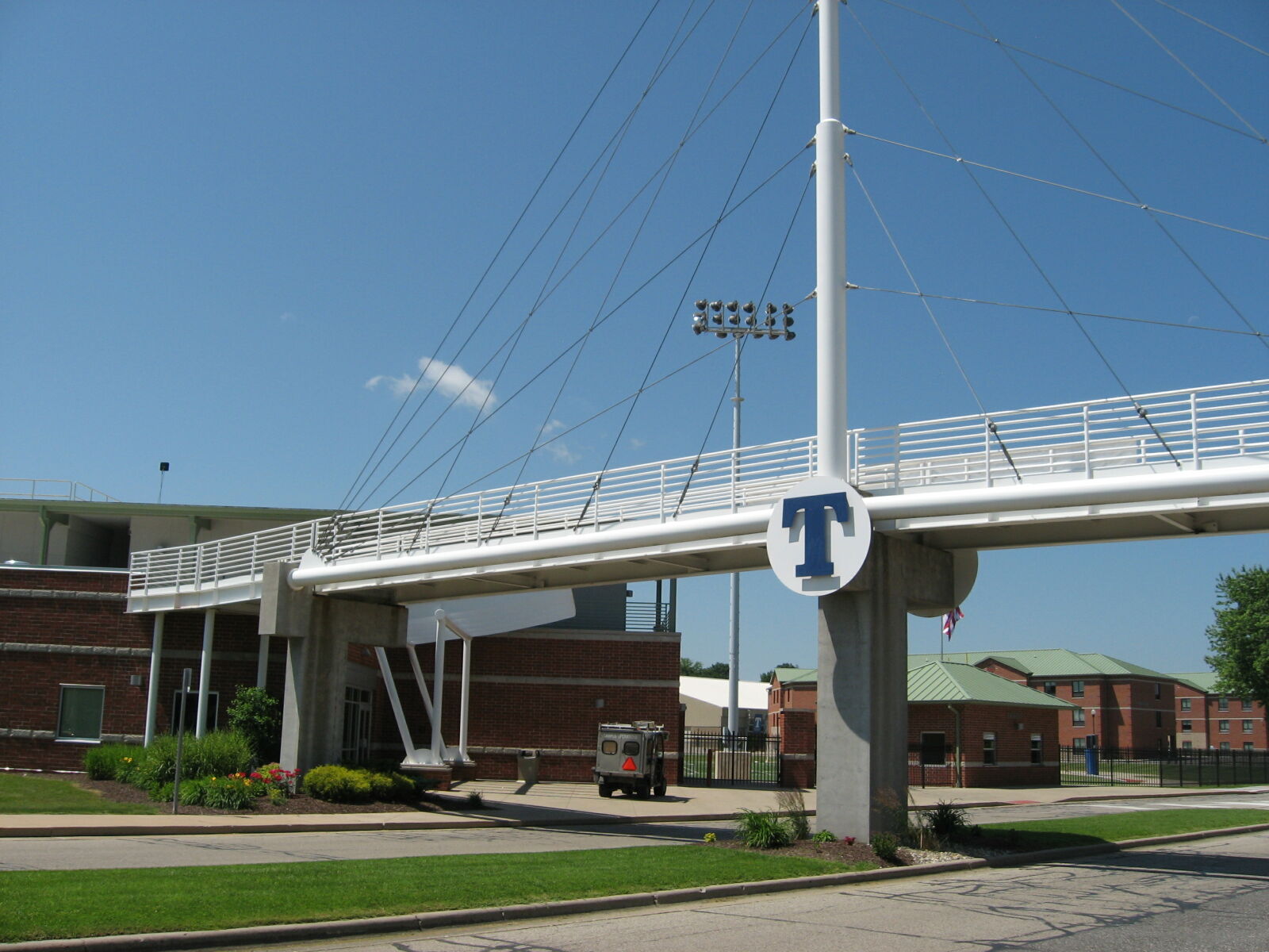
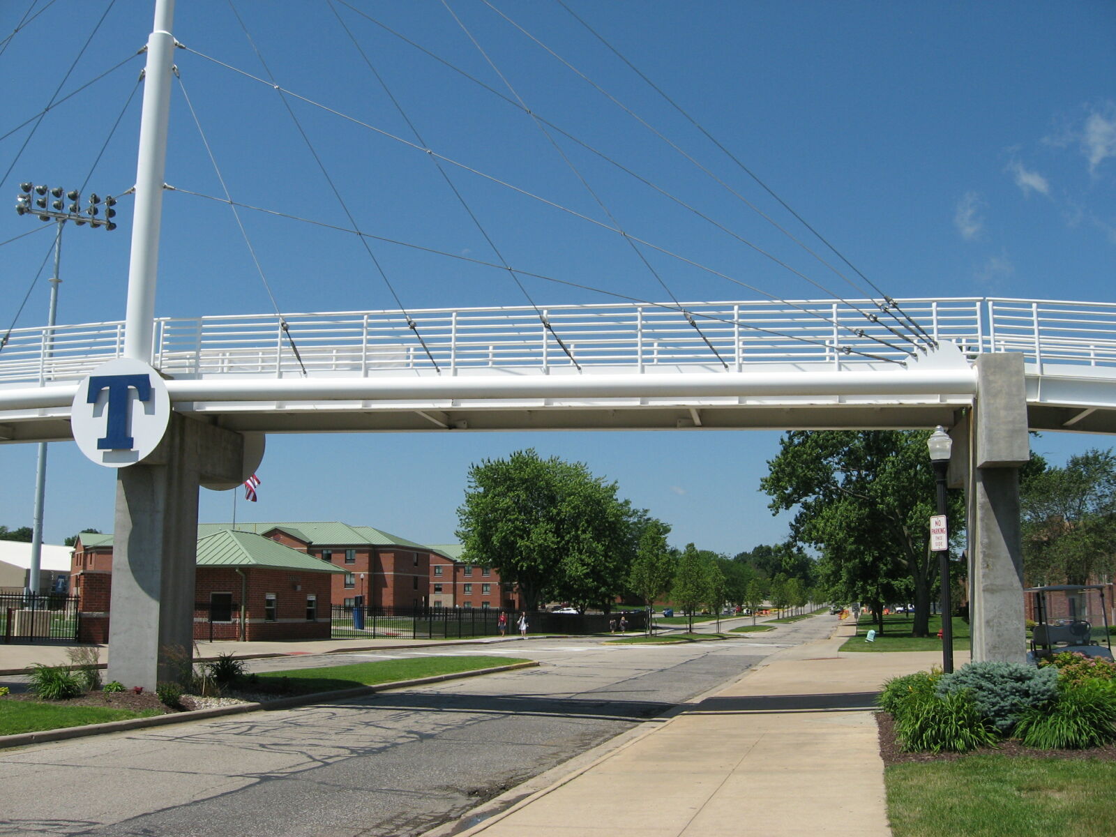
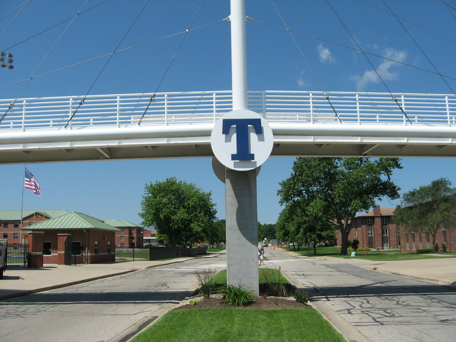
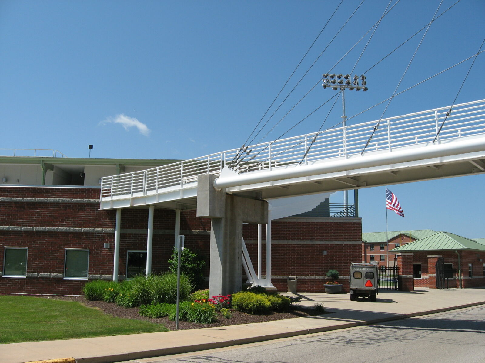
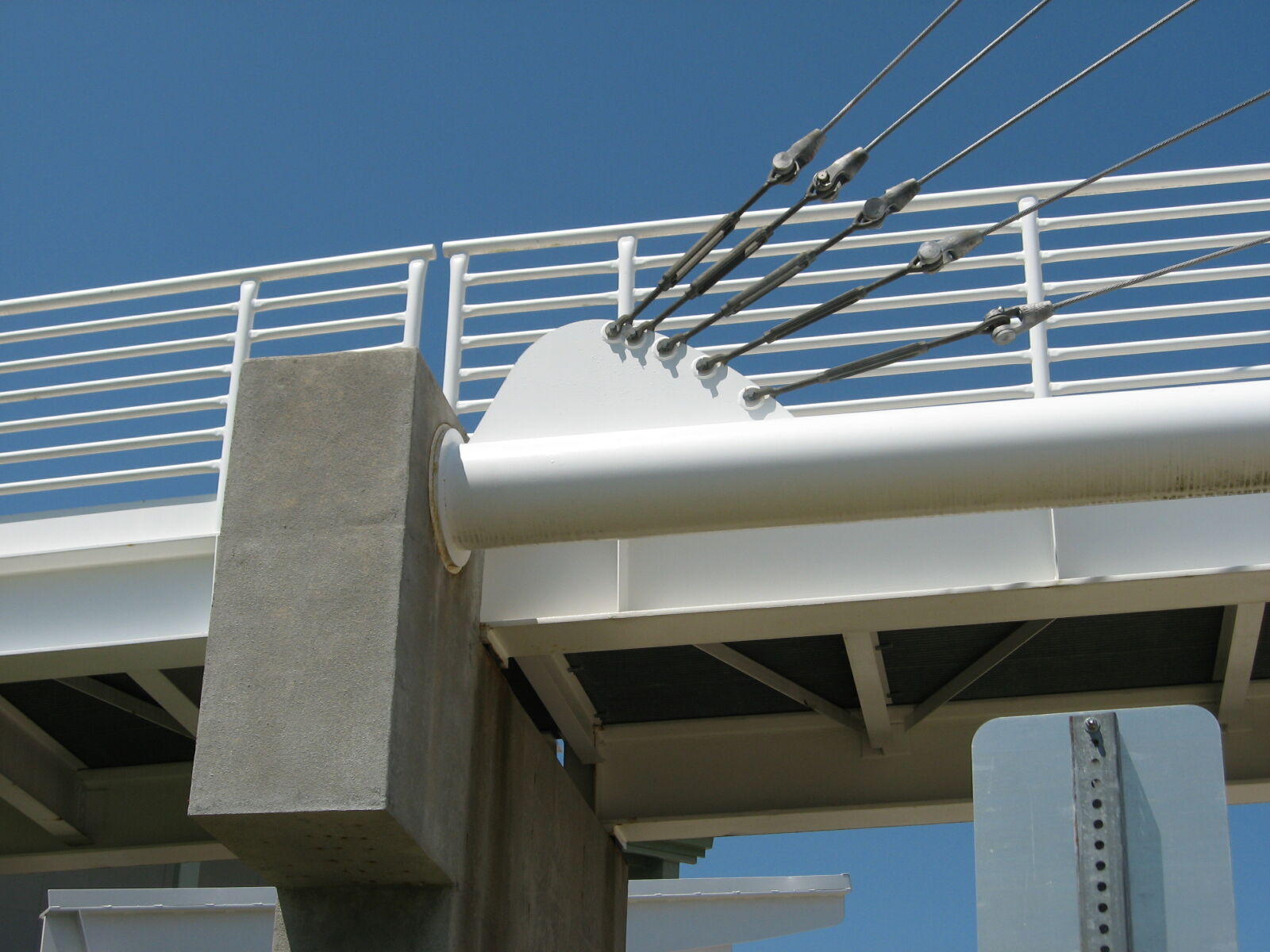
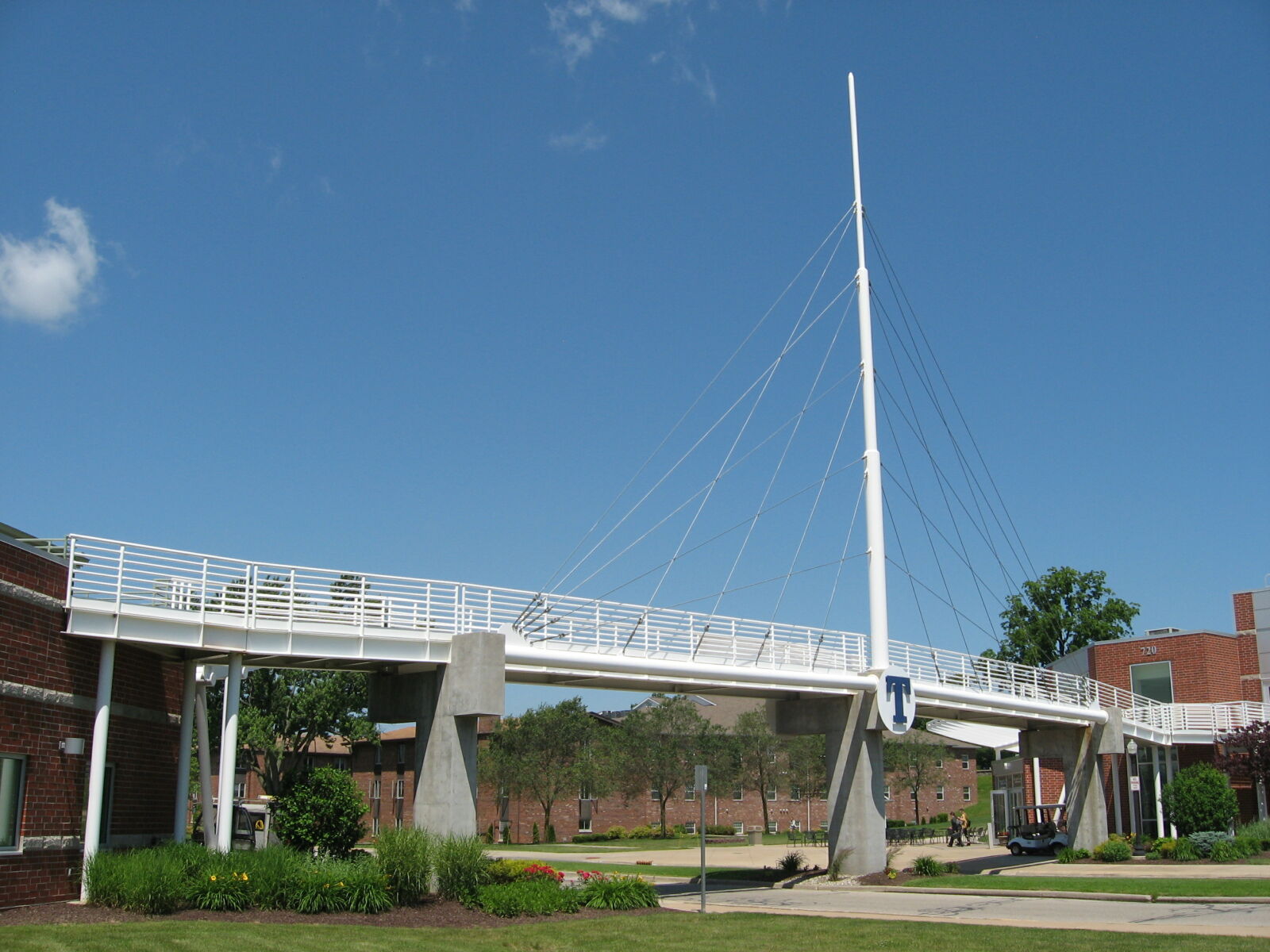
Status: Open to pedestrians only
Location: 41.631755,-85.008590
Carries Pedestrian path over Thunder Avenue
Design: suspension/stayed
Design Details: Cable-stayed footbridge with steel stringer approaches
Total Length: 0.0 Feet
Span Length: 0.0 Feet
Overview: Cable-stayed bridge over Thunder Avenue on Pedestrian path
History:
Built:
Location: Steuben County
View Bridge Information In Wayback Machine
![]()
507227
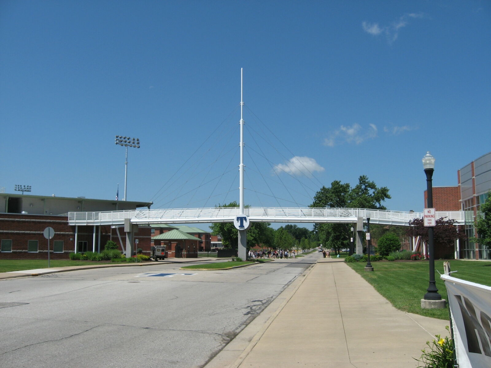
Approaching from east
Photo taken by Paul Plassman in June 2019
507228
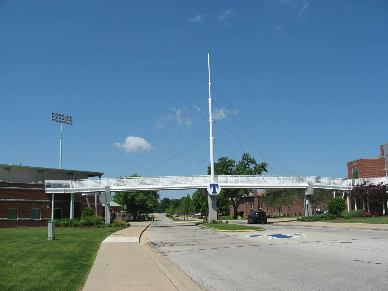
Approaching from east, opposite side of road
Photo taken by Paul Plassman in June 2019
507229
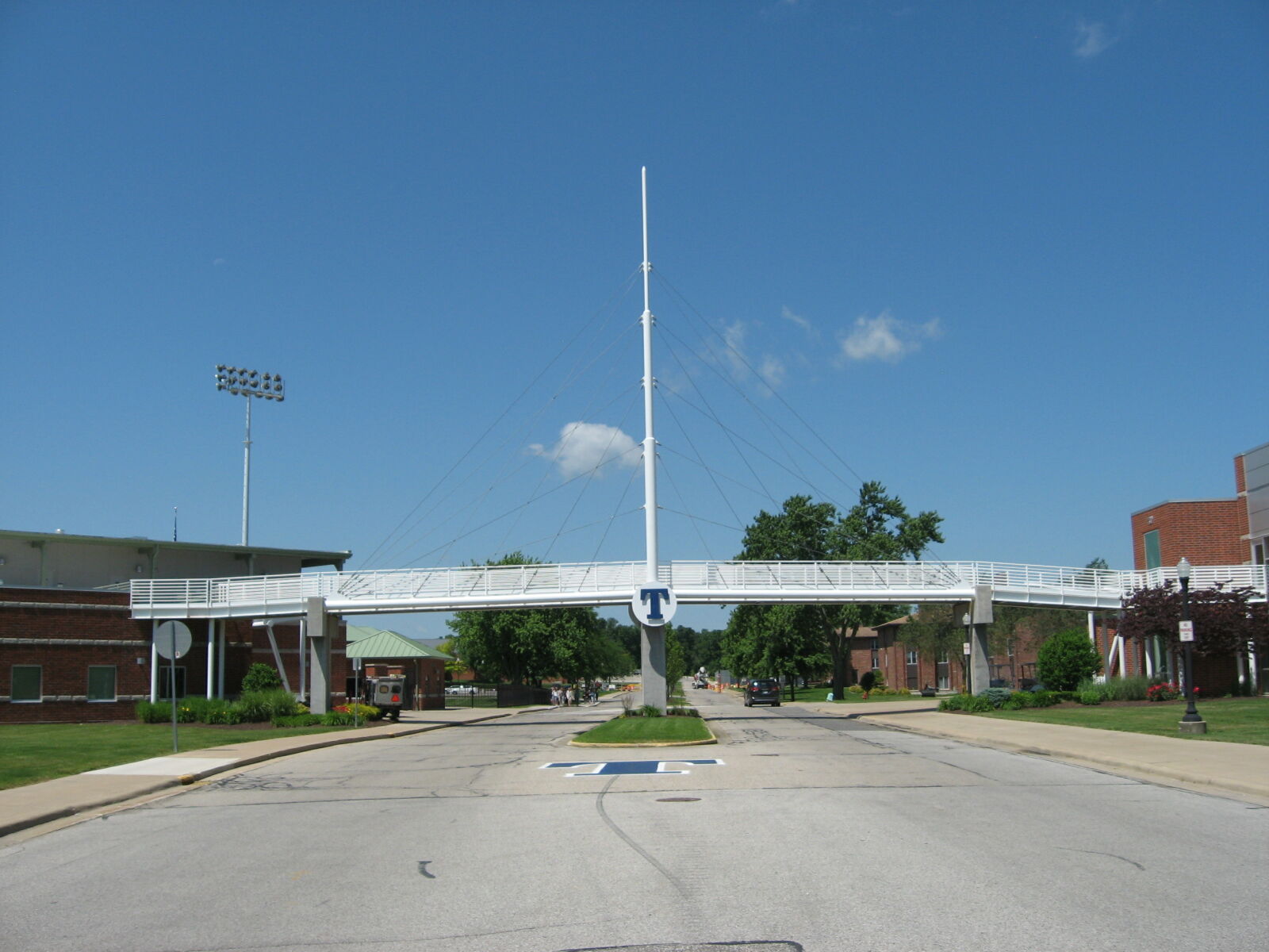
East elevation view
Photo taken by Paul Plassman in June 2019
507230
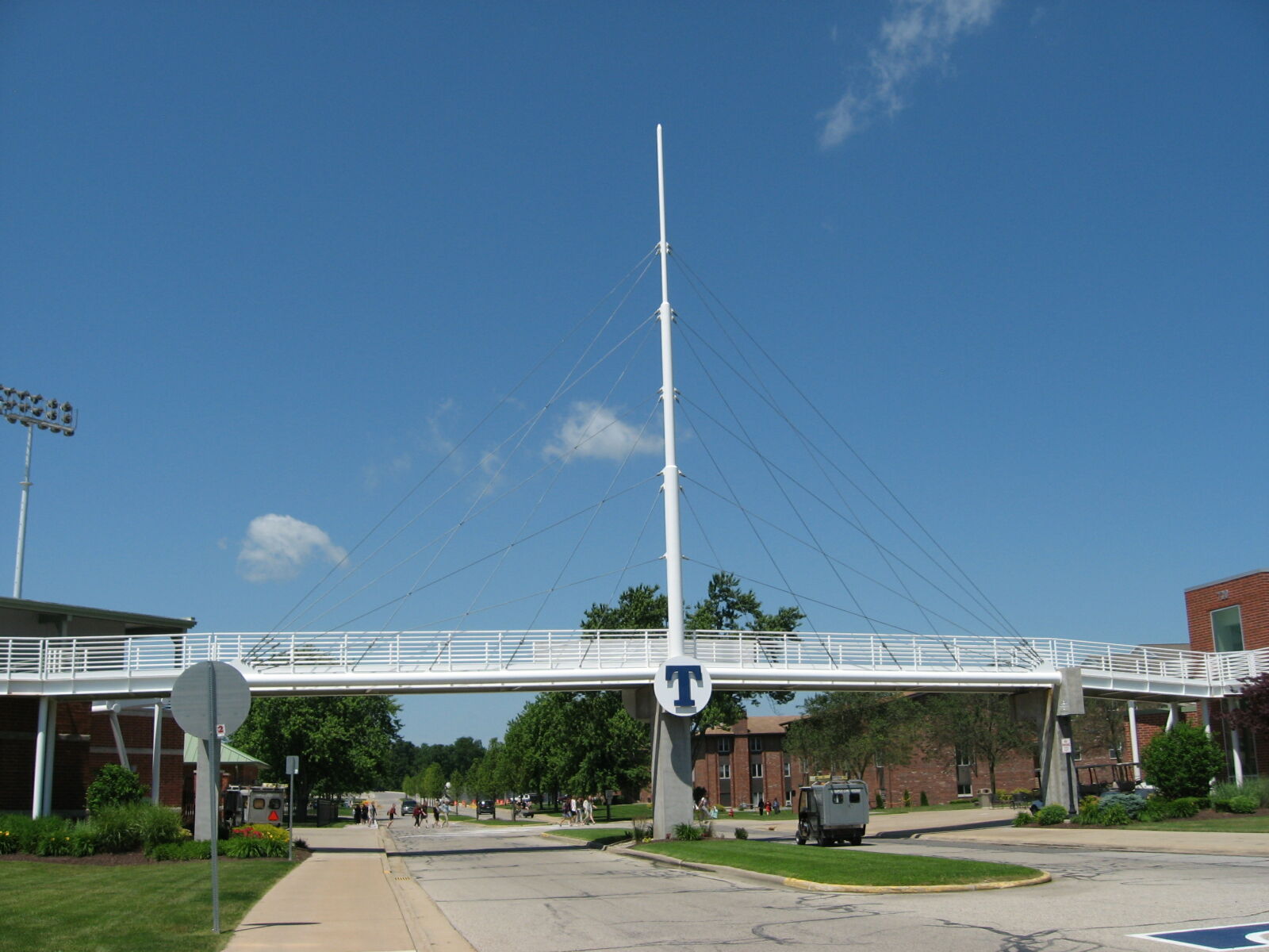
Closer elevation view
Photo taken by Paul Plassman in June 2019
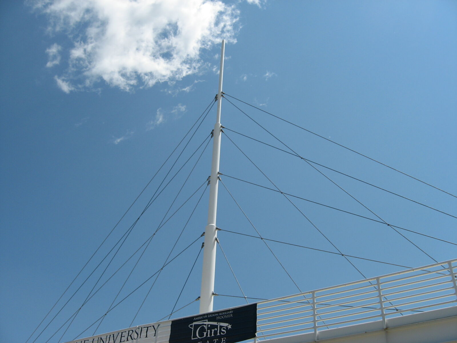
507231
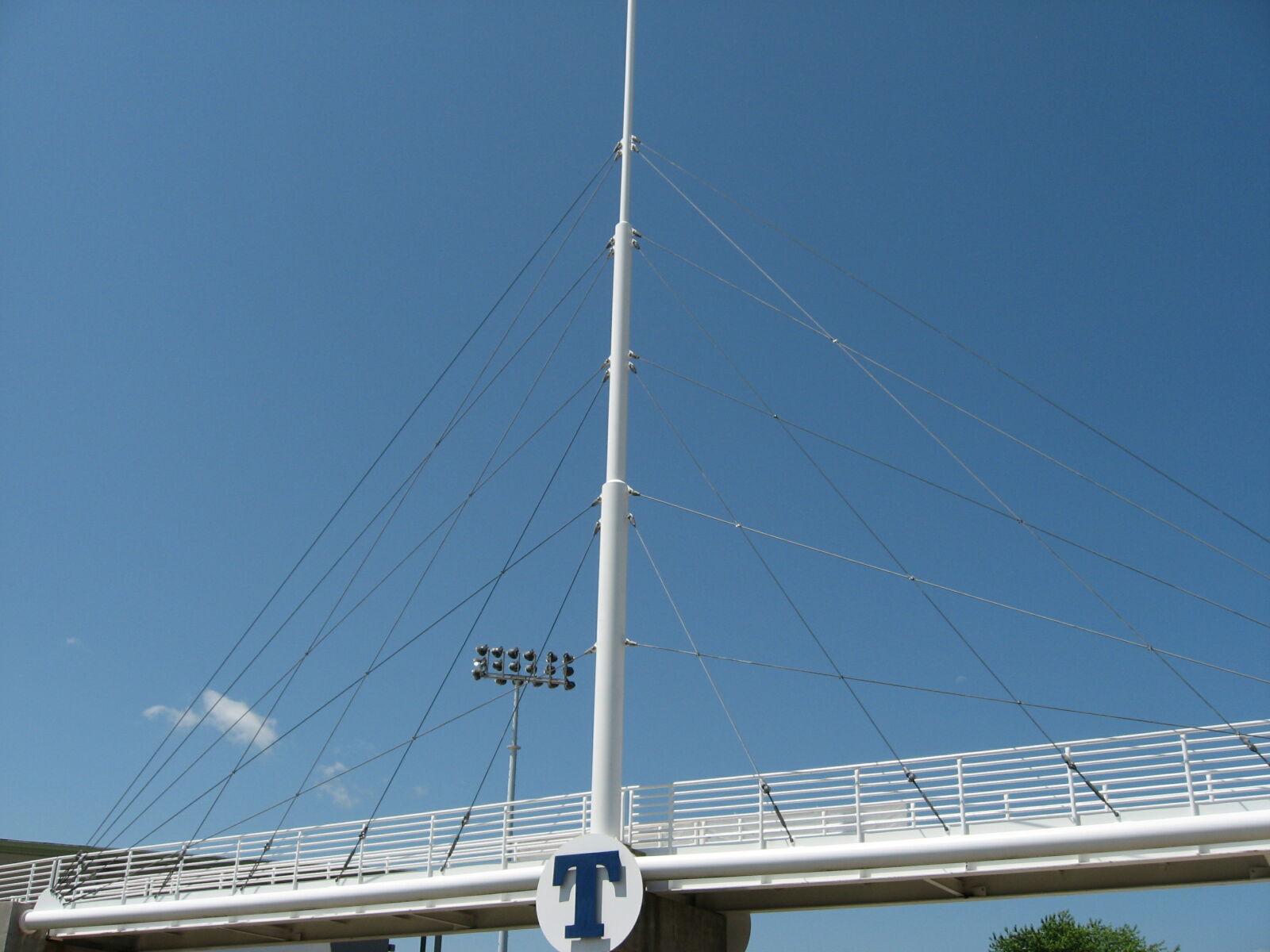
Tower and cable fan
Photo taken by Paul Plassman in June 2019
507232
South half of bridge
Photo taken by Paul Plassman in June 2019
507233
North main span
Photo taken by Paul Plassman in June 2019
507234
Base of tower
Photo taken by Paul Plassman in June 2019
507235
South approach
Photo taken by Paul Plassman in June 2019
507236
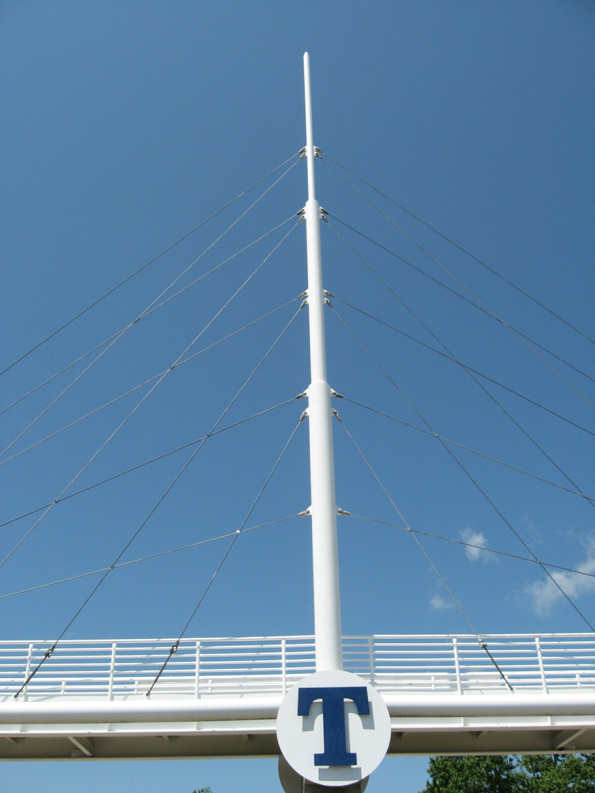
Tower
Photo taken by Paul Plassman in June 2019
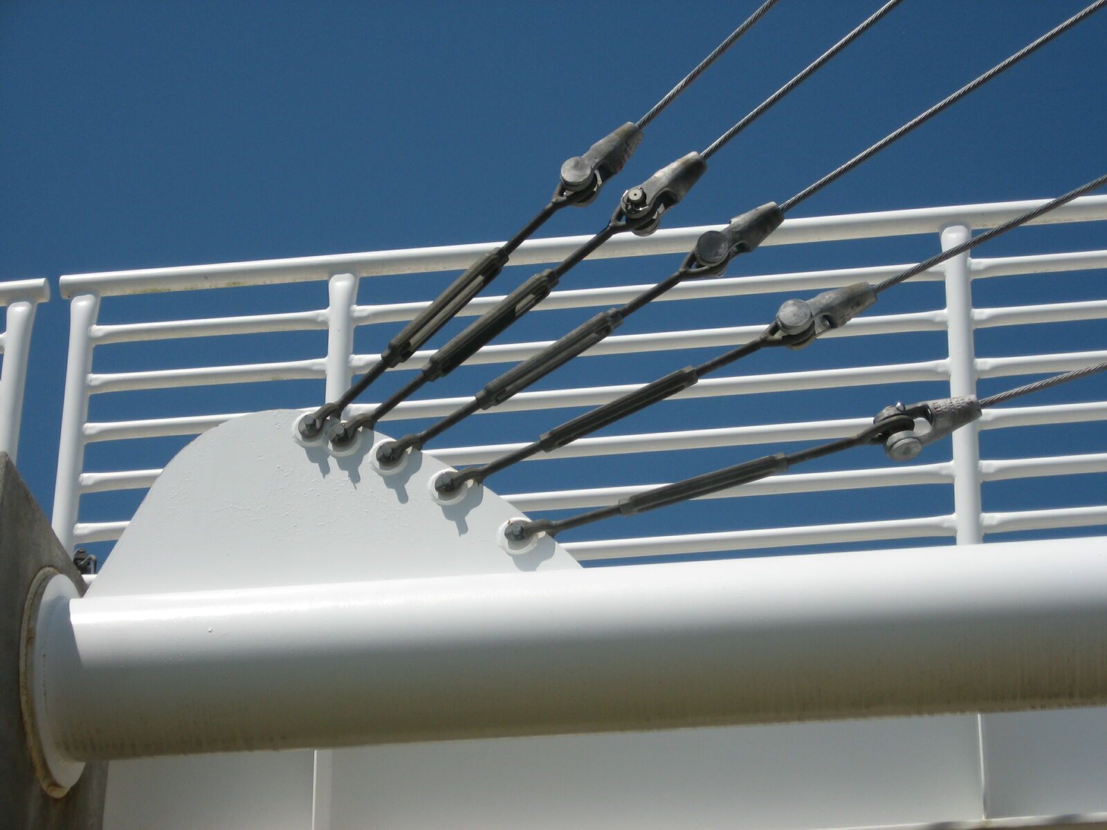
507237
Cable anchors
Photo taken by Paul Plassman in June 2019
507238
Central pier
Photo taken by Paul Plassman in June 2019
507239
Deck structure
Photo taken by Paul Plassman in June 2019
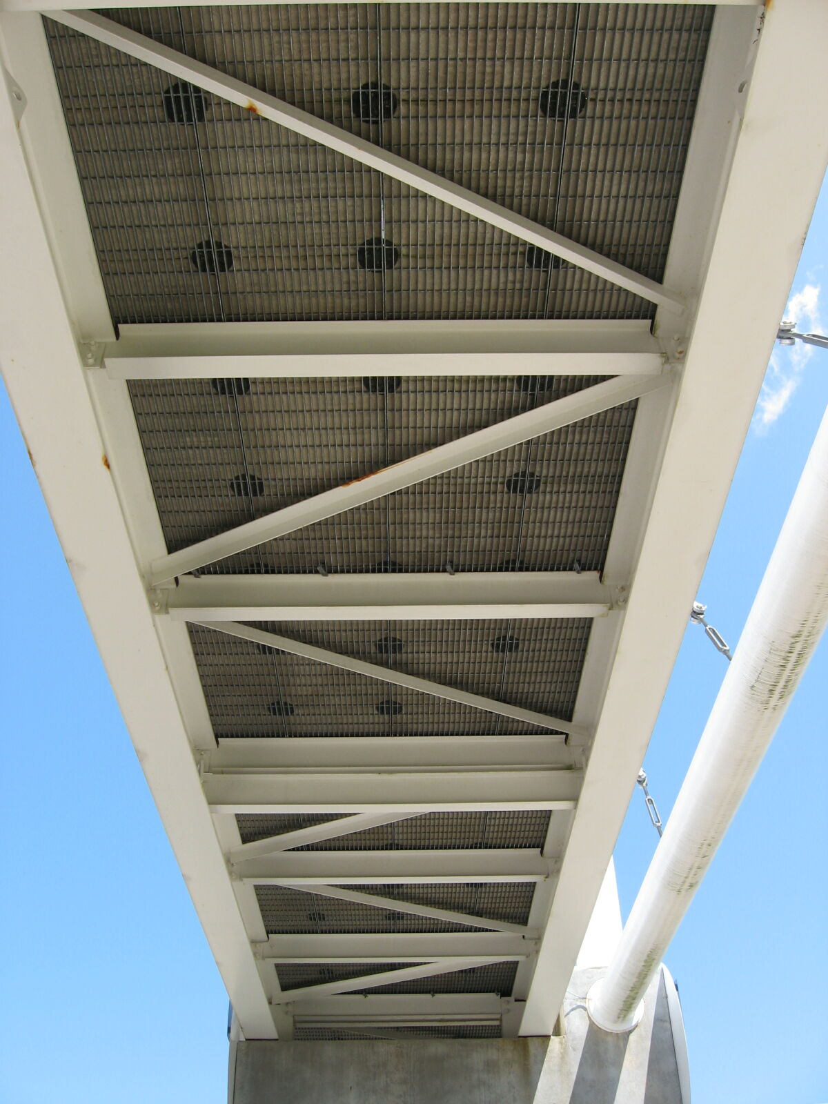
507240
Looking up
Photo taken by Paul Plassman in June 2019
507241
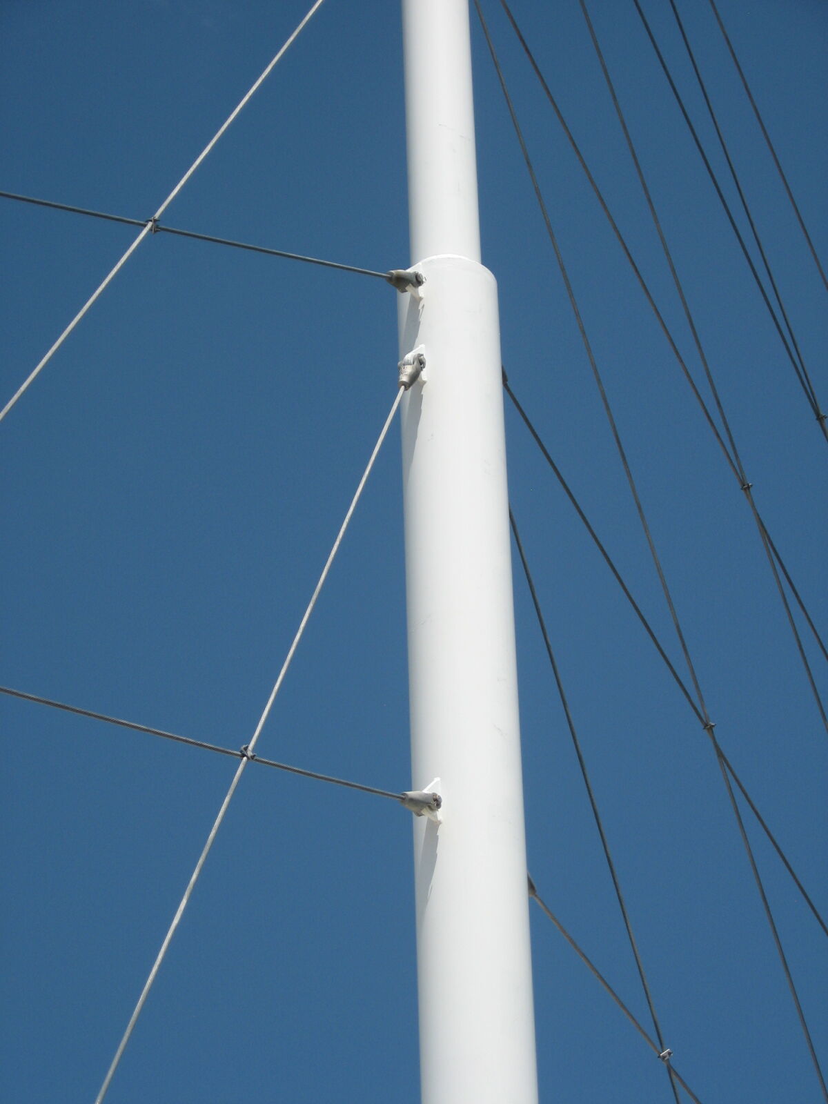
Tower detail
Photo taken by Paul Plassman in June 2019
507242
Cable details
Photo taken by Paul Plassman in June 2019
507243
Southeast oblique view
Photo taken by Paul Plassman in June 2019
507244
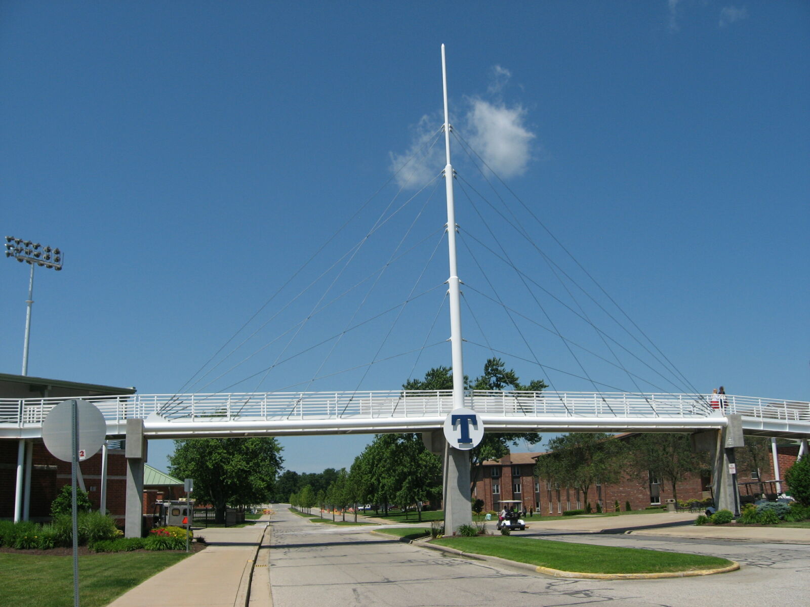
Elevation from east
Photo taken by Paul Plassman in June 2019
507245
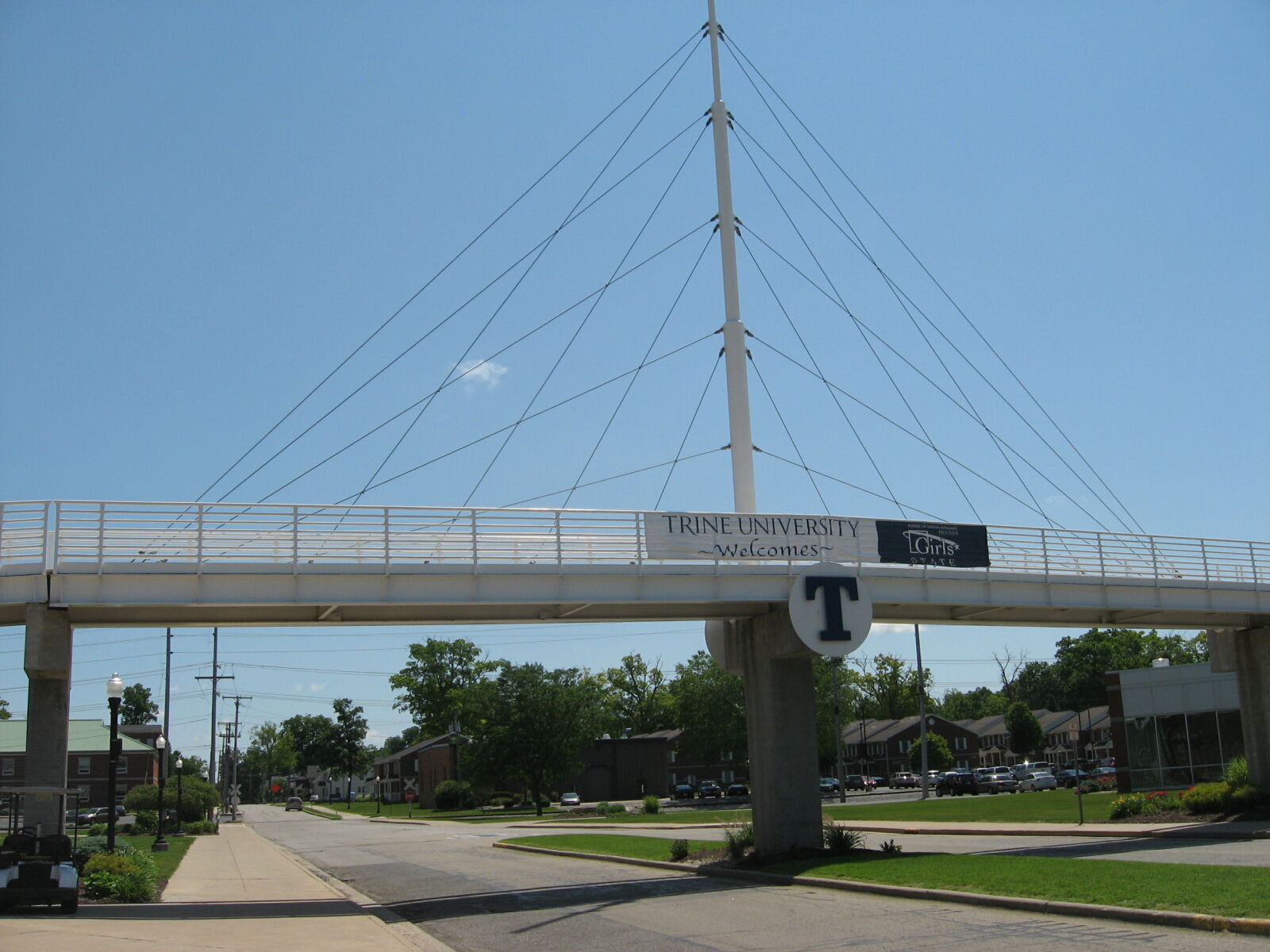
West elevation view
Photo taken by Paul Plassman in June 2019
Special Bridge Conditions Legend: R - Former location of relocated bridge. ! - At risk for demolition or destruction. X - Confirmed demolished or collapsed. S - Dismantled and/or in storage. L - Severe loss of historic integrity due to alteration.
![]()

![]()