![]()
![]()
Status: Open to traffic
Inspection on May 16, 2012 found a broken pin and bridge was closed. Ford County Commissioners voted on June 4, 2012 to scrap the bridge and replace with seven foot culvert. I have appealed the commission's decision to district court. W R Keller maandpakeller@cox.net
Location: 37.601333,-99.809032
Carries Valley Road over Mulberry Creek
Design: truss/through/pratt
Design Details: Two five panel, pin-connected Pratt through trusses
Total Length: 176.8 Feet
Span Length: 85.0 Feet
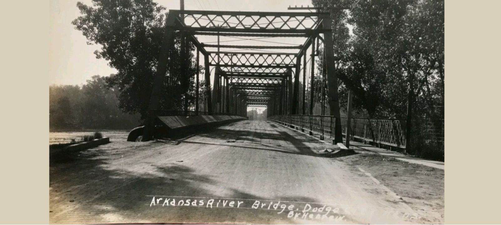
Overview: Through truss bridge over Mulberry Creek, 2.6 mi. south and 3.0 mi. west of Ford
History: Built 1906 at 2nd Avenue in Dodge City; Relocated to Coronado Road in 1935; Rebuilt here 1958
Built: 1958
Location: Ford County
View Bridge Information In Wayback Machine
![]()
249601
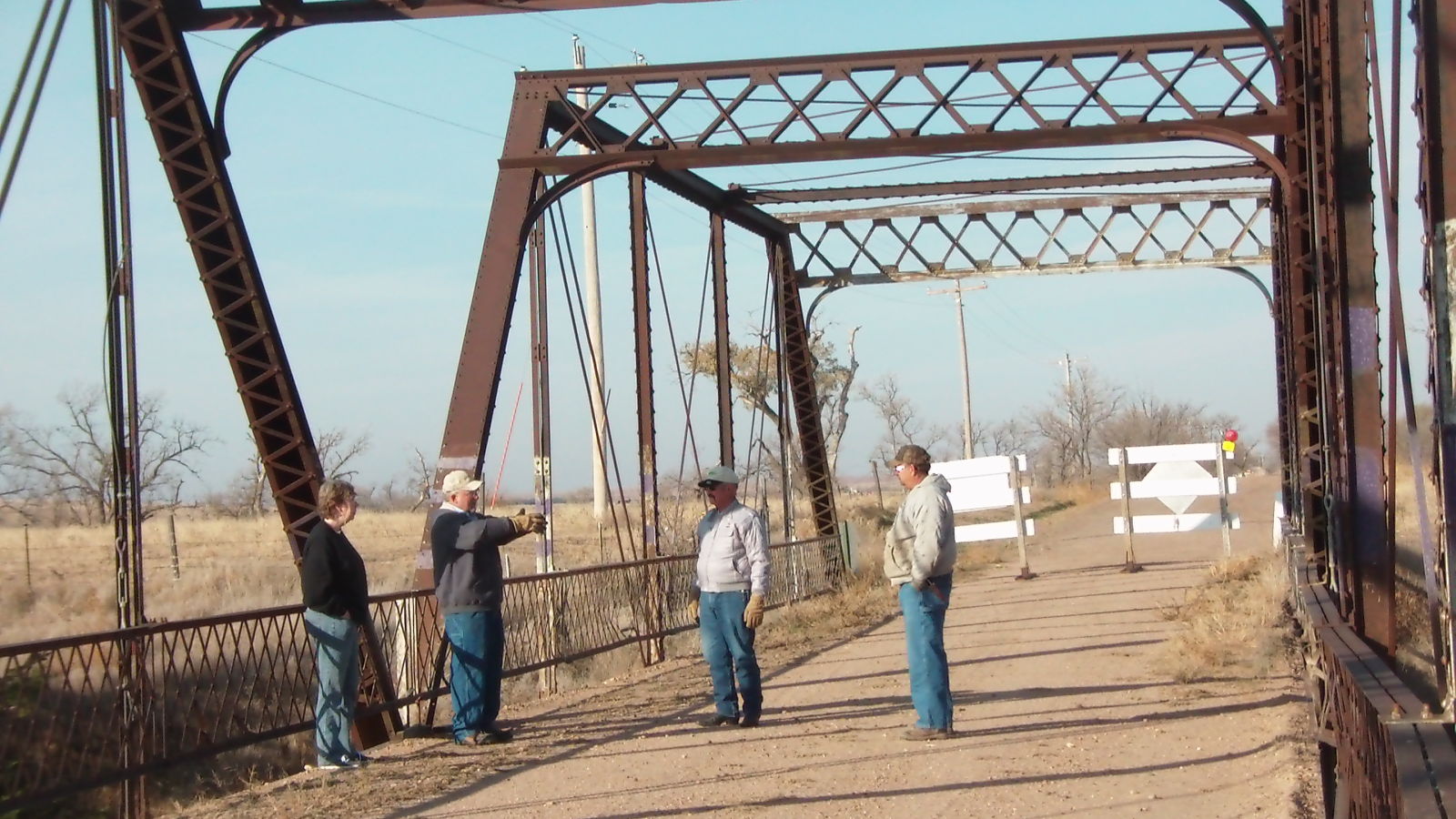
Meeting at the center of the bridge
Photo taken by Julie Bowers in November 2012
249602
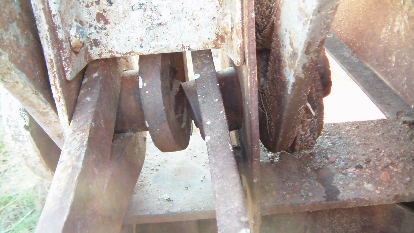
Broken Pin
turned out to be an axle with a hole drilled across the center of the pin and a keyway channel down the length
Photo taken by Julie Bowers in November 2012
249603
Broken Pin
Photo taken by Julie Bowers in November 2012
249604
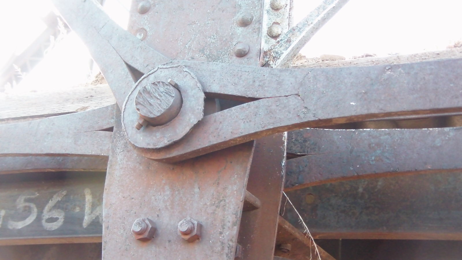
Cotter Pin
Photo taken by Julie Bowers in november 2012
249605
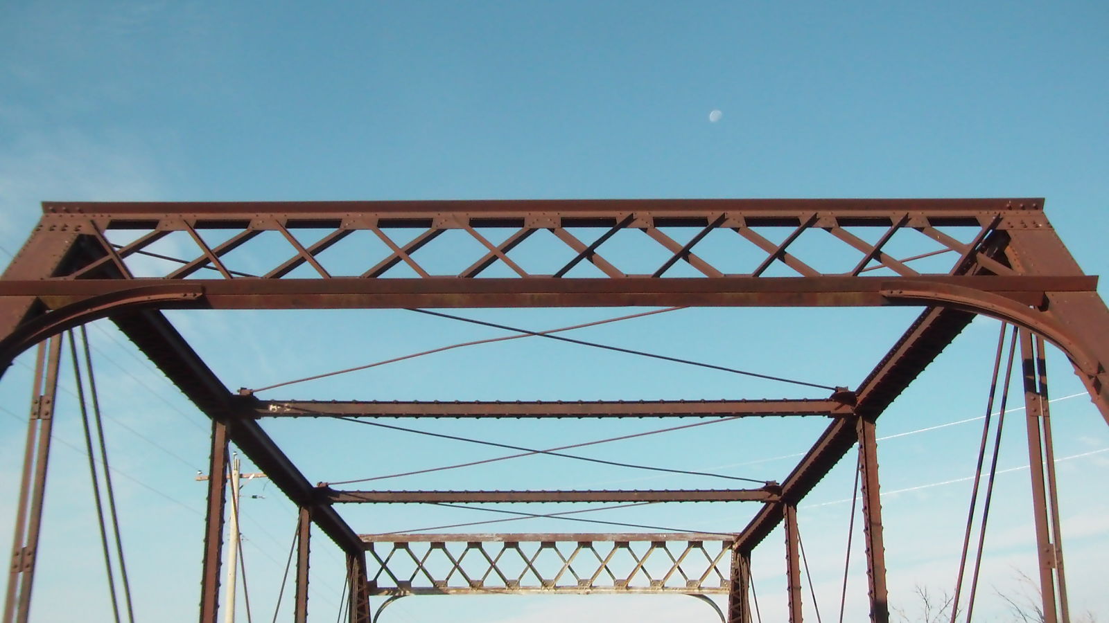
Portal Bracing
Photo taken by Julie Bowers in November 2012
249606
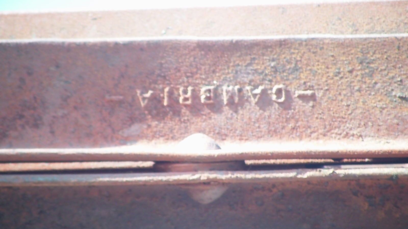
Cambria Iron Co.
Photo taken by Julie Bowers in November 2012
249607
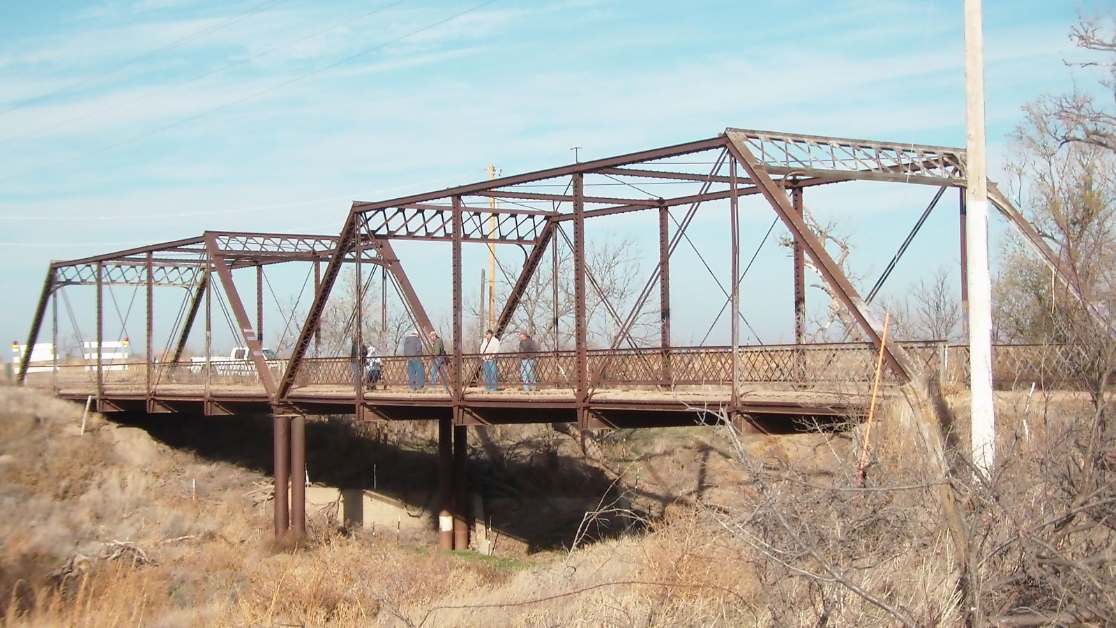
Both spans
Photo taken by Julie Bowers in November 2012
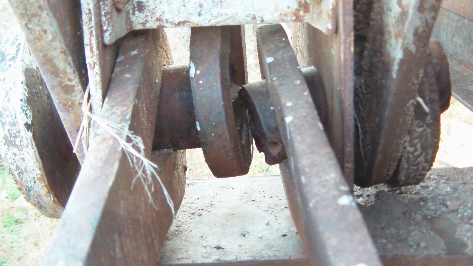
249608
Keyway Channel from below
Photo taken by Julie Bowers in November 2012
446437
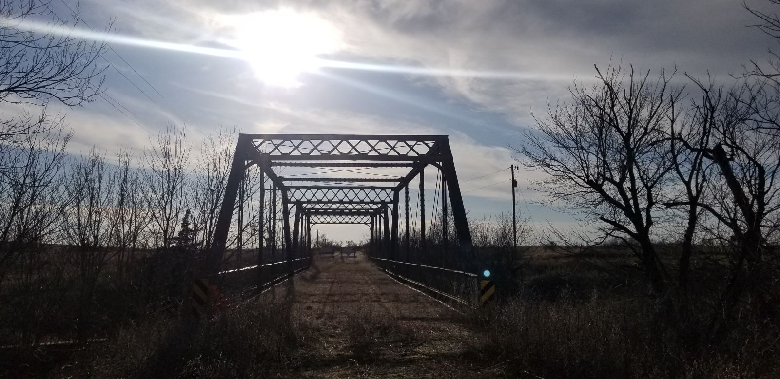
Photo taken by Nick Schmiedeler in April 2019
446438
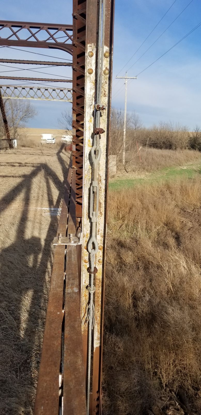
Photo taken by Nick Schmiedeler in April 2019
446439
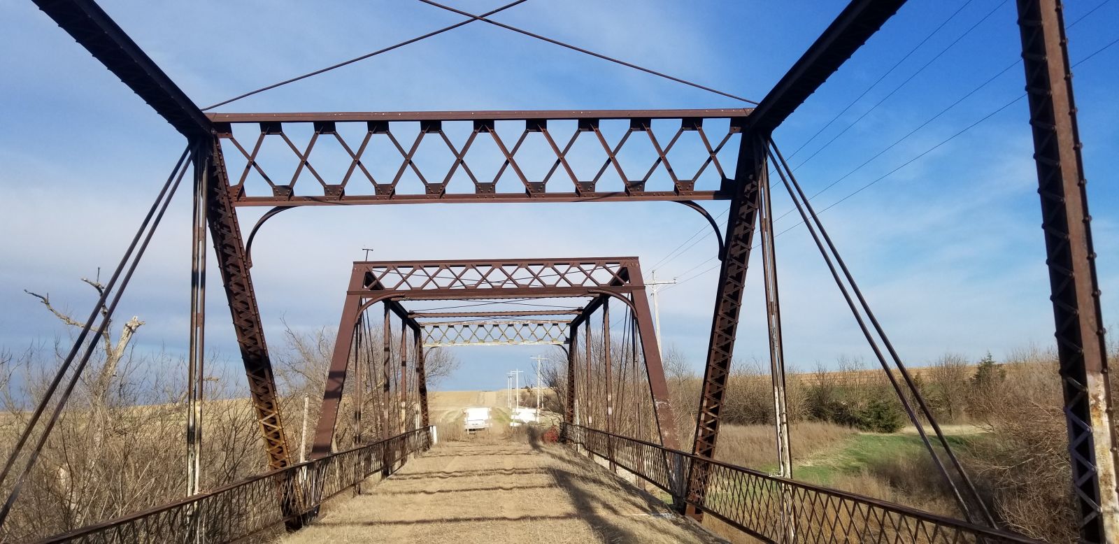
Photo taken by Nick Schmiedeler in April 2019
446440
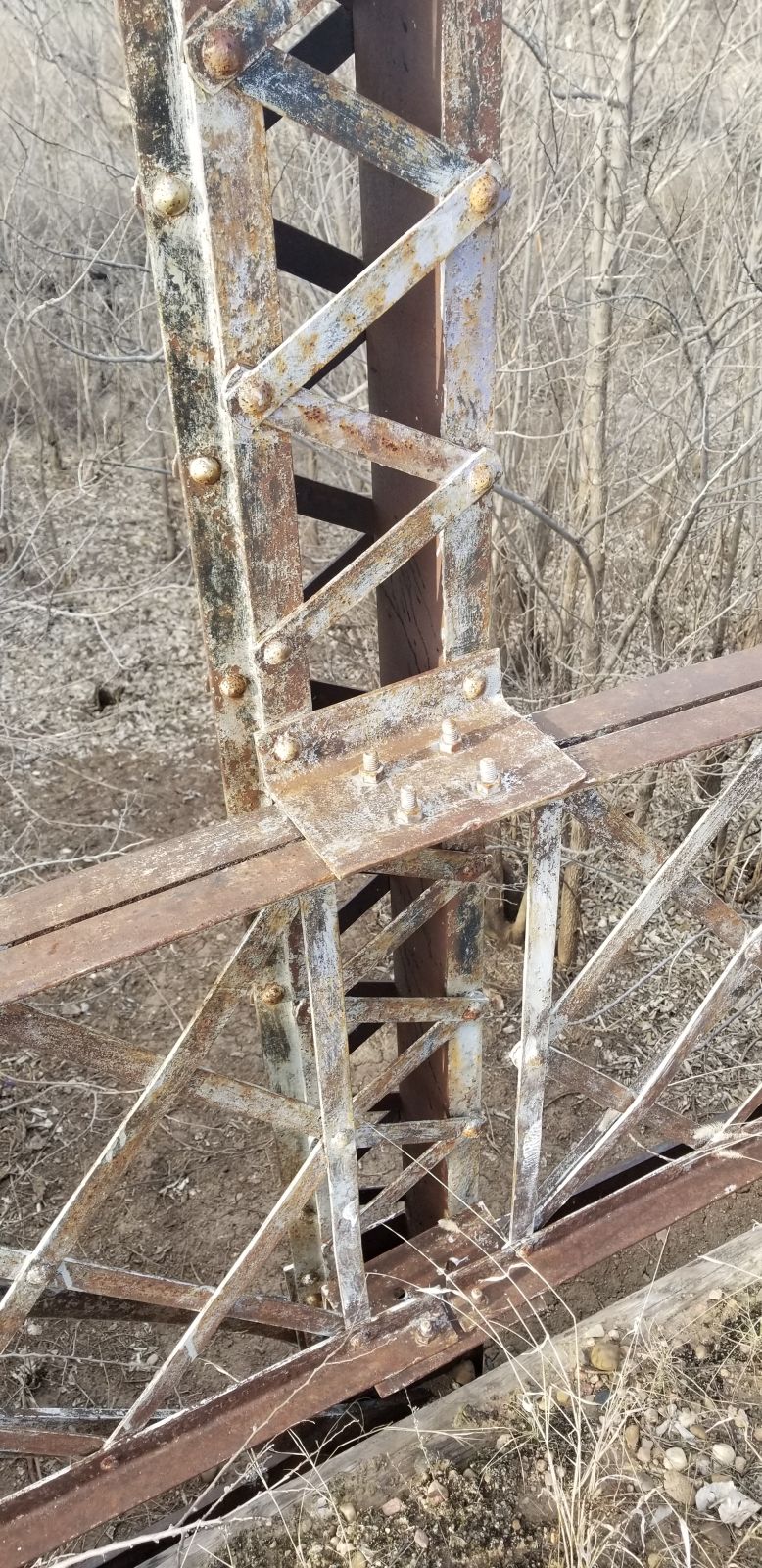
Photo taken by Nick Schmiedeler in April 2019
446441
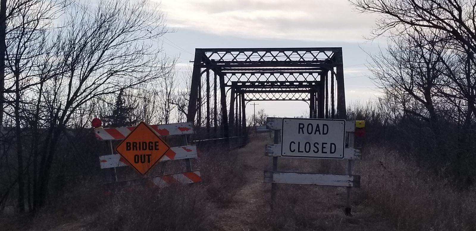
Photo taken by Nick Schmiedeler in April 2019
446442
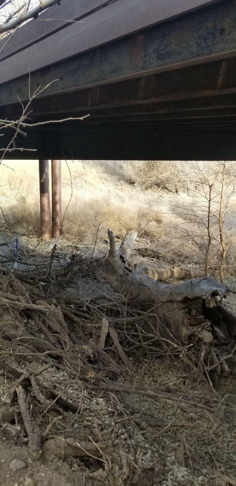
Photo taken by Nick Schmiedeler in April 2019
446443
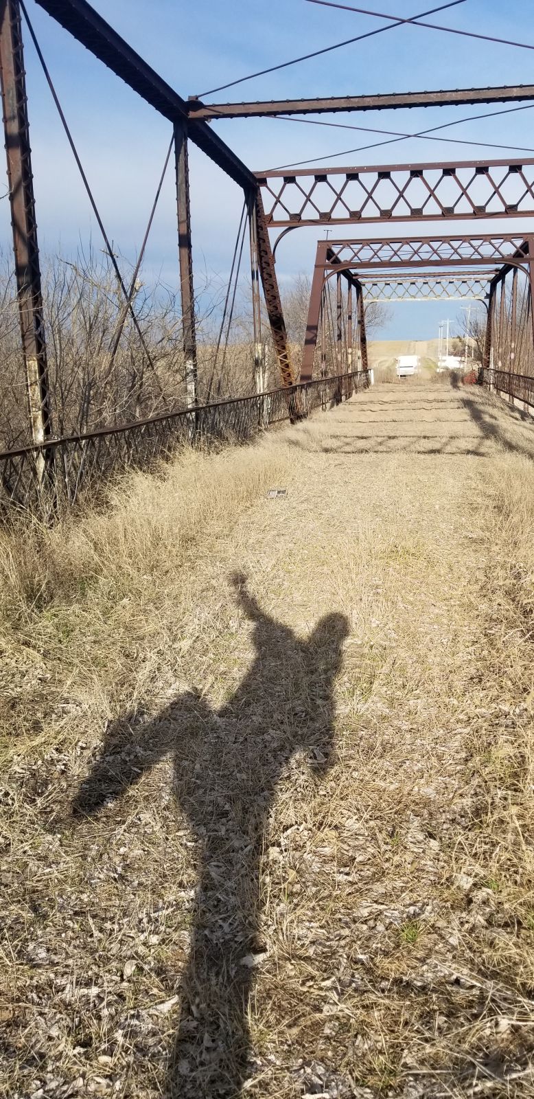
Photo taken by Nick Schmiedeler in April 2019
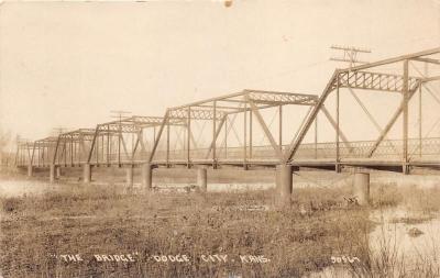
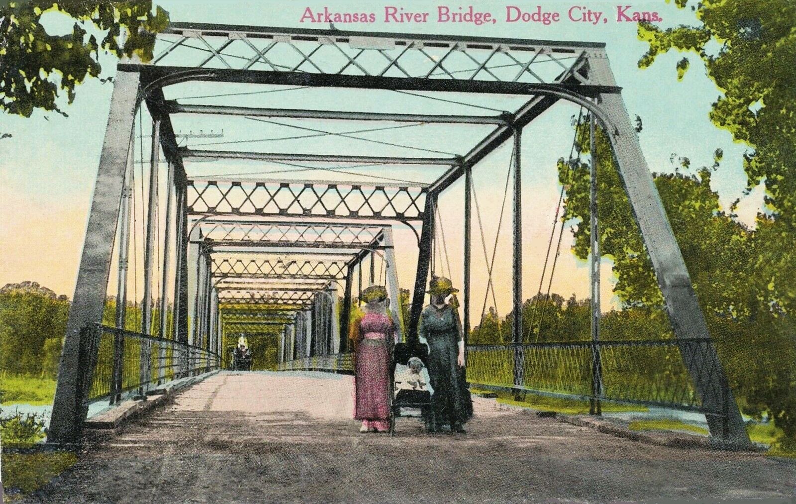
500749
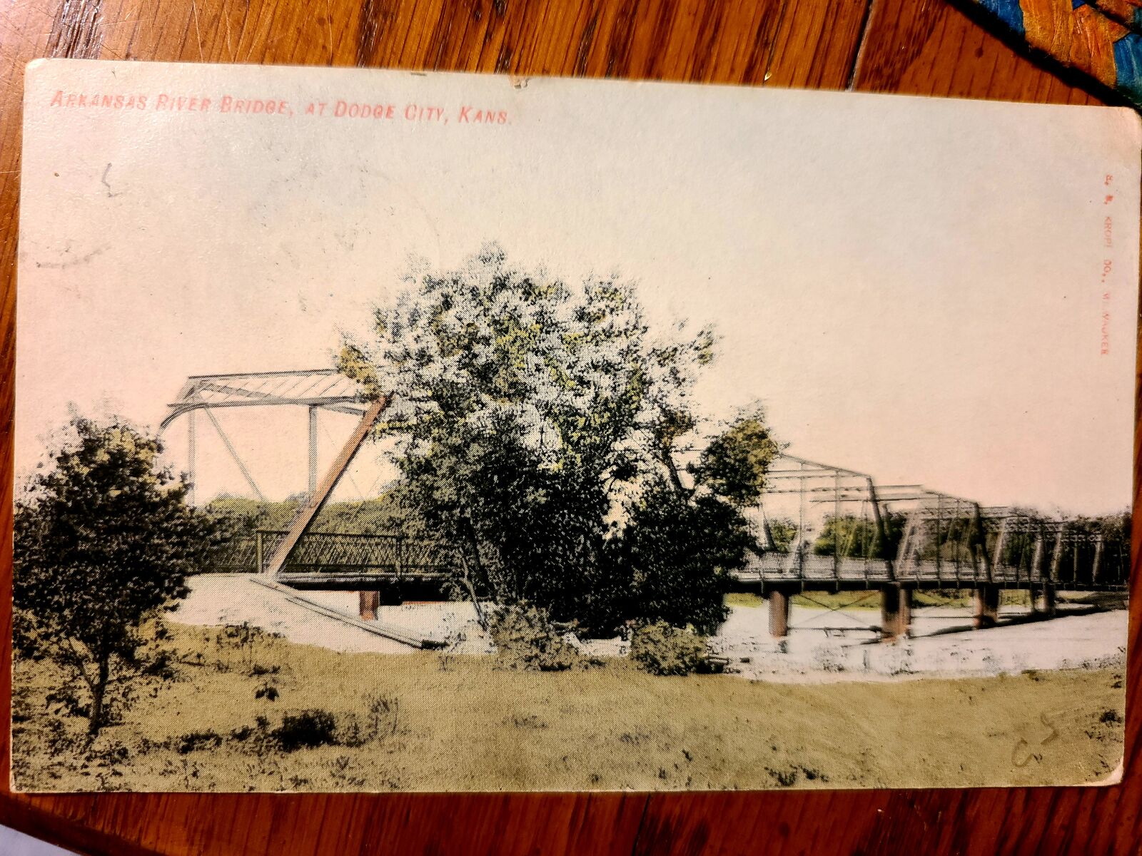
Original bridge location postcard
East of Dodge City, Arkansas River Bridge before dismantling/moving
Photo taken by Nick Schmiedeler in June 2021
![]()
Status: No longer exists
Location: 37.905556,-100.045556
Carries RS 255 over Sawlog Creek
Design: arch
Design Details: Arch
Total Length: 61.0 Feet
Span Length: 17.1 Feet
Overview: Lost arch bridge over Sawlog Creek, 11.0 mi. north of Dodge City
History: Built ca. 1930; replaced 2003
Built: ca. 1930
Location: Ford County
View Bridge Information In Wayback Machine
![]()
![]()
Status: Replaced by new bridge
Location: 37.825924,-100.037942
Carries RS 253 over Duck Creek
Design: truss/through/pratt
Design Details: Five panel, pin-conected Pratt through truss
Total Length: 86.9 Feet
Span Length: 85.0 Feet
Overview: Lost Pratt through truss bridge over Duck Creek on RS 253, 5.0 mi. north and 1.7 mi. east of Dodge City
History: Built 1905; replaced 1994
Built: 1905
Location: Ford County
View Bridge Information In Wayback Machine
![]()
![]()
Status: Open to traffic
Location: 37.716166,-100.097101
Carries Cimarron Valley Railroad over Arkansas River Tributary
Design: beam/stringer/wood
Design Details: Wooded trestle
Total Length: 0.0 Feet
Span Length: 0.0 Feet
Overview: Timber stringer bridge over Arkansas River Tributary on Cimarron Valley Railroad
History:
Built:
Location: Ford County
View Bridge Information In Wayback Machine
![]()
![]()
Status: Open to traffic
Location: 37.710781,-100.118419
Carries Cimarron Valley Railroad over Tributary to Arkansas River
Design: beam/stringer/wood
Design Details: Wooden trestle
Total Length: 0.0 Feet
Span Length: 0.0 Feet
Overview: Timber stringer bridge over Tributary to Arkansas River on Cimarron Valley Railroad
History:
Built:
Location: Ford County
View Bridge Information In Wayback Machine
![]()
![]()
Status: Open to traffic
Location: 37.700133,-100.152097
Carries Cimarron Valley Railroad over Arkansas River Tributary
Design: beam/stringer/wood
Design Details: Wooden trestle
Total Length: 0.0 Feet
Span Length: 0.0 Feet
Overview: Timber stringer bridge over Arkansas River Tributary on Cimarron Valley Railroad
History:
Built:
Location: Ford County
View Bridge Information In Wayback Machine
![]()
![]()
Status: Open to traffic
Location: 37.691558,-100.170057
Carries Cimarron Valley Railroad over Arkansas River Tributary
Design: beam/stringer/wood
Design Details: Wooden trestle
Total Length: 0.0 Feet
Span Length: 0.0 Feet
Overview: Timber stringer bridge over Arkansas River Tributary on Cimarron Valley Railroad
History:
Built:
Location: Ford County
View Bridge Information In Wayback Machine
![]()
![]()
Status: Open to traffic
Location: 37.666713,-100.202260
Carries Cimarron Valley Railroad over Mulberry Creek Tributary
Design: beam/stringer/wood
Design Details: Wooden trestle
Total Length: 0.0 Feet
Span Length: 0.0 Feet
Overview: Timber stringer bridge over Mulberry Creek Tributary on Cimarron Valley Railroad
History:
Built:
Location: Ford County
View Bridge Information In Wayback Machine
![]()
![]()
Status: Replaced by a new bridge
Location: 37.747064,-100.019410
Carries 2nd Avenue over Arkansas River
Design: truss/through/pratt
Design Details: (6)5-panel, pinned Pratt through trusses
Total Length: 510.0 Feet
Span Length: 85.0 Feet
Overview: Lost Pratt through truss bridge over Arkansas River on 2nd Avenue
History: Built in 1906; moved 2 miles east in 1935 to Coronado Road and named Coronado Bridge
Built: 1906
Location: Ford County
View Bridge Information In Wayback Machine
![]()
480153
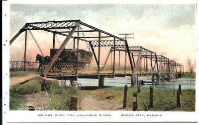
2nd Avenue Bridge
Photo from old postcard
480154
2nd Avenue Bridge
1920 view
Photo from old postcard
484323
old postcard image
Photo taken by Nick Schmiedeler
489184
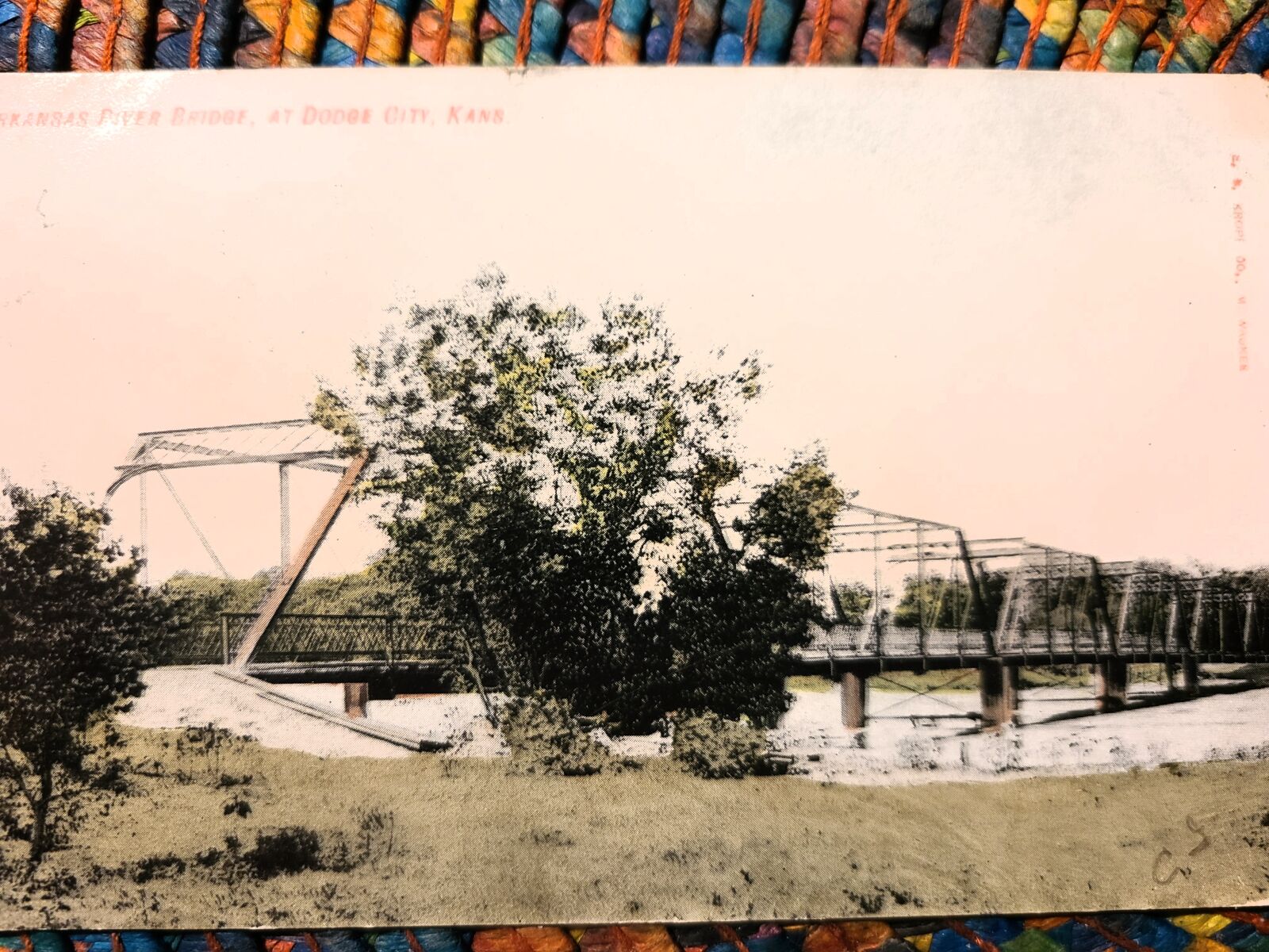
Photo taken by Nick Schmiedeler in January 2021
511668
1919 postmark
Charming image, lightly cleaned up. Source image in link
Photo digitally altered by Art S. in November 2021
![]()
Status:
Location: 37.713435,-99.906481
Carries Coronado Road over Arkansas River
Design: truss/through/pratt
Design Details: Pratt through truss
Total Length: 0.0 Feet
Span Length: 0.0 Feet
Overview: Pratt through truss bridge over Arkansas River on Coronado Road
History: Built 1906 at 2nd Avenue in Dodge City; Rebuilt here 1935; replaced 1958
Built: 1935
Location: Ford County
View Bridge Information In Wayback Machine
![]()
Special Bridge Conditions Legend: R - Former location of relocated bridge. ! - At risk for demolition or destruction. X - Confirmed demolished or collapsed. S - Dismantled and/or in storage. L - Severe loss of historic integrity due to alteration.
![]()

![]()