![]()
![]()
Status: Open to traffic
Location: 38.970000,-76.248333
Carries MD 18B over Kent Island Narrow
Design: other
Design Details: Bascule
Total Length: 663.1 Feet
Span Length: 74.2 Feet
Overview: Bascule bridge over Kent Island Narrow on MD 18B in Chester
History: Built 1951; rehabilitated 1982
Built: 1951
Location: Queen Anne's County
View Bridge Information In Wayback Machine
![]()
154058
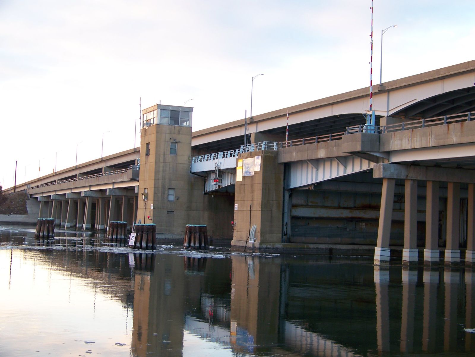
Photo taken by Daniel McFarland
260809
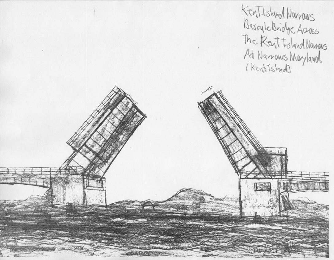
Drawing
Drawing made by Douglas Butler
261035
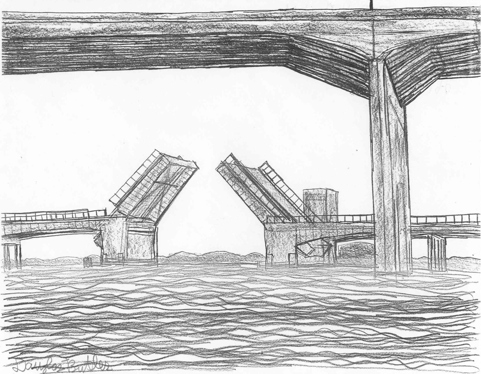
Photo taken by Douglas Butler
286445
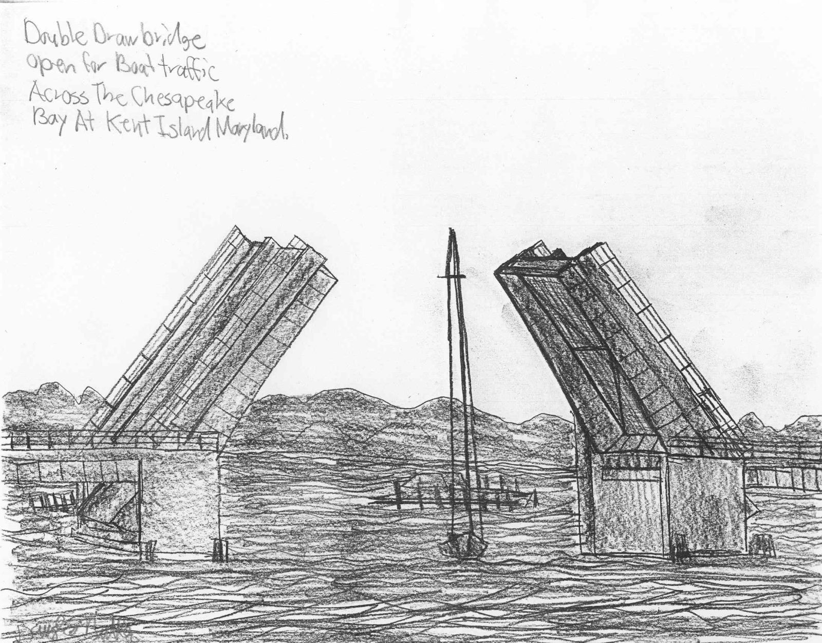
Kent Island Narrow Bridge
Boats traveling through
Photo taken by Douglas Butler in April 2013
![]()
Status: Open to traffic
Location: 39.191111,-75.833889
Carries MD 300 over Unicorn Branch
Design: beam/stringer/wood
Design Details: Timber stringer
Total Length: 55.1 Feet
Span Length: 18.0 Feet
Overview: Wooden bridge over Unicorn Branch on MD 300
History: Built 1939
Built: 1939
Location: Queen Anne's County
View Bridge Information In Wayback Machine
![]()
![]()
Status: Open to traffic
Location: 38.970000,-76.248333
Carries Us 50/301 over Kent Island Narrow
Design: beam/stringer/steel
Design Details: Steel stringer
Total Length: 3001.1 Feet
Span Length: 191.9 Feet
Overview: Steel stringer bridge over Kent Island Narrow on Us 50/301
History: Built 1990
Built: 1990
Location: Queen Anne's County
View Bridge Information In Wayback Machine
![]()
256222

Photo taken in July 2005
256223
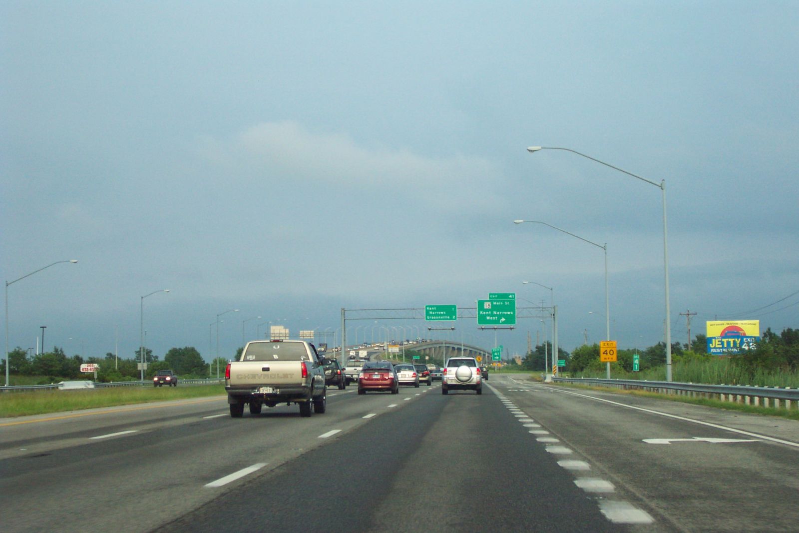
Photo taken in July 2005
256224
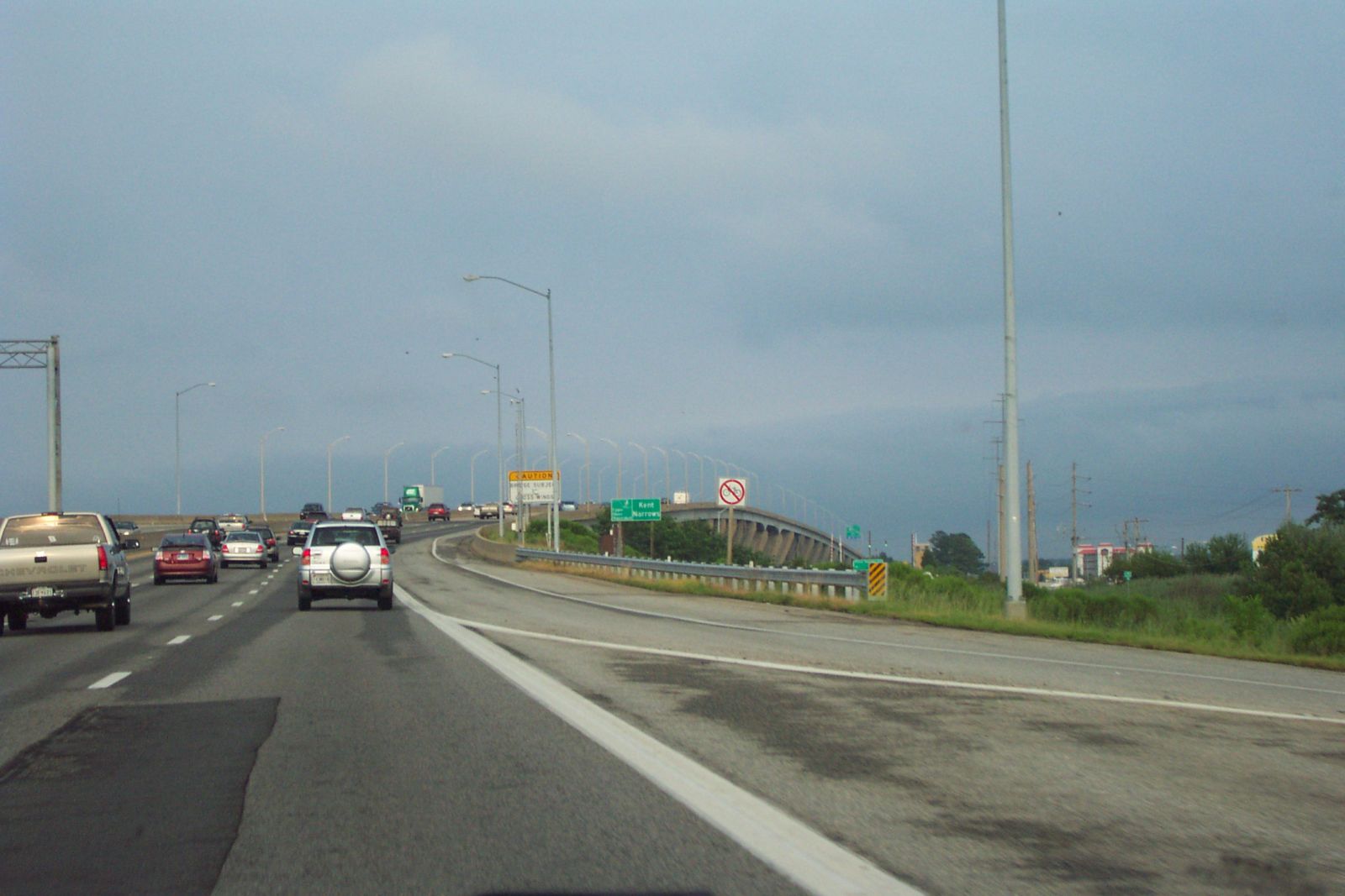
Photo taken in July 2005
![]()
Status: Open to traffic
Location: 39.250408,-75.841434
Carries High Bridge Road over Massey/Centrville Rr
Design: girder/pony/plate
Design Details: Pony plate girder
Total Length: 90.9 Feet
Span Length: 43.0 Feet
Overview: Pony/through plate girder bridge over Massey/Centrville Rr on High Bridge Road
History: Built 1914
Built: 1914
Location: Queen Anne's County
View Bridge Information In Wayback Machine
![]()
437751
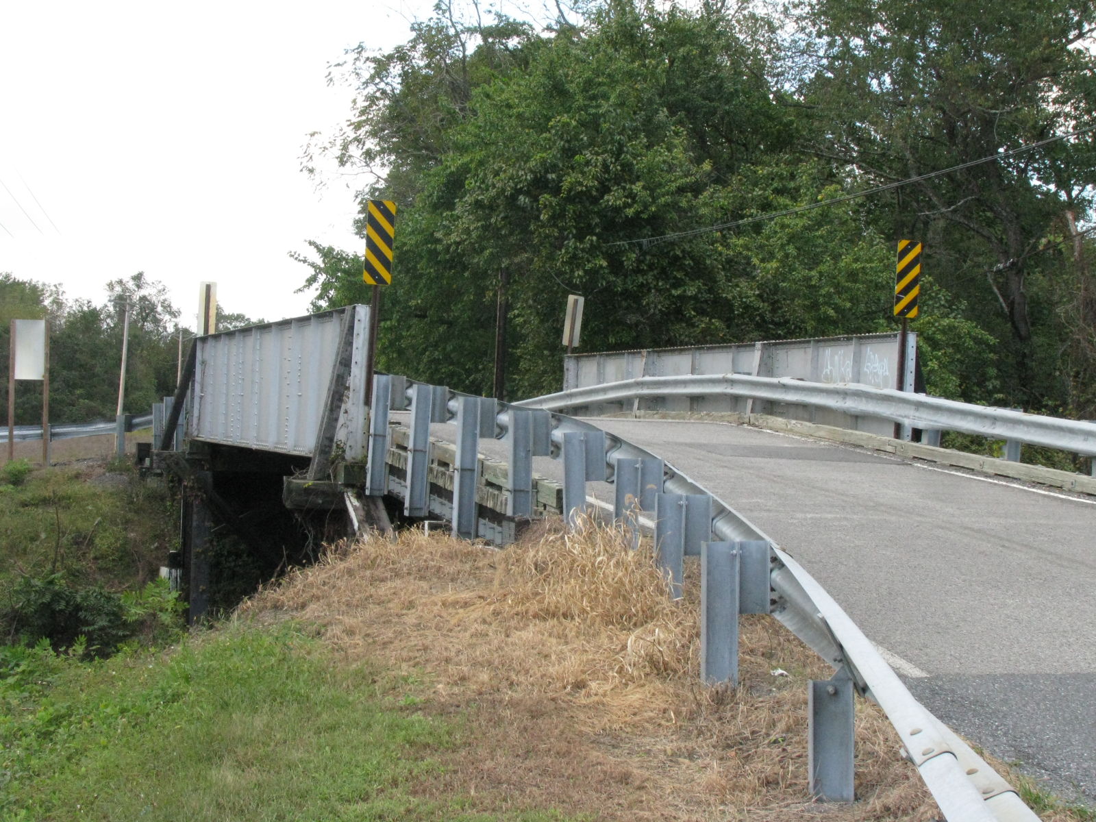
Photo taken by Timothy and Joann Phillips in October 2018
437752
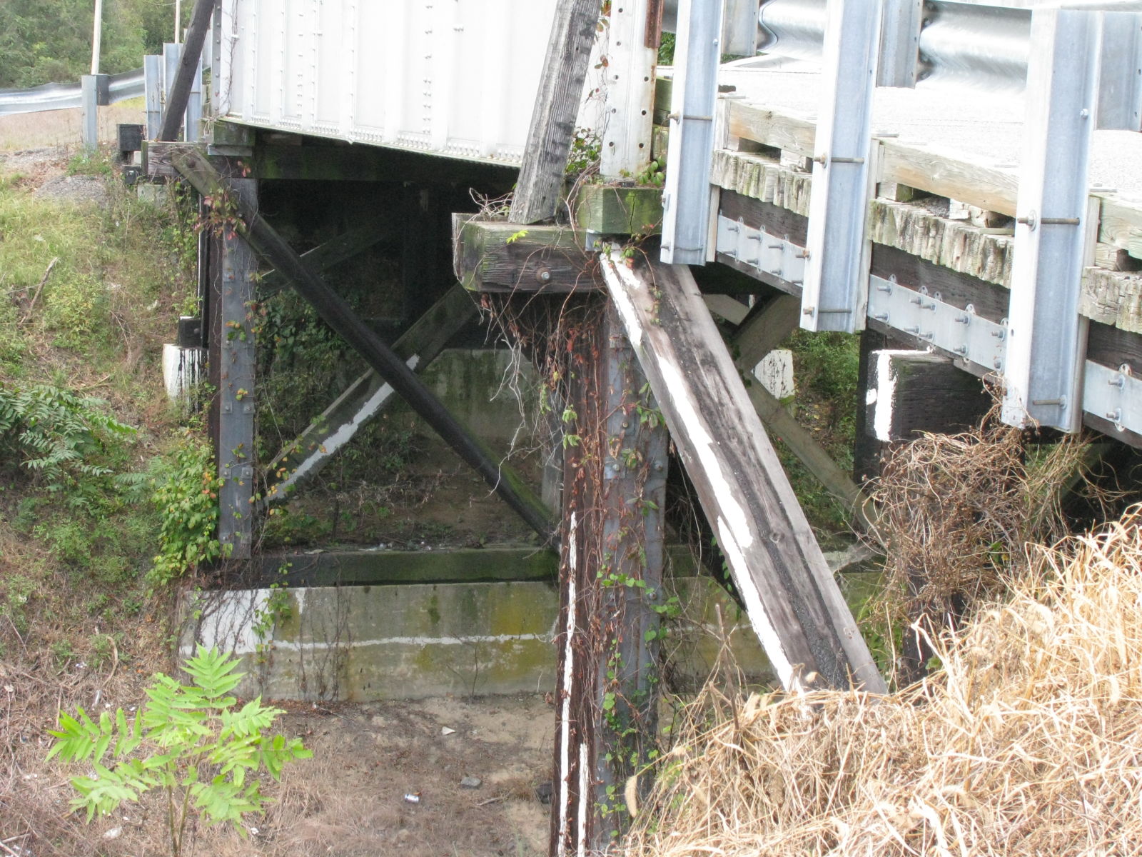
Photo taken by Timothy and Joann Phillips in October 2018
437753
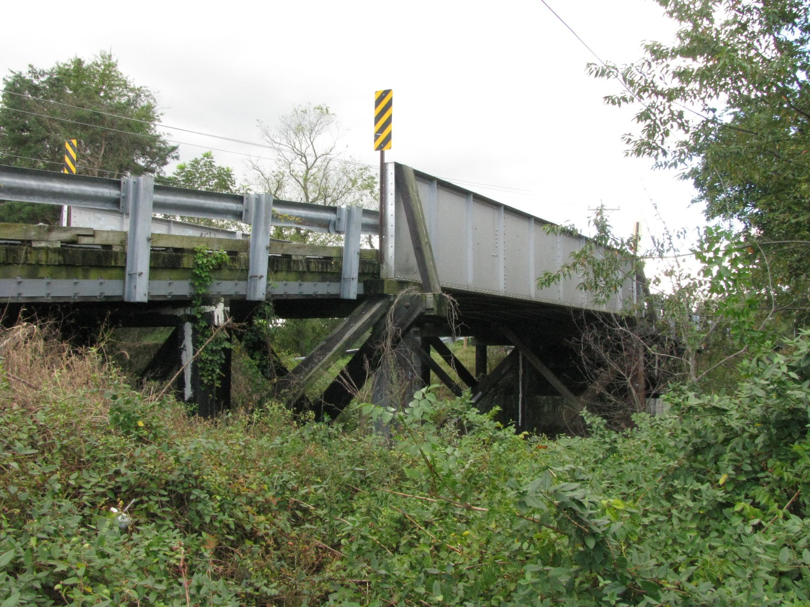
Photo taken by Timothy and Joann Phillips in October 2018
437754
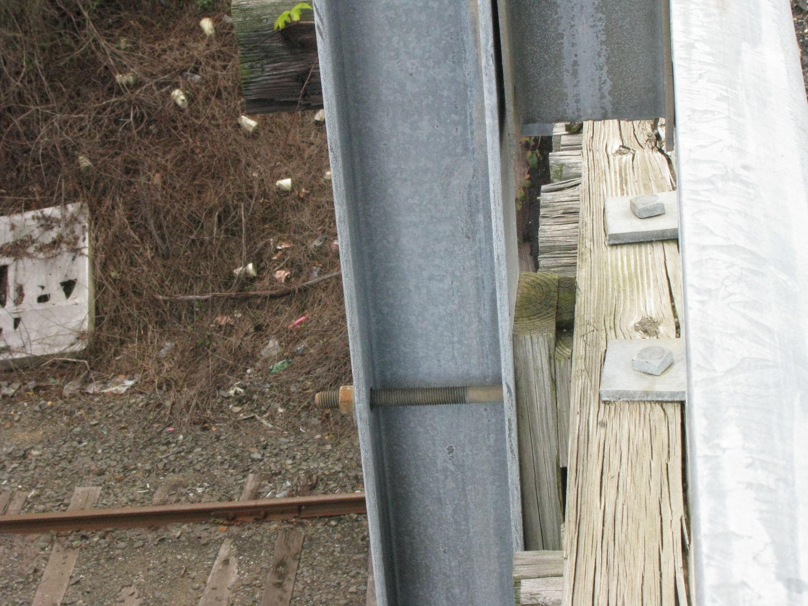
Photo taken by Timothy and Joann Phillips in October 2018
437755
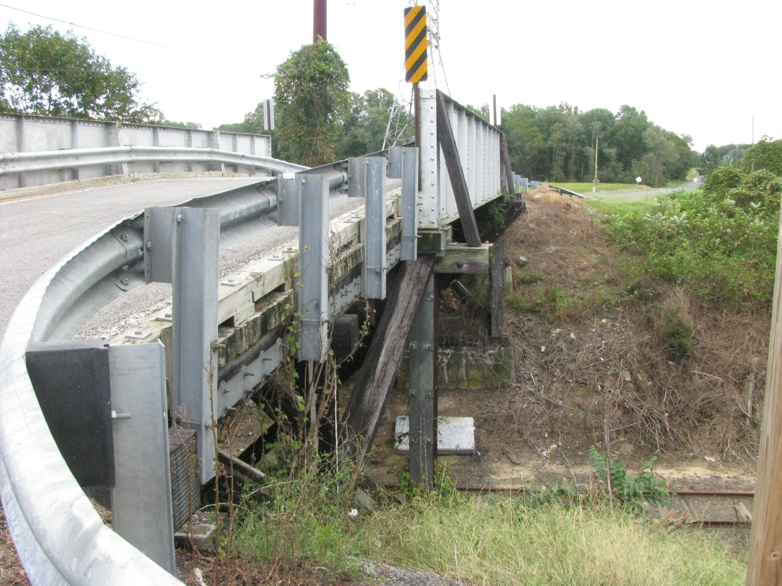
Photo taken by Timothy and Joann Phillips in October 2018
437756
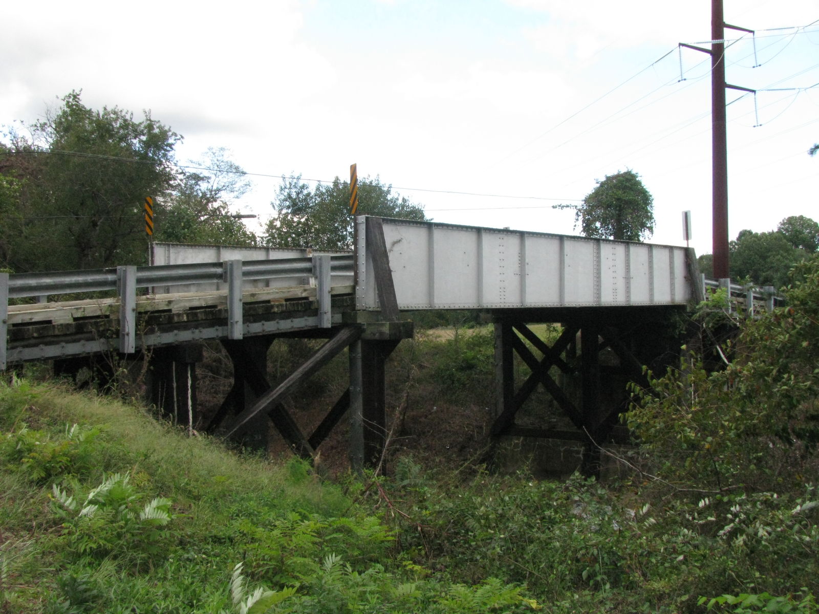
Photo taken by Timothy and Joann Phillips in October 2018
437757
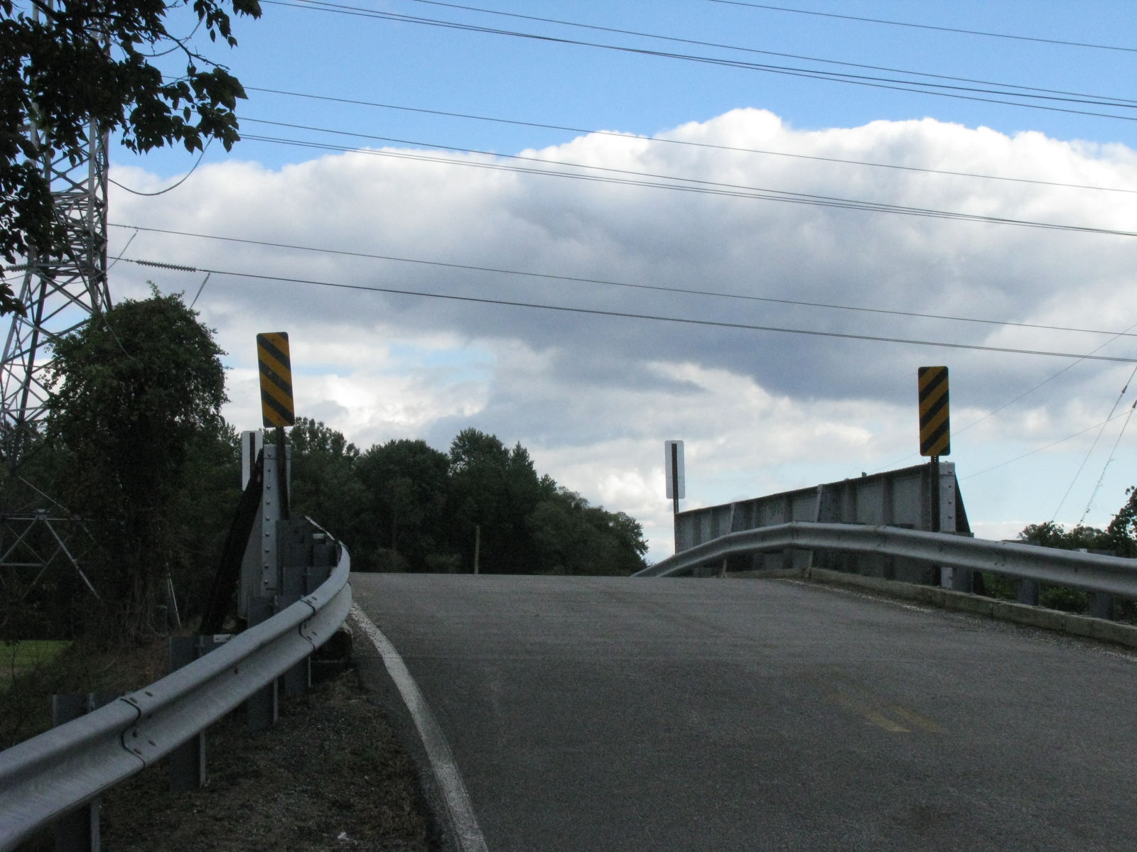
Photo taken by Timothy and Joann Phillips in October 2018
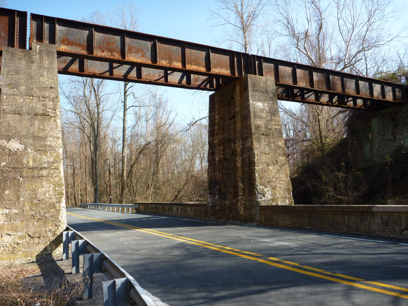
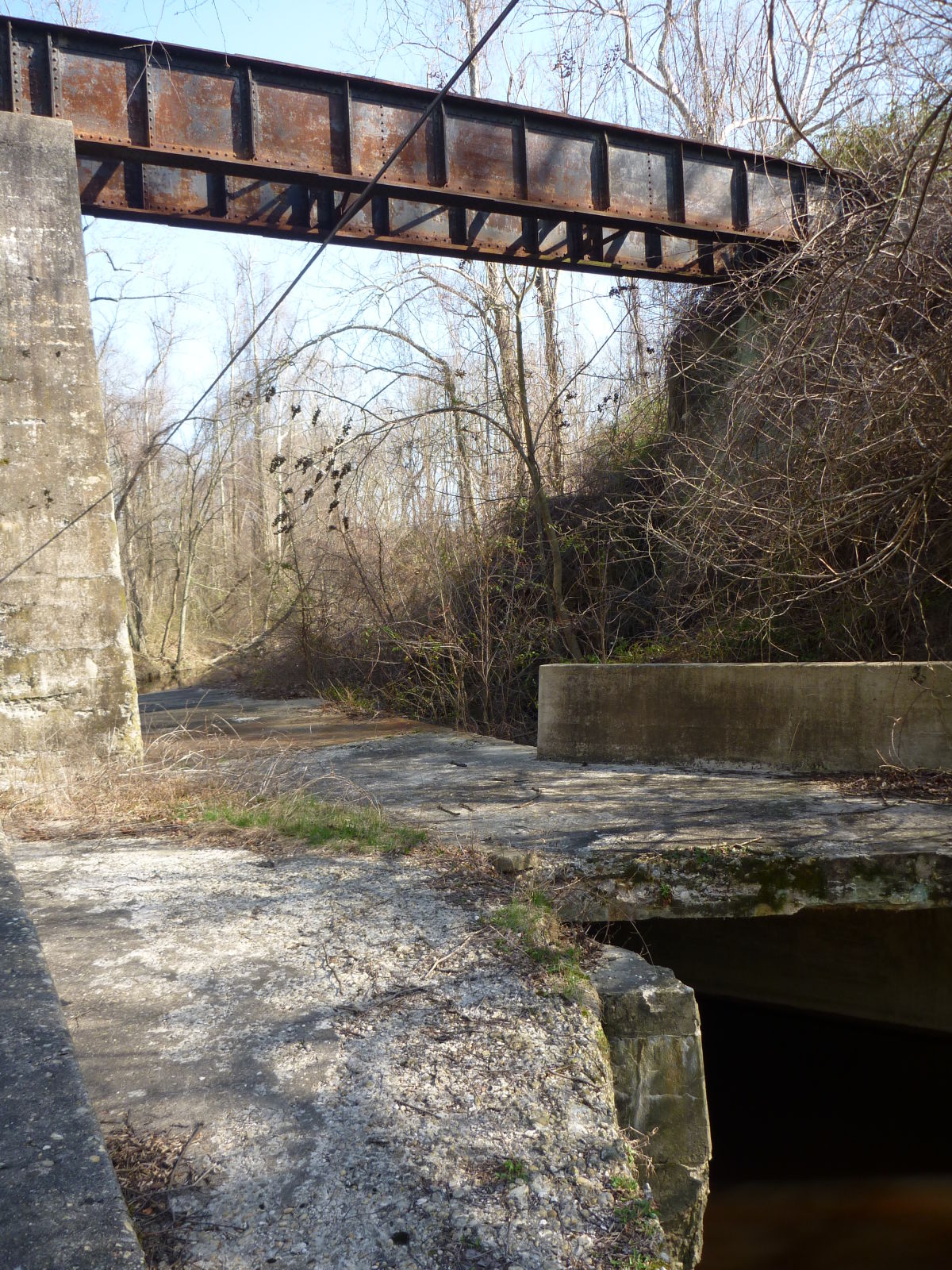
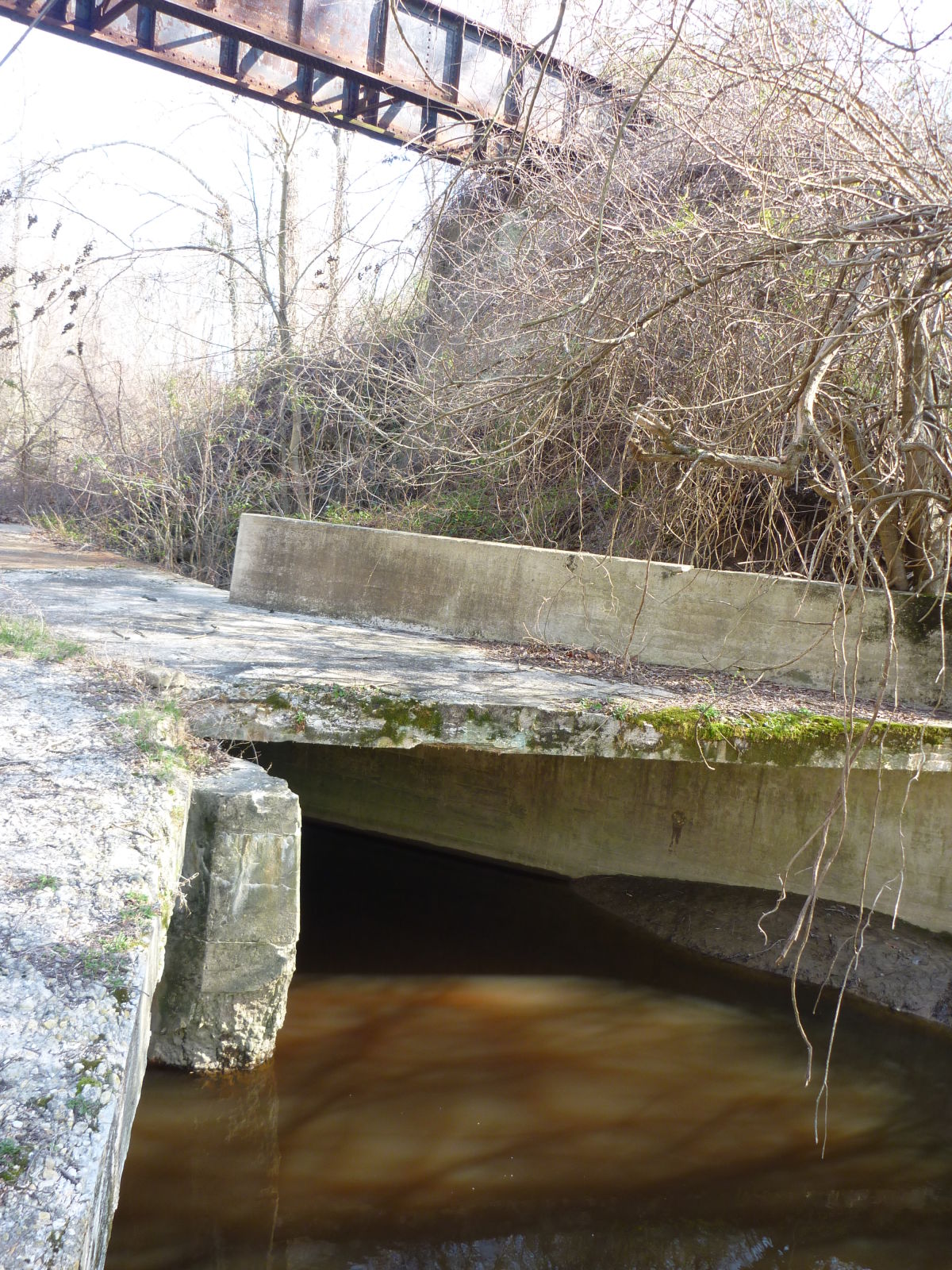
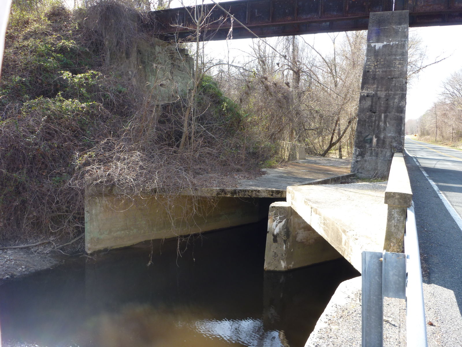
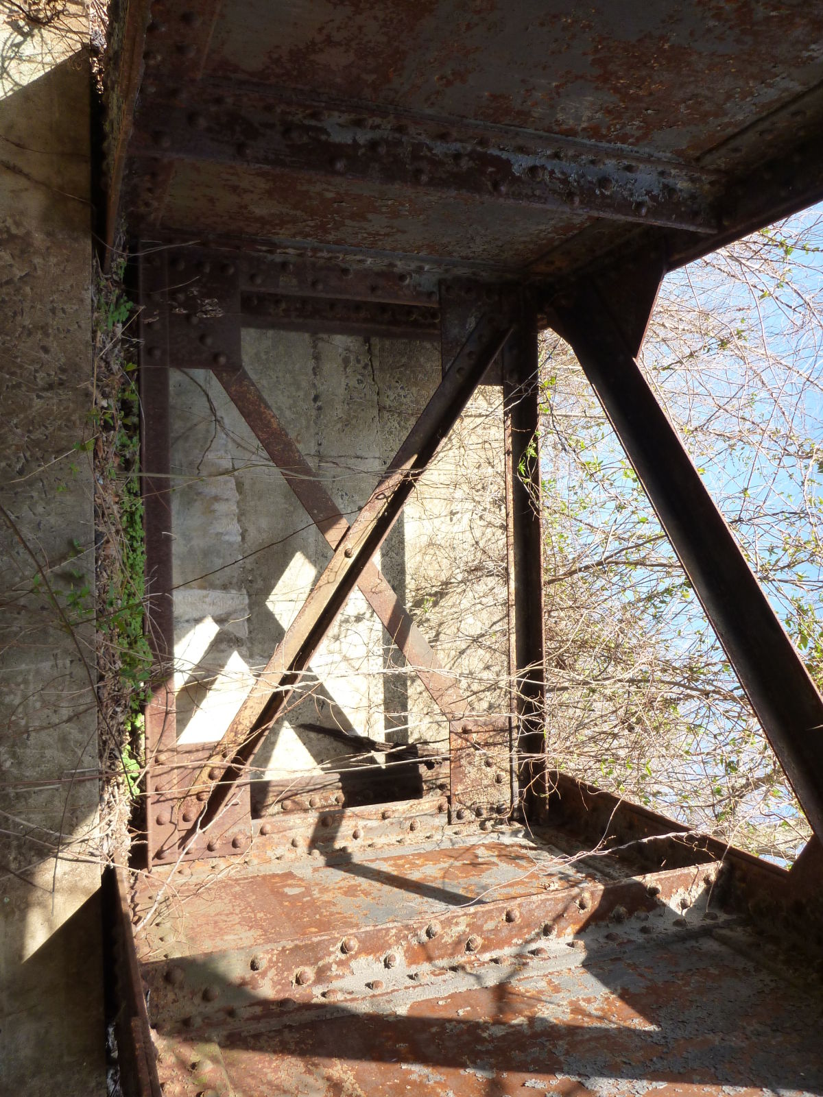
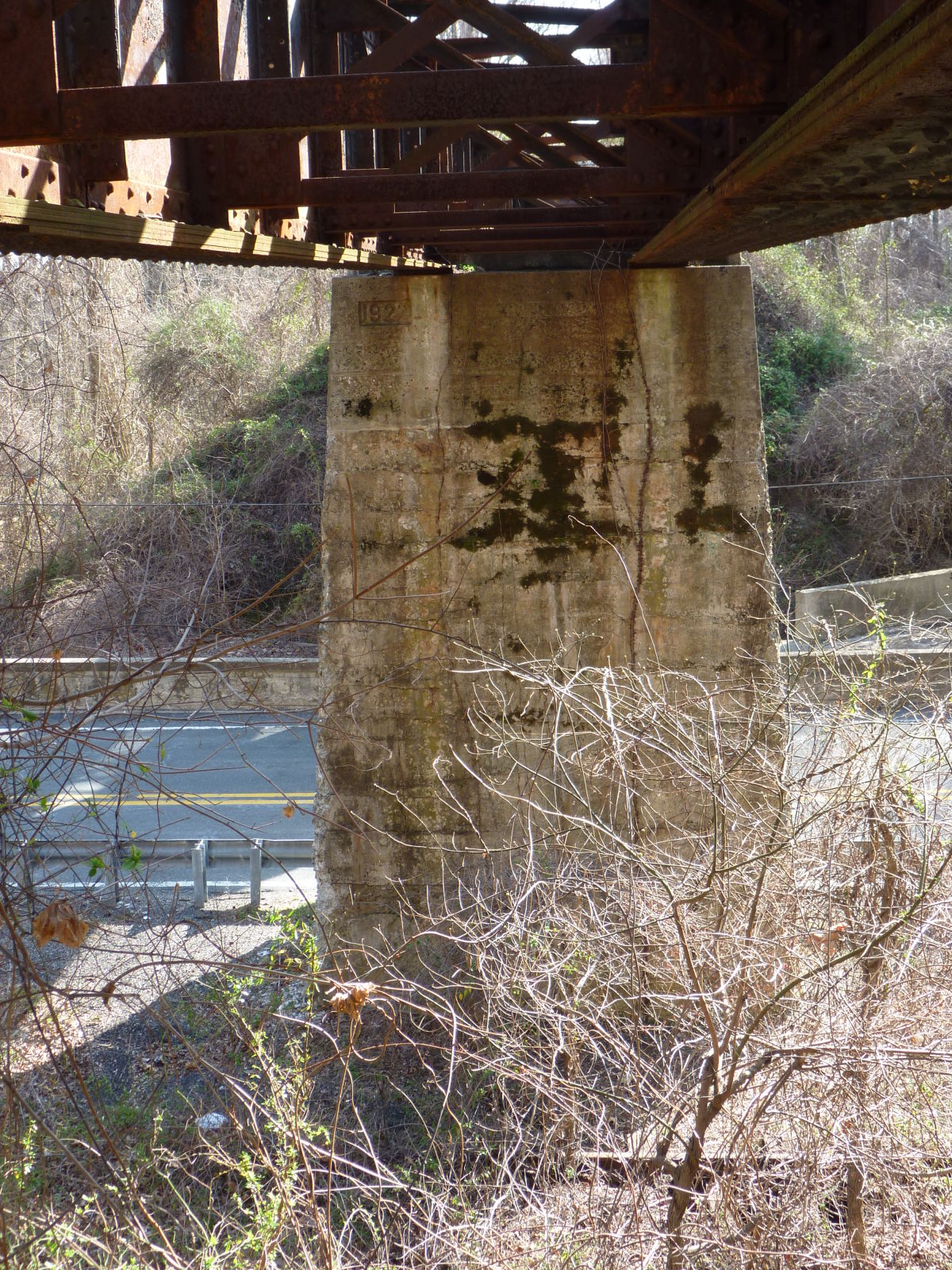
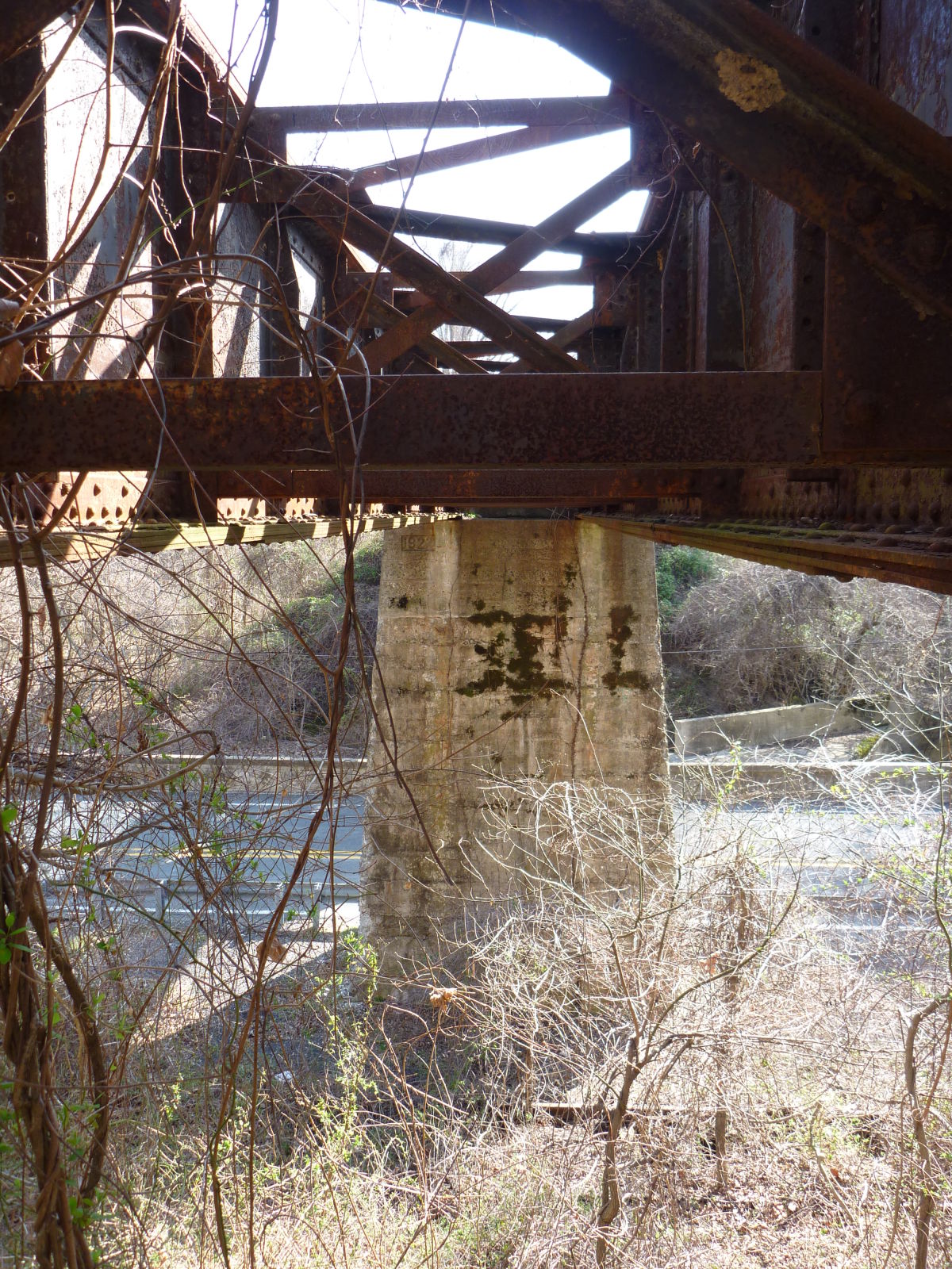
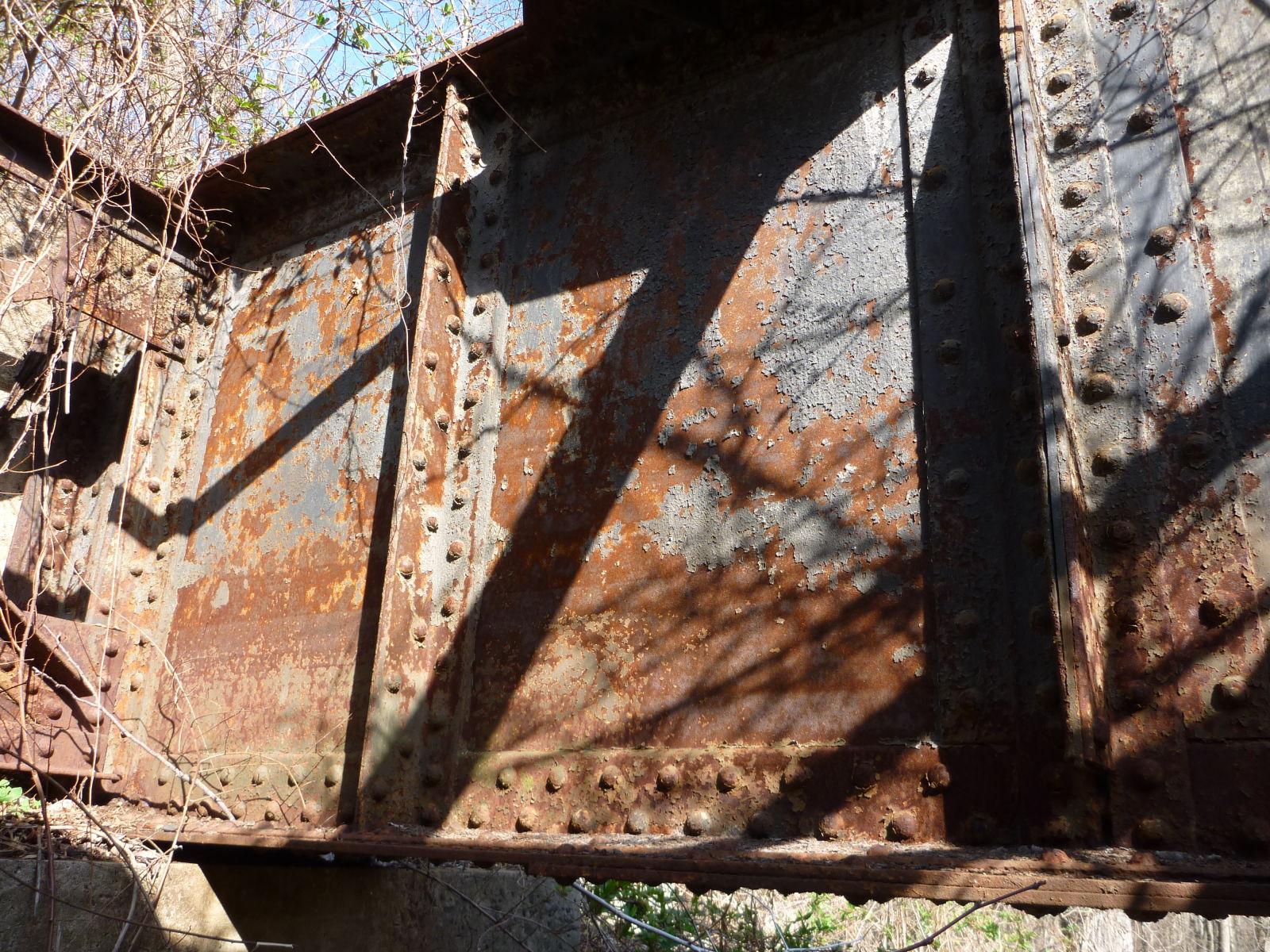
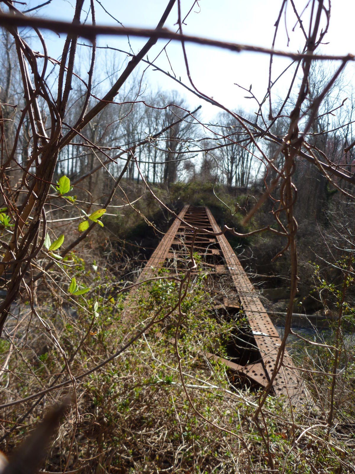
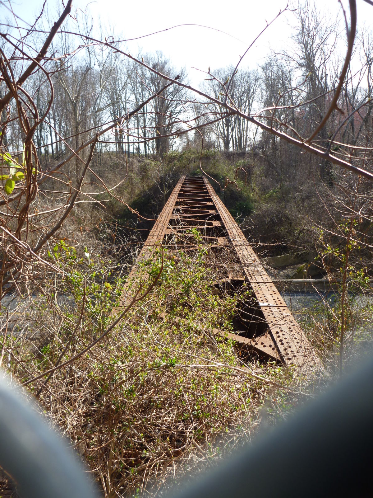
![]()
Status: Derelict/abandoned
Location: 38.917185,-75.957415
Carries former Maryland & Delaware Easton Branch (ex-Pennsylvania RR) over Old Queen Anne Highway (Business Md. 404) and Norwich Creek
Design: girder/deck/plate
Design Details: Deck plate girder
Total Length: 0.0 Feet
Span Length: 0.0 Feet
Overview: Abandoned deck plate girder bridge over Old Queen Anne Highway (Business Md. 404) and Norwich Creek on former Maryland & Delaware Easton Branch (ex-Pennsylvania RR)
History:
Built:
Location: Queen Anne's County
View Bridge Information In Wayback Machine
![]()
361813
Queen Anne Railroad Overpass
Photo taken by Alexander D. Mitchell IV in March 2011
361814
Queen Anne Railroad Overpass
Photo taken by Alexander D. Mitchell IV in March 2011
361815
Queen Anne Railroad Overpass
Photo taken by Alexander D. Mitchell IV in March 2011
361816
Queen Anne Railroad Overpass
Photo taken by Alexander D. Mitchell IV in March 2011
361817
Queen Anne Railroad Overpass
Photo taken by Alexander D. Mitchell IV in March 2011
361818
Queen Anne Railroad Overpass
Photo taken by Alexander D. Mitchell IV in March 2011
361819
Queen Anne Railroad Overpass
Photo taken by Alexander D. Mitchell IV in March 2011
361820
Queen Anne Railroad Overpass
Photo taken by Alexander D. Mitchell IV in March 2011
361821
Queen Anne Railroad Overpass
Photo taken by Alexander D. Mitchell IV in March 2011
361822
Queen Anne Railroad Overpass
Photo taken by Alexander D. Mitchell IV in March 2011
![]()
Status: Open to traffic
Location: 39.040117,-76.072369
Carries Md 213 over Mill Stream Branch
Design: slab
Design Details: Slab
Total Length: 35.1 Feet
Span Length: 16.1 Feet
Overview: Slab bridge over Mill Stream Branch on Md 213
History: Built 1912; rehabilitated 1945
Built: 1912
Location: Queen Anne's County
View Bridge Information In Wayback Machine
![]()
439202
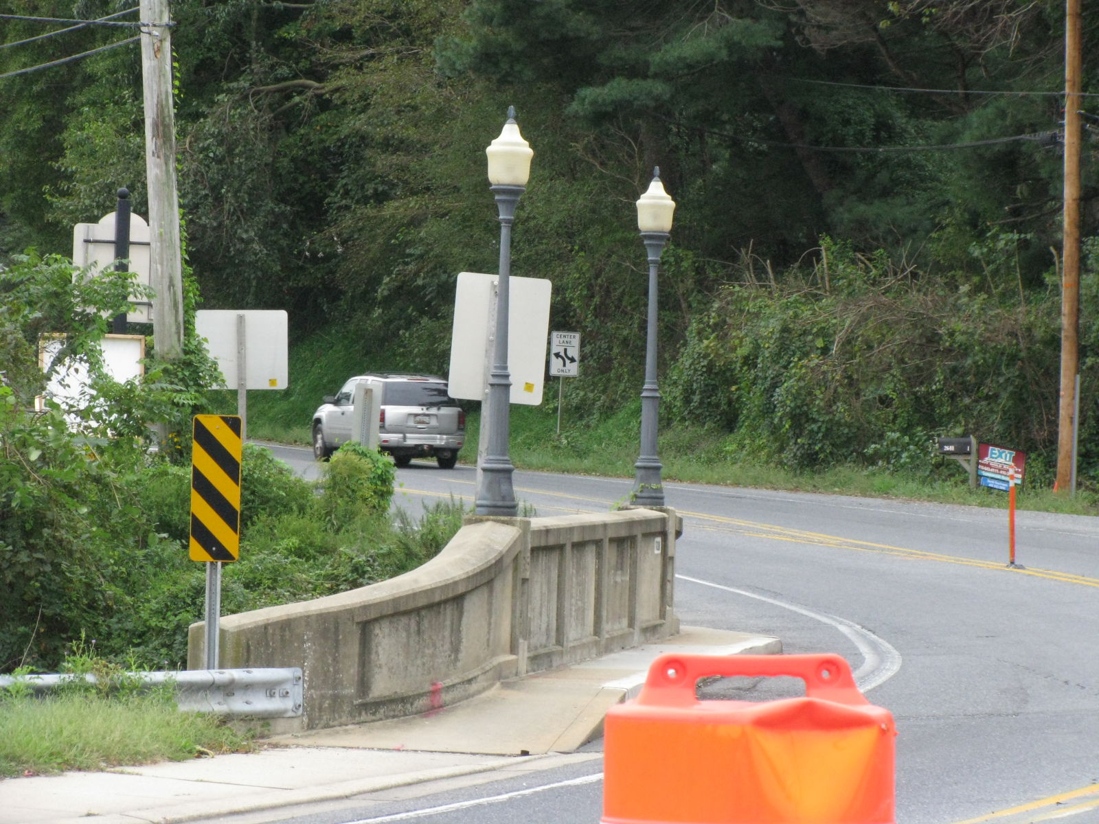
Photo taken by Timothy and Joann Phillips in October 2018
439203
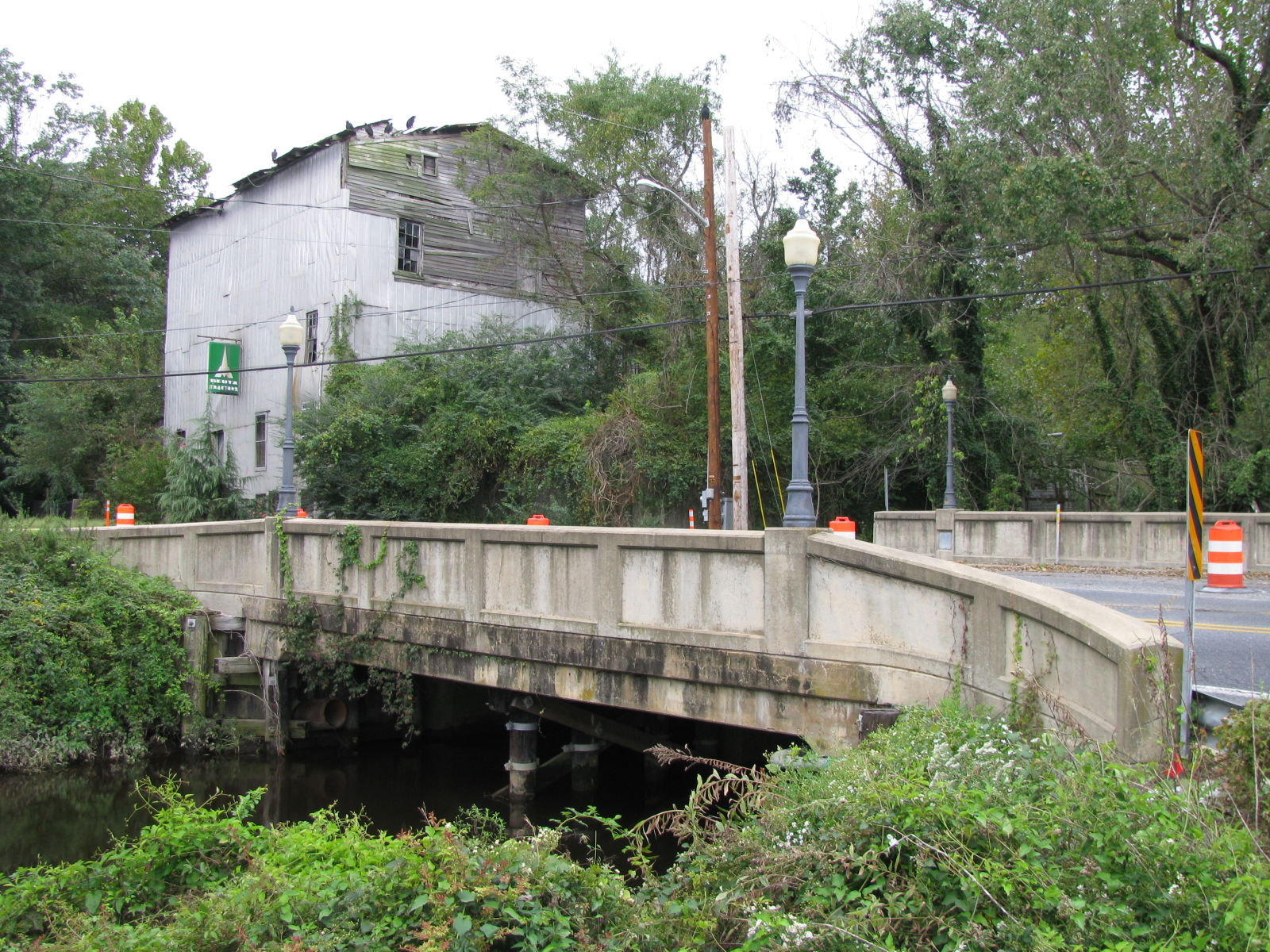
Photo taken by Timothy and Joann Phillips in October 2018
439204
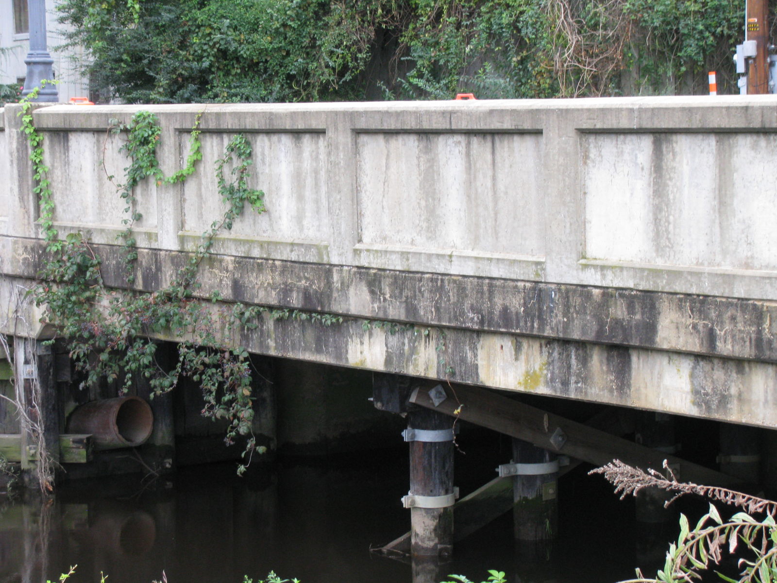
Photo taken by Timothy and Joann Phillips in October 2018
439205
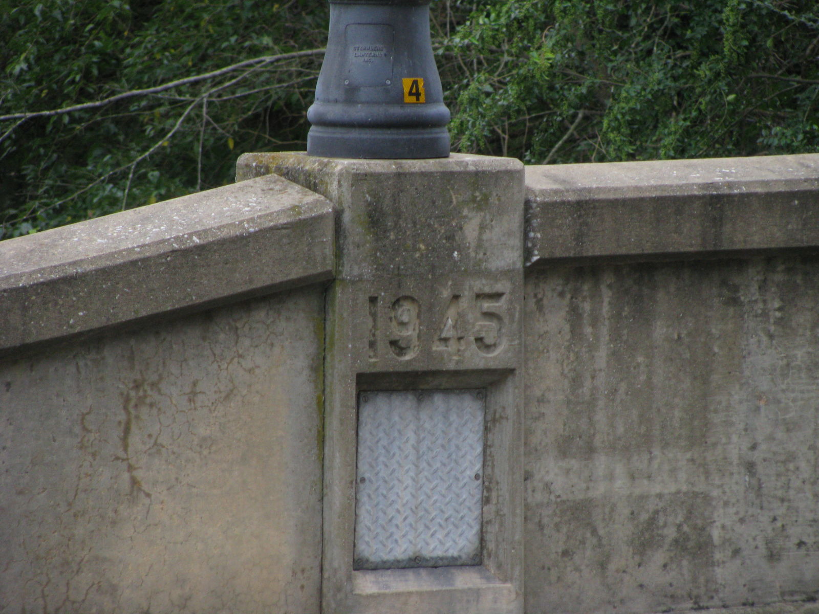
Photo taken by Timothy and Joann Phillips in October 2018
439206
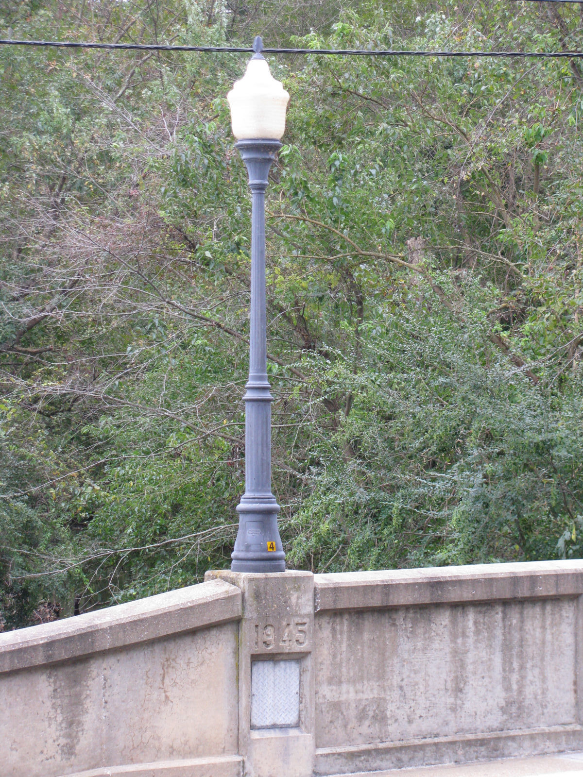
Photo taken by Timothy and Joann Phillips in October 2018
439207

Photo taken by Timothy and Joann Phillips in October 2018
![]()
Status: Open to traffic
Location: 39.048192,-76.062253
Carries Md 213 over Gravel Run
Design: slab
Design Details: Slab
Total Length: 23.0 Feet
Span Length: 20.0 Feet
Overview: Slab bridge over Gravel Run on Md 213
History: Built 1932. "Possibly eligible" for National Register, according to Bridgereports.com.
Built: 1932
Location: Queen Anne's County
View Bridge Information In Wayback Machine
![]()
447257
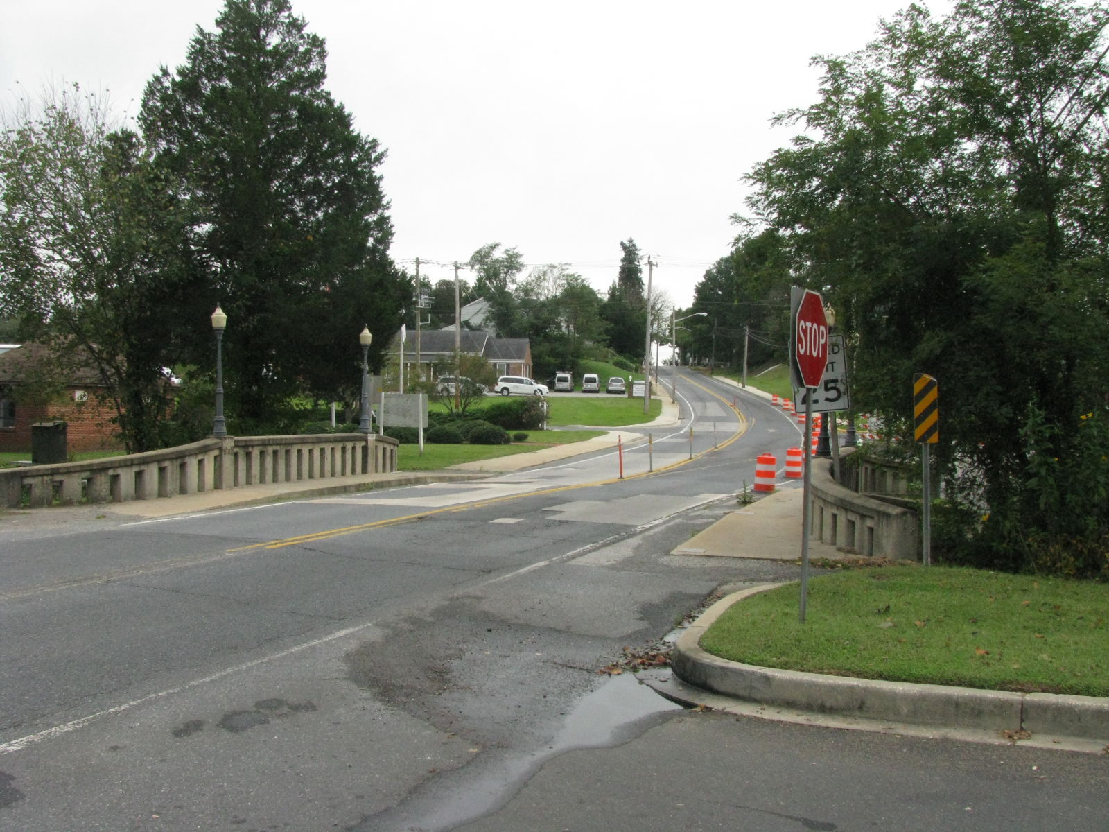
Photo taken by Timothy and Joann Phillips in October 2018
447258
Photo taken by Timothy and Joann Phillips in October 2018
447259
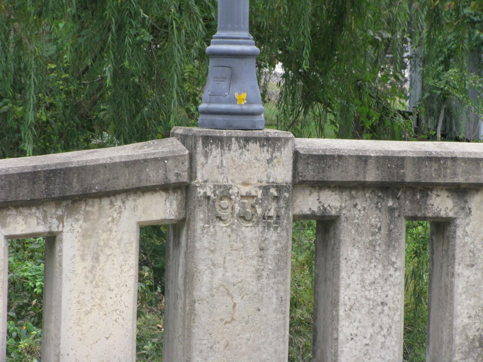
Photo taken by Timothy and Joann Phillips in October 2018
447260
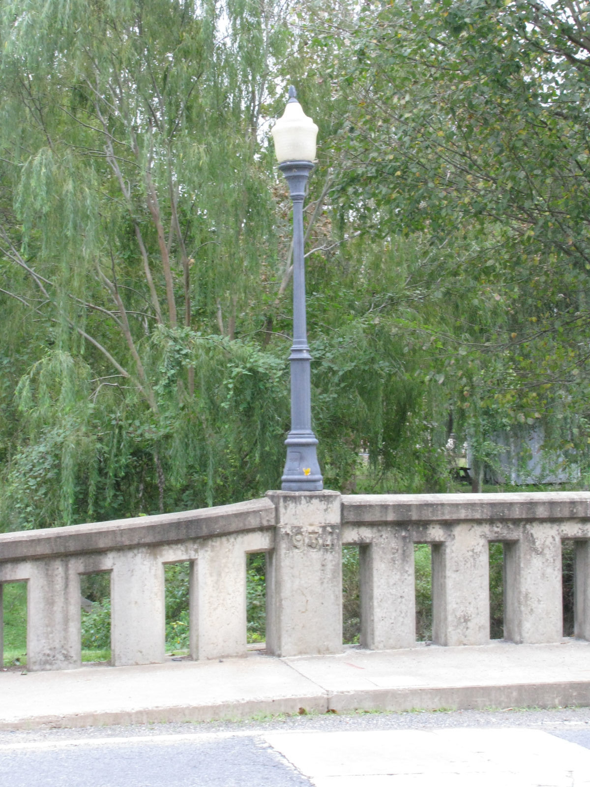
Photo taken by Timothy and Joann Phillips in October 2018
447261
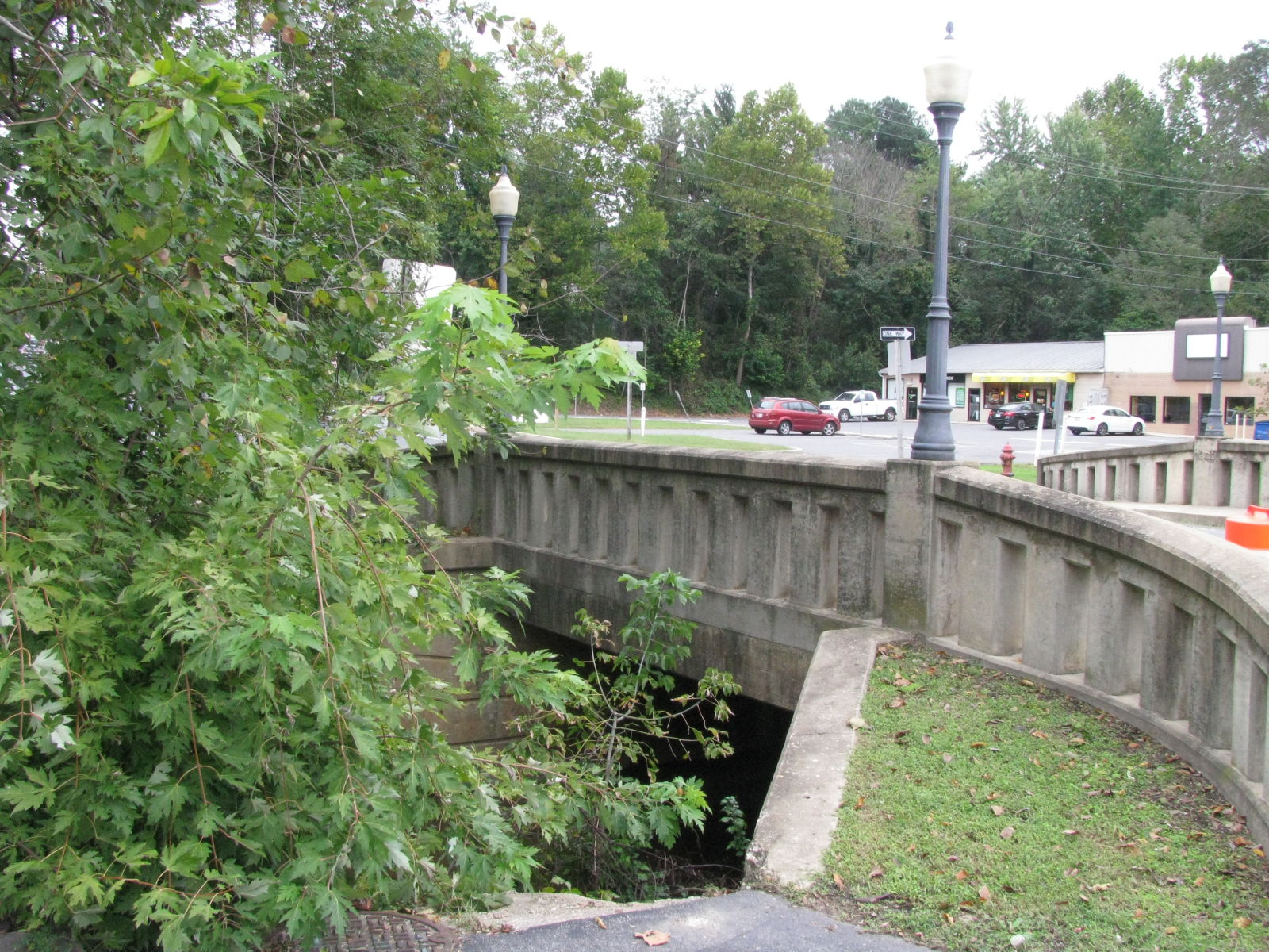
Photo taken by Timothy and Joann Phillips in October 2018
Special Bridge Conditions Legend: R - Former location of relocated bridge. ! - At risk for demolition or destruction. X - Confirmed demolished or collapsed. S - Dismantled and/or in storage. L - Severe loss of historic integrity due to alteration.
![]()

![]()