![]()
![]()
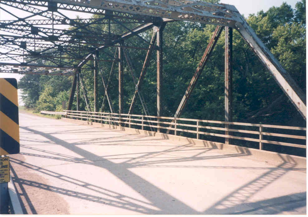
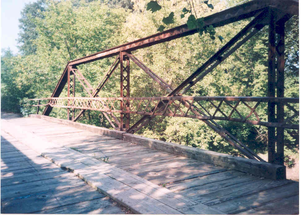
Status: Open to traffic
Location: 43.608611,-94.077778
Carries CR 228 over Coon Creek
Design: truss/pony/warren/verticals
Design Details: Riveted Warren pony truss with all verticals
Total Length: 46.3 Feet
Span Length: 44.3 Feet
Overview: Warren pony truss bridge over Coon Creek on CR 228
History: Built 1909
Built: 1909
Location: Faribault County
View Bridge Information In Wayback Machine
![]()
283286
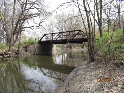
Photo taken by Joe Fishbein
283287
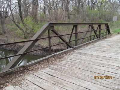
Photo taken by Joe Fishbein
![]()
Status: Removed but not replaced
Location: 43.579444,-94.187778
Carries CR 299 over Ditch No. 14
Design: truss/pony
Design Details: Pony truss
Total Length: 41.0 Feet
Span Length: 38.7 Feet
Overview: Pony truss bridge over Ditch No. 14 on CR 299
History: Built 1909
Built: 1909
Location: Faribault County
View Bridge Information In Wayback Machine
![]()
![]()
Status: No longer exists
Location: 43.525278,-94.167778
Carries CR 2 over Ditch No. 7
Design: truss/pony
Design Details: Pony truss
Total Length: 30.5 Feet
Span Length: 28.2 Feet
Overview: Lost Pony truss bridge over Ditch No. 7 on CR 2
History: Built 1914
Built: 1914
Location: Faribault County
View Bridge Information In Wayback Machine
![]()
![]()
Status: Replaced by a new bridge
Location: 43.644637,-94.115680
Carries W. 1st Street (CSAH 16) over Blue Earth River
Design: truss/through/parker
Design Details: Parker through truss
Total Length: 124.0 Feet
Span Length: 117.1 Feet
Overview: Lost through truss bridge over Blue Earth River on W. 1st Street (CSAH 16) in Blue Earth
History: Built 1931; replaced 2002
Built: 1931
Location: Faribault County
View Bridge Information In Wayback Machine
![]()
111969
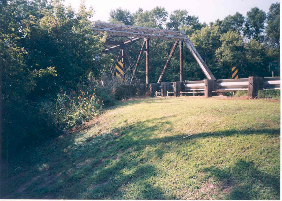
Overview of east approach
The following four photos are the predecessors to the current bridge. The truss structure was built in the 1930s as part of the plan to build US Hwy. 16. The Hwy. was delegated to county status when I-90 was opened in 1978. This bridge remained until 2002.
Photo taken in 1998 by Jason Smith
111970
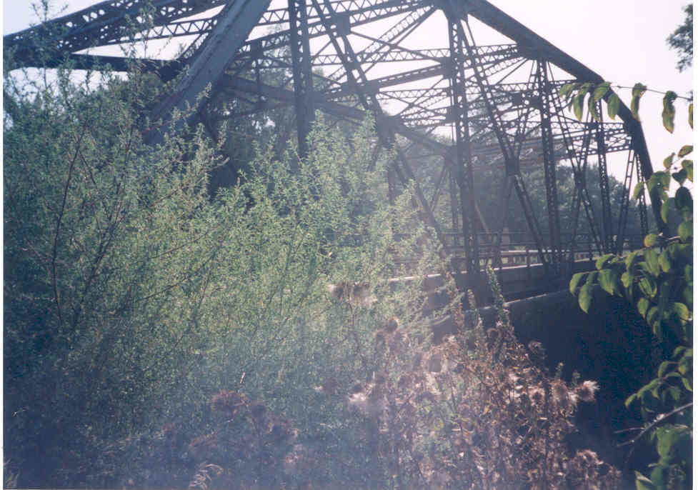
Oblique view from the north east
Photo taken by Jason Smith
111971
Inside the bridge
Photo taken by Jason Smith
111972
east approach
Photo taken by Jason Smith
![]()
Status: Replaced by a new bridge
Location: 43.644181,-94.087611
Carries N. East Street over East Fork Blue Earth River
Design: truss/pony/pratt
Design Details: Pratt pony truss
Total Length: 70.9 Feet
Span Length: 57.7 Feet
Overview: Lost pony truss bridge over East Fork Blue Earth River on N. East Street in Blue Earth
History: Built 1910; replaced 2002
Built: 1910
Location: Faribault County
View Bridge Information In Wayback Machine
![]()
111975
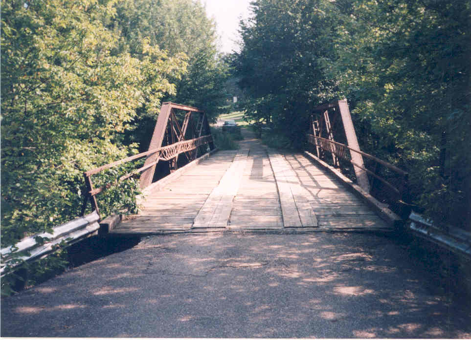
North approach
Photo taken in 1998 by Jason Smith
111976
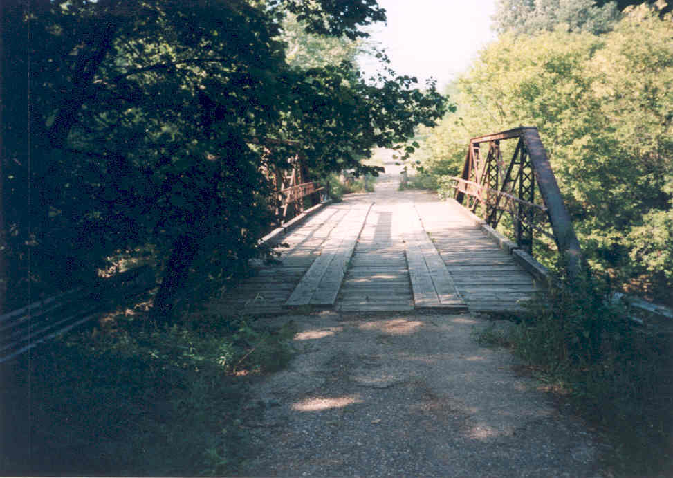
South approach
Photo taken in 1998 by Jason Smith
111977
Inside the bridge
Photo taken in 1998 by Jason Smith
![]()
Status: Open to traffic
Location: 43.615833,-94.097778
Carries Twp 232 over Coon Creek
Design: girder
Design Details: Concrete girder
Total Length: 63.0 Feet
Span Length: 60.0 Feet
Overview: Girder bridge over Coon Creek on Twp 232
History: Built 1919
Built: 1919
Location: Faribault County
View Bridge Information In Wayback Machine
![]()
![]()
Status: Open to private traffic
Location: 43.527968,-94.180494
Carries Field over Judicial Ditch Number 7
Design: truss/pony
Design Details: Pony truss
Total Length: 0.0 Feet
Span Length: 0.0 Feet
Overview: Pony truss bridge over Judicial Ditch Number 7 on Field
History:
Built:
Location: Faribault County
View Bridge Information In Wayback Machine
![]()
![]()
Status: Open to private traffic
Location: 43.553097,-94.221522
Carries Field over Ditch
Design: truss/pony
Design Details: Pony truss
Total Length: 0.0 Feet
Span Length: 0.0 Feet
Overview: Pony truss bridge over Ditch on Field
History:
Built:
Location: Faribault County
View Bridge Information In Wayback Machine
![]()
![]()
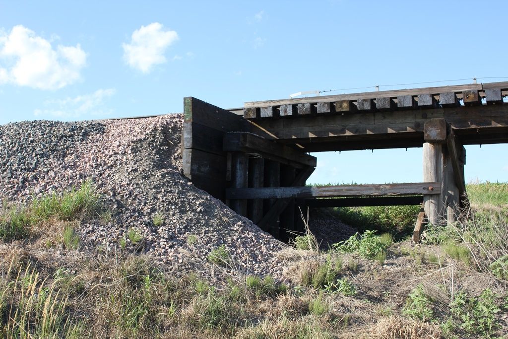
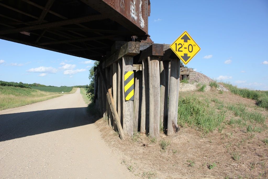
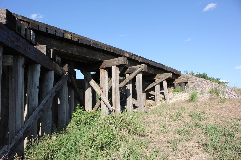
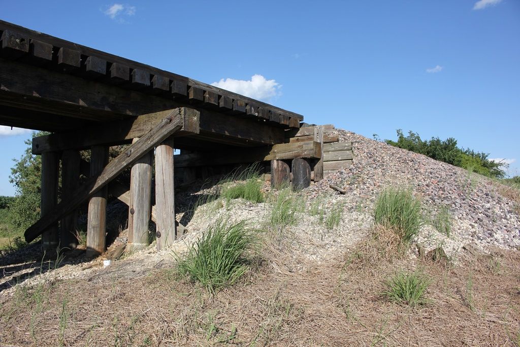
Status: Derelict/abandoned
Location: 43.590389,-94.103404
Carries 60th Street over Blue Earth River
Design: truss/pony
Design Details: Pony truss
Total Length: 0.0 Feet
Span Length: 0.0 Feet
Overview: Abandoned pony truss bridge over Blue Earth River on 60th Street
History:
Built:
Location: Faribault County
View Bridge Information In Wayback Machine
![]()
![]()
Status: Open to traffic
Location: 43.743679,-94.190514
Carries Dakota, Minnesota & Easterm Railway over Blue Earth River
Design: girder/deck/plate
Design Details: Deck plate girder
Total Length: 445.0 Feet
Span Length: 80.0 Feet
Overview: Deck plate girder bridge over Blue Earth River on Dakota, Minnesota & Easterm Railway
History:
Built:
Location: Faribault County
View Bridge Information In Wayback Machine
![]()
![]()
Status: Open to traffic
Location: 43.646402,-94.115437
Carries Union Pacific Railroad over Blue Earth River
Design: girder/deck/plate
Design Details: Deck plate girder
Total Length: 405.0 Feet
Span Length: 90.0 Feet
Overview: Deck plate girder bridge over Blue Earth River on Union Pacific Railroad
History:
Built:
Location: Faribault County
View Bridge Information In Wayback Machine
![]()
![]()
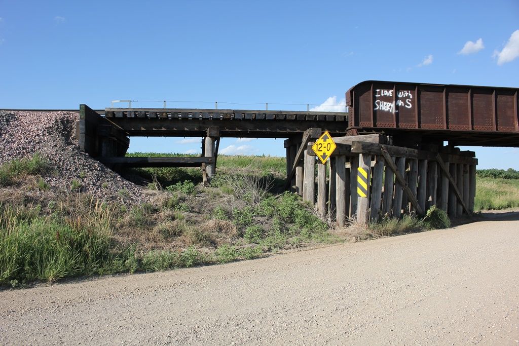
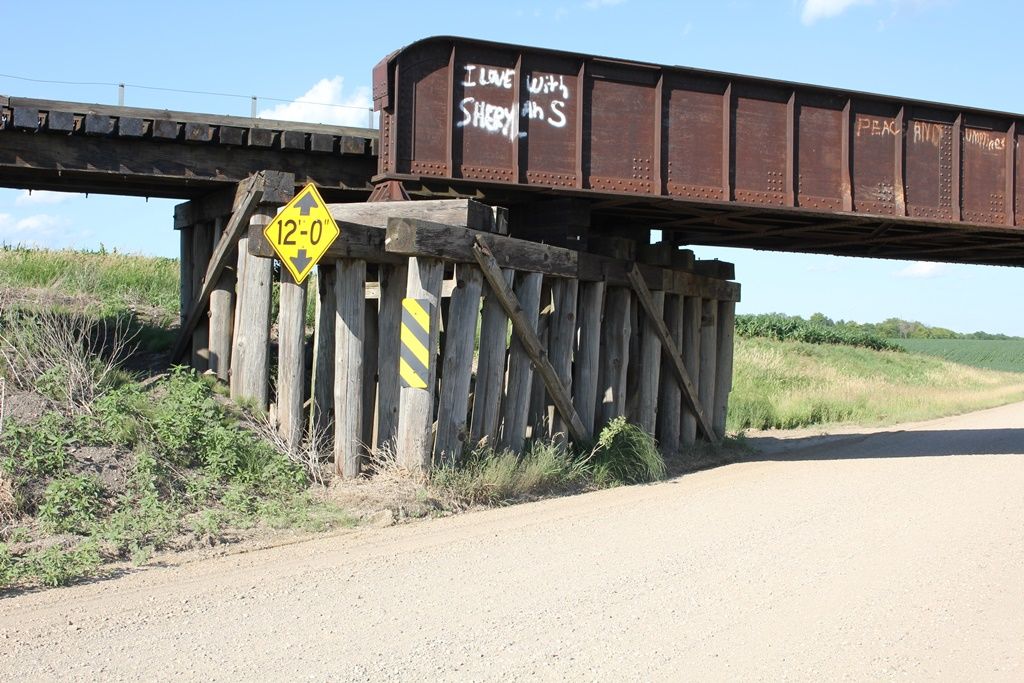
Status: Open to traffic
Location: 43.631494,-94.091919
Carries Union Pacific Railroad over US Highway 169
Design: beam/stringer/steel
Design Details: Steel stringer
Total Length: 125.0 Feet
Span Length: 47.0 Feet
Overview: Steel stringer bridge over US Highway 169 on Union Pacific Railroad
History: Built 1932
Built: 1932
Location: Faribault County
View Bridge Information In Wayback Machine
![]()
397355
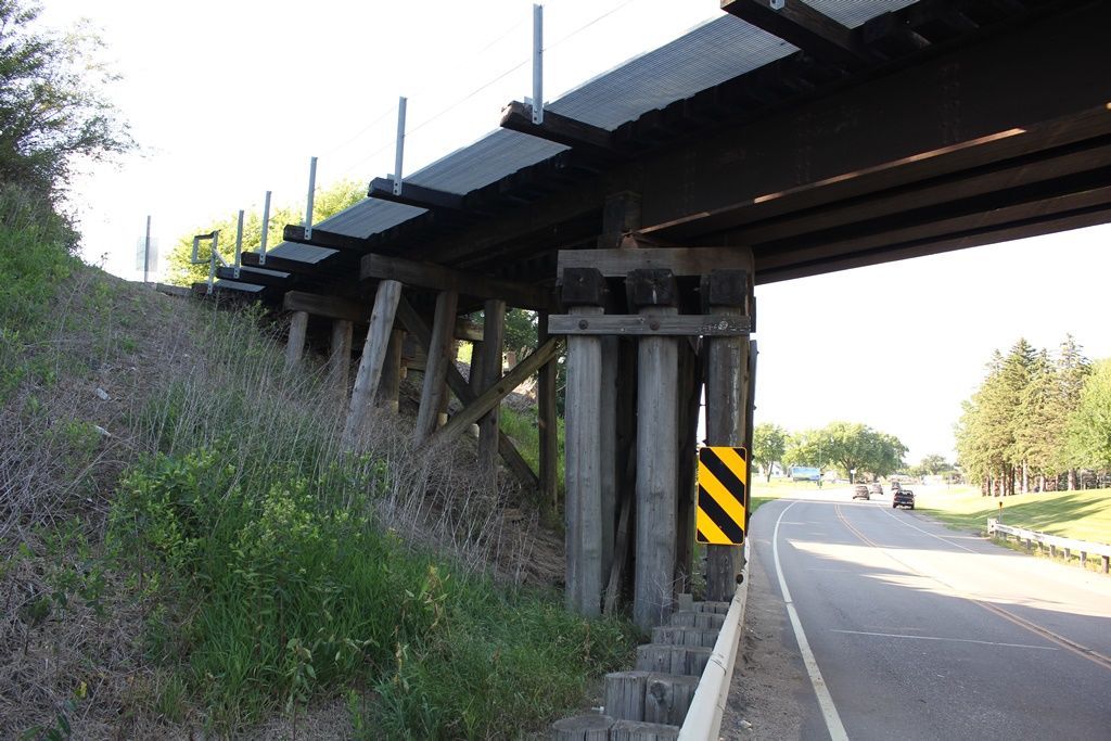
UP US-169 Bridge
West Pier
Photo taken by John Marvig in July 2017
397356
UP US-169 Bridge
East Approach
Photo taken by John Marvig in July 2017
397357
UP US-169 Bridge
East Pier
Photo taken by John Marvig in July 2017
397358
UP US-169 Bridge
Overview
Photo taken by John Marvig in July 2017
397359
UP US-169 Bridge
East Abutment
Photo taken by John Marvig in July 2017
397360
UP US-169 Bridge
West Pier
Photo taken by John Marvig in July 2017
397361
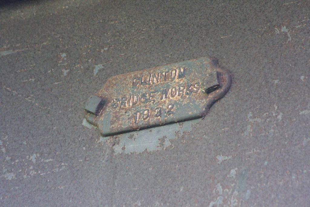
UP US-169 Bridge
Plate
Photo taken by John Marvig in July 2017
397362
UP US-169 Bridge
Overview
Photo taken by John Marvig in July 2017
![]()
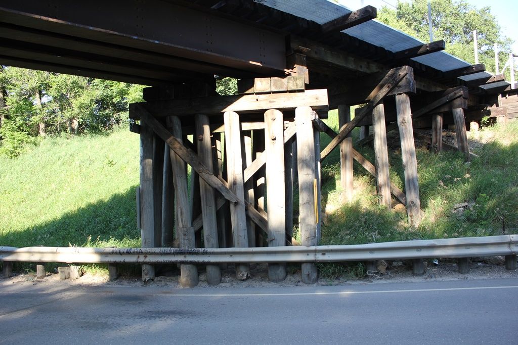
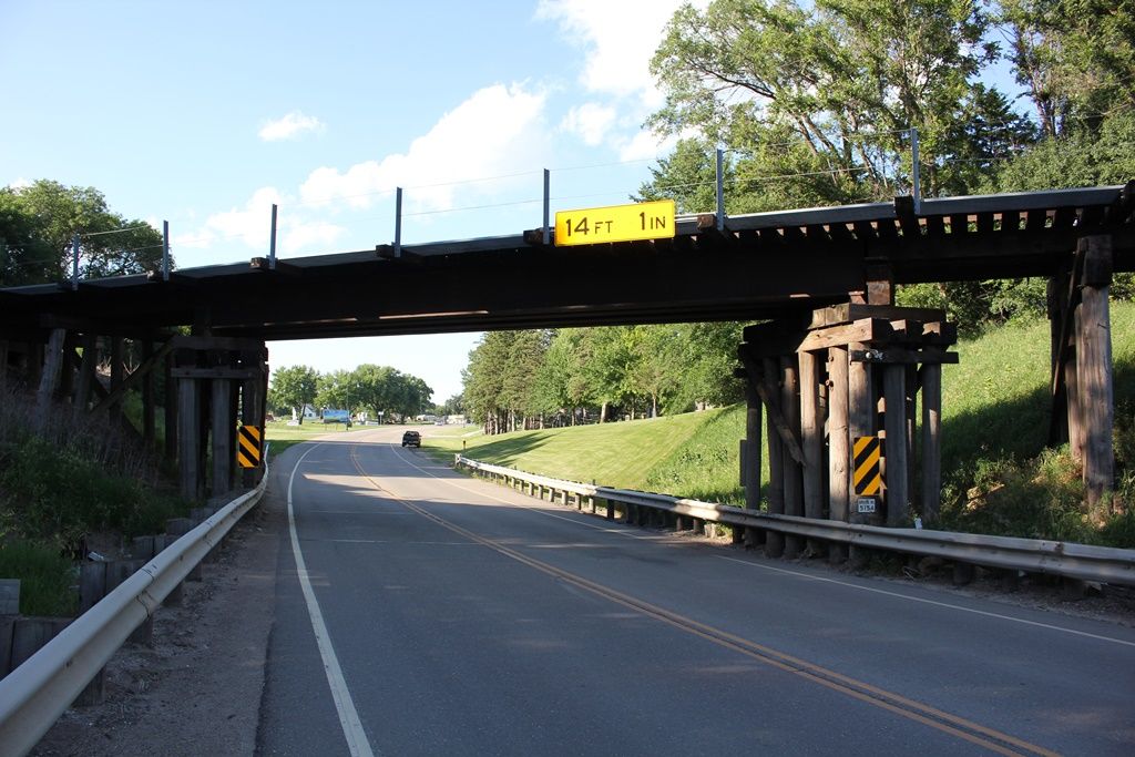
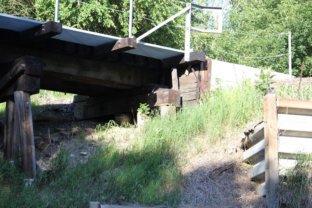
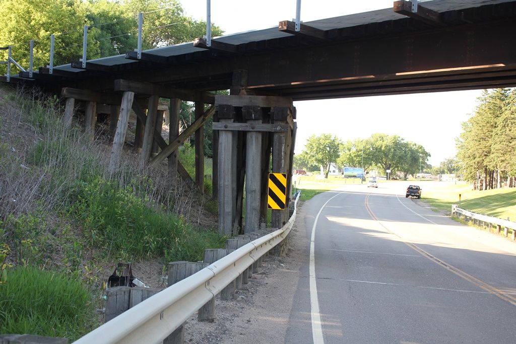
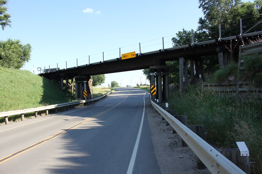
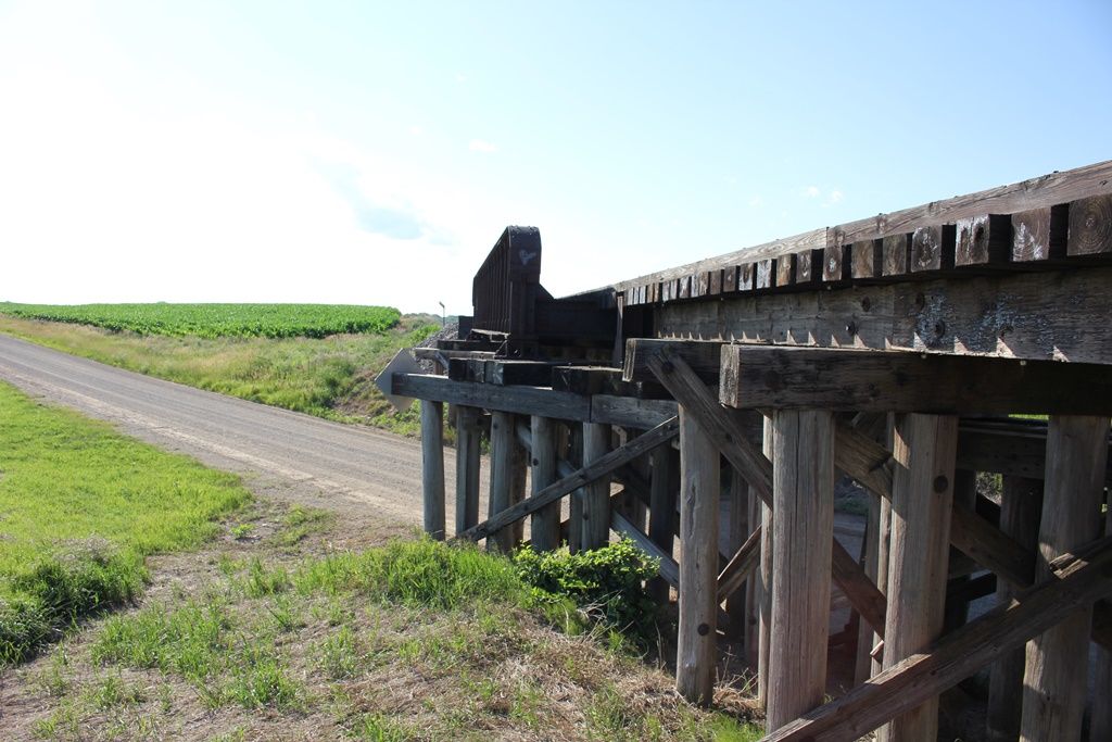
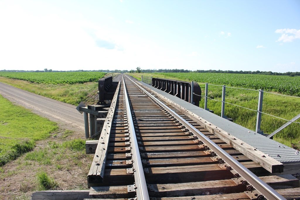
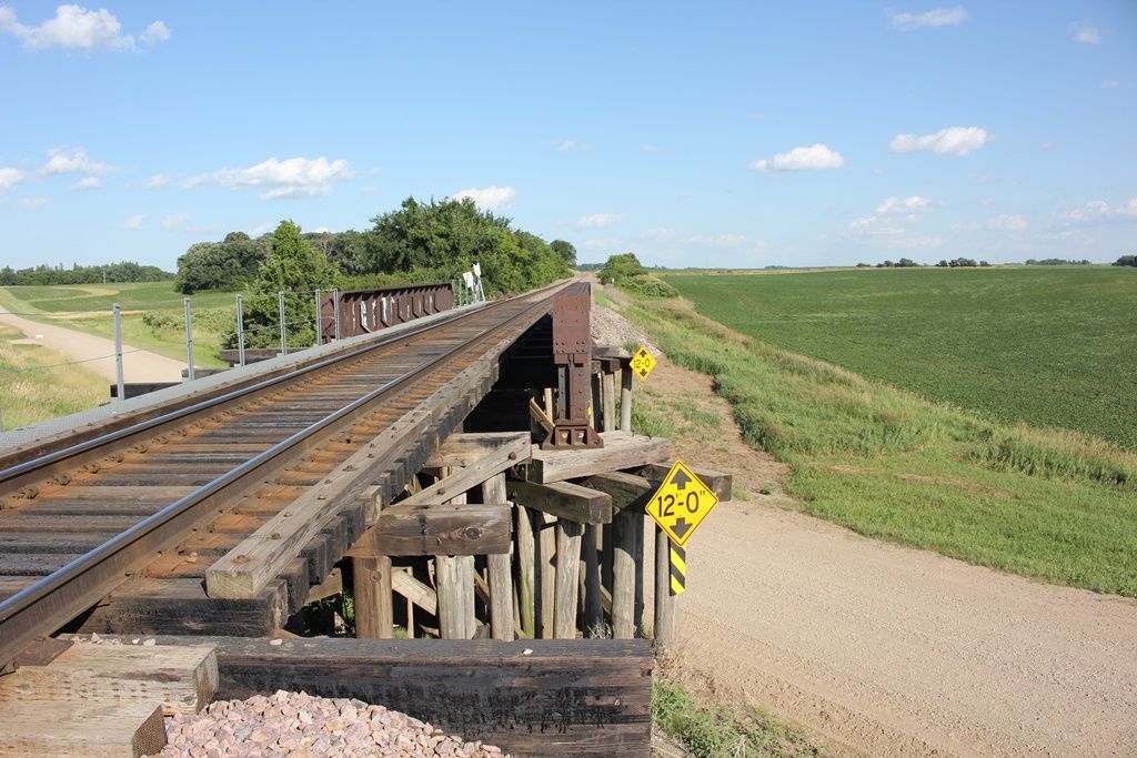
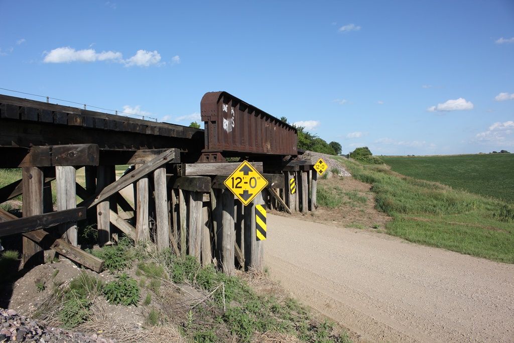
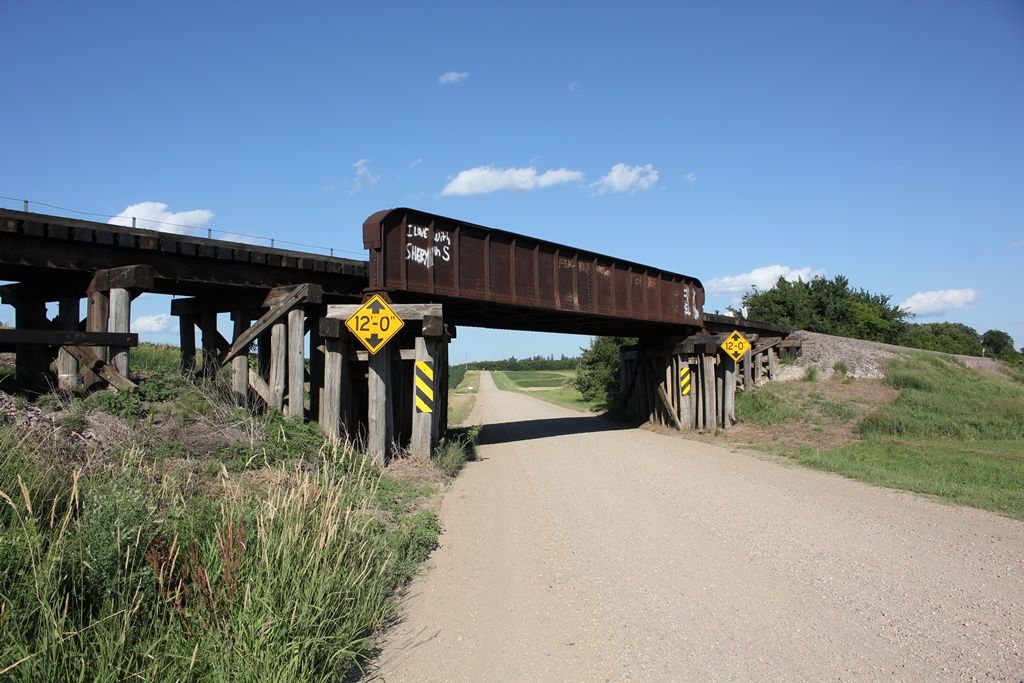
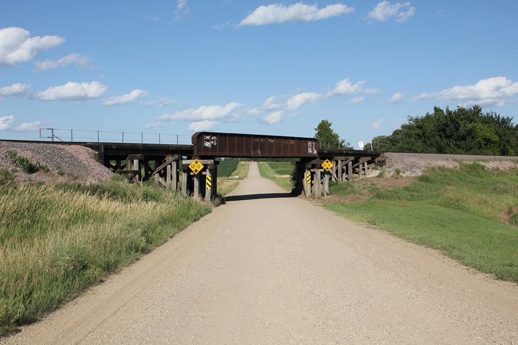
Status: Open to traffic
Location: 43.623231,-94.076083
Carries Union Pacific Railroad over 95th Street
Design: girder/pony/plate
Design Details: Pony plate girder
Total Length: 137.0 Feet
Span Length: 58.0 Feet
Overview: Pony/through plate girder bridge over 95th Street on Union Pacific Railroad
History: Built 1915
Built: 1915
Location: Faribault County
View Bridge Information In Wayback Machine
![]()
397363
UP 95th Street Bridge
Overview
Photo taken by John Marvig in July 2017
397364
UP 95th Street Bridge
West Approach
Photo taken by John Marvig in July 2017
397365
UP 95th Street Bridge
West Pier
Photo taken by John Marvig in July 2017
397366
UP 95th Street Bridge
West Abutment
Photo taken by John Marvig in July 2017
397367
UP 95th Street Bridge
East Pier
Photo taken by John Marvig in July 2017
397368
UP 95th Street Bridge
East Approach
Photo taken by John Marvig in July 2017
397369
UP 95th Street Bridge
East Abutment
Photo taken by John Marvig in July 2017
397370
UP 95th Street Bridge
Looking West
Photo taken by John Marvig in July 2017
397371
UP 95th Street Bridge
Looking West
Photo taken by John Marvig in July 2017
397372
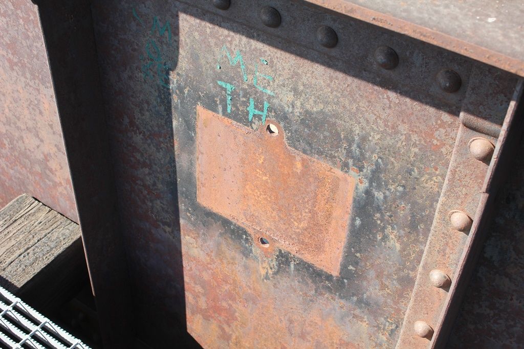
UP 95th Street Bridge
Missing Plate
Photo taken by John Marvig in July 2017
397373
UP 95th Street Bridge
Looking East
Photo taken by John Marvig in July 2017
397374
UP 95th Street Bridge
Looking East
Photo taken by John Marvig in July 2017
397375
UP 95th Street Bridge
Overview
Photo taken by John Marvig in July 2017
397376
UP 95th Street Bridge
Overview
Photo taken by John Marvig in July 2017
397377
UP 95th Street Bridge
Overview
Photo taken by John Marvig in July 2017
Special Bridge Conditions Legend: R - Former location of relocated bridge. ! - At risk for demolition or destruction. X - Confirmed demolished or collapsed. S - Dismantled and/or in storage. L - Severe loss of historic integrity due to alteration.
![]()

![]()