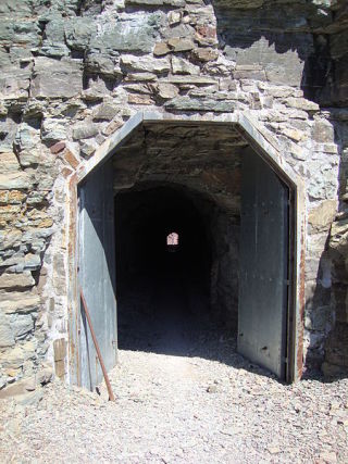
![]()
![]()
Status: Open to traffic
Location: 48.697263,-113.696228
Carries Going-To-The-Sun Road over Rock formation
Design: tunnel
Design Details: Tunnel
Total Length: 194.9 Feet
Span Length: 0.0 Feet
Overview: Tunnel on Going-To-The-Sun Road
History: Built 1934
Built: 1934
Location: Glacier County
View Bridge Information In Wayback Machine
![]()
305722
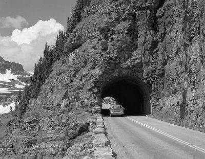
View Of East Portal From Roadway
Photo taken for the Historic American Engineering Record
![]()
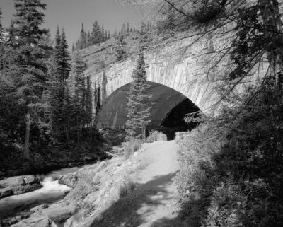
Status: Unknown status
Location: 0.000000,0.000000
Carries Going-To-The-Sun Road over Baring Creek
Design: arch/deck/closed
Design Details: Closed-spandrel arch
Total Length: 71.9 Feet
Span Length: 71.9 Feet
Overview: Concrete arch bridge over Baring Creek on Going-To-The-Sun Road
History: Built 1932
Built: 1932
Location: Glacier County
View Bridge Information In Wayback Machine
![]()
![]()
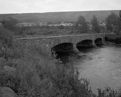
Status: Open to traffic
Location: 48.678056,-113.595833
Carries Going-To-The-Sun Road over Baring Creek
Design: arch/deck/closed
Design Details: Reinforced concrete arch bridge with stone facade
Total Length: 71.9 Feet
Span Length: 71.9 Feet
Overview: Concrete and stone arch bridge over Baring Creek on the Going-to-the-Sun Road
History: Built 1931
Built: 1932
Location: Glacier County
View Bridge Information In Wayback Machine
![]()
119486
View Of Downstream Side Of Bridge From East Bank Looking Northwest
Photo taken by Historic American Engineering Record
119487
View Of Upstream Side Of Bridge From East Bank Looking Southwest
Photo taken by Historic American Engineering Record
![]()
Status: Open to traffic
Location: 48.930833,-113.412778
Carries CR 225 over Saint Mary Canal
Design: truss
Design Details: Truss
Total Length: 91.5 Feet
Span Length: 91.5 Feet
Overview: Truss bridge over Saint Mary Canal on CR 225
History: Built 1928
Built: 1928
Location: Glacier County
View Bridge Information In Wayback Machine
![]()
![]()
Status: Open to traffic
Location: 48.556389,-113.270556
Carries US 89 over South Fork Cut Bank Creek
Design: arch/deck
Design Details: Arch
Total Length: 33.1 Feet
Span Length: 20.0 Feet
Overview: Concrete arch bridge over South Fork Cut Bank Creek on US 89
History: Built 1928
Built: 1928
Location: Glacier County
View Bridge Information In Wayback Machine
![]()
![]()
Status: Open to traffic
Location: 48.651389,-113.320273
Carries US 89 over South Fork Milk River
Design: arch/deck
Design Details: Arch
Total Length: 30.5 Feet
Span Length: 20.7 Feet
Overview: Concrete arch bridge over South Fork Milk River on US 89
History: Built 1928
Built: 1928
Location: Glacier County
View Bridge Information In Wayback Machine
![]()
447256
HAER
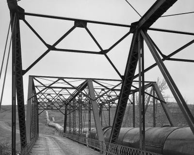
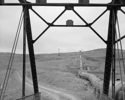
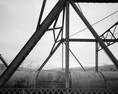
![]()
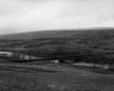
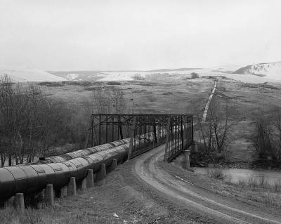
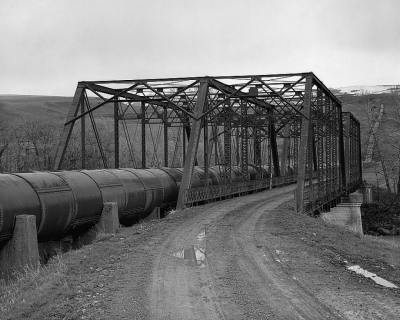
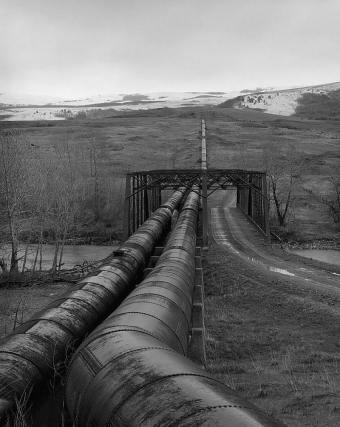
Status: Closed to traffic, but still carries pipelines
Location: 48.943978,-113.370638
Carries CR 224 and a pair of water pipelines over St. Mary River
Design: truss/through/pratt
Design Details: Two double-barreled pin-connected, 6-panel Pratt through trusses
Total Length: 201.1 Feet
Span Length: 100.1 Feet
Overview: Two-span through truss bridge over St. Mary River on CR 224, also carrying a pair of water pipelines
History: Built 1915 by the Minneapolis Bridge Co.; bypassed 2008
Built: 1915
Location: Glacier County
View Bridge Information In Wayback Machine
![]()
119467
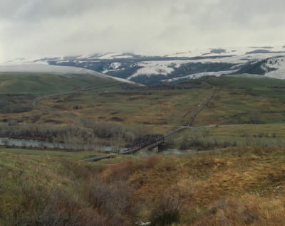
Photo taken by Historic American Engineering Record
119468
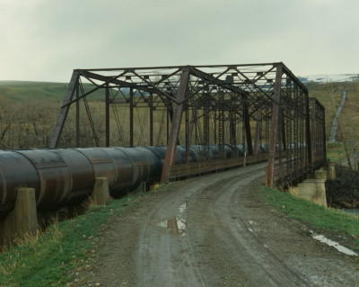
Photo taken by Historic American Engineering Record
119469
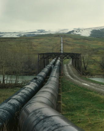
Photo taken by Historic American Engineering Record
119470
View Looking Northeast, General Elevation
Photo taken by Historic American Engineering Record
119471
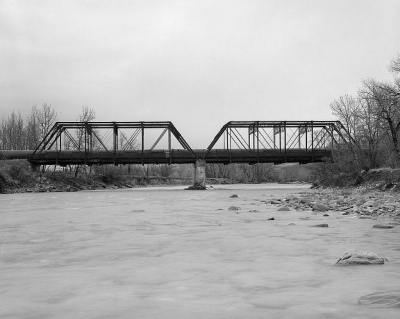
View Looking Southwest, General Elevation
Photo taken by Historic American Engineering Record
119472
View Looking Southeast, 3/4 Elevation
Photo taken by Historic American Engineering Record
119473
View Looking Southeast, Showing Portal
Photo taken by Historic American Engineering Record
119474
View Looking Southeast, Showing Siphon Pipes
Photo taken by Historic American Engineering Record
119475
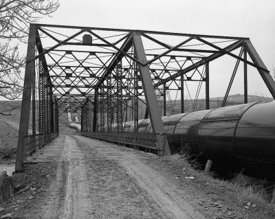
View Looking Northwest, 'Barrel Shot'
Photo taken by Historic American Engineering Record
119476
View Looking Northwest, From Mid-Bridge
Photo taken by Historic American Engineering Record
119477
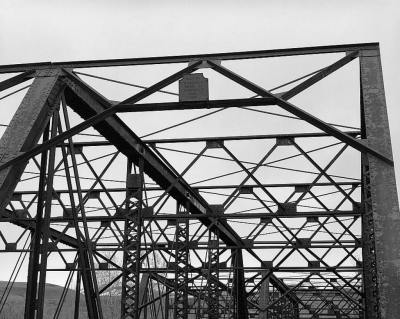
View Showing Manufacturer's Dateplaque And Upper Chord
Photo taken by Historic American Engineering Record
119478
View Looking Northwest From Deck, Showing Endposts
Photo taken by Historic American Engineering Record
119479
View Looking Northeast, Detail Of Endpost And Hip Vertical
Photo taken by Historic American Engineering Record
119480
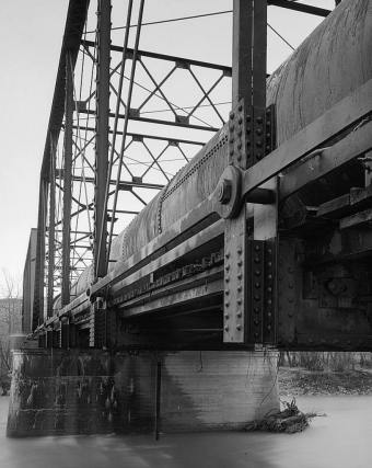
Detail Of Pin Connection And Lower Chord
Photo taken by Historic American Engineering Record
119481

View Showing Underside Of Deck And Floor Beams
Photo taken by Historic American Engineering Record
119482
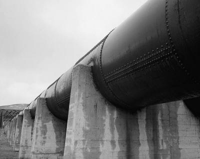
View Showing Siphon And Concrete Piers
Photo taken by Historic American Engineering Record
119483
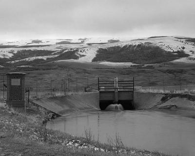
View Showing Siphon Outlet At Irregation Ditch
Photo taken by Historic American Engineering Record
![]()
Status: Replaced by a new bridge
Location: 48.450000,-113.205556
Carries US 2 over Two Medicine River
Design: truss/deck
Design Details: Deck truss
Total Length: 740.8 Feet
Span Length: 240.2 Feet
Overview: Deck truss bridge over Two Medicine River on US 2 in East Glacier Park Village
History: Built 1941; rehabilitated 1985; Replaced 2012
Built: 1941
Location: Glacier County
View Bridge Information In Wayback Machine
![]()
288638
Image
Photo taken by Beth Wieland
![]()
Status: Open to traffic
Location: 48.749444,-113.444167
Carries Going-To-The-Sun Road over St. Mary River
Design: arch/deck/closed
Design Details: Closed-spandrel arch
Total Length: 140.1 Feet
Span Length: 52.5 Feet
Overview: Three-span concrete arch bridge over St. Mary River on Going-To-The-Sun Road
History: Built 1934
Built: 1934
Location: Glacier County
View Bridge Information In Wayback Machine
![]()
119485
View From North River Bank Looking East
Photo taken by Historic American Engineering Record
464663

St. Mary River Bridge
Photo taken by R. Sieben in 2005
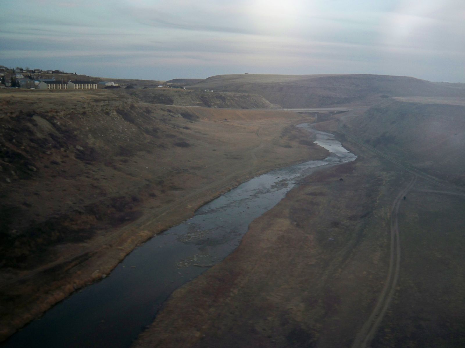
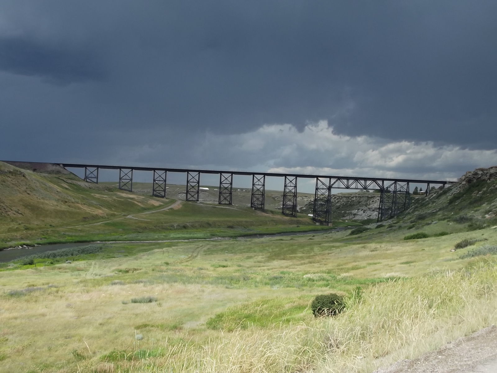
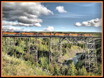
![]()
Status:
Location: 48.640964,-112.344669
Carries BNSF Railway over Cutbank Creek
Design: truss/deck/warren
Design Details: Warren deck truss
Total Length: 0.0 Feet
Span Length: 0.0 Feet
Overview: Warren deck truss bridge over Cutbank Creek on BNSF Railway in Cut Bank
History: Built 1910
Built: 1910
Location: Glacier County
View Bridge Information In Wayback Machine
![]()
138827
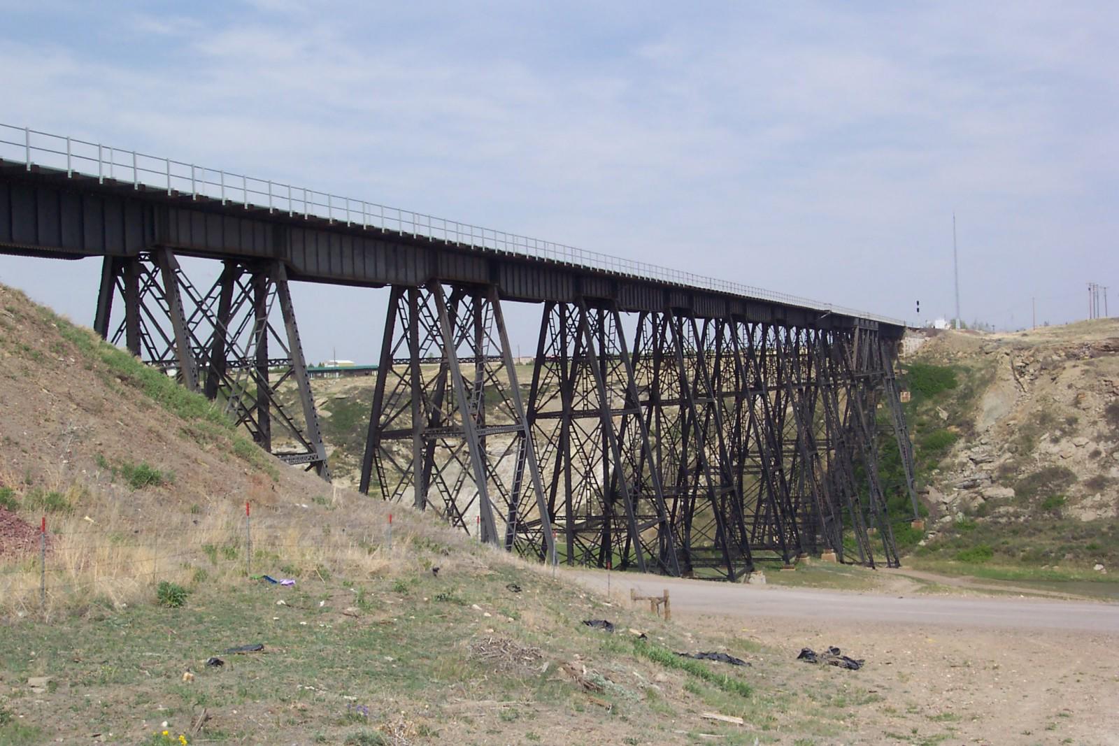
Overview
Photo taken by James McCray
138828
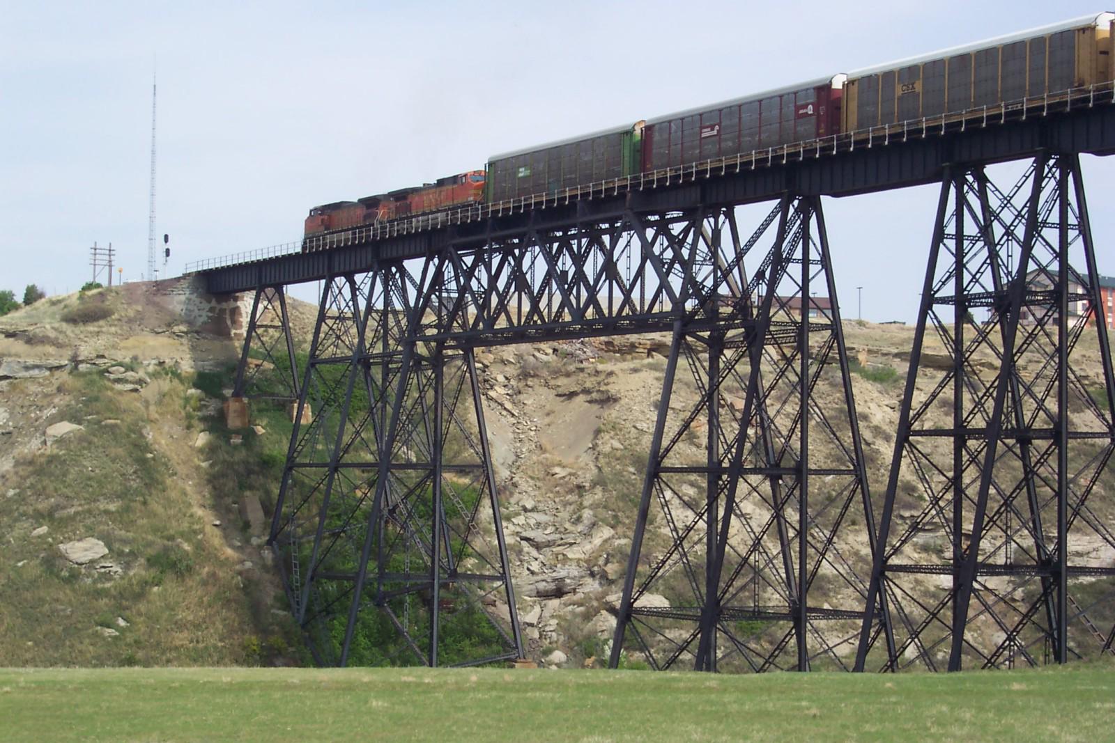
Main Span with Train
Photo taken by James McCray
162821
View from trestle looking south
Photo taken by Nathan Morton in April 2010
275713
Bnsf Cut Bank Trestle
Photo taken by Jack Schmidt in July 2013
464660

BNSF - Cut Bank Trestle
Photo from elevation.maplogs
![]()
Status:
Location: 48.453996,-113.210162
Carries Railroad over Two Medicine River
Design: truss/deck/warren
Design Details: Warren deck truss
Total Length: 1000.0 Feet
Span Length: 150.0 Feet
Overview: Deck truss bridge over Two Medicine River on BNSF Railway
History: Built 1900
Built: 1900
Location: Glacier County
View Bridge Information In Wayback Machine
![]()
314189
Crossing Two Medicine Creek: East Glacier park MT
Photo by Loco's Loco Co.
![]()
Status: Derelict/abandoned
Location: 48.852064,-113.415899
Carries an abandoned road over Saint Mary River
Design: truss/through/pratt
Design Details: Pratt through truss
Total Length: 0.0 Feet
Span Length: 0.0 Feet
Overview: Abandoned pratt through truss bridge over Saint Mary River on an abandoned road
History:
Built:
Location: Glacier County
View Bridge Information In Wayback Machine
![]()
![]()
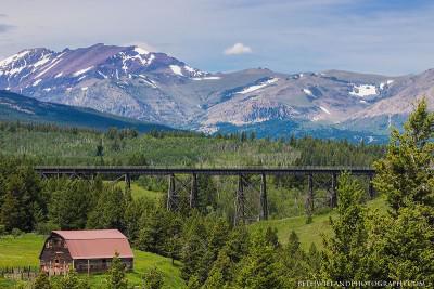
Status: Open to traffic
Location: 48.439323,-113.219749
Carries BNSF Hi-Line Subdivision over Midvale Creek & Trestle Trail
Design: girder/deck/plate
Design Details: Deck plate girder
Total Length: 380.0 Feet
Span Length: 48.0 Feet
Overview: Deck plate girder bridge over Midvale Creek & Trestle Trail on BNSF Hi-Line Subdivision
History: Built 1906; Reinforced and Extended 1953
Built: 1906
Location: Glacier County
View Bridge Information In Wayback Machine
![]()
464661

BNSF - Midvale Creek Bridge
looking northwest
Photo taken by Dan Mackey in 2017
![]()
Status: Open to traffic
Location: 48.441544,-113.219312
Carries BNSF Hi-Line Subdivision over MT 49
Design: arch/deck/closed
Design Details: Closed-spandrel arch
Total Length: 0.0 Feet
Span Length: 0.0 Feet
Overview: Closed-spandrel arch bridge over MT 49 on BNSF Hi-Line Subdivision
History:
Built:
Location: Glacier County
View Bridge Information In Wayback Machine
![]()
464659

BNSF - Highway 49 Overpass
Photo from stexboat
![]()
Status: Open to pedestrians only
Location: 48.849990,-113.707287
Carries Hiking Trail over Ptarmigan Wall
Design: tunnel
Design Details: Tunnel
Total Length: 250.0 Feet
Span Length: 0.0 Feet
Overview: Tunnel under Ptarmigan Wall on Hiking Trail
History: Built 1930
Built: 1930
Location: Glacier County
View Bridge Information In Wayback Machine
![]()
316099
South Entrance of Ptarmigan Tunnel
Ptarmigan Tunnel, North of Ptarmigan Lake West Glacier
Photo by Tyrooooone
![]()
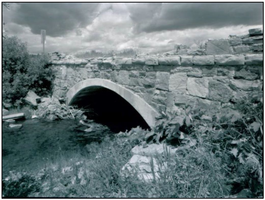
Status: Open to traffic
Location: 48.485361,-113.367806
Carries Two Medicine Road over Appistoki Creek
Design: frame/concrete
Design Details: Concrete rigid frame
Total Length: 37.4 Feet
Span Length: 16.1 Feet
Overview: Concrete rigid frame bridge over Appistoki Creek on Two Medicine Road
History: Built 1929
Built: 1929
Location: Glacier County
View Bridge Information In Wayback Machine
![]()
![]()
Status: Open to traffic
Location: 48.744222,-113.431472
Carries Going-To-The-Sun R over Divide Creek
Design: slab
Design Details: Slab
Total Length: 51.8 Feet
Span Length: 20.0 Feet
Overview: Slab bridge over Divide Creek on Going-To-The-Sun R
History: Built 1934
Built: 1934
Location: Glacier County
View Bridge Information In Wayback Machine
![]()
464662

Going to The Sun Road-Divide Creek Bridge
HAER Photo
![]()
Status: Open to traffic
Location: 48.982528,-113.630417
Carries Chief Mountain Int over Lee Creek
Design: girder
Design Details: Girder
Total Length: 209.7 Feet
Span Length: 80.4 Feet
Overview: Girder bridge over Lee Creek on Chief Mountain Int
History: Built 1935; rehabilitated 1979
Built: 1935
Location: Glacier County
View Bridge Information In Wayback Machine
![]()
![]()
Status: Replaced by a new bridge
Location: 48.470276,-113.236794
Carries MT 49 over Two Medicine River Bridge
Design: arch/deck/steel
Design Details: Steel arch
Total Length: 0.0 Feet
Span Length: 0.0 Feet
Overview: Lost Steel arch bridge over Two Medicine River Bridge on MT 49
History:
Built:
Location: Glacier County
View Bridge Information In Wayback Machine
![]()
497902
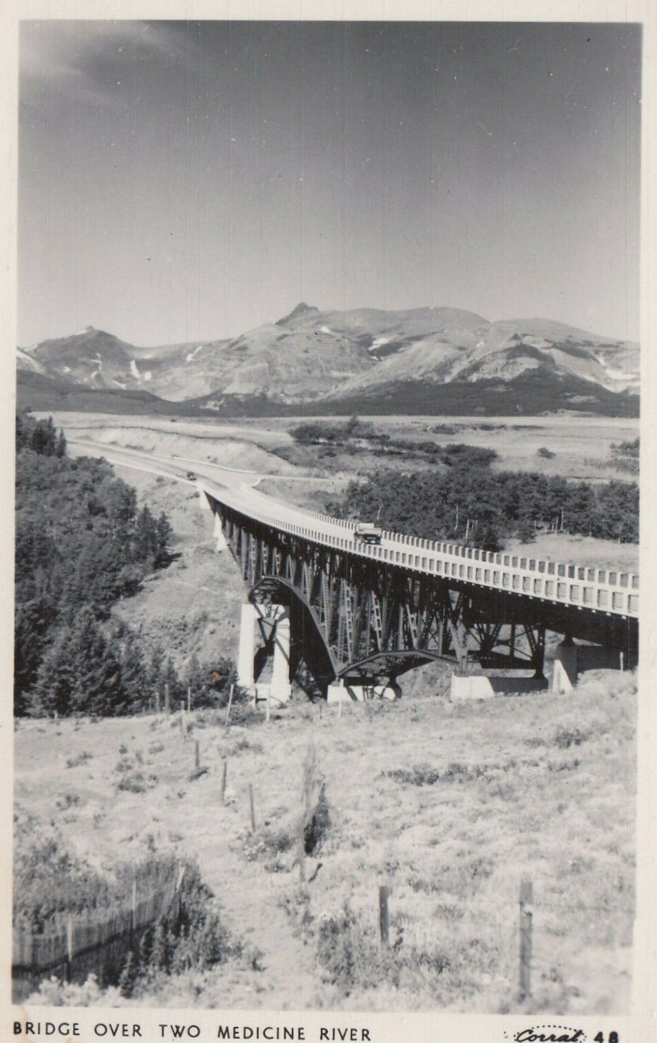
Two Medicine River Bridge
looking north
Photo from old postcard
Special Bridge Conditions Legend: R - Former location of relocated bridge. ! - At risk for demolition or destruction. X - Confirmed demolished or collapsed. S - Dismantled and/or in storage. L - Severe loss of historic integrity due to alteration.
![]()

![]()